Menu
JTWC Patrick Hoareau

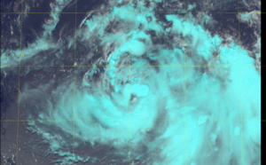
WNP: TD 06W, Up-dated position at 21/09utc, forecast to track south of Guam within 12hours - 06/21/2021 - 14:15

2021 JUNE 21 0935UTC #WESTERNNORTHPACIFIC TD #06W WARNING 2/UPDATE As of 09:00 UTC June 21, 2021: Location: 11.9°N 145.8°E Maximum Winds: 30 kt ( 55km/h) Gusts: 40 kt ( 75km/h) Minimum Central...

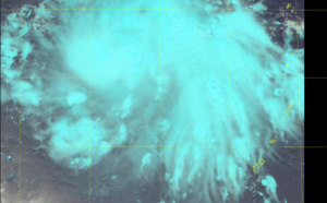
WNP: TD 06W(Invest 94W) approaching Guam and slowly intensifying, 21/03utc update - 06/21/2021 - 07:35

2021 JUNE 21 0230UTC #WESTERNNORTHPACIFIC TD #06W WARNING 1 As of 00:00 UTC June 21, 2021: Location: 11.2°N 147.4°E Maximum Winds: 30 kt ( 55km/h) Gusts: 40 kt ( 75km/h) Minimum Central...

Western North Pacific: Invest 94W now under watch, Up-graded to Medium at 18/14utc - 06/18/2021 - 13:10
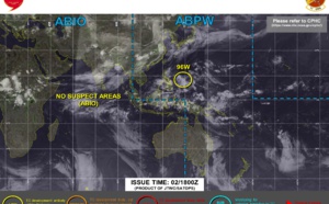
2021 JUNE 18 1435UTC #WESTERNNORTHPACIFIC INVEST #94W UPDATE As of 12:00 UTC June18, 2021: Location: 6.0°N 153.7°E Maximum Winds: 15/20 kt Minimum Central Pressure: 1008 mb LOCATED AT 18/12UTC...

05W(KOGUMA) peaked over the Golf of Tonkin, now Southeast of Hanoi// Tropical Cyclone Formation Alert for Invest 92E, 12/21utc updates - 06/13/2021 - 00:55

2021 JUNE 12 2025UTC #WESTERNNORTHPACIFIC TD #05W #KOGUMA WARNING 4/ As of 18:00 UTC June12, 2021: Location: 20.5°N 106.5°E Maximum Winds: 25 kt Gusts: 35 kt ( 65km/h) Minimum Central...

WNP: TD 05W tracking over Hainan, forecast to reach T.Storm intensity within 12hours over the Gulf of Tonkin, Eastern North Pacific Invests, 12/09utc updates - 06/12/2021 - 12:25

2021 JUNE 12 0745UTC #WESTERNNORTHPACIFIC TD #05W WARNING 2/UPDATE As of 06:00 UTC June12, 2021: Location: 19.0°N 108.8°E Maximum Winds: 25 kt Gusts: 35 kt ( 65km/h) Minimum Central Pressure:...

SCS: Tropical Cyclone Formation Alert for Invest 92W, likely to intensify, track over Hainan and then Gulf of Tonkin, 11/12h30utc update - 06/11/2021 - 17:10

2021 JUNE 11 1245UTC #WESTERNNORTHPACIFIC INVEST #92W TCFA/UPDATE As of 12:00 UTC June11, 2021: Location: 18.0°N 112.2°E Maximum Winds: 18/23 kt Minimum Central Pressure: 1005 mb LOCATED AT...

South China Sea: Invest 92W is up-graded to Medium, 11/06utc update - 06/11/2021 - 13:55

2021 JUNE 11 0930UTC #WESTERNNORTHPACIFIC INVEST #92W UPDATE As of 06:00 UTC June11, 2021: Location: 18.0°N 112.7°E Maximum Winds: 20 kt Minimum Central Pressure: 1000 mb LOCATED AT 11/06UTC...

South China Sea: JTWC is now monitoring Invest 92W apprx 520km South of Hong Kong, 10/0830utc update - 06/10/2021 - 12:40

2021 JUNE 10 0825UTC #WESTERNNORTHPACIFIC INVEST #92W UPDATE As of 06:00 UTC June10, 2021: Location: 17.6°N 115.0°E Maximum Winds: 15/20 kt Minimum Central Pressure: 1000 mb LOCATED AT...

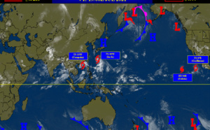
2 week cyclonic development potential: heightened potential for development through mid-June, 09/06utc update - 06/09/2021 - 10:40

Issued at 08/1730UTC by NOAA. In collaboration with the JTWC and several well known organizations.  Archives: HERE Cheers, Patrick Hoareau  JTWC PH ILES SOEURS Joint Typhoon Warning...

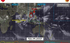
Western North Pacific: Invest 91W on the map to the Southwest of Kwajalein - 06/08/2021 - 11:30

2021 JUNE 08 07UTC #WESTERNNORTHPACIFIC INVEST #91W UPDATE As of 06:00 UTC June 08, 2021: Location: 5.6°N 167.5°E Maximum Winds: 15 kt Minimum Central Pressure: 1008 mb LOCATED AT 08/06UTC...

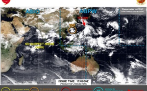
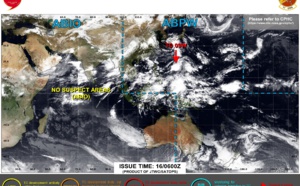
Western North Pacific: no Suspect Area at the moment// Eastern North Pacific: TCFA for Invest 92E - 06/07/2021 - 12:10

JTWC PH ILES SOEURS Joint Typhoon Warning Center

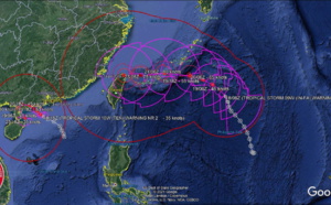
WNP: 04W (CHOI-wan) has begun to turn Northeastward, clipping Southern Taiwan,forecast to dissipate by 48h South of Kyushu, 03/21utc update - 06/04/2021 - 02:10

TS 04W. ANIMATED ENHANCED INFRARED SATELLITE IMAGERY SHOWS THE BROAD AREA OF CONVECTION ASSOCIATED WITH THE SYSTEM HAS BECOME TOTALLY OFFSET TO THE WEST-SOUTHWEST FROM A FULLY EXPOSED LOW LEVEL...

WNP: 04W (CHOI-wan) is back to Tropical Storm intensity, extended forecast track to include likely extra-tropical transition in 4/5 days - 06/03/2021 - 07:30

TS 04W. ANIMATED MULTISPECTRAL SATELLITE IMAGERY SHOWS A SYSTEM THAT HAS DEEPENED, ALBEIT WITH A PARTIALLY EXPOSED LOW LEVEL CIRCULATION (LLC) AS THE BROAD CENTRAL CONVECTION HAS BECOME OFFSET TO THE...

WNP: TD 04W (CHOI-wan) is forecast to intensify a bit within 24hours, track Southwest of Manila and then over the South China Sea, 02/09utc update - 06/02/2021 - 13:45

TD 04W. ANIMATED MULTISPECTRAL SATELLITE IMAGERY DEPICTS A SMALL, DISORGANIZED LOW LEVEL CIRCULATION CENTER(LLCC) JUST NORTHEAST OF MINDORO, WITH A RECENT FLARE UP OF MODERATE TO DEEP CONVECTION NOW...

WNP: 04W (CHOI-wan) : forecast to track over the Sibuyan Sea within 24hours as a 35knot Tropical Storm, 01/21utc update - 06/02/2021 - 01:42

TD 04W. 01/20UTC. 6H LOOP.ANIMATED ENHANCED INFRARED SATELLITE IMAGERY DEPICTS A DISORGANIZED LOW-LEVEL CIRCULATION WITH DEEP CONVECTION BEING SHEARED TO THE SOUTHWEST OF THE CENTER. 2021 JUNE 01...

04W (CHOI-wan) : struggling to organize, forecast intensity is much lower than the previous forecast// Invest 93S and Invest 90W on the map, 01/03utc update - 06/01/2021 - 08:55

TS 04W. DUE TO THE WESTWARD SHIFT IN THE FORECAST TRACK OVER THE PHILIPPINES THROUGH 72H, THE INTENSITY FORECAST IS SIGNIFICANTLY LOWER THAN THE PREVIOUS FORECAST. 2021 JUNE 01 0425UTC...

WNP: 04W(CHOI-wan) : the forecast track is now closer to Samar in 24h, Confidence in the forecast is moderate, 31/21utc update - 06/01/2021 - 01:45

TS 04W(CHOI-wan). SATELLITE ANIMATION DEPICTS INTENSE (-82C TOPS) DEEP CONVECTION SPREADING OVER AND OBSCURING THE LOW-LEVEL CIRCULATION CENTER. 2021 MAY 31 2050UTC #WESTERNNORTHPACIFIC TS #04W...

WNP: 04W named (CHOI-wan) is forecast to intensify to Typhoon/CAT 1 in 36hours and then track close to the East of Catanduanes, 31/09utc update - 05/31/2021 - 13:32

TS 04W(CHOI-wan). ANIMATED MULTISPECTRAL SATELLITE IMAGERY SHOWS THE LOW-LEVEL CIRCULATION (LLC) IS PARTIALLY EXPOSED, OFFSETTING THE REGION OF DEEPENED CENTRAL CONVECTION WITH OVERSHOOTING CLOUD...

WNP: 04W is now analyzed as 50knot Tropical Storm, forecast to reach Typhoon intensity by 36hours, 31/03utc update - 05/31/2021 - 07:25

TS 04W. 31/0230UTC. 4H LOOP.ANIMATED MULTISPECTRAL SATELLITE IMAGERY SHOWS THE LOW LEVEL CIRCULATION HAS BECOME PARTIALLY EXPOSED, OFFSETTING AN OTHERWISE DEEPENED CENTRAL CONVECTION WITH...

WNP: Tropical Storm 04W is gradually intensifying in a favourable environment to the North of Sonsorol, 30/15utc update - 05/30/2021 - 19:30

TS 04W. 30/14UTC. 4H30 LOOP. ANIMATED ENHANCED INFRARED IMAGERY (EIR) INDICATES A DEEP CONSOLIDATED CENTRAL BALL OF CONVECTION WRAPPING AROUND A LOW LEVEL CIRCULATION (LLC). 2021 MAY 30 1450UTC...

WNP: TD 04W is forecast to reach US/CAT 1 Typhoon intensity by 72hours offshore to the East of the Philippines, 30/03utc update - 05/30/2021 - 07:35

TD 04W. ANIMATED ENHANCED MULTISPECTRAL SATELLITE IMAGERY SHOWS OVERALL CONSOLIDATION EVEN AS THE CENTRAL CONVECTION SLIGHTLY WARMED WITH THE FEEDER BANDS, MOSTLY FROM THE NORTHWEST AND SOUTH,...

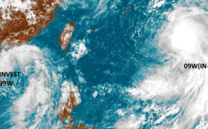
Western North Pacific: Tropical Cyclone Fomation Alert issued for Invest 90W// Invest 99W up-graded to Medium, 29/06utc update - 05/29/2021 - 11:20

29/0630UTC. 6H LOOP. INVEST 90W: ANIMATED MULTISPECTRAL SATELLITE IMAGERY (MSI) DEPICTS MID TO UPPER LEVEL TURNING OVER AN ILL DEFINED LOW LEVEL CIRCULATION. INVEST 99W: ANIMATED MULTISPECTRAL...

Western North Pacific: Invest 90W is up-graded to Medium, Invest 99W closely monitored too, 28/03utc update - 05/28/2021 - 08:05

NPP/NIGHT TIME VISIBLE. INVEST 90W: ANIMATED MULTISPECTRAL SATELLITE IMAGERY DEPICTS FLARING CONVECTION AND LOW LEVEL CLOUD LINES THAT WRAP INTO AN OBSCURED LOW LEVEL CENTER// INVEST 99W: ANIMATED...

Western North Pacific: a couple of Invest Areas under watch, likely to consolidate next several days, 27/05 03utc update - 05/27/2021 - 07:30

INVEST 99W: ANIMATED MULTISPECTRAL SATELLITE IMAGERY REVEALS DEEP CONVECTION TO THE NORTH OF A DEFINED LOW LEVEL CIRCULATION CENTER. INVEST 90W: ANIMATED MULTISPECTRAL SATELLITE IMAGERY DEPICTS A...

BAY OF BENGAL: TC 02B(YAAS) is close to be making landfall near Balasore/Odisha with 150km/h top gusts, 26/03utc update - 05/26/2021 - 07:30

TC 02B(YAAS). 26/0252UTC.RADAR ANIMATION. PARADIP. THE LOW LEVEL CIRCULATION CENTER IS ABOUT TO MAKE LANDFALL NEAR BALASORE. ANIMATION COURTESY OF IMD/RSMC. 2021 MAY 26 0255UTC #NORTHINDIAN...

2 week cyclonic development potential: "Multiple TCs are likely to develop over the West Pacific during the next two weeks", 25/1730utc update - 05/25/2021 - 23:15

WEEK 1: MAY 26 TO JUNE 01: The Madden-Julian Oscillation (MJO) propagated eastward from the Indian Ocean to the Maritime Continent during mid to late May. An atmospheric Kelvin wave (KW) is currently...

BAY OF BENGAL: TC 02B(YAAS) has reached US/CAT 1 and is forecast to make landfall near Balasore/Odisha with top gusts in excess of 150km/h shortly before 24h, 25/15utc update - 05/25/2021 - 19:50

2021 MAY 25 1445UTC #NORTHINDIAN #GULFOFBENGAL TC #02B #YAAS WARNING 7 As of 12:00 UTC May 25, 2021: Location: 19.8°N 88.3°E Maximum Winds: 65 kt ( 120km/h) Gusts: 80 kt ( 150km/h) Minimum...

BAY OF BENGAL: TC 02B(YAAS) is approaching Northern Odisha coastline while intensifying within 24h to US/CAT 1, landfall forecast near Balasore, 25/09utc update - 05/25/2021 - 14:30

TC 02B(YAAS). 25/10UTC. 6H ANIMATION. EXPANDING CONVECTION NEAR THE LOW LEVEL CIRCULATION CENTER(LLCC). CLICK TO ANIMATE IF NECESSARY. 2021 MAY 25 0930UTC #NORTHINDIAN #GULFOFBENGAL TC #02B #YAAS...

BAY OF BENGAL: 02B(YAAS) now a 60knot cyclone,forecast to reach US/CAT 1 within 24hours while making landfall near BHITARKANINKA National Park/India by 24h, 25/03utc update - 05/25/2021 - 07:31

2021 MAY 25 0230UTC #NORTHINDIAN #GULFOFBENGAL TC #02B #YAAS WARNING 5 As of 00:00 UTC May 25, 2021: Location: 18.2°N 88.1°E Maximum Winds: 60 kt ( 110km/h) Gusts: 75 kt ( 140km/h) Minimum...
1 ... « 21 22 23 24 25 26 27 » ... 57