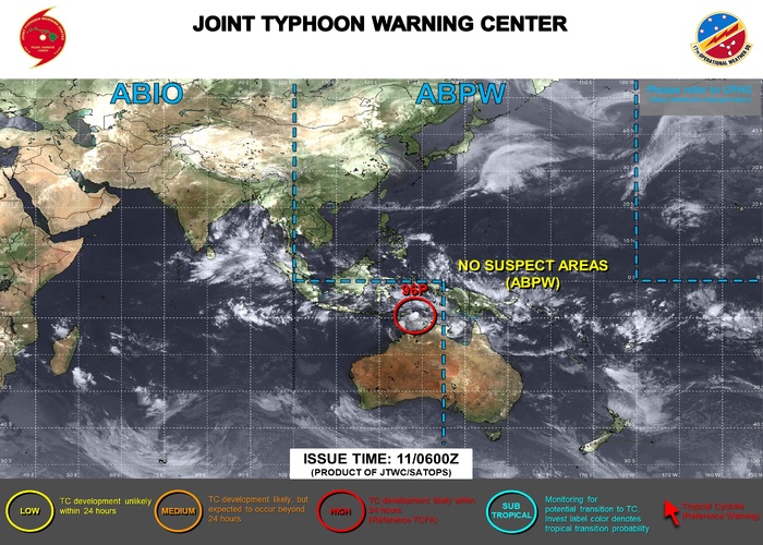
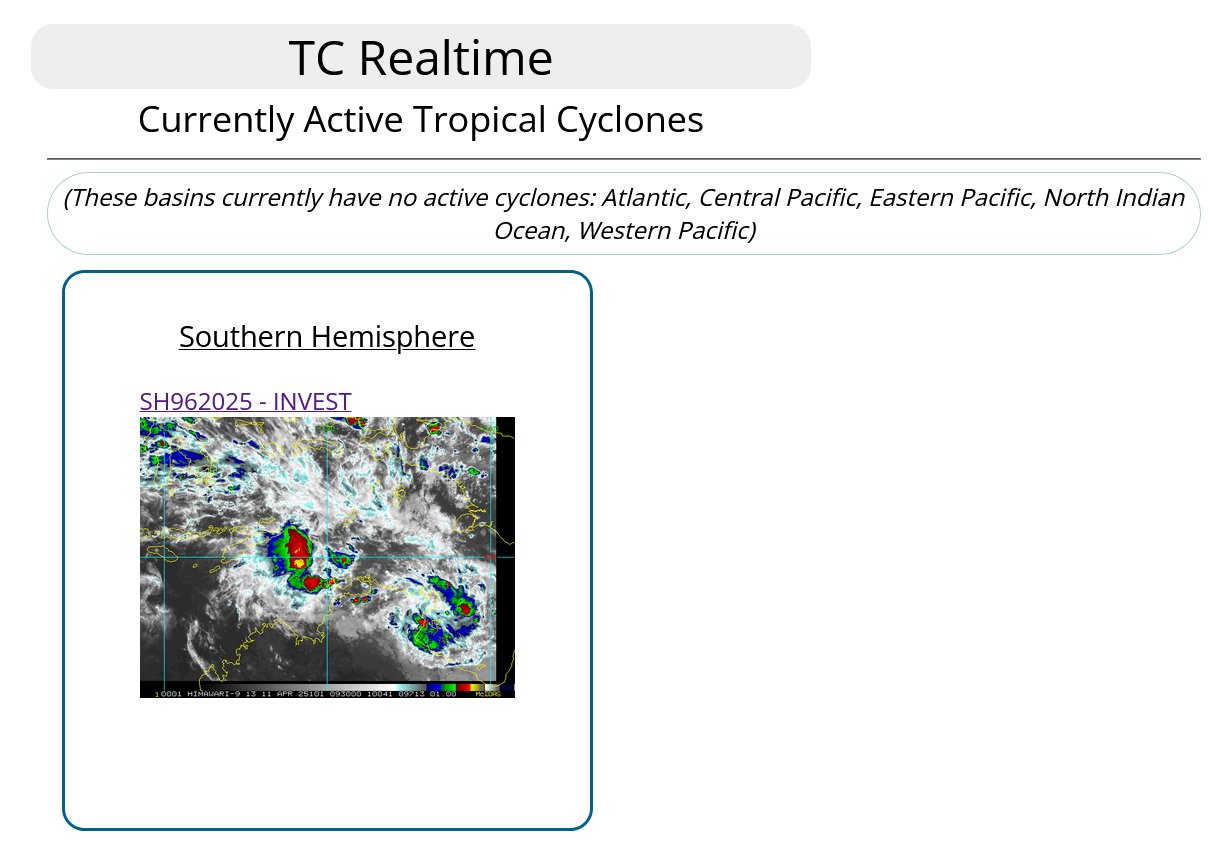
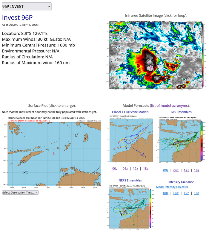
CLICK ON THE IMAGERIES BELOW TO GET THEM ENLARGED
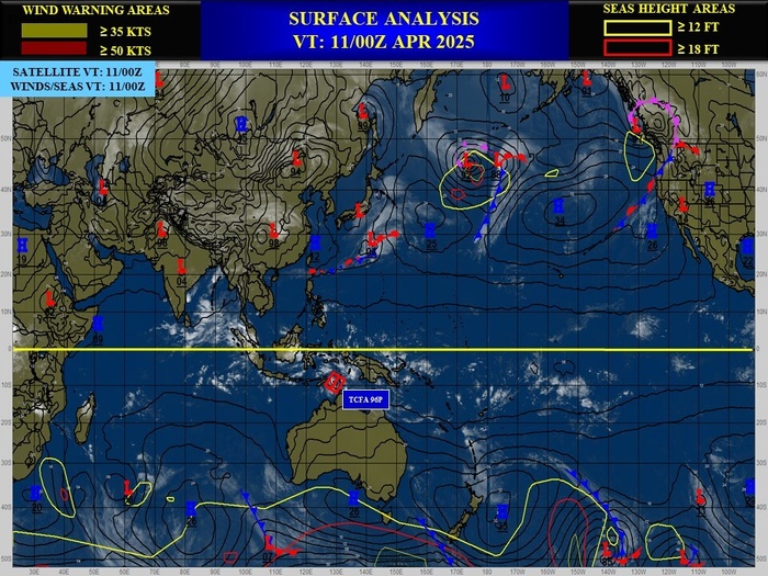
SOUTH INDIAN OCEAN/NORTHWEST AUSTRALIA: INVEST 96P. 11/06UTC ESTIMATED LOCATION AND INTENSITY
9625040900 96S1335E 25
9625040906 91S1332E 25
9625040912 86S1328E 25
9625040918 82S1320E 25
9625041000 79S1313E 25
9625041006 82S1307E 25
9625041012 87S1303E 25
9625041018 91S1300E 30
9625041100 87S1296E 25
9625041106 89S 1291E 30
9625040906 91S1332E 25
9625040912 86S1328E 25
9625040918 82S1320E 25
9625041000 79S1313E 25
9625041006 82S1307E 25
9625041012 87S1303E 25
9625041018 91S1300E 30
9625041100 87S1296E 25
9625041106 89S 1291E 30
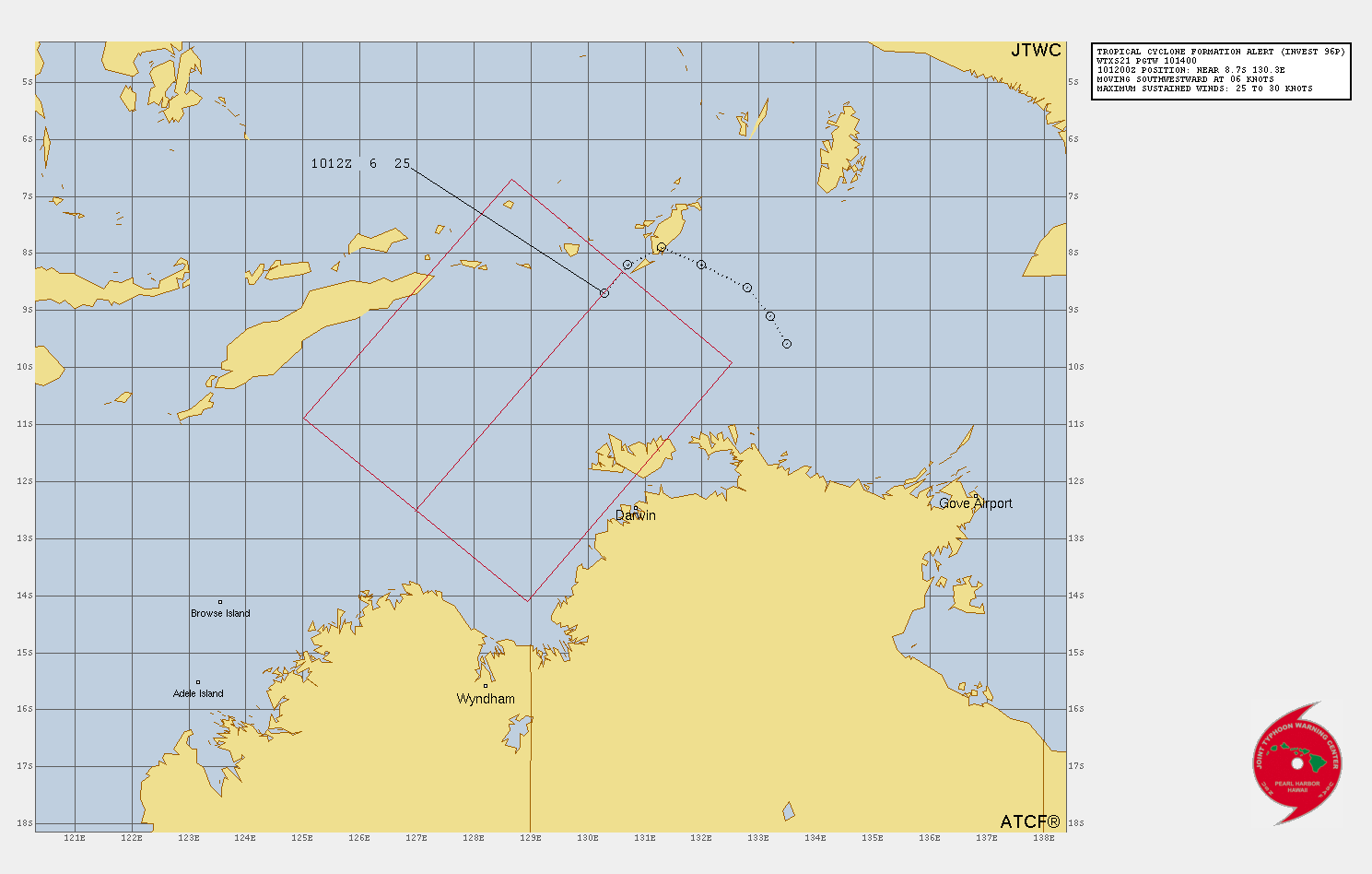
TROPICAL CYCLONE FORMATION ALERT ISSUED AT 10/14UTC
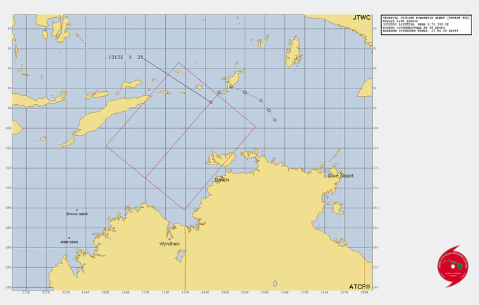
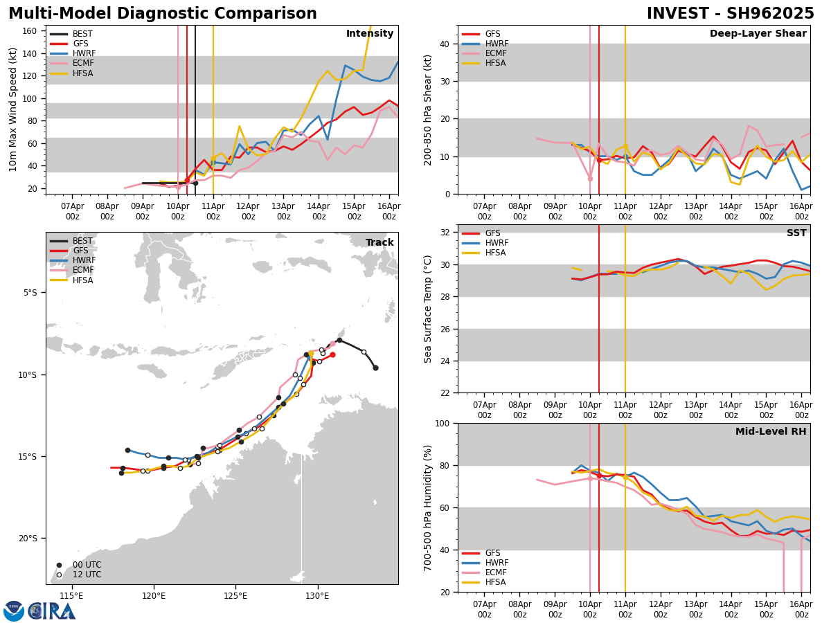
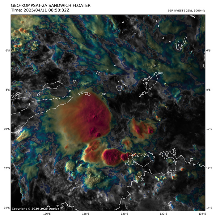
THE AREA OF CONVECTION (INVEST 96P) PREVIOUSLY LOCATED NEAR 8.7S 130.3E REMAINS APPROXIMATELY 230 NM NORTH OF DARWIN, AUSTRALIA. ANIMATED ENHANCED INFRARED (EIR) SATELLITE IMAGERY DEPICTS A CONSOLIDATING LOW-LEVEL CIRCULATION (LLC) WITH PERSISTENT AND INCREASING DEEP CORE CONVECTION. EARLIER METOP-C AMSU-B 89 GHZ MICROWAVE IMAGERY FROM 101242Z REVEALED BANDING BEGINNING TO FORM ALONG THE SOUTHERN PERIPHERY. ENVIRONMENTAL ANALYSIS REVEALS VERTICAL WIND SHEAR (VWS) OF 15-20 KNOTS, MODEST WESTWARD OUTFLOW AND INDICATIONS OF PRESSURE ON THE EAST SIDE. SEA SURFACE TEMPERATURES (SST) OF 30-31 C ARE CONDUCIVE FOR FURTHER DEVELOPMENT. BOTH DETERMINISTIC AND ENSEMBLE MODELS ARE IN AGREEMENT THAT THE SYSTEM WILL CONTINUE TO DEVELOP, BUT VARY REGARDING THE RATE OF INTENSIFICATION OVER THE NEXT 24-48 HOURS. MAXIMUM SUSTAINED SURFACE WINDS ARE ESTIMATED AT 25 TO 30 KNOTS. MINIMUM SEA LEVEL PRESSURE IS ESTIMATED TO BE NEAR 1001 MB. THE POTENTIAL FOR THE DEVELOPMENT OF A SIGNIFICANT TROPICAL CYCLONE WITHIN THE NEXT 24 HOURS REMAINS HIGH.
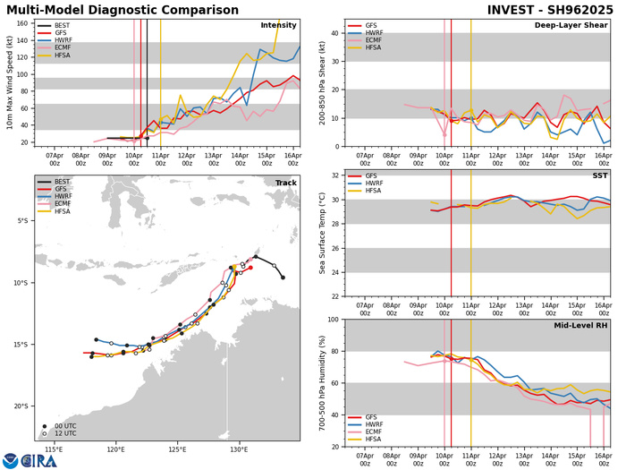
BOTH DETERMINISTIC AND ENSEMBLE MODELS ARE IN AGREEMENT THAT THE SYSTEM WILL CONTINUE TO DEVELOP, BUT VARY REGARDING THE RATE OF INTENSIFICATION OVER THE NEXT 24-48 HOURS.
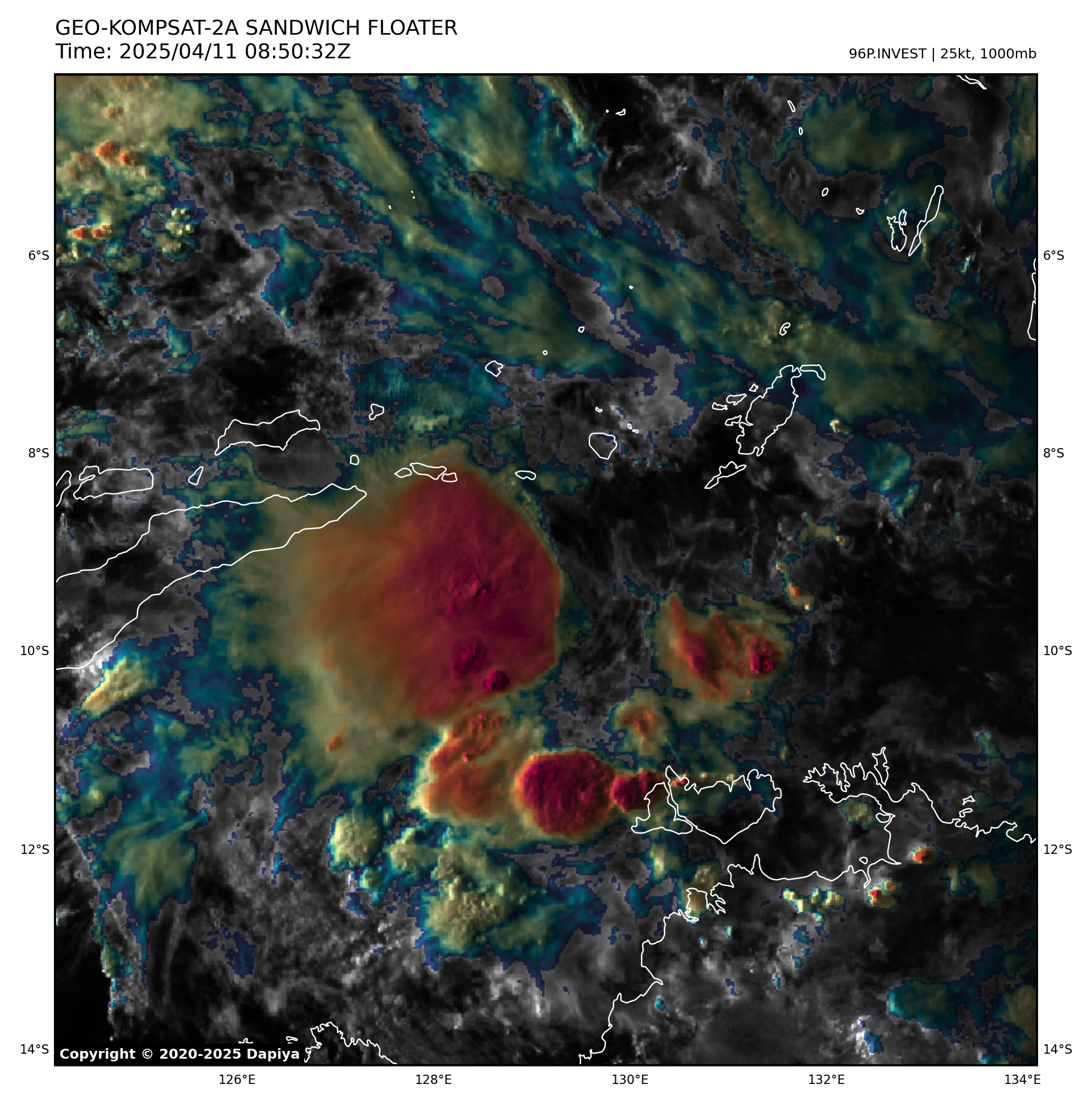
11/0830UTC SATELLITE BULLETIN ANALYSIS
TPXS10 PGTW 110905
A. TROPICAL DISTURBANCE 96P (SW OF TANIMBAR ISLANDS)
B. 11/0830Z
C. 9.14S
D. 128.94E
E. FIVE/GK2A
F. T2.0/2.0/D1.0/21HRS STT: D0.5/03HRS
G. IR/EIR/VIS/MSI
H. REMARKS: 71A/PBO XTRP/ANMTN. LOOSELY DEFINED CLOUD LINES WITH
COLD OVERCAST GREATER THAN 90NM ACROSS YIELD A DT OF 1.5. MET
YILEDS 1.5. PT YIELDS 2.0. DBO PT.
I. ADDITIONAL POSITIONS:
11/0522Z 9.17S 129.32E AMS2
SWANSON
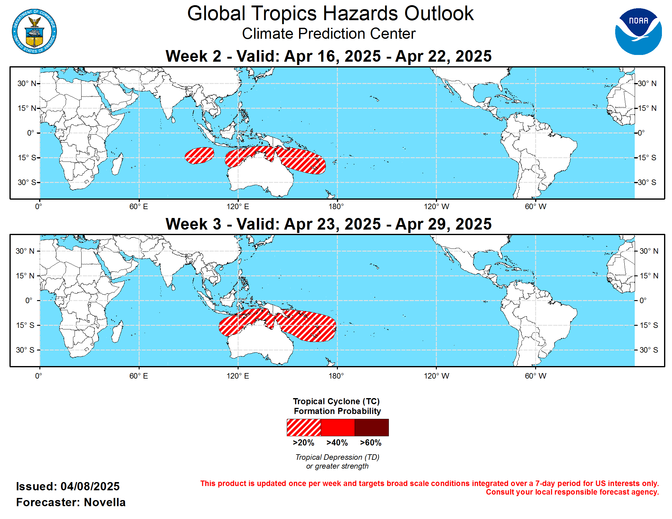
Last Updated - 04/08/25 3 WEEK TROPICAL CYCLONE FORMATION PROBABILITY
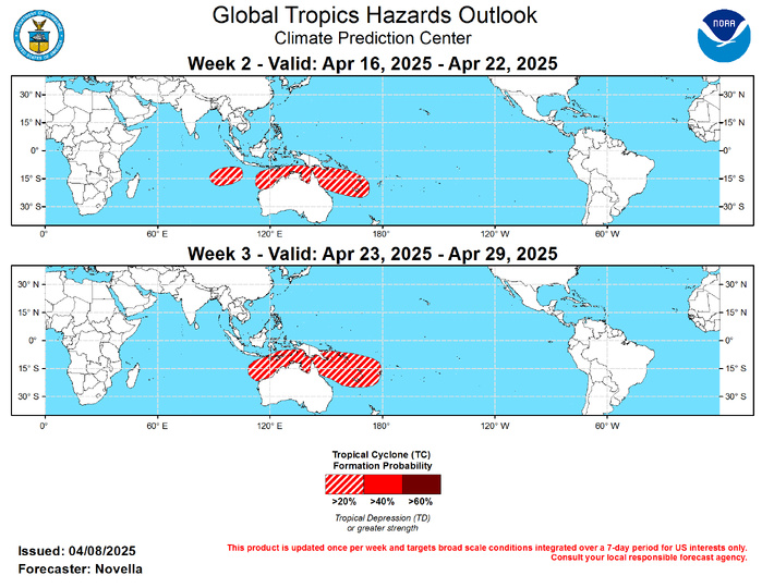
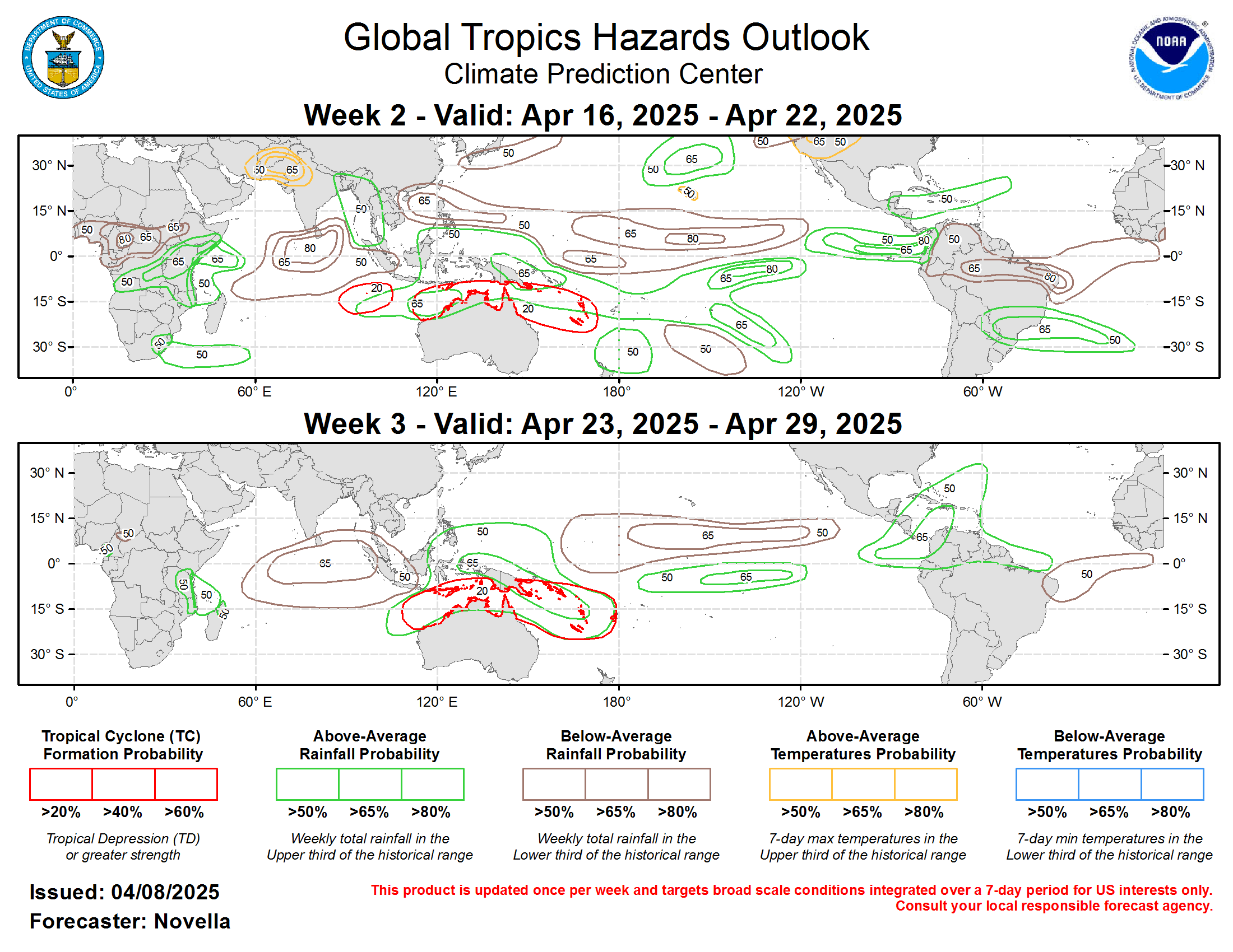
GTH Outlook Discussion Last Updated - 04/08/25 Valid - 04/16/25 - 04/29/25 After the Madden-Julian Oscillation (MJO) entered the Western Pacific last month, RMM observations continue to show the enhanced phase remaining weak while exhibiting an erratic propagation across the basin. This incoherence is likewise reflected in the upper-level velocity potential anomaly observations, which suggest that the MJO has been stymied by other modes of tropical variability, namely strong equatorial Kelvin wave activity, and a pair of low frequency responses in the equatorial eastern Pacific and Maritime Continent associated with a complex base state. This has resulted in multiple envelopes of enhanced divergence aloft over the past few weeks, inconsistent with a canonical MJO pattern. Looking ahead, RMM forecasts generally favor a signal that quickly circumnavigates the RMM origin at a low amplitude and returns to the Western Pacific during the next week or so. Given the fast phase speed favored, the thinking is that these forecasts are latching onto the aforementioned Kelvin wave activity that eventually relaxes during week-2, which is supported in the objectively wave filtered OLR and upper-level velocity potential forecast fields from the dynamical models. Unlike the RMM perspective, these filtered fields depict an MJO envelope that stays dormant within the Eastern Hemisphere on the near term, before resuming a more canonical eastward propagation across the Western Pacific and Western Hemisphere, with much of the enhanced divergence aloft being expressed south of the equator during the next several weeks (likely due to the suppressed convective La Nina footprint north of the equator in the central Pacific). As the main MJO envelope begins to overspread the Western Hemisphere in the velocity potential forecasts, there is some model support for a better defined wave-1 pattern taking shape towards the end of April. This potential for reorganizing subseasonal activity is also evidenced in the RMM forecasts at the extended leads, where there are a growing number of ensemble members in the GEFS and CFSv2 favoring a high amplitude event by the week-3 timeframe. Therefore, the updated outlook is not ruling out a more coherent MJO unfolding later this month, but there remains a good deal of uncertainty given the ongoing multiple modes of tropical variability and their associated convective responses. There is also low confidence in the outlook for Tropical Cyclone (TC) development amidst a quiet background climatology, especially during late April. No TCs formed during the past week. Within a band of anomalous lower-level westerlies that is favored to develop south of the equator from approximately 95E to 160E during week-1, probabilistic TC genesis tools continue to feature increased chances of formation to the north of Australia. While TC development appears most likely in the Timor Sea during week-1 based on these tools, the persistence of lower-level westerlies would support additional development to the north of Australia and into the South Pacific where 20% chances are highlighted for week-2. A secondary 20% area for TC development is also posted for week-2, centered near 95E in the southern Indian Ocean given increased support in the guidance for a deepening low late in week-1. For week-3, late April marks the climatologically quietest time of the year for TC activity throughout the global tropics, with genesis becoming more limited over the southern Indian Ocean, southern and western Pacific. While this would favor no TC areas being posted, 20% chances are again issued to the north of Australia and into the South Pacific based on continued elevated signals in the probabilistic TC genesis tools over the basin. 20% chances were also considered for the northwestern Pacific, however, guidance suggests the mean shearing environment not being as favorable north of the equator towards the end of April, with better support for genesis in the basin after the start of May.
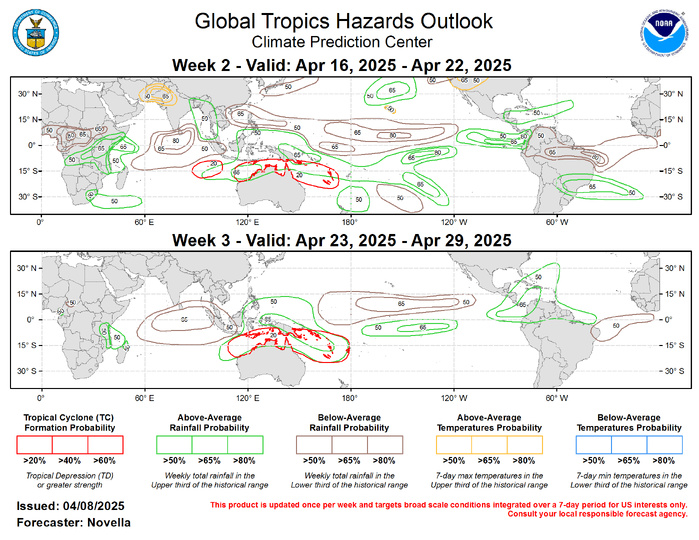
Forecasts for enhanced and suppressed precipitation are mainly based on a consolidated skill weighted blend of GEFS, CFSv2, and ECMWF ensemble systems, anticipated TC tracks, with less reliance on seasonal MJO and ENSO composites for Mar-May due to uncertainty with evolving subseasonal activity, and the unusual base state, respectively. Above-normal temperatures are favored over parts of Afghanistan, Pakistan and northwestern India, with daytime maximum temperatures possibly exceeding 100 deg F during week-2. While cooler, above-normal temperatures are also favored for Hawaii and parts of the Great Basin of the contiguous United States (CONUS). Forecasts for Africa are made in coordination with the CPC International Desk. For hazardous weather concerns in your area for the next two weeks, please refer to your local NWS office, the Medium Range Hazards Outlook issued by the Weather Prediction Center, and the CPC Week-2 Hazards Outlook.
