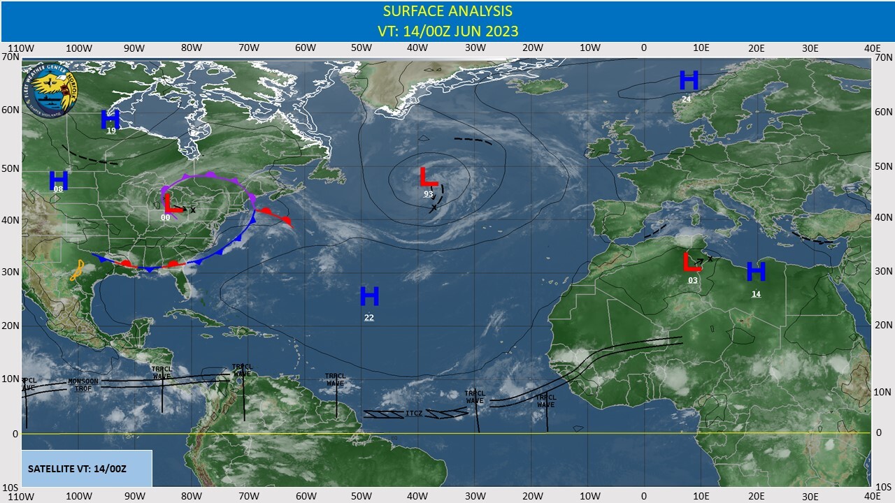
CLICK ON THE IMAGERIES BELOW TO GET THEM ENLARGED
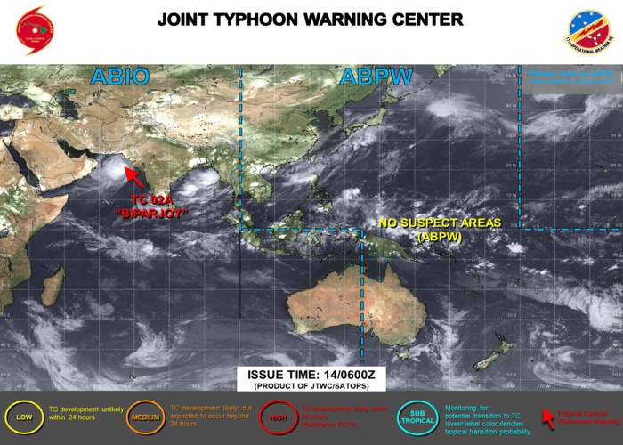
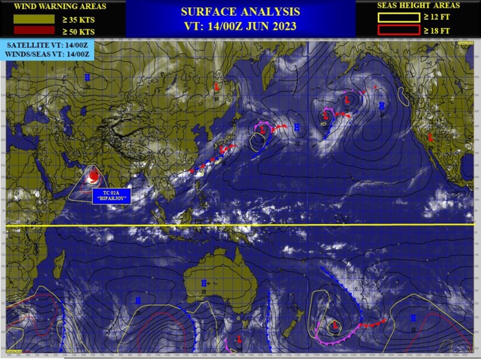
NORTH INDIAN/ARABIAN SEA: TC 02A(BIPARJOY). ESTIMATED LOCATION AND INTENSITY AT 140000UTC. CATEGORY 2 US.
0223061218 202N 673E 85
0223061300 207N 671E 90
0223061306 210N 669E 90
0223061312 212N 667E 95
0223061318 214N 664E 90
0223061400 216N 662E 90
0223061300 207N 671E 90
0223061306 210N 669E 90
0223061312 212N 667E 95
0223061318 214N 664E 90
0223061400 216N 662E 90
WARNING 32 ISSUED AT 140000UTC.

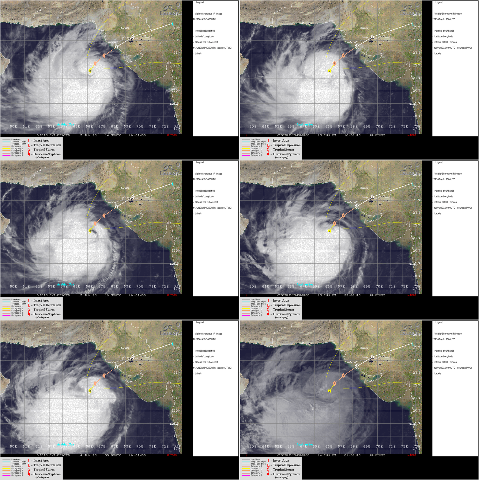
CLICK ON THE IMAGERY BELOW TO GET IT ANIMATED AND ENLARGED.

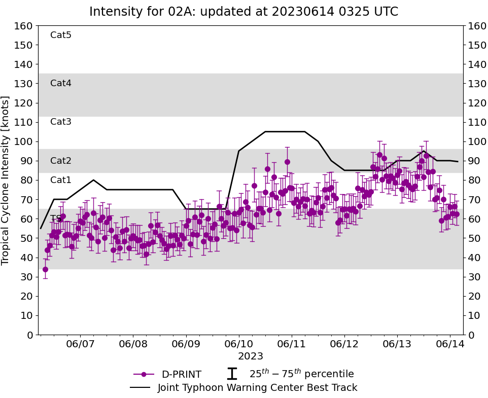
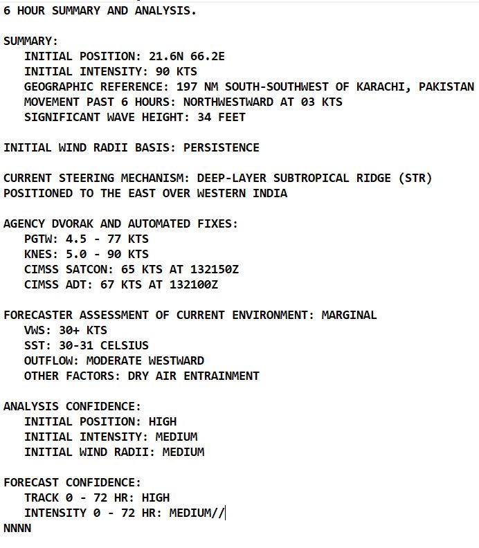
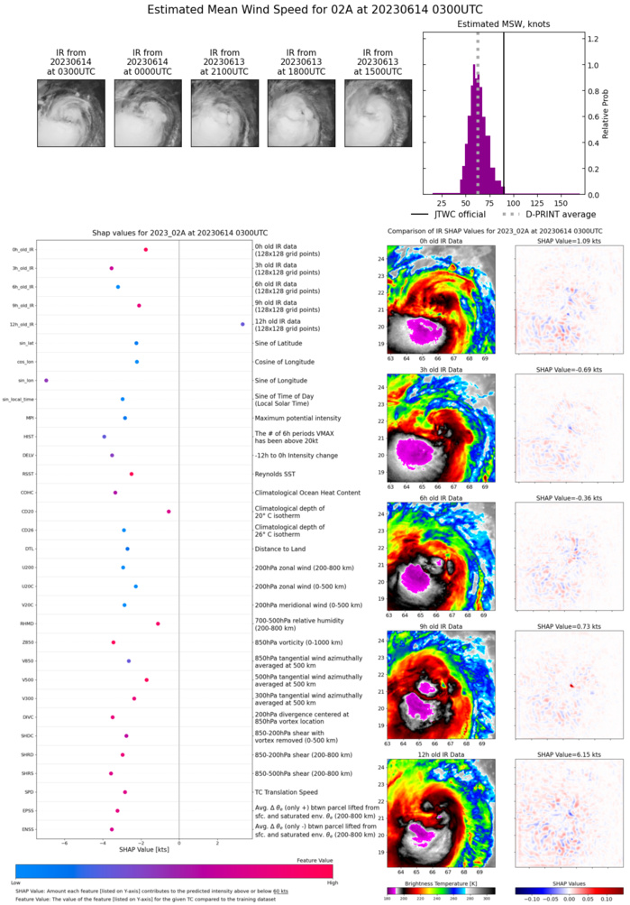
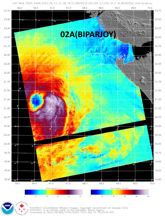
SATELLITE ANALYSIS, INITIAL POSITION AND INTENSITY DISCUSSION: TROPICAL CYCLONE (TC) 02A REMAINS SURPRISINGLY RESILIENT AGAINST STRONG, PERSISTENT (30 KNOTS) NORTHEASTERLY VERTICAL WIND SHEAR (VWS). ANIMATED ENHANCED INFRARED (EIR) SATELLITE IMAGERY DEPICTS RAPIDLY PULSING CORE CONVECTION WRAPPING INTO THE EASTERN QUADRANT WITH THE BULK OF THE DEEP CONVECTION DISPLACED OVER THE SOUTHERN SEMICIRCLE. ENVIRONMENTAL CONDITIONS REMAIN MARGINAL WITH STRONG VWS AND HIGH-LEVEL DRY AIR ENTRAINMENT OFFSET SOMEWHAT BY MODERATE WESTWARD OUTFLOW AND VERY WARM SST VALUES. THE SYSTEM HAS BECOME MORE VERTICALLY ALIGNED WITH IMPROVED CORE STRUCTURE AS INDICATED IN A 132327Z SSMIS 91GHZ MICROWAVE IMAGE, WHICH REVEALS TIGHTLY-CURVED BANDING WRAPPING AROUND A WELL-DEFINED, 30-35NM DIAMETER MICROWAVE EYE FEATURE. THE SSMIS 37GHZ MICROWAVE IMAGE SHOWS THE LOW-LEVEL CIRCULATION IS NOW POSITIONED ONLY ABOUT 5NM NORTHEAST OF THE UPPER- LEVEL CIRCULATION CENTER--THIS REDUCED TILT RESULTING IN A BETTER ORGANIZED SYSTEM. THANKS TO THE HIGH RESOLUTION SSMIS IMAGERY, THERE IS HIGH CONFIDENCE IN THE INITIAL POSITION. AFTER CONSIDERABLE DISCUSSION, THE 131200Z INTENSITY WAS INCREASED TO 95 KNOTS SUPPORTED BY THE 131330Z RCM-1 SAR DATA WITH MAXIMUM WINDS OF 96 KNOTS OVER THE SOUTHEAST QUADRANT; THE 131800Z INTENSITY WAS ADJUSTED UP SLIGHTLY TO 90 KNOTS; AND THE 140000Z INITIAL INTENSITY WAS CONSERVATIVELY HELD AT 90 KNOTS, WHICH IS SUPPORTED BY THE KNES CURRENT INTENSITY ESTIMATE. SUBJECTIVE DVORAK DATA-T ESTIMATES AND THE RECENT OBJECTIVE CIMSS SATCON AND ADT ESTIMATES HAVE DECREASED SUBSTANTIALLY BUT APPEAR TOO LOW BASED ON THE RECENT SAR IMAGE AND A 131709Z ULTRA HIGH RESOLUTION ASCAT IMAGE.
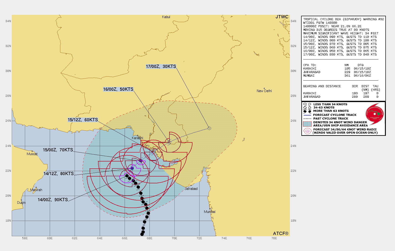
TC Warning Graphic
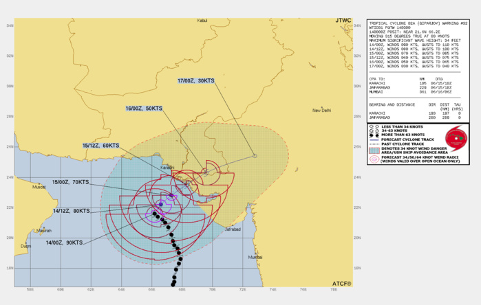
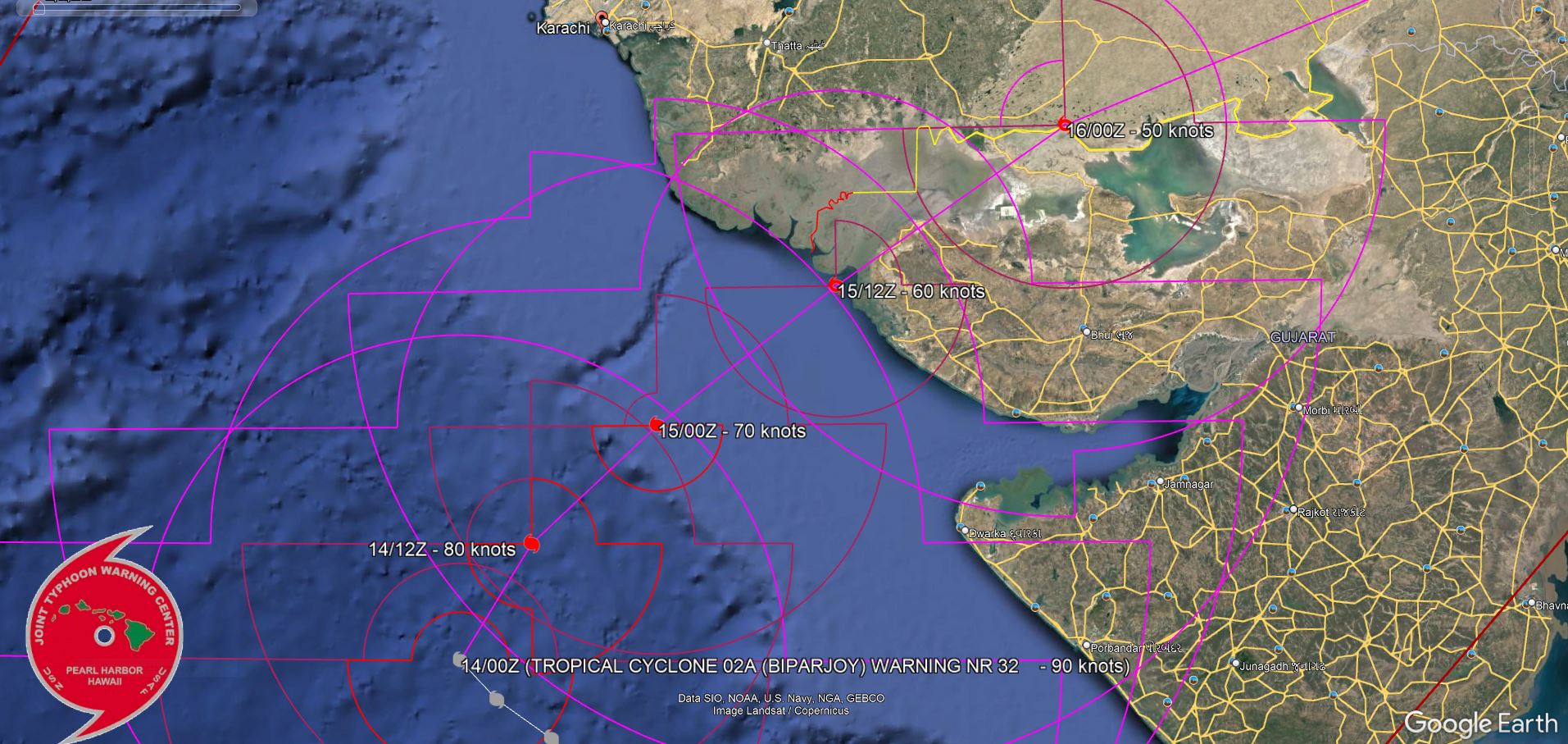
FORECAST REASONING. SIGNIFICANT FORECAST CHANGES: THERE ARE NO SIGNIFICANT CHANGES TO THE FORECAST FROM THE PREVIOUS WARNING. FORECAST DISCUSSION: TC 02A WILL RECURVE SHARPLY NORTHEASTWARD ALONG THE NORTHWESTERN PERIPHERY OF THE STR AND WILL APPROACH THE INDIA- PAKISTAN BORDER AREA WITH SIGNIFICANT WEAKENING AFTER TAU 24 DUE TO INCREASED FRICTIONAL EFFECTS. AFTER TAU 36 WHEN THE SYSTEM MAKES LANDFALL, TC 02A WILL RAPIDLY WEAKEN AND IS EXPECTED TO DISSIPATE BY TAU 72 OVER NORTHWEST INDIA.
FORECAST LANDFALL AREA.
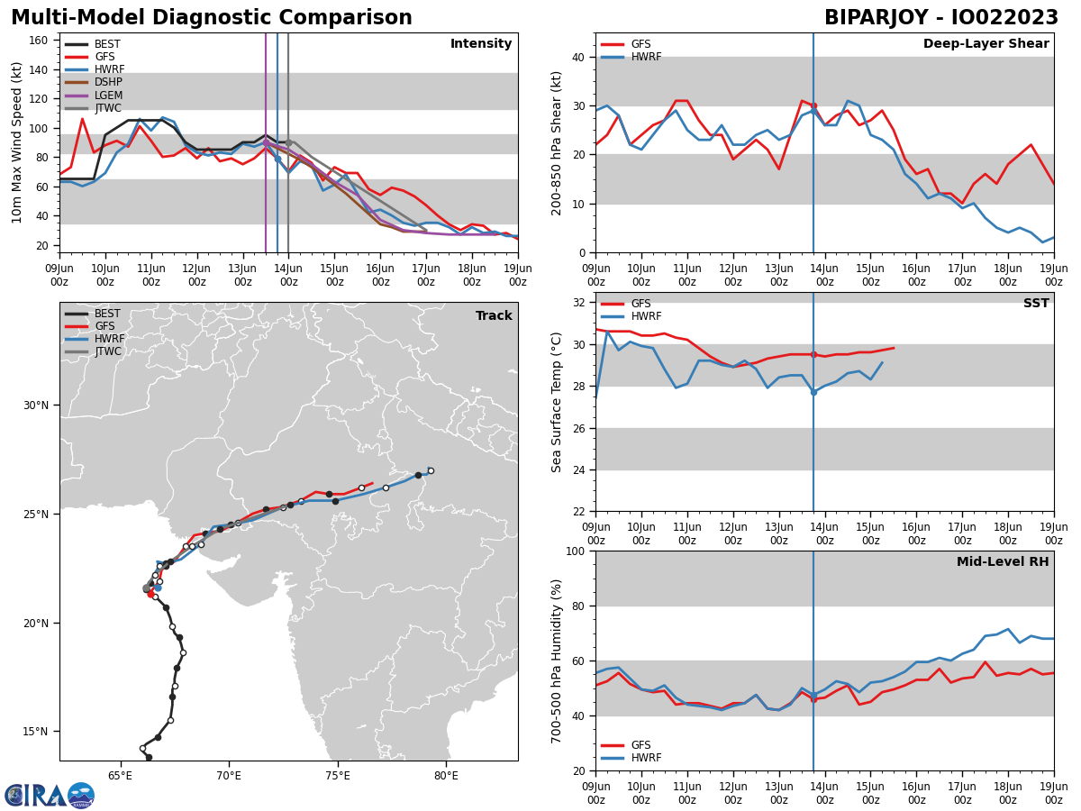
Model Diagnostic Plot

MODEL DISCUSSION: WITH THE EXCEPTION OF NAVGEM, WHICH REMAINS THE SOLE OUTLIER WITH A NORTH-NORTHEASTWARD TRACK, NUMERICAL MODEL GUIDANCE IS IN GOOD AGREEMENT WITH A 45NM CROSS-TRACK SPREAD AT LANDFALL (TAU 36). IN GENERAL, THE 131800Z ECMWF AND GFS ENSEMBLES INDICATE A SIMILAR SPREAD AND REVEAL A TIGHT GROUPING OF SOLUTIONS NEAR THE INDIA-PAKISTAN BORDER REGION. OVERALL CONFIDENCE IN THE JTWC FORECAST TRACK IS HIGH.
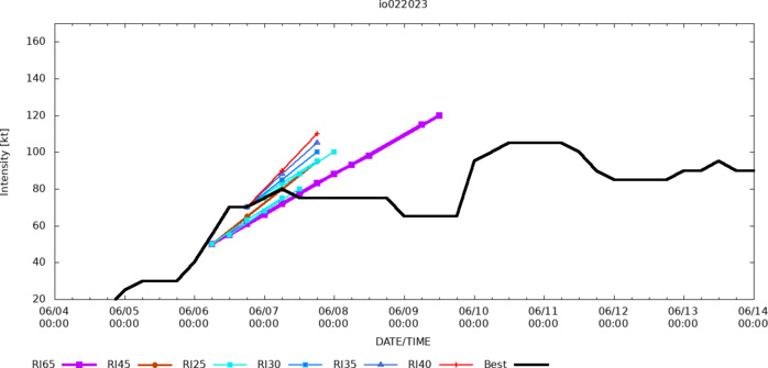
RIPA Forecast AND RIPA STORM TABLE ATTACHED BELOW
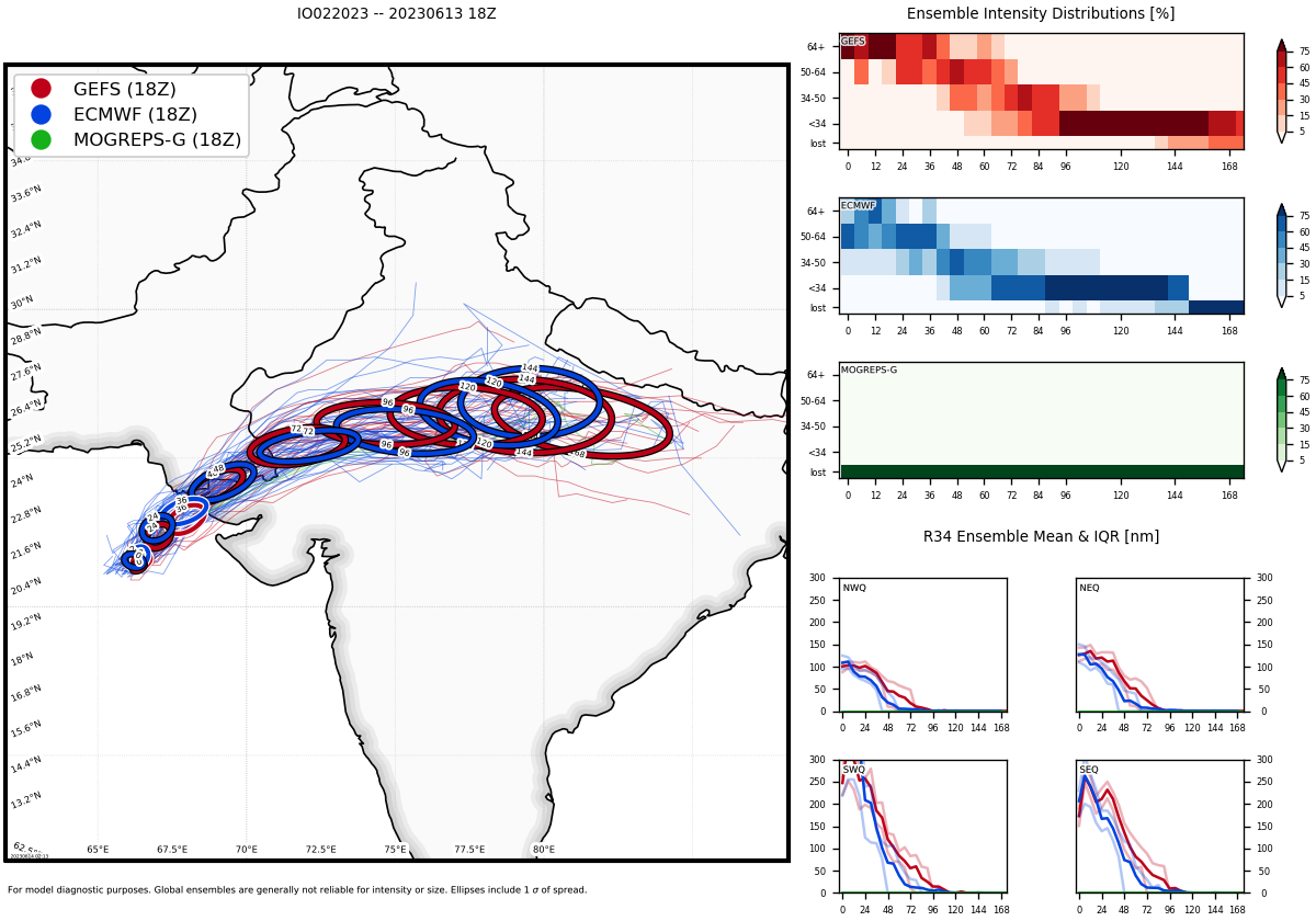
Ensemble Track Ellipses
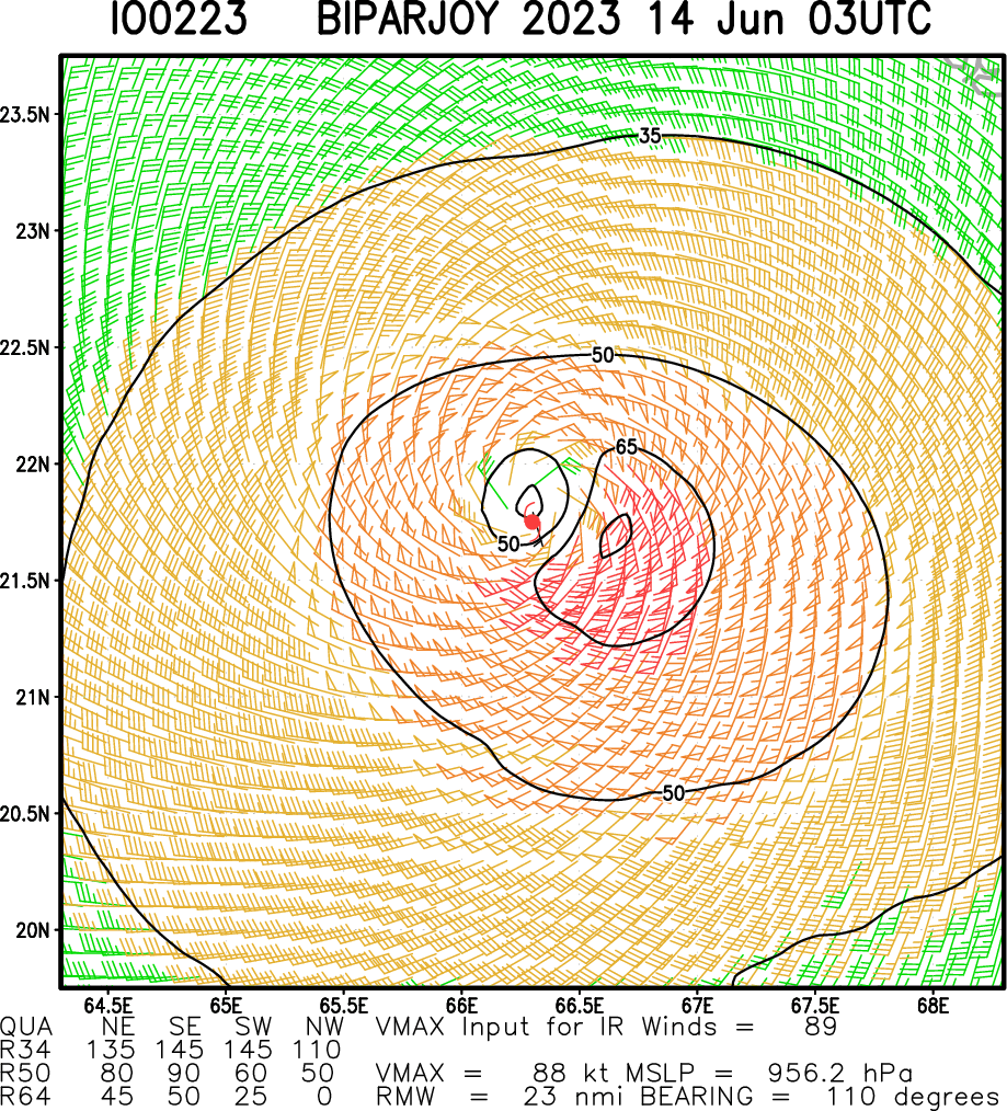
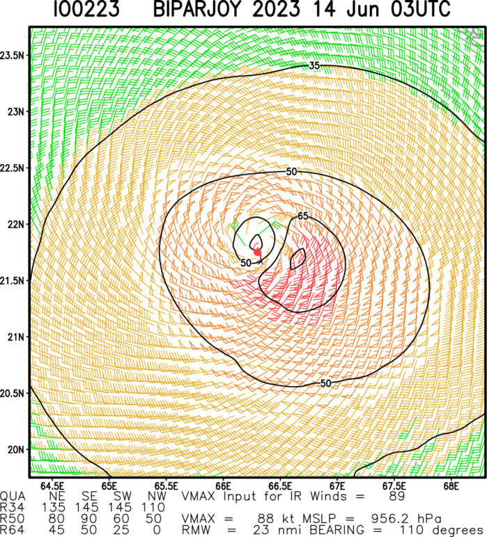
Multiplatform Satellite Surface Wind Analysis (Experimental)
MAXIMUM 1 MINUTE WINDS: 96 KNOTS.
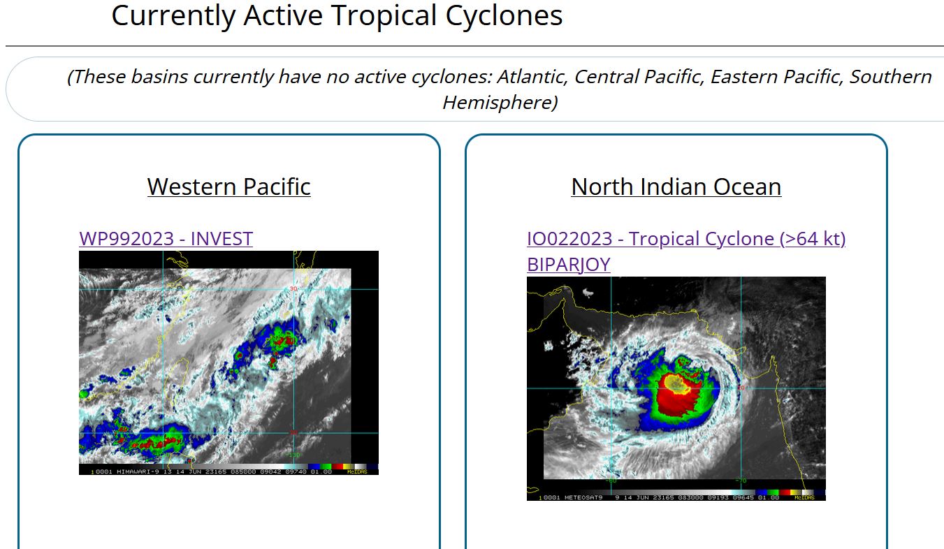
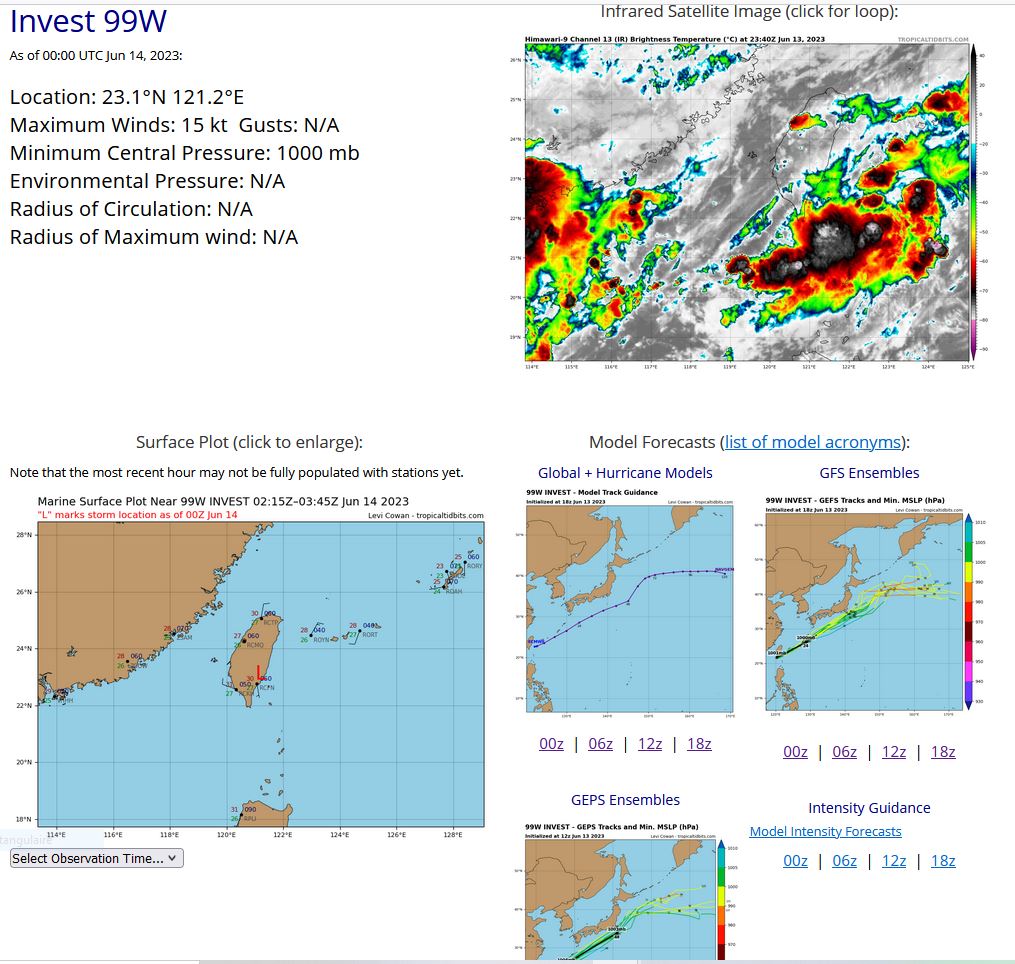
WESTERN NORTH PACIFIC: INVEST 99W. ESTIMATED LOCATION AND INTENSITY AT 140000UTC.
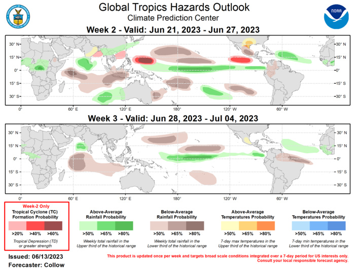
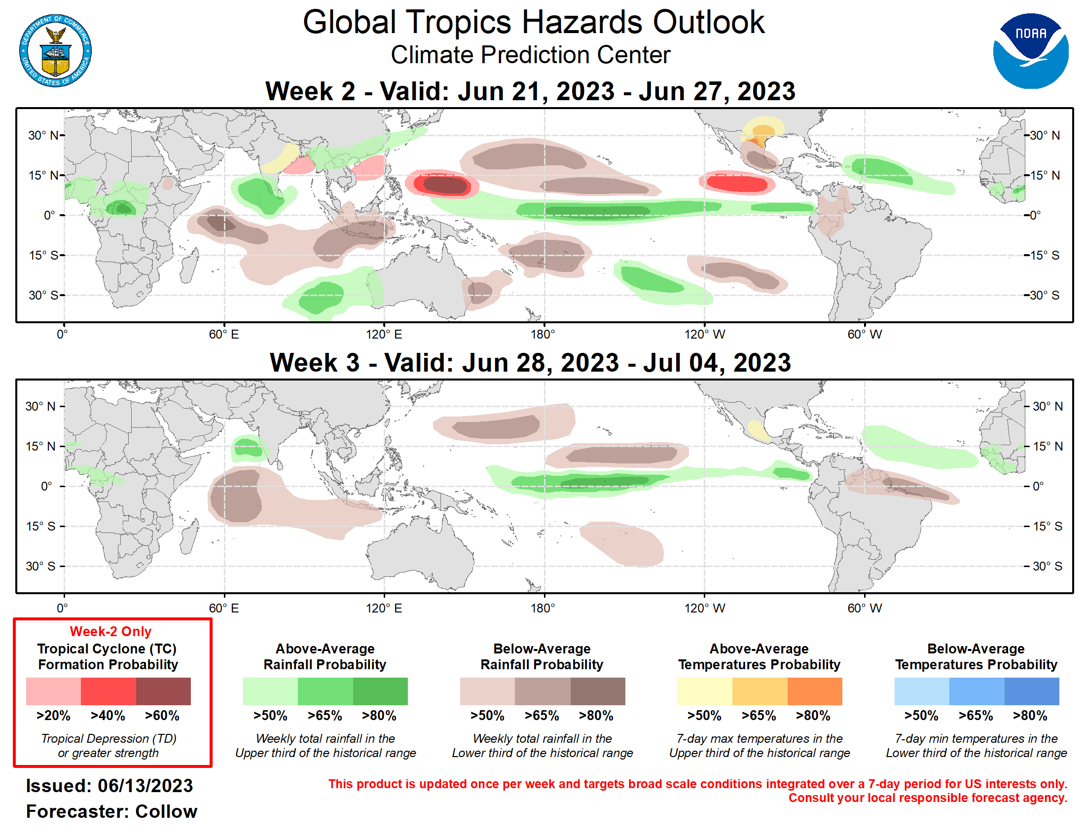
Last Updated - 06/13/23 Valid - 06/21/23 - 07/04/23 A weak RMM-based Madden Julian Oscillation (MJO) signal has propagated across the Western Hemisphere and into the Indian Ocean at the end of May and into early June. While RMM-based forecasts from the GEFS and ECMWF ensembles generally depict a weakening of the signal back into the unit circle, upper-level velocity potential based MJO forecasts are more robust, depicting the MJO propagating across the Pacific during the next 2 weeks, possibly enhanced by the low frequency El Nino state. The GEFS also depicts a Convectively Coupled Kelvin Wave breaking off the main convective envelope and moving into the Atlantic, while the ECMWF indicates a longer persistence of suppressed convection across the Atlantic. The only new TC formation during the past week was Tropical Cyclone 03B, which developed near the coast of Bangladesh on 6/9, and quickly moved inland. Cyclone Biparjay and Typhoon Guchol reached their peak intensities over the Arabian Sea and Western Pacific respectively. Biparjay is forecast to move into southeastern Pakistan or western India, with Guchol becoming a remnant low southeast of Japan. Invest 99W, currently over the South China Sea, has a low chance (10% per the Joint Typhoon Warning Center) for developing into a TC. The strongest enhanced convective signal is forecast across the Western Pacific during the next 2 weeks, with the MJO constructively interfering with El Nino, and perhaps enhanced Rossby Wave activity. This supports a 60 percent chance of TC formation across the Western Pacific basin east of the Philippines in today’s outlook. This is also consistent with seasonal climatology, as well as several ECMWF ensemble members which indicate a system developing in week-2. TC development may also occur across the South China Sea given the enhanced convection predicted over the region, although probabilities are weaker compared to further east, and only a 20 percent chance for TC development is indicated. Although marginal, TC development is also possible (20 percent chance) across the Bay of Bengal given the delayed onset of the Indian Monsoon and increased wet signals over the region. TC formation probabilities are forecast to increase across the Eastern Pacific during the next 2 weeks as the enhanced convective envelope shifts eastward. The National Hurricane Center notes a 20 percent chance of TC development in week-1. By week-2, this signal increases further, with several GEFS and ECMWF ensemble members depicting TC development to the southwest of Mexico, supporting a 40 percent chance for TC formation in today’s week-2 outlook. Multiple GEFS and ECMWF ensemble members depict potential TC formation across the Main Development Region in the Atlantic. However, based on climatology, it is likely too early to have TC development in this region despite enhanced precipitation signals in both models. Therefore, no risk area is designated over the Atlantic Basin. The precipitation outlook for weeks 2 and 3 is based on a historical skill weighted blend of GEFS, ECMWF, CFS and Canadian ensemble guidance, anticipated TC tracks, and historical precipitation composites of Maritime Continent and Western Pacific MJO events during May-Jul. Above-normal rainfall is generally forecast across the equatorial Pacific tied to enhanced convection and El Nino. The suppressed phase of the MJO supports below-normal rainfall across much of the southern Indian Ocean during weeks 2 and 3, with increased onshore flow across western Australia favoring above-normal rainfall during week-2. Increased rainfall is also forecast across the central Atlantic, including over the northwesternmost Caribbean Islands. Hot temperatures are possible across portions of central and eastern India, and across Mexico and the south-central U.S., with daytime highs across both regions possibly exceeding 100 deg F.
