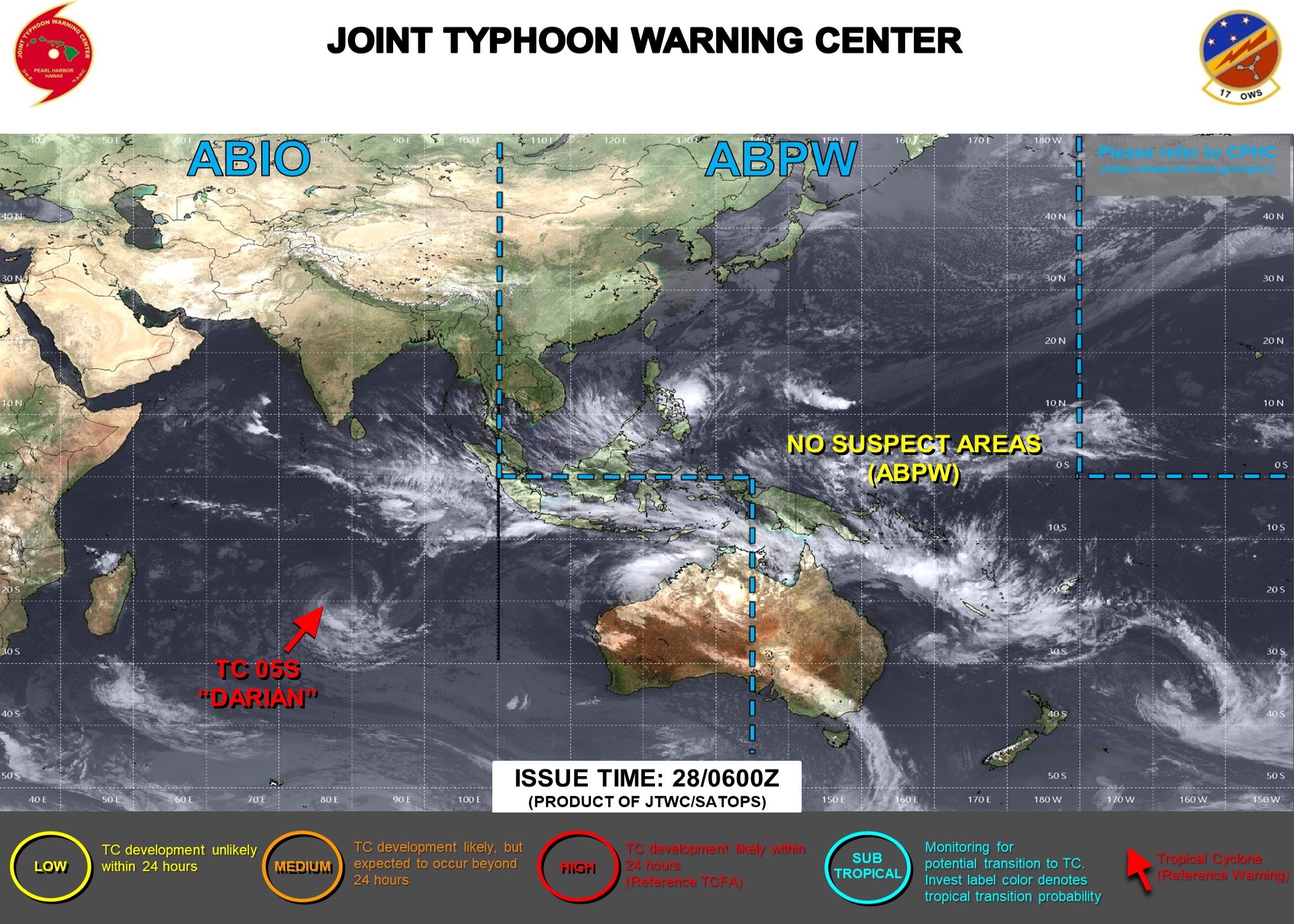
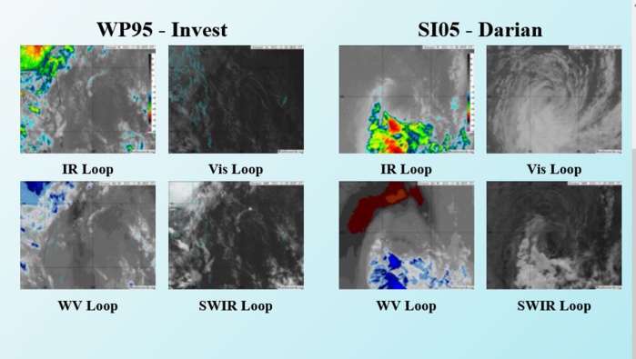
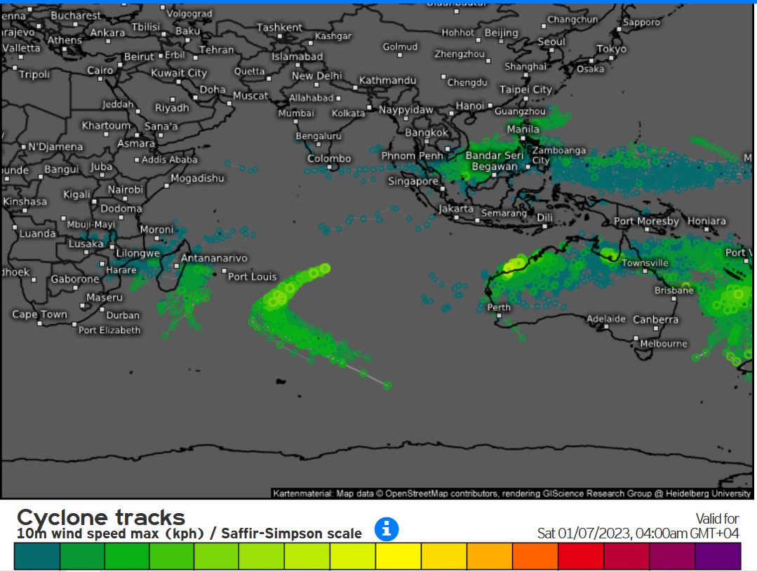
CLICK ON THE IMAGERIES BELOW TO GET THEM ENLARGED
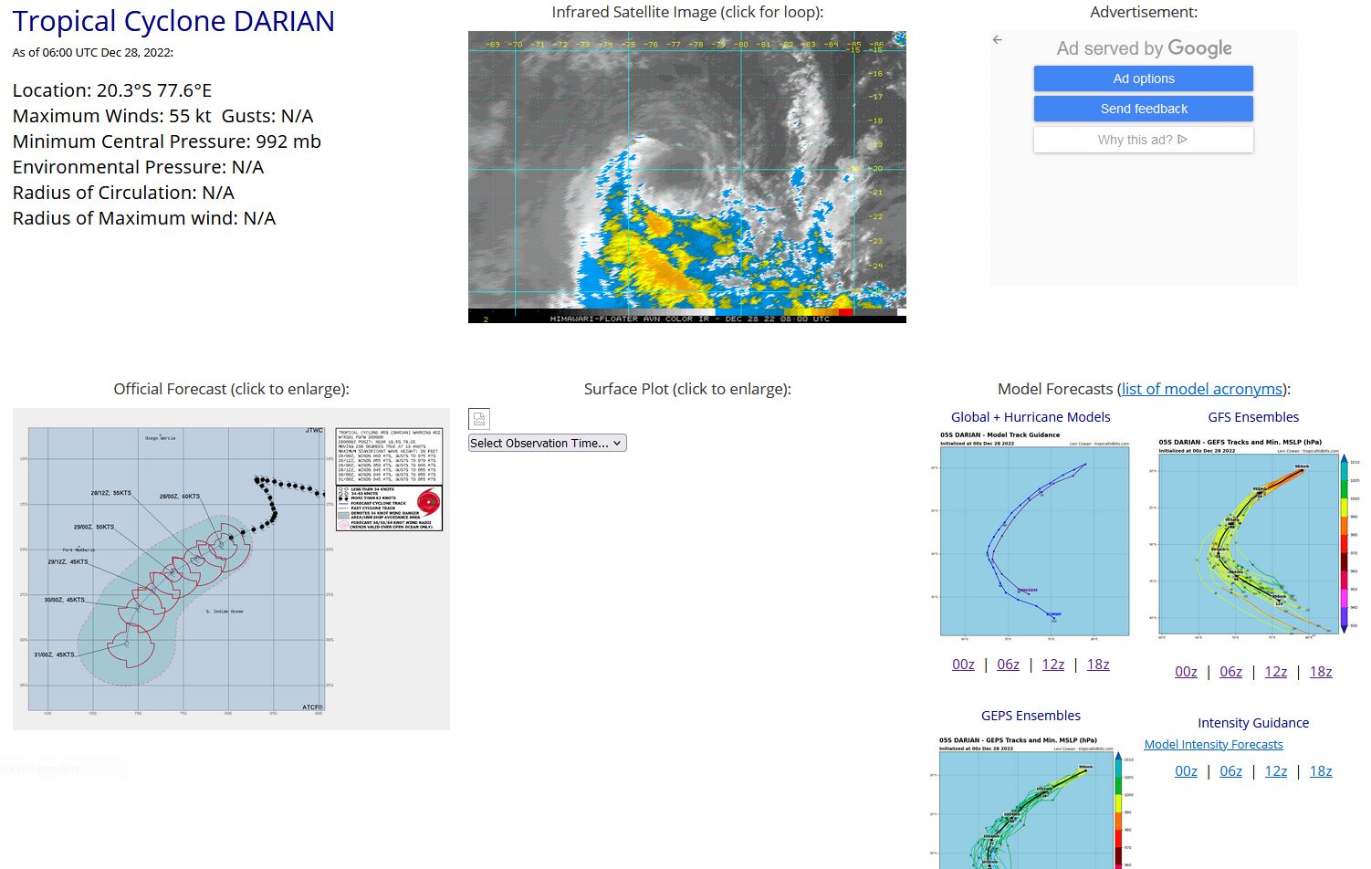
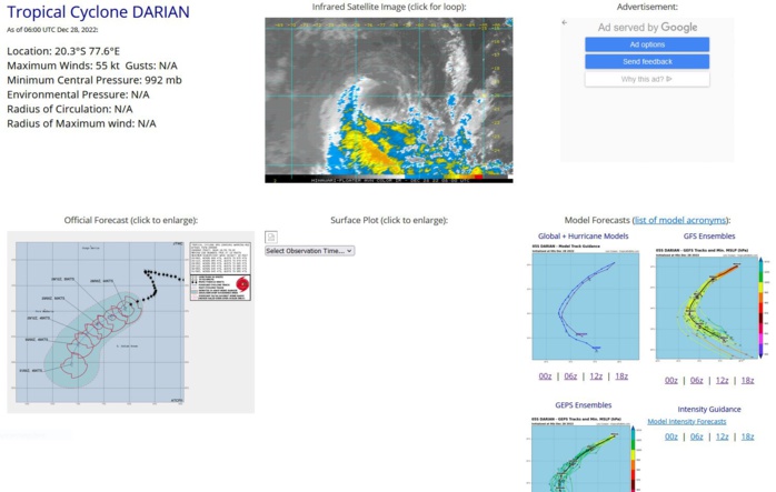
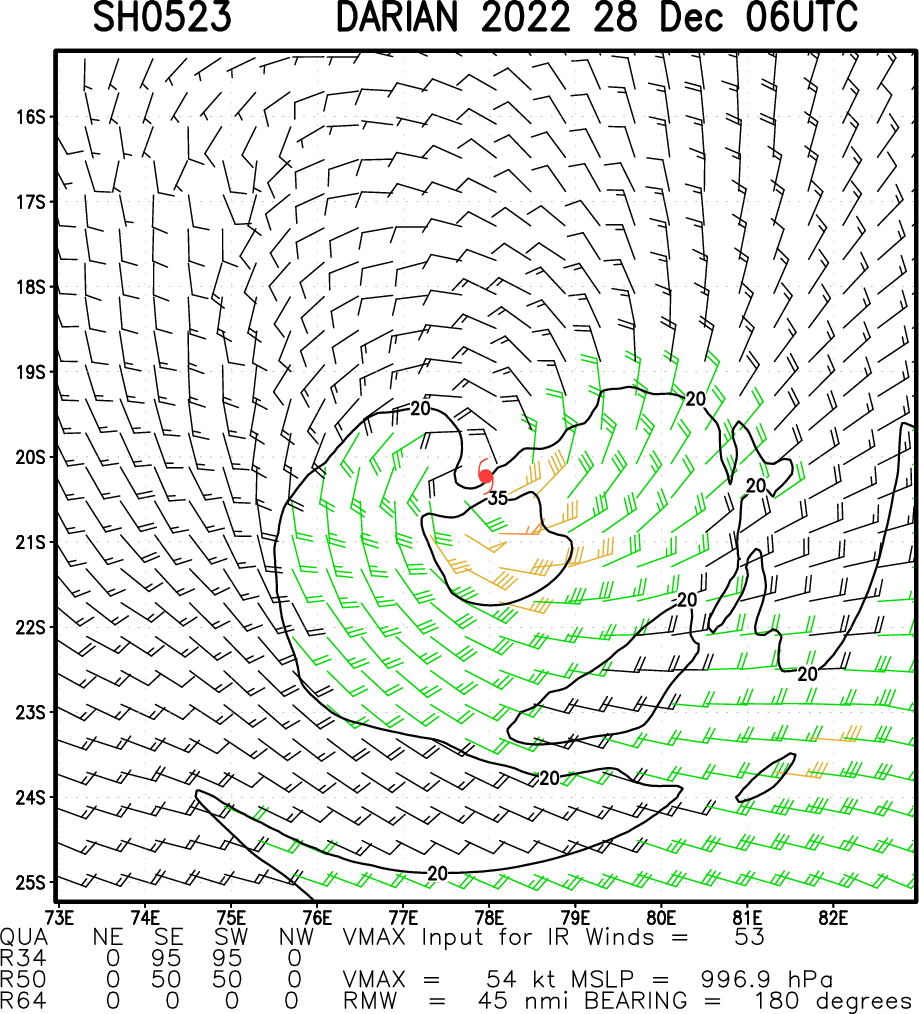
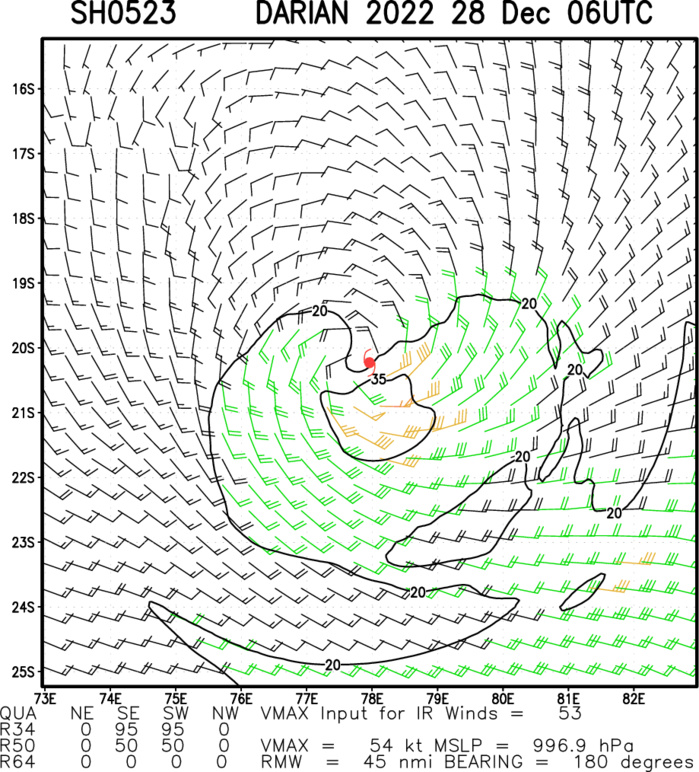
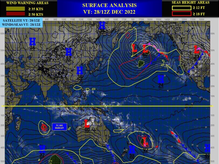
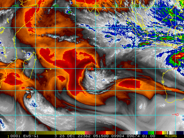
SOUTH INDIAN OCEAN: TC 05S(DARIAN). ESTIMATED LOCATION AND INTENSITY AT 28/06UTC.
SH, 05, 2022122612,168S, 848E, 110, 948, TY
SH, 05, 2022122618,171S, 843E, 105, 953, TY
SH, 05, 2022122700,175S, 837E, 90, 967, TY
SH, 05, 2022122706,178S, 828E, 80, 976, TY
SH, 05, 2022122712,181S, 816E, 75, 979, TY
SH, 05, 2022122718,187S, 803E, 70, 983, TY
SH, 05, 2022122800,195S, 792E, 60, 989, TS
SH, 05, 2022122806,203S, 776E, 55, 992, TS
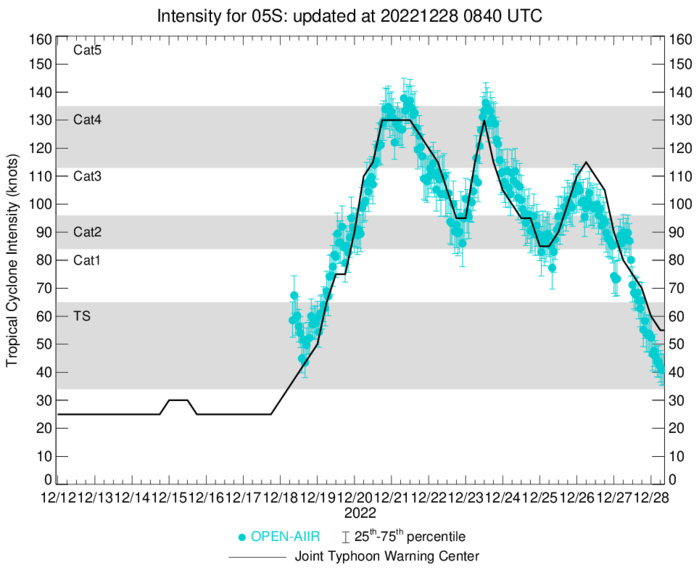
CURRENT ESTIMATED INTENSITY IS 55KNOTS/992MB.
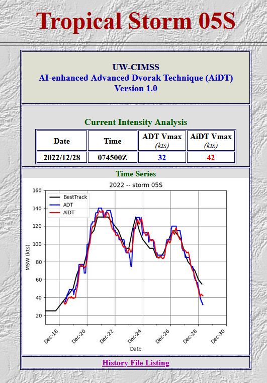
OPEN-AIIR DATA. LATEST DVORAK ANALYSIS AT 28/0845UTC: T2.5/3.5/W2.0/24HRS STT: W0.5/03HRS

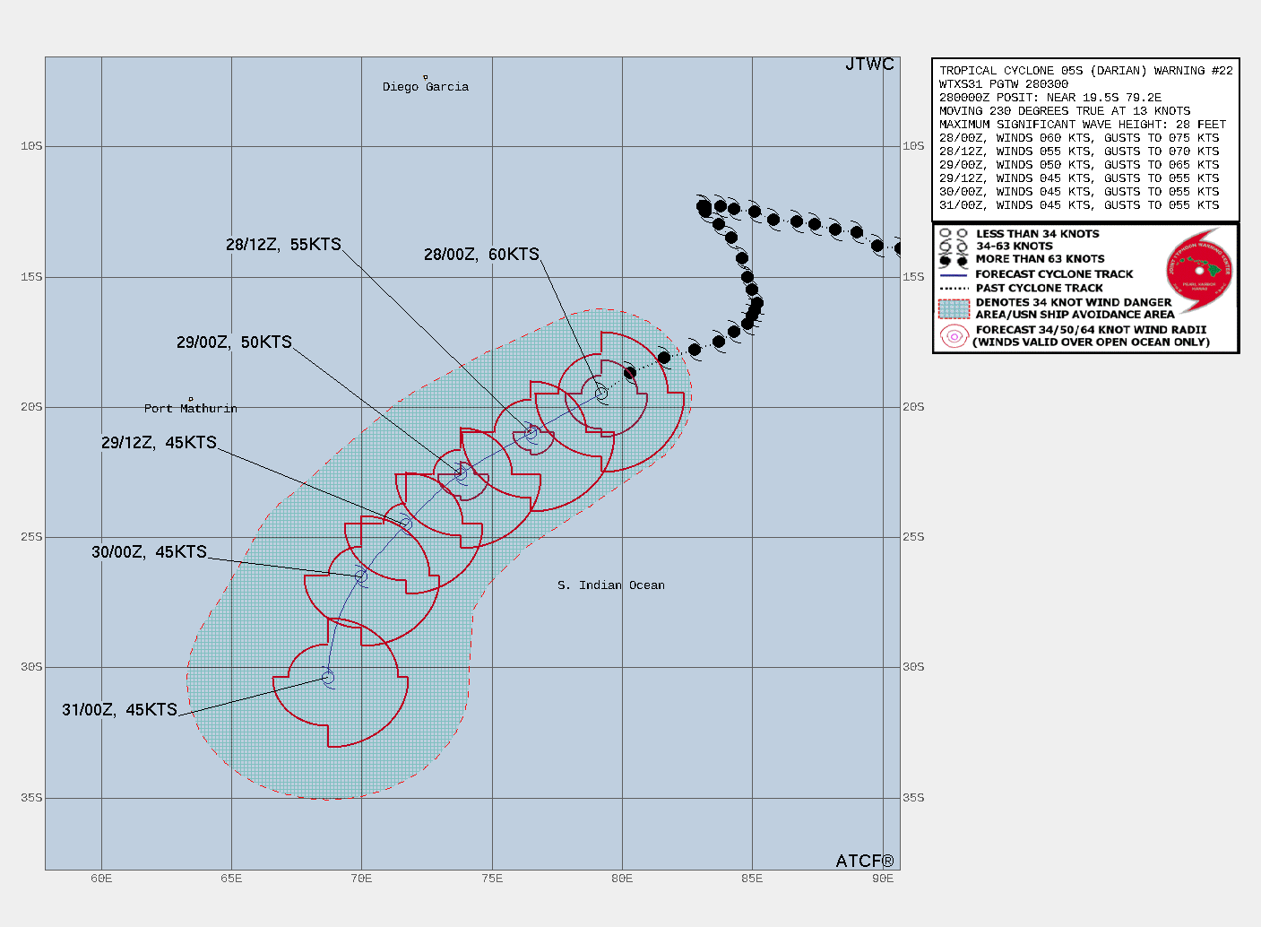
WARNING 22 ISSUED AT 28/03UTC.

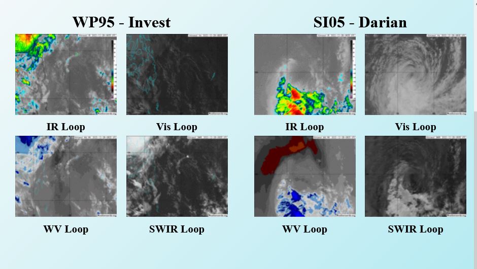
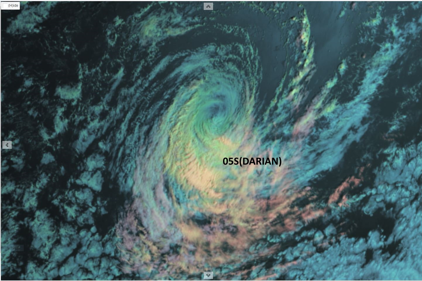
SATELLITE ANALYSIS, INITIAL POSITION AND INTENSITY DISCUSSION: TROPICAL CYCLONE (TC) 05S HAS CONTINUED TO WEAKEN DUE TO PERSISTENT NORTHERLY VERTICAL WIND SHEAR, COOLER SEA SURFACE TEMPERATURE AND DRY AIR ENTRAINMENT AS EVIDENCED IN ANIMATED MULTISPECTRAL SATELLITE IMAGERY, WHICH SHOWS AN EXPOSED LOW-LEVEL CIRCULATION CENTER (LLCC) WITH RAPIDLY-DECAYING DEEP CONVECTION CONFINED TO THE SOUTHERN SEMICIRCLE. DESPITE THE POOR DEEP CONVECTIVE STRUCTURE, LOW-LEVEL BANDING CONTINUES TO WRAP TIGHTLY INTO A WELL-DEFINED LLCC. ADDITIONALLY, A 272331Z SSMIS 37GHZ MICROWAVE IMAGE REVEALS SHALLOW BANDING WRAPPING INTO A RAGGED BUT DEFINED LLCC, WHICH, ALONG WITH THE MSI, SUPPORTS THE INITIAL POSITION WITH HIGH CONFIDENCE. A RECENT 271953Z AMSR2 WINDSPEED IMAGE INDICATES AN ASYMMETRIC WIND FIELD BUT SHOWS A SWATH OF 50-61 KNOT WINDS OVER THE SOUTHERN QUADRANT, THEREFORE, THE INITIAL INTENSITY IS HELD AT 60 KNOTS. THIS ESTIMATE IS CONSISTENT WITH THE DVORAK CURRENT INTENSITY ESTIMATES AS WELL AS THE CIMSS SATCON ESTIMATE.
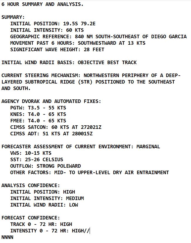

FORECAST REASONING. SIGNIFICANT FORECAST CHANGES: THERE ARE NO SIGNIFICANT CHANGES TO THE FORECAST FROM THE PREVIOUS WARNING. FORECAST DISCUSSION: TC 05S WILL TRACK STEADILY SOUTHWESTWARD THROUGH TAU 48 ALONG THE NORTHWESTERN PERIPHERY OF THE STR. AFTER TAU 48, THE SYSTEM WILL TURN SOUTH-SOUTHWESTWARD AS IT ROUNDS THE WESTERN PERIPHERY OF THE STR. TC 05S WILL COMMENCE SUBTROPICAL TRANSITION NEAR TAU 48 AS IT ENCOUNTERS INCREASING NORTHWESTERLIES ALONG THE LEADING EDGE OF AN APPROACHING SUBTROPICAL TROUGH. INCREASING DRY AIR ENTRAINMENT AND COOLING SST (22-24C) WILL SERVE TO FURTHER WEAKEN THE SYSTEM. BY TAU 72, THE SYSTEM WILL BECOME EMBEDDED WITHIN THE SUBTROPICAL TROUGH AND COMPLETE SUBTROPICAL TRANSITION.
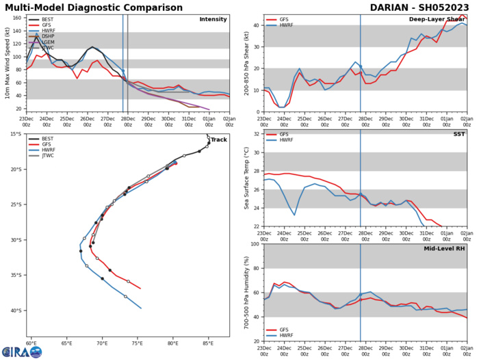
MODEL DISCUSSION: NUMERICAL MODEL GUIDANCE REMAINS IN TIGHT AGREEMENT LENDING HIGH CONFIDENCE TO THE JTWC FORECAST TRACK. OVERALL, THIS FORECAST IS HIGHLY CONSISTENT WITH THE PREVIOUS TRACK FORECAST. INTENSITY GUIDANCE IS ALSO IN GOOD AGREEMENT WITH A 40-50 KNOT SPREAD IN GUIDANCE AT TAU 48-72.
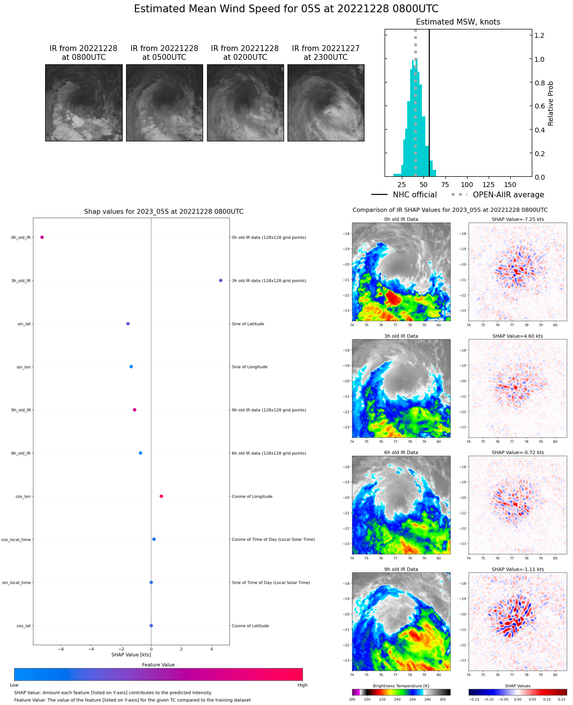
Multiplatform Satellite Surface Wind Analysis (Experimental)
DRY AIR ENTRAINMENT IS TAKING ITS TOLL ON TC 05S.
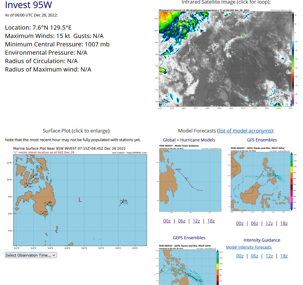
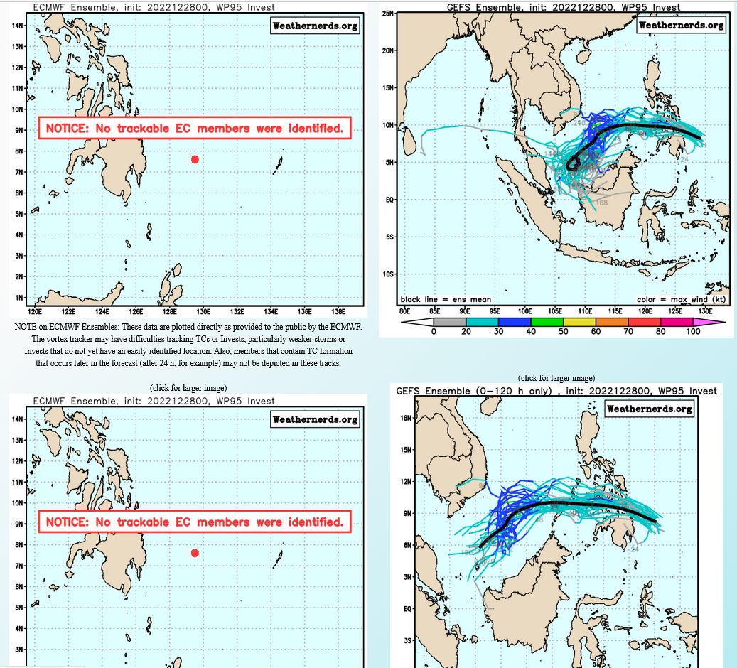
WESTERN NORTH PACIFIC: INVEST 95W. ESTIMATED LOCATION AND INTENSITY AT 28/06UTC.
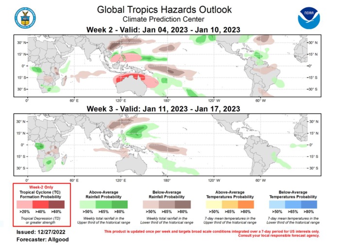
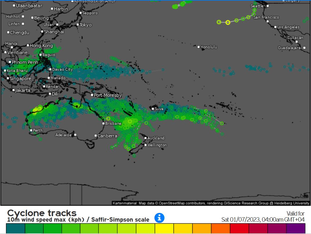
Last Updated - 12/27/22 Valid - 01/04/23 - 01/17/23 Recent observations, including both the CPC upper-level velocity potential based and RMM-based MJO indices, reflect an active MJO signal, with the enhanced phase currently crossing the Maritime Continent. Rossby wave interference over the Indian Ocean that led to a weaker projection of the MJO onto the RMM index for much of December has relaxed, and clear eastward propagation has been established over the past week. A Maritime Continent MJO tends to constructively interfere with the La Nina base state, and trade winds have recently strengthened across the west-central Pacific. Dynamical model MJO forecasts are in fair agreement supporting continued evolution of the MJO, with the signal propagating to the West Pacific during Week-1, and possibly the Western Hemisphere by Week-2. Many ensemble members from both the GEFS monthly and extended ECMWF depict the signal returning to the Indian Ocean by Week-4. During the Boreal winter months, the MJO teleconnects well into the downstream midlatitude pattern, and the anticipated warmth over the eastern U.S. during Week-2 is consistent with a lagged response to an Indian Ocean and Maritime Continent MJO. As the signal crosses the West Pacific, the MJO response favors a pattern change towards increased troughing over the eastern US, and recent Weeks 3-4 forecasts over the US are beginning to reflect this signal; however, a lack of substantial cold air over Canada may help limit the potential for severe cold air outbreaks. Two tropical cyclones formed over the Indian Ocean basin during the past week. Tropical Storm Ellie formed on 22 December north of Australia, and made landfall over Northern Territory, causing generally light damage. Cyclone Darian formed over the eastern Indian Ocean on 18 December, strengthening to a strong Category-4 intensity on the Saffir-Simpson scale while moving generally westward. Now well southeast of Diego Garcia, Cyclone Darian is forecast to weaken while recurving over the southern Indian Ocean. During the Week-2 period, an MJO crossing from the Maritime Continent to the West Pacific tends to favor tropical cyclogenesis north of Australia and over the Coral Sea, as well as the Northwest Pacific in the vicinity of the Philippines. Despite a fairly strong South Pacific Convergence Zone (SPCZ), dynamical models do not favor tropical cyclone development east of the Coral Sea. Forecasts for above- and below-normal precipitation are based on a consensus of dynamical model inputs, with an anticipated continuation of La Nina conditions and an active MJO crossing the West Pacific towards the Western Hemisphere. Due to destructive interference between the MJO and the base state, widespread enhanced convection is not favored near the Equator, but dynamical models indicate widespread MJO-associated convection both north and south of the Equator, in the vicinity of Guam, north of New Guinea, and near the Philippines, and along the SPCZ. The wet signal over the Northwest Pacific is favored to shift slightly poleward during Week-3.
