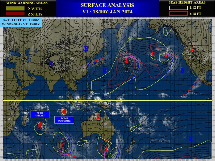
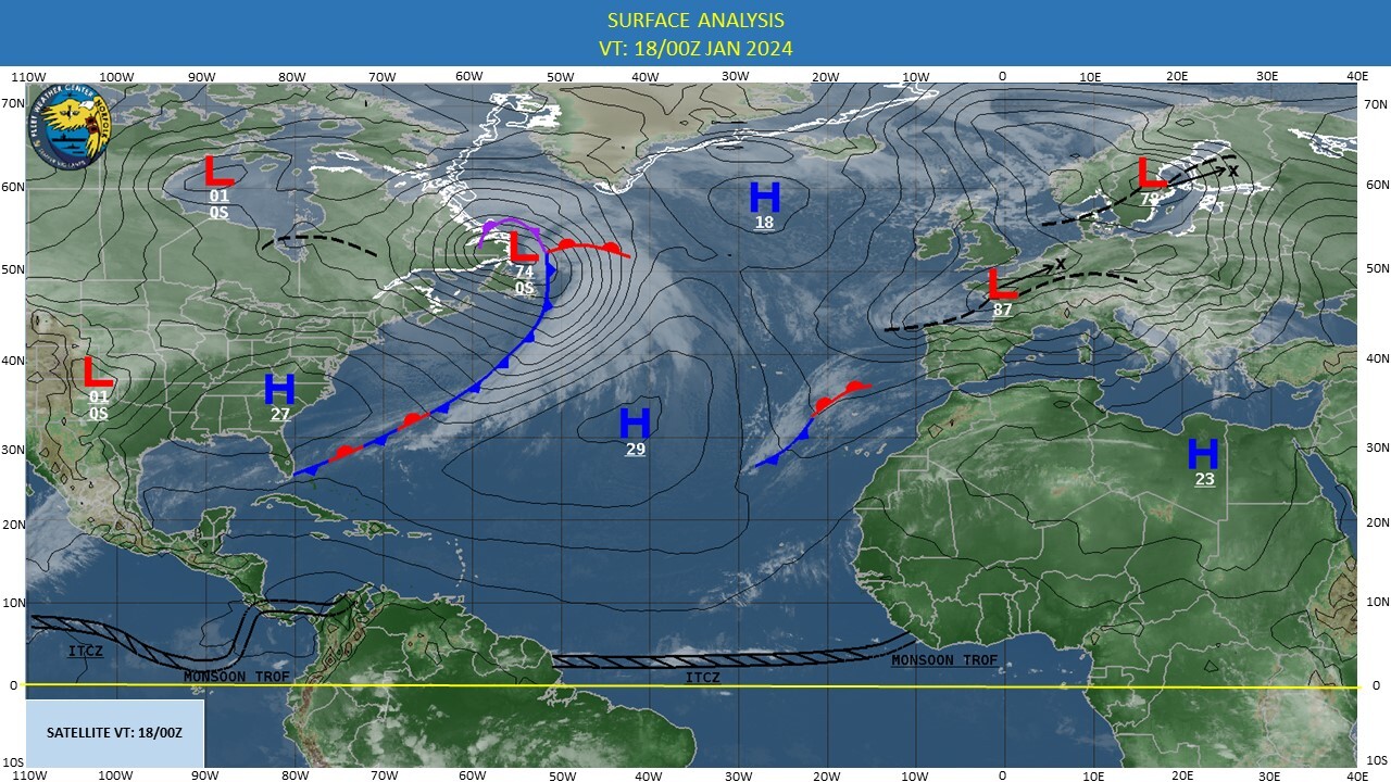
CLICK ON THE IMAGERIES BELOW TO GET THEM ENLARGED
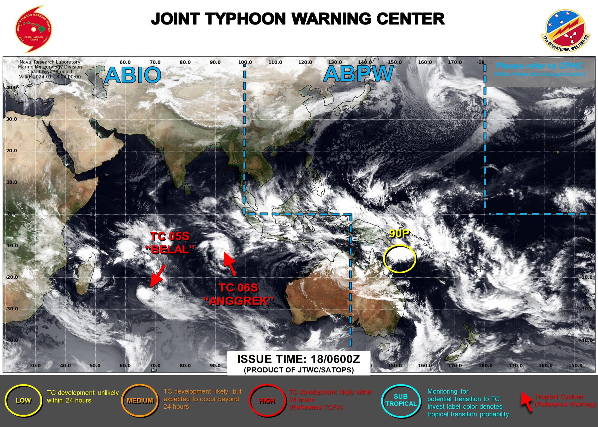
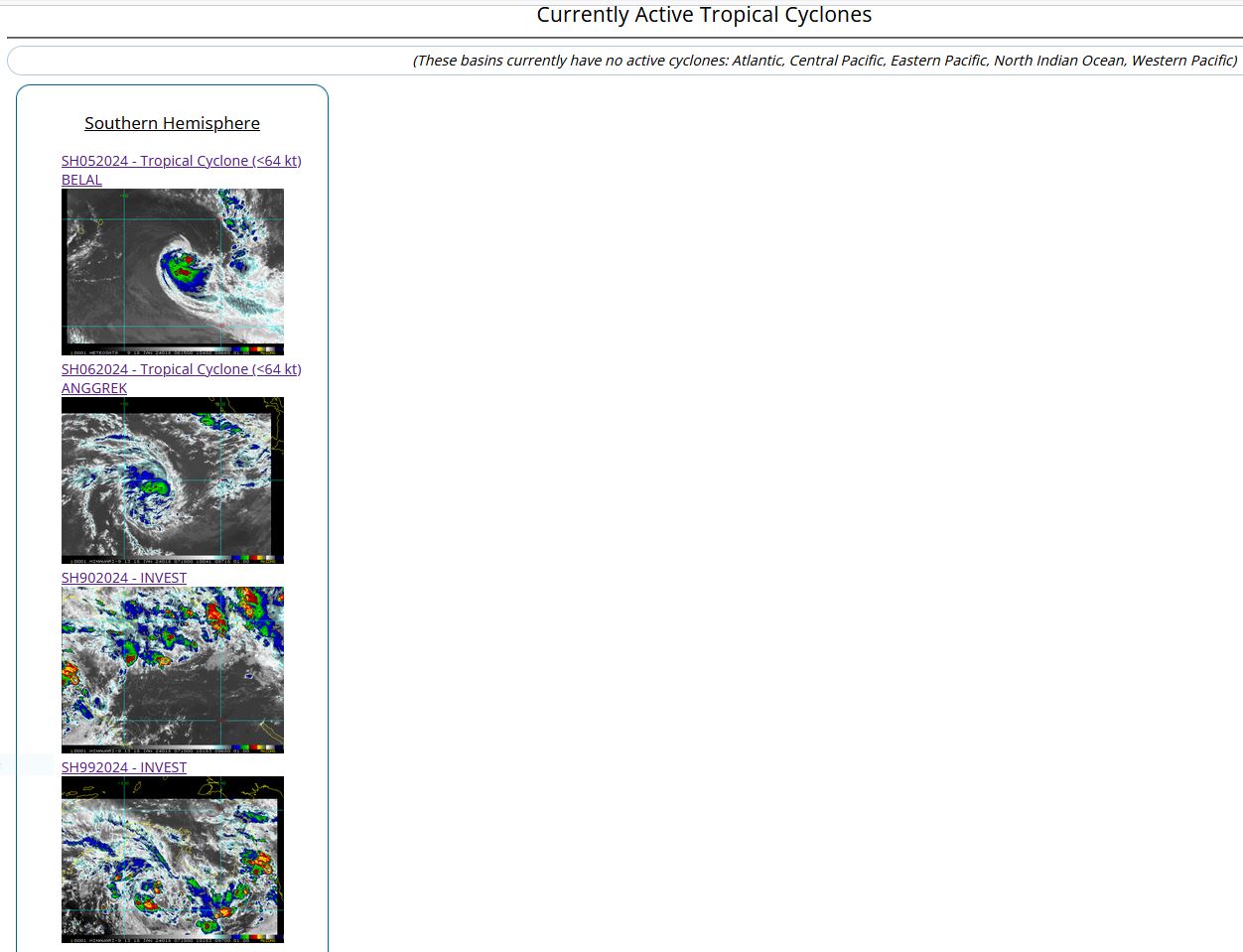
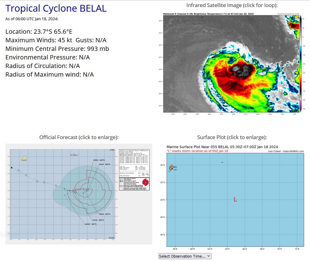
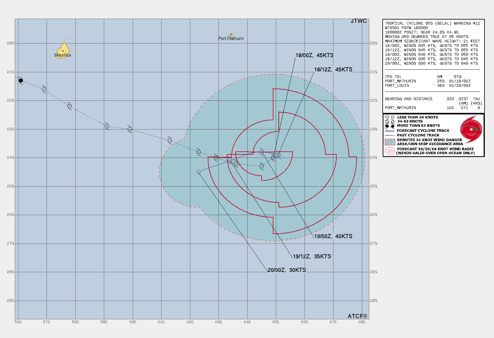
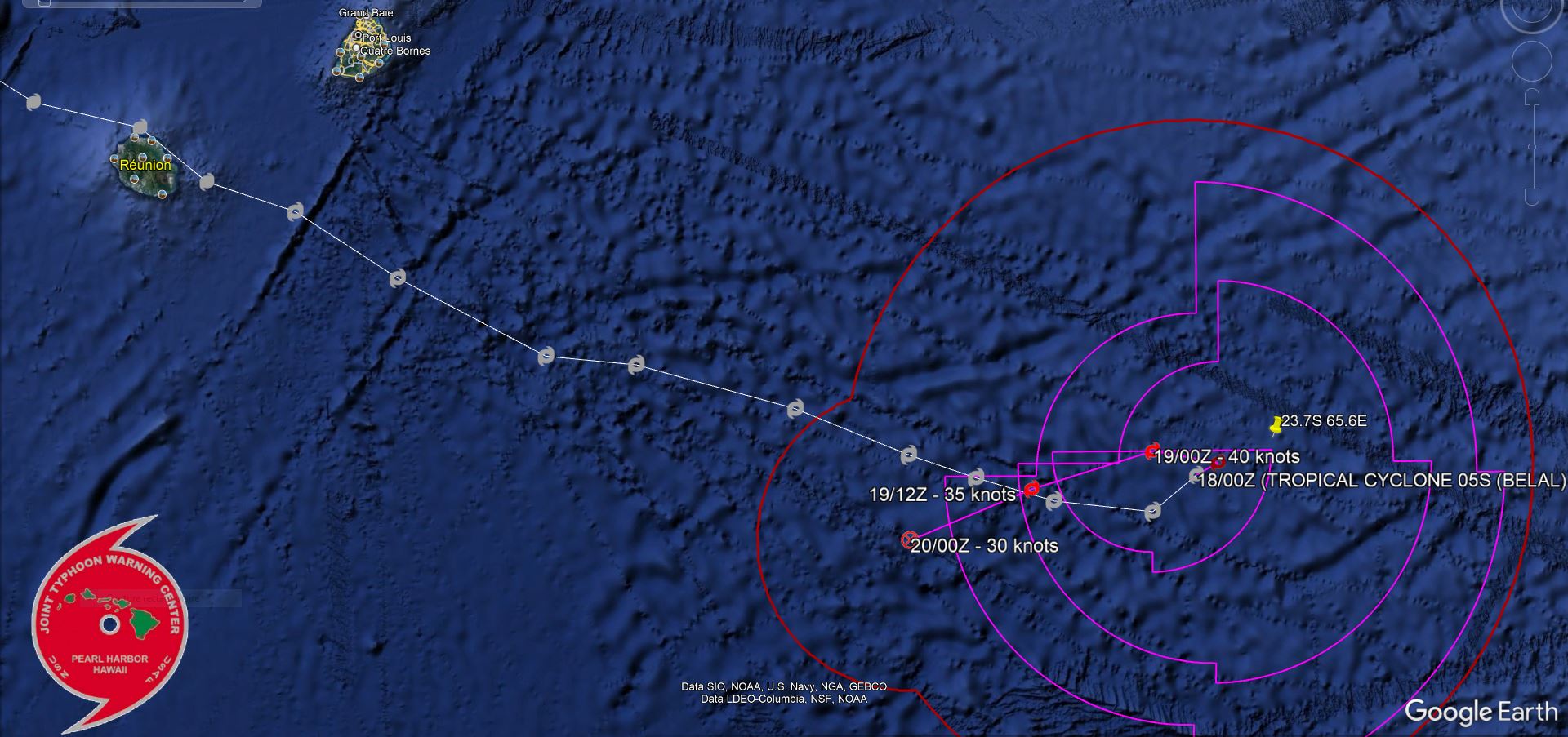
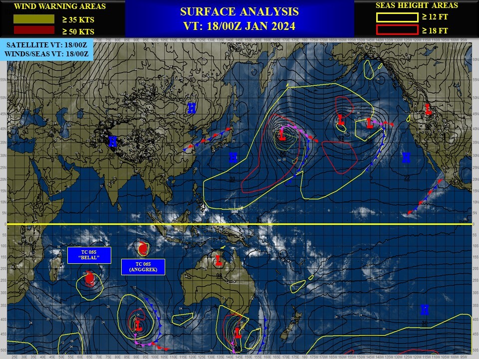
SOUTH INDIAN OCEAN: TC 05S(BELAL). ESTIMATED LOCATION AND INTENSITY AT 18/06UTC IS 45 KNOTS: -5 KNOTS OVER 24HOURS.
WARNING 12 ISSUED AT 18/03UTC.
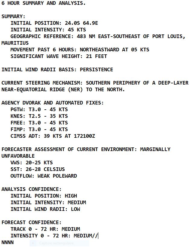
2024 JAN 18 07UTC
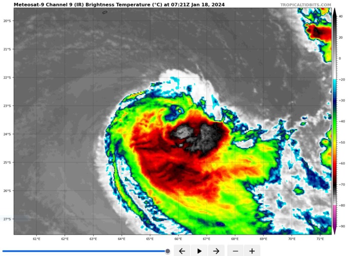
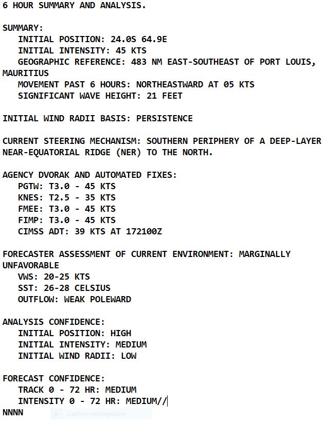
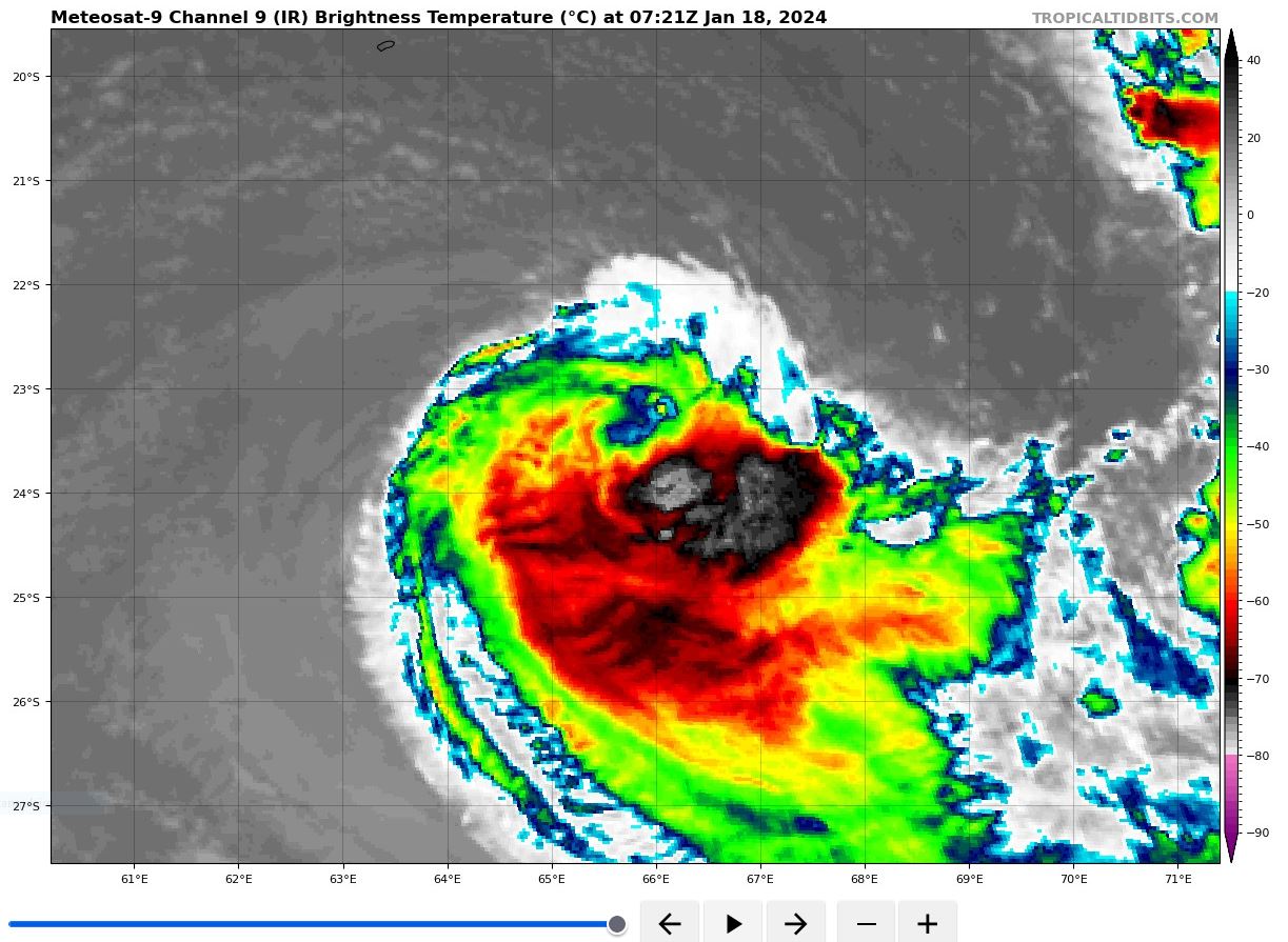
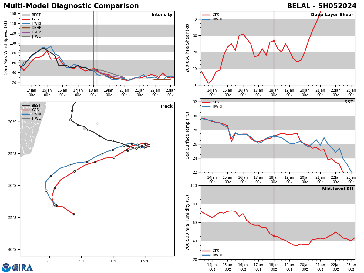
SATELLITE ANALYSIS, INITIAL POSITION AND INTENSITY DISCUSSION: ANIMATED MULTISPECTRAL SATELLITE IMAGERY (MSI) DEPICTS TC 05S (BELAL) WITH A PARTIALLY EXPOSED LOW-LEVEL CIRCULATION CENTER (LLCC) LOCATED JUST NORTH OF AN OBSERVABLE CONVECTIVE STRUCTURE BEING HEAVILY INFLUENCED BY A NORTHWESTERLY SHEAR COMPONENT. THE STORM HAS CREPT NORTHEASTWARD OVER THE LAST SIX HOURS, AS IT IS INCREASINGLY INFLUENCED BY THE STEERING RIDGES TO THE NORTHEAST AND SOUTH. THE INITIAL POSITION WAS IDENTIFIED WITH HIGH CONFIDENCE BY A 172246Z 37GHZ MICROWAVE PASS, INDICATING AN ASYMMETRIC AND SHALLOW EYE-LIKE FEATURE WITH DEEP, BUT ISOLATED CONVECTION JUST TO THE SOUTHEAST. THE INITIAL INTENSITY WAS ASSESSED WITH MEDIUM CONFIDENCE BASED ON PERSISTENCE AND SUSTAINED CONVECTIVE DEVELOPMENT WITH SUBJECTIVE AND OBJECTIVE FIXES LISTED BELOW. STRONG NORTHWESTERLY VERTICAL WIND SHEAR (VWS) WITH CONTINUOUS DRY-AIR ENTRAINMENT FROM THE WEST WILL CONTINUE TO DISSIPATE TC 05S THROUGH THE FORECAST PERIOD (TAU 48), DESPITE RELATIVELY WARM SEA SURFACE TEMPERATURES (SST) OF 26-28C.
TC Warning Graphic
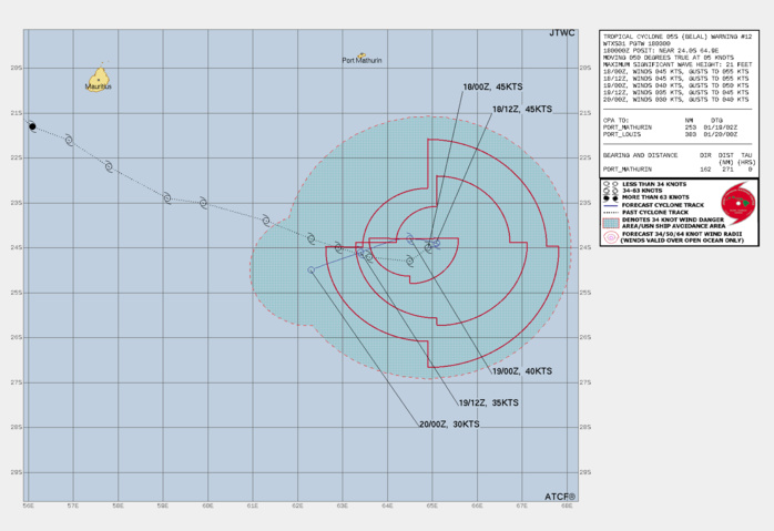
FORECAST REASONING. SIGNIFICANT FORECAST CHANGES: THERE ARE NO SIGNIFICANT CHANGES TO THE FORECAST FROM THE PREVIOUS WARNING. FORECAST DISCUSSION: TC 05S (BELAL) IS FORECASTED TO CONTINUE TO PROGRESS SLIGHTLY FURTHER TO THE NORTHEAST AND LOOP BACK TO THE WEST ALONG THE SOUTHERN EDGE OF THE NER TO THE NORTH, SLOWS DOWN TO A NEAR-STALL, AND EJECTS SHARPLY SOUTHWESTWARD ALONG THE NORTHERN SIDE OF A LOW TO MID-LEVEL MID-LATITUDE AREA OF ANTICYCLONIC ROTATION POSITIONED DIRECTLY POLEWARD OF TC 05S BETWEEN TAU 0 AND TAU 36. THROUGHOUT THE FORECAST PERIOD, THE CYCLONE WILL CONTINUE TO DECREASE IN INTENSITY AS STRONG WIND SHEAR (25-30 KTS) WILL FURTHER DISSIPATE THE TROPICAL STRUCTURE OF THE SYSTEM, DEGRADING ANY OPPORTUNITY FOR FURTHER DEVELOPMENT. TC 05S WILL ALSO CONTINUE TO BE FURTHER WEAKENED A CONTINUOUS SURGE OF DRY AIR FROM THE WESTERN PERIPHERY, COMPLETELY ENCIRCLING THE TC BY TAU 48. THE COMBINATION OF DRY AIR AND STRONG VWS WILL LEAD TO DISSIPATION OVER WATER BY TAU 48.
48H FORECAST TRACK+ 18/06UTC ESTIMATED LOCATION
Model Diagnostic Plot
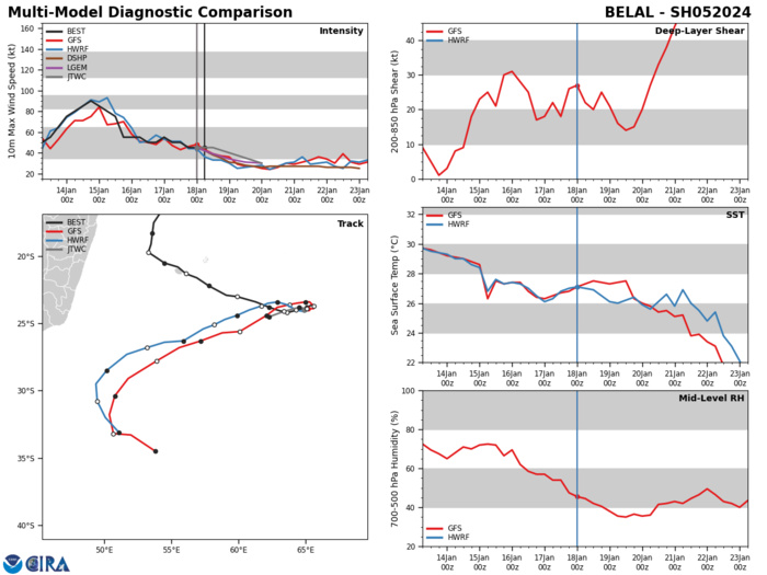
MODEL DISCUSSION: DETERMINISTIC MODEL GUIDANCE IS IN AGREEMENT THAT TC 05S (BELAL) WILL CONTINUE TO STEADILY SLOW IN ITS RE-CURVE TO THE WEST THROUGH TAU 12. THE MODELS ARE IN RELATIVE AGREEMENT THAT A DIRECTION SHIFT TO THE WEST IS EXPECTED, BACKING SLIGHTLY TO THE NORTH BY TAU 12, THEN PROGRESSING WEST AND SOUTHWESTWARD BETWEEN TAU 24 AND TAU 36. TRACK SPREAD DURING TC 05S RE-CURVE REMAINS IN CLOSE AGREEMENT WITH A CROSS-TRACK SPREAD OF 45 NM, AND INCREASING TO A CROSS-TRACK SPREAD DURING ITS SOUTHWESTWARD TREK BETWEEN TAU 24 AND TAU 48. THE CROSS-TRACK SPREAD CONTINUES TO INCREASE TO 150 NM NEAR TAU 48, AS TC 05S DISSIPATES WITH STRONG AND CONSTANT INFLUENCE FROM DRY-AIR ENTRAINMENT AND STRONG VWS. THE MAJORITY OF JTWC CONSENSUS MEMBERS AGREE THAT THE CYCLONE WILL STEADILY WEAKEN THROUGH THE END OF THE FORECAST PERIOD (TAU 48).
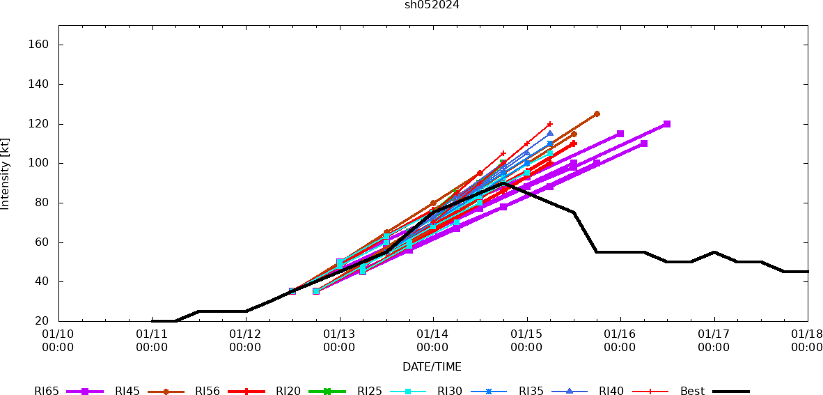
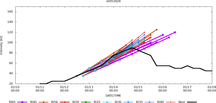
Rapid Intensification Guidance
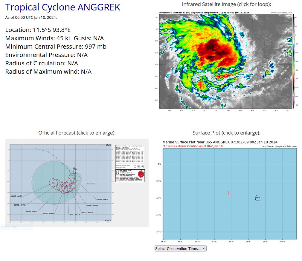
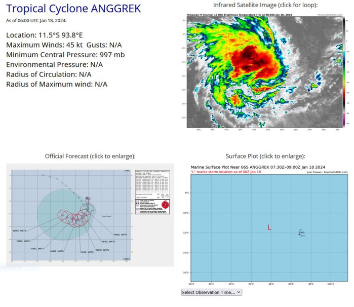
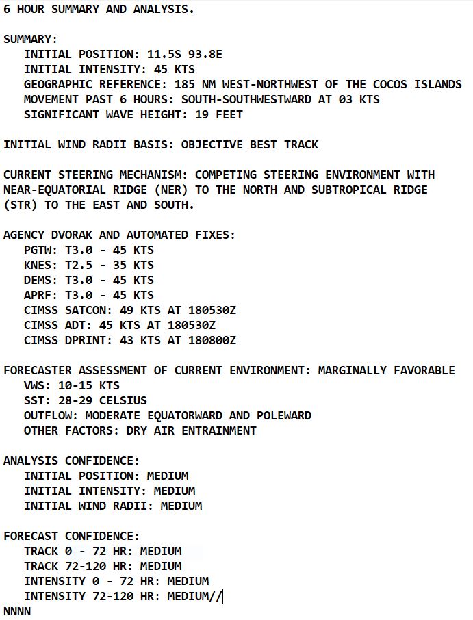
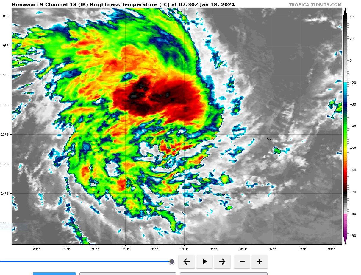
SOUTH INDIAN OCEAN: TC 06S(ANGGREK). ESTIMATED LOCATION AND INTENSITY AT 18/06UTC IS 45 KNOTS: -5 KNOTS OVER 24HOURS.
0624011606 95S 938E 45
0624011612 96S 940E 45
0624011618 96S 942E 45
0624011700 98S 941E 50
0624011706 101S 940E 50
0624011706 101S 940E 50
0624011712 104S 940E 45
0624011718 109S 940E 45
0624011800 112S 939E 45
0624011806 115S 938E 45
0624011612 96S 940E 45
0624011618 96S 942E 45
0624011700 98S 941E 50
0624011706 101S 940E 50
0624011706 101S 940E 50
0624011712 104S 940E 45
0624011718 109S 940E 45
0624011800 112S 939E 45
0624011806 115S 938E 45
WARNING 7 ISSUED AT 1809UTC.
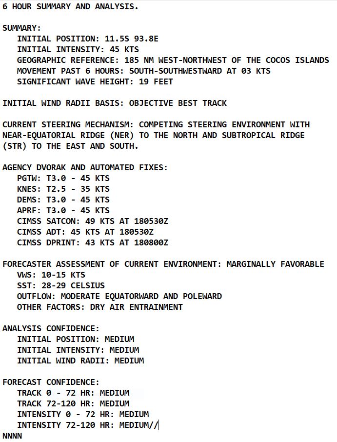
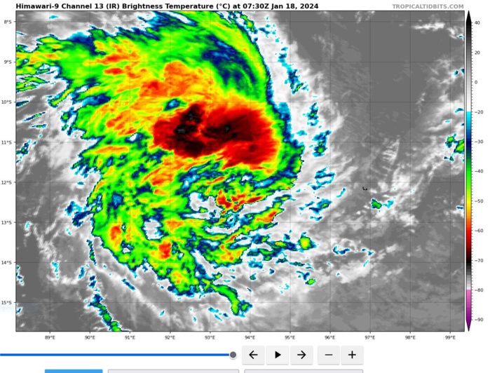
SATELLITE ANALYSIS, INITIAL POSITION AND INTENSITY DISCUSSION: ANIMATED MULTISPECTRAL SATELLITE IMAGERY (MSI) DEPICTS A BROAD, PARTIALLY-EXPOSED LOW-LEVEL CIRCULATION (LLC) WITH DEEP CONVECTIVE BANDING OVER THE NORTHERN SEMICIRCLE. A PARTIAL 180637Z ATMS 183 GHZ MICROWAVE IMAGE SHOWS THE BULK OF THE DEEP CONVECTION CONFINED TO THE NORTHERN SEMICIRCLE WITH A WEAKLY-DEFINED CENTER ON THE SOUTHERN EDGE OF THE CONVECTIVE BAND, WHICH SUPPORTS THE INITIAL POSITION WITH MEDIUM CONFIDENCE. THE 180000Z HAFS-A 700-300 MB RELATIVE HUMIDITY PRODUCT INDICATES DRY AIR ENTRAINMENT IS CURRENTLY OCCURRING OVER THE SOUTHERN SEMICIRCLE. THE INITIAL INTENSITY OF 45 KTS IS ASSESSED WITH MEDIUM CONFIDENCE BASED ON THE CURRENT INTENSITY ESTIMATES FROM PGTW, KNES AND APRF. ADDITIONALLY, IT IS SUPPORTED BY THE CIMSS ADT ESTIMATE.
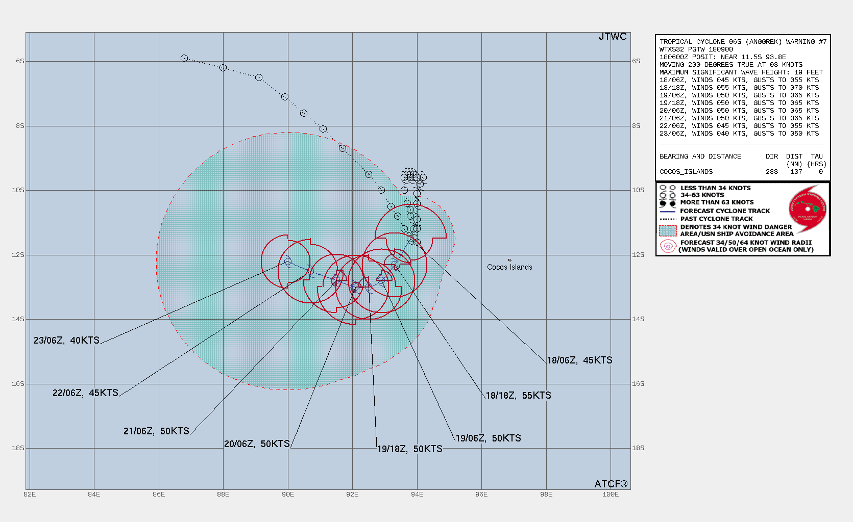
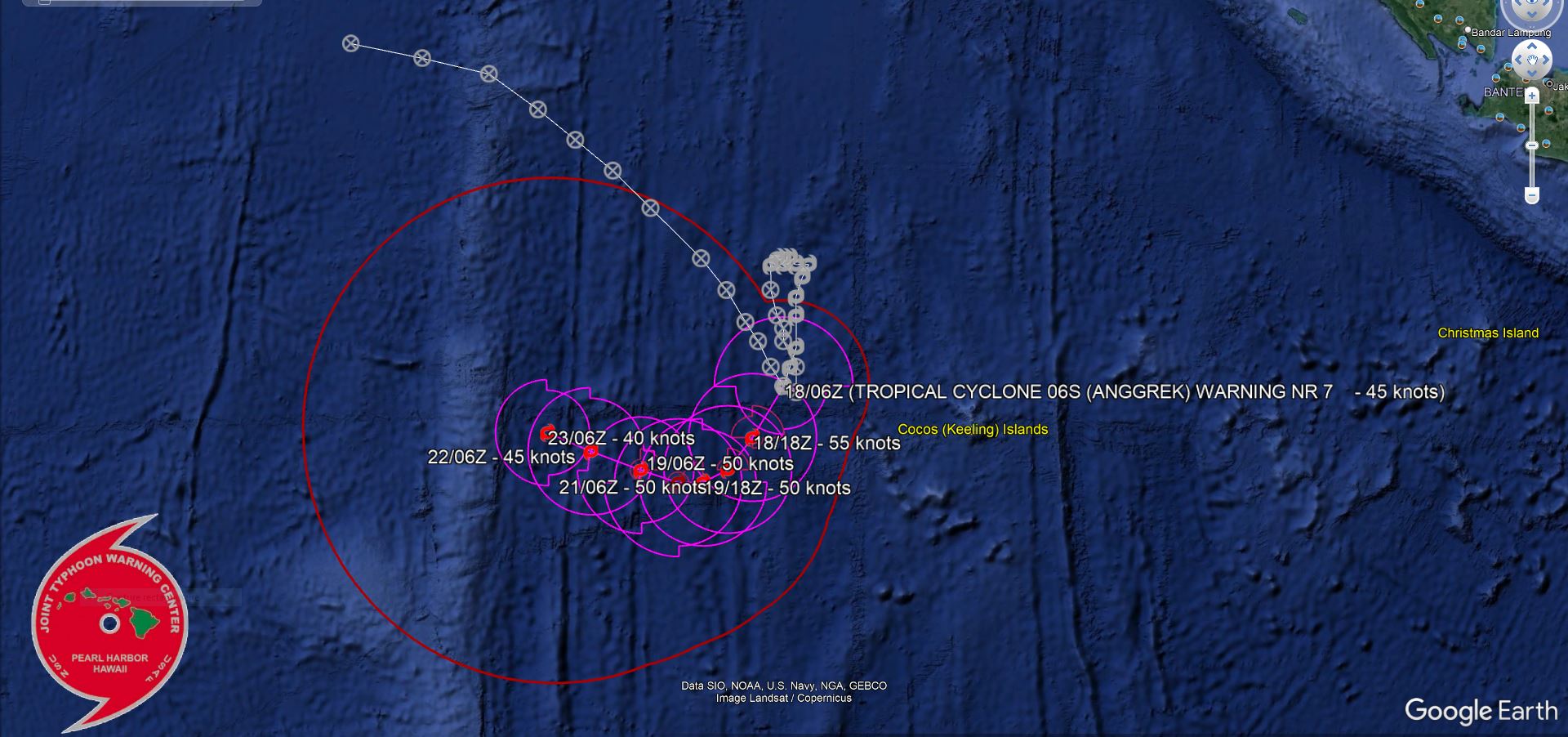
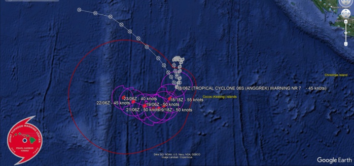
TC Warning Graphic
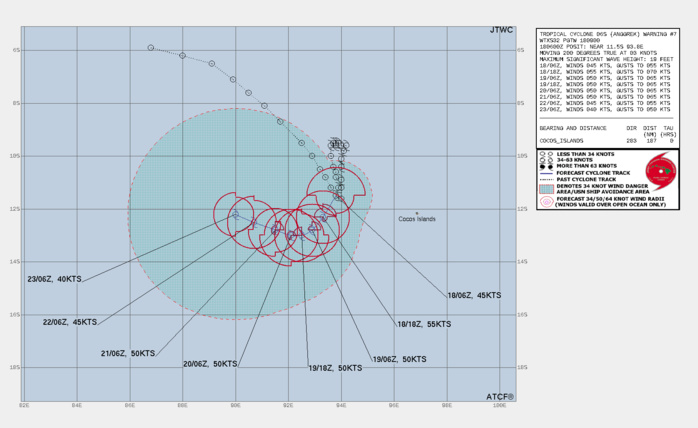
FORECAST REASONING. SIGNIFICANT FORECAST CHANGES: THERE ARE NO SIGNIFICANT CHANGES TO THE FORECAST FROM THE PREVIOUS WARNING. FORECAST DISCUSSION: TROPICAL CYCLONE (TC) 06S IS DRIFTING SLOWLY SOUTHWARD WITHIN THE COMPETING STEERING ENVIRONMENT, ALONG AN EXTENSION OF THE STEERING RIDGE TO THE EAST. HOWEVER, THE SYSTEM IS EXPECTED TO TURN WESTWARD WITHIN THE NEXT 24 TO 36 HOURS AS IT TRANSITIONS TO THE STEERING INFLUENCE OF THE WEAK STR POSITIONED TO THE SOUTH. AFTER TAU 48, TC 06S WILL TRACK SLOWLY WEST-NORTHWESTWARD ALONG THE NORTHEASTERN PERIPHERY OF THE LOW- TO MID-LEVEL STR. TC 06S SHOULD INTENSIFY TO A PEAK INTENSITY OF 55 KNOTS WITHIN THE NEXT DAY DUE TO THE FAVORABLE OUTFLOW, HINDERED SLIGHTLY BY THE PRESENCE OF DRY AIR. THE SYSTEM WILL MAINTAIN INTENSITY NEAR 50 KNOTS FROM TAU 24 TO TAU 72 THEN FINALLY SUCCUMB TO SIGNIFICANT DRY AIR ENTRAINMENT.
96H FORECAST TRACK
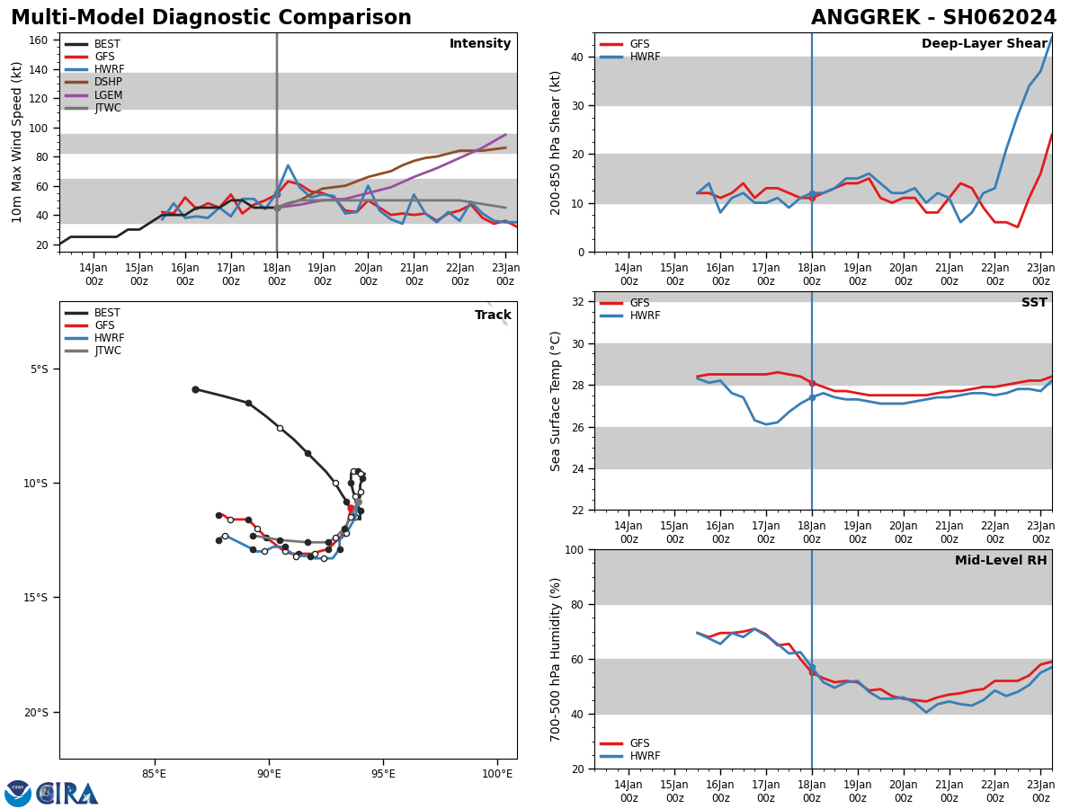
Model Diagnostic Plot
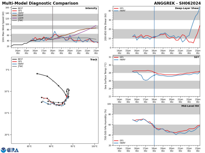
MODEL DISCUSSION: IN GENERAL, NUMERICAL MODEL GUIDANCE REMAINS IN FAIR AGREEMENT SUPPORTING THE JTWC FORECAST TRACK THROUGH TAU 36. AFTER TAU 36, THE GUIDANCE DIVERGES WITH INCREASING UNCERTAINTY IN THE EXACT TRACK AND TRACK SPEEDS. THE LATEST ECMWF TRACKER INDICATES A SLOW LOOPING MOTION WHILE THE GFS TRACKER INDICATES A FASTER (UNREALISTIC) WESTWARD TRACK. THE 171800Z ECMWF ENSEMBLE RUN, HOWEVER, SHOWS THE BULK OF THE SOLUTIONS WITH A SLOW WESTWARD TRACK. BOTH THE GFS AND HAFS-A INDICATE SIGNICANT DRY AIR ENTRAINMENT IN THE EXTENDED PERIOD.
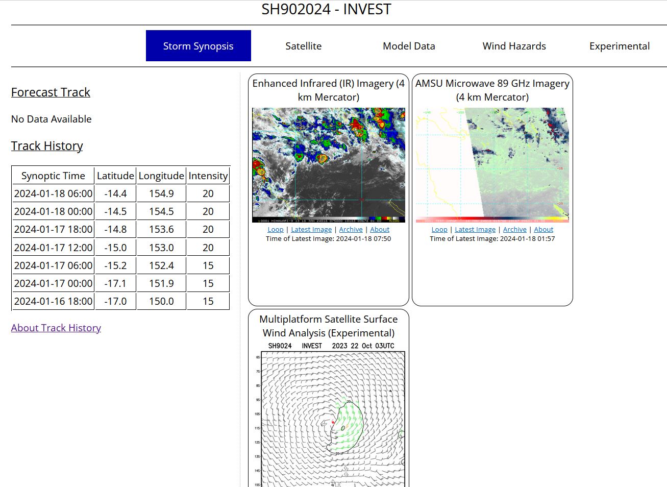
SOUTH PACIFIC OCEAN/CORAL SEA: INVEST 90P. ADVISORY(ABPW) ISSUED AT 18/06UTC.
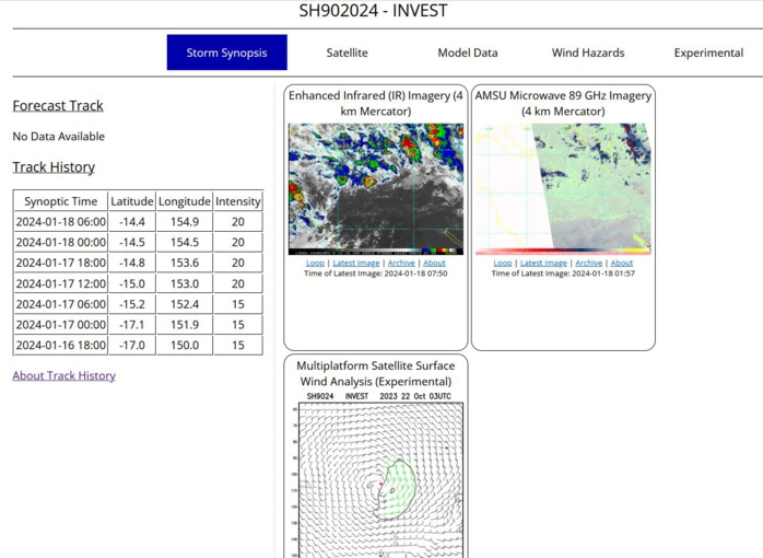
THE AREA OF CONVECTION (INVEST 90P) PREVIOUSLY LOCATED NEAR 15.2S 152.4E IS NOW LOCATED NEAR 14.5S 154.8E, APPROXIMATELY 548 NM EAST-NORTHEAST OF CAIRNS, AUSTRALIA. ANIMATED MULTISPECTRAL SATELLITE IMAGERY DEPICTS A FULLY EXPOSED LOW-LEVEL CIRCULATION CENTER (LLCC) WITH DEEP FLARING CONVECTION IN THE NORTHERN SEMICIRCLE. ENVIRONMENTAL ANALYSIS INDICATES THAT 90P IS IN A MARGINALLY UNFAVORABLE ENVIRONMENT FOR DEVELOPMENT WITH WEAK OUTFLOW ALOFT, LOW TO MODERATE (15-20 KTS) VERTICAL WIND SHEAR, AND DRY AIR ENTRAINMENT. GLOBAL MODELS ARE IN AGREEMENT THAT 90P WILL TRACK NORTHEAST OVER THE NEXT 48 HOURS AS IT STEADILY DEVELOPS. MAXIMUM SUSTAINED SURFACE WINDS ARE ESTIMATED AT 15 TO 20 KNOTS. MINIMUM SEA LEVEL PRESSURE IS ESTIMATED TO BE NEAR 998 MB. THE POTENTIAL FOR THE DEVELOPMENT OF A SIGNIFICANT TROPICAL CYCLONE WITHIN THE NEXT 24 HOURS REMAINS LOW.
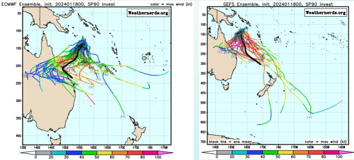
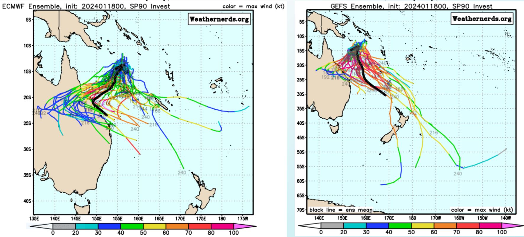
GLOBAL MODELS ARE IN AGREEMENT THAT 90P WILL TRACK NORTHEAST OVER THE NEXT 48 HOURS AS IT STEADILY DEVELOPS.
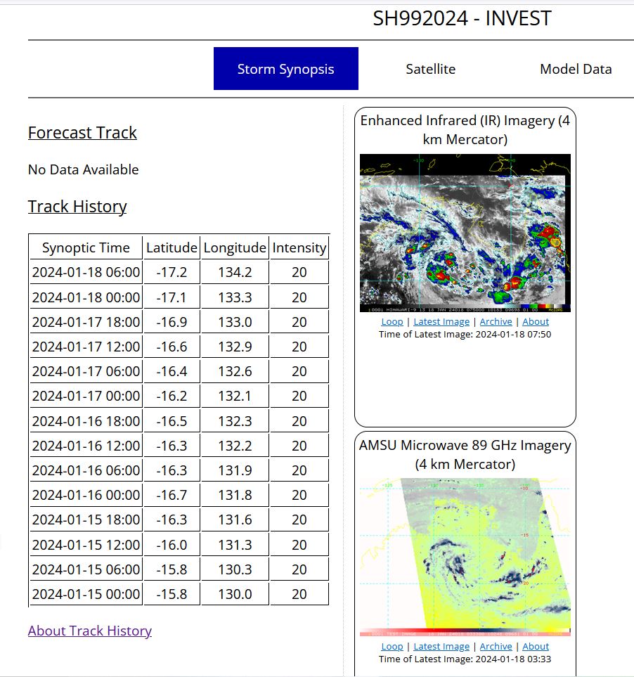
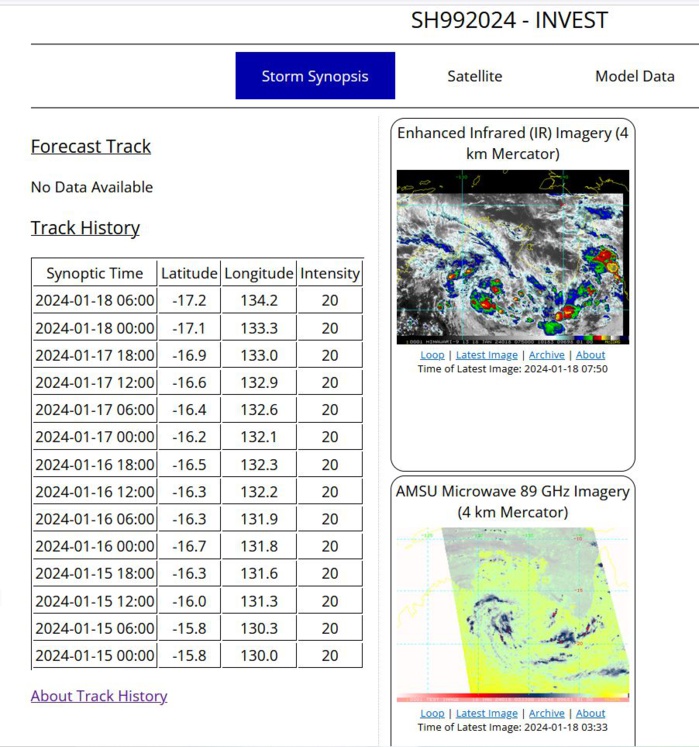
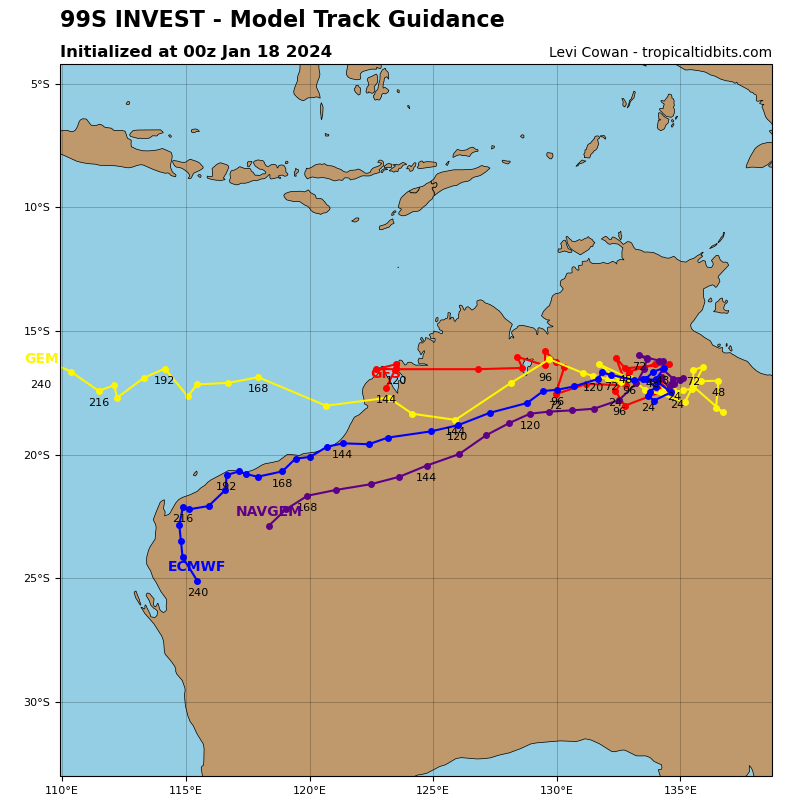
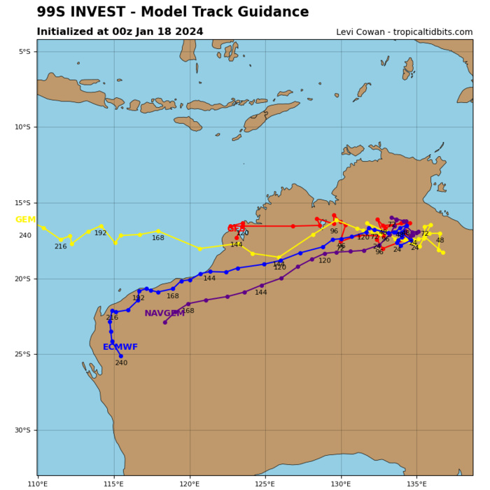
AUSTRALIA: OVER-LAND INVEST 99S.
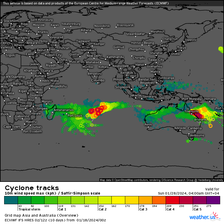
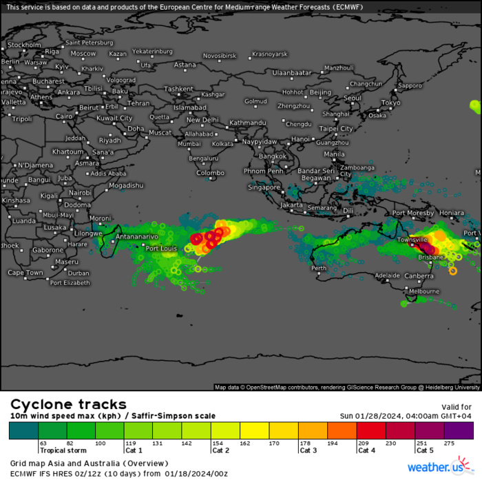
Storm Tracks (Ensemble) : 01/18 00UTC+ 10 DAYS
Last Updated - 01/16/24
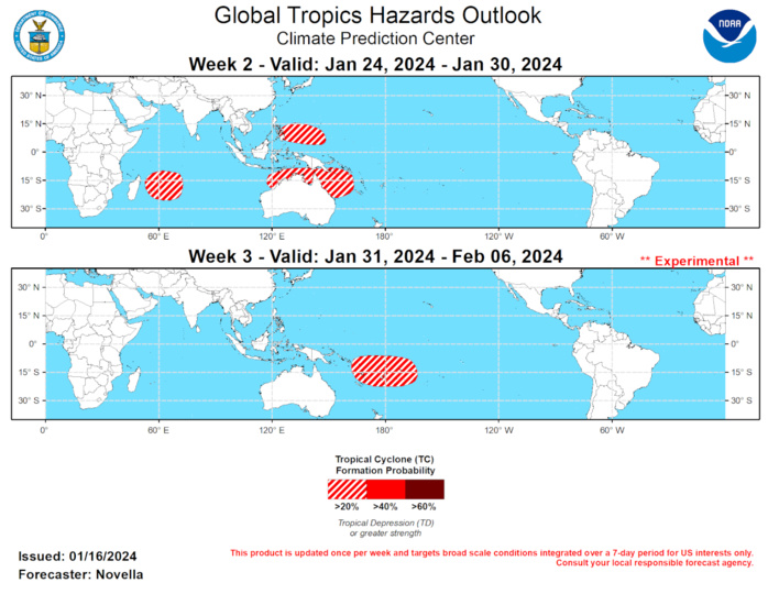
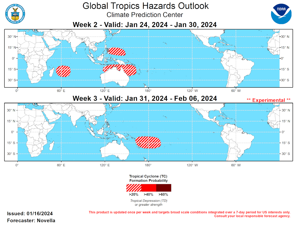
Last Updated - 01/16/24 Valid - 01/24/24 - 02/06/24 Following a period of weakening over the Indian Ocean earlier this month, the MJO became much more organized during the past week. Latest RMM observations show the MJO signal propagating eastward into the Maritime Continent (phase 4), and steadily gaining amplitude, which is well reflected by a reemerging wave-1 pattern in the 200-hPa velocity potential anomaly fields. A large uptick in MJO amplitude is heavily favored in the dynamical models during the next week, which appears to be tied to constructive interference with a convectively coupled Kelvin Wave propagating out of the Indian Ocean. This wave phasing is likely to promote widespread enhanced convection over the Maritime Continent, which has been otherwise persistently dominated by a suppressed convective El Nino response. Even with the MJO continuing to destructively interfere with the low frequency El Nino conditions, intraseasonal activity is largely favored to remain coherent during the next several weeks. Very good agreement exists in the RMM forecasts depicting a high amplitude event propagating eastward into the Western Pacific during the next two weeks, where the MJO looks to eventually constructively interfere again with base state over the Equatorial Pacific. Ensemble spread increases in the extended range, however many solutions (especially the GEFS) continue to maintain a high amplitude event, taking the MJO signal back into the Western Hemisphere by the first or second week of February. A healthy, eastward propagating MJO is expected to provide increasingly favorable conditions for Tropical Cyclone (TC) development over parts of the southern Indian Ocean, as well as the Western Pacific on both sides of the Equator. And in light of aforementioned convective pattern reversal favored over the Maritime Continent in the near term, this could induce a stronger MJO teleconnection in the extratropics downstream. Wintertime Indian Ocean and Maritime Continent MJO events typically lead to the development of anomalous mid-level ridging with warmer than normal temperatures over the central and eastern U.S. This is consistent with the latest week-2 guidance, however there is also both model and historical support for the associated anomalous mid-level ridging to retrograde over western North America with time, potentially allowing for the return of colder than normal temperatures over parts of the U.S. heading into February. Two TCs developed in the Southern Indian Ocean during the past week. To the east of Madagascar, TC Belal formed on 1/12 and gradually intensified to a category 2 strength system. Belal recurved and made landfall over Reunion during the past 24 hours, bringing torrential precipitation, flooding and damages to infrastructure in the Island nation. The Joint Typhoon Warning Center (JTWC) expects Belal to continue eastward before gradually weakening and slowing down over open waters during the next week. To the northwest of the Cocos Islands, TC Anggrek formed near 94E/9S on 1/15. Currently at Tropical Storm Intensity, the JTWC forecasts Anggrek to generally drift southeastward and then meander over open waters before potentially dissipating later this week. Late in week-1, the GEFS and ECMWF ensembles feature a secondary area of low pressure to the east of Madagascar that deepens and shifts westward. Deterministic solutions point to a new area of potential TC development, though it is possible that this mean surface feature may be Belal restrengthening or reforming. Regardless, the persistence of strongly anomalous low-level westerlies forecast is expected to maintain an elevated TC formation potential, and a broad 20% area is posted for week-2. Based on TC composites by MJO phase and increased signals in the probabilistic tools over the southeastern Indian Ocean, 20% chances for development are posted from the Timor Sea to the Coral Sea. Higher chances for development were considered, however probabilistic tools suggest any formation is more likely to occur late in week-1. North of the Equator, 20% chances are also posted to the east of the Philippines where lower-level wind anomalies are favored to flip and create a decreased shear environment conducive for development during week-2. As the enhanced phase of the MJO propagates eastward, much of the Indian Ocean looks to become more unfavorable for additional TC development, as anomalous lower-level westerlies and decreased shear are favored to shift into the Western Pacific by early February. While formation is possible north of the Equator, there is less support for this realization in the probabilistic tools. However, 20% chances are issued in the South Pacific, where composites and probabilistic guidance indicate the greatest chances for development to the east and west of the Date Line.


