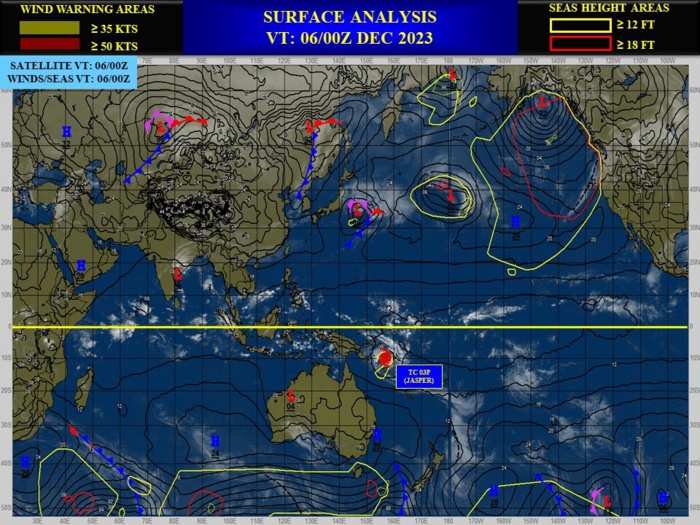
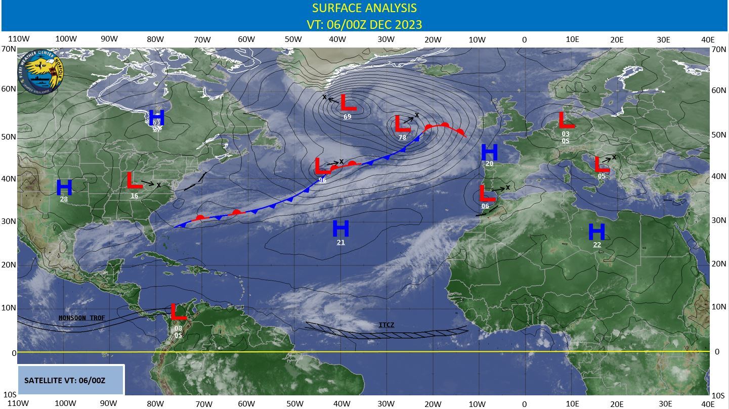
CLICK ON THE IMAGERIES BELOW TO GET THEM ENLARGED
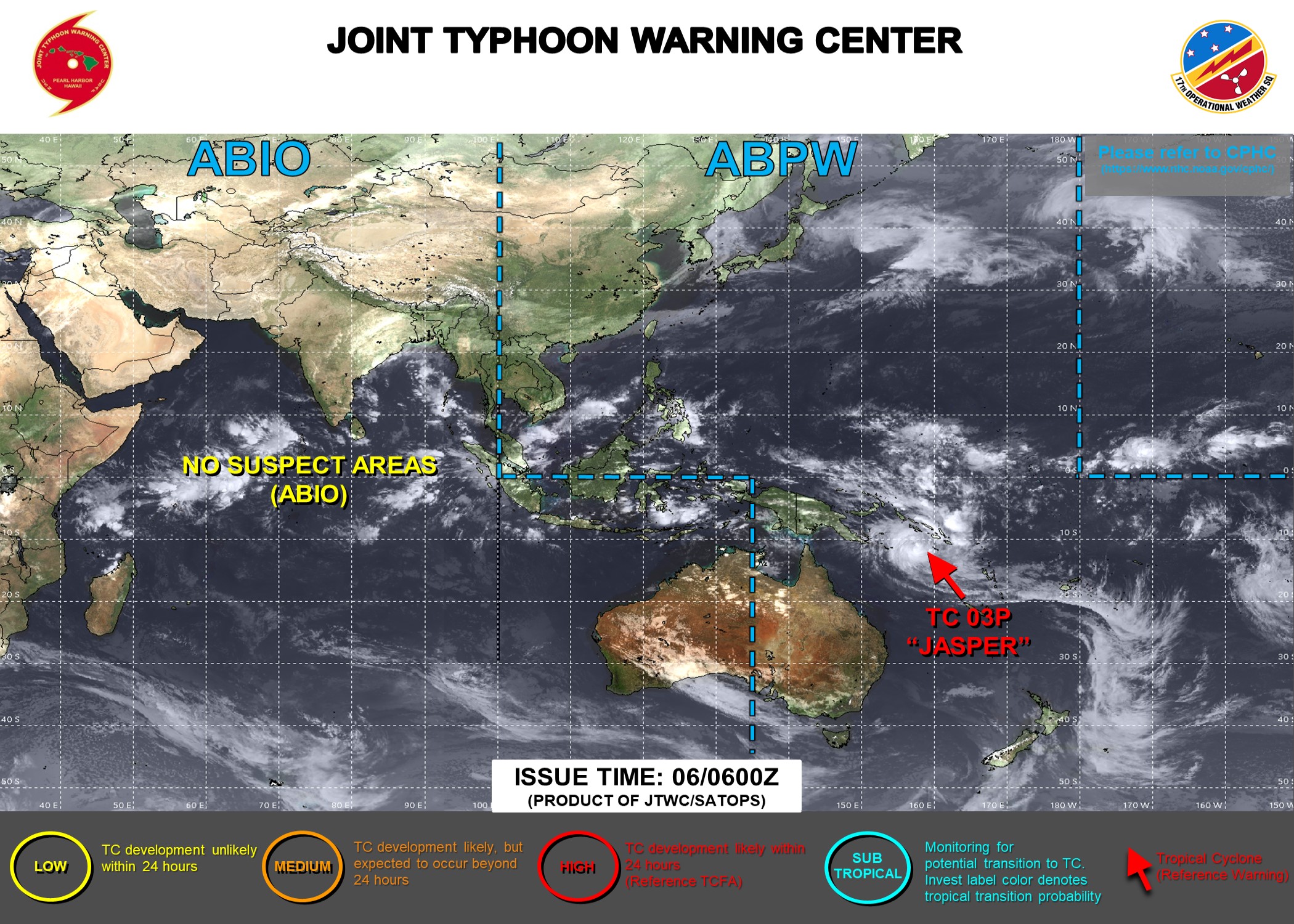
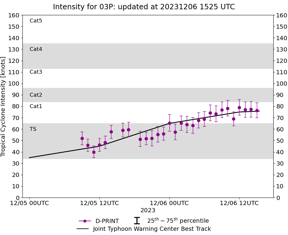
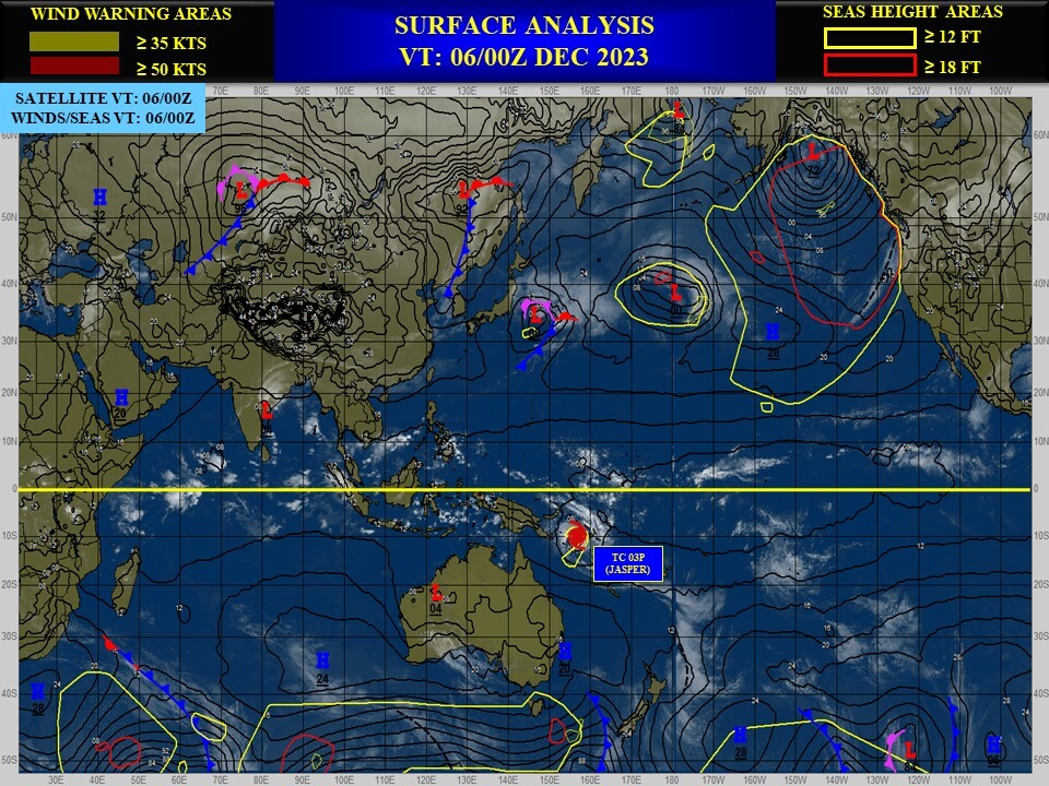
SOUTHERN HEMISPHERE/SOUTH PACIFIC: TC 03P(JASPER). CURRENT ESTIMATED INTENSITY IS 75 KNOTS/CAT 1 US: +30 KNOTS/24H.
0323120400 77S1587E 20
0323120406 81S1582E 25
0323120412 84S1578E 25
0323120418 88S1576E 30
0323120500 93S1572E 35
0323120506 94S1569E 40
0323120512 95S1573E 45
0323120518 102S1574E 55
0323120600 107S1573E 65
0323120606 112S1572E 70
0323120612 116S1571E 75
0323120406 81S1582E 25
0323120412 84S1578E 25
0323120418 88S1576E 30
0323120500 93S1572E 35
0323120506 94S1569E 40
0323120512 95S1573E 45
0323120518 102S1574E 55
0323120600 107S1573E 65
0323120606 112S1572E 70
0323120612 116S1571E 75
WARNING 7 ISSUED AT 06/15UTC.
CLICK ON THE IMAGERY BELOW TO GET IT ANIMATED AND ENLARGED.
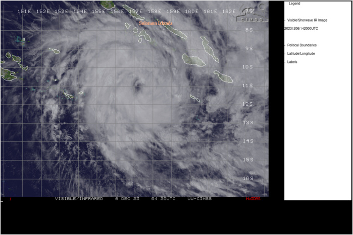
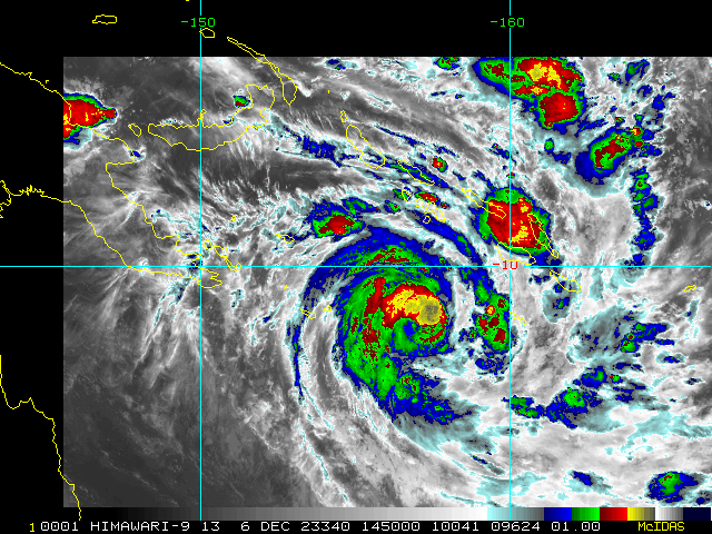
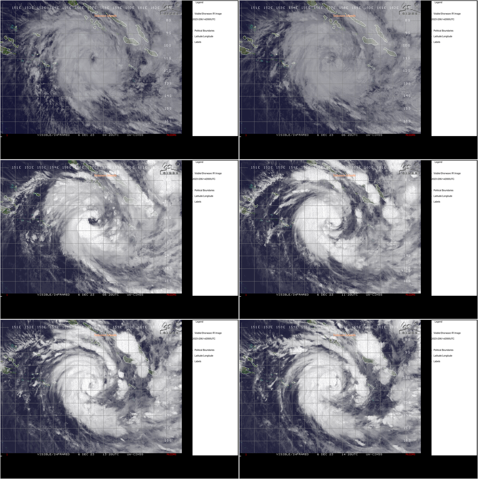
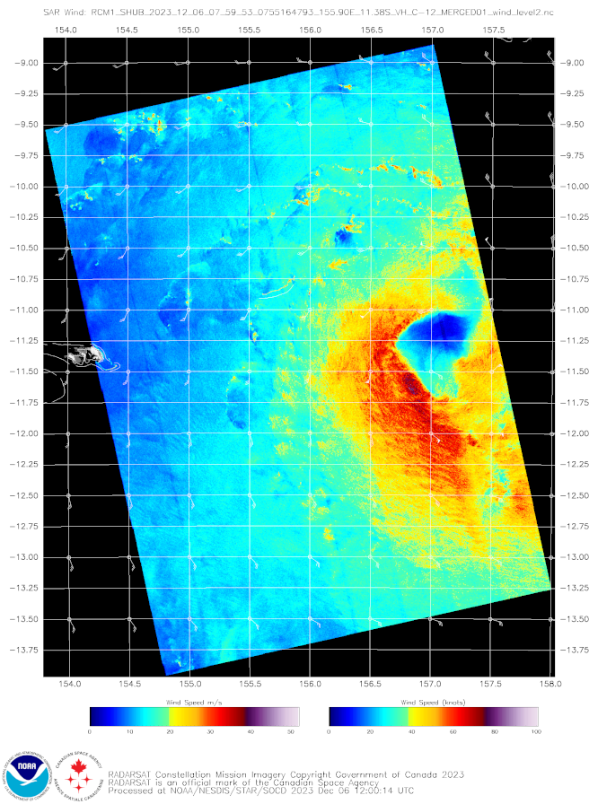
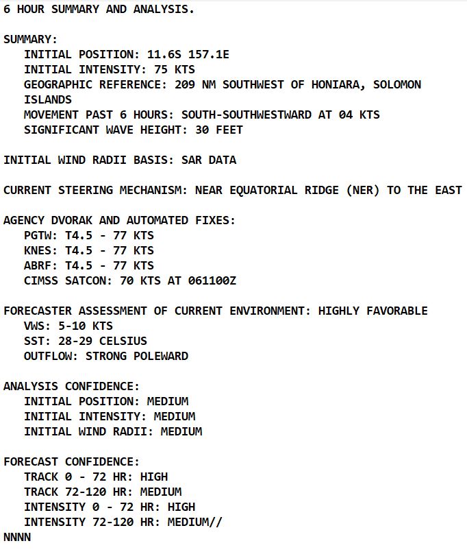
SATELLITE ANALYSIS, INITIAL POSITION AND INTENSITY DISCUSSION: ANIMATED ENHANCED INFRARED (EIR) SATELLITE IMAGERY DEPICTS TROPICAL CYCLONE (TC) 03P (JASPER) HAVING BRIEFLY EXPOSED A SYMMETRIC EYE, FREE OF DISCERNABLE HYDROMETEORS AT 060910Z, BUT THE FEATURE QUICKLY VANISHED WITH THE ONGOING TROCHOIDAL MOTION OF THE SYSTEM OVER THE PAST SIX HOURS. SPIRAL BANDING WITH DEEP CONVECTION PERSISTS IN THE SOUTHWEST AND NORTHEAST QUADRANTS OF THE SYSTEM, RIDDLED WITH LIGHTNING OBSERVATIONS. A 060759Z RCM 1 SYNTHETIC APERTURE RADAR IMAGE UNVEILED A TIGHTENING OF MAXIMUM SUSTAINED WINDS TOWARD THE LOW-LEVEL CIRCULATION CENTER (LLCC) AND AN OVERALL LARGER WIND FIELD, EXPANDING NOTABLY FURTHER IN THE WESTERN PERIPHERY THAN OBSERVED 6 HOURS PRIOR. LOW (5-10 KTS) VERTICAL WIND SHEAR, HIGH (28-29 C) SEA SURFACE TEMPERATURE (SST), STRONG POLEWARD OUTFLOW, AND A MOIST ENVIRONMENT CONTRIBUTE TO THE ASSESSMENT OF A HIGHLY FAVORABLE ENVIRONMENT. THE INITIAL POSITION IS PLACED WITH MEDIUM CONFIDENCE BASED ON A 061200Z HIMAWARI-9 INFRARED SATELLITE IMAGE. THE INITIAL INTENSITY OF 75 KTS IS ASSESSED WITH MEDIUM CONFIDENCE BASED ON THE SUBJECTIVE AND OBJECTIVE INTENSITY GUIDANCE LISTED BELOW.
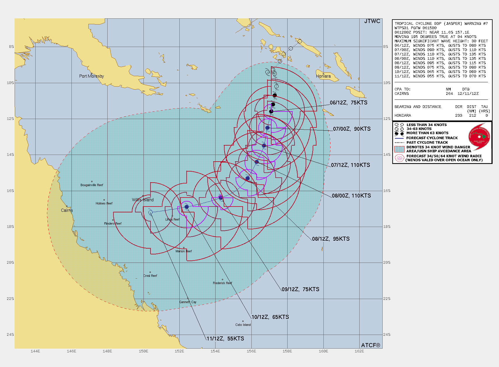
TC Warning Graphic

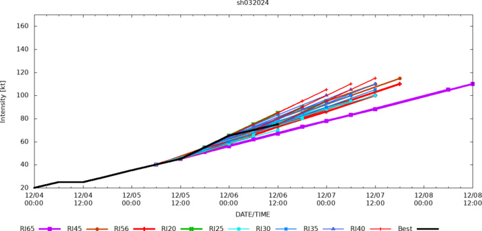
FORECAST REASONING. SIGNIFICANT FORECAST CHANGES: THERE ARE NO SIGNIFICANT CHANGES TO THE FORECAST FROM THE PREVIOUS WARNING. FORECAST DISCUSSION: TC 03P (JASPER) IS FORECAST TO CONTINUE TRACKING SOUTH-SOUTHWESTWARD OVER THE NEXT 72 HOURS. ALONG-TRACK RAPID INTENSIFICATION IS EXPECTED, DRIVING UP THE SYSTEMS INTENSITY TO A PEAK OF NEAR 110KTS AROUND TAU 30. AFTER TAU 30, VERTICAL WIND SHEAR VALUES ARE FORECAST TO RAMP UP TO 33KTS BY TAU 48 AND WILL LIKELY INFLUENCE A WEAKENING TREND TO TRANSPIRE. TANGENTIAL TO THE BIFURCATION DISCUSSION BELOW, THE JTWC FORECAST IS SUPPORTED BY THE SUSTAINMENT OF THE NEAR EQUATORIAL RIDGE EAST OF THE TC AND EVENTUALLY (TAU 72 TO TAU 120) THE BUILDING SUBTROPICAL RIDGE TO THE SOUTH, WHICH IS EXPECTED TO STEER THE SYSTEM TO A MORE WESTWARD TRAJECTORY BY TAU 120. SHOULD THE SOUTHERN RIDGE NOT BUILD IN AND INFLUENCE THE STEERING PATTERN, A QUASI-STATIONARY TRACK MAY ONSET BETWEEN TAU 60 AND 72.
Model Diagnostic Plot
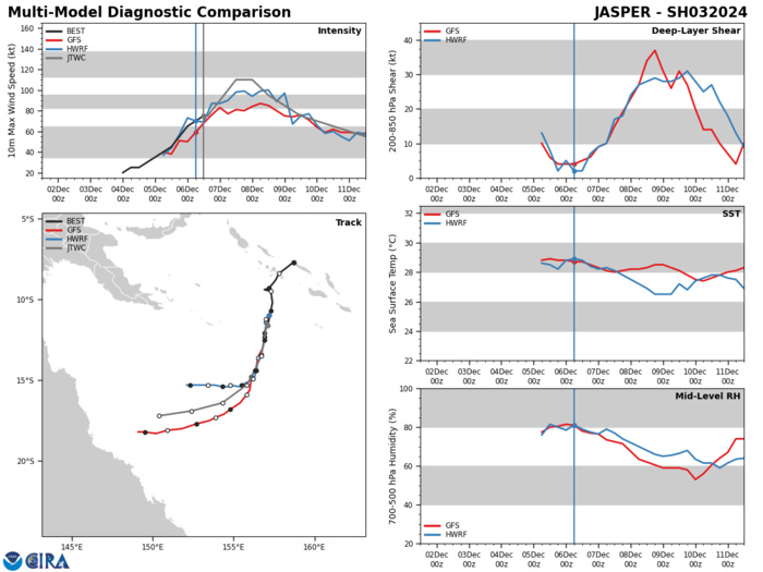
MODEL DISCUSSION: GLOBAL NUMERICAL MODEL GUIDANCE OFFERS A PRIMARY AND ALTERNATE TRACK SOLUTION. THE MAJORITY OF THE JTWC CONSENSUS MEMBERS TRACK TC 03P SOUTH-SOUTHWESTWARD, GRADUALLY TURNING THROUGH THE FORECAST PERIOD TO A WESTWARD TRACK BY TAU 120. AN ALTERNATE SOLUTION OCCURS BETWEEN TAU 60 AND TAU 72 IN GALWEM AND UKMET SOLUTIONS, WHEREBY A QUASI-STATIONARY SCENARIO ARISES AND THE TC LOITERS THROUGH TAU 120. DUE TO THE NATURE OF THE BIFURCATED GUIDANCE AND TIMELINE, THE FORECAST CONFIDENCE FOR TRACK IS HIGH THROUGH TAU 72, AND MEDIUM THEREAFTER. GOOD ALIGNMENT IN INTENSITY GUIDANCE CONTINUES TO SHOW SIGNIFICANT POSSIBILITY FOR RAPID INTENSIFICATION TO OCCUR THROUGH TAU 24. DUE TO GOOD AGREEMENT IN INTENSITY GUIDANCE, THE FORECAST CONFIDENCE FOR INTENSITY MIRRORS THAT OF THE TRACK FORECAST CONFIDENCE.
RIPA Forecast AND RIPA STORM TABLE ATTACHED BELOW
RCM-1, STAR Synthetic Aperture Radar 202312060759: 1 MINUTE MAXIMUM SUSTAINED WINDS: 64 KNOTS

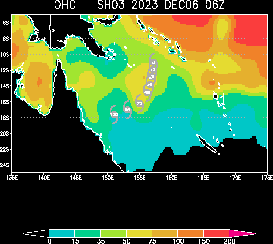
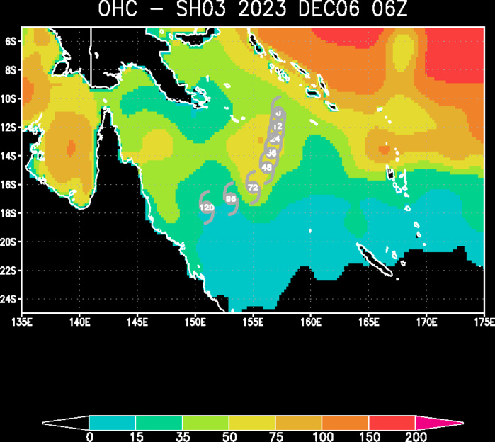
Ocean Heat Content & Forecast Track

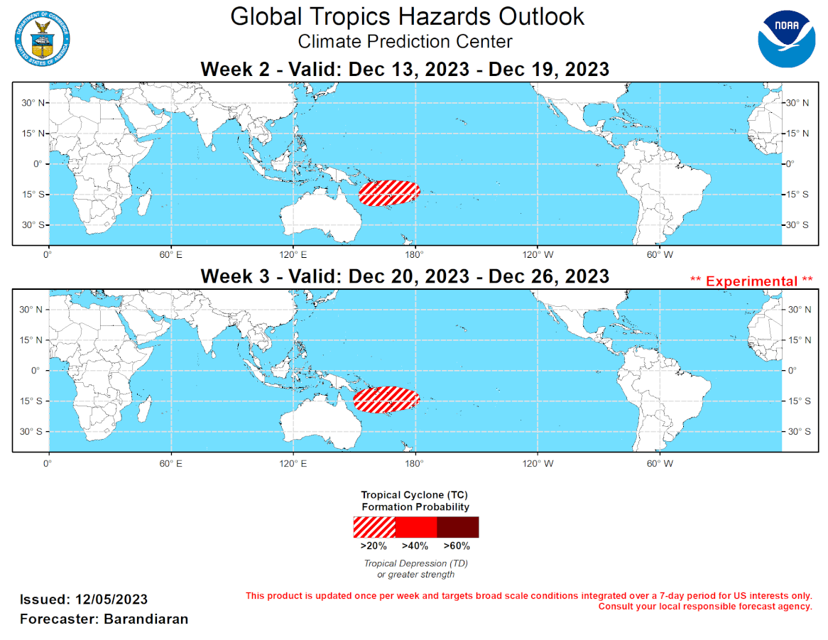
GTH Outlook Discussion Last Updated - 12/05/23 Valid - 12/13/23 - 12/26/23 The dominance of low-frequency modes (ENSO, IOD) in the global tropics has been declining over the last several weeks as the MJO has become stronger and more coherent. Starting in mid-November the RMM-based MJO signal increased in amplitude, moving out of the unit circle as the MJO propagated steadily across Africa and the Indian Ocean. Currently the MJO continues to propagate eastward with a high amplitude, with the enhanced convective envelope moving into the Maritime Continent. Dynamical models depict continued eastward propagation and fairly strong signal strength during the next 2-3 weeks. Models are also indicating a generally quiet period for tropical cyclone (TC) development, with enhanced TC activity favored for the South Pacific only during the coming forecast period. There have been two TCs that formed in the last week. On 12/3, Michaung formed in the Bay of Bengal. It tracked west-northwest and intensified, making landfall north of Chennai, India on 12/5. It is expected to dissipate over land in the coming days. TC Jasper formed on 12/4 near the Solomon Islands east of New Guinea. Current forecasts indicate that Jasper will intensify as it moves southwestward towards the Gold Coast of Australia. For the latest information on TC Jasper or TC Michaung please refer to the Joint Typhoon Warning Center (JTWC). Model consensus places the MJO in phase 6 during the week-2 period, enhancing convection over the Maritime Continent and the South Pacific and suppressing convection over the Indian Ocean. While phase 6 generally enhances TC genesis probabilities over the Western and South Pacific, guidance from the ECMWF and GEFS is less supportive of a TC spinning up in these basins during the forecast period. Nonetheless, both ensembles indicate some potential for the South Pacific, so a 20% probability of TC genesis is posted for much of the Coral Sea and extending eastward to Fiji for week-2. Models depict increased shear over the Western Pacific, reducing the impact of organizing enhanced convection from the MJO and the potential for TC genesis. With strongly suppressed convection over the Indian Ocean, no areas of potential TC development are highlighted for any of the ocean’s TC formation regions throughout weeks 2-3. Model consensus for the week-3 period places the MJO in either phase 6 or 7, shifting the enhanced convective envelope slightly further away from the Maritime Continent. In either case, the South Pacific basin would continue to have elevated probabilities for TC formation. The ECMWF extended range TC genesis forecast reflects this potential with probabilities of formation exceeding 30% for both weeks 2-3. Accordingly the area highlighted for enhanced TC genesis in the South Pacific for week-2 extends to week-3 as well.
