CLICK ON THE IMAGERIES BELOW TO GET THEM ENLARGED
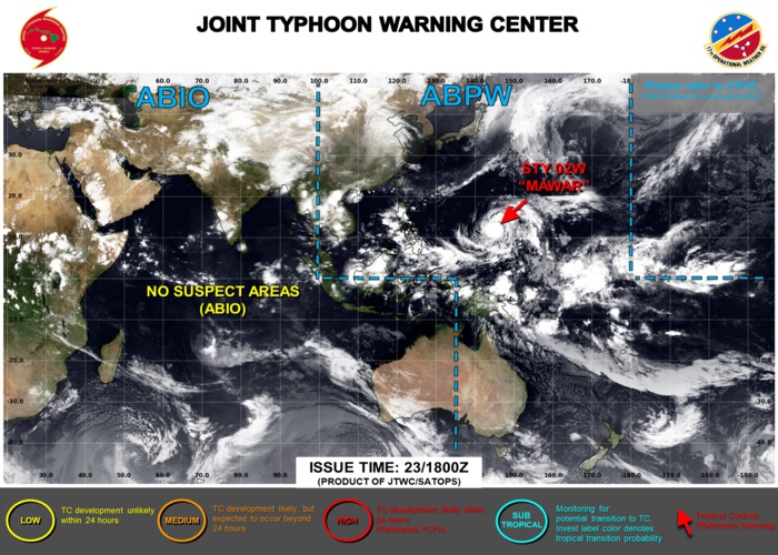
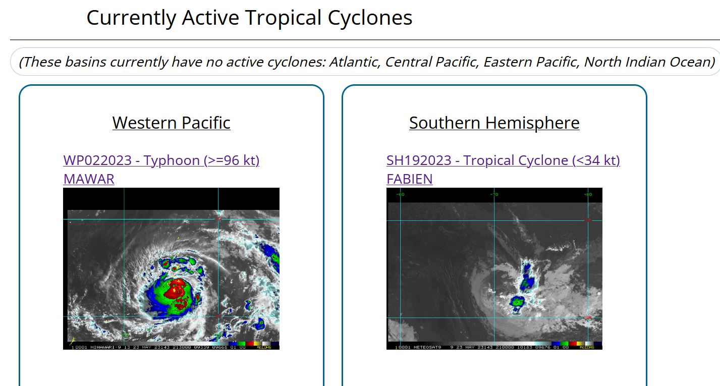
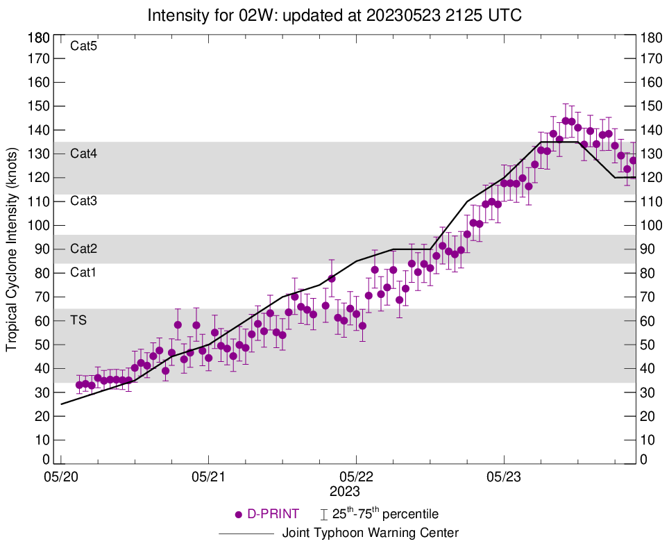
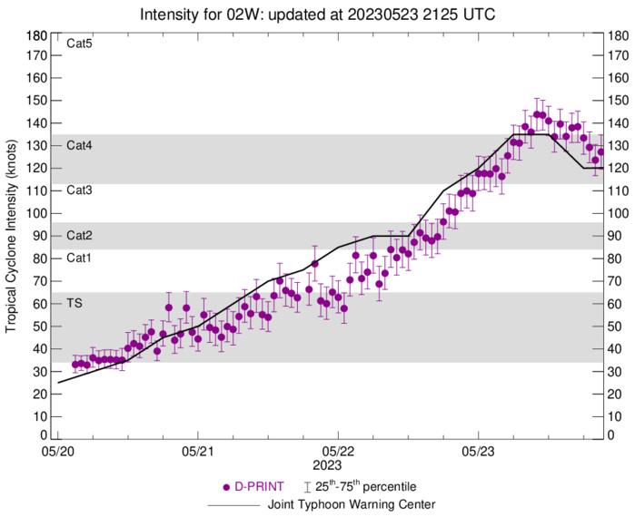
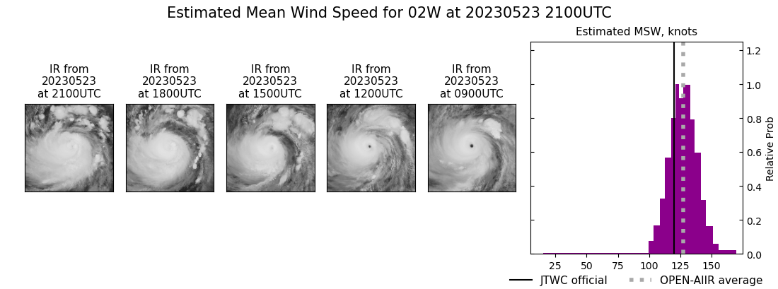
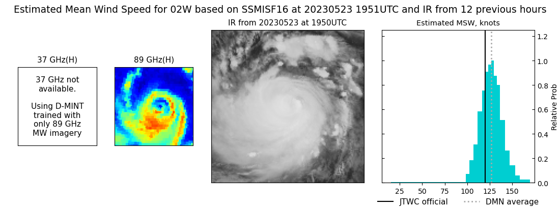
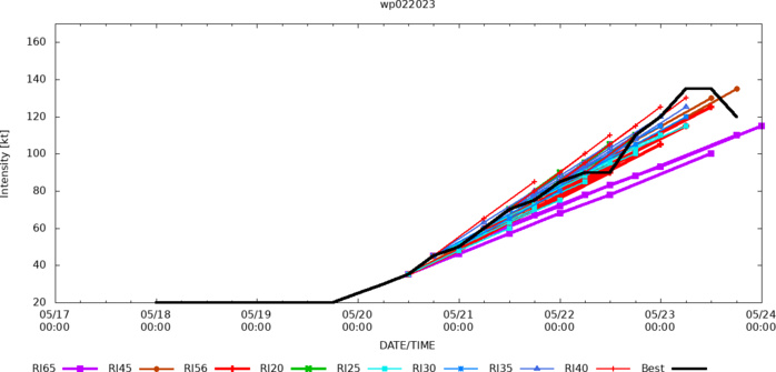
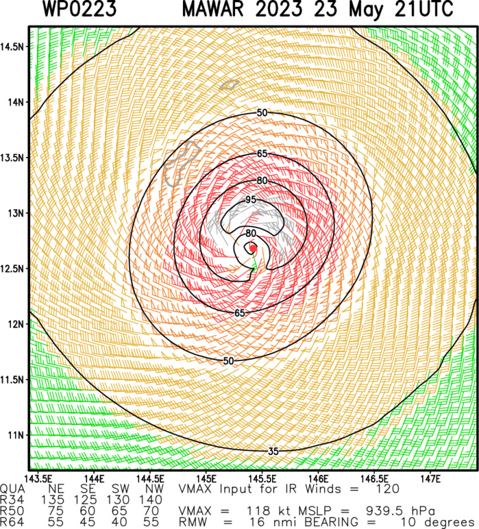
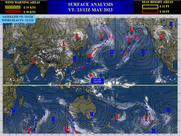
WESTERN NORTH PACIFIC: TY 02W(MAWAR). CURRENT ESTIMATED INTENSITY IS 120 KNOTS(CAT 4 US) AT 23/18UTC: +10 KNOTS OVER 24HOURS.
0223052212 99N1469E 90
0223052218 105N1468E 110
0223052300 112N1468E 120
0223052306 118N1465E 135
0223052312 122N1461E 135
0223052318 125N1457E 120
0223052218 105N1468E 110
0223052300 112N1468E 120
0223052306 118N1465E 135
0223052312 122N1461E 135
0223052318 125N1457E 120
WARNING 16 ISSUED AT 23/21UTC.
CLICK ON THE IMAGERY BELOW TO GET IT ANIMATED AND ENLARGED.
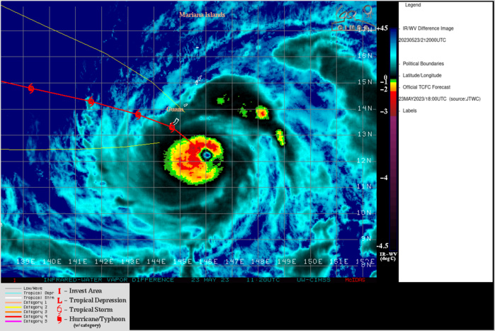
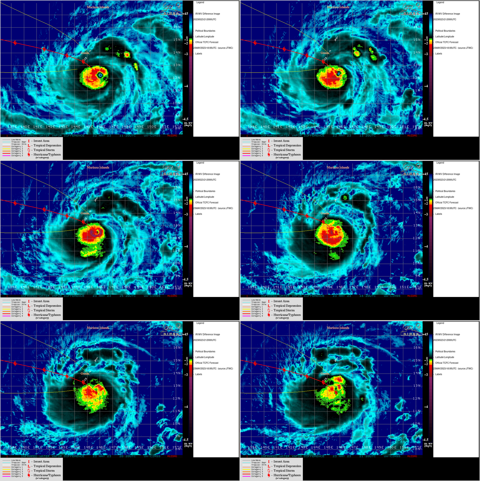
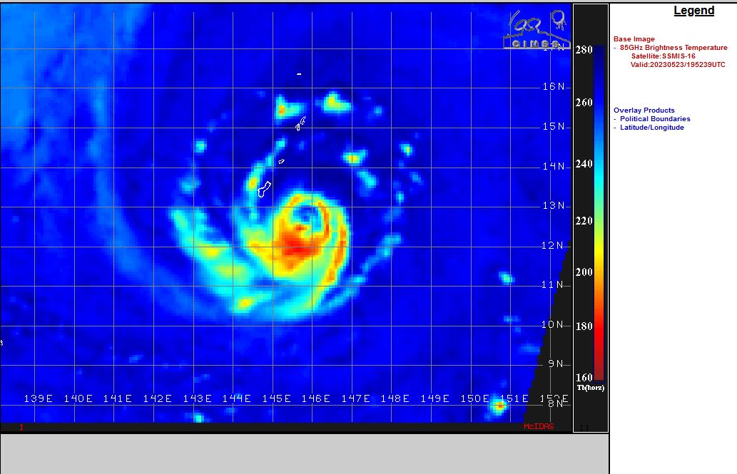
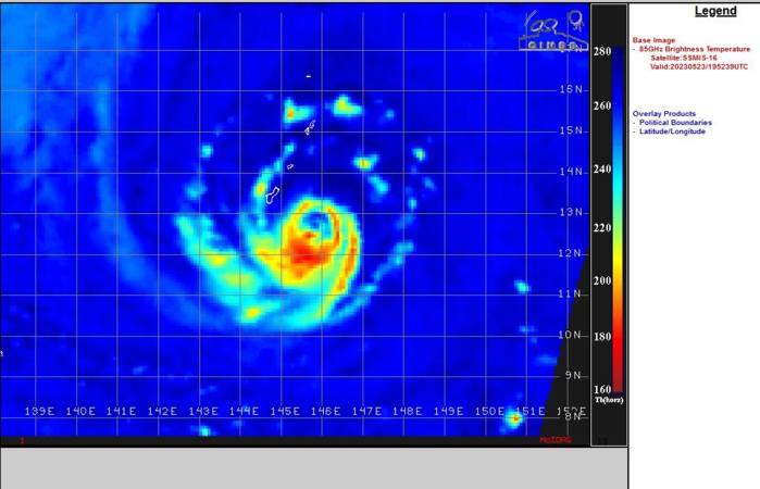
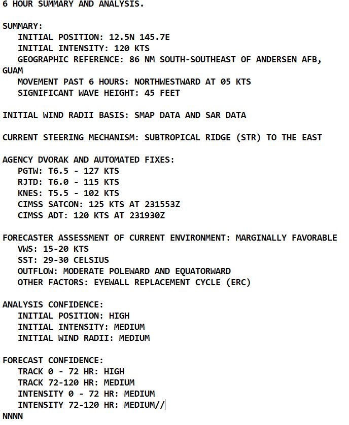
SATELLITE ANALYSIS, INITIAL POSITION AND INTENSITY DISCUSSION: ANIMATED ENHANCED INFRARED (EIR) SATELLITE IMAGERY DEPICTS A SOMEWHAT ASYMMETRICAL SYSTEM THAT HAS A SMALL (6 NM DIAMETER) EYE. IN ADDITION, BANDS OF DEEP CONVECTION ARE NOTED IN THE WESTERN SEMICIRCLE AND FRAGMENTED BANDS OF CONVECTION IN THE EASTERN SEMI-CIRCLE. THESE FRAGMENTED BANDS ARE THE RESULT OF DRY AIR FROM THE SOUTH BEING INTRODUCED INTO THE LOW LEVEL CIRCULATION CENTER (LLCC). THERE WERE SEVERAL HOURS WITHOUT ANY USABLE MICROWAVE DATA, HOWEVER A RECENT 231756Z SSMIS 91 GHZ PASS SHOWS THE INNER EYEWALL HAS BEEN BROKEN DOWN AND A SECONDARY EYEWALL IS FORMING. DUE TO THE ONSET OF THIS EYEWALL REPLACEMENT CYCLE (ERC), THE INITIAL INTENSITY IS LOWER THAN PREVIOUSLY FORECAST. RADAR IMAGERY FROM ANDERSEN AIR FORCE BASE (PGUA) SHOWS THE OUTER BANDS OF THE NORTHWEST QUADRANT OVER GUAM, ROTA, AND THE NORTHERN MARIANA ISLANDS, AS WELL AS THE EYE OF THE SYSTEM IN CLEAR VIEW AS IT APPROACHES GUAM FROM THE SOUTHEAST. MOREOVER, RECENT SURFACE WEATHER OBSERVATIONS FROM ANDERSEN AFB INDICATE CONSISTENT NORTHEASTERLY WIND FLOW WITH GUSTS IN THE 35-40 KT RANGE OVER THE PAST SEVERAL HOURS. TC MAWAR IS IN A MARGINALLY FAVORABLE ENVIRONMENT FOR FURTHER TROPICAL DEVELOPMENT. THESE CONDITIONS ARE CHARACTERIZED BY GOOD EQUATORWARD AND POLEWARD OUTFLOW ALOFT, A PRONOUNCED 850 MB VORTICITY SIGNATURE, MODERATE (15-20 KTS) VERTICAL WIND SHEAR (VWS), AND VERY WARM (29-30 C) SEA SURFACE TEMPERATURES (SST). THE INITIAL POSITION IS PLACED WITH HIGH CONFIDENCE BASED ON MULTI-AGENCY FIXES, ALONG WITH THE ABOVEMENTIONED RADAR IMAGERY AND RECENT SSMIS IMAGERY. THE INITIAL INTENSITY OF 120 KNOTS IS ASSESSED WITH MEDIUM CONFIDENCE BASED OFF ANALYSIS OF THE ERC AND A BLEND OF MULTI-AGENCY AND AUTOMATED DVORAK ESTIMATES.
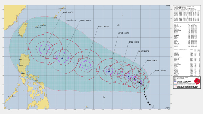
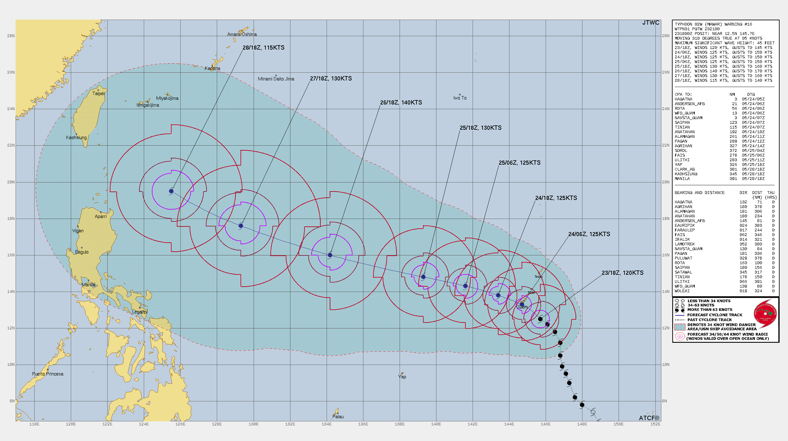
FORECAST REASONING. SIGNIFICANT FORECAST CHANGES: DROPPED INITIAL INTENSITY TO 120 KNOTS BASED OFF RECENT SSMIS PASS AND ANALYSIS OF THE ERC FORECAST DISCUSSION: TC 02W IS RIDING THE WESTERN PERIPHERY OF THE STR TO THE EAST. THROUGH TAU 12, TC MAWAR WILL TRACK NORTHWESTWARD AND STEADILY INTENSIFY TO 125 KNOTS AS THE STORM CENTER MAKES ITS PASS OVER THE SOUTHERN SHORES OF GUAM. THIS INCREASE IN INTENSITY WILL BE THE RESULT OF THE COMPLETION OF THE ERC. AFTER TAU 12, TC MAWAR WILL MAKE THE TURN MORE WEST-NORTHWESTWARD AS THE STR TO THE EAST BUILDS IN OVER THE NORTH. THIS STR WILL CONTINUE TO BUILD THROUGHOUT THE REMAINDER OF THE FORECAST PERIOD AND CONTINUE TO STEER THE SYSTEM ON A WEST-NORTHWESTWARD TRAJECTORY. IN ADDITION, THE SYSTEM WILL BE PASSING INTO A FAVORABLE AREA FOR FURTHER DEVELOPMENT AS COPIOUS AMOUNTS OF DEEP OCEAN HEAT CONTENT (OHC) IN THE PHILIPPINE SEA WILL INCREASE THE INTENSIFICATION TO 140 KNOTS BY TAU 72. BY TAUS 96 AND 120, TC 02W WILL NEARING THE STR AXIS AND WILL HEAD ON A NORTHWESTWARD TRAJECTORY. DURING THIS TIME IT WILL BEGIN TO WEAKEN IN INTENSITY AS IT APPROACHES THE COOLER (26 C) SST AT APPROXIMATELY THE 20TH LATITUDE.
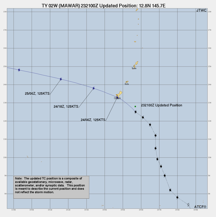
3 Hour Position Update Graphic
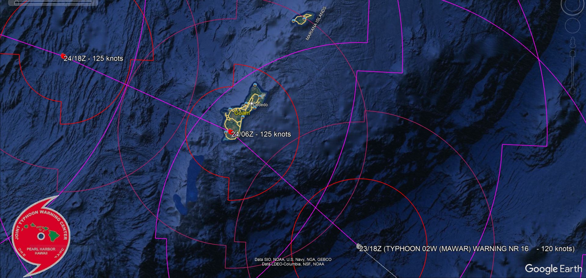
FORECAST CPA TO GUAM
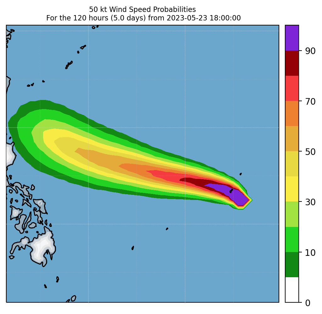
Experimental 50-kt Wind Speed Probabilities

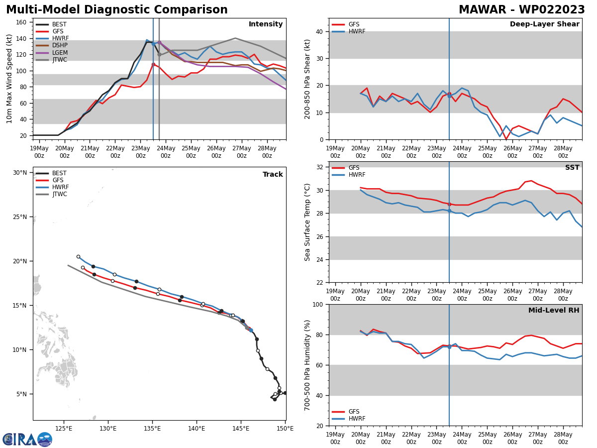
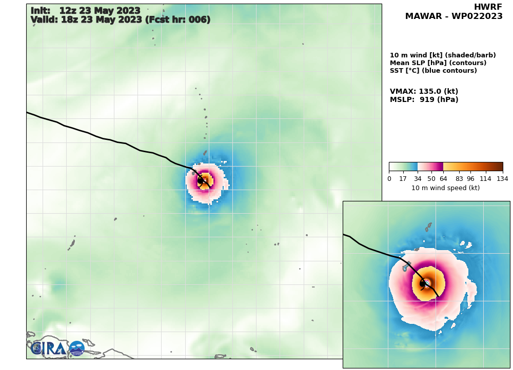
MODEL DISCUSSION: THE DETERMINISTIC AND ENSEMBLE MODELS ARE ALL IN TIGHT AGREEMENT THAT TC MAWAR WILL CONTINUE TO TRACK NORTHWESTWARD THROUGH TAU 12, THEN MAKE THE TURN WEST-NORTHWESTWARD BY TAU 24. IN THE SHORT TERM, THE JTWC FORECAST TRACK CONSENSUS MEMBERS ARE SHOWING A 27 NM SPREAD AT TAU 12 THAT GRADUALLY INCREASES TO 50 NM BY TAU 24, AND 80 NM BY TAU 36. AFTERWARDS, THE SPREAD INCREASES AND STAYS STEADY AT APPROXIMATELY 90 NM THROUGHOUT THE FORECAST PERIOD. AFTER TAU 12, THE NAVGEM TRACKER BECOMES THE OUTLIER SHOWING A MORE POLEWARD TRACK AS COMPARED TO THE OTHER MEMBERS. DUE TO THIS, THE JTWC TRACK IS PLACED WITH HIGH CONFIDENCE JUST TO THE LEFT OF CONSENSUS THROUGH TAU 72, AND MEDIUM CONFIDENCE AFTERWARDS DUE TO THE SPREAD OF THE MODELS. THE JTWC INTENSITY CONSENSUS DISPLAYS AN AVERAGE OF A 30 KNOT SPREAD THROUGHOUT THE FORECAST PERIOD. THE GFS INTENSITY SOLUTION IS THE OUTLIER SHOWING LOWER VALUES THAN THE OTHER MEMBERS. HOWEVER, ALL INTENSITY MEMBERS AGREE ON AN INCREASE UP TO TAU 72, FOLLOWED BY A DIP AFTERWARDS. THIS IS LIKELY DUE TO THE SYSTEM PASSING INTO A MORE HOSTILE ENVIRONMENT IN THE LATER TAUS. THE JTWC INTENSITY FORECAST IS SET SLIGHTLY HIGHER THAN CONSENSUS WITH MEDIUM CONFIDENCE DUE TO THE MODEL SPREAD AND RECENT ERC.
RIPA Forecast Storm Table ATTACHED BELOW
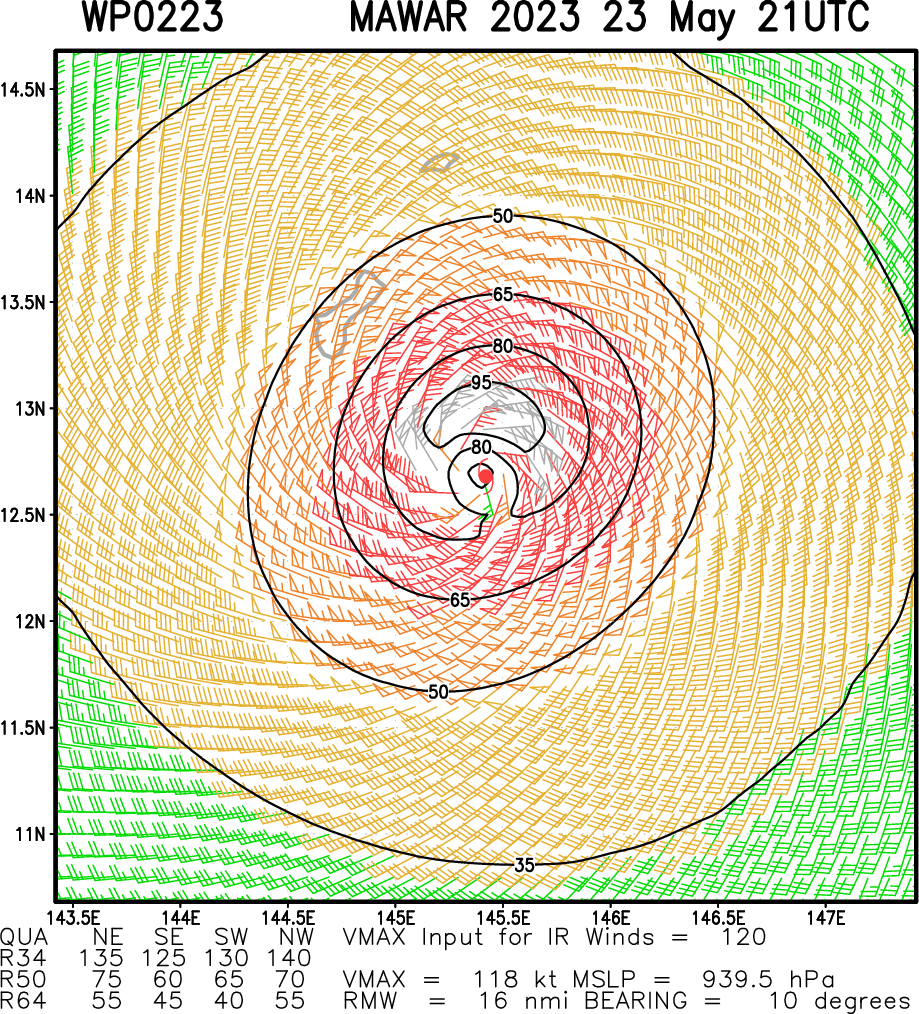
Multiplatform Satellite Surface Wind Analysis (Experimental)
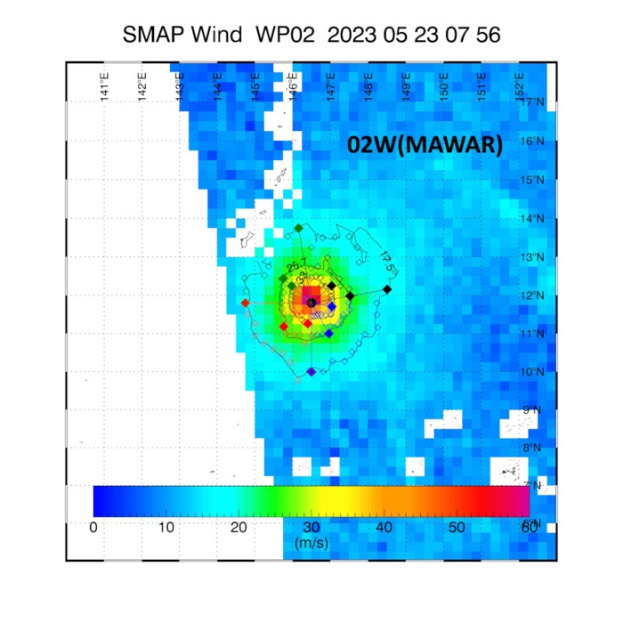
SMAP AT 23/0756UTC: MAXIMUM 10 MINUTE WINDS: 123 KNOTS.
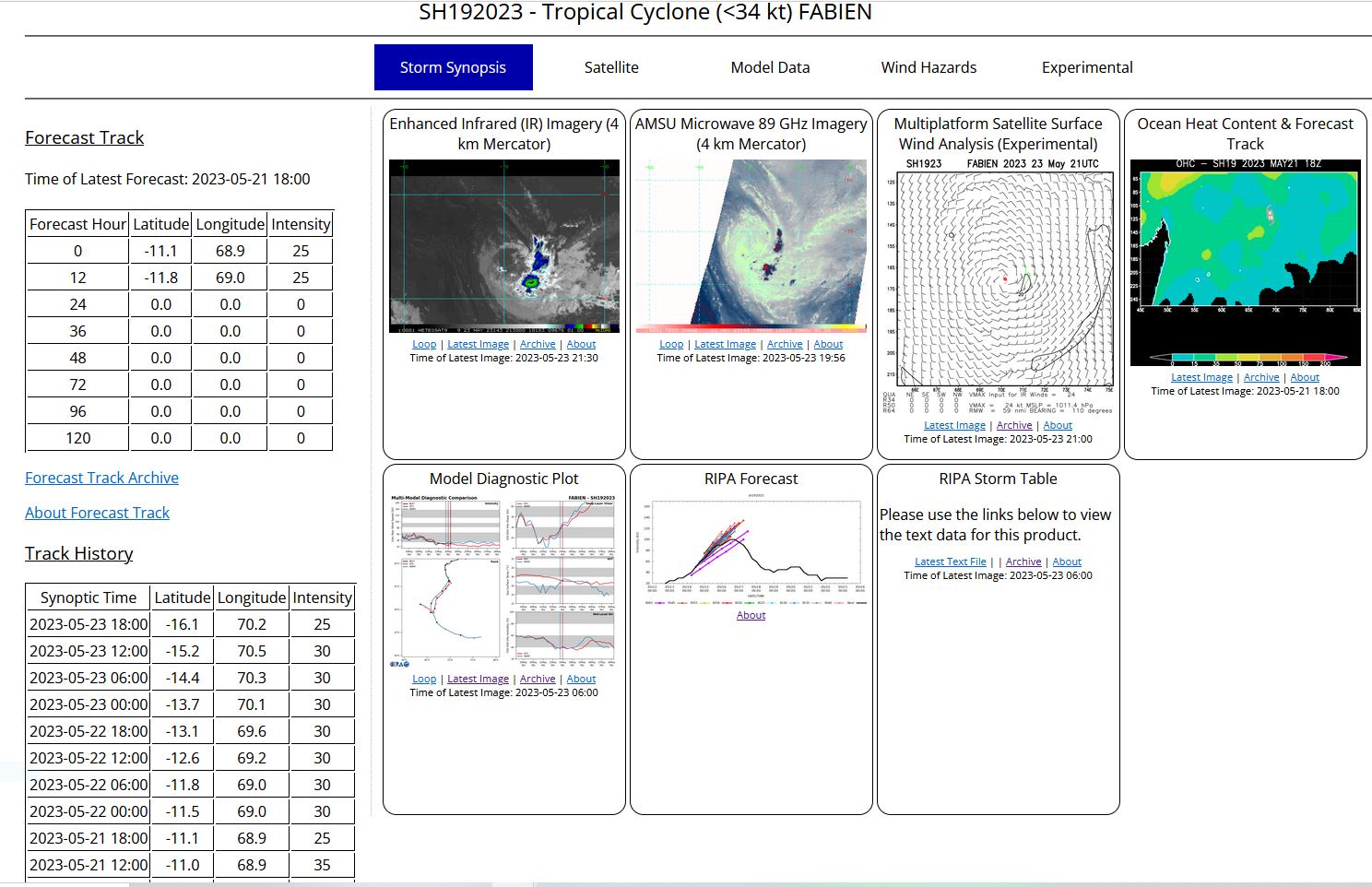
SOUTH INDIAN OCEAN: REMNANTS OF TC 19S(FABIEN).ESTIMATED LOCATION AND INTENSITY AT 231800UTC.
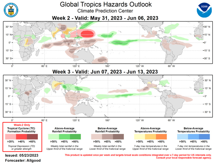
Last Updated - 05/23/23 Valid - 05/31/23 - 06/13/23 An active Madden-Julian Oscillation (MJO) signal remains apparent in various atmospheric fields, and continues to project well on the RMM-based and CPC upper-level velocity potential based MJO indices. Recent observations have indicated that other modes are interfering with this intraseasonal signal. Notably, the large circulation of Typhoon Mawar over the West Pacific, and persistent anomalously strong upper-level westerly winds over the East Pacific have caused a slowdown in the eastward propagation of the MJO, which had been on the fast end of the 30-60 day circumnavigational envelope throughout much of the Boreal Spring. The confluence of these modes has resulted in a very strong westerly wind burst (WWB) along the equatorial West Pacific, co-located with the warmest waters of the West Pacific warm pool. This WWB is likely to generate a strong and breaking downwelling oceanic Kelvin wave, which would serve to reinforce and increase the influx of warmer upper-ocean water across the equatorial Pacific. Therefore the MJO slowdown and tropical cyclone activity over the Pacific increases confidence in a transition towards El Ni�o conditions. Dynamical model MJO index forecasts are mixed, with the GEFS showing a breakdown of the eastward propagation over the next two weeks, favoring a more persistent pattern of enhancement across the Pacific. This persistence may be due both to continued West Pacific tropical cyclone activity in the model forecasts, as well as a depiction of the transition towards an ENSO warm base state. By Week-3, several ensemble members show a resumption of eastward propagation across the Western Hemisphere. The ECMWF is more progressive in general, depicting a transition across the Western Hemisphere during Week-2, with the enhanced phase potentially reaching the Indian Ocean by Week-3. However, most ECMWF ensemble members depict a weak signal overall. Based on these forecasts, there is increased uncertainty with respect to the influence of the MJO on the global tropical convective pattern during the Weeks 2-3 time period, although the signal is likely to remain active. The ENSO base state will likely begin emerging as the dominant mode of tropical variability, especially after the outlook period in response to the potential downwelling oceanic Kelvin wave generated in response to the current strong WWB. Super-Typhoon Mawar formed on 20 May over the West Pacific basin at a fairly low latitude, which allowed for a projection of strong low-level westerlies on the Equator. Currently near Category-5 intensity on the Saffir-Simpson scale, forecasts from the Joint Typhoon Warning Center bring the tropical cyclone near or over Guam within the next 24 hours at Category-5 intensity. Severe to devastating impacts from wind, flooding, and storm surge are likely across Guam and portions of the Mariana Islands. Dynamical models generally depict continued west-northwestward movement of Super-Typhoon Mawar during Week-1, with the cyclone arriving east of Taiwan at the beginning of the Week-2 period. A recurve towards the north and northeast is anticipated, with the cyclone potentially impacting Japan during Week-2. The West Pacific is favored to remain active during Week-2, as the MJO favors enhanced convection across the South China Sea, Philippines, and the Northwest Pacific, with the axis of enhanced convection shifting poleward from its current position. Tropical cyclogenesis is also possible as far west as the eastern Bay of Bengal, where vertical shear remains sufficiently low due to a slightly delayed monsoon onset. Although the MJO or Kelvin wave activity moving ahead of the main enhanced convective envelope typically would favor tropical cyclogenesis over the East Pacific basin, strong westerly shear remains in place, which would largely limit development. Should these westerlies relax, tropical cyclogenesis would become increasingly likely. Forecasts for above- and below-normal precipitation are based on an anticipated atmospheric response to continued warming across the Equatorial Pacific, MJO activity progressing slowly across the Pacific, and a consensus of dynamical model guidance. Above-normal precipitation during Week-2 along and east of Japan is in association with Typhoon Mawar. Suppressed (enhanced) convection across the Maritime Continent (tropical Pacific) during both Weeks 2 and 3 are consistent with both the MJO and the transitioning base state. A weakness in the midlatitude height field as well as a potential for MJO propagation favors enhanced precipitation across portions of the North Atlantic, with a slight chance for brief tropical or subtropical cyclone development. Suppressed rainfall across portions of South and Southeast Asia related to a delayed monsoon onset may promote heatwaves and severe weather outbreaks. Drier conditions across portions of east-central Africa and the Sahel region during Week-2 may also result in periods of excessive heat.
