Menu

Cyclone development outlook for the Southern Hemisphere & Western North Pacific, 09/02 update


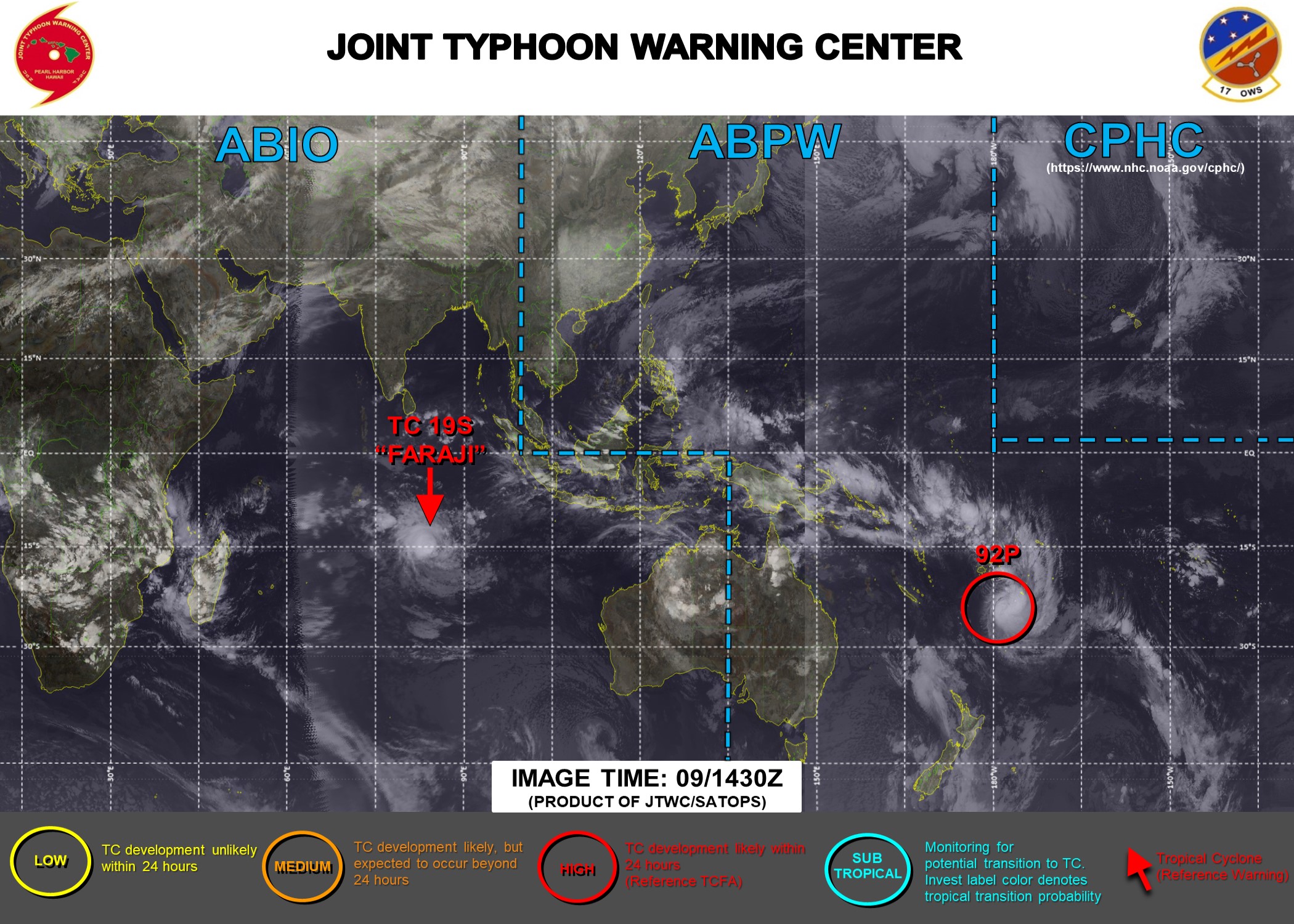
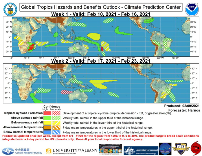
09/18UTC. The only tropical cyclone (TC) to develop over the past week was 19S(FARAJI), over the southern Indian Ocean. Faraji developed near 13S/81E on the 5th of February and subsequently tracked to the south, before an eastward turn and intensification two days later. Faraji rapidly intensified to a strength of 140 knots/US Category 5 by the 8th as its eyewall contracted around a pinhole eye, although there are some signs of weakening and a possible eyewall replacement underway today. The Joint Typhoon Warning Center (JTWC) forecasts Faraji to start to recurve to the west over the next several days, with the residual disturbance possibly approaching Madagascar by Week-2. JTWC is currently monitoring a disturbance (92P) presently located just south of Fiji and forecasting a high chance of tropical cyclogenesis during the next 24 hours (high confidence for Week-1 TC development). Elsewhere, the CFS, ECMWF, GEFS, and Canadian ensembles all spin up a TC over the Gulf of Mozambique during Week-1, leading to high confidence for TC formation. By Week-2, model guidance hints at the potential for a westward tracking disturbance forming off the Kimberley Coast of Australia (moderate confidence). There is also some hint of a Coral Sea system developing during Week-2, but this area is prone to false alarms, so confidence is insufficient to make it onto the forecast graphic at this time. NOAA.


09/18UTC. The only tropical cyclone (TC) to develop over the past week was 19S(FARAJI), over the southern Indian Ocean. Faraji developed near 13S/81E on the 5th of February and subsequently tracked to the south, before an eastward turn and intensification two days later. Faraji rapidly intensified to a strength of 140 knots/US Category 5 by the 8th as its eyewall contracted around a pinhole eye, although there are some signs of weakening and a possible eyewall replacement underway today. The Joint Typhoon Warning Center (JTWC) forecasts Faraji to start to recurve to the west over the next several days, with the residual disturbance possibly approaching Madagascar by Week-2.  JTWC is currently monitoring a disturbance (92P) presently located just south of Fiji and forecasting a high chance of tropical cyclogenesis during the next 24 hours (high confidence for Week-1 TC development). Elsewhere, the CFS, ECMWF, GEFS, and Canadian ensembles all spin up a TC over the Gulf of Mozambique during Week-1, leading to high confidence for TC formation. By Week-2, model guidance hints at the potential for a westward tracking disturbance forming off the Kimberley Coast of Australia (moderate confidence). There is also some hint of a Coral Sea system developing during Week-2, but this area is prone to false alarms, so confidence is insufficient to make it onto the forecast graphic at this time.NOAA.
09/18UTC. The only tropical cyclone (TC) to develop over the past week was 19S(FARAJI), over the southern Indian Ocean. Faraji developed near 13S/81E on the 5th of February and subsequently tracked to the south, before an eastward turn and intensification two days later. Faraji rapidly intensified to a strength of 140 knots/US Category 5 by the 8th as its eyewall contracted around a pinhole eye, although there are some signs of weakening and a possible eyewall replacement underway today. The Joint Typhoon Warning Center (JTWC) forecasts Faraji to start to recurve to the west over the next several days, with the residual disturbance possibly approaching Madagascar by Week-2. JTWC is currently monitoring a disturbance (92P) presently located just south of Fiji and forecasting a high chance of tropical cyclogenesis during the next 24 hours (high confidence for Week-1 TC development). Elsewhere, the CFS, ECMWF, GEFS, and Canadian ensembles all spin up a TC over the Gulf of Mozambique during Week-1, leading to high confidence for TC formation. By Week-2, model guidance hints at the potential for a westward tracking disturbance forming off the Kimberley Coast of Australia (moderate confidence). There is also some hint of a Coral Sea system developing during Week-2, but this area is prone to false alarms, so confidence is insufficient to make it onto the forecast graphic at this time.NOAA.
2021 FEB 09 1825UTC #SOUTHERNHEMISPHERE
                                       #WESTERNNORTHPACIFIC
 
 Cheers,
Patrick Hoareau
 Météo974
M974World
Cyclone Class 4
 Cheers,PH.

Joint Typhoon Warning Center
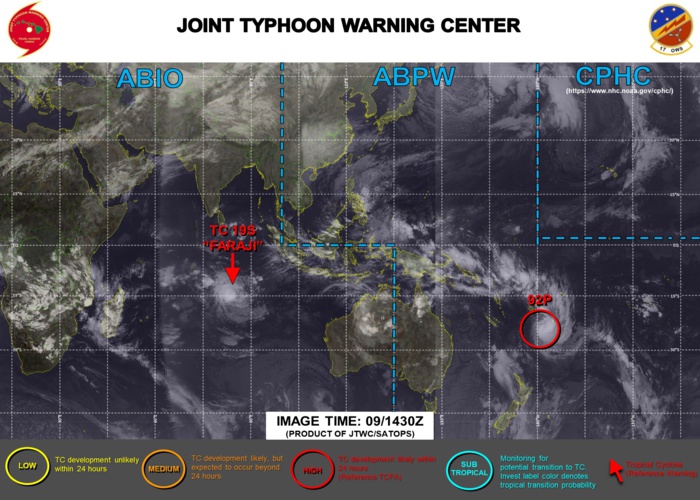
09/02 1730UTC. JTWC HAS BEEN ISSUING 12HOURLY WARNINGS ON 19S(FARAJI). INVEST 92P IS STILL HIGH. 3HOURLY SATELLITE BULLETINS ARE PROVIDED FOR BOTH 19S AND 92P.
Rédigé par PATRICK HOAREAU le Tuesday, February 9th 2021 à 22:40