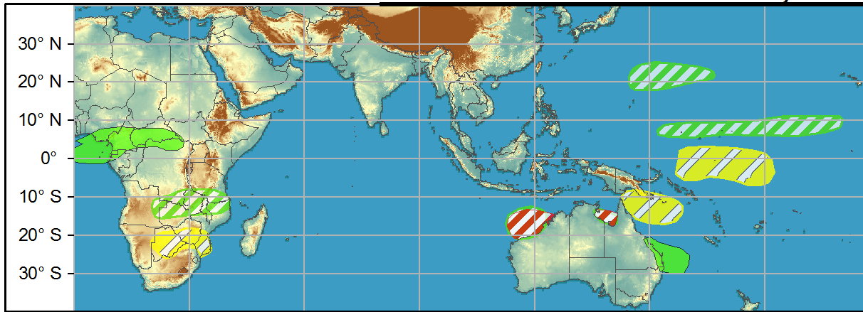
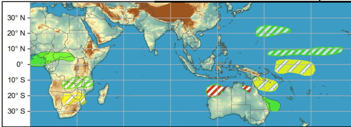
WEEK 1: As predicted in last week's outlook, two tropical cyclones developed over the South Indian Ocean during the past week. Cyclone Habana formed over the south-central Indian Ocean and strengthened to major hurricane intensity (125kt peak sustained winds) as it tracked generally eastward over the open ocean. Over the past few days, the cyclone has turned southward and westward, and forecasts from the JTWC show the system regaining major hurricane intensity as it tracks westward just south of its prior track. Ultimately the cyclone is forecast to recurve to the south well east of Mauritius and La Reunion. Tropical Storm Iman formed to the west of Cyclone Habana's location, and is currently weakening as it recurves southward. During Week-1, additional tropical cyclogenesis is possible over the eastern portion of the Indian Ocean basin, with two regions exhibiting a moderate potential for development. Formation northwest of Australia in the vicinity of 100-110E is possible, with dynamical model track forecasts bringing this potential system generally southward, with a potential for impacts to Western Australia.
Issued at 09/1830UTC by NOAA.
In collaboration with the JTWC and several well known organizations.
Archives: HERE
Cheers,
Patrick Hoareau
M974World
ILES SOEURS
Cyclone Class 4
Cheers,PH.
Joint Typhoon Warning Center
In collaboration with the JTWC and several well known organizations.
Archives: HERE
Cheers,
Patrick Hoareau
M974World
ILES SOEURS
Cyclone Class 4
Cheers,PH.
Joint Typhoon Warning Center
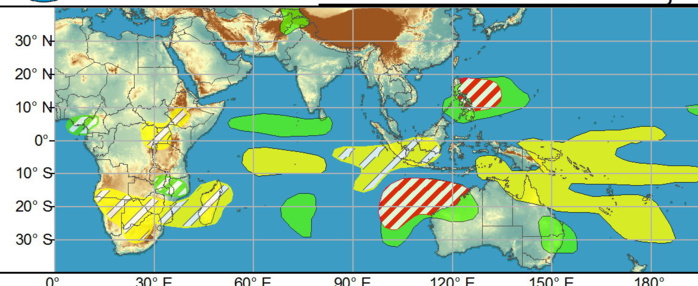
LATE WEEK1/WEEK 2: formation is possible during late Week-1 or Week-2 closer to the Kimberley Coast or the Gulf of Carpentaria. Elsewhere, a disturbance east of the Philippines has a moderate potential for formation before moving westward across the archipelago.
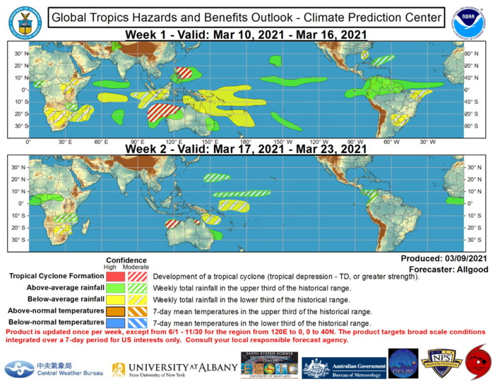
Precipitation forecasts are based on dynamical model consensus, with an anticipated strengthening of the MJO signal over the Western Hemisphere. More widespread suppressed rainfall is favored for the West Pacific due to a resurging La Nina response and the suppressed phase of a Rossby wave. In contrast, the MJO favors widespread rainfall across northern South America, with a potential for flooding and flood-related impacts across the higher elevations of northwestern South America. Additional heavy rainfall is also favored for Hawaii, which may exacerbate ongoing flooding across parts of Maui. Strong ridging over the eastern CONUS favors dry conditions across parts of the Southeast, which may promote expanding drought conditions across parts of southern Georgia or the Florida peninsula. During Week-2, the coverage of dynamical model consensus drops considerably. Additional heavy rainfall is possible across northwestern South America, while a remnant MJO circulation may promote above-average rainfall across parts of equatorial Africa. Dynamical models also favor heavy rainfall across southeastern Queensland.
