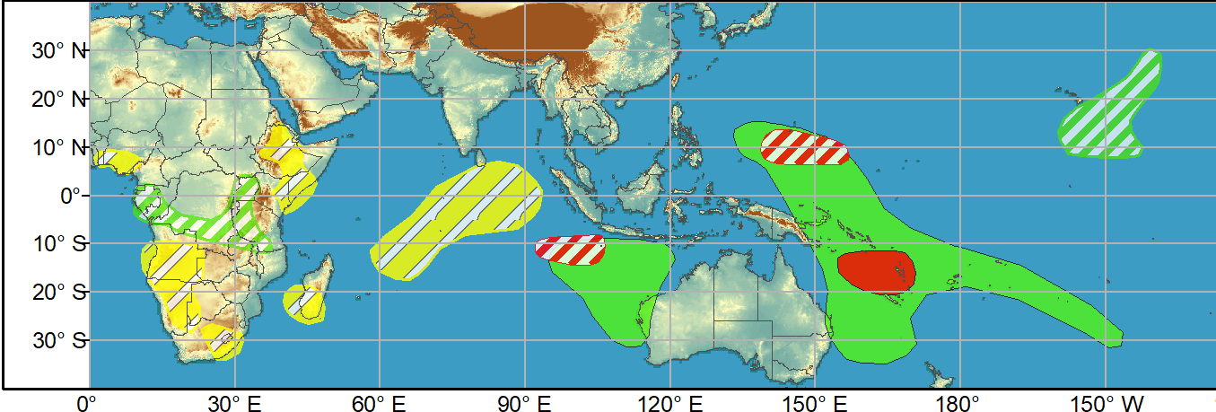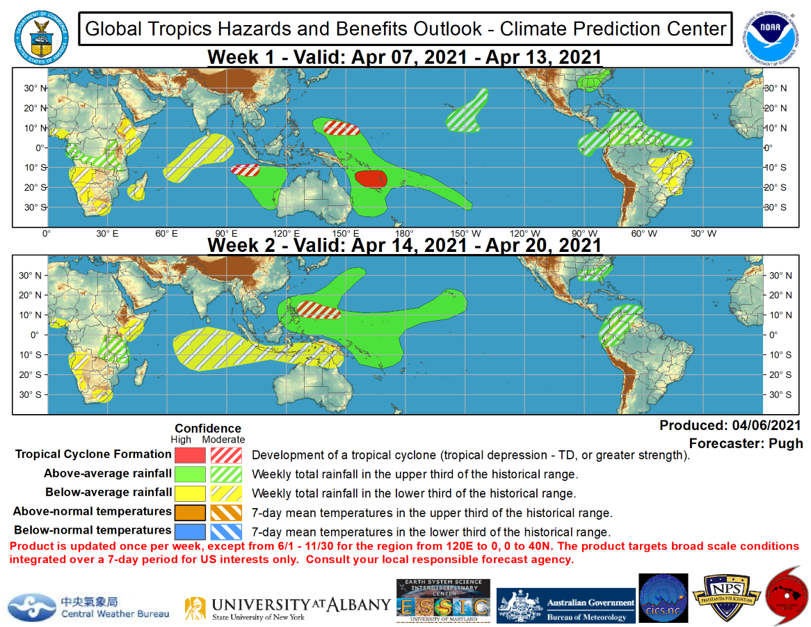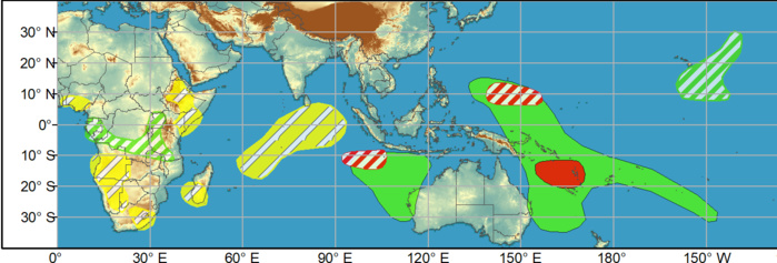
WEEK 1. 7 to 13 April. A couple of tropical cyclones (TCs) developed over the South Indian Ocean at the beginning of April and the MJO likely contributed to the genesis of these TCs. Tropical Cyclone 27S (centered at 16.2S/105.8E on Apr 7) is forecast to remain nearly stationary during the next 72 hours and then dissipate. The Joint Typhoon Warning Center calls for Tropical Cyclone Seroja, at 11.5S/118.9E, to strengthen with maximum sustained winds reaching 105 knots as it tracks southwest and parallels the Kimberley Coast of Australia. Later in week-1, TC Seroja could make landfall in Western Australia. Just to the west of these ongoing TCs, deterministic model runs continue to indicate that another TC may form early in week-1. Based on a favorable large-scale environment with the enhanced phase of the MJO crossing the West Pacific and support from model guidance, a high confidence or TC development exists over the Coral Sea during week-1.
Issued at 06/1730UTC by NOAA.
In collaboration with the JTWC and several well known organizations.
Archives: HERE
Cheers,
Patrick Hoareau
M974World
ILES SOEURS
Cyclone Class 4
Cheers,PH.
Joint Typhoon Warning Center
In collaboration with the JTWC and several well known organizations.
Archives: HERE
Cheers,
Patrick Hoareau
M974World
ILES SOEURS
Cyclone Class 4
Cheers,PH.
Joint Typhoon Warning Center
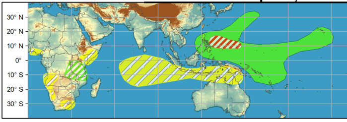
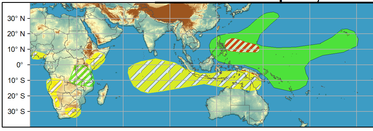
WEEK 2. 14 to 20 April. An elevated chance of TC development also is forecast across the West Pacific. Due to uncertainty on timing, a moderate confidence area covers weeks 1 and 2.
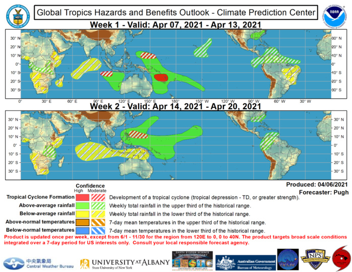
Favored areas of above and below median precipitation are based on: predicted tracks of TCs, a model consensus, and MJO precipitation composites (phases 6, 7, and 8). During the next two weeks, above average rainfall is likely across the West Pacific along with parts of the Central Pacific, including Hawaii. Above average rainfall is also favored to affect parts of the Caribbean (week-1) and northern South America (weeks 1 and 2). Once the ongoing TCs across the South Indian Ocean track poleward, below average rainfall is expected to expand east from the Indian Ocean to parts of the Maritime Continent and northern Australia by week-2. During weeks 1 and 2, an amplifying 500-hPa trough over the eastern U.S. favors above average rainfall across the southeastern United States. This favored area of above average rainfall is also consistent with MJO precipitation composites. For hazardous weather concerns during the upcoming two weeks across the U.S. please refer to your local NWS Forecast Office, the Weather Prediction Center's Medium Range Hazards Forecast, and CPC's Week-2 U.S. Hazards Outlook
