NORTH INDIAN OCEAN/ARABIAN SEA: INVEST 93A
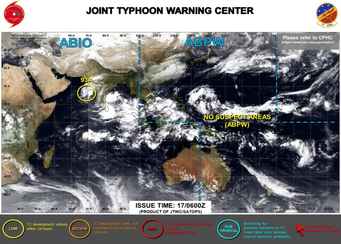
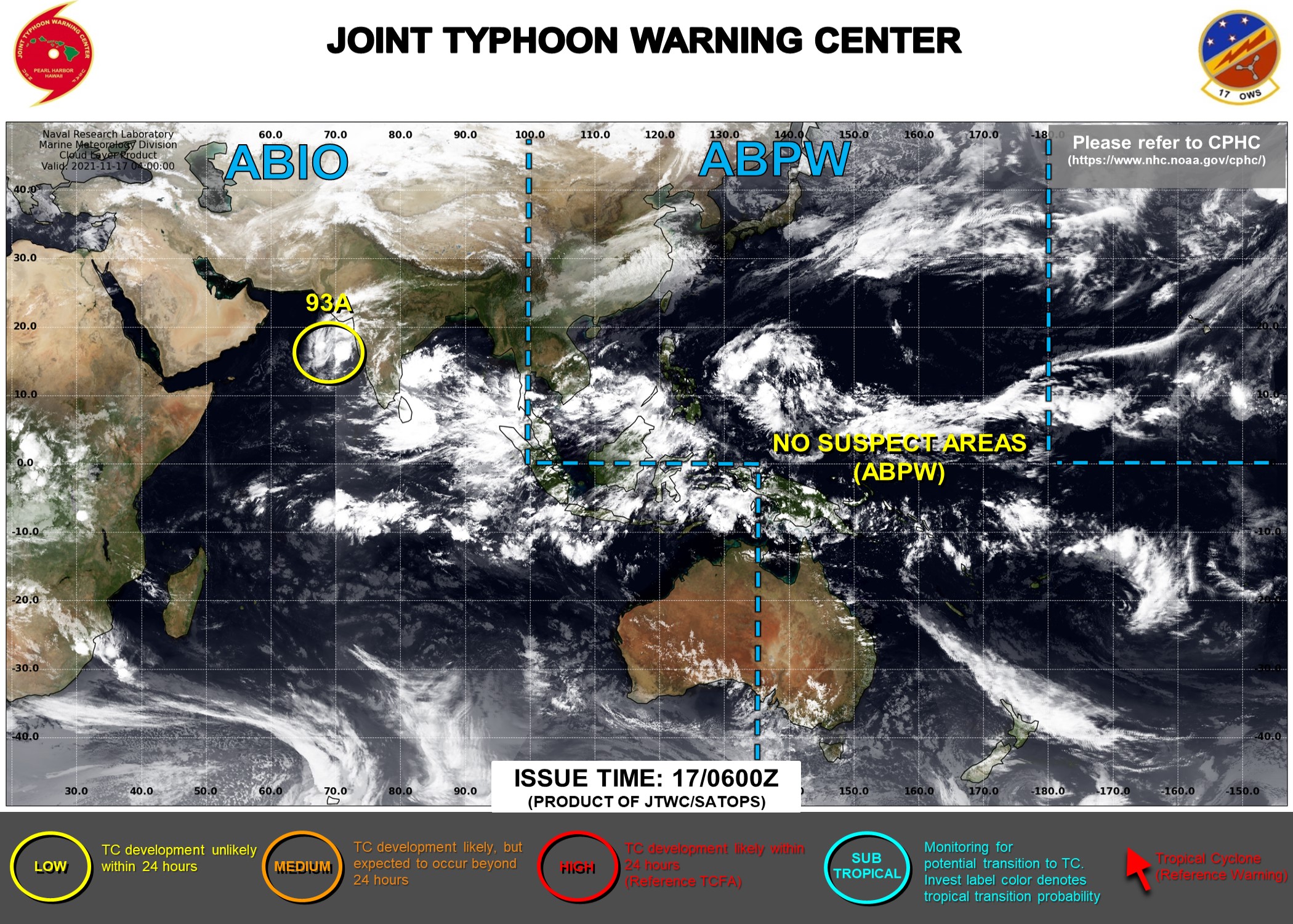
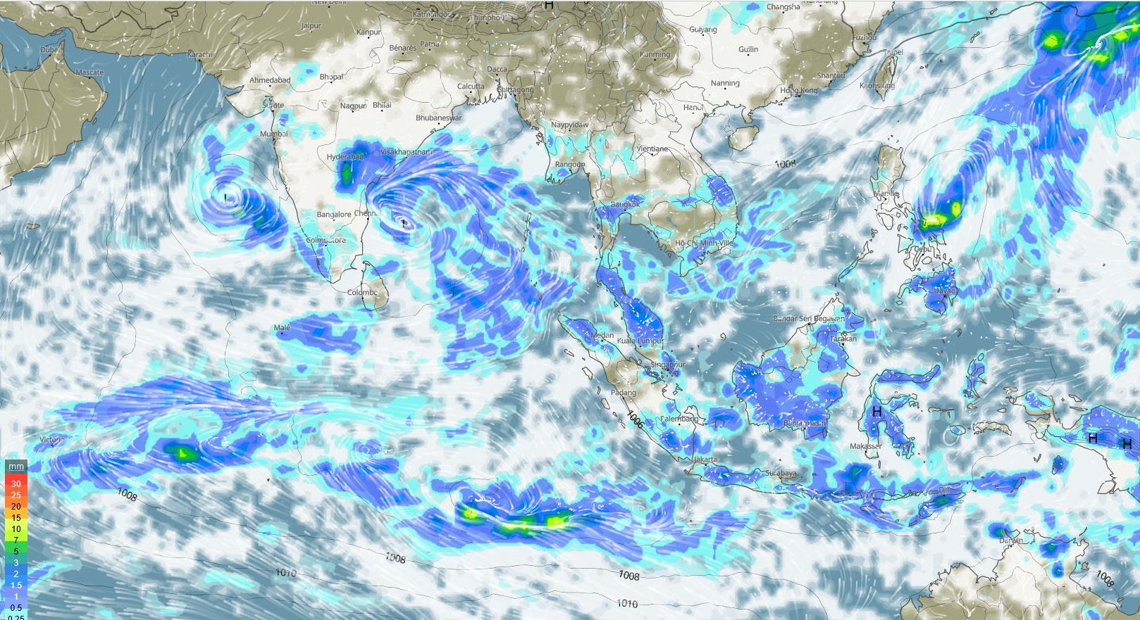
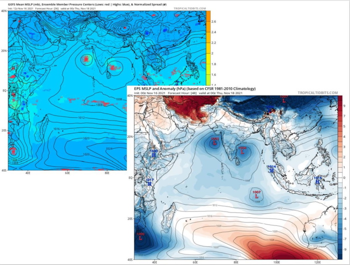
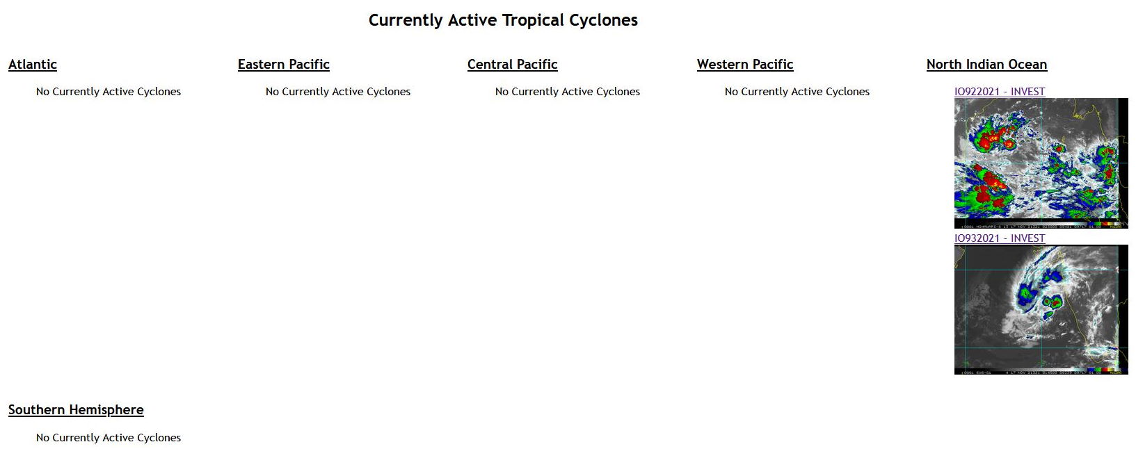
AN AREA OF CONVECTION (INVEST 93A) HAS PERSISTED NEAR 14.8N 69.1E, APPROXIMATELY 610 KM SOUTHWEST OF MUMBAI, INDIA. ANIMATED ENHANCED INFRARED SATELLITE IMAGERY (EIR) AND A TIMELY 162359Z SSMIS 91GHZ MICROWAVE IMAGE DEPICTS A POORLY ORGANIZED LLC WITH MOST OF THE CONVECTION SHEARED TO THE NORTHWESTERN PERIPHERY. UPPER LEVEL ANALYSIS INDICATES A FAVORABLE ENVIRONMENT WITH LOW TO MODERATE (10 TO 20 KTS) VWS, EXCELLENT POLEWARD OUTFLOW AND WARM (28- 29C) SEA SURFACE TEMPERATURES. GLOBAL MODELS ARE IN AGREEMENT THAT INVEST 93A WILL SEE MINIMAL DEVELOPMENT AS IT TRACKS WEST- NORTHWESTWARD. MAXIMUM SUSTAINED SURFACE WINDS ARE ESTIMATED AT 12 TO 17 KNOTS. MINIMUM SEA LEVEL PRESSURE IS ESTIMATED TO BE NEAR 1010 MB. THE POTENTIAL FOR THE DEVELOPMENT OF A SIGNIFICANT TROPICAL CYCLONE WITHIN THE NEXT 24 HOURS IS LOW.
WEEK 1: 17/23 NOVEMBER

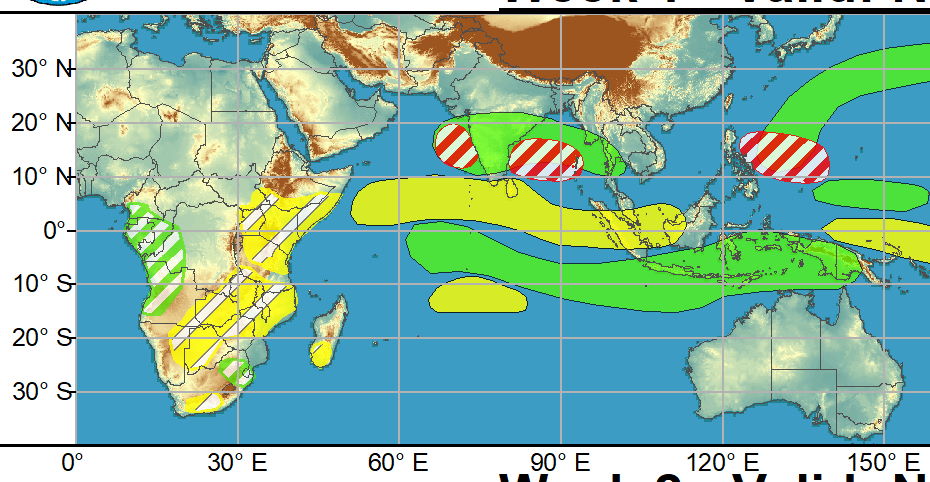
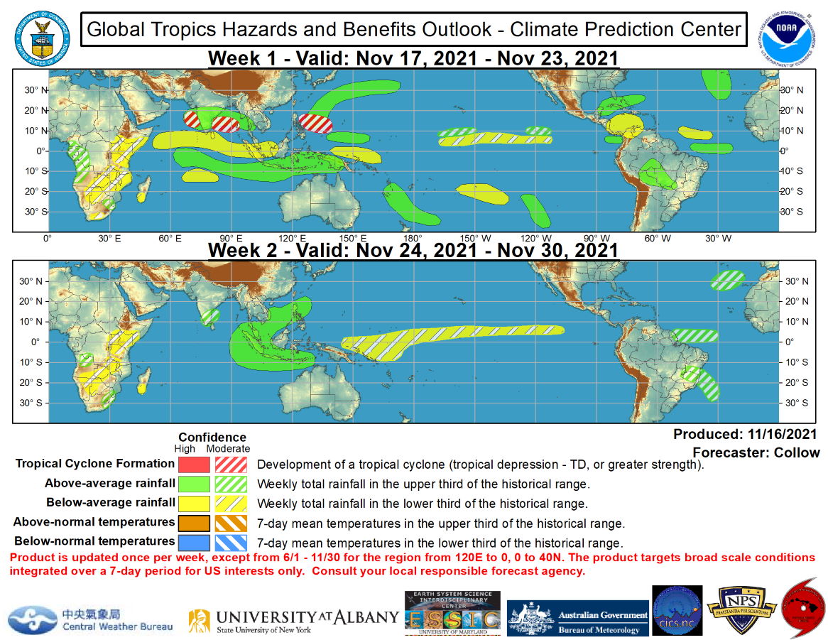
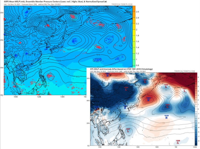
Tropical cyclone (TC) activity has been generally quiet across the globe. The only new system in the past week was Tropical Cyclone 04B, which developed over the Bay of Bengal on 11/11 and impacted southern India. Although the system was weak, the heavy rainfall associated with this system exacerbated ongoing severe flooding across southern India and Sri Lanka. Given the enhanced convective mode across the region, additional rainfall is likely to continue over these areas with a slight northward shift in the heaviest rainfall forecast in the near term, with the highest accumulations favored over the states of Andhra Pradesh and Karnataka, and relatively drier conditions over Sri Lanka. There is moderate confidence in TC development across both the Bay of Bengal and the eastern Arabian Sea during the next week, with considerable ensemble support from the ECMWF and GEFS. Any potential system that develops over the Bay of Bengal would likely take a west to northwest track into India, further increasing flooding concerns. Over the western Pacific, a moderate confidence for TC development is indicated across the Philippine Sea during week-1, with the potential system forecast to weaken as it approaches the northern Philippines. Subtropical development is also possible across the far north Atlantic, in the vicinity of the Azores, although confidence is too low to include an associated risk area on today’s graphic given the uncertainty and the time of year. No areas of TC development are highlighted during week-2 throughout the globe. NOAA.
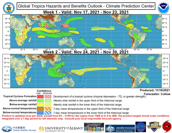
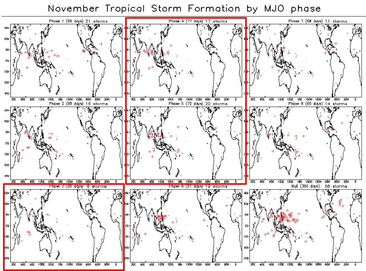
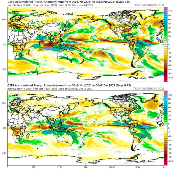
Global Tropics Hazards and Benefits Outlook Discussion Last Updated: 11.16.21 Valid: 11.17.21 - 11.30.21 During the past week, the RMM-based MJO index shifted eastward to the Maritime Continent. Its magnitude has also increased slightly, and now lies near the edge of the RMM unit circle. Rather than a true emergence of an MJO, this signal is more likely tied to constructive interference between a convectively coupled Kelvin Wave and the low frequency enhanced convective state established across the Maritime Continent associated with La Nina. There is large ensemble spread in the GEFS and ECMWF regarding MJO propagation, with a mean consensus being a slight retrogression and weakening of the intraseasonal signal during the next two weeks. This evolution is consistent with La Nina and also indicated more clearly in the JMA ensembles, which show less variability compared to the GEFS and ECMWF ensembles. Tropical cyclone (TC) activity has been generally quiet across the globe. The only new system in the past week was Tropical Cyclone 04B, which developed over the Bay of Bengal on 11/11 and impacted southern India. Although the system was weak, the heavy rainfall associated with this system exacerbated ongoing severe flooding across southern India and Sri Lanka. Given the enhanced convective mode across the region, additional rainfall is likely to continue over these areas with a slight northward shift in the heaviest rainfall forecast in the near term, with the highest accumulations favored over the states of Andhra Pradesh and Karnataka, and relatively drier conditions over Sri Lanka. There is moderate confidence in TC development across both the Bay of Bengal and the eastern Arabian Sea during the next week, with considerable ensemble support from the ECMWF and GEFS. Any potential system that develops over the Bay of Bengal would likely take a west to northwest track into India, further increasing flooding concerns. Over the western Pacific, a moderate confidence for TC development is indicated across the Philippine Sea during week-1, with the potential system forecast to weaken as it approaches the northern Philippines. Subtropical development is also possible across the far north Atlantic, in the vicinity of the Azores, although confidence is too low to include an associated risk area on today’s graphic given the uncertainty and the time of year. No areas of TC development are highlighted during week-2 throughout the globe. The precipitation outlook during the next two weeks is based on a consensus of GEFS, CFS, and ECMWF guidance. The most significant areas of heavy rainfall forecast during week-1 are over interior South America tied to a potential mesoscale convective system, the eastern half of Indonesia, situated underneath the enhanced low frequency convective signal, and as discussed previously, over southern India. A more tranquil pattern is forecast over South America by week-2, with only moderate confidence areas for heavy rainfall indicated over eastern Brazil and French Guiana. Heavy rain is favored to continue across southern India, in addition to much of the Maritime Continent associated with the persistence of the low frequency signal. For hazardous weather concerns during the next two weeks across the U.S., please refer to your local NWS Forecast Office, the Weather Prediction Center's Medium Range Hazards Forecast, and CPC's Week-2 Hazards Outlook. Forecasts over Africa are made in consultation with the International Desk at CPC and can represent local-scale conditions in addition to global scale variability. Product Release Information The full Global Tropics Hazards and Benefits Outlook (GTH) is released once per week every Tuesday at 1730 UTC (1830 UTC when on standard time) including U.S. federal holidays. At the time of product release, there is a live briefing (available via webinar) open to all interested parties in which the latest conditions in the Tropics and the just released outlook and associated impacts are discussed. There is an opportunity to ask questions after the briefing and the briefings are available at the Live Briefing Archive and soon will be recorded. CPC also issues an operational update of this product every Friday at 2 PM local Eastern Time to further support the NWS regions. The update only spans the release period from June 1 through November 30 and a region from 120E to the Prime Meridian in longitude and from the equator to 40N in latitude. The update does not extend the time horizon of the product, but rather applies for the remaining 4 days of the previous Week-1 time period and Days 5-11 from the previous Week-2 period. This page will depict both the original and updated outlook maps as well short text outlining the forecast rationale for any changes. NOAA.
