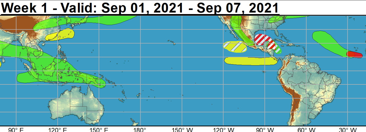
Hurricane Ida made landfall near Port Fourchon, LA as a Category 4 Major Hurricane on 8/29 and brought devastating impacts to many areas near the central Gulf Coast. Early assessments indicate torrential rainfall amounts well in excess of 10 inches and storm surge estimates as high as 12 to 16 feet. As Ida is forecast to continually weaken on land and undergo extratropical transition, above-normal rainfall is anticipated along its path across the CONUS with an elevated risk for flash flooding across portions of the Tennessee and Ohio Valleys, Appalachians, Mid-Atlantic, and the Northeast during the next several days. Elsewhere in the Atlantic, Tropical Storms (TS) Kate and Julian formed in open waters of the central Atlantic on 8/27 and 8/28, respectively. TS Julian has since dissipated, but the National Hurricane Center (NHC) forecasts Tropical Depression Kate to maintain its intensity and track northward into the central Atlantic where it is favored to be eventually absorbed by an extratropical frontal system this weekend. In the eastern Pacific, Hurricane Nora formed on 8/26 and peaked as a category 1 Hurricane triggering floods and landslides in western Mexico as the system entered the Gulf of California. Although Hurricane Nora rapidly weakened this past weekend, the enhancement of moisture in the monsoonal circulation is likely to trigger locally heavy rainfall and flash flooding across western Mexico, and into the Desert Southwest and Four Corners region of the U.S. during the next few days. The NHC is monitoring a well defined area of low pressure just off the West Africa coast with a 90% chance for development in the coming days prompting a high confidence formation area in the outlook for week-1. There is good model agreement favoring the strengthening of this potential system as it tracks westward through the Main Development Region (MDR) through the end of this week. Farther west, the NHC expects an area of low pressure to form in the southwestern Caribbean with a 20% chance of formation during the next 5 days. Tied to this low pressure area, there has been good run to run continuity in the deterministic ECCC model depicting the formation of a closed low in the western Gulf of Mexico late in week-1. Several ensemble members from this morning's 00z GEFS support this realization, and a moderate confidence area for development is issued in the outlook extending from the Gulf of Honduras to the western Gulf of Mexico. NOAA.
2 WEEK CYCLONIC DEVELOPMENT POTENTIAL:
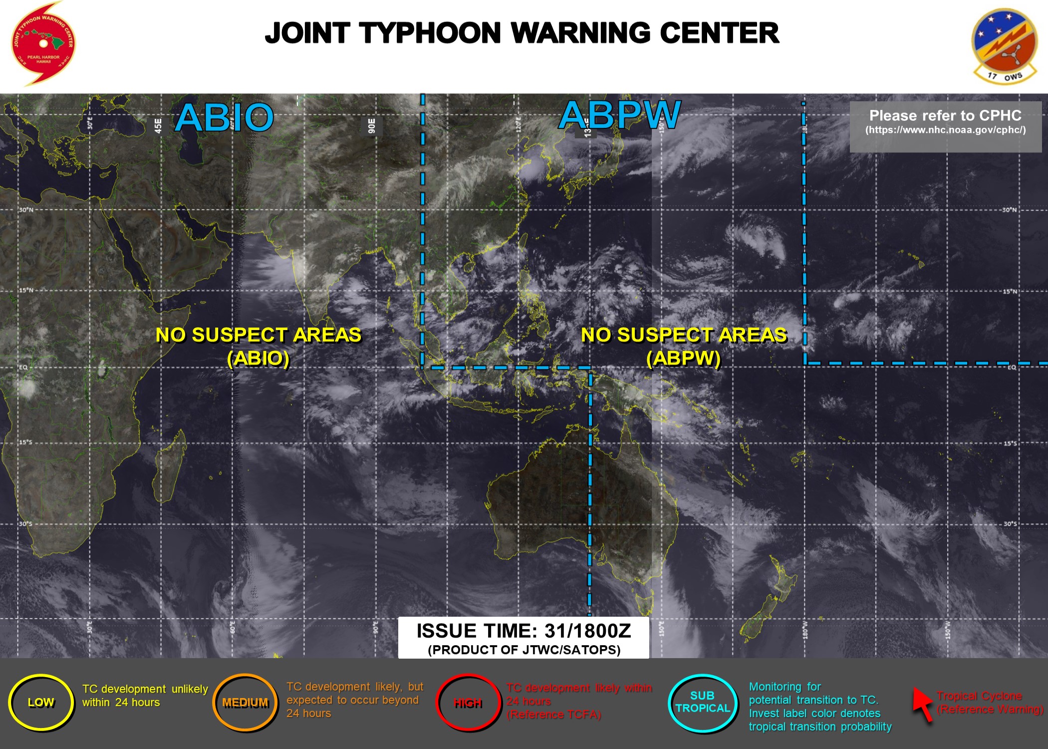
Issued at 31/1730UTC by NOAA.
In collaboration with the JTWC and several well known organizations.
Archives: HERE
Cheers,
Patrick Hoareau
JTWC PH
ILES SOEURS
Joint Typhoon Warning Center
JTWC BIS
Issued at 31/1730UTC by NOAA.
In collaboration with the JTWC and several well known organizations.
Archives: HERE
Cheers,
Patrick Hoareau
JTWC PH
ILES SOEURS
Joint Typhoon Warning Center
JTWC BIS

Over the eastern Pacific, conditions are expected to be quiet during week-1, however a moderate confidence area for TC development is posted to the south of Mexico for week-2 given support from probabilistic tools and the passage of another Kelvin wave favored by the ECMWF and CFS models over the basin. A moderate confidence region is also issued for the eastern MDR for week-2 where guidance favors another area of deepening low pressure associated with an easterly wave moving off of West Africa next weekend.NOAA.
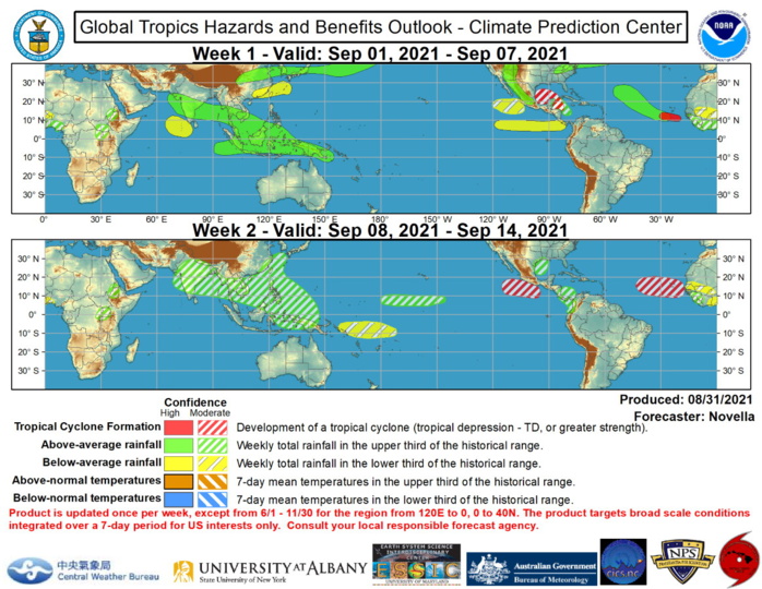
The precipitation outlook during the next two weeks is based on a consensus of GEFS, CFS, and ECMWF guidance, and anticipated TC tracks. For hazardous weather concerns during the next two weeks across the U.S., please refer to your local NWS Forecast Office, the Weather Prediction Center's Medium Range Hazards Forecast, and CPC's Week-2 Hazards Outlook. Forecasts over Africa are made in consultation with the International Desk at CPC and can represent local-scale conditions in addition to global scale variability.NOAA.
