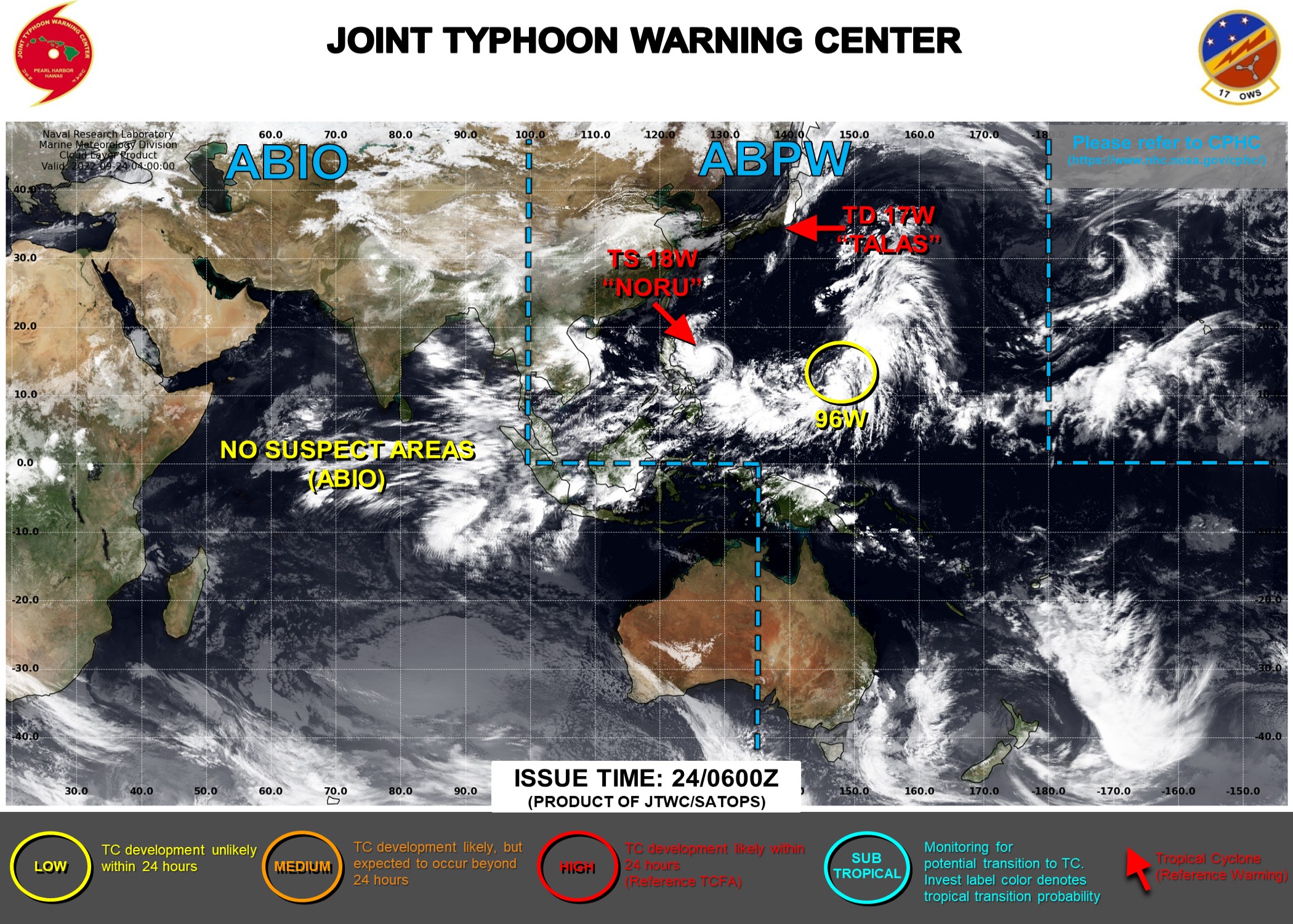
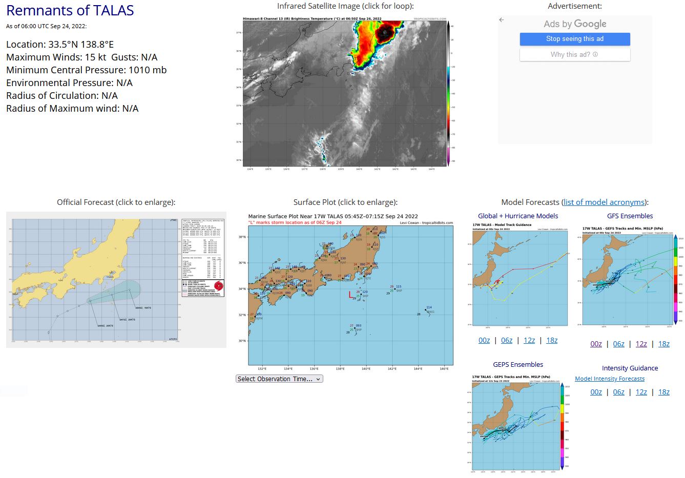
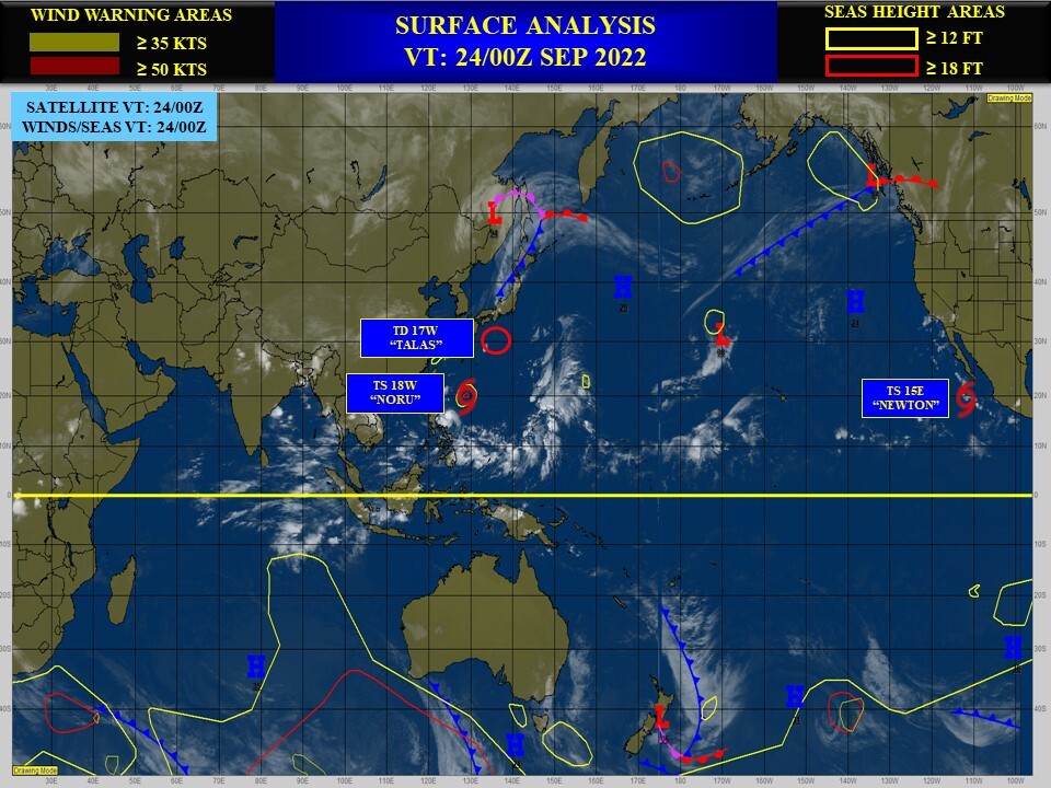
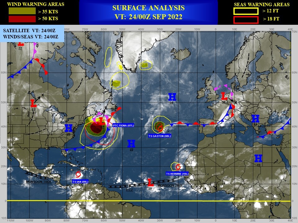
CLICK ON THE IMAGERIES BELOW TO GET THEM ENLARGED
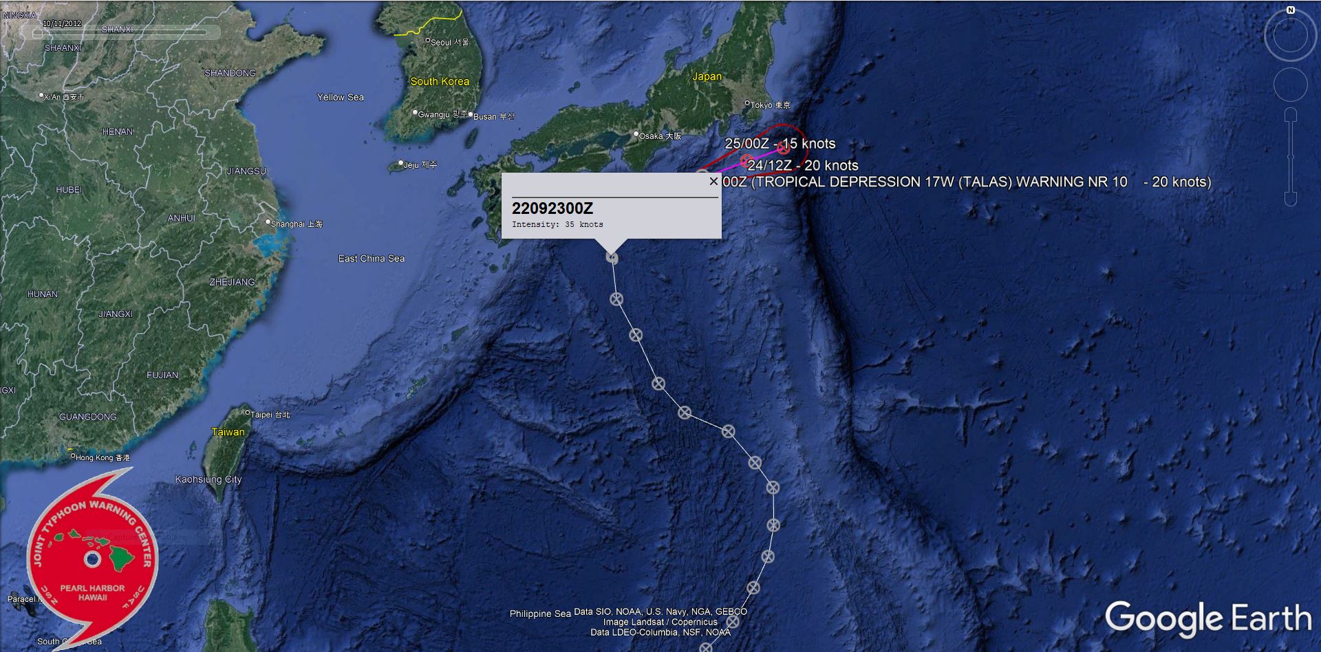
WESTERN NORTH PACIFIC: REMNANTS OF 17W(TALAS). ESTIMATED LOCATION AND INTENSITY AT 24/06UTC. WARNING 10/FINAL ISSUED AT 24/03UTC.
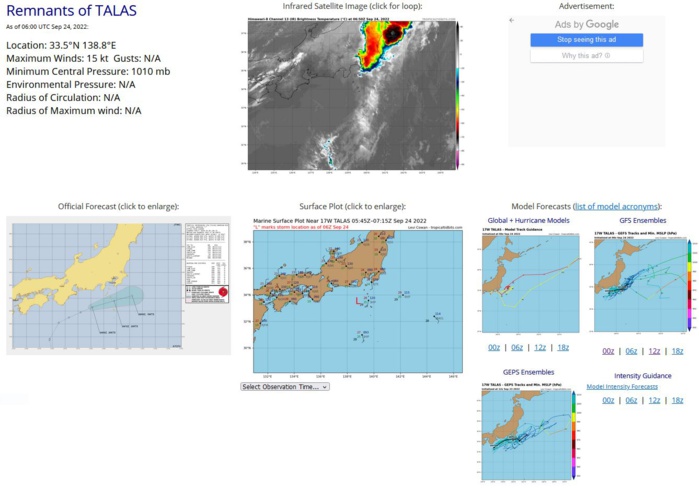
REMARKS: 240300Z POSITION NEAR 33.4N 138.5E. 24SEP22. TROPICAL DEPRESSION (TD) 17W (TALAS), LOCATED APPROXIMATELY 144 NM SOUTHWEST OF YOKOSUKA, JAPAN, HAS TRACKED EAST-NORTHEASTWARD AT 09 KNOTS OVER THE PAST SIX HOURS. ANIMATED MULTISPECTRAL SATELLITE IMAGERY INDICATES THAT TD 17W WAS ABSORBED INTO THE WEAK FRONTAL BOUNDARY EXTENDING SOUTH OF HONSHU AND HAS COMPLETELY DISSIPATED; THERE IS NO EVIDENCE OF A DISTINCT LOW-LEVEL CIRCULATION. A 232152Z SCATTEROMETER IMAGE SHOWS A TROUGH EXTENDING SOUTH FROM THE IZU PENINSULA WITH NO CLOSED CIRCULATION. ANIMATED RADAR IMAGERY SHOWS SEVERAL PROMINENT RAINBANDS FLOWING NORTHWARD INTO THE FRONTAL BOUNDARY. NUMERICAL MODEL GUIDANCE SHOWS ANOTHER EXTRA-TROPICAL LOW (NOT TD 17W) WILL FORM ALONG THE FRONTAL BOUNDARY OVER THE IZU PENINSULA AND TRACK EASTWARD WITH LITTLE DEVELOPMENT OVER THE NEXT TWO DAYS. THIS IS THE FINAL WARNING ON THIS SYSTEM BY THE JOINT TYPHOON WRNCEN PEARL HARBOR HI. THE SYSTEM WILL BE CLOSELY MONITORED FOR SIGNS OF REGENERATION. MAXIMUM SIGNIFICANT WAVE HEIGHT AT 240000Z IS 12 FEET.
ESTIMATED PEAK INTENSITY WAS 35KT.
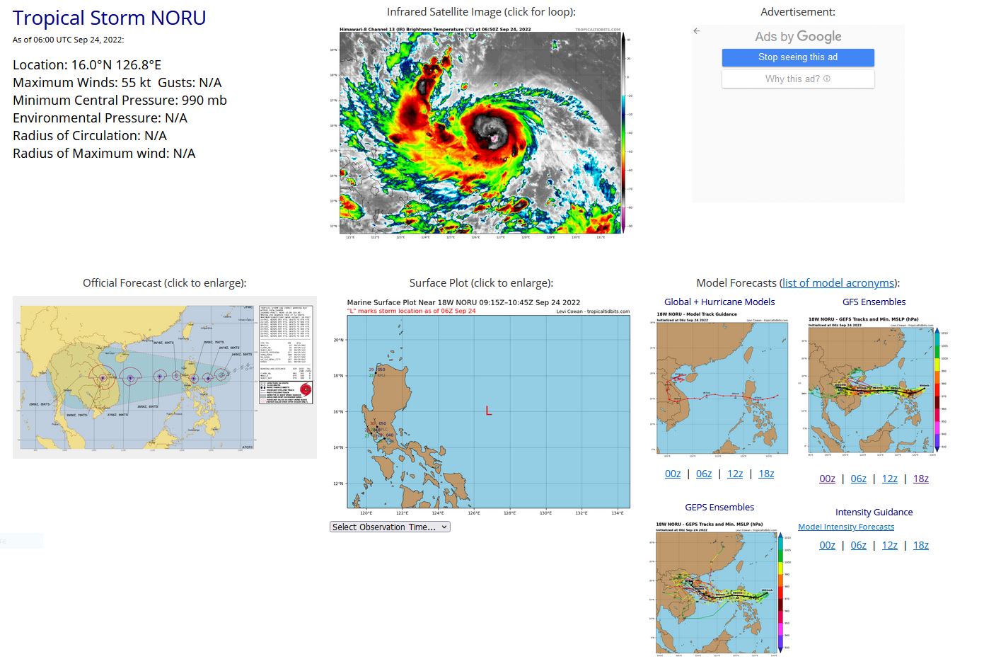
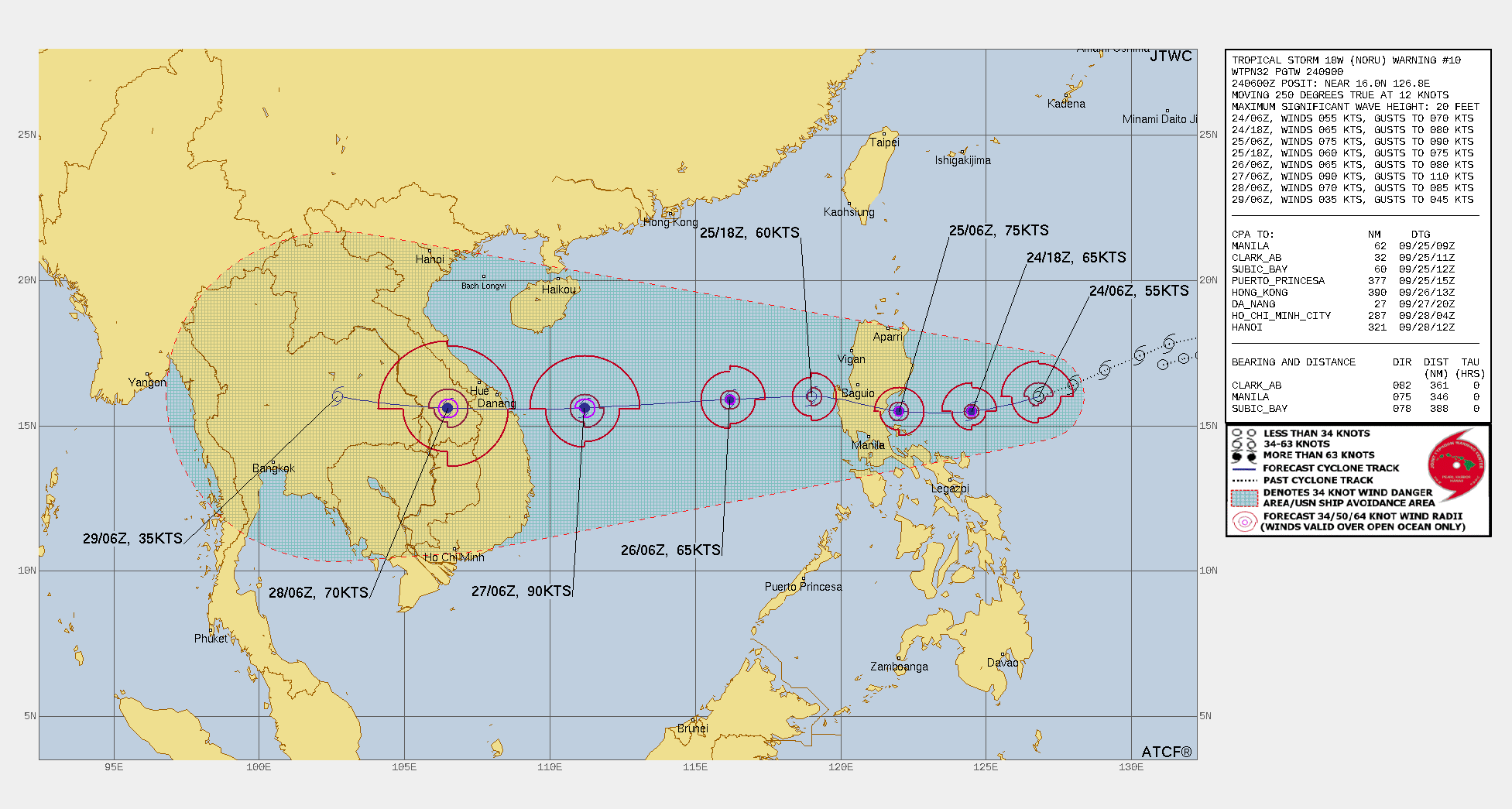
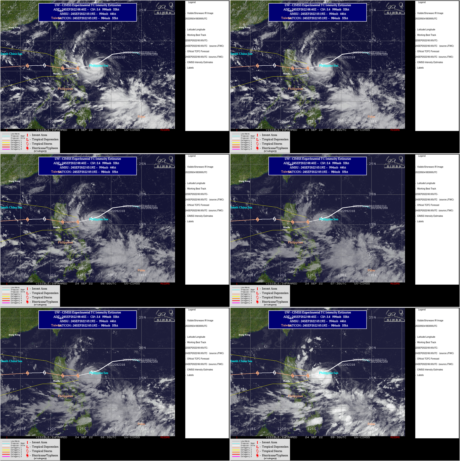
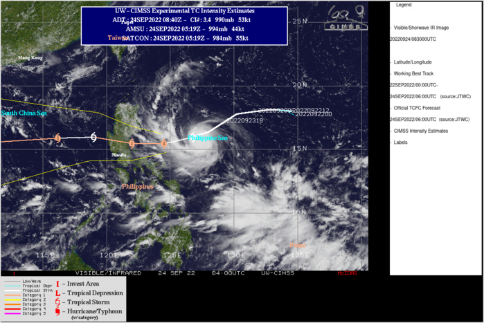
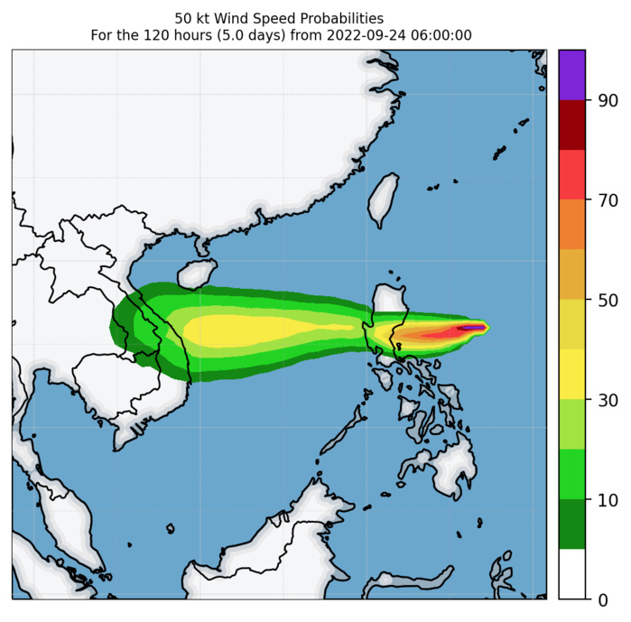
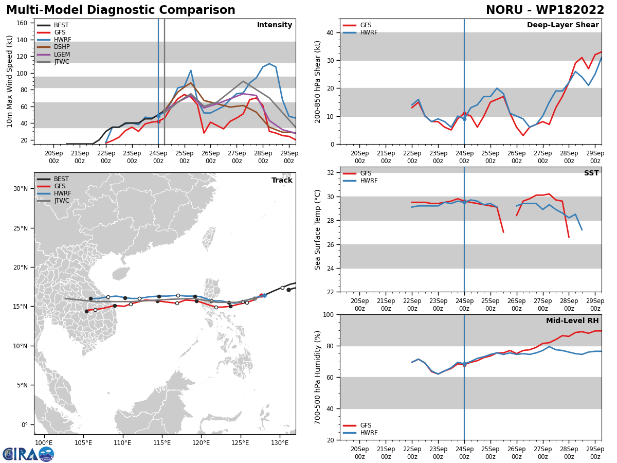
WESTERN NORTH PACIFIC: TS 18W(NORU). ESTIMATED LOCATION AND INTENSITY AT 24/06UTC. WARNING 10 ISSUED AT 24/09UTC.
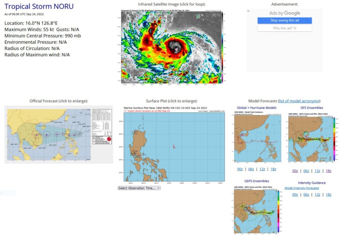
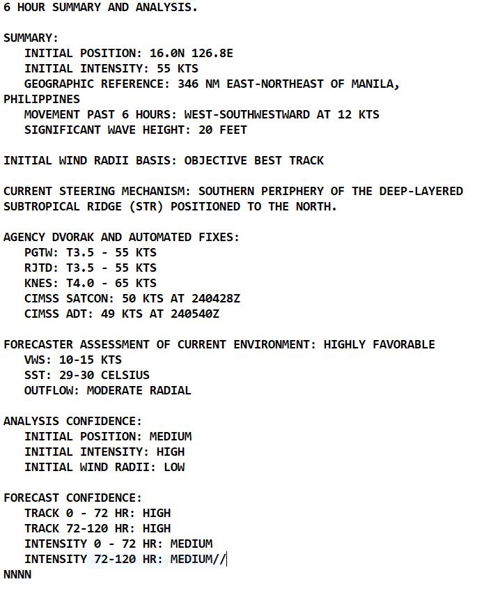
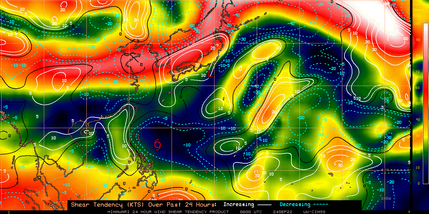
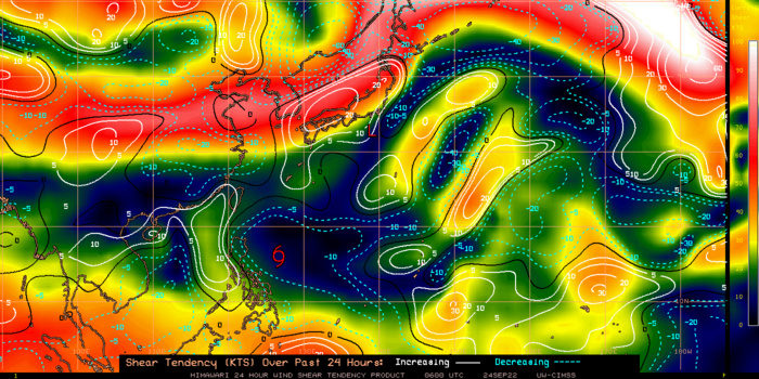
SATELLITE ANALYSIS, INITIAL POSITION AND INTENSITY DISCUSSION: ANIMATED MULTISPECTRAL SATELLITE IMAGERY (MSI) DEPICTS A DEEP CONVECTIVE CORE WITH A CENTRAL DENSE OVERCAST (CDO) FEATURE OBSCURING THE LOW-LEVEL CIRCULATION CENTER (LLCC). THE ANIMATED ENHANCED INFRARED IMAGERY (EIR) SHOWS INTENSE CONVECTIVE BURSTS ON THE SOUTHERN SIDE OF THE LLCC WITH CLOUD TOP TEMPERATURES AS COLD AS -82C (APPROXIMATELY 54,800 FEET). A 240700Z SSMIS 91GHZ IMAGE REVEALS A 60NM DIAMETER CONVECTIVE CORE WITH THE LLCC POSITIONED ALONG THE SOUTHERN SIDE OF THE CORE. BASED ON THIS IMAGE AND THE MSI LOOP, THE INITIAL POSITION IS PLACED WITH MEDIUM CONFIDENCE. THE INITIAL INTENSITY IS ASSESSED AT 55 KNOTS BASED MULTIPLE AGENCY DVORAK INTENSITY ESTIMATES AND THE ADVANCED DVORAK TECHNIQUE (ADT) RAW OF T3.5-55KTS, LENDING HIGH CONFIDENCE. ENVIRONMENTAL CONDITIONS ARE VERY FAVORABLE WITH MODERATE RADIAL OUTFLOW, ENHANCED BY AN UPPER-LOW OVER THE CONTINUES MIGRATING WEST OVER THE SOUTH CHINA SEA, AND LOW VERTICAL WIND SHEAR (VWS).
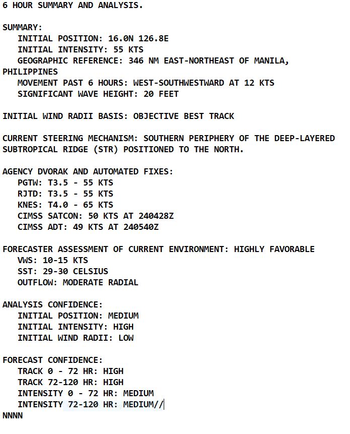
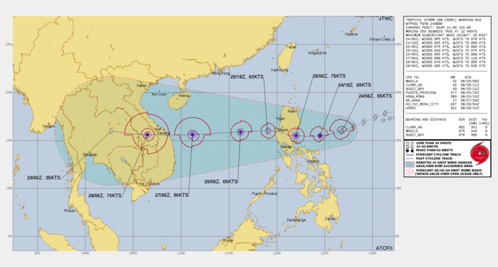
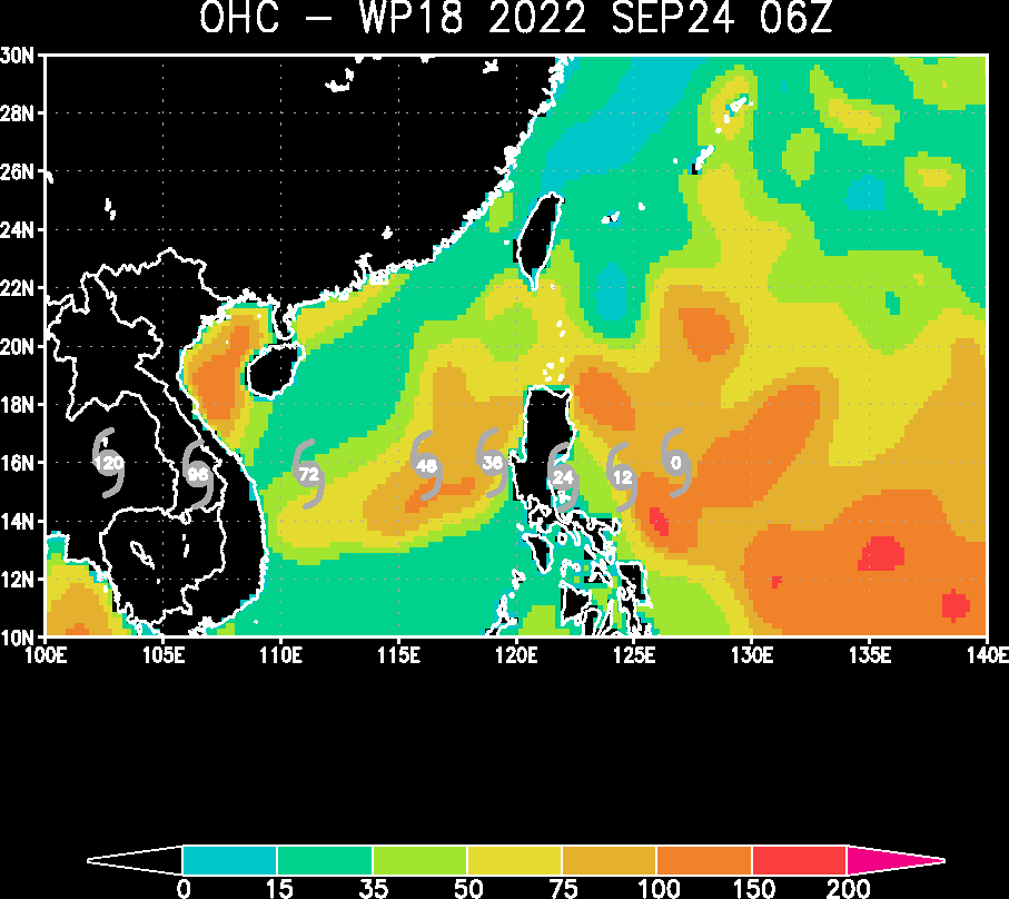
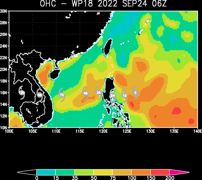
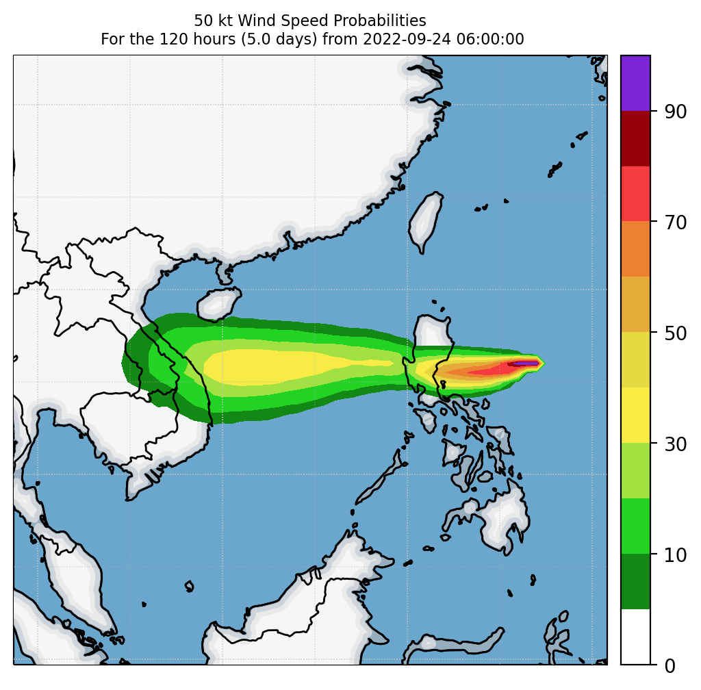
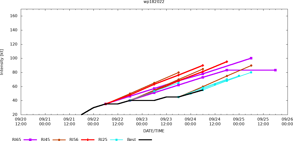
FORECAST REASONING. SIGNIFICANT FORECAST CHANGES: THERE ARE NO SIGNIFICANT CHANGES TO THE FORECAST FROM THE PREVIOUS WARNING. FORECAST DISCUSSION: TS 18W WILL CONTINUE TRACKING TO THE WEST-SOUTHWEST ALONG THE SOUTHWEST PERIPHERY OF THE STR THROUGH TAU 12, THEREAFTER, IT WILL TURN MORE WESTWARD, AFTER IT MAKES INITIAL LANDFALL ON LUZON SHORTLY AFTER TAU 24. THE FAVORABLE CONDITIONS AND IMPROVED RADIAL OUTFLOW ARE ALLOWING FURTHER DEVELOPMENT TO A PEAK INTENSITY OF 75 KNOTS JUST BEFORE MAKING LANDFALL. AFTER THE SYSTEM TRANSITS ACROSS LUZON, IT WILL DECREASE IN INTENSITY ONLY SLIGHTLY BEFORE IT REEMERGES OVER THE VERY WARM WATERS OF THE SOUTH CHINA SEA. SHORTLY AFTER MOVING OVER THE HIGH OCEAN HEAT CONTENT REGION, TS 18W WILL QUICKLY INTENSIFY BACK TO TYPHOON STRENGTH ALONG ITS WESTWARD TRACK TOWARDS VIETNAM AND SOUTHEAST ASIA. BY TAU 60, THERE EXISTS A HIGH LIKELIHOOD FOR RAPID INTENSIFICATION WITH TS NORU. HOWEVER, PEAK INTENSITY IS EXPECTED TO REACH 90 KNOTS BEFORE MAKING SECONDARY LANDFALL, NEAR DA NANG, VIETNAM. RAPID WEAKENING WILL OCCUR AS THE SYSTEM TRACKS OVER SOUTHEAST ASIA.
CLICK ON THE IMAGERY BELOW TO GET IT ANIMATED.
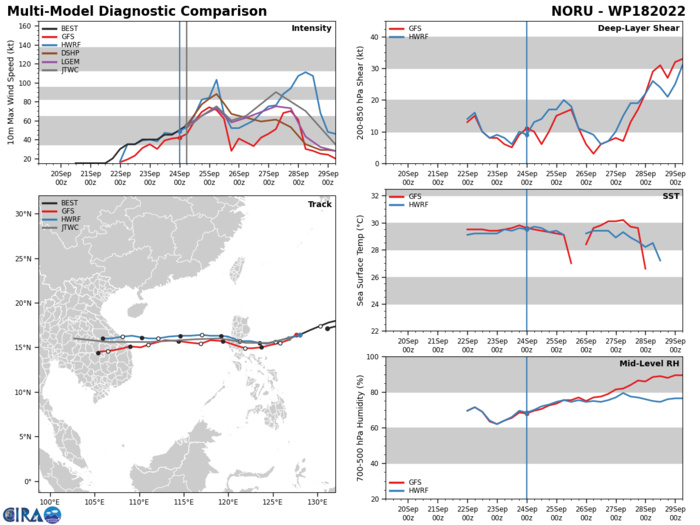
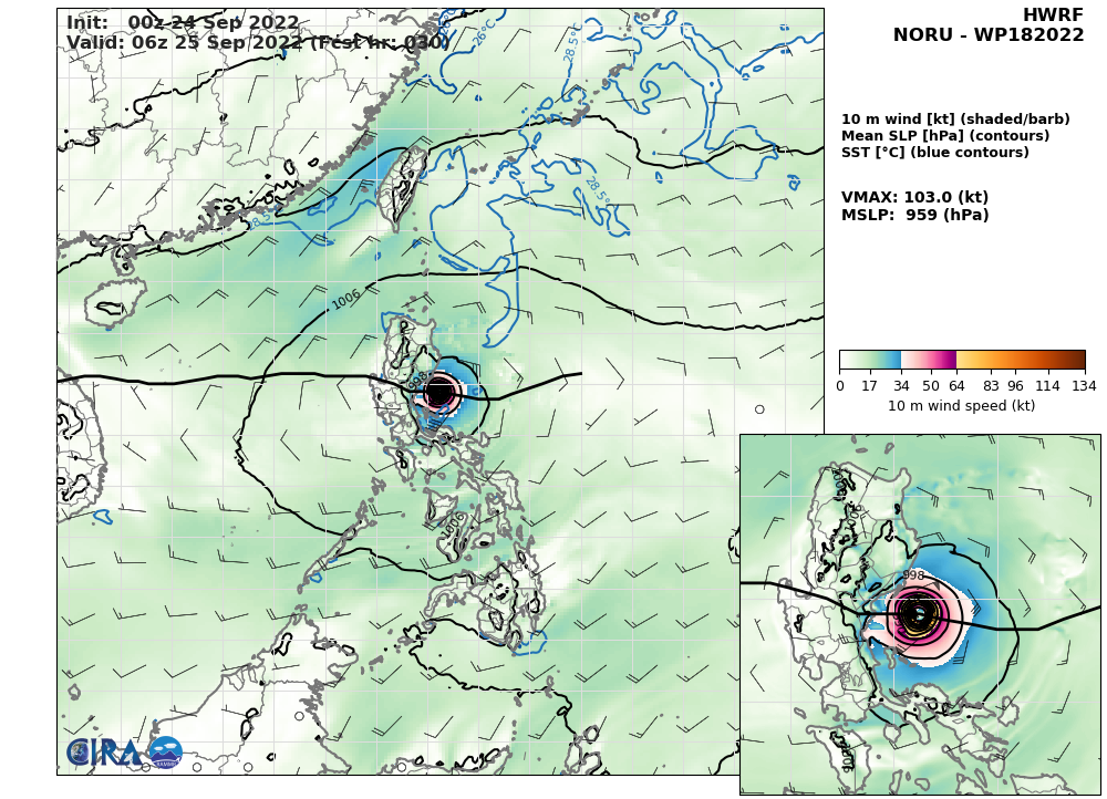
MODEL DISCUSSION: NUMERICAL MODEL GUIDANCE IS IN TIGHT AGREEMENT THROUGH THE FORECAST PERIOD WITH A MERE 60NM TO 80NM SPREAD IN SOLUTIONS FROM TAU 48 TO TAU 96 LENDING HIGH CONFIDENCE TO THE JTWC FORECAST TRACK. RAPID INTENSIFICATION REMAINS A POSSIBILITY NEAR TAU 72 THROUGH 96, JUST PRIOR TO LANDFALL. COAMPS-TC SHOWS A 20 TO 25 PERCENT PROBABILITY OF RI IN THE SOUTH CHINA SEA, WHICH IS MOST LIKELY TO OCCUR BETWEEN 260600Z TO 270600Z PERIOD. HWRF SHOWS AN RI POSSIBILITY OCCURRING BY TAU 72 REACHING A PEAK INTENSITY OF 100 KNOTS AT TAU 96, JUST AFTER THE SYSTEM MAKES LANDFALL, LIMITING THE BELIEF IN THE HWRF RI. THEREFORE, THERE IS ONLY MEDIUM CONFIDENCE WITH THE JTWC INTENSITY FORECAST.
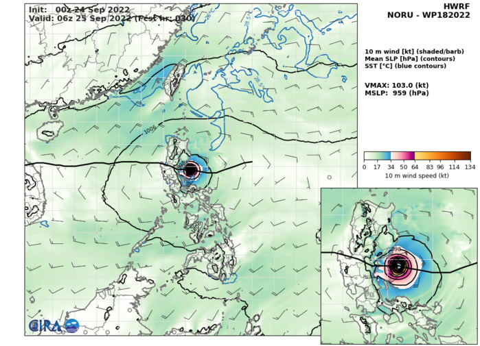
HWRF AT 24/00UTC: 103KT AT +30H.
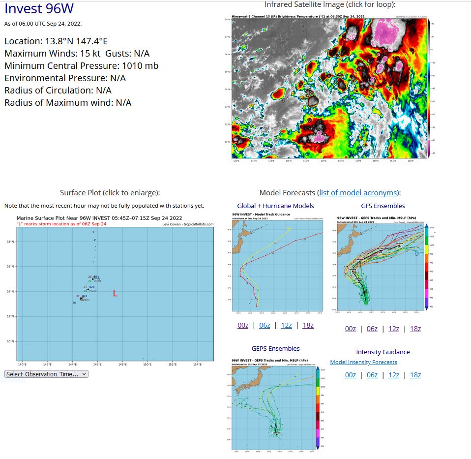
WESTERN NORTH PACIFIC: INVEST 96W. ESTIMATED LOCATION AND INTENSITY AT 24/06UTC. ADVISORY(ABPW) ISSUED AT 24/06UTC
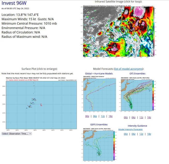
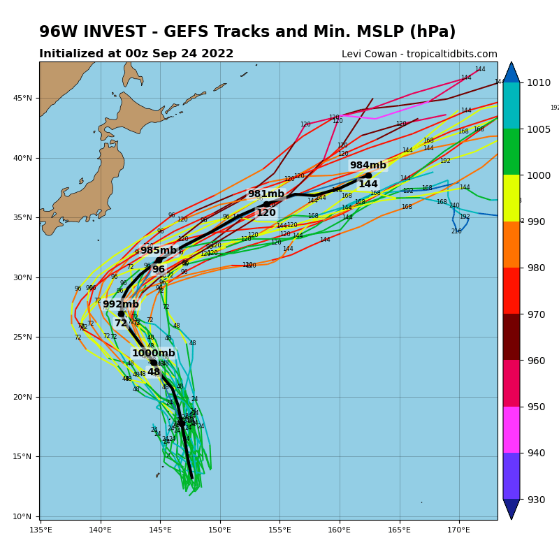
THE AREA OF CONVECTION (INVEST 96W) PREVIOUSLY LOCATED NEAR 12.8N 147.7E IS NOW LOCATED NEAR 13.4N 147.5E, APPROXIMATELY 163 NM EAST OF GUAM. ANIMATED MULTISPECTRAL SATELLITE IMAGERY AND A 232111Z SSMIS 91GHZ MICROWAVE IMAGE DEPICT AN AREA OF DISORGANIZED, FLARING CONVECTION WITH A BROAD, POORLY ORGANIZED LOW-LEVEL CIRCULATION. A 240024Z ASCAT-C PASS REVEALS WEAK TROUGHING EAST OF THE MARIANA ISLANDS. INVEST 96W IS EMBEDDED WITHIN THE EASTERN PERIPHERY OF THE MONSOON TROUGH, WHICH HAS MAINTAINED EXTENSIVE CONVERGENT WESTERLIES AND SOUTHERLIES ALONG THE SOUTHERN AND EASTERN PERIPHERIES. ENVIRONMENTAL ANALYSIS REVEALS MARGINALLY FAVORABLE CONDITIONS FOR DEVELOPMENT AS CHARACTERIZED BY WARM (29-30C) SST, LOW (10-15KT) VERTICAL WIND SHEAR, AND STRONG EQUATORWARD AND POLEWARD OUTFLOW. GLOBAL MODELS ARE IN RELATIVELY GOOD AGREEMENT THAT OVERALL CONDITIONS ARE FAVORABLE FOR DEVELOPMENT WITHIN 36-48 HOURS AS THE LOW TRACKS NORTH-NORTHWESTWARD WHILE QUICKLY INTENSIFYING. MAXIMUM SUSTAINED SURFACE WINDS ARE ESTIMATED AT 15 TO 20 KNOTS. MINIMUM SEA LEVEL PRESSURE IS ESTIMATED TO BE NEAR 1003 MB. THE POTENTIAL FOR THE DEVELOPMENT OF A SIGNIFICANT TROPICAL CYCLONE WITHIN THE NEXT 24 HOURS REMAINS LOW.
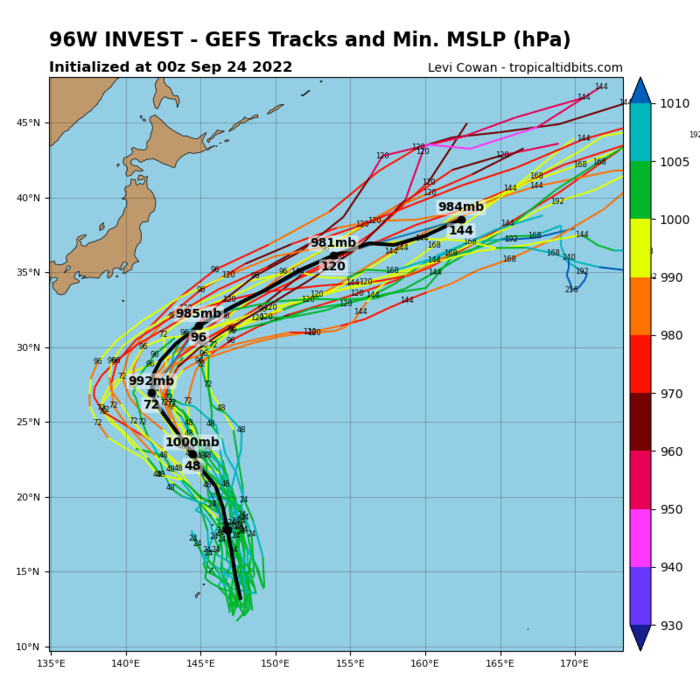
GLOBAL MODELS ARE IN RELATIVELY GOOD AGREEMENT THAT OVERALL CONDITIONS ARE FAVORABLE FOR DEVELOPMENT WITHIN 36-48 HOURS AS THE LOW TRACKS NORTH-NORTHWESTWARD WHILE QUICKLY INTENSIFYING.
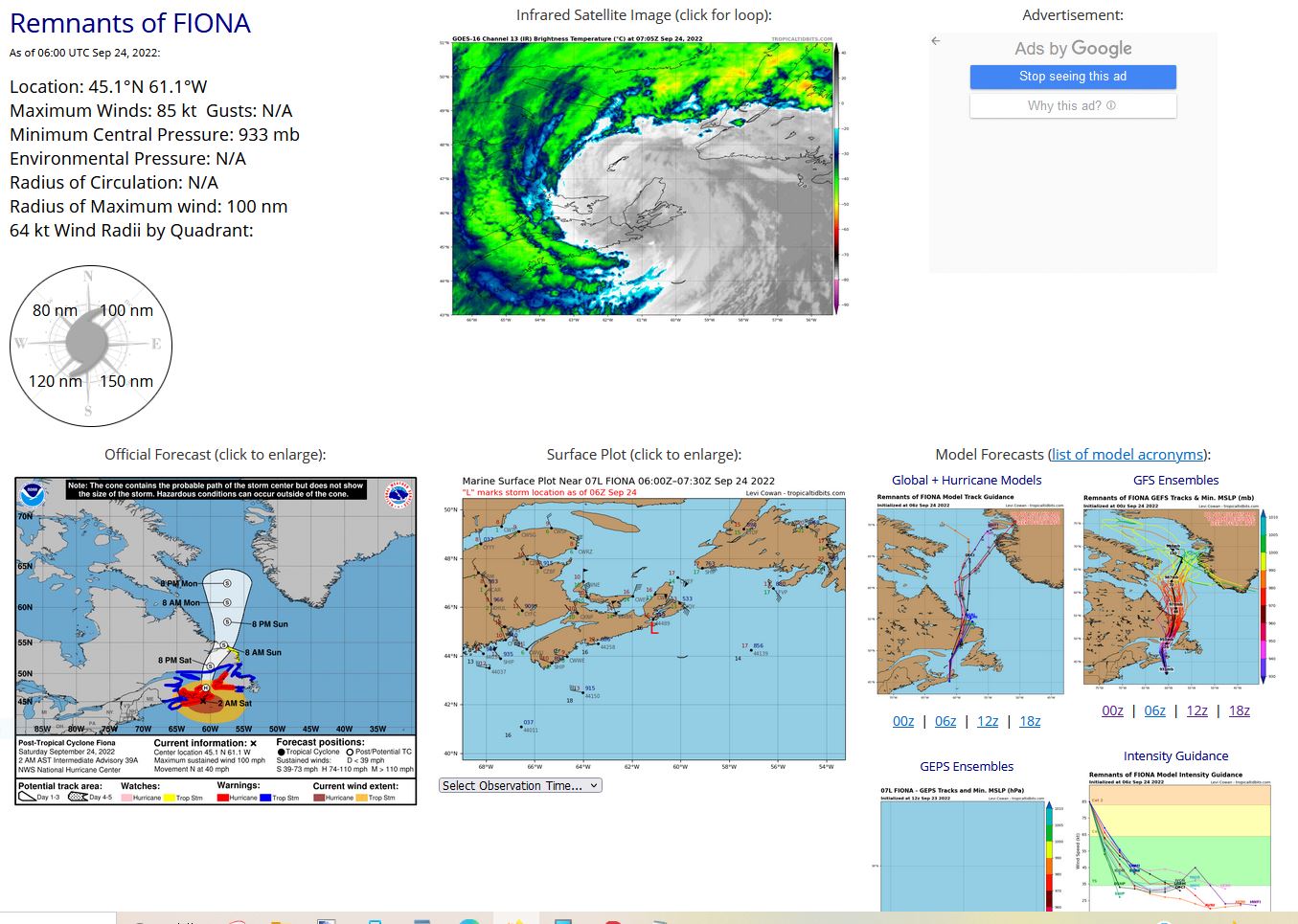
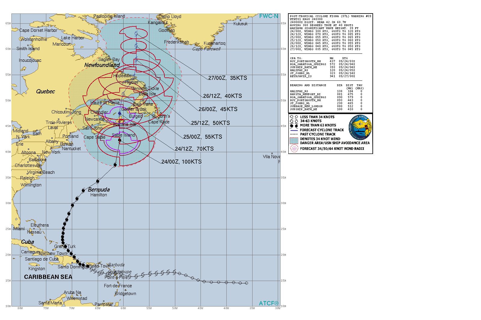
NORTH ATLANTIC: PTC 07L(FIONA). ESTIMATED LOCATION AND INTENSITY AT 24/06UTC. NHC COMMENTS.
ESTIMATED PEAK INTENSITY WAS 115KT: CAT 4 US.
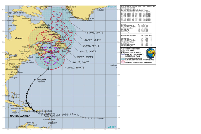
Post-Tropical Cyclone Fiona Discussion Number 39 NWS National Hurricane Center Miami FL AL072022 1100 PM AST Fri Sep 23 2022 Satellite images and observations from an Air Force Hurricane Hunter aircraft indicate that Fiona is now an intense extratropical cyclone. The system's appearance has evolved into a comma-shaped cloud pattern with a frontal band extending well to the south and southwest. Data from the Hurricane Hunters indicate that the radius of maximum winds is on the order of 100 miles or more. Although the minimum central pressure is a very low 933 mb, the maximum winds have decreased to near 90 kt. The cyclone has been moving very rapidly northward or around 360/40 kt on the eastern side of a deep-layer trough. Fiona should slow its forward speed while it interacts with the trough during the next couple of days. The official track forecast has been adjusted a little to the west of the previous one for the next 12-24 hours, and is on the western side of the track model suite. Fiona's center should move over eastern Nova Scotia shortly, and then traverse the eastern Gulf of Saint Lawrence, eastern Labrador and move over the southeastern Labrador Sea. It should be repeated that strong winds, heavy rains, and storm surges are occurring well away from the center. Gradual weakening is anticipated during the next couple of day, and Fiona's winds should drop below hurricane strength in 24 hours or so. The system should wind down to a marginal gale center after moving into the southeastern Labrador Sea, and the global models indicate that the system should dissipate to the west of Greenland in about 4 days. The official intensity forecast remains on the high end of the model guidance. Key Messages: 1. Fiona is expected to affect portions of Atlantic Canada as a powerful hurricane-force cyclone overnight, and significant impacts from high winds, storm surge, and heavy rainfall are expected. Hurricane and Tropical Storm Warnings are in effect for much of Atlantic Canada. 2. Large swells generated by Fiona are expected to cause life-threatening surf and rip current conditions along much of the east coast of the United States, the northwestern Bahamas, Bermuda, and Atlantic Canada during the next couple of days.
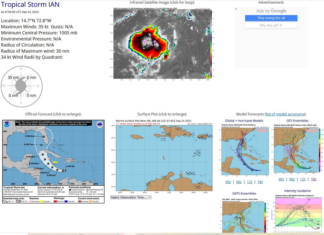
NORTH ATLANTIC: TS 09L(IAN). ESTIMATED LOCATION AND INTENSITY AT 24/06UTC. NHC COMMENTS.
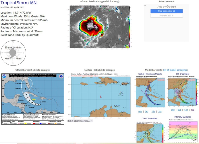
Tropical Storm Ian Discussion Number 4 NWS National Hurricane Center Miami FL AL092022 1100 PM EDT Fri Sep 23 2022 The system remains sheared from the northeast, with the low-level circulation evident a bit to the east of the deep convection. Unfortunately, we didn't have the benefit of a reconnaissance aircraft this evening to sample the winds, but satellite estimates did increase a bit. TAFB and SAB provided Dvorak classifications of T2.0/30 kt and T3.0/45 kt, respectively, while the objective UW-CIMSS ADT and SATCON estimates are at tropical storm intensity. Based on a blend of these data, the depression is upgraded to Tropical Storm Ian with 35-kt winds. Ian's center appears to have been moving more slowly this evening, and the initial motion estimate is west-northwestward, or 285/10 kt. The track guidance is in good agreement that Ian should turn westward during the next 12-24 hours while located to the south of a small mid-level anticyclone centered just north of Hispaniola. After 24 hours, Ian is expected to begin recurving around the western side of this high, turning northwestward over the northwestern Caribbean Sea, and then northward while crossing Cuba into the Gulf of Mexico and toward Florida. The track models agree on this general scenario, and the guidance envelope is flanked by the major global models, with the ECMWF taking a route over South Florida and the GFS farther west, remaining over the eastern Gulf of Mexico by day 5. The new NHC forecast lies between these two scenarios and is not much different from the previous forecast. The GFS and ECMWF ensembles both show a similar amount of spread as the deterministic guidance, but both ensemble means are close to the multi-model consensus aids, which helps to give more credence to the position of the official forecast. The moderate deep-layer shear affecting Ian is forecast to decrease during the next 6 to 12 hours, and the cyclone will be moving over the very warm waters of the central and northwestern Caribbean Sea, where sea surface temperatures are between 29 and 31 degrees Celsius. Intensification is expected to be gradual during the next 36 hours while Ian gets better organized in a lower-shear environment, but after that time, conditions will be conducive for faster strengthening. In fact, the NHC intensity forecast explicitly calls for rapid intensification (RI) between days 2 and 3 while Ian is moving over the northwestern Caribbean Sea toward western Cuba. It's worth nothing too that the RI indices from SHIPS are showing a 2-in-3 chance of a 65-kt increase in winds during the next 3 days, and if that transpires, Ian could be stronger than what's shown in the official forecast. The storm is not expected to be over Cuba long enough to cause much weakening, and the forecast still shows Ian as a major hurricane over the eastern Gulf of Mexico while approaching the west coast of Florida. Key Messages: 1. Ian is expected to produce heavy rainfall and instances of flash flooding and possible mudslides in areas of higher terrain, particularly over Jamaica and Cuba. 2. Hurricane conditions are possible in the Cayman Islands by early Monday, with tropical storm conditions possible by late Sunday. Tropical storm conditions are possible in Jamaica on Sunday. 3. Early next week, Ian is forecast to move near or over western Cuba as a strengthening hurricane and then approach the Florida peninsula at or near major hurricane strength, with the potential for significant impacts from storm surge, hurricane-force winds, and heavy rainfall. While it is too soon to determine the exact magnitude and location of these impacts, residents in Cuba, the Florida Keys, and the Florida peninsula should ensure they have their hurricane plan in place and closely monitor forecast updates through the weekend.
