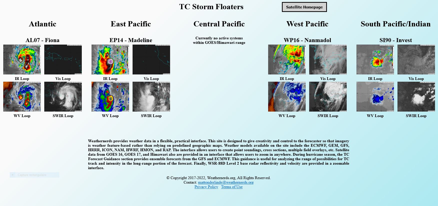
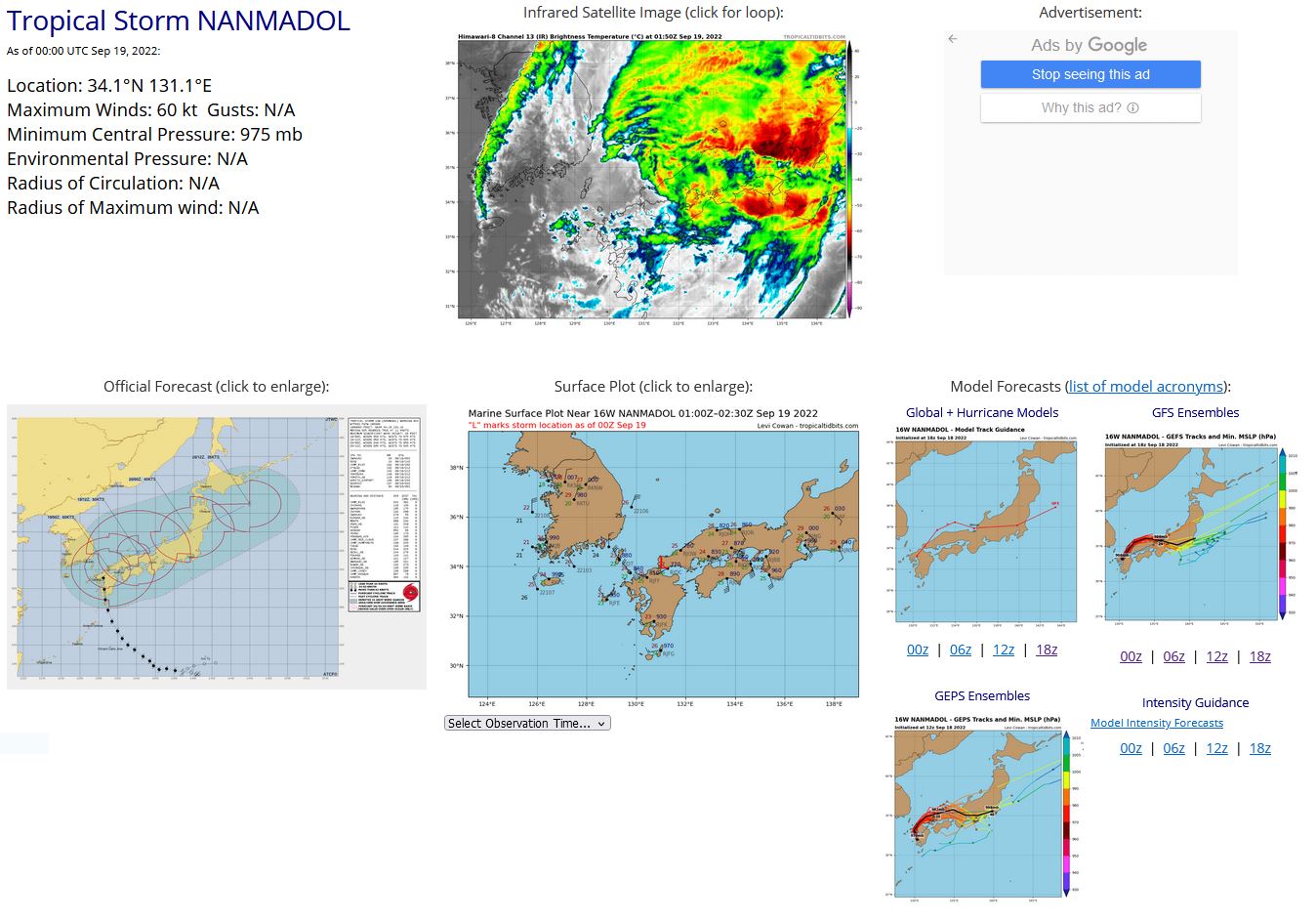
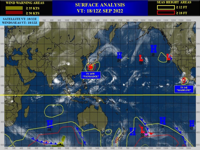
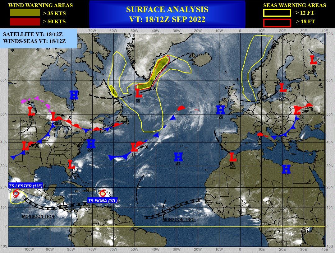
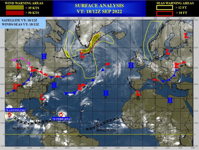
CLICK ON THE IMAGERIES BELOW TO GET THEM ENLARGED
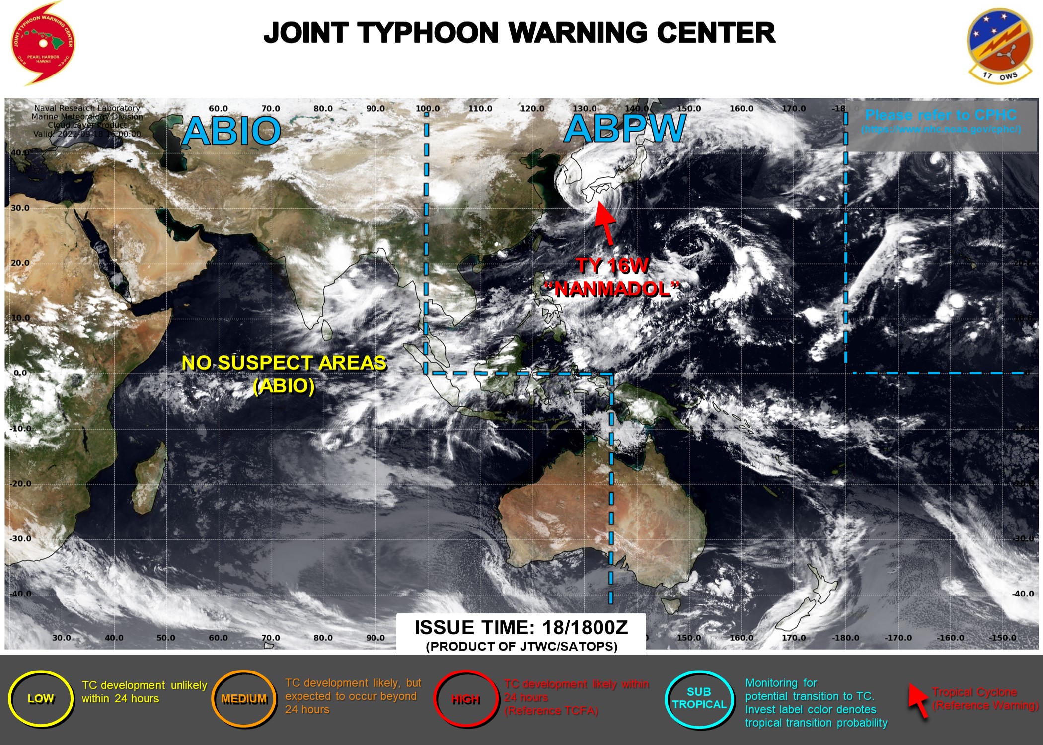
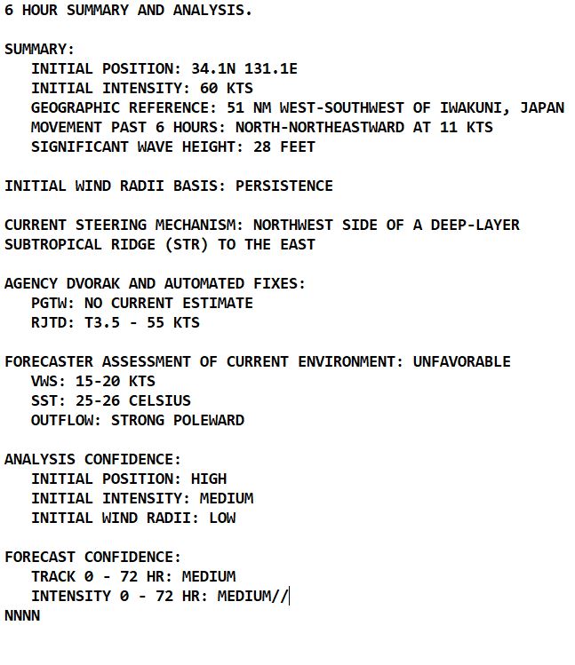
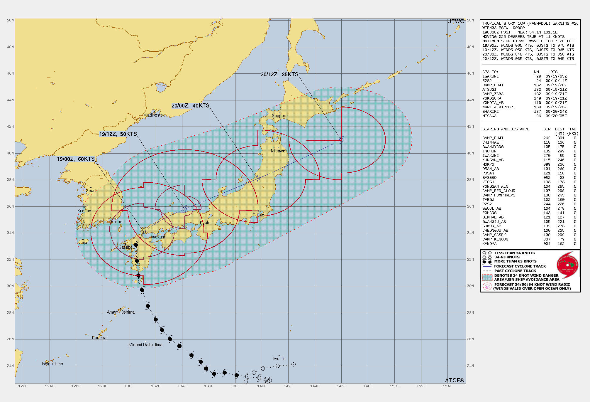
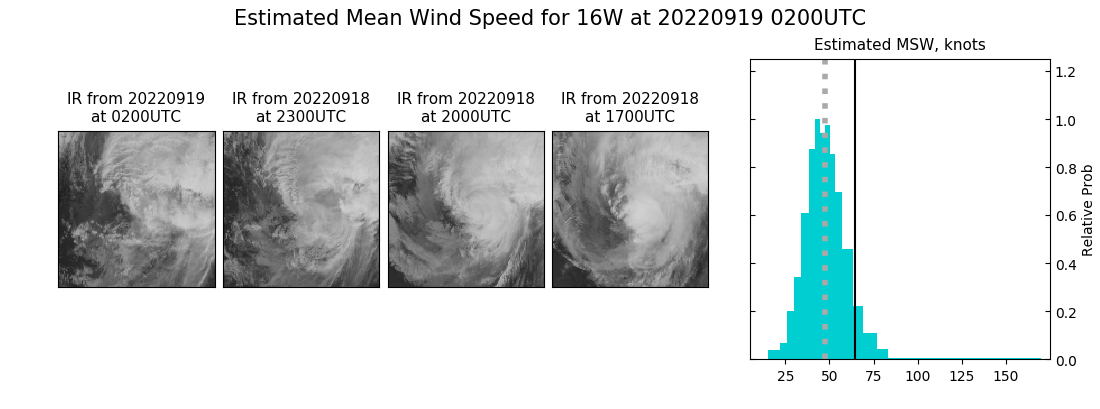
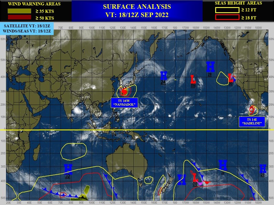
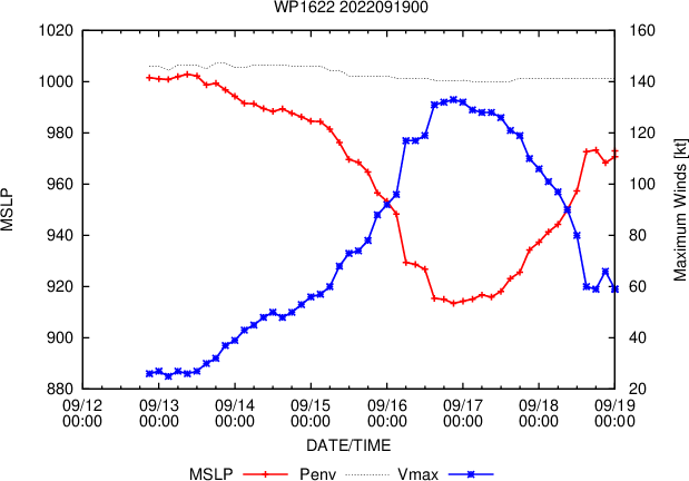
WESTERN NORTH PACIFIC: TS 16W(NANMADOL). ESTIMATED LOCATION AND INTENSITY AT 19/00UTC. WARNING 26 ISSUED AT 19/03UTC.
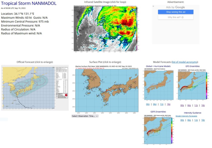
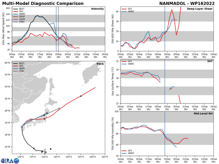
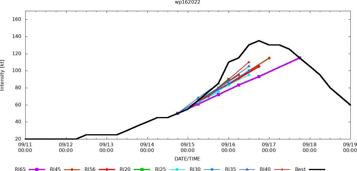
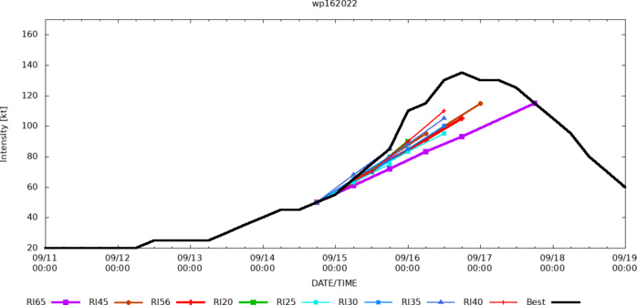
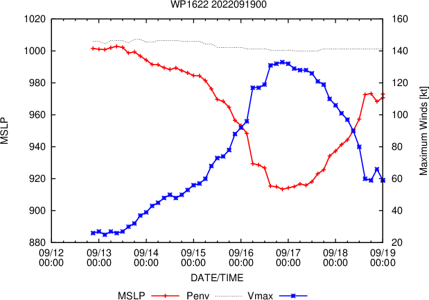
SATELLITE ANALYSIS, INITIAL POSITION AND INTENSITY DISCUSSION: NOW DOWNGRADED TO A STRONG TROPICAL STORM, NANMADOL HAS REACHED ITS FURTHEST NORTHWARD POINT, JUST WEST OF SHIMONOSEKI AND HAS NOW FINALLY MADE THE LONG-EXPECTED HARD RIGHT TURN TOWARDS THE EAST-NORTHEAST. TRACK MOTION OVER THE PAST SIX HOURS IS 025 DEGREES BUT ACTUALLY THE SYSTEM HAS TRACKED ALMOST DUE EAST IN THE LAST THREE HOURS. ANIMATED MULTISPECTRAL SATELLITE IMAGERY (MSI) DEPICTS AN INCREASINGLY DISORGANIZED SYSTEM, WITH THE LOW-LEVEL CLOUD LINES ON THE WESTERN SIDE STARTING TO PEAK OUT FROM UNDER THE UPPER-LEVEL CIRRUS SHIELD. THE LOW LEVEL CIRCULATION CENTER (LLCC) IS BECOMING INCREASINGLY DIFFICULT TO TEASE OUT, EVEN IN THE ANIMATED RADAR DATA AND THE POSITIONING IS NOW MORE RELIANT UPON THE HIGH-DENSITY SURFACE WIND OBSERVATIONS. THE COMBINATION OF THESE FACTORS LENT HIGH CONFIDENCE TO THE INITIAL POSITION. THE INITIAL INTENSITY IS ASSESSED WITH SOMEWHAT LOWER CONFIDENCE BASED ON A T3.5 RJTD DVORAK INTENSITY ESTIMATE AND SURFACE PRESSURE READINGS OF 975 MB FROM MULTIPLE SITES NEAR THE CENTER, WHICH EQUATES TO ABOUT 62 KNOTS USING THE KNAFF-ZEHR WIND PRESSURE RELATIONSHIP. THE SYSTEM IS CLEARLY BEING IMPACTED BY STRONG WESTERLY FLOW THROUGH THE COLUMN AS WELL AS MID TO UPPER-LEVEL DRY AIR, AS INDICATED ON THE 0000Z FUKUOKA SOUNDING, WHICH IS ERODING THE WESTERN HALF OF THE SYSTEM AND PUSHING THE CONVECTION TO THE NORTHEAST OF THE CENTER. AND WHILE THE SYSTEM IS BENEFITING FROM A BURST OF ROBUST POLEWARD OUTFLOW, THE INCREASED SHEAR, AND TERRAIN INTERACTION IS LEADING TO RAPID WEAKENING.
1622091706 267N1325E 130
1622091712 275N1320E 125
1622091718 285N1314E 115
1622091800 297N1310E 105
1622091803 303N1307E 100
1622091806 308N1307E 95
1622091812 319N1306E 80
1622091818 331N1305E 70
1622091900 341N1311E 60
1622091712 275N1320E 125
1622091718 285N1314E 115
1622091800 297N1310E 105
1622091803 303N1307E 100
1622091806 308N1307E 95
1622091812 319N1306E 80
1622091818 331N1305E 70
1622091900 341N1311E 60
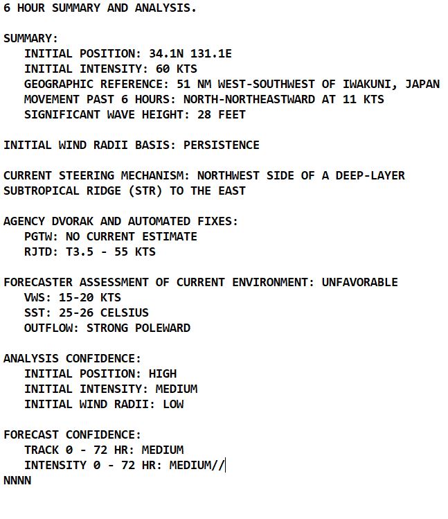
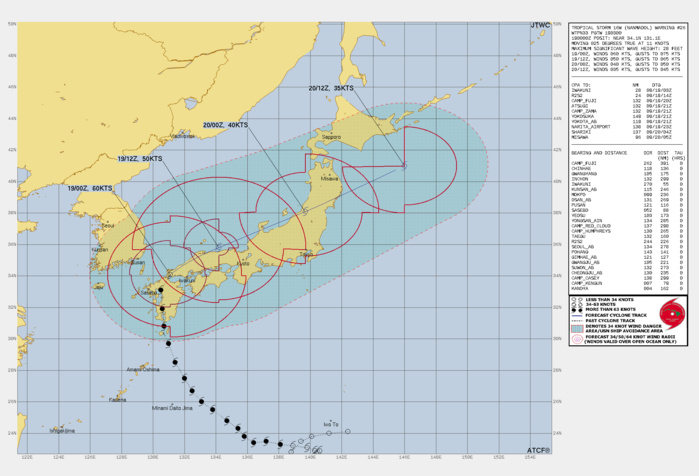
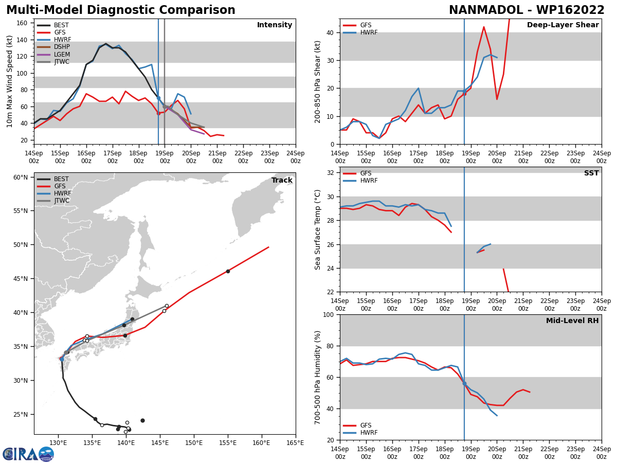
FORECAST REASONING. SIGNIFICANT FORECAST CHANGES: THERE ARE NO SIGNIFICANT CHANGES TO THE FORECAST FROM THE PREVIOUS WARNING. FORECAST DISCUSSION: BASED ON THE SATELLITE AND RADAR DATA, TS 16W HAS ALREADY STARTED THE DECAPITATION PROCESS, WITH THE LOWER AND UPPER-LEVELS ALREADY BECOMING DECOUPLED. MEANWHILE, THE FRONTAL SYSTEM PUSHING OUT OF NORTHEAST ASIA HAS BEEN MOVING SOUTHWARD AT A RATHER LEISURELY RATE, AND THIS ALLOWED TS 16W TO PUSH A BIT FURTHER NORTHWARD BEFORE IT FINALLY TURNED TO THE EAST. BUT A BURST OF COLD AIR PUSHING OUT OF SIBERIA IS PUSHING THE FRONT FORWARD MORE QUICKLY NOW AND THE SOUTHERN EDGE OF THE FRONT SHOULD START TO IMPINGE ON THE WESTERN SIDE OF THE TS 16WS CIRCULATION WITHIN THE NEXT SIX HOURS OR SO. WHEN THIS OCCURS, HIGH-RESOLUTION MODELING SUGGESTS THE DEVELOPMENT OF VERY STRONG, NEAR TYPHOON STRENGTH WINDS, ALONG THE VERY TIGHT GRADIENT TO THE NORTH AND NORTHWEST OF THE CENTER AS THE SYSTEM SLIDES TO THE NORTHEAST ALONG THE COAST OF NORTHERN HONSHU. THIS BURST OF HIGH WINDS SHOULD BE RELATIVELY SHORT-LIVED, AS THE GRADIENT WILL WEAKEN AS TS 16W ALSO WEAKENS AND BY TAU 24, THE INTENSITY WILL BE DOWN TO 40 KNOTS AS THE SYSTEM MAKES ANOTHER LANDFALL IN NORTHWEST HONSHU. THE SYSTEM WILL DRAMATICALLY PICK UP SPEED TO ABOUT 30 KNOTS, OR ROUGHLY 50 PERCENT OF THE 500MB FLOW, DRIVING NORTHEAST ALONG THE FRONTAL BOUNDARY AS IT PUSHES TO THE EAST. THE SYSTEM WILL BEGIN EXTRATROPICAL TRANSITION (ETT) WITHIN THE NEXT 12 HOURS AND WILL TRANSITION TO A GALE-FORCE, COLD-CORE LOW EAST OF HOKKAIDO BY TAU 36.
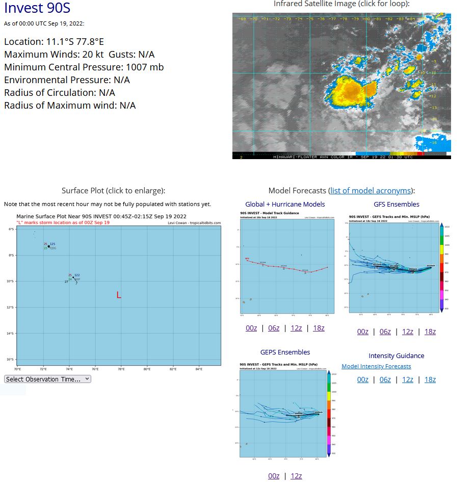
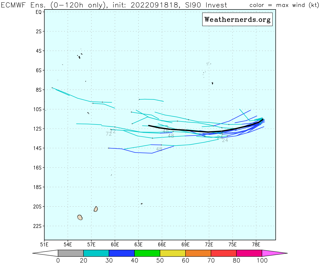
SOUTH INDIAN OCEAN: INVEST 90S. ESTIMATED LOCATION AND INTENSITY AT 19/00UTC.
SH, 90, 2022091700,106S, 849E, 15,1010
SH, 90, 2022091706,108S, 845E, 15,1008
SH, 90, 2022091712,109S, 842E, 20,1008
SH, 90, 2022091718,108S, 834E, 20,1007
SH, 90, 2022091800,108S, 827E, 20,1007
SH, 90, 2022091806,110S, 818E, 20,1007
SH, 90, 2022091812,113S, 808E, 20,1008
SH, 90, 2022091818,107S, 794E, 20,1007
SH, 90, 2022091900,111S, 778E, 20,1007
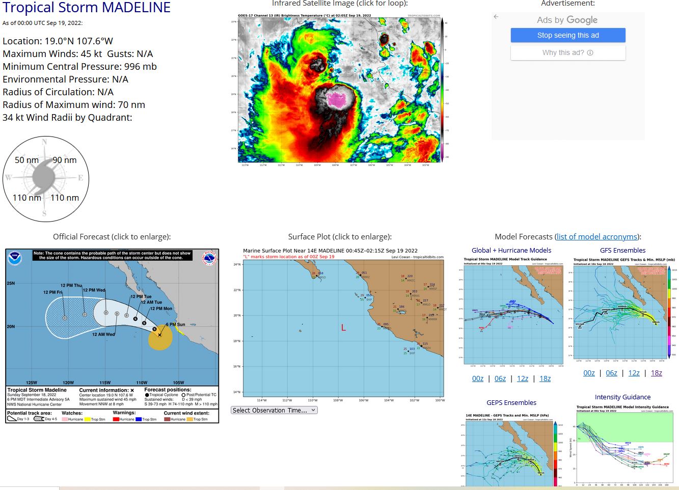
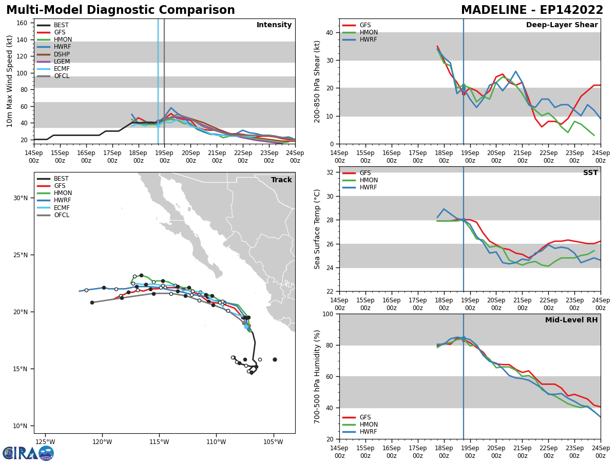
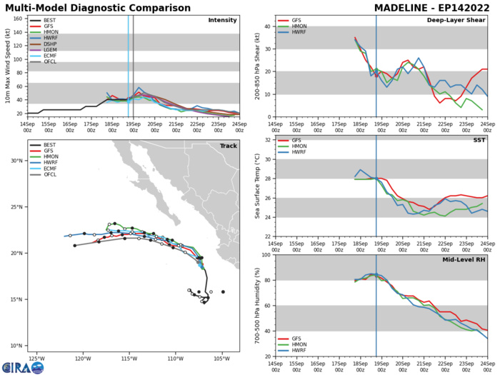
EASTERN NORTH PACIFIC: TS 14E(MADELINE). ESTIMATED LOCATION AND INTENSITY AT 19/00UTC. NHC COMMENTS.
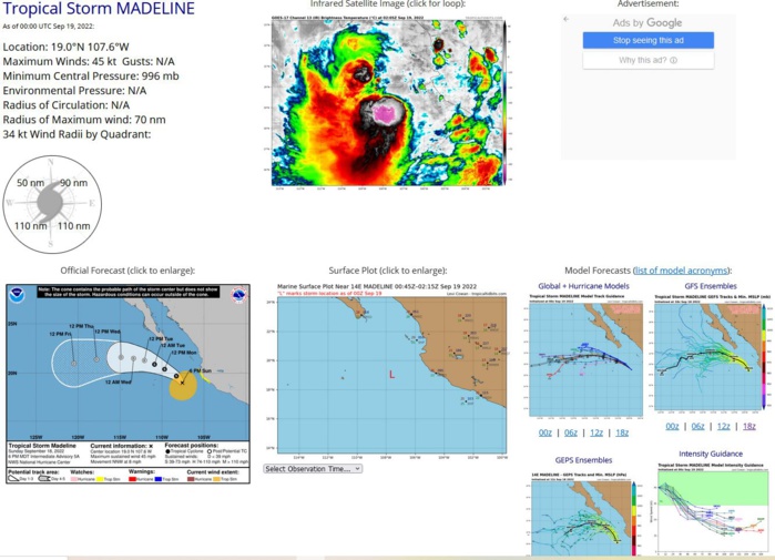
000 WTPZ44 KNHC 190240 TCDEP4 Tropical Storm Madeline Discussion Number 6 NWS National Hurricane Center Miami FL EP142022 900 PM MDT Sun Sep 18 2022 Madeline has increased in organization over the past several hours. The low-level center is now embedded underneath the northeastern portion of a mass of deep convection with cloud tops as cold as -85 degrees Celsius. A recent SSMIS overpass also shows a well-defined curved band within the western semicircle. The latest subjective Dvorak intensity estimates from TAFB and SAB are both T-3.0, and support raising the initial intensity to 45 kt for this advisory. There is a small window of opportunity through Monday morning for Madeline to strengthen a little more, as the storm begins to move along the shear vector and remains over warm waters and within a favorable thermodynamic environment. However, by late Monday the cyclone is forecast to reach the 26 degrees C isotherm and begin to move into a progressively drier and more stable environment. Therefore, steady weakening is forecast to begin by that time. Both the GFS and ECMWF simulated satellite suggest that Madeline will become devoid of deep convection by Tuesday and degenerate into a remnant low. The latest NHC intensity forecast was increased through the next 24 h, but is the same as the previous advisory thereafter. Madeline is continuing its slow turn to the left, and is now moving northwestward at 8 kt to the southwest of a mid-level ridge. This motion is beginning to increase the cyclone's distance from the coast of southwestern Mexico. Based on this and surface observations, the government of Mexico has discontinued the Tropical Storm Watch that was in effect for the portion of that coastline. Model guidance is in very good agreement that Madeline will turn to the west-northwest on Monday night and then west by Tuesday as the weakening cyclone becomes steered by the surrounding low-level flow. The combination of this track and a contracting wind field should keep tropical-storm-force winds well offshore of the southern Baja California peninsula as the system passes to the south through Monday night. The latest NHC track forecast is very little changed from the previous one and lies near the various multi-model consensus tracks. KEY MESSAGES: 1. Heavy rains from Madeline are expected for portions of coastal southwestern Mexico into Monday. This rainfall may produce flash and urban flooding, along with possible mudslides in areas of higher coastal terrain. FORECAST POSITIONS AND MAX WINDS INIT 19/0300Z 19.3N 107.9W 45 KT 50 MPH 12H 19/1200Z 20.1N 109.0W 50 KT 60 MPH 24H 20/0000Z 20.6N 110.3W 45 KT 50 MPH 36H 20/1200Z 21.0N 111.5W 35 KT 40 MPH 48H 21/0000Z 21.4N 112.7W 30 KT 35 MPH...POST-TROP/REMNT LOW 60H 21/1200Z 21.6N 114.0W 25 KT 30 MPH...POST-TROP/REMNT LOW 72H 22/0000Z 21.6N 115.5W 25 KT 30 MPH...POST-TROP/REMNT LOW 96H 23/0000Z 21.2N 118.3W 25 KT 30 MPH...POST-TROP/REMNT LOW 120H 24/0000Z 20.8N 120.9W 20 KT 25 MPH...POST-TROP/REMNT LOW $$ Forecaster Latto
1422091706 149N1065W 30
1422091712 155N1065W 35
1422091718 158N1068W 40
1422091800 165N1067W 40
1422091806 173N1066W 40
1422091812 181N1068W 40
1422091818 185N1071W 40
1422091900 190N1076W 45
1422091712 155N1065W 35
1422091718 158N1068W 40
1422091800 165N1067W 40
1422091806 173N1066W 40
1422091812 181N1068W 40
1422091818 185N1071W 40
1422091900 190N1076W 45
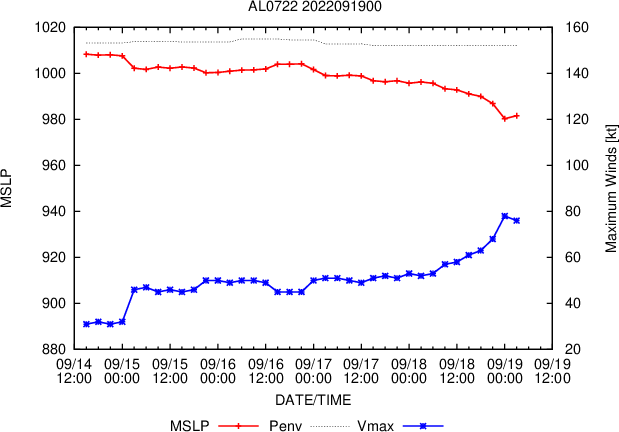
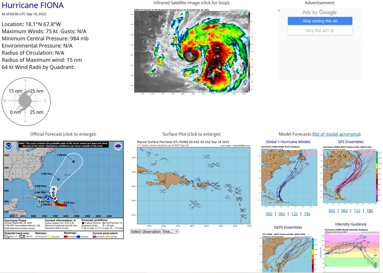
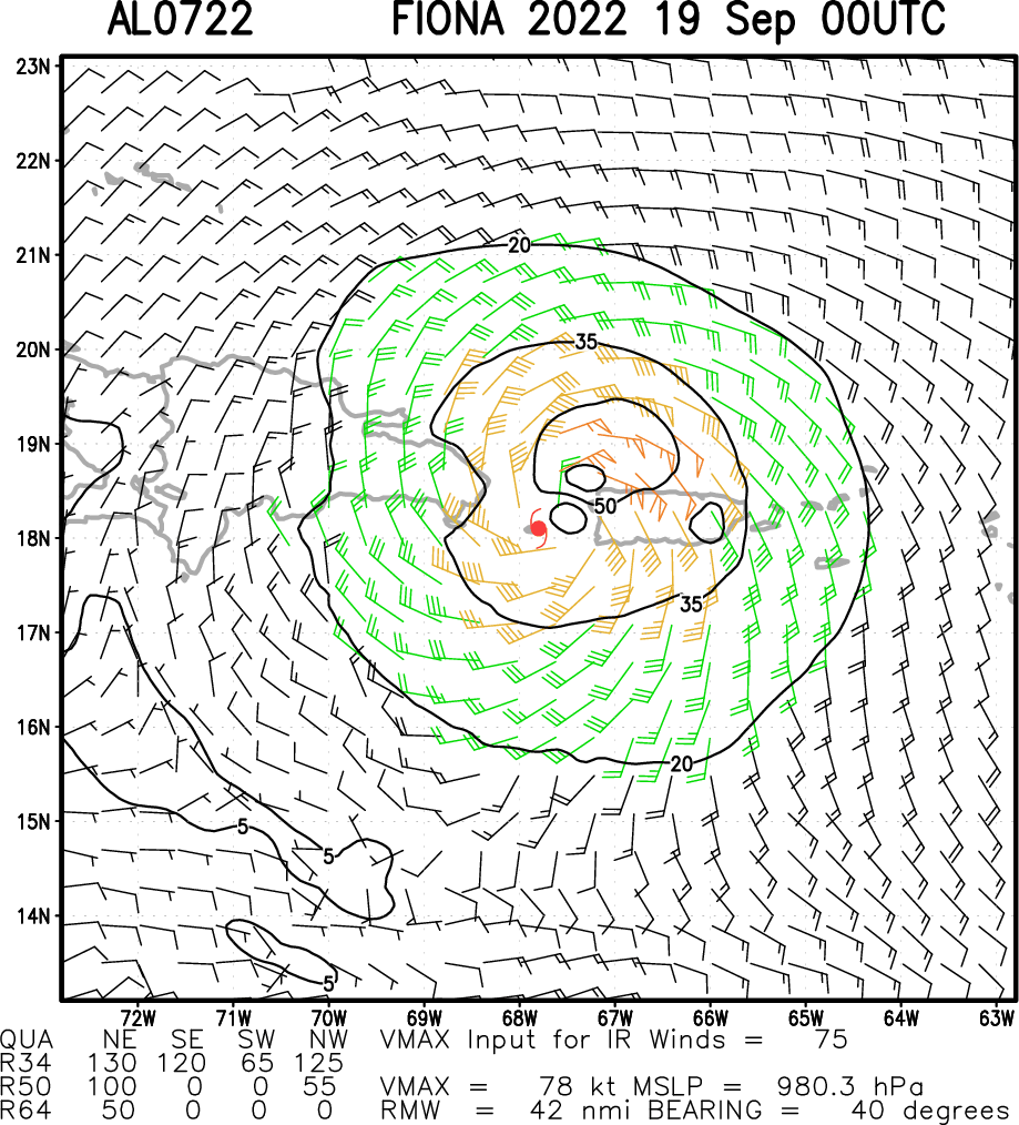
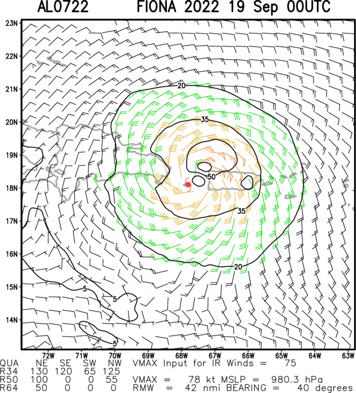
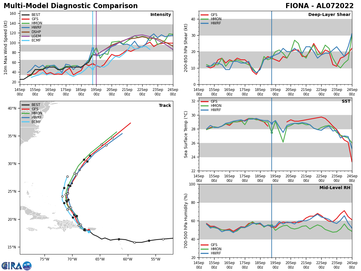
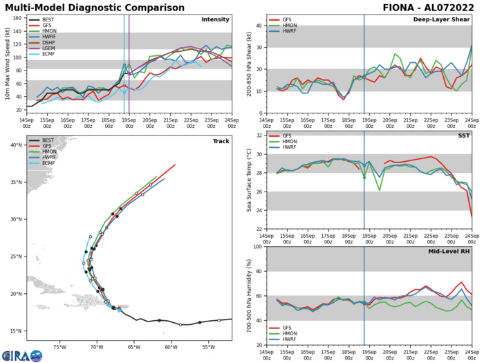
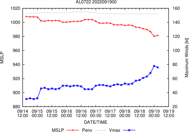
NORTH ATLANTIC: HU 07L(FIONA). ESTIMATED LOCATION AND INTENSITY AT 19/00UTC. NHC COMMENTS.
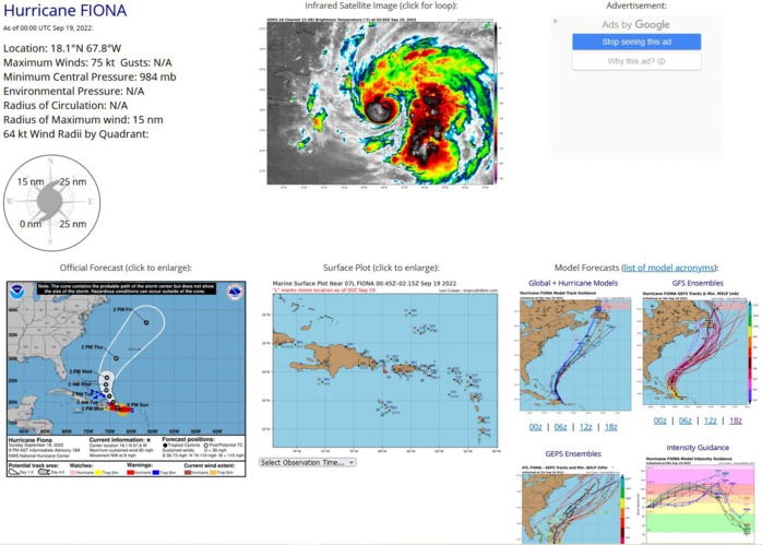
000 WTNT42 KNHC 190255 TCDAT2 Hurricane Fiona Discussion Number 19 NWS National Hurricane Center Miami FL AL072022 1100 PM AST Sun Sep 18 2022 Radar imagery and recent fixes from an Air Force Reserve Hurricane Hunter aircraft show that Fiona has jogged westward over the Mona Passage, in between Puerto Rico and the Dominican Republic this evening. Radar, microwave imagery, and observations from the aircraft indicate that the eye has become smaller, with the radius of maximum winds decreasing to 10-15 n mi. There has been some warming of the clouds tops in the band just outside the CDO, but the conventional satellite presentation has not changed much since late this afternoon. The aircraft has measured a peak 700-mb flight- level wind of 75 kt, and SFMR winds of around 70 kt. A dropwindsonde in the northwestern eyewall measured a mean wind of 89 kt in the lowest 150 m of the profile, which supports the 75 kt initial intensity. The aircraft just reported a minimum pressure of 982 mb on it latest pass through the center just a short time ago. As mentioned above, Fiona has been moving more westward this evening, but the longer-term motion estimate is 300/9 kt. With this westward jog, the center is likely to make landfall in the eastern portion of the Dominican Republic overnight, and the early portion of the track forecast has been adjusted accordingly. The dynamical model guidance insists that a northwestward motion should begin soon, and the models are in good agreement that Fiona will move around the western periphery of a subtropical ridge over the next several days. Later in the forecast period, Fiona is forecast to accelerate northeastward, and north-northeastward ahead of a trough that is expected to move across the northeastern United States by the end of the week. The official forecast is near the center of the guidance envelope, but is slightly slower than the previous forecast at days 4 and 5 to be closer to the latest consensus aids. Fiona could strengthen slightly within the next few hours before it reaches the coast of the Dominican Republic overnight. After that time, some weakening could occur while the center remains near eastern Hispaniola. Once Fiona moves over the Atlantic waters north of the Dominican Republic, the hurricane will be over warm water and in fairly moist environment. Although there is likely to be some moderate shear over the hurricane, nearly all of the intensity models suggest the cyclone will strengthen, and the official forecast again calls for Fiona to become a major hurricane in a couple of days. The NHC intensity forecast is close to the IVCN intensity aid, and is similar to the previous wind speed forecast. Based on Fiona's latest forecast track, the government of the Bahamas has issued a Hurricane Warning for the Turks and Caicos Islands. Key Messages: 1. Hurricane conditions are expected to begin in portions of the warning area in the Dominican Republic within the next few hours. Tropical storm conditions will continue to spread over portions of the Dominican Republic within the warning area through Monday. 2. Heavy rains from Fiona will continue across Puerto Rico overnight tonight and spread over the Dominican Republic through Monday. These rains will continue to produce life-threatening and catastrophic flash and urban flooding across Puerto Rico and portions of the eastern Dominican Republic, along with mudslides and landslides in areas of higher terrain. 3. Fiona is forecast to continue to strengthen after moving away from Puerto Rico and the Dominican Republic. Hurricane conditions are expected in portions of the Turks and Caicos Islands on Tuesday, and tropical storm conditions are expected in the southeastern Bahamas by late Monday or early Tuesday. FORECAST POSITIONS AND MAX WINDS INIT 19/0300Z 18.0N 68.1W 75 KT 85 MPH 12H 19/1200Z 19.0N 69.1W 80 KT 90 MPH 24H 20/0000Z 20.4N 70.0W 90 KT 105 MPH 36H 20/1200Z 21.9N 70.8W 95 KT 110 MPH 48H 21/0000Z 23.3N 71.1W 100 KT 115 MPH 60H 21/1200Z 24.7N 71.1W 105 KT 120 MPH 72H 22/0000Z 26.4N 70.5W 110 KT 125 MPH 96H 23/0000Z 31.2N 67.4W 110 KT 125 MPH 120H 24/0000Z 40.3N 59.8W 95 KT 110 MPH $$ Forecaster Brown
AL, 07, 2022091706,163N, 626W, 50,1000
AL, 07, 2022091712,162N, 631W, 50,1000
AL, 07, 2022091718,166N, 641W, 50,1002
AL, 07, 2022091800,164N, 647W, 50, 997
AL, 07, 2022091806,169N, 655W, 55, 994
AL, 07, 2022091812,172N, 662W, 60, 991
AL, 07, 2022091818,178N, 669W, 75, 986
AL, 07, 2022091900,181N, 678W, 75, 984
AL, 07, 2022091712,162N, 631W, 50,1000
AL, 07, 2022091718,166N, 641W, 50,1002
AL, 07, 2022091800,164N, 647W, 50, 997
AL, 07, 2022091806,169N, 655W, 55, 994
AL, 07, 2022091812,172N, 662W, 60, 991
AL, 07, 2022091818,178N, 669W, 75, 986
AL, 07, 2022091900,181N, 678W, 75, 984
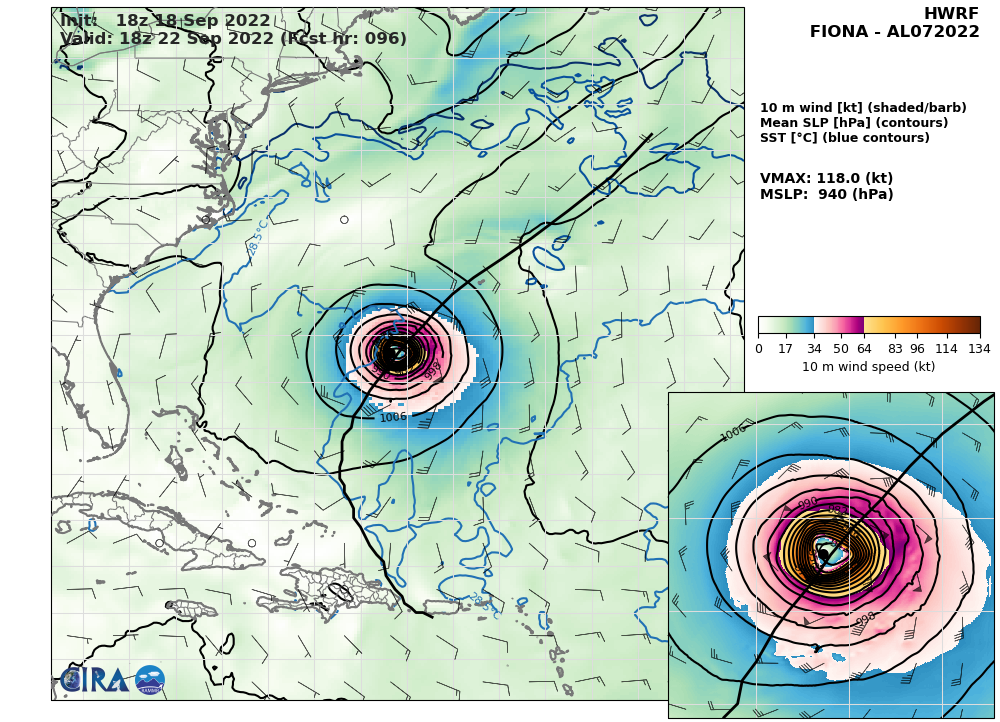
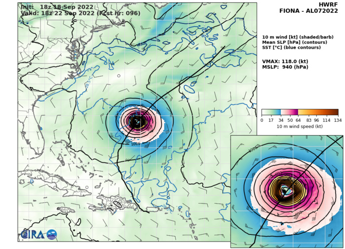
HWRF AT 18/18UTC: 118KT AT +96H.
