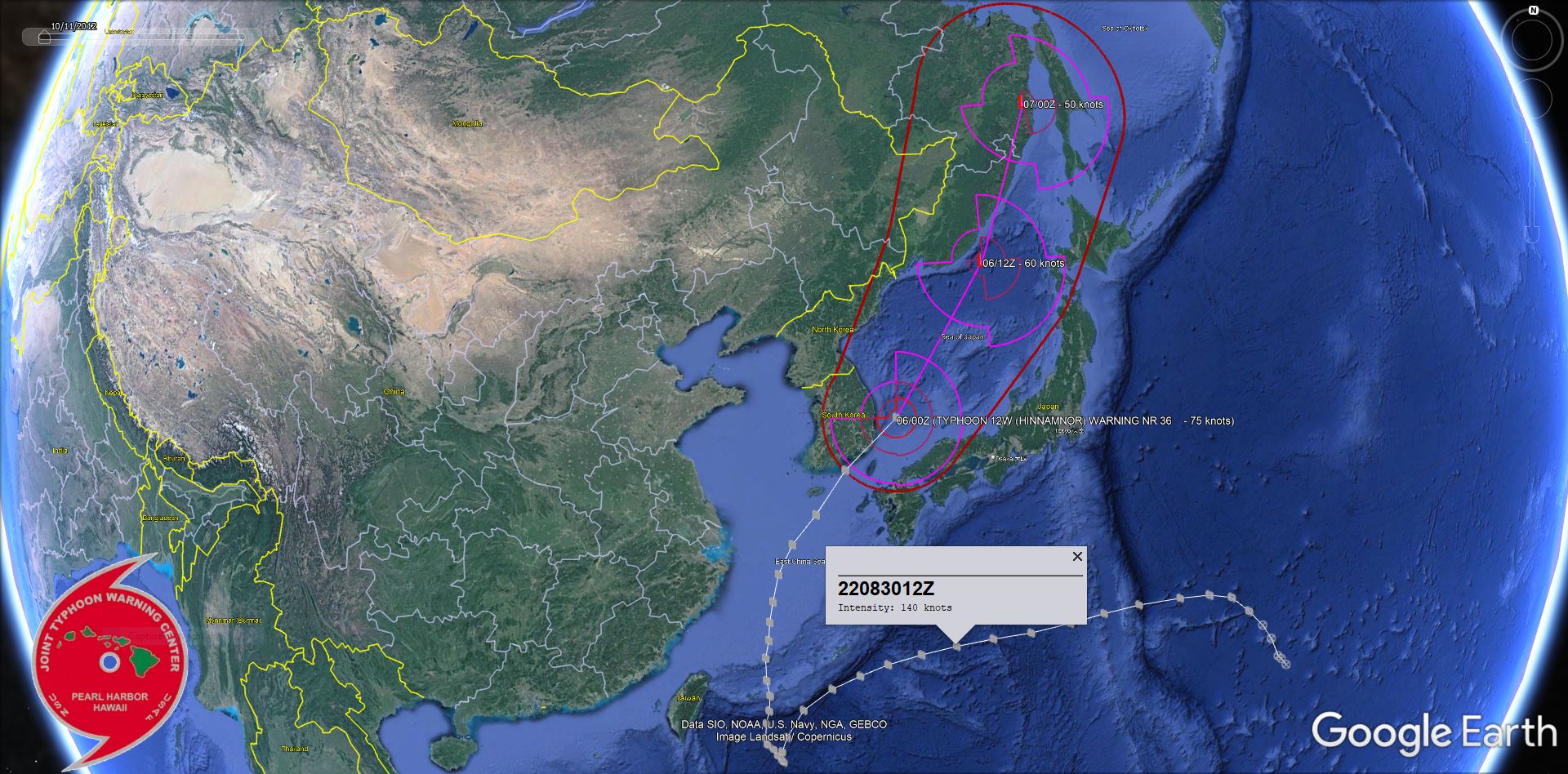
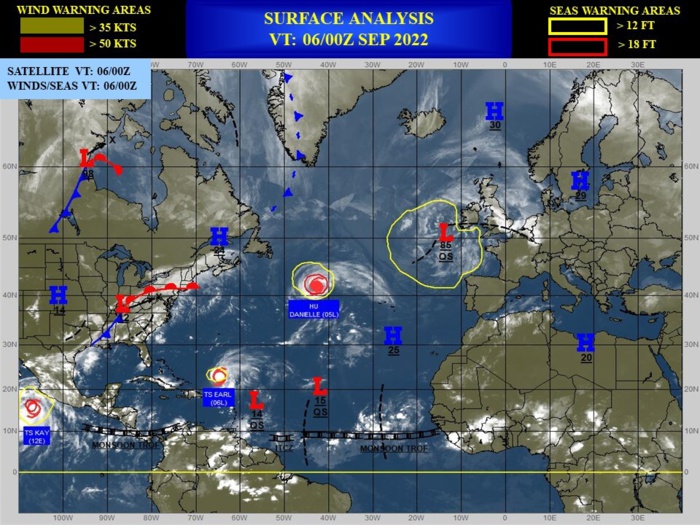
CLICK ON THE IMAGERIES BELOW TO GET THEM ENLARGED
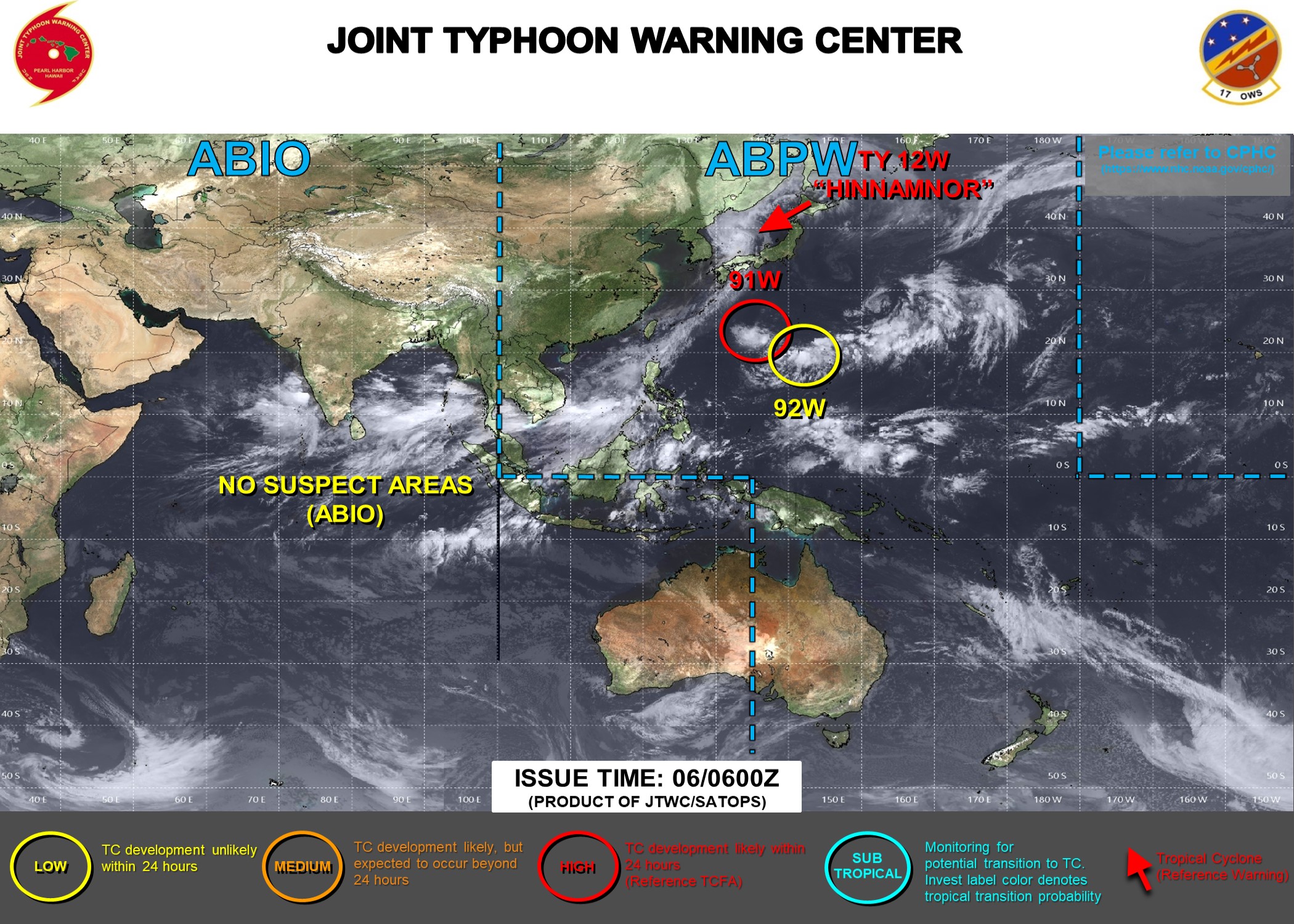
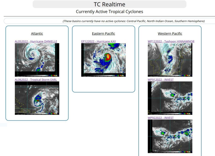
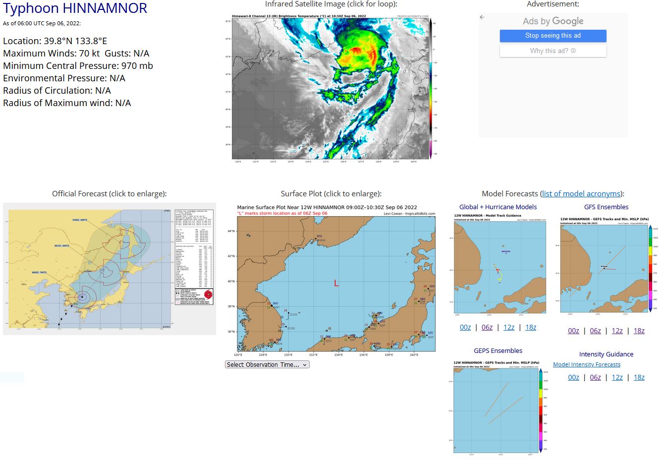
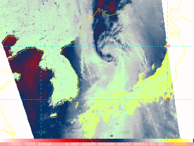
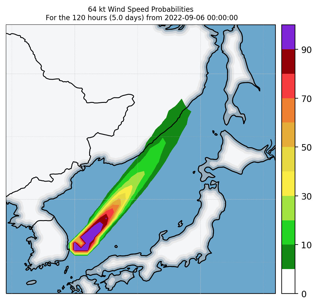
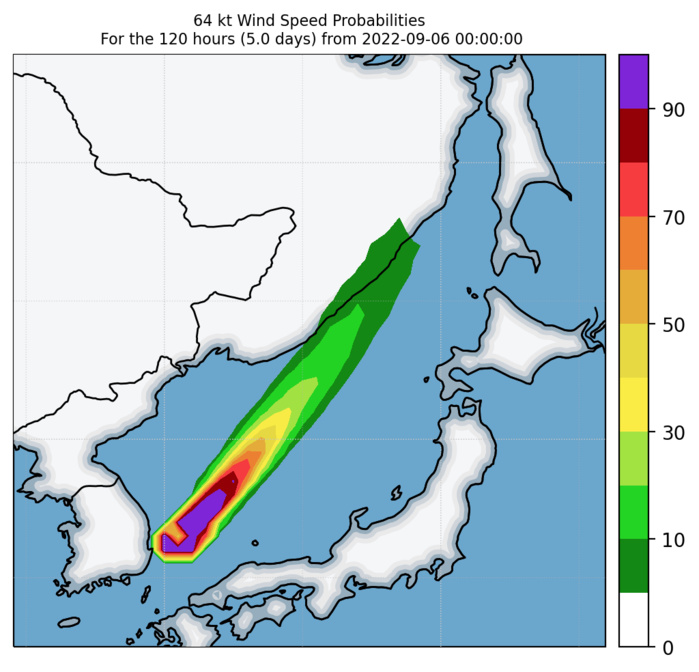
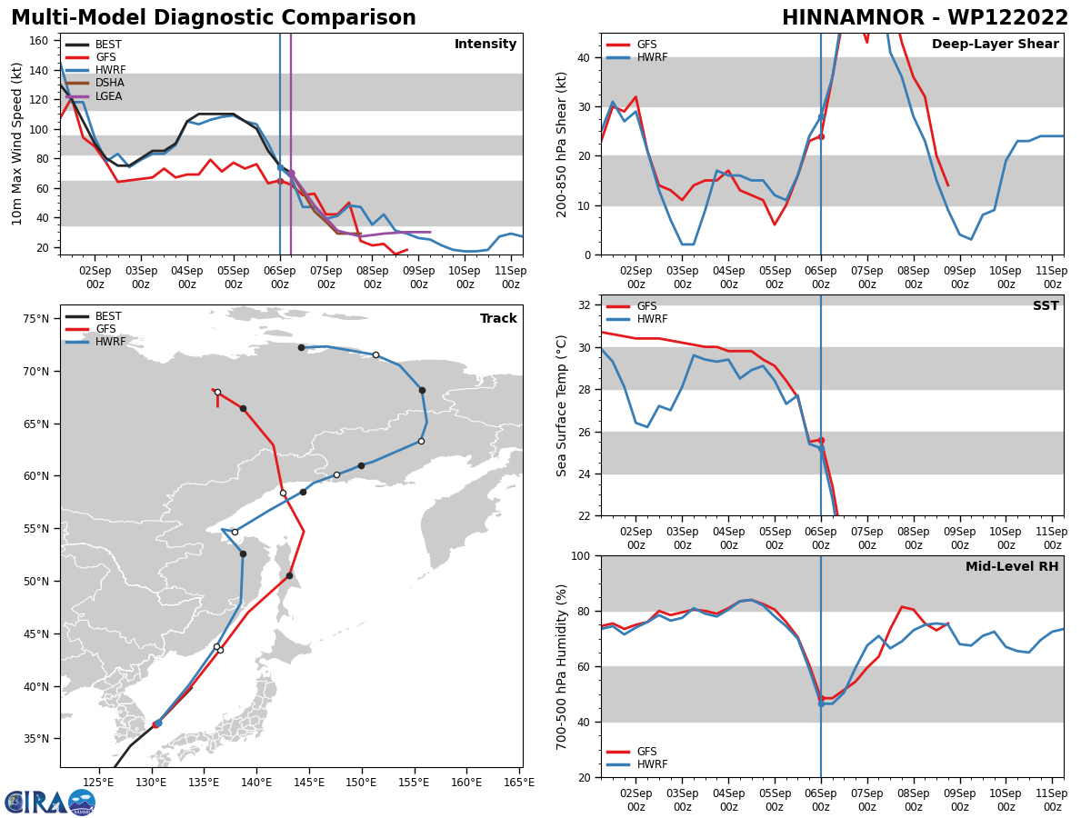
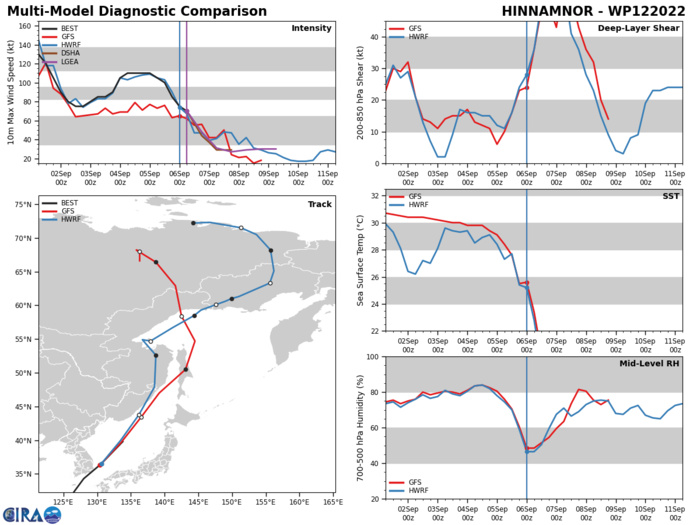
WESTERN NORTH PACIFIC: TY 12W(HINNAMNOR). ESTIMATED LOCATION AND INTENSITY AT 06/06UTC. WARNING 36/FINAL ISSUED AT 06/03UTC.
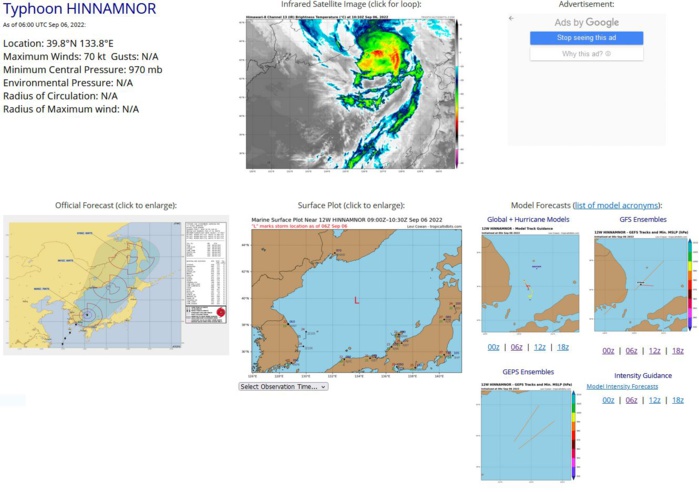
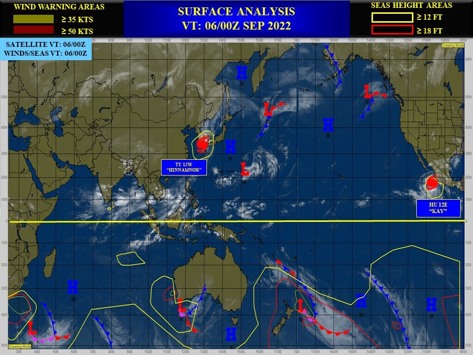
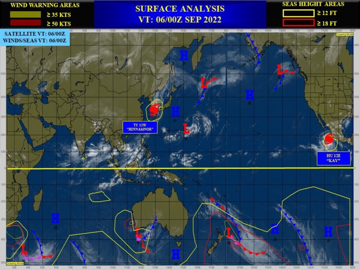
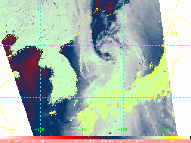
REMARKS: 060300Z POSITION NEAR 38.1N 131.9E. 06SEP22. TYPHOON (TY) 12W (HINNAMNOR), LOCATED APPROXIMATELY 111 NM NORTHEAST OF BUSAN, SOUTH KOREA, HAS TRACKED NORTHEASTWARD AT 31 KNOTS OVER THE PAST SIX HOURS. TY 12W IS EMBEDDED WITHIN A STRONG MIDLATITUDE SHORTWAVE TROUGH WITH WEAK FRONTAL STRUCTURE, AND HAS COMMENCED EXTRA-TROPICAL TRANSITION. ANIMATED ENHANCED INFRARED SATELLITE IMAGERY INDICATES ASYMMETRIC CONVECTION OBSCURING THE LOW- LEVEL CIRCULATION CENTER (LLCC) WITH THE BULK OF THE DEEP CONVECTION SHEARING POLEWARD DUE TO STRONG SOUTHERLY VERTICAL WIND SHEAR (VWS). A 060035Z AMSU-B 89GHZ MICROWAVE IMAGE INDICATES THE SYSTEM HAS MAINTAINED A DEFINED LLCC WITH LIMITED CURVED BANDING, HOWEVER, A DELTA RAIN REGION IS EVIDENT OVER THE NORTHERN QUADRANT. BASED ON THE DEFINED LLCC, RJTD RADAR FIX AND A 060036Z ASCAT AMBIGUITY IMAGE, THERE IS HIGH CONFIDENCE IN THE INITIAL POSITION. THE INITIAL INTENSITY IS ASSESSED AT 75 KNOTS PRIMARILY BASED ON A 052124Z RADARSAT2 SAR PASS SHOWING A SWATH OF 70-78 KNOT WINDS OVER THE EAST AND SOUTHEAST QUADRANTS. DVORAK CURRENT INTENSITY ESTIMATES OF 4.5 (77 KNOTS) FROM RJTD AND PGTW ALSO SUPPORT THE ASSESSMENT. ALTHOUGH NOT OVERLY IMPRESSIVE, SURFACE OBSERVATIONS FROM BUSAN AROUND 051900- 2100Z, INDICATED MAXIMUM WINDS OF 35 KNOTS GUSTING TO 64 KNOTS AND MINIMUM SLP NEAR 967MB, WHICH CORRESPONDS TO A 75 KNOT SYSTEM. TY 12W IS FORECAST TO RAPIDLY TRANSITION INTO A STRONG EXTRA-TROPICAL, COLD- CORE LOW BY TAU 12 AS IT GAINS FRONTAL CHARACTERISTICS AND APPROACHES THE MIDLATITUDE JET WITH VERY HIGH VWS (40-50 KNOTS). THIS IS THE FINAL WARNING ON THIS SYSTEM BY THE JOINT TYPHOON WRNCEN PEARL HARBOR HI. THE SYSTEM WILL BE CLOSELY MONITORED FOR SIGNS OF REGENERATION. MAXIMUM SIGNIFICANT WAVE HEIGHT AT 060000Z IS 27 FEET.
1222082700 225N1515E 25
1222082706 229N1512E 25
1222082712 231N1510E 25
1222082718 241N1506E 30
1222082800 249N1501E 30
1222082806 258N1493E 40
1222082812 267N1483E 50
1222082818 271N1470E 55
1222082900 273N1453E 65
1222082906 274N1430E 75
1222082912 273N1411E 100
1222082918 271N1393E 125
1222083000 269N1373E 115
1222083006 268N1354E 130
1222083006 268N1354E 130
1222083012 266N1336E 140
1222083018 263N1319E 140
1222083100 259N1303E 135
1222083106 254N1290E 130
1222083112 248N1277E 125
1222083118 238N1264E 125
1222090100 225N1257E 140
1222090106 218N1255E 130
1222090112 213N1256E 120
1222090118 214N1255E 105
1222090200 216N1253E 90
1222090206 219N1251E 80
1222090212 221N1248E 75
1222090218 224N1247E 75
1222090300 231N1247E 80
1222090306 237N1248E 85
1222090312 244N1248E 85
1222090318 251N1246E 90
1222090400 261N1245E 105
1222090406 269N1246E 110
1222090412 277N1246E 110
1222090418 286N1247E 110
1222090500 298N1249E 110
1222090506 311N1255E 105
1222090512 324N1266E 100
1222090518 343N1280E 85
1222090600 365N1306E 75
1222090606 398N1338E 70
NNNN
ESTIMATED PEAK INTENSITY WAS 140KTS/CAT 5.
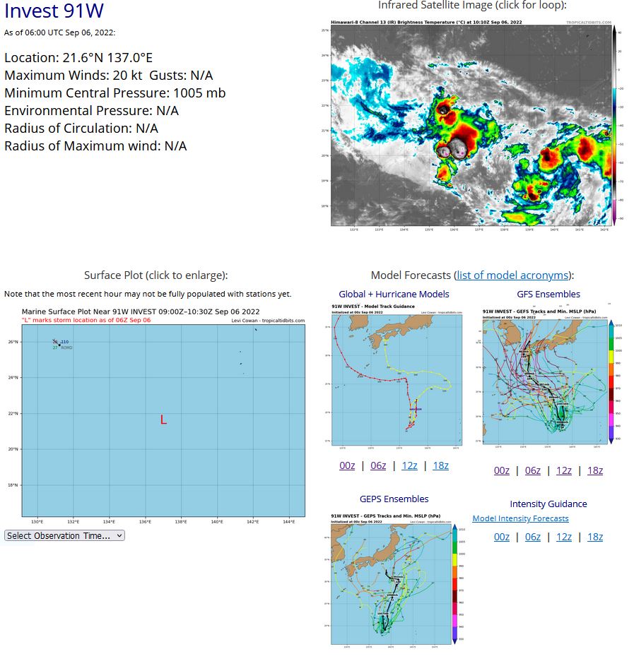
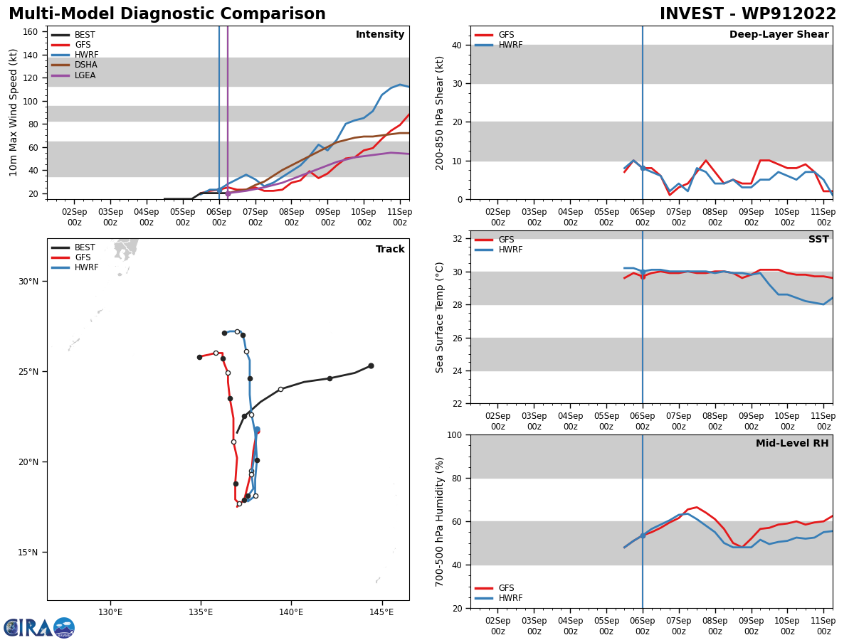
WESTERN NORTH PACIFIC: INVEST 91W. ESTIMATED LOCATION AND INTENSITY AT 06/06UTC. TROPICAL CYCLONE FORMATION ALERT ISSUED AT 06/0330UTC.
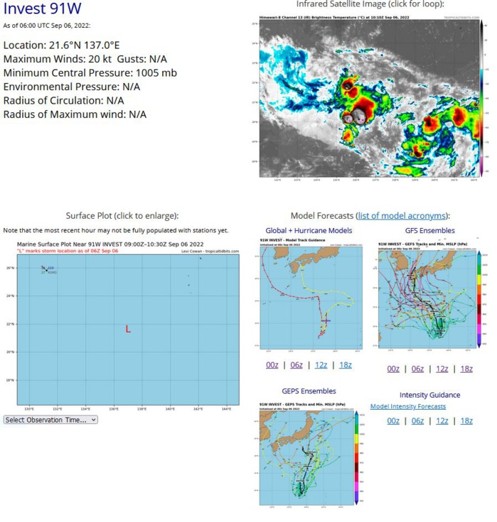
THE AREA OF CONVECTION (INVEST 91W) PREVIOUSLY LOCATED NEAR 24.4N 139.9E IS NOW LOCATED NEAR 22.5N 137.4E, APPROXIMATELY 255 NM WEST-SOUTHWEST OF IWO-TO. ANIMATED MULTISPECTRAL SATELLITE IMAGERY (MSI) SHOWS A PARTIALLY-EXPOSED LOW-LEVEL CIRCULATION CENTER WITH PERSISTENT DEEP CONVECTION OVER THE WESTERN SEMICIRCLE. A 052149Z SSMIS 91GHZ MICROWAVE IMAGE SHOWS FORMATIVE CONVECTIVE BANDING BUT WEAK LOW-LEVEL STRUCTURE. UPPER-LEVEL ANALYSIS REVEALS A MARGINALLY FAVORABLE ENVIRONMENT WITH MODERATE EQUATORWARD OUTFLOW AND LOW TO MODERATE (10-20 KNOTS) VERTICAL WIND SHEAR. WARM SEA SURFACE TEMPERATURE (SST) (30-31C). GLOBAL MODELS INDICATE A SOUTHWARD TO SOUTH-SOUTHWESTWARD TRACK OVER THE NEXT TWO DAYS WITH A COMPLEX MERGER OCCURRING WITH INVEST 92W AND GRADUAL DEVELOPMENT. MAXIMUM SUSTAINED SURFACE WINDS ARE ESTIMATED AT 18 TO 23 KNOTS. MINIMUM SEA LEVEL PRESSURE IS ESTIMATED TO BE NEAR 1005 MB. THE POTENTIAL FOR THE DEVELOPMENT OF A SIGNIFICANT TROPICAL CYCLONE WITHIN THE NEXT 24 HOURS IS UPGRADED TO HIGH.
WP, 91, 2022090412,253N, 1444E, 15,1008
WP, 91, 2022090418,249N, 1435E, 15,1007
WP, 91, 2022090500,246N, 1421E, 15,1007
WP, 91, 2022090506,244N, 1407E, 15,1006
WP, 91, 2022090512,240N, 1394E, 20,1011
WP, 91, 2022090518,233N, 1383E, 20,1008
WP, 91, 2022090600,225N, 1374E, 20,1005
WP, 91, 2022090606,216N, 1370E, 20,1005
WP, 91, 2022090418,249N, 1435E, 15,1007
WP, 91, 2022090500,246N, 1421E, 15,1007
WP, 91, 2022090506,244N, 1407E, 15,1006
WP, 91, 2022090512,240N, 1394E, 20,1011
WP, 91, 2022090518,233N, 1383E, 20,1008
WP, 91, 2022090600,225N, 1374E, 20,1005
WP, 91, 2022090606,216N, 1370E, 20,1005
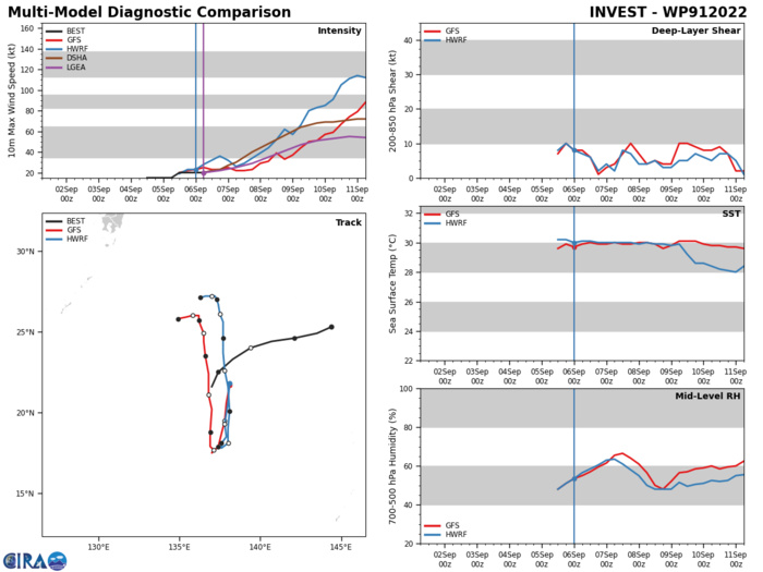
GLOBAL MODELS INDICATE A SOUTHWARD TO SOUTH-SOUTHWESTWARD TRACK OVER THE NEXT TWO DAYS WITH A COMPLEX MERGER OCCURRING WITH INVEST 92W AND GRADUAL DEVELOPMENT.
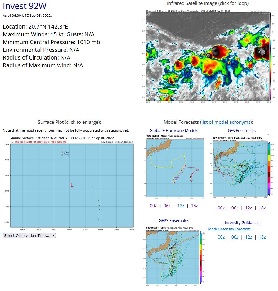
WESTERN NORTH PACIFIC: INVEST 92W. ESTIMATED LOCATION AND INTENSITY AT 06/06UTC. ADVISORY(ABPW) ISSUED AT 06/06UTC.
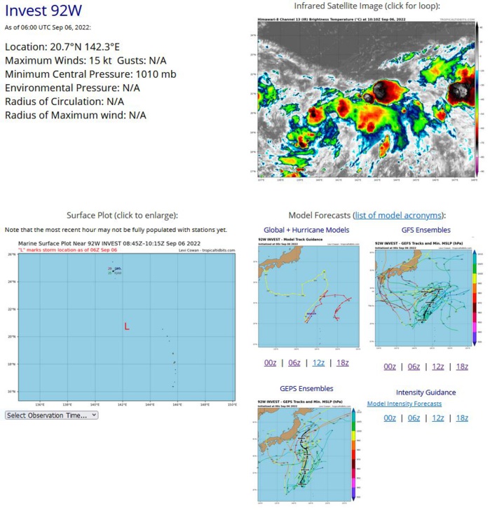
AN AREA OF CONVECTION (INVEST 92W) HAS PERSISTED NEAR 20.5N 142.2E, APPROXIMATELY 259 NM SOUTH-SOUTHEAST OF IWO-TO. ANIMATED MULTISPECTRAL SATELLITE IMAGERY DEPICTS A WEAK AND ILL-DEFINED LOW LEVEL CIRCULATION (LLC) WITH BROAD CONVECTION IN THE EASTERN AND SOUTHERN PERIPHERY. A 060042Z ASCAT-B PASS REVEALS A WEAK LLC WITH A SWATH OF 15KT WINDS LOCATED IN THE EASTERN PERIPHERY. ENVIRONMENTAL ANALYSIS INDICATES MARGINALLY FAVORABLE CONDITIONS FOR DEVELOPMENT DEFINED BY LOW TO MODERATE (15-20KT) VERTICAL WIND SHEAR AND WARM SST (30-31C), OFFSET BY MARGINAL OUTFLOW ALOFT. GLOBAL MODELS ARE IN GENERAL AGREEMENT THAT 92W WILL HAVE SLOW DEVELOPMENT AND REMAIN QUASI-STATIONARY BEFORE MEANDERING GENERALLY NORTHEAST AFTER TAU 24. MAXIMUM SUSTAINED SURFACE WINDS ARE ESTIMATED AT 10 TO 15 KNOTS. MINIMUM SEA LEVEL PRESSURE IS ESTIMATED TO BE NEAR 1005 MB. THE POTENTIAL FOR THE DEVELOPMENT OF A SIGNIFICANT TROPICAL CYCLONE WITHIN THE NEXT 24 HOURS IS LOW.
WP, 92, 2022090512,203N, 1415E, 15,1005
WP, 92, 2022090518,204N, 1419E, 15,1005
WP, 92, 2022090600,205N, 1422E, 15,1005
WP, 92, 2022090606,207N, 1423E, 15,1010
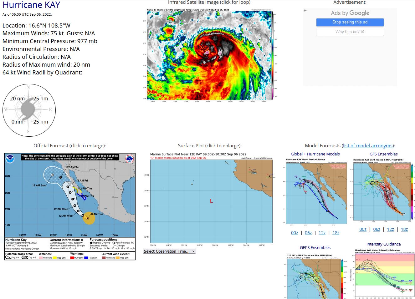
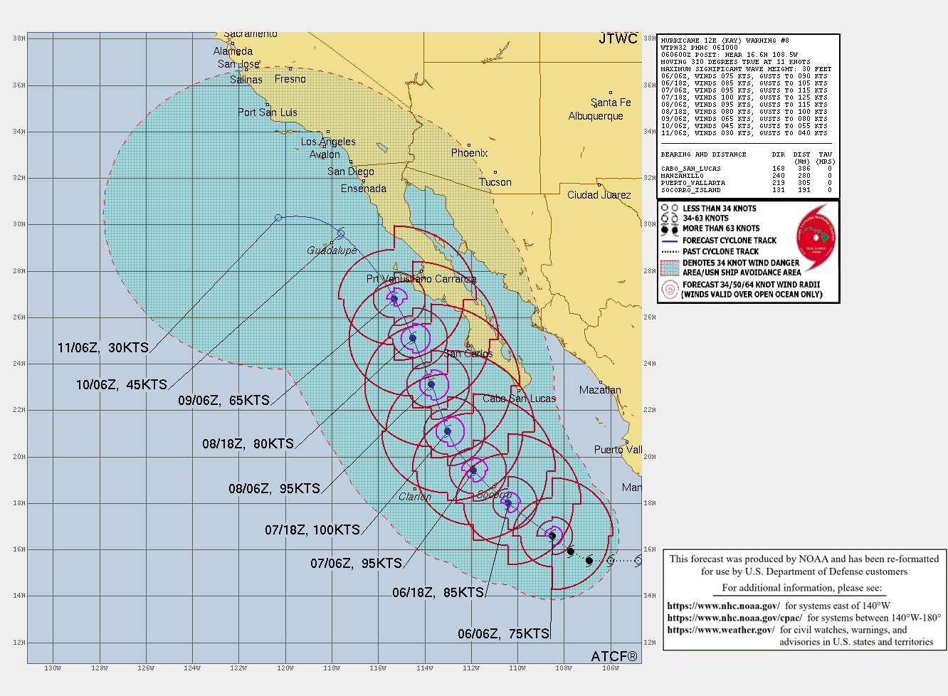
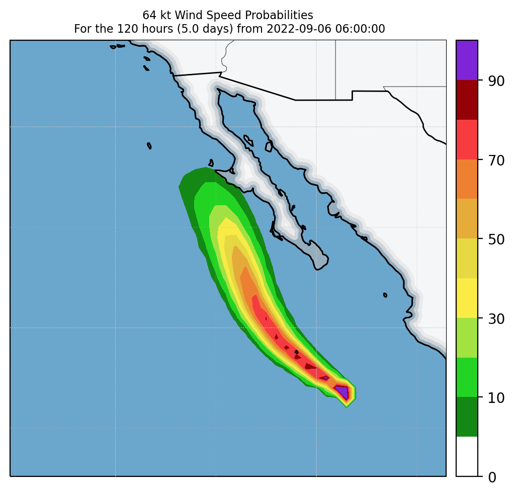
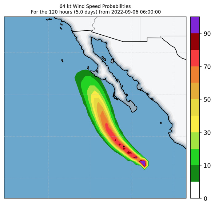
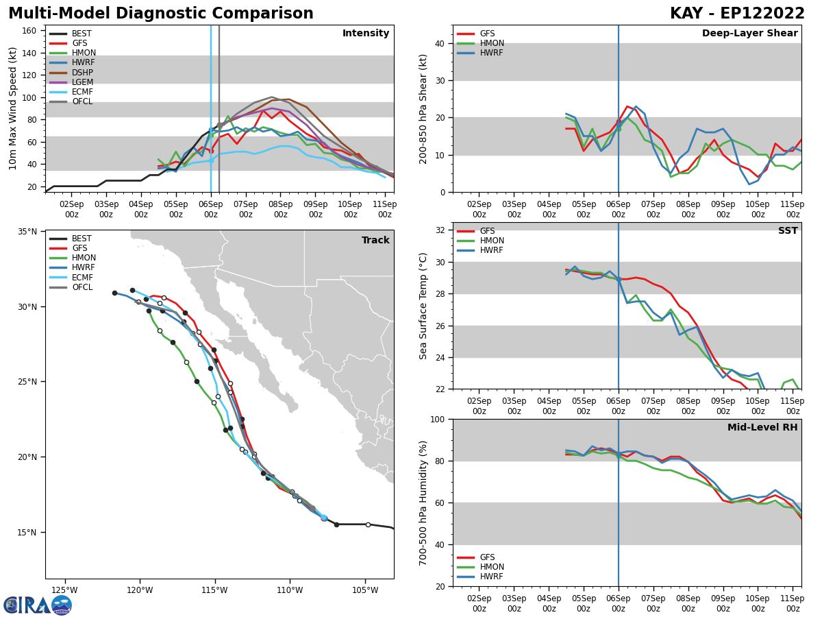
EASTERN NORTH PACIFIC: HU 12E(KAY). ESTIMATED LOCATION AND INTENSITY AT 06/06UTC. WARNING 8 ISSUED AT 06/10UTC. NHC COMMENTS.
EP, 12, 2022090500,153N, 1033W, 35,1002
EP, 12, 2022090506,155N, 1048W, 45, 998
EP, 12, 2022090512,155N, 1060W, 55, 990
EP, 12, 2022090518,155N, 1069W, 65, 983
EP, 12, 2022090600,159N, 1077W, 70, 980
EP, 12, 2022090606,166N, 1085W, 75, 977
EP, 12, 2022090506,155N, 1048W, 45, 998
EP, 12, 2022090512,155N, 1060W, 55, 990
EP, 12, 2022090518,155N, 1069W, 65, 983
EP, 12, 2022090600,159N, 1077W, 70, 980
EP, 12, 2022090606,166N, 1085W, 75, 977
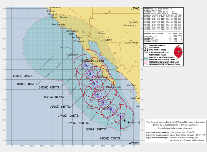
WTPZ42 KNHC 060848 TCDEP2 Hurricane Kay Discussion Number 8 NWS National Hurricane Center Miami FL EP122022 300 AM MDT Tue Sep 06 2022 The satellite presentation of Kay has improved within the past couple of hours. A curved band with cloud top temperatures below -85C has wrapped around the center and has formed a ragged banding-type eye in infrared imagery. The latest subjective and objective Dvorak satellite estimates are all around 65 kt, but with the earlier reconnaissance data supporting a higher intensity and the recent improvement in structure, the initial intensity has been raised to 75 kt. Another Air Force Reserve reconnaissance aircraft is scheduled to investigate Kay this afternoon. The much-anticipated northwestward turn appears to have occurred, and the initial motion estimate is now 310/11 kt. Kay is forecast to move on a northwestward heading during the next 24 to 36 hours around a mid-level ridge centered over Mexico. After that time, the hurricane is forecast to turn north-northwestward, bringing the core near the west-central coast of the Baja peninsula in 60-72 hours. Some of the dynamical track models including the HWRF, GFS and GFS ensemble mean, have made a noticeable eastward shift over the past few cycles, while the ECMWF has changed little. The updated NHC track forecast has been adjusted slightly east of the previous advisory out of respect for the aforementioned models, but it is not quite as far east as the latest GFS, GFS ensemble mean or HFIP corrected consensus. The forecast is a blend of the ECMWF and GFS and is just east of the simple consensus aids. Kay's outflow remains somewhat constricted over the northeastern quadrant due to moderate northeasterly shear. However, the shear is forecast to relax over the next 24 to 36 hours, and given the recent improvement in organization, additional strengthening is expected during that time. The NHC forecast has been raised from the previous advisory and is near the upper-end of the guidance in best agreement with the SHIPS model. After 36 hours, Kay will be moving over decreasing sea surface temperatures and weakening should begin. Although Kay is likely to weaken before it makes its closest approach to the west-central coast of the Baja peninsula, it is forecast to remain a large and strong hurricane at that time. In addition, winds and rainfall impacts will extend far form the center so users should not focus on the exact forecast track. The government of Mexico has issued a Tropical Storm Warning for the southern portions of the Baja California peninsula. Additional tropical storm or hurricane watches or warnings could be necessary for portions of Baja California later today. KEY MESSAGES: 1. Heavy rainfall from Kay could lead to flash flooding, including landslides, across portions of western Mexico, including the Baja California peninsula, through Thursday night. 2. Tropical storm conditions are expected over portions of the southern Baja California peninsula beginning Wednesday morning, where a Tropical Storm Warning is now in effect. 3. While the details of the long-range track and intensity forecasts remain uncertain, there is increasing risk of significant wind, surf, and rainfall impacts across the central portion of the Baja California peninsula later this week. A tropical storm or hurricane watch could be issued for that region later today. FORECAST POSITIONS AND MAX WINDS INIT 06/0900Z 17.0N 108.9W 75 KT 85 MPH 12H 06/1800Z 18.0N 110.4W 85 KT 100 MPH 24H 07/0600Z 19.4N 111.9W 95 KT 110 MPH 36H 07/1800Z 21.1N 113.0W 100 KT 115 MPH 48H 08/0600Z 23.1N 113.7W 95 KT 110 MPH 60H 08/1800Z 25.1N 114.5W 80 KT 90 MPH 72H 09/0600Z 26.8N 115.3W 65 KT 75 MPH 96H 10/0600Z 29.6N 117.6W 45 KT 50 MPH 120H 11/0600Z 30.3N 120.3W 30 KT 35 MPH...POST-TROP/REMNT LOW $$ Forecaster Brown
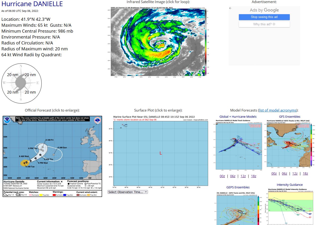
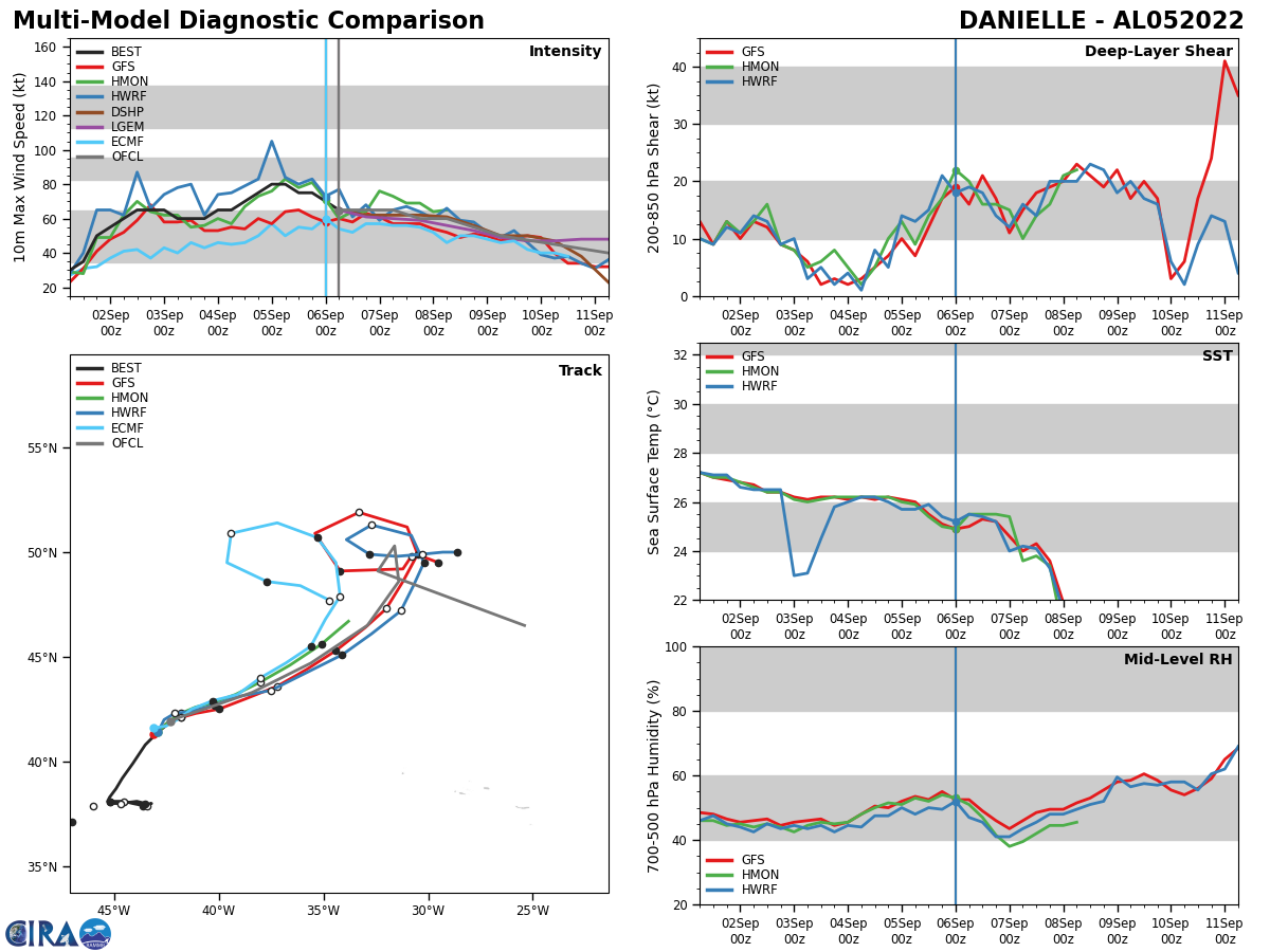
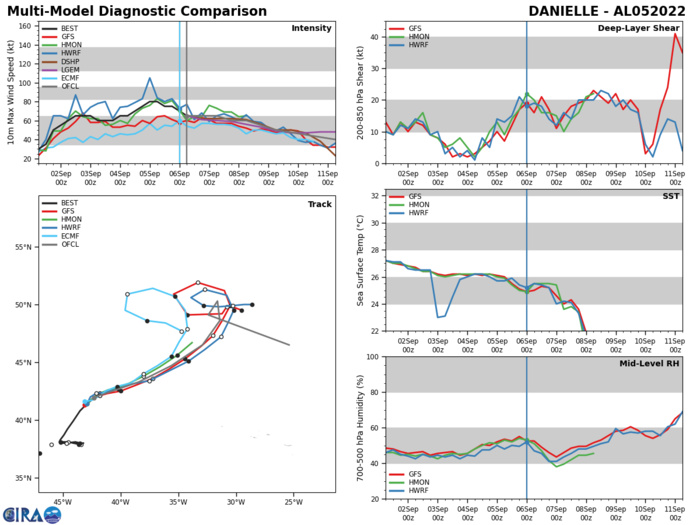
NORTH ATLANTIC: HU 05L(DANIELLE). ESTIMATED LOCATION AND INTENSITY AT 06/06UTC. NHC COMMENTS.
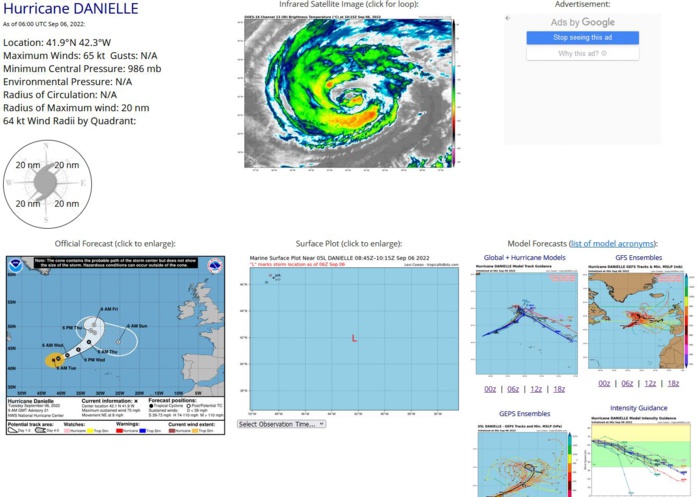
WTNT45 KNHC 060833 TCDAT5 Hurricane Danielle Discussion Number 21 NWS National Hurricane Center Miami FL AL052022 900 AM GMT Tue Sep 06 2022 Danielle's cloud pattern has degraded further this morning by shedding its curved bands in the eastern semicircle. The remaining outer bands have become more fragmented with cloud top temperatures of only -47C. Dvorak final-T numbers are on the decline, and a compromise of both TAFB's and SAB's intensity estimates, along with the UW-CIMSS objective assessment, supports lowering the initial intensity to 65 kt for this advisory. Although Danielle is currently moving over relatively warm (25C) oceanic surface temperatures, the cyclone should begin to lose its tropical characteristics soon as it traverses cooler SSTs of less than 22C during the next day or two. Guidance continues to indicate that Danielle will complete its extratropical transition on Thursday, although the vertical thermal structure shows the system sustaining its warm core above 600 mb. Over the weekend, deterministic cyclone phase analyses, and simulated IR predictions show Danielle, as the dominant system, merging with a baroclinic system approaching from the west. A warm seclusion structure develops while the system occludes, or is cut-off north of the mid-latitude westerlies. The NHC intensity forecast is similar to the previous advisory and continues to lean toward the IVCN intensity consensus model. The initial motion is estimated to be northeastward at 7 kt, and Danielle should continue moving in this heading through this evening. Afterward, a turn toward the east-northeast by early Wednesday, while accelerating, is anticipated. By the early weekend, the cyclone is expected to interact with a baroclinic system by rotating cyclonically north of the westerlies and becoming a vastly larger extratropical low well west of the British Isles. Once merged into one large, storm-force extratropical low, the system should commence a general motion toward the east-southeast on Sunday. Danielle is producing huge seas over the central-north Atlantic. Complete information on the High Seas Forecasts can be found at the Ocean Prediction Center under AWIPS header NFDHSFAT1, WMO header FZNT01 KWBC, and online at ocean.weather.gov/shtml/NFDHSFAT1.php. FORECAST POSITIONS AND MAX WINDS INIT 06/0900Z 42.1N 41.9W 65 KT 75 MPH 12H 06/1800Z 42.5N 40.7W 65 KT 75 MPH 24H 07/0600Z 43.3N 38.4W 65 KT 75 MPH 36H 07/1800Z 44.7N 35.6W 60 KT 70 MPH 48H 08/0600Z 46.5N 32.9W 60 KT 70 MPH 60H 08/1800Z 48.6N 31.4W 55 KT 65 MPH...POST-TROP/EXTRATROP 72H 09/0600Z 50.3N 31.6W 50 KT 60 MPH...POST-TROP/EXTRATROP 96H 10/0600Z 49.1N 32.4W 45 KT 50 MPH...POST-TROP/EXTRATROP 120H 11/0600Z 46.5N 25.4W 40 KT 45 MPH...POST-TROP/EXTRATROP $$ Forecaster Roberts
AL, 05, 2022090500,387N, 449W, 80, 975
AL, 05, 2022090506,392N, 446W, 80, 975
AL, 05, 2022090512,399N, 441W, 75, 976
AL, 05, 2022090518,408N, 435W, 75, 976
AL, 05, 2022090600,414N, 429W, 70, 980
AL, 05, 2022090606,419N, 423W, 65, 986
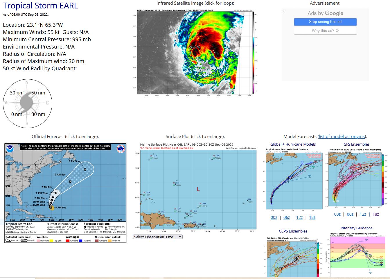
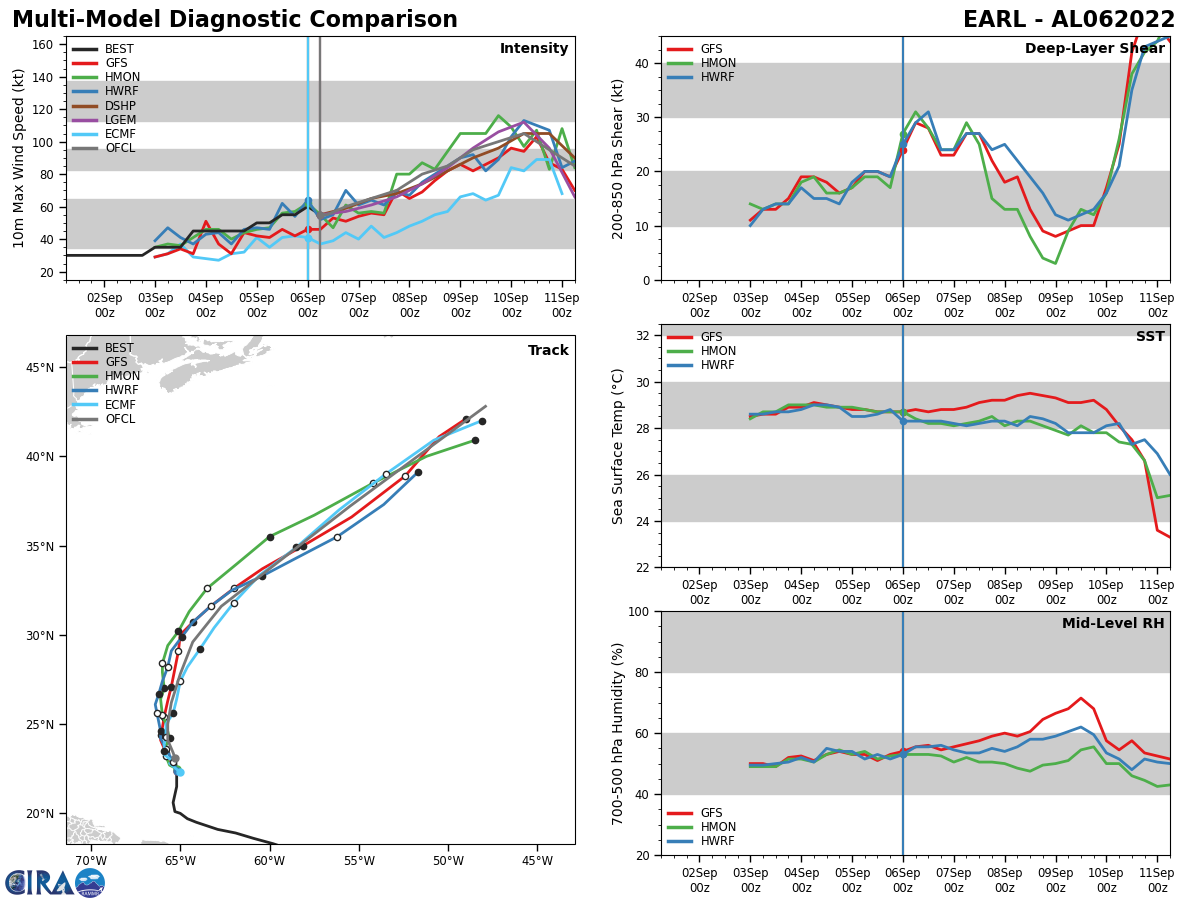
NORTH ATLANTIC: TS 06L(EARL). ESTIMATED LOCATION AND INTENSITY AT 06/06UTC. NHC COMMENTS.
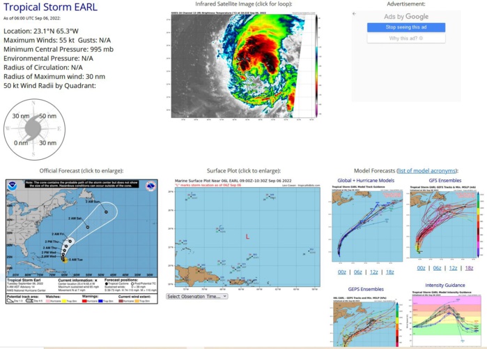
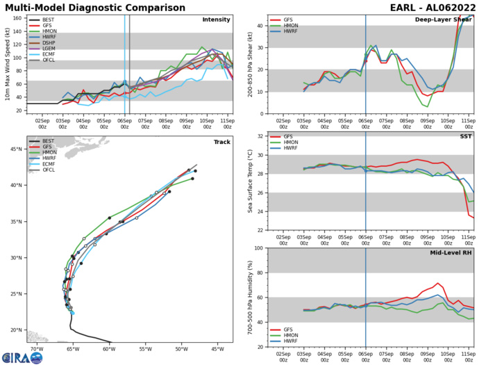
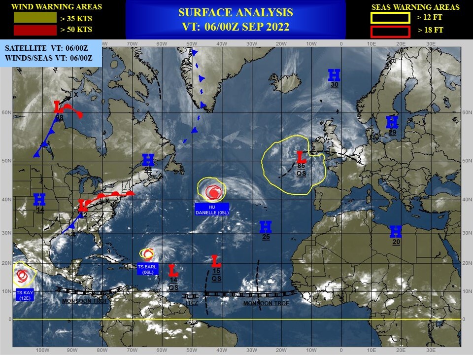
WTNT41 KNHC 060847 TCDAT1 Tropical Storm Earl Discussion Number 14 NWS National Hurricane Center Miami FL AL062022 500 AM AST Tue Sep 06 2022 The deep convective blow-up that occurred last evening and led to Earl strengthening just shy of hurricane strength was quickly obliterated by strong shear around the issuance of the previous advisory. In fact, after measuring a pressure as low as 991 mb early in their flight, the NOAA Hurricane Hunters reported that the central pressure had risen to near 998 mb based on the final dropsonde released near the center. Some deep convection continues near and to the northeast of the estimated center, but based on the degraded structure from earlier, the intensity is estimated to be 55 kt. This value agrees with the latest Dvorak Data-T numbers from TAFB and SAB. The remnant cirrus shield is obscuring the low-level center, so the initial position is based on interpolation from the previous forecast. Earl is moving just west of due north, or 350/6 kt, and it should continue a slow northward path through a break in the subtropical ridge during the next 36 hours. After that time, a deep-layer trough sliding off the U.S. east coast is expected to impart a faster north-northeastward and then northeastward motion into the upcoming weekend. The updated NHC track forecast lies very close to the previous official prediction during the first 3 days, situated among the various multi-model consensus aids. On days 4 and 5, however, the new forecast is faster and to the east of the previous one, following the trend noted in most of the models. UW-CIMSS and SHIPS analyses indicate that deep-layer shear over Earl is from the west-southwest at 30-35 kt. Although the thermodynamic environment is plenty favorable for intensification, continued moderate to strong shear could put the breaks on significant strengthening until Earl turns and moves in the same direction as the shear vector, which should be in 2-3 days. At about the same time, Earl could also benefit from a positive interaction with a mid- to upper-level trough located over the western Atlantic. While the intensity forecast is highly uncertain, Earl is still expected to become a hurricane during the next couple of days, and possibly reach major hurricane strength in 3-4 days. Earl's center is expected to pass to the southeast of Bermuda in about 3 days. However, the size of the wind field of the tropical cyclone is expected to increase significantly, and interests on the island should continue to monitor the progress of the storm closely. FORECAST POSITIONS AND MAX WINDS INIT 06/0900Z 23.4N 65.4W 55 KT 65 MPH 12H 06/1800Z 24.1N 65.7W 60 KT 70 MPH 24H 07/0600Z 25.0N 65.7W 65 KT 75 MPH 36H 07/1800Z 26.2N 65.5W 70 KT 80 MPH 48H 08/0600Z 27.8N 65.0W 80 KT 90 MPH 60H 08/1800Z 29.6N 64.3W 85 KT 100 MPH 72H 09/0600Z 31.6N 62.7W 95 KT 110 MPH 96H 10/0600Z 37.2N 55.5W 105 KT 120 MPH 120H 11/0600Z 42.8N 47.9W 85 KT 100 MPH $$ Forecaster Berg
AL, 06, 2022090500,201N, 653W, 50, 998
AL, 06, 2022090506,206N, 654W, 50, 998
AL, 06, 2022090506,206N, 654W, 50, 998
AL, 06, 2022090512,215N, 652W, 55, 998
AL, 06, 2022090518,219N, 652W, 55, 998
AL, 06, 2022090600,225N, 652W, 60, 991
AL, 06, 2022090606,231N, 653W, 55, 995
AL, 06, 2022090506,206N, 654W, 50, 998
AL, 06, 2022090506,206N, 654W, 50, 998
AL, 06, 2022090512,215N, 652W, 55, 998
AL, 06, 2022090518,219N, 652W, 55, 998
AL, 06, 2022090600,225N, 652W, 60, 991
AL, 06, 2022090606,231N, 653W, 55, 995
