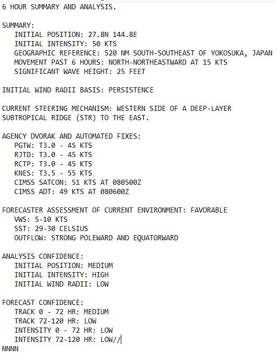
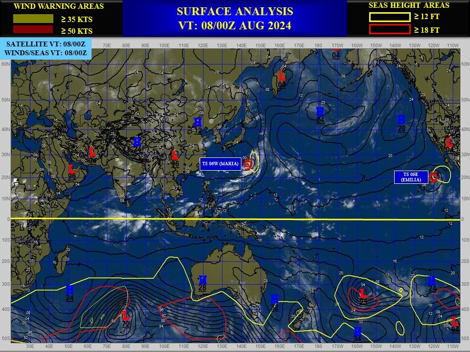
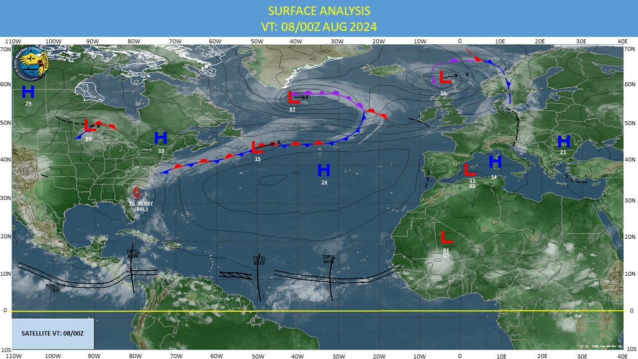
CLICK ON THE IMAGERIES BELOW TO GET THEM ENLARGED
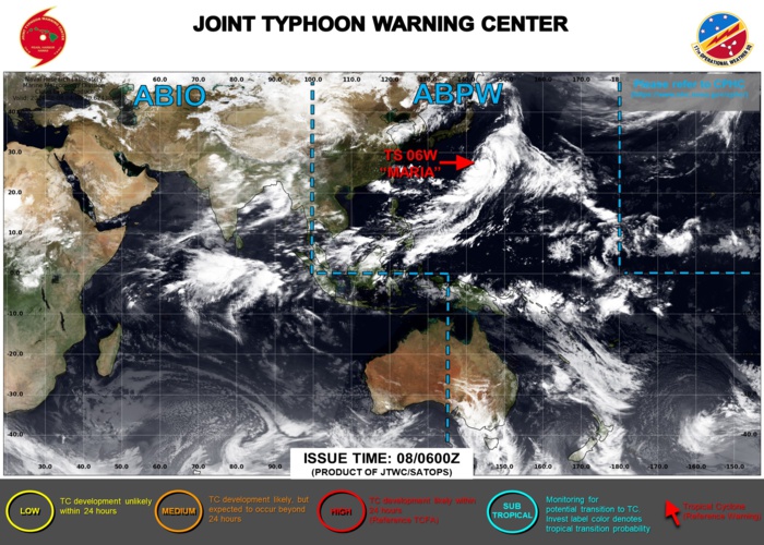
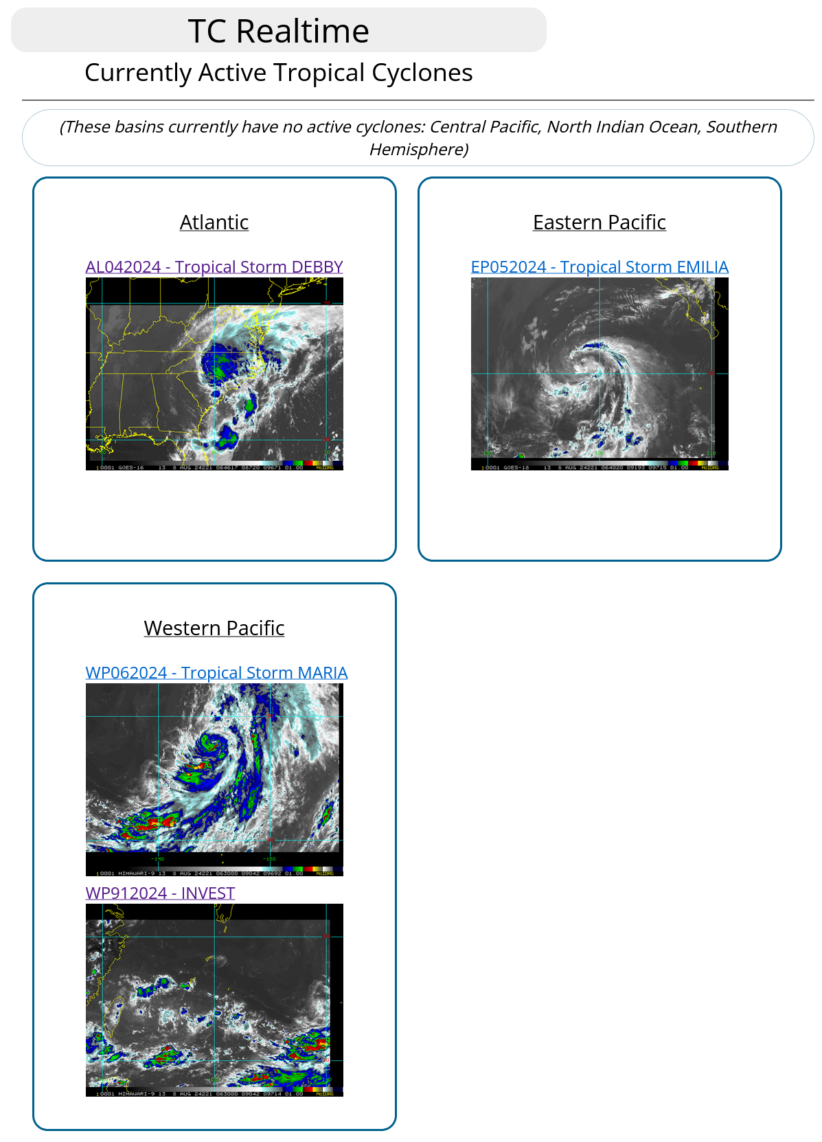
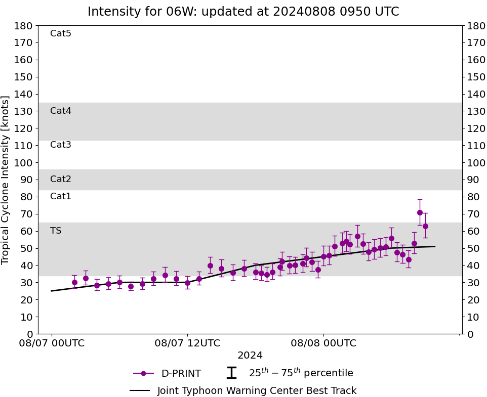
WESTERN NORTH PACIFIC: TS 06W(MARIA). ESTIMATED INTENSITY AT 0806UTC IS 50 KNOTS: + 20 KNOTS OVER 24 HOURS.
0624080518 253N1414E 20
0624080600 255N1413E 20
0624080606 256N1410E 20
0624080612 256N1407E 20
0624080618 257N1410E 20
0624080700 255N1411E 25
0624080706 254N1417E 30
0624080712 254N1423E 30
0624080718 256N1430E 40
0624080800 265N1440E 45
0624080806 278N1448E 50
0624080600 255N1413E 20
0624080606 256N1410E 20
0624080612 256N1407E 20
0624080618 257N1410E 20
0624080700 255N1411E 25
0624080706 254N1417E 30
0624080712 254N1423E 30
0624080718 256N1430E 40
0624080800 265N1440E 45
0624080806 278N1448E 50
WARNING 6 ISSUED AT 0906UTC.

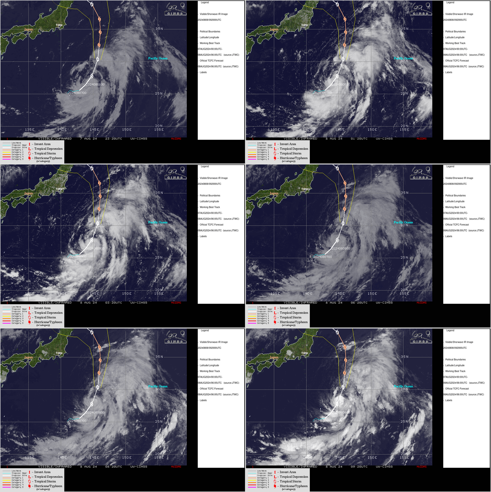
CLICK ON THE IMAGERY BELOW TO GET IT ANIMATED AND ENLARGED

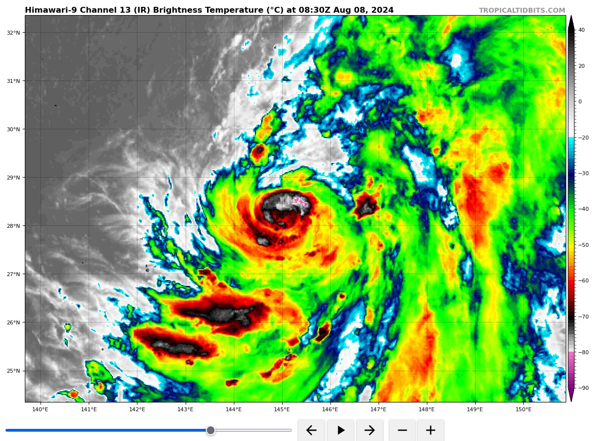
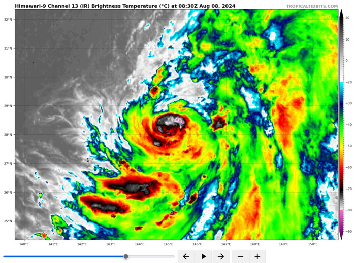
SATELLITE ANALYSIS, INITIAL POSITION AND INTENSITY DISCUSSION: TROPICAL STORM (TS) 06W (MARIA) CONTINUES TO SLOWLY INTENSIFY WHILE TRACKING POLEWARD TO THE NORTHEAST OF IWO TO. ANIMATED MULTISPECTRAL SATELLITE IMAGERY (MSI) DEPICTS A COMPACT SYSTEM, WITH WELL-DEFINED LOW-LEVEL BANDING FEATURES WRAPPING INTO AN OBSCURED LOW LEVEL CIRCULATION CENTER (LLCC). DEEP CONVECTIVE CELLS (HOT TOWERS) CAN BE SEEN DEVELOPING ON THE SOUTHERN PERIPHERY AND WRAPPING UP THE EASTERN SIDE OF THE CIRCULATION, BUT HAVE NOT YET BEEN ABLE TO COMPLETELY ENCIRCLE THE SMALL CORE VORTEX. THE LACK OF ANY SIGNIFICANT CONVECTIVE ACTIVITY AND RELATIVELY CLEAR AIR BETRAYS THE PRESENCE OF DRY AIR ACROSS THE MAJORITY OF THE WESTERN HEMISPHERE OF THE SYSTEM. A 080629Z SSMIS 91GHZ IMAGE SHOWS A SMALL INNER CORE, WITH DEEP CONVECTION ACROSS THE SOUTHERN SIDE OF THE VORTEX AND A LOW EMISSIVITY REGION SUGGESTING A NASCENT MICROWAVE EYE. THE INITIAL POSITION IS PLACED WITH MEDIUM CONFIDENCE BASED ON ANALYSIS OF THE ANIMATED MSI AND THE AFOREMENTIONED MICROWAVE FIXES. THE INITIAL INTENSITY OF 50 KTS IS ASSESSED WITH HIGH CONFIDENCE BASED ON THE AGREEANCE OF ALL SUBJECTIVE AND OBJECTIVE INTENSITY ESTIMATES, WITH THE EXCEPTION OF THE SLIGHTLY HIGHER KNES DVORAK ESTIMATE OF T3.5. ANALYSIS REVEALS A SUPPORTIVE ENVIRONMENT, WITH LOW VWS, STRONG POLEWARD AND EQUATORWARD OUTFLOW AND WARM SSTS. THE SYSTEM IS CURRENTLY TRACKING NORTH-NORTHEASTWARD ALONG THE WESTERN SIDE OF A DEEP-LAYER SUBTROPICAL RIDGE (STR) TO THE EAST.
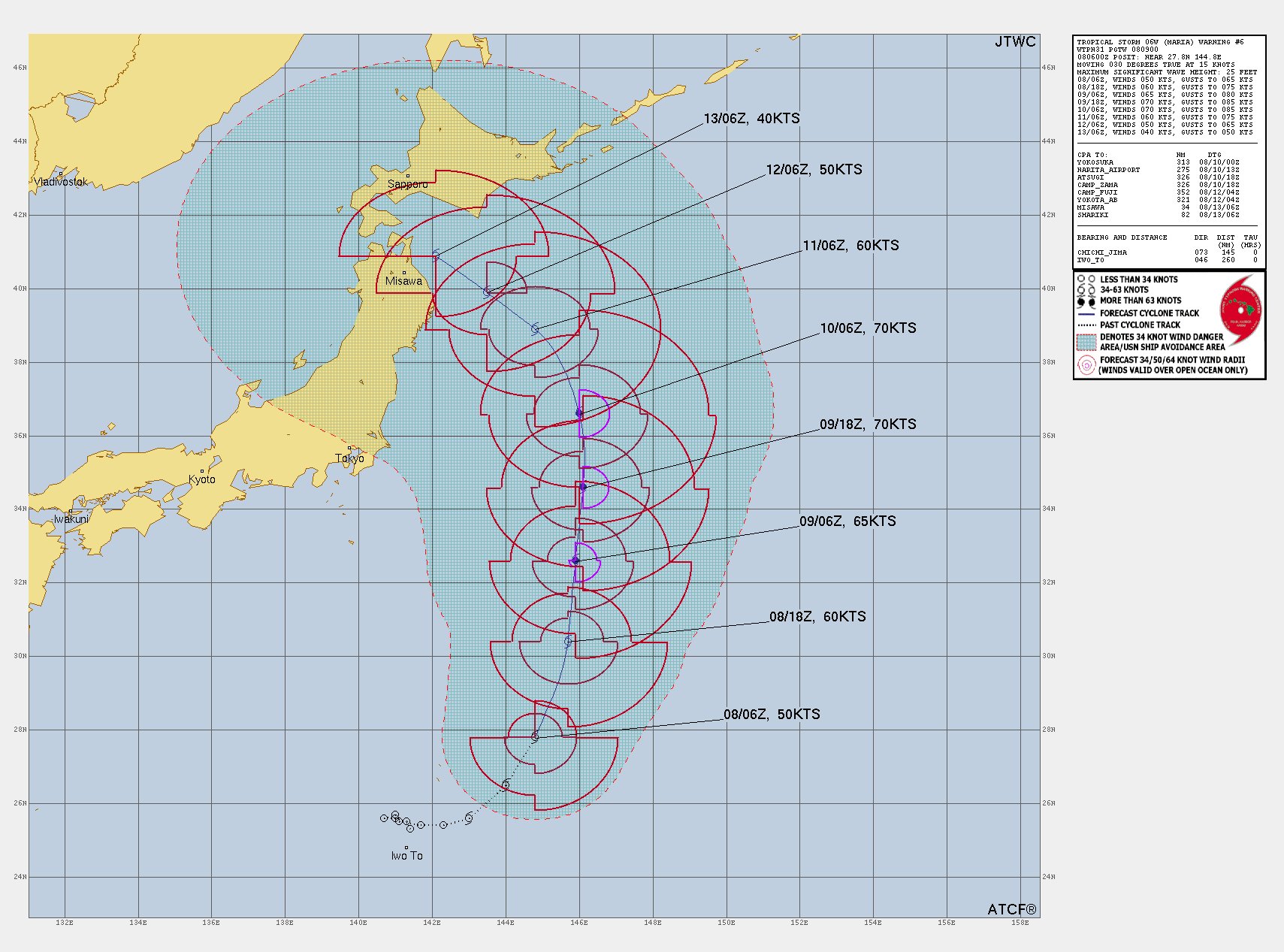
TC Warning Graphic
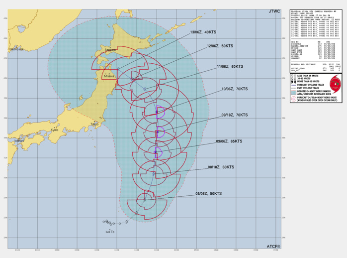
FORECAST REASONING. SIGNIFICANT FORECAST CHANGES: THERE ARE NO SIGNIFICANT CHANGES TO THE FORECAST FROM THE PREVIOUS WARNING. FORECAST DISCUSSION: TS 06W IS FORECAST TO CONTINUE TRACKING NORTH-NORTHEASTWARD ALONG THE WESTERN SIDE OF THE STR FOR THE NEXT 24 HOURS, BEFORE IT TURNS DUE NORTH AS THE RIDGE PATTERN REORIENTS SLIGHTLY. AN APPROACHING MID-LATITUDE TROUGH, MOVING IN RAPIDLY FROM THE WEST, WILL BREAK DOWN THE RIDGE PATTERN TO THE NORTH AND ALLOW TS 09W TO MAINTAIN A FAIR AMOUNT OF SPEED HEADING NORTHWARD THROUGH TAU 48. HOWEVER, THE TROUGH IS EXPECTED TO START TO FILL AS A ASSOCIATED JET MAX MOVES DOWNSTREAM. THIS WILL CREATE A COL-REGION DUE NORTH OF TS 09W, AND A GENERAL WEAKENING OF THE STEERING PATTERN, ALLOWING THE SYSTEM TO BEGIN SLOWING DOWN AFTER ABOUT TAU 60. THE FILLING TROUGH WILL NOT BE STRONG ENOUGH TO SEDUCE TS 09W POLEWARD BUT THE POST-TROUGH DEEP-LAYER RIDGE WHICH IS EXPECTED TO DEVELOP IN THE SEA OF JAPAN (SOJ) WILL BE. AS THE SOJ RIDGE SLIDES EASTWARD, IT IS EXPECTED TO BUILD ACROSS HOKKAIDO AND CONNECT WITH A LARGE STR POSITIONED NEAR 40N 170E. THIS WILL HAVE THE EFFECT OF BOTH SLOWING TS 09W AND TURNING IT ONTO A MORE WEST-NORTHWESTWARD TRACK AFTER TAU 72. SIGNIFICANT UNCERTAINTY EXISTS IN THE POTENTIAL TRACK OF TS 06W AS GLOBAL MODELS ARE SPLIT BETWEEN A DUE WEST TRACK AND A VERY FAST NORTHEASTWARD TRACK. IN TERMS OF INTENSITY, THE ENVIRONMENT IS OVERALL FAVORABLE FOR INTENSIFICATION, THOUGH THE PROBABILITY OF RAPID INTENSIFICATION HAS LOWERED SINCE THE PREVIOUS RUN. THERE REMAINS THE ISSUE OF THE DRY AIR TO THE WEST AND VORTEX CONSOLIDATION, WHICH IS STILL OCCURRING. THE FORECAST CALLS FOR STEADY, BUT NOT RAPID, INTENSIFICATION TO A PEAK OF 70 KNOTS BY TAU 36, FOLLOWED BY STEADY WEAKENING AS THE SYSTEM MOVES OVER COOLER WATERS, UPPER-LEVEL FLOW BECOMES CONVERGENT OR WEAK AND DRY AIR MOVES IN TO ENCIRCLE THE CORE.
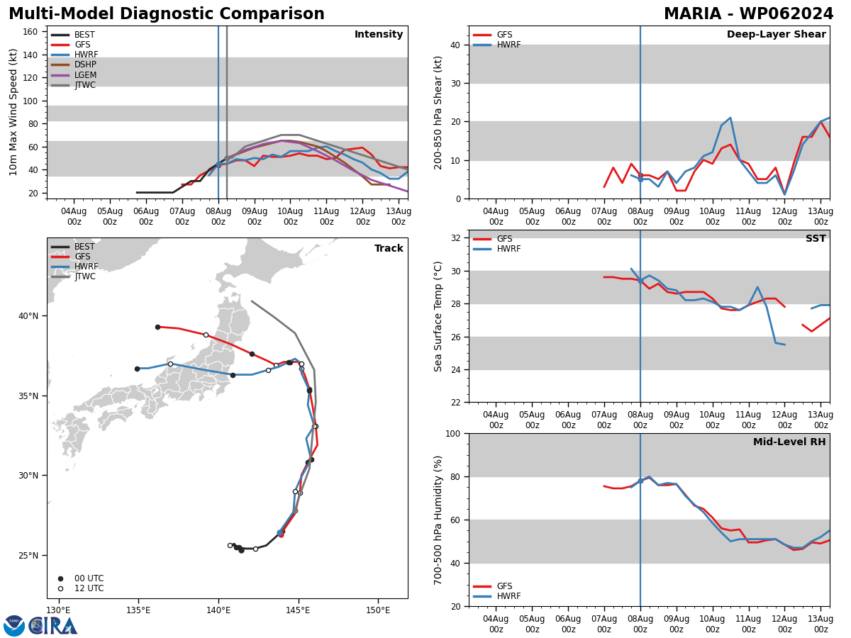
Model Diagnostic Plot

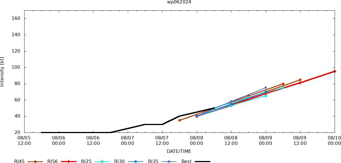
MODEL DISCUSSION: TRACK DETERMINISTIC AND ENSEMBLE TRACK GUIDANCE DEPICTS A BIFURCATION SCENARIO, WITH AN 1150NM SPREAD BETWEEN THE OUTLIERS AT TAU 120. THE WESTERN GROUPING OF MODELS (GFS, GEFS, ECMWF ENSEMBLE MEAN, AND THE ECMWF DETERMINISTIC) TURN THE SYSTEM WEST OR NORTHWEST AFTER TAU 60, AND TRACK IT INTO JAPAN. WITHIN THIS GROUP, THE GFS AND GEFS ARE FURTHEST SOUTH NEAR SENDAI, WHILE THE ECMWF IS THE FURTHEST NORTH, TAKING THE TRACK INTO HOKKAIDO BY TAU 120. THE EASTERN GROUP (NAVGEM, UKMET, GALWEM AND THE UKMET ENSEMBLE) MEANWHILE TAKES THE SYSTEM RAPIDLY NORTHEASTWARD AFTER TAU 60, IN A CLASSIC RECURVE SCENARIO. THE KEY FACTOR WILL BE THE STRENGTH OF THE MID-LATITUDE TROUGH AND THE SPEED AT WHICH THE POST-TROUGH RIDGING BUILDS IN ACROSS HOKKAIDO. THE ECMWF HAS SHIFTED SIGNIFICANTLY IN THIS REGARD SINCE THE PREVIOUS FULL RUN, HAVING SHIFTED FROM A NORTHEASTWARD TRACK TO A NORTHWESTWARD TRACK. ADDITIONALLY, THE GFS GROUPING HAS SHIFTED NORTHWARD FROM A TRACK SOUTH OF TOKYO TO NOW CLOSER TO SENDAI. THE COMBINATION LENDS INCREASING CONFIDENCE TO THE WESTERN TRACK SCENARIO, THOUGH CONFIDENCE IS STILL LOW AFTER TAU 72 DUE TO THE LARGE DISAGREEMENT IN THE OVERALL SCENARIO. INTENSITY GUIDANCE ALSO SHOWS A WIDE SPREAD IN POSSIBLE SOLUTIONS. THE RAPID INTENSIFICATION (RI) AIDS CONTINUE TO BE TRIGGERED, SHOWING A PEAK BETWEEN 75 AND 95 KNOTS. BUT THE REMAINDER OF THE CONSENSUS MEMBERS, INCLUDING ALL OF THE MESOSCALE MODELS, SHOW A MUCH WEAKER SYSTEM, PEAKING OUT AROUND 60 KNOTS. THE JTWC FORECAST CLOSELY FOLLOWS THE CONSENSUS MEAN AND SHIPS GUIDANCE IN TERMS OF THE SHAPE OF THE TREND, AND ROUGHLY 5 KNOTS HIGHER THAN THE CONSENSUS MEAN THROUGH THE DURATION OF THE FORECAST PERIOD. SIGNIFICANT DEVIATIONS REMAIN POSSIBLE DUE TO THE COMPACT NATURE OF THE SYSTEM, LEADING TO LOW CONFIDENCE IN THE TRACK FORECAST.
Rapid Intensification Guidance
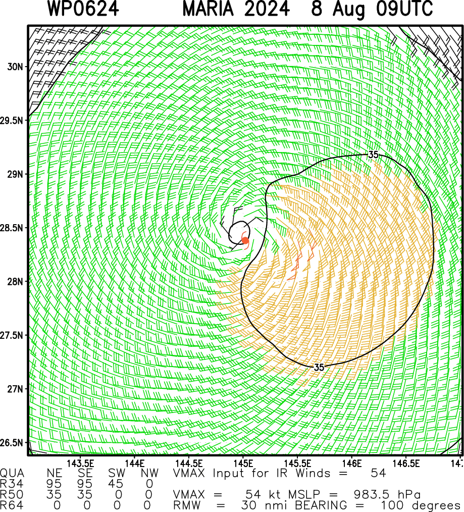
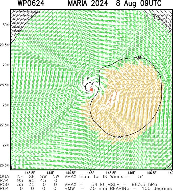
Multiplatform Satellite Surface Wind Analysis (Experimental)
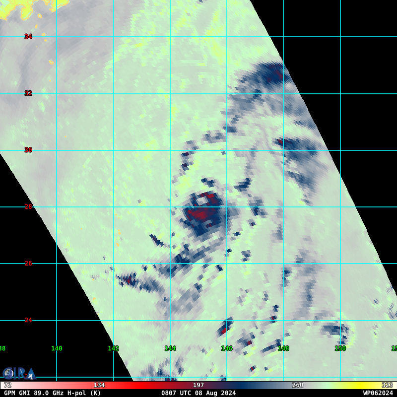
85 – 92 GHz Brightness Temperature
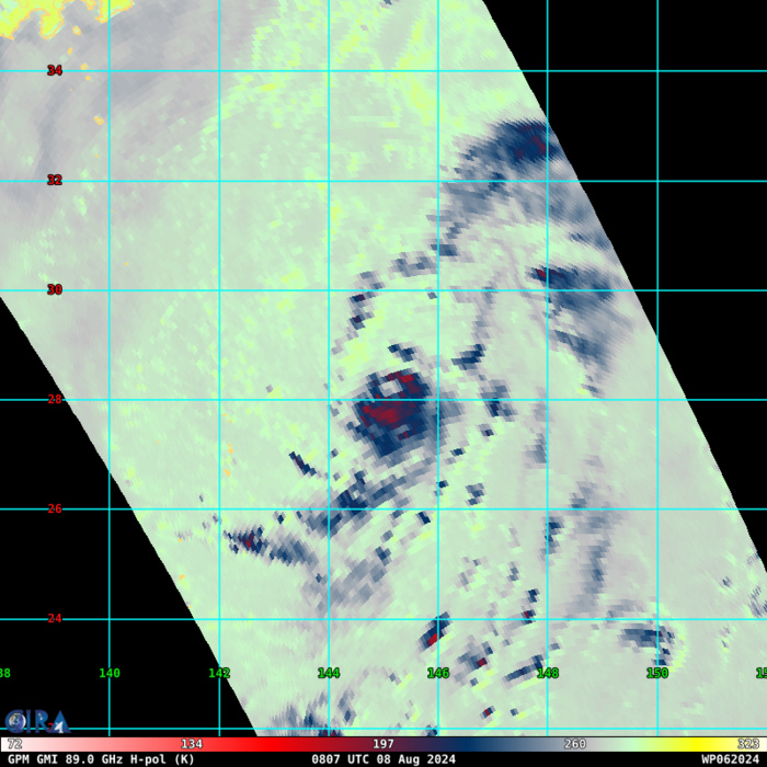
SSMIS 91GHZ IMAGE SHOWS A SMALL INNER CORE, WITH DEEP CONVECTION ACROSS THE SOUTHERN SIDE OF THE VORTEX AND A LOW EMISSIVITY REGION SUGGESTING A NASCENT MICROWAVE EYE.
UPDATED SATELLITE FIX AT 080830UTC
TPPN11 PGTW 080849
A. TROPICAL STORM 06W (MARIA)
B. 08/0830Z
C. 28.21N
D. 145.14E
E. FIVE/GK2A
F. T3.0/3.0/D1.5/24HRS STT: S0.0/03HRS
G. IR/EIR/VIS/MSI
H. REMARKS: 40A/PBO SBC/ANMTN. CNVCTN WRAPS .7 ON LOG10 SPIRAL
YIELDING A DT OF 3.0. MET YIELDS 2.5. PT YIELDS 3.0. DBO DT.
I. ADDITIONAL POSITIONS: NONE
EL-NAZLY
A. TROPICAL STORM 06W (MARIA)
B. 08/0830Z
C. 28.21N
D. 145.14E
E. FIVE/GK2A
F. T3.0/3.0/D1.5/24HRS STT: S0.0/03HRS
G. IR/EIR/VIS/MSI
H. REMARKS: 40A/PBO SBC/ANMTN. CNVCTN WRAPS .7 ON LOG10 SPIRAL
YIELDING A DT OF 3.0. MET YIELDS 2.5. PT YIELDS 3.0. DBO DT.
I. ADDITIONAL POSITIONS: NONE
EL-NAZLY
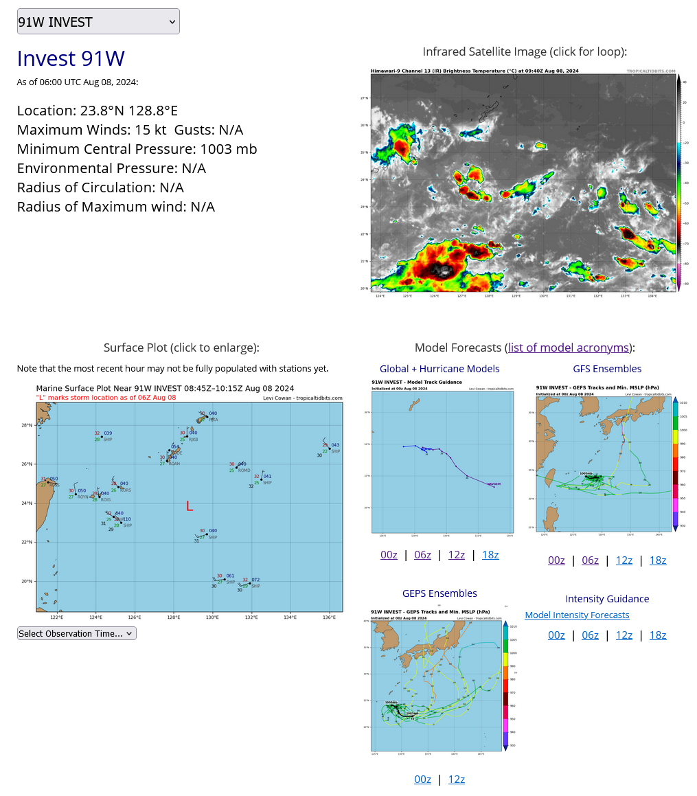
WESTERN NORTH PACIFIC: INVEST 91W. ESTIMATED LOCATION AND INTENSITY AT 0806UTC.
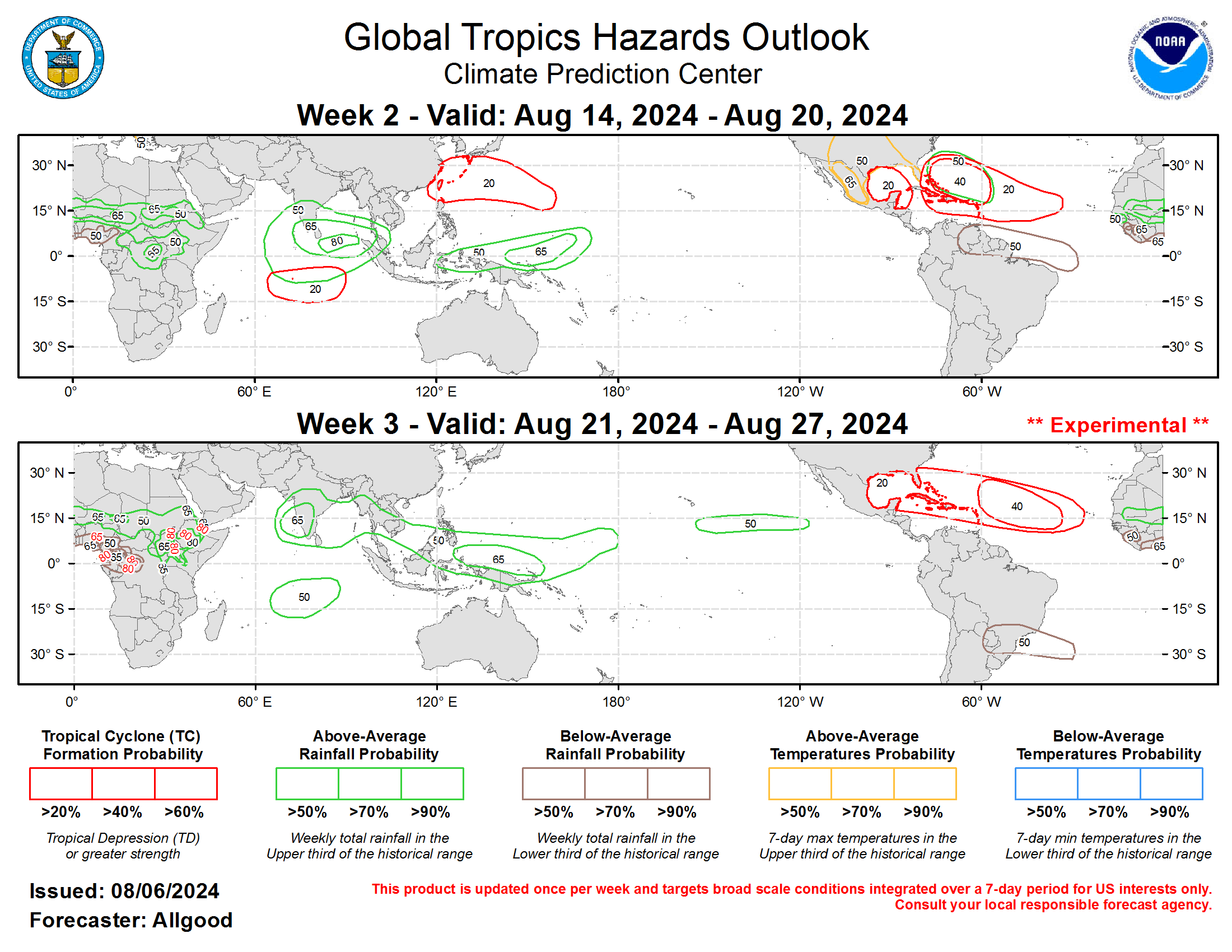
Last Updated - 08/08/24 3 WEEK TROPICAL CYCLONE FORMATION PROBABILITY
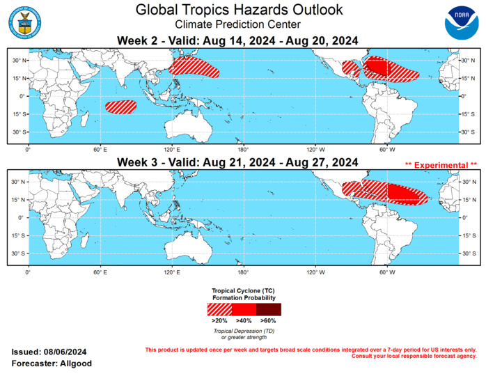
GTH Outlook Discussion Last Updated - 08/06/24 Valid - 08/14/24 - 08/27/24 Following a period of disorganization during much of July, the Madden-Julian Oscillation (MJO) began to exhibit increased organization during early August. The RMM-based MJO index shifted rapidly from a signal favoring the Maritime Continent to the East Pacific, likely due to influence from an unusually strong convectively coupled Kelvin wave (CCKW). This Kelvin wave completely reversed the low frequency pattern of enhanced trades across the eastern Pacific and provided a window of favorability for tropical cyclogenesis over the East Pacific basin, which has been unusually quiet since the start of the season. The upper-level velocity potential anomaly field, which is the clearest indicator of tropical intraseasonal activity, currently shows a wave-2 pattern, with enhanced divergence over the East Pacific and Western Hemisphere associated with the strong CCKW, and another area of enhanced divergence over the Indian Ocean, due to interactions between an earlier Kelvin wave and equatorial Rossby wave activity. Dynamical model MJO index forecasts show good agreement that after the CCKW crosses the Atlantic during Week-1, interactions with Rossby wave activity over the Indian Ocean will result in a broader, more canonical MJO propagation across the Indian Ocean during Weeks 2-3. Therefore, the MJO is favored to play a substantial role in the evolution of the global tropical convective pattern during the outlook period, helping to promote a renewed trade wind surge across the central Pacific, and promoting a period of high favorability for Atlantic tropical cyclone activity. Hurricane Debby formed from a long-lived tropical wave over the eastern Gulf of Mexico on 4 August, strengthening to Category-1 intensity on the Saffir-Simpson scale just prior to landfall in the Florida Big Bend region. Weakening to tropical storm intensity, Debby is currently emerging over the Atlantic near Georgia and South Carolina, and will progress slowly across the eastern seaboard over the next few days, resulting in widespread and locally catastrophic rainfall accumulations. Three new tropical storms formed over the East Pacific during the brief window of favorability granted by the passing CCKW, one of which, Carlotta, became the first hurricane of the East Pacific season. The tropical cyclones are currently spaced rather close together, and are experiencing "Fujuwhara" type interactions resulting in counter-clockwise path motions and general weakening. No new tropical cyclones formed over the West Pacific basin, continuing a rather quiet start to the year. During Weeks 2-3, numerous factors appear to be coming together to support a period of high favorability for tropical cyclogenesis across the Atlantic basin, with a potential for several tropical cyclones to form during the period. During late Week-1 or early Week-2, a tropical wave crossing the Caribbean is forecast to emerge over the Gulf of Mexico, where multiple dynamical model ensemble members from the GFS and ECMWF depict formation. Later in Week-2, the passage of the CCKW, increased divergence aloft over Africa due to the strengthening MJO signal, and much above-normal sea surface temperatures (SSTs) will provide an environment highly favorable for development over the Atlantic Main Development Region (MDR). An enhanced and northerly displaced African monsoon also favors the emergence of numerous moisture laden tropical waves during the period. Therefore, a broad area of favorability is indicated on the outlook for much of the Atlantic basin during both Weeks 2 and 3. Forecast confidence higher than 60-percent for development is only precluded by differences between the GEFS and ECMWF regarding where formations would occur, with the ECMWF favoring a region near the northeast of the Lesser Antilles, and the GEFS favoring a region closer to the Bahamas. During Week-3, the area of greatest favorability is anticipated to shift eastward across the basin, as the MJO progresses towards the eastern Indian Ocean and the Maritime Continent. While confidence is high for a period of high activity across the Atlantic basin, possibly hyperactivity given the warm SSTs, it should be noted that track forecasts of individual cyclones are too unpredictable to forecast at this point, as they are dependent on the exact location of formation, intensity, and less predictable midlatitude influences. Dynamical model ensemble members depict a wide range of scenarios. Interests across the eastern US, the Gulf of Mexico, and the Caribbean should refer to the National Hurricane Center for official track forecasts once any system has developed. Elsewhere, constructive interference between the CCKW, Rossby wave activity, and the developing MJO may produce a strong westerly wind burst (WWB) across the central Indian Ocean. This WWB may provide a window of opportunity for a rare off-season south-central Indian Ocean tropical cyclone. While not unprecedented, such formations during the Arboreal winter are extremely rare. A return to a quieter pattern is favored for the East Pacific, though some dynamical models depict a potential for formations during Week-3, possibly tied to Rossby wave activity. Over the West Pacific, dynamical models show a fairly diffuse pattern of potential formation regions, with some clustering on the north side of the basin, north of the Philippines, south of Japan, and extending eastward towards Guam. The pattern becomes even more diffuse during Week-3, precluding a hazard on the outlook at this time.

Forecasts for above- and below-normal precipitation are based on historical composites of MJO events crossing the Indian Ocean, ENSO cold phase composites, a potential for tropical cyclone activity during the period, and a skill weighted consensus of the CFS, GEFS, ECMWF, and ECCC model systems. Enhanced convection over the equatorial Indian Ocean during MJO events tends to shift poleward into the South Asian Monsoon as the MJO progresses to the Maritime Continent, with enhanced convection increasing across the equatorial Maritime Continent. Forecasts over Africa were coordinated with the International Desk at the Climate Prediction Center, and Week-2 temperature forecasts over the US were coordinated with the CPC Days 8-14 outlook.
