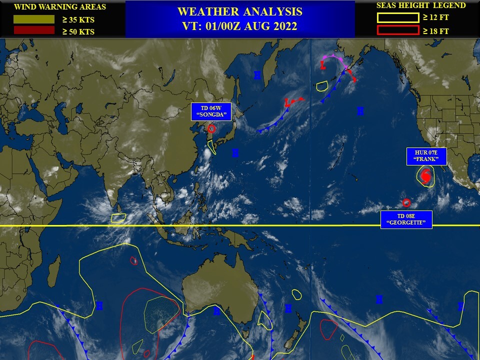
CLICK ON THE IMAGERIES BELOW TO GET THEM ENLARGED
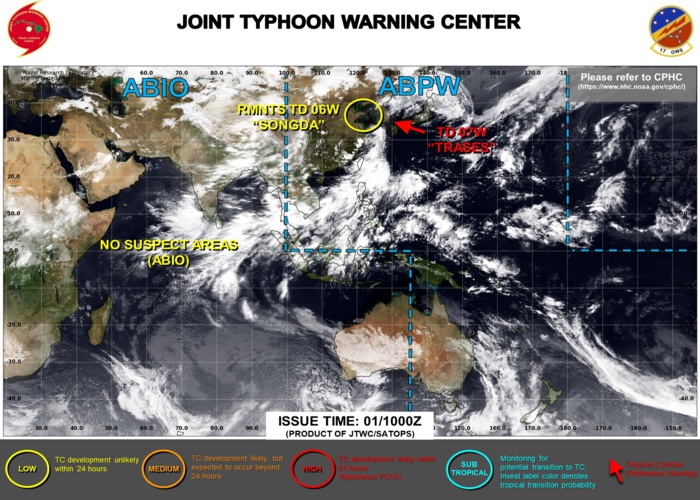
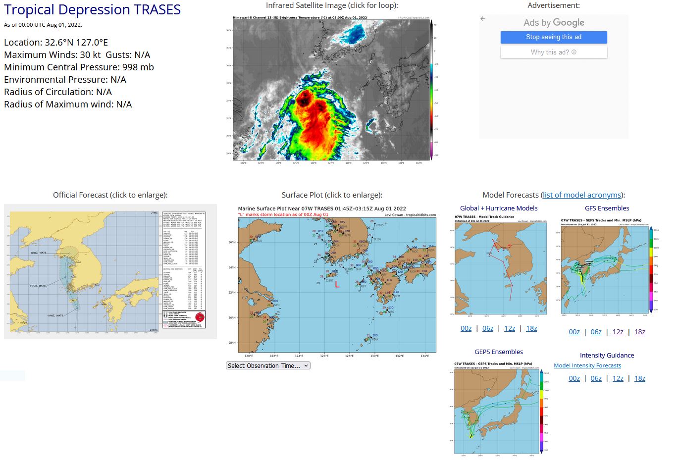
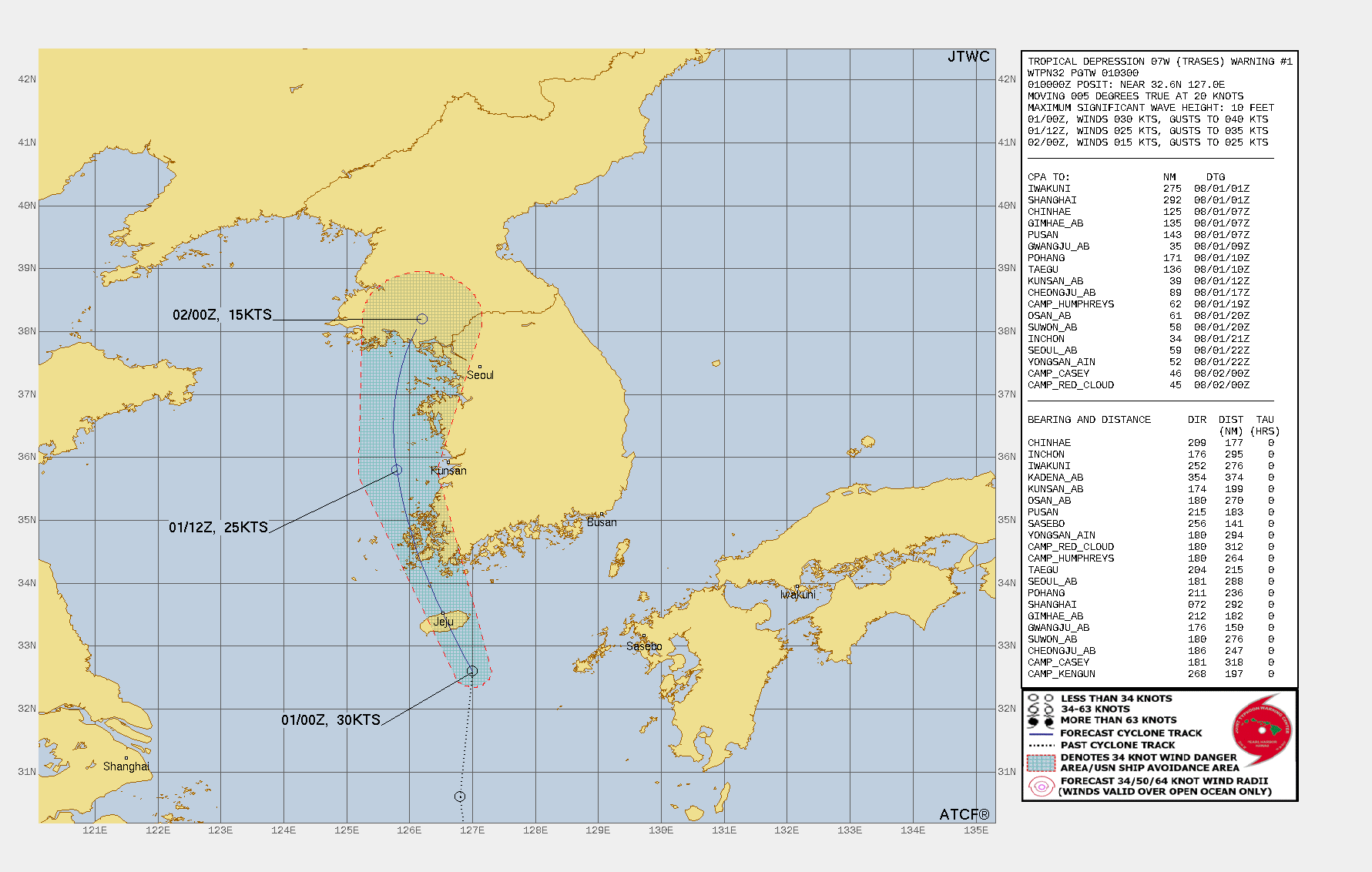
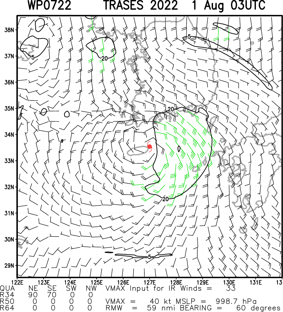
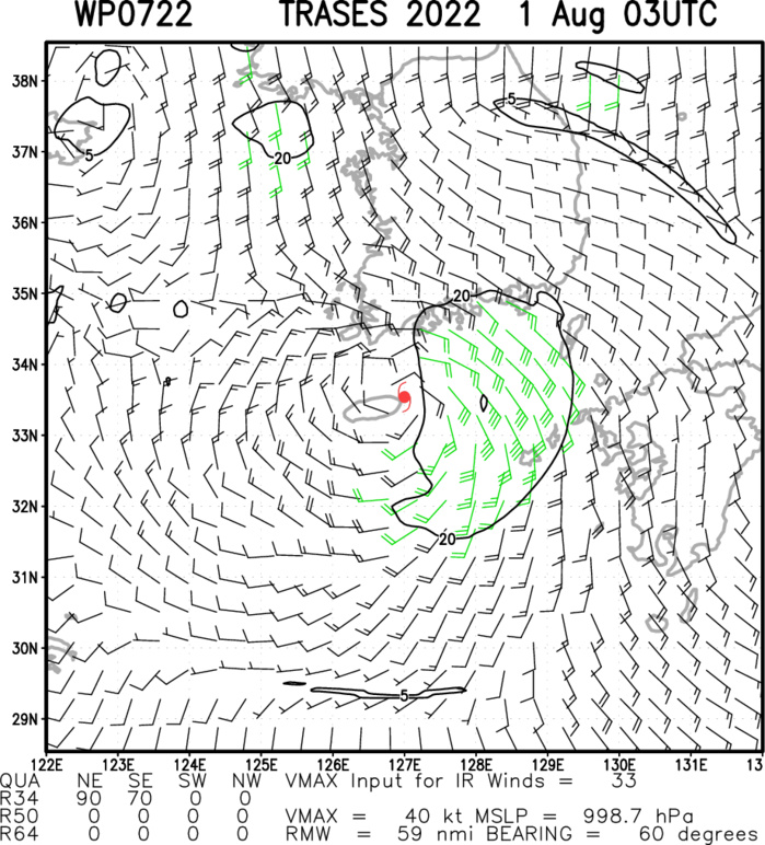
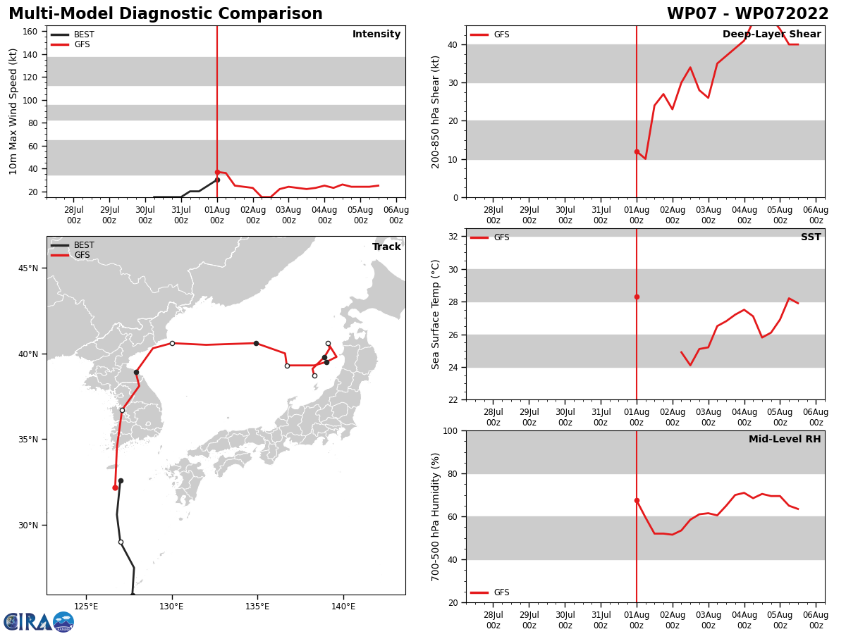
WESTERN NORTH PACIFIC: TD 07W(TRASES). WARNING 1 ISSUED AT 01/03UTC.
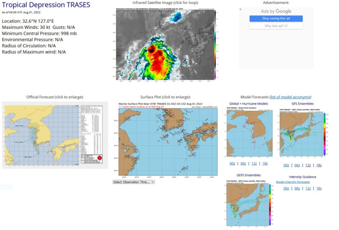
SATELLITE ANALYSIS, INITIAL POSITION AND INTENSITY DISCUSSION: ANIMATED MULTISPECTRAL SATELLITE IMAGERY (MSI) DEPICTS A FULLY-EXPOSED, WELL-DEFINED LOW-LEVEL CIRCULATION WITH DEEP CONVECTION DISPLACED ABOUT 45-50NM TO THE SOUTH. MSI ALSO INDICATES THE TWO SYSTEMS ARE BEGINNING TO INTERACT WITH THE OUTER LOW-LEVEL BANDING (NORTHWEST OF CHEJU-DO) BEGINNING TO CONVERGE AND FRAGMENT. THE TRACK MOTION OF BOTH SYSTEMS IS ALSO ALTERED WITH TD 06W NOW QUASI-STATIONARY WHILE TD 07W IS ACCELERATING NORTH-NORTHWESTWARD ALONG THE SOUTHEASTERN PERIPHERY OF TD 06W. ENVIRONMENTAL CONDITIONS ARE MARGINAL WITH CONVERGENT FLOW NORTH OF 07W LIMITING POLEWARD OUTFLOW AND INTERACTION WITH LAND OFFSET SOMEWHAT BY MODERATE EQUATORWARD OUTFLOW, WHICH IS SUSTAINING SOME DISORGANIZED DEEP CONVECTION OVER THE SOUTHERN SEMICIRCLE. THE INITIAL POSITION IS PLACED WITH HIGH CONFIDENCE BASED ON MSI. THE INITIAL INTENSITY OF 30 KTS IS ASSESSED WITH HIGH CONFIDENCE BASED ON WIND DATA FROM BUOY 22187 (33.1N 127.0E), WHICH REPORTED 25-33 KNOTS AS THE CENTER PASSED ABOUT 10-15 NM WEST FROM 010000Z TO 010100Z. ADDITIONALLY, RECENT ASCAT INDICATED 20 KNOT WINDS OVER THE WESTERN SEMICIRCLE AND A LARGE SWATH OF 30-35 KNOT WINDS OVER THE EASTERN SEMICIRCLE.
WP, 07, 2022073006,226N, 1280E, 15
WP, 07, 2022073012,236N, 1280E, 15
WP, 07, 2022073018,248N, 1279E, 15
WP, 07, 2022073100,259N, 1277E, 15
WP, 07, 2022073106,275N, 1278E, 20
WP, 07, 2022073112,290N, 1270E, 20
WP, 07, 2022073118,306N, 1268E, 25
WP, 07, 2022080100,326N, 1270E, 30
WP, 07, 2022080106,343N, 1265E, 25
WP, 07, 2022073012,236N, 1280E, 15
WP, 07, 2022073018,248N, 1279E, 15
WP, 07, 2022073100,259N, 1277E, 15
WP, 07, 2022073106,275N, 1278E, 20
WP, 07, 2022073112,290N, 1270E, 20
WP, 07, 2022073118,306N, 1268E, 25
WP, 07, 2022080100,326N, 1270E, 30
WP, 07, 2022080106,343N, 1265E, 25
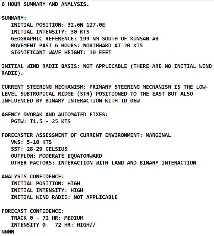
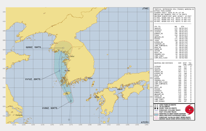
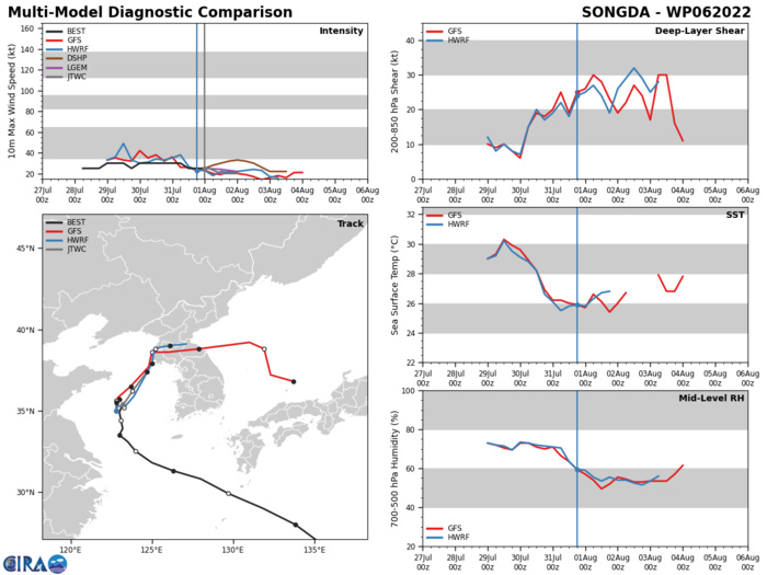
FORECAST REASONING. SIGNIFICANT FORECAST CHANGES: THIS INITIAL PROGNOSTIC REASONING MESSAGE ESTABLISHES THE FORECAST PHILOSOPHY. FORECAST DISCUSSION: TD 07W IS UNDERGOING BINARY INTERACTION WITH TD 06W, WHICH IS LOCATED ABOUT 190NM WEST-NORTHWEST OF TD 07W'S 010200Z POSITION. THE TWO SYSTEMS ARE EQUAL IN INTENSITY AND ARE FAIRLY COMPACT SYSTEMS, HOWEVER, TD 06W HAS MAINTAINED A STRONGER, MORE DOMINANT PRESSURE FIELD. THEREFORE, TD 07W IS FORECAST TO TRACK ALONG THE SOUTHEASTERN AND EASTERN PERIPHERY OF TD 06W THROUGH TAU 12 THEN TURN POLEWARD AS IT GETS ABSORBED AND DISSIPATES WITHIN THE EASTERN PERIPHERY OF TD 06W. INTERACTION WITH LAND WILL ALSO SERVE TO SIGNIFICANTLY WEAKEN THE SYSTEM AS IT TRACKS ACROSS CHEJU-DO AND SOUTHWEST SOUTH KOREA. DUE TO THESE FACTAORS, TD 07W IS FORECAST TO WEAKEN QUICKLY WITH DISSIPATION BETWEEN TAU 12 AND TAU 24.
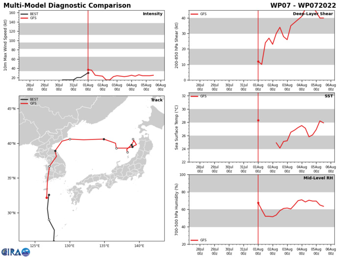
MODEL DISCUSSION: DESPITE THE COMPLEX INTERACTION WITH TD 06W, THE NUMERICAL GUIDANCE IS IN FAIR AGREEMENT INDICATING A NORTH-NORTHWESTWARD TO NORTHWARD TRACK THROUGH TAU 24. THE 311800Z ECMWF ENSEMBLE (EPS) ALSO INDICATES A SIMILAR SPREAD OF SOLUTIONS, THEREFORE, THERE IS MEDIUM OVERALL CONFIDENCE IN THE JTWC TRACK FORECAST. THE INTENSITY FORECAST IS FAIRLY STRAIGHT-FORWARD WITH PEAK INTENSITY LIMITED, THEREFORE, THERE IS HIGH CONFIDENCE IN THE JTWC INTENSITY FORECAST.
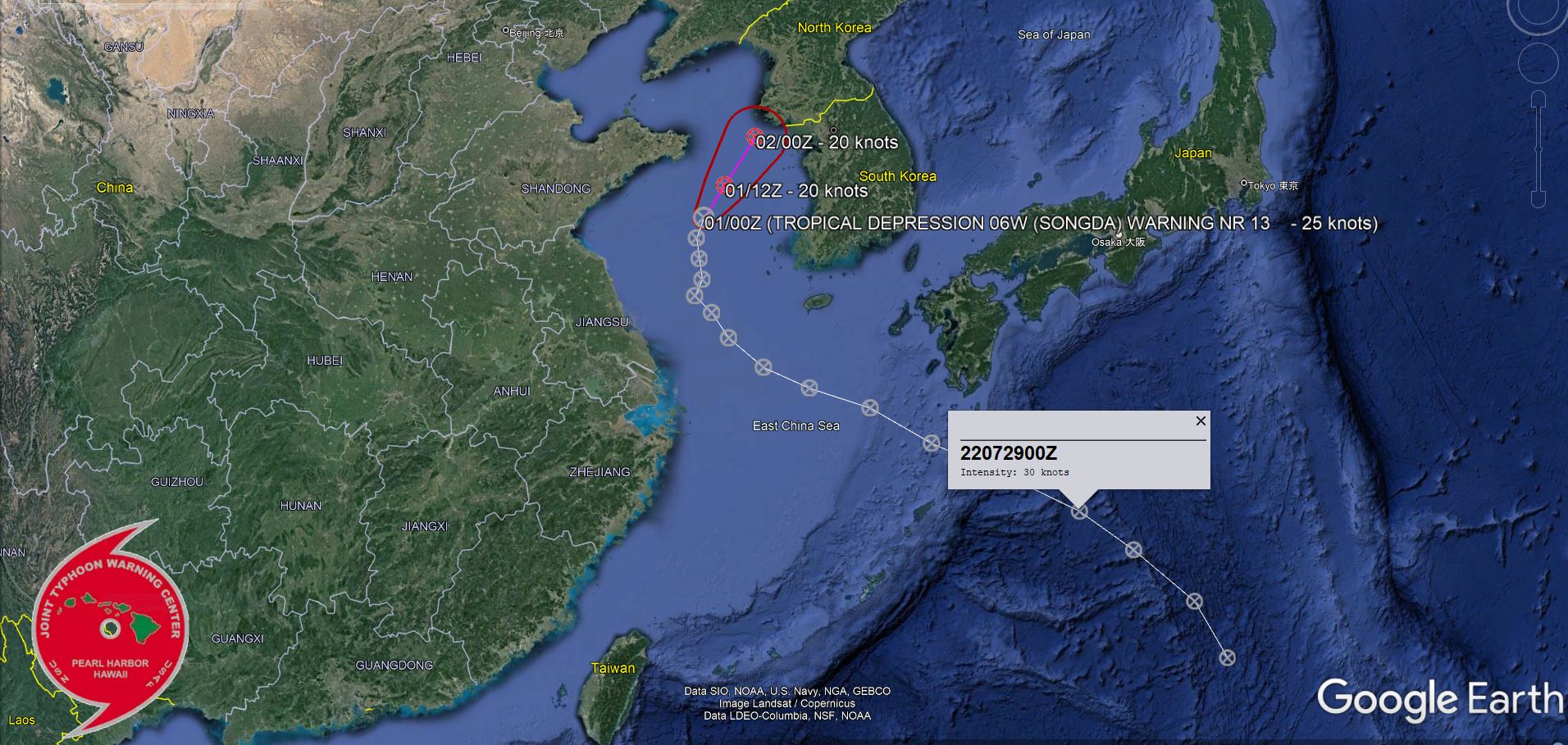
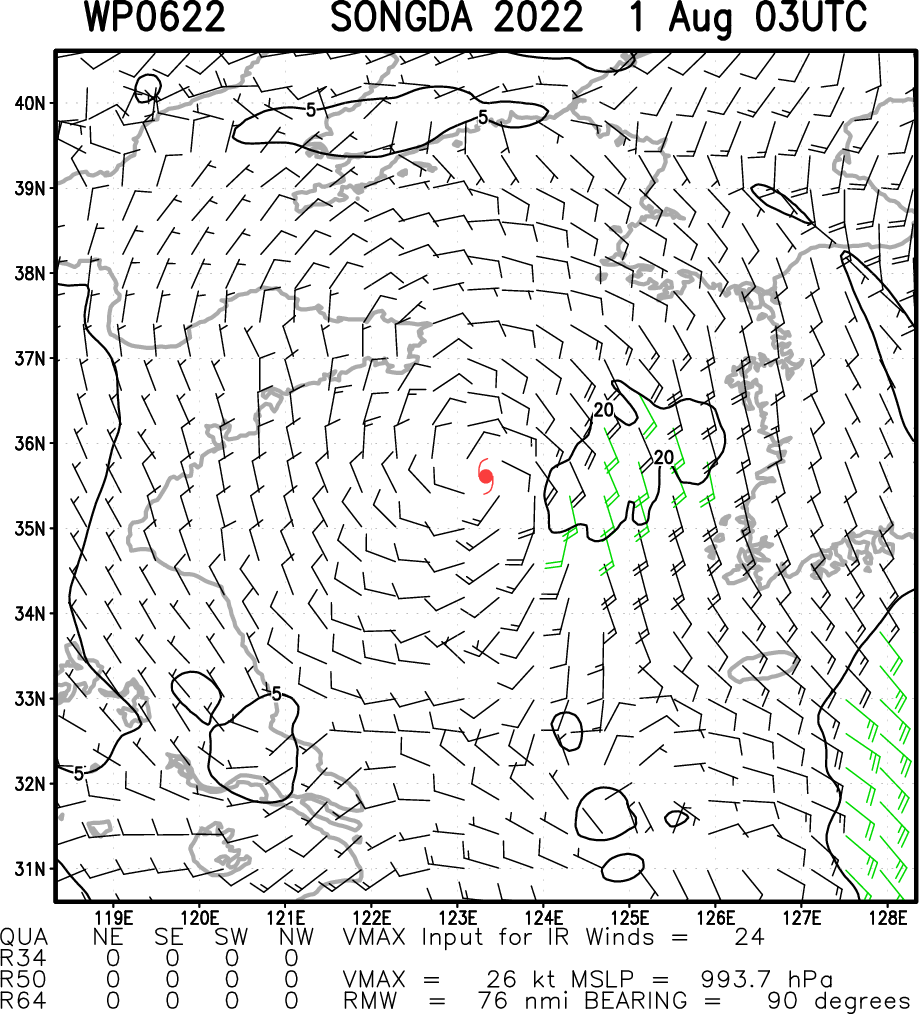
WESTERN NORTH PACIFIC: TD 06W(SONGDA).WARNING 13/FINAL ISSUED AT 01/03UTC.
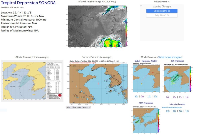
REMARKS: 010300Z POSITION NEAR 35.6N 123.4E. 01AUG22. TROPICAL DEPRESSION (TD) 06W (SONGDA), LOCATED APPROXIMATELY 168 NM WEST OF KUNSAN AB, HAS TRACKED NORTH-NORTHEASTWARD AT 05 KNOTS OVER THE PAST SIX HOURS. ANIMATED MULTISPECTRAL SATELLITE IMAGERY DEPICTS A FULLY-EXPOSED, DEFINED LOW-LEVEL CIRCULATION (LLC) WITH NO ASSOCIATED DEEP CONVECTION. THEREFORE THERE IS HIGH CONFIDENCE IN THE INITIAL POSITION. A 312306Z SSMIS 91GHZ COLOR COMPOSITE MICROWAVE IMAGE SHOWS SHALLOW BANDING WRAPPING AROUND A BROAD, WEAKENING CENTER. THE INITIAL INTENSITY IS ASSESSED AT 25 KNOTS WITH MEDIUM CONFIDENCE. TD 06W IS LOCATED UNDER STRONG SOUTHWESTERLY FLOW ALOFT ASSOCIATED WITH AN UPPER-LEVEL TROUGH POSITIONED OVER THE GULF OF POHAI. THIS UNFAVORABLE ENVIRONMENT IS DOMINATED BY CONVERGENCE ALOFT, MODERATE TO HIGH VERTICAL WIND SHEAR AND SIGNIFICANT DRY AIR. THESE CONDITIONS WILL PERSIST THROUGH THE FORECAST PERIOD WITH STEADY WEAKENING EXPECTED AND DISSIPATION LIKELY BY TAU 12. THERE IS SOME UNCERTAINTY IN THE EXACT FORECAST TRACK WITH TD 07W LOCATED ABOUT 250NM SOUTHEAST OF TD 06W'S INITIAL POSITION. THUS BINARY INTERACTION COULD OCCUR AS TD 07W GETS ABSORBED IN THE SOUTHEASTERN PERIPHERY OF TD 06W. THIS IS THE FINAL WARNING ON THIS SYSTEM BY THE JOINT TYPHOON WRNCEN PEARL HARBOR HI. THE SYSTEM WILL BE CLOSELY MONITORED FOR SIGNS OF REGENERATION. MAXIMUM SIGNIFICANT WAVE HEIGHT AT 010000Z IS 10 FEET.
WP, 06, 2022072806,238N, 1379E, 25,1004
WP, 06, 2022072812,254N, 1370E, 25,1004
WP, 06, 2022072818,269N, 1353E, 25,1000
WP, 06, 2022072900,280N, 1338E, 30, 998
WP, 06, 2022072906,290N, 1318E, 30, 998
WP, 06, 2022072912,299N, 1297E, 30, 997
WP, 06, 2022072918,308N, 1280E, 25, 999
WP, 06, 2022073000,313N, 1263E, 30, 998
WP, 06, 2022073006,318N, 1250E, 30, 997
WP, 06, 2022073012,325N, 1240E, 30, 998
WP, 06, 2022073018,331N, 1235E, 30, 998
WP, 06, 2022073100,335N, 1230E, 30, 999
WP, 06, 2022073106,339N, 1232E, 30, 999
WP, 06, 2022073112,344N, 1231E, 25,1000
WP, 06, 2022073118,349N, 1230E, 25,1000
WP, 06, 2022080100,354N, 1232E, 25,1000
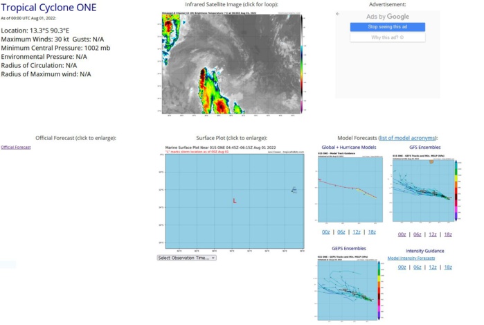
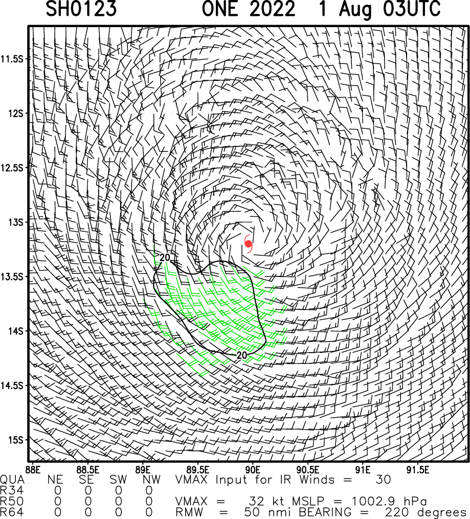
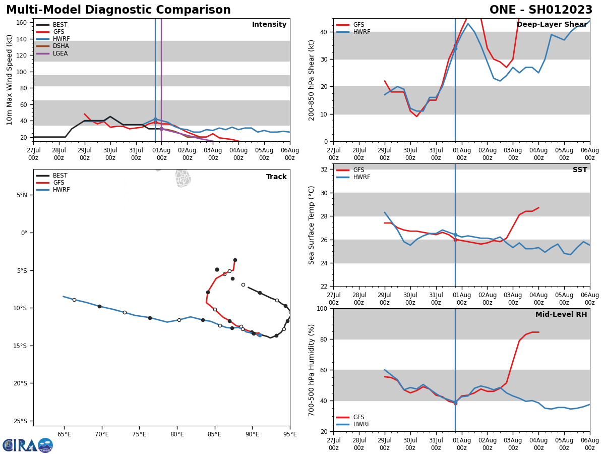
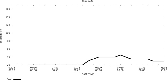
SOUTH INDIAN OCEAN: TC 01S. LOCATION AND INTENSITY ESTIMATED AT 01/00UTC. WARNING 6/FINAL ISSUED AT 31/09UTC.
SH, 01, 2022072506,49S, 853E, 15,1010
SH, 01, 2022072512,52S, 858E, 15,1007
SH, 01, 2022072518,55S, 863E, 20,1007
SH, 01, 2022072600,58S, 868E, 20,1007
SH, 01, 2022072606,61S, 874E, 20,1007
SH, 01, 2022072612,65S, 881E, 20,1007
SH, 01, 2022072618,69S, 888E, 20,1007
SH, 01, 2022072700,73S, 895E, 20,1007
SH, 01, 2022072706,80S, 910E, 20,1007
SH, 01, 2022072712,87S, 925E, 20,1003
SH, 01, 2022072718,90S, 933E, 20,1003
SH, 01, 2022072800,95S, 940E, 20,1004
SH, 01, 2022072806,97S, 944E, 20,1003
SH, 01, 2022072812,100S, 947E, 30,1001
SH, 01, 2022072818,105S, 951E, 35, 998
SH, 01, 2022072900,111S, 951E, 40, 996
SH, 01, 2022072906,117S, 947E, 40, 996
SH, 01, 2022072912,122S, 944E, 40, 995
SH, 01, 2022072918,128S, 942E, 40,1001
SH, 01, 2022073000,133S, 938E, 45, 998
SH, 01, 2022073006,137S, 932E, 40,1001
SH, 01, 2022073012,138S, 929E, 35,1002
SH, 01, 2022073018,139S, 927E, 35,1002
SH, 01, 2022073100,140S, 924E, 35,1002
SH, 01, 2022073106,138S, 920E, 35,1002
SH, 01, 2022073112,137S, 916E, 30,1003
SH, 01, 2022073118,135S, 910E, 30,1002
SH, 01, 2022080100,133S, 903E, 30,1002
SH, 01, 2022080106,131S, 895E, 30,1002
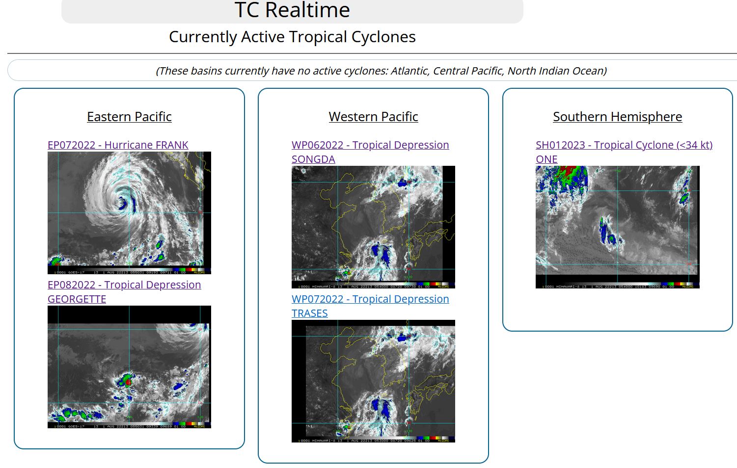
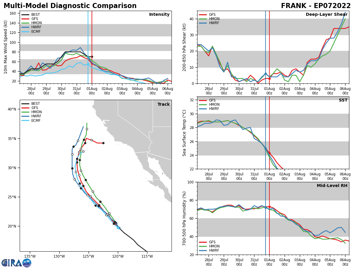
EASTERN NORTH PACIFIC: HU 07E(FRANK). ESTIMATED LOCATION AND INTENSITY AT 01/00UTC. NHC COMMENTS.
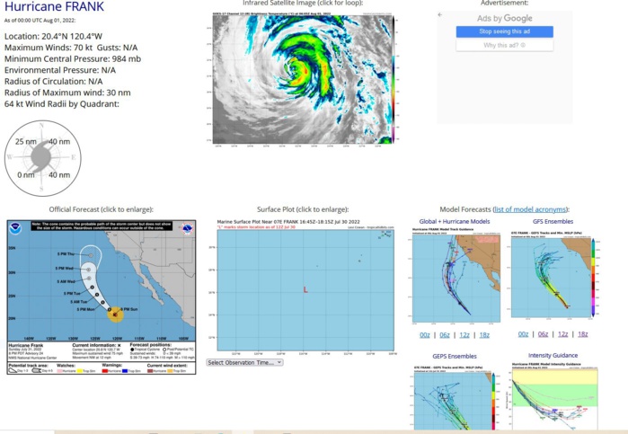
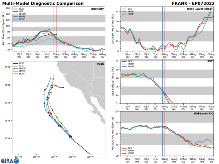
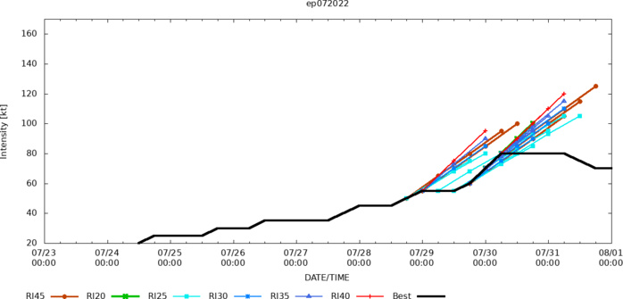
000 WTPZ42 KNHC 010233 TCDEP2 Hurricane Frank Discussion Number 24 NWS National Hurricane Center Miami FL EP072022 800 PM PDT Sun Jul 31 2022 The hurricane is continuing to weaken as it moves over colder water, and the cloud tops temperatures associated with the cyclone are gradually warming. The various objective and subjective satellite intensity estimates have nudged downward, and the initial intensity is reduced to 65 kt. The cyclone will continue to move over colder water, reaching the 21C sea surface temperature isotherm between 36-48 h. Thus, steady weakening should continue, with Frank becoming a post-tropical cyclone between 48-60 h and dissipating completely before 120 h. The new intensity forecast follows the trend of the intensity guidance and has only minor adjustments from the previous forecast. Frank is still moving northwestward or 320/10 kt, and while it sounds like a broken record there is no change to the track forecast reasoning. The cyclone should continue northwestward around the western periphery of a mid-level ridge during the next couple of days. Later in the forecast period, the steering currents should change some as cyclone should become more vertically shallow, and a slower northward motion is expected. The new forecast track is again an update of the previous track and follows the consensus models.
EP, 07, 2022073100,176N, 1173W, 80
EP, 07, 2022073106,183N, 1182W, 80
EP, 07, 2022073112,189N, 1190W, 75
EP, 07, 2022073118,197N, 1198W, 70
EP, 07, 2022080100,204N, 1204W, 70
EP, 07, 2022073106,183N, 1182W, 80
EP, 07, 2022073112,189N, 1190W, 75
EP, 07, 2022073118,197N, 1198W, 70
EP, 07, 2022080100,204N, 1204W, 70
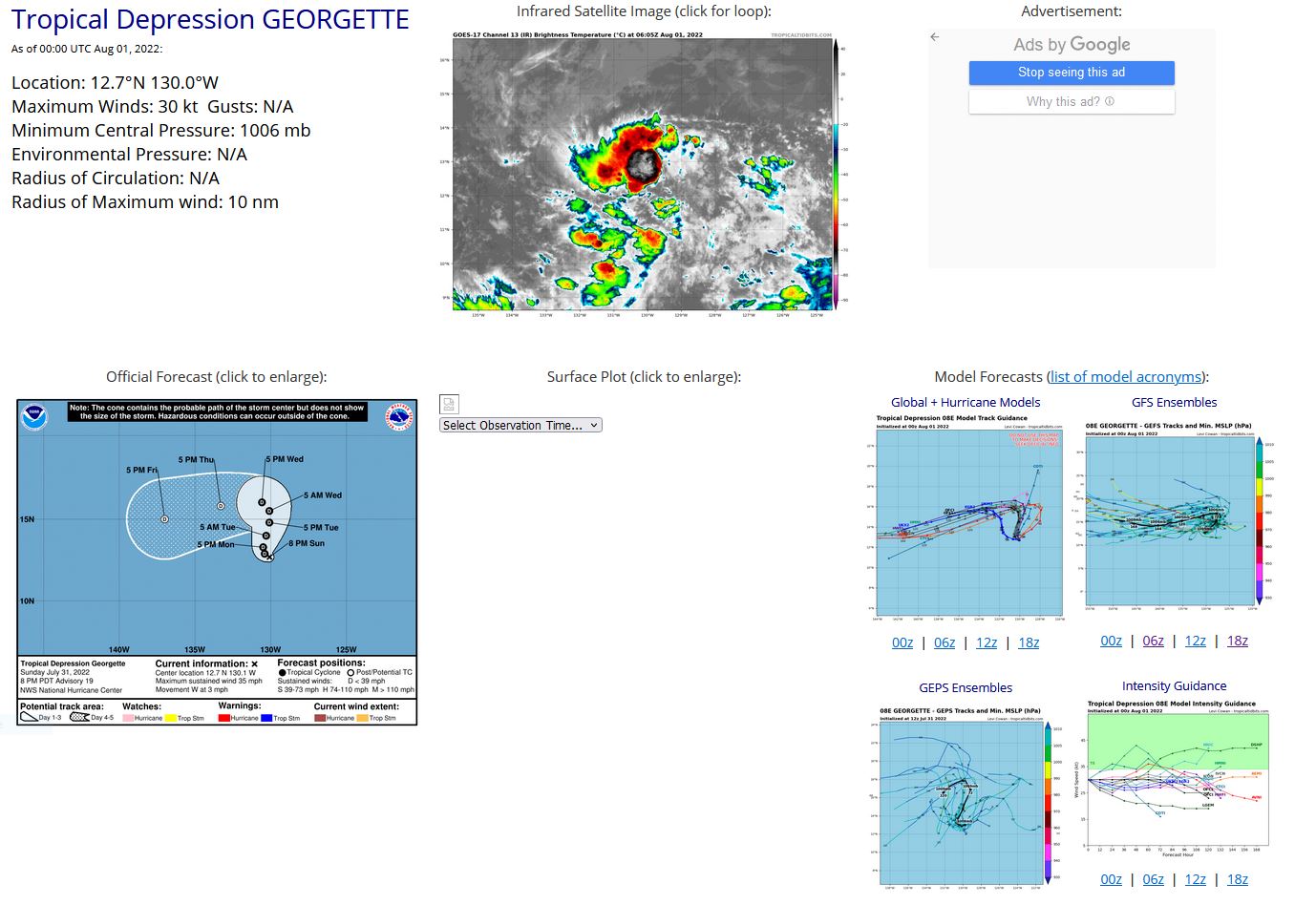
EASTERN NORTH PACIFIC: TS 08E(GEORGETTE). ESTIMATED LOCATION AND INTENSITY AT 01/00UTC. NHC COMMENTS.

110 WTPZ43 KNHC 010235 TCDEP3 Tropical Depression Georgette Discussion Number 19 NWS National Hurricane Center Miami FL EP082022 800 PM PDT Sun Jul 31 2022 Almost all deep convection has collapsed near the center of Georgette. Last-light visible imagery showed an exposed low-level circulation and satellite water vapor imagery indicates the presence of dry air near the inner core of the storm. Subjective Dvorak intensity estimates from TAFB and SAB range between 35-25 kt. The initial intensity is held at 30 kt to represent a blend of the classifications. Georgette is drifting westward at 3 kt, to the south of a weak mid-level ridge. The tropical depression is expected to turn northward at a break in the ridge, though models disagree on the timing of the turn and this has created a large spread amongst the track guidance. However, most models do show the ridge restrengthening by mid-week and steering Georgette westward to west-southward through the end of the forecast period. The official track forecast is similar to the previous advisory track prediction and closest to the model consensus aid, TVCE. Moderate-to-strong easterly vertical wind shear caused by the outflow from Frank is expected to continue over Georgette for the next couple of days. This combined with the dry mid-tropospheric relative humidities around the cyclone will likely prevent Georgette from restrengthening. The NHC intensity forecast shows Georgette maintaining tropical depression strength until day 4, when it is predicted to become a post-tropical remnant low. Though, if deep convection does not reform near the center, this could happen even sooner.
EP, 08, 2022073000,146N, 1246W, 45
EP, 08, 2022073006,143N, 1255W, 45
EP, 08, 2022073012,141N, 1264W, 45
EP, 08, 2022073018,137N, 1273W, 45
EP, 08, 2022073100,135N, 1282W, 45
EP, 08, 2022073106,134N, 1290W, 40
EP, 08, 2022073112,130N, 1294W, 35
EP, 08, 2022073118,127N, 1298W, 30
EP, 08, 2022080100,127N, 1300W, 30
EP, 08, 2022073006,143N, 1255W, 45
EP, 08, 2022073012,141N, 1264W, 45
EP, 08, 2022073018,137N, 1273W, 45
EP, 08, 2022073100,135N, 1282W, 45
EP, 08, 2022073106,134N, 1290W, 40
EP, 08, 2022073112,130N, 1294W, 35
EP, 08, 2022073118,127N, 1298W, 30
EP, 08, 2022080100,127N, 1300W, 30
