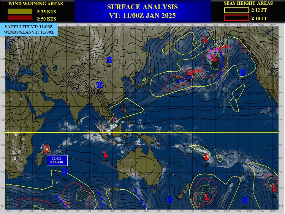
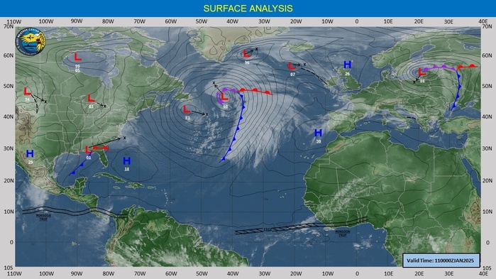
CLICK ON THE IMAGERIES BELOW TO GET THEM ENLARGED

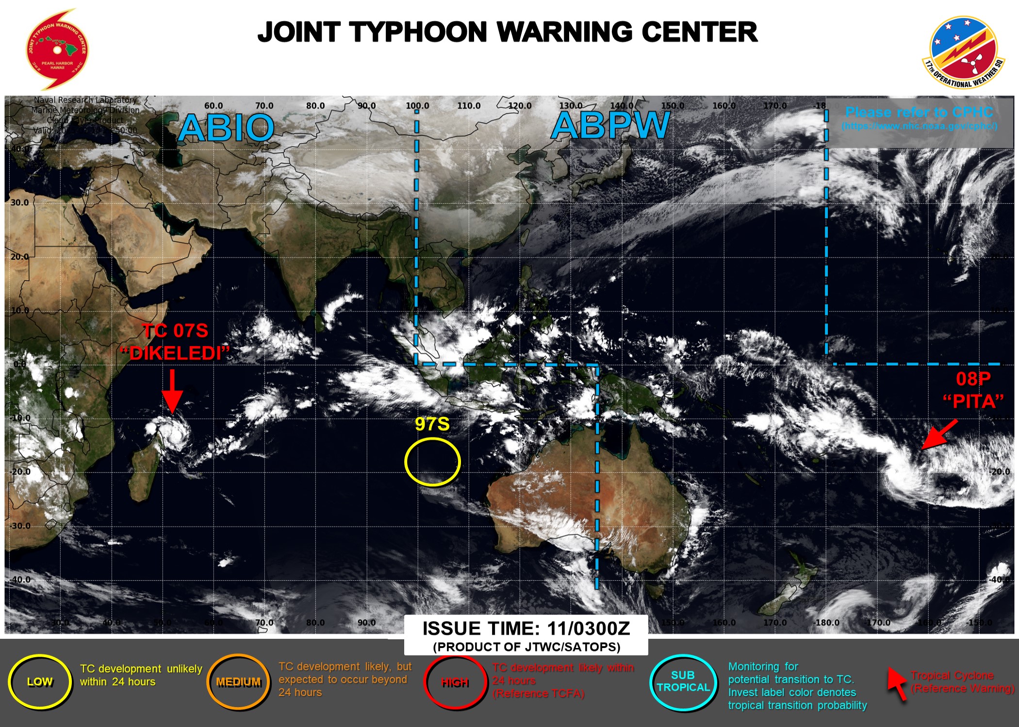
JTWC IS ISSUING 6 HOURLY WARNINGS AND 3 HOURLY SATELLITE BULLETINS ON 08P. 12 HOURLY WARNINGS AND 3 HOURLY SATELLITE BULLETINS ARE ISSUED ON 07S. 3 HOURLY SATELLITE BULLETINS ARE ISSUED ON 97S.
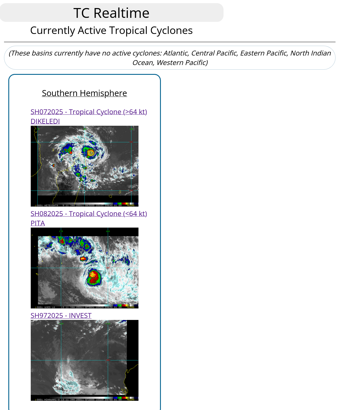
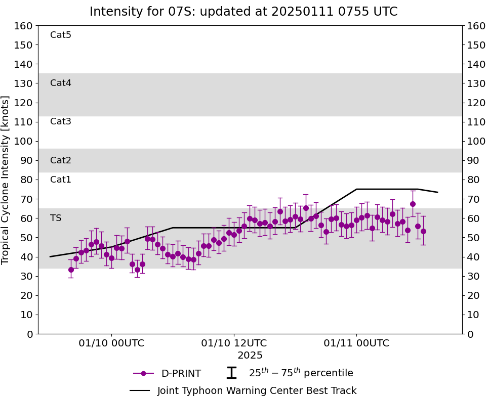
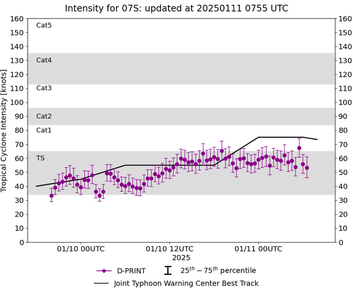
SOUTH INDIAN OCEAN: TC 07S(DIKELEDI). 11/06UTC ESTIMATED INTENSITY IS 75 KNOTS/CAT 1 US: + 20 KNOTS OVER 24 HOURS
0724122912 124S1132E 15
0724122918 126S1123E 20
0724123000 127S1115E 20
0724123006 129S1106E 20
0724123012 125S1100E 20
0724123018 124S1096E 20
0724123100 123S1092E 25
0724123106 126S1091E 25
0724123112 131S1090E 25
0724123118 140S1084E 25
0725010100 142S1071E 25
0725010106 145S1063E 25
0725010112 145S1054E 25
0725010118 145S1044E 25
0725010200 145S1035E 25
0725010206 145S1027E 25
0725010212 145S1015E 25
0725010218 148S1008E 20
0725010300 150S1000E 25
0725010306 153S 990E 25
0725010312 154S 973E 25
0725010318 153S 955E 25
0725010400 152S 943E 25
0725010406 150S 936E 25
0725010412 149S 927E 25
0725010418 147S 911E 25
0725010500 151S 896E 25
0725010506 154S 880E 25
0725010512 150S 867E 20
0725010518 147S 855E 20
0725010600 142S 840E 20
0725010606 138S 824E 20
0725010612 133S 809E 20
0725010618 128S 793E 20
0725010700 135S 787E 20
0725010706 144S 792E 20
0725010712 146S 774E 25
0725010718 148S 756E 30
0725010800 146S 743E 30
0725010806 148S 722E 30
0725010812 149S 702E 30
0725010818 150S 682E 30
0725010900 149S 658E 30
0725010906 144S 634E 30
0725010912 136S 616E 35
0725010918 136S 601E 40
0725011000 136S 586E 45
0725011006 136S 571E 55
0725011012 135S 556E 55
0725011018 132S 543E 55
0725011100 130S 530E 75
0725011106 127S 516E 75
NNNN
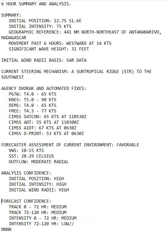
WARNING 4 ISSUED AT 11/09UTC
CLICK ON THE IMAGERY BELOW TO GET IT ANIMATED AND ENLARGED
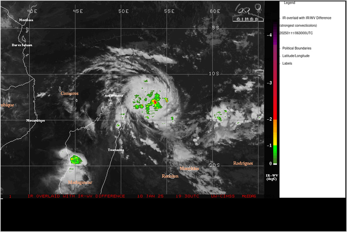
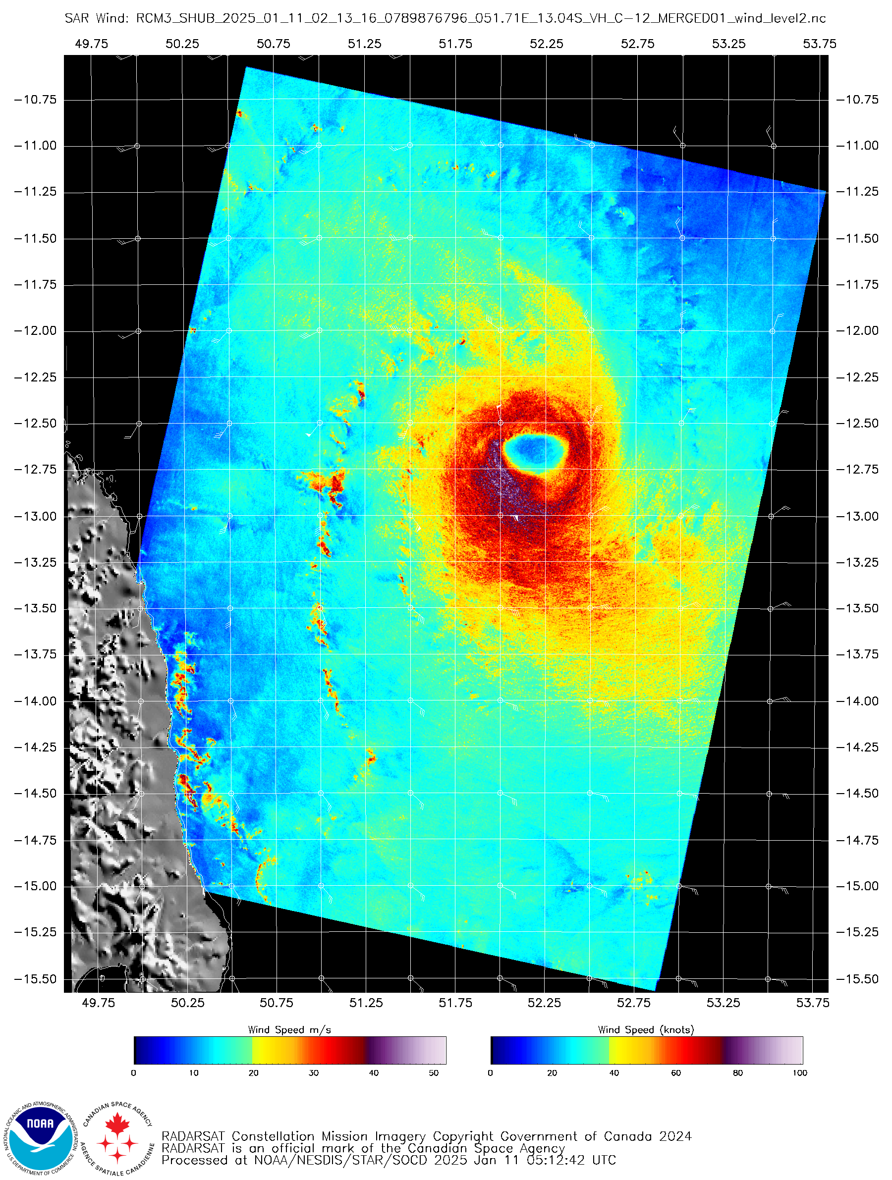
SATELLITE ANALYSIS, INITIAL POSITION AND INTENSITY DISCUSSION: ANIMATED MULTISPECTRAL SATELLITE IMAGERY (MSI) DEPICTS A DIMPLE-LIKE FEATURE EMBEDDED WITHIN A DEEP CONVECTIVE MASS OBSCURING THE CENTER OF THE TROPICAL CYCLONE (TC) 07S. THE DIMPLING FEATURE INDICATING A FORMATIVE EYE HIGHLIGHTS THE INTENSIFICATION THAT HAS OCCURRED OVER THE LAST 12 HOURS. AN 110213Z RCM-3 SYNTHETIC APERTURE RADAR (SAR) PRODUCT REVEALS WIND SPEEDS IN THE SOUTHERN AND SOUTHWESTERN PERIPHERY BETWEEN 75-77KTS. THE INITIAL POSITION IS PLACED WITH HIGH CONFIDENCE BASED ON THE AFOREMENTIONED ANIMATED MSI. THE INITIAL INTENSITY OF 75 KTS IS ASSESSED WITH HIGH CONFIDENCE BASED ON THE AFOREMENTIONED SCATTEROMETRY.
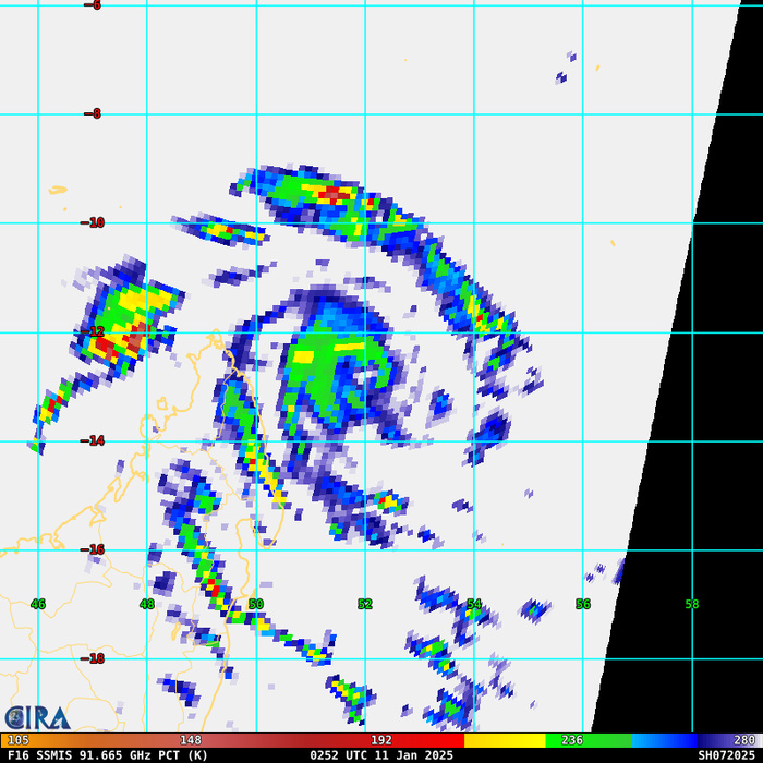
85 – 92 GHz Polarization-Corrected Brightness Temperature
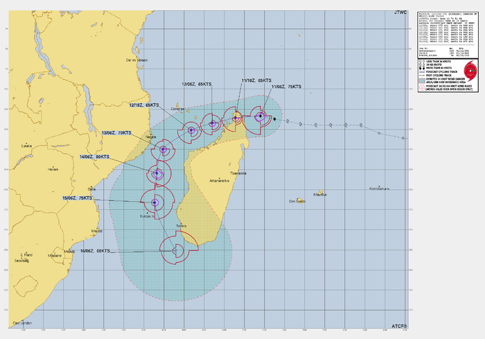
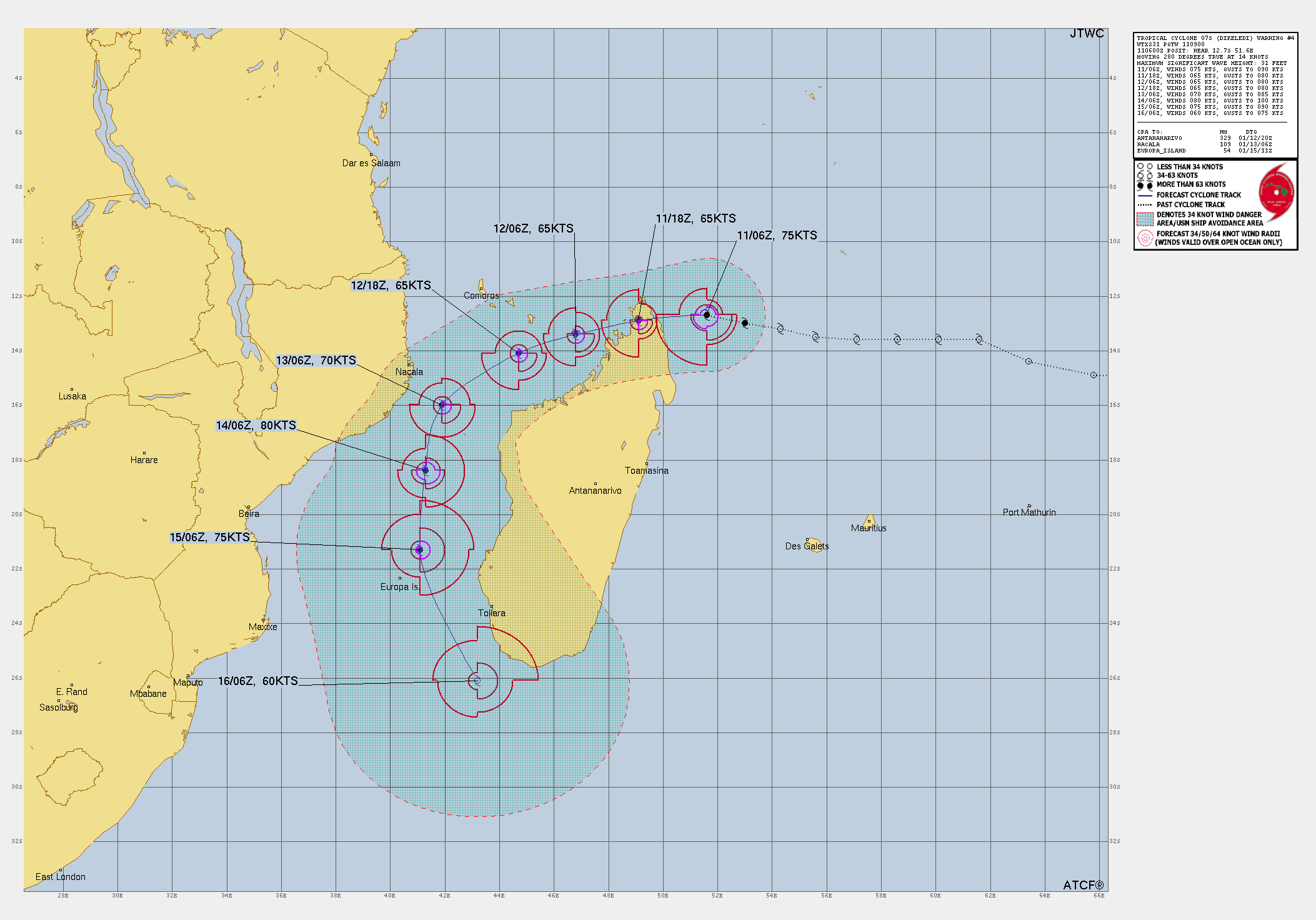
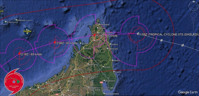
FORECAST REASONING. SIGNIFICANT FORECAST CHANGES: THERE ARE NO SIGNIFICANT CHANGES TO THE FORECAST FROM THE PREVIOUS WARNING. FORECAST DISCUSSION: TC 07S WILL CONTINUE TO TRACK WESTWARD PASSING OVER THE NORTHERN TIP OF MADAGASCAR OVER THE NEXT 12 HOURS. AFTER PASSING BACK OVER WATER, THE SYSTEM WILL BEGIN TO ROUND THE CURVE OF A STR CENTERED OVER SOUTHEASTERN MADAGASCAR, CAUSING THE SYSTEM TO TRACK THROUGH THE MOZAMBIQUE CHANNEL. AT TAU 96 THE SYSTEM WILL TRACK SOUTHEASTWARD WHILE REMAINING UNDER THE STEERING INFLUENCE OF THE STR. THE SYSTEM WILL CONTINUE TO INTENSIFY UNTIL MAKING LANDFALL, WHICH WILL DISRUPT INTENSIFICATION DUE TO HIGH SHEAR AND TOPOGRAPHIC INTERACTION. HIGH SHEAR WILL CONTINUE TO HINDER INTENSIFICATION UNTIL TAU 48, AND TC 07S WILL PEAK AT AN INTENSITY OF 80KTS BY TAU 80. VERTICAL WIND SHEAR WILL INCREASE TO 20KTS ONCE AGAIN BY TAU 60, DUE TO AN APPROACHING UPPER-LEVEL TROUGH APPROACHING FROM THE SOUTHWEST. AS THE UPPER-LEVEL TROUGH CONTINUES EAST, THE SYSTEM WILL WEAKEN. EXTRATROPICAL TRANSITION WILL COMMENCE BY THE END OF THE FORECAST PERIOD.
LANDFALL AREA/GOOGLE EARTH OVERLAY
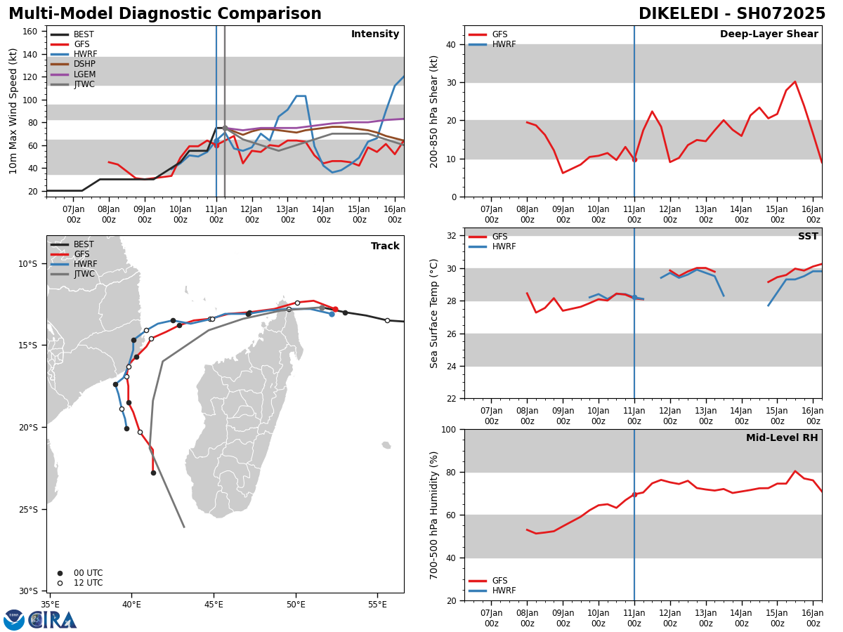
Model Diagnostic Plot
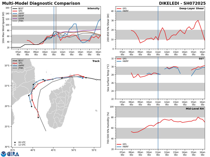
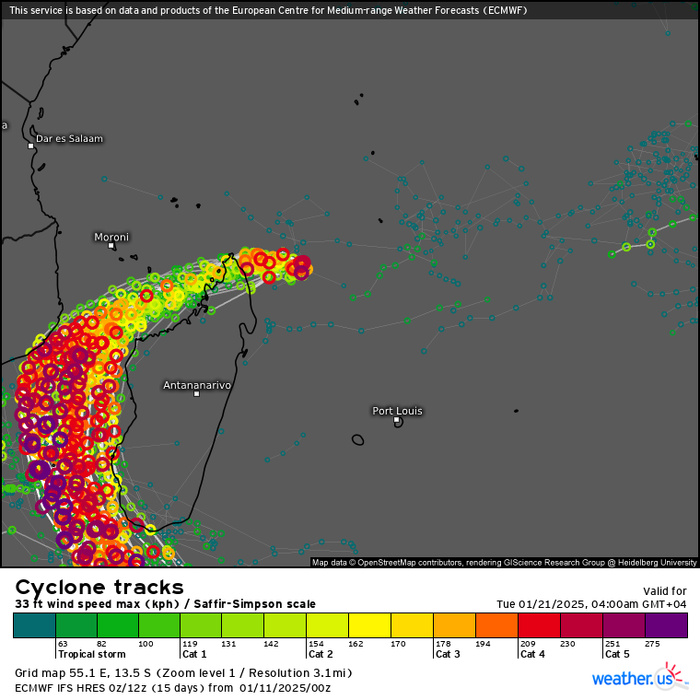
MODEL DISCUSSION: DETERMINISTIC MODEL GUIDANCE IS IN MOSTLY GOOD AGREEMENT REGARDING EARLY TRACK FORECAST, BUT THE MID- TO LATE- FORECAST GUIDANCE VARIES LARGELY BETWEEN GFS AND ECMWF. THE STR IN THE GFS GUIDANCE TRACKS THE SYSTEM OVER LAND IN MOZAMBIQUE BETWEEN TAU 48-108, ULTIMATELY INFLUENCING THE INTENSITY FORECAST AND CAUSING WEAKENING BEFORE TRACKING BACK OVER THE MOZAMBIQUE CHANNEL. ECMWF KEEPS THE SYSTEM OVER WATER, ALLOWING FOR INTENSIFICATION TO OCCUR UNTIL TAU 72 BEFORE MEETING HIGH SHEAR IN THE SOUTHERN MOZAMBIQUE CHANNEL. THE SMALL VARIATIONS IN THE TRACK GUIDANCE LEADS TO HIGH UNCERTAINTY IN THE MID- TO LATE-TERM INTENSITY FORECAST.
ECMWF STROM TRACKS ENSEMBLE: 11/00UTC + 120 HOURS
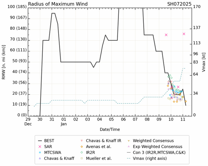
Platform: RCM-3 Acquisition Date: 2025-01-11 02:13:16 UTC : Quadrant 3 SW VMax (kts): 78.39
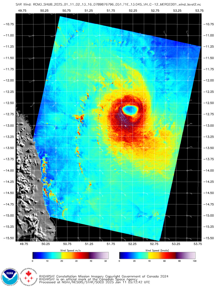
Platform: RCM-3 Acquisition Date: 2025-01-11 02:13:16 UTC Storm Name: SH072025 / DIKELEDI Storm ID: SH07 Storm Center Longitude: 53.296 Storm Center Latitude: -12.608 Incidence Angle (Degrees): 20.860 Quadrant 1 NE VMax (kts): N/A Quadrant 2 SE VMax (kts): 38.12 Quadrant 3 SW VMax (kts): 78.39 Quadrant 4 NW VMax (kts): 67.43 RMax (nmi): 33.00 - 76.00
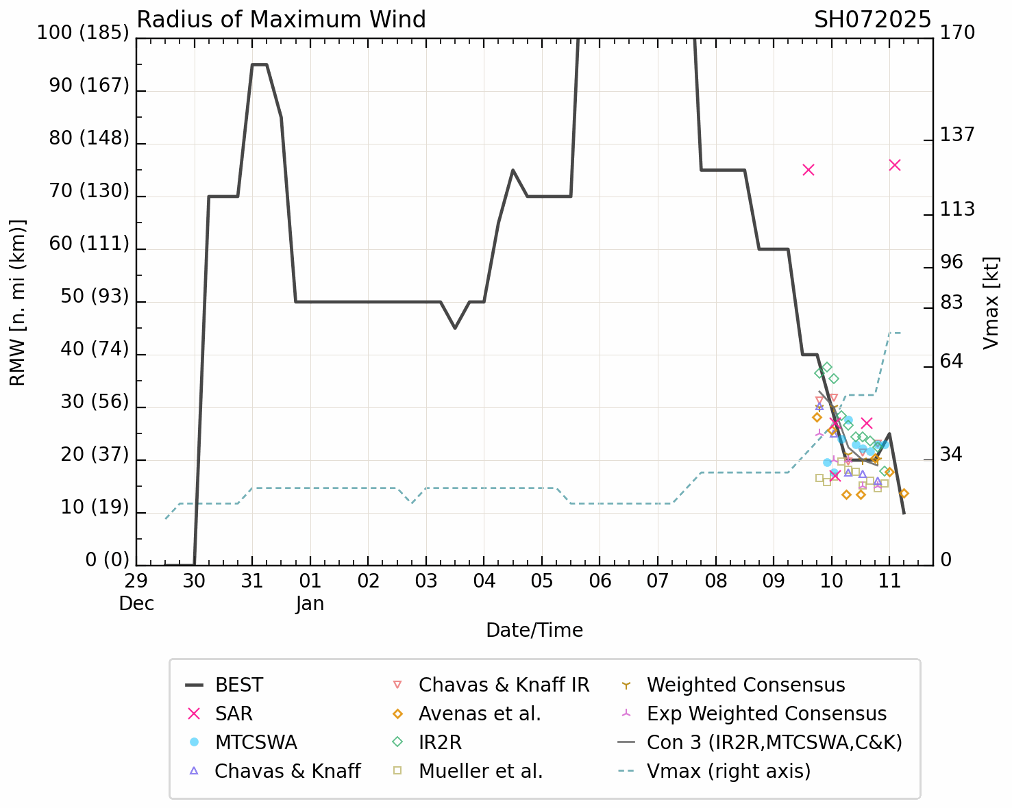
Radius of Maximum Wind (RMW)
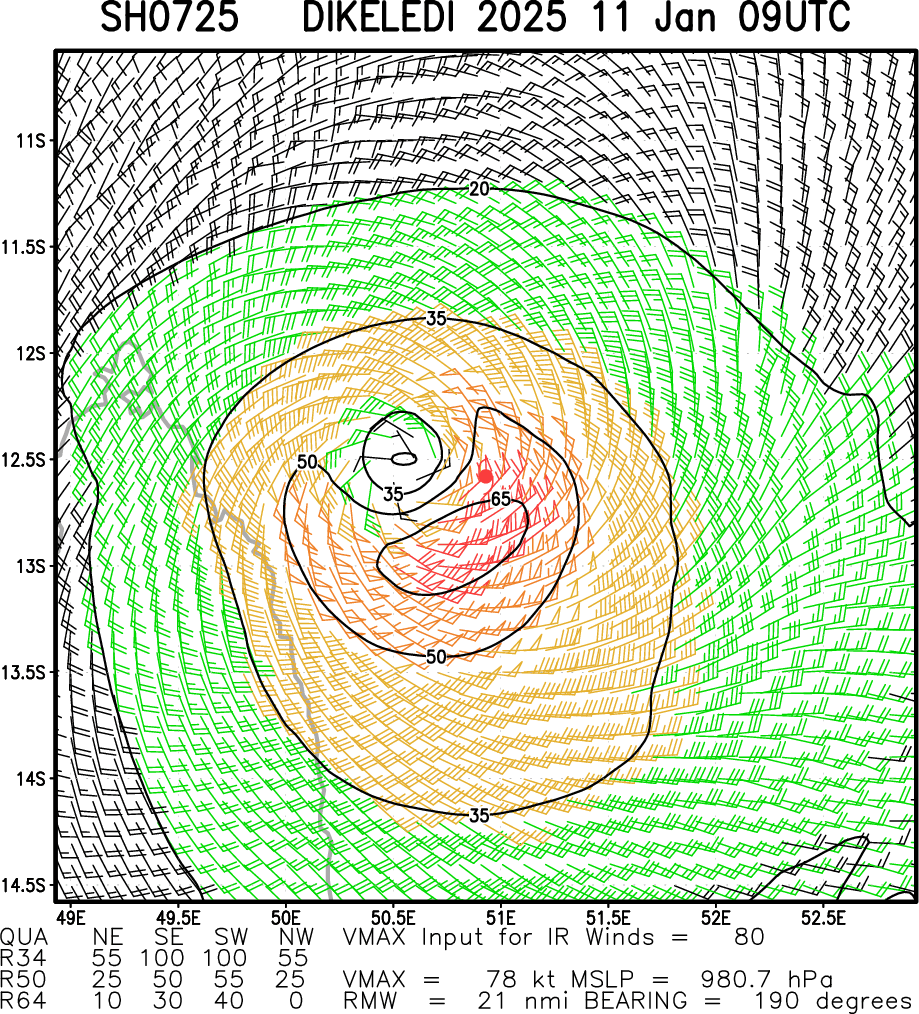
Multiplatform Satellite Surface Wind Analysis (Experimental)
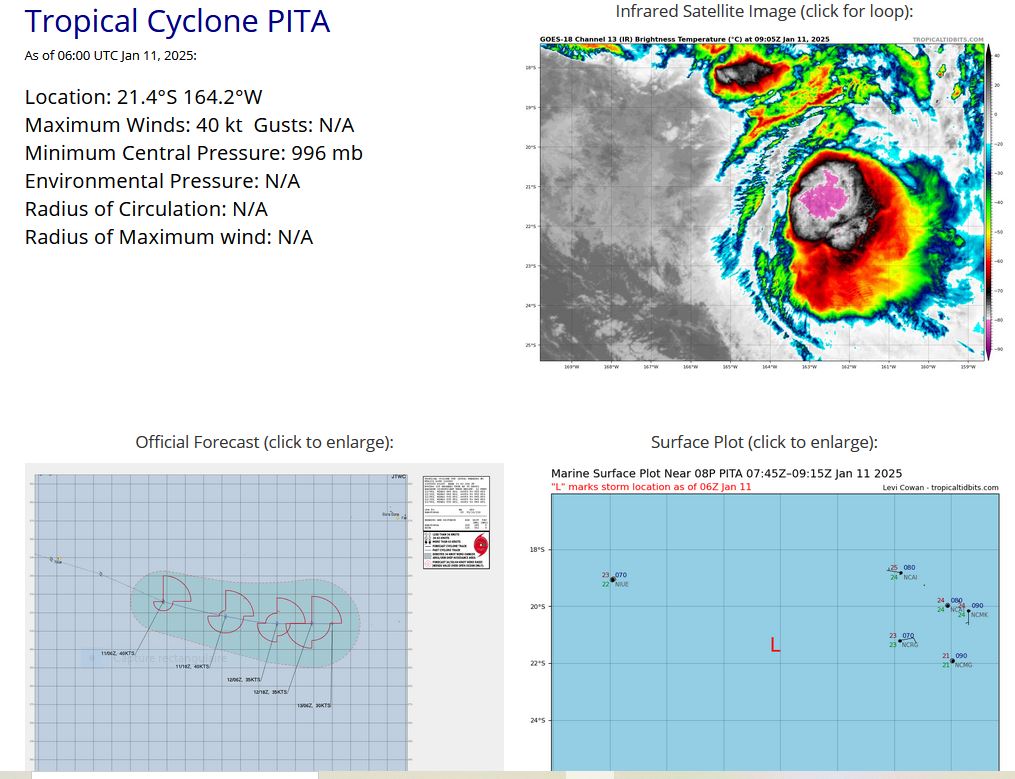
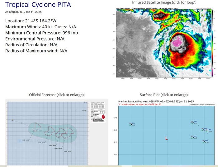
SOUTH PACIFIC OCEAN: TC 08P(PITA). WARNING 2 ISSUED AT 11/09UTC.
1. FOR METEOROLOGISTS.
2. 6 HOUR SUMMARY AND ANALYSIS.
SUMMARY:
INITIAL POSITION: 21.4S 164.2W
INITIAL INTENSITY: 40 KTS
GEOGRAPHIC REFERENCE: 246 NM WEST OF RAROTONGA
MOVEMENT PAST 6 HOURS: EAST-SOUTHEASTWARD AT 35 KTS
SIGNIFICANT WAVE HEIGHT: 12 FEET
SATELLITE ANALYSIS, INITIAL POSITION AND INTENSITY DISCUSSION:
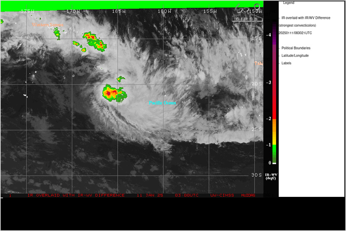
ANIMATED ENHANCED INFRARED (EIR) SATELLITE IMAGERY DEPICTS
ELONGATED LOW-LEVEL BANDING IN THE NORTHWESTERN QUADRANT OF THE
CIRCULATION WITH DEEP CONVECTION OBSCURING THE REMAINDER OF
TROPICAL CYCLONE (TC) 08P TO THE SOUTHEAST. THE SYSTEM EMBEDDED
WITHIN THE SOUTH PACIFIC CONVERGENCE ZONE (SPCZ) IS COMBATTING HIGH
VERTICAL WIND SHEAR TO REMAIN 40KTS. AN 110512Z F-16 SSMIS COLOR-
ENHANCED 91GHZ MICROWAVE IMAGE HIGHLIGHTS THE AFOREMENTIONED
CONVECTIVE BURST AND ASSOCIATED LOW-LEVEL BANDING AROUND THE
CIRCULATION CENTER. THE INITIAL POSITION IS PLACED WITH HIGH
CONFIDENCE BASED ON THE AFOREMENTIONED ANIMATED MSI AND MICROWAVE
IMAGERY. THE INITIAL INTENSITY OF 40 KTS IS ASSESSED WITH HIGH
CONFIDENCE BASED ON PERSISTENCE ALONGSIDE THE AGENCY AND OBJECTIVE
FIXES LISTED BELOW.
INITIAL WIND RADII BASIS: PERSISTENCE
CURRENT STEERING MECHANISM: A NEAR EQUATORIAL RIDGE (NER) TO THE
NORTHEAST
AGENCY DVORAK AND AUTOMATED FIXES:
PGTW: T3.0 - 45 KTS
KNES: T4.0 - 65 KTS
CIMSS ADT: 41 KTS AT 110540Z
CIMSS AIDT: 36 KTS AT 0740Z
CIMSS D-PRINT: 50 KTS AT 110740Z
FORECASTER ASSESSMENT OF CURRENT ENVIRONMENT: UNFAVORABLE
VWS: 20-25 KTS
SST: 26-27 CELSIUS
OUTFLOW: MODERATE EASTWARD
ANALYSIS CONFIDENCE:
INITIAL POSITION: MEDIUM
INITIAL INTENSITY: MEDIUM
INITIAL WIND RADII: LOW
3. FORECAST REASONING.
SIGNIFICANT FORECAST CHANGES: THERE ARE NO SIGNIFICANT CHANGES TO
THE FORECAST FROM THE PREVIOUS WARNING.
FORECAST DISCUSSION: TC 08P WILL CONTINUE TO TRACK EAST-SOUTHEASTWARD
UNDER THE STEERING INFLUENCE OF THE NORTHEASTERN STR FOR THE NEXT 48
HOURS. WHILE THE SYSTEM WILL CONTINUE TO BE FUELED BY WARM SEA
SURFACE TEMPERATURES AND STRONG UPPER-LEVEL DIVERGENCE FOR THE
REMAINDER OF THE FORECAST PERIOD, THE SYSTEM WILL BE HINDERED BY HIGH
VWS THAT WILL REMAIN ABOVE AN UNFAVORABLE 20KTS. A JET MAX
APPROACHING FROM THE SOUTHWEST WILL CAUSE SHALLOWING OF TC 08P AND
BEGIN TO CAUSE SUBTROPICAL TRANSITION BY TAU 36. TC 08P WILL BECOME
FULLY SUBTROPICAL BY TAU 48.
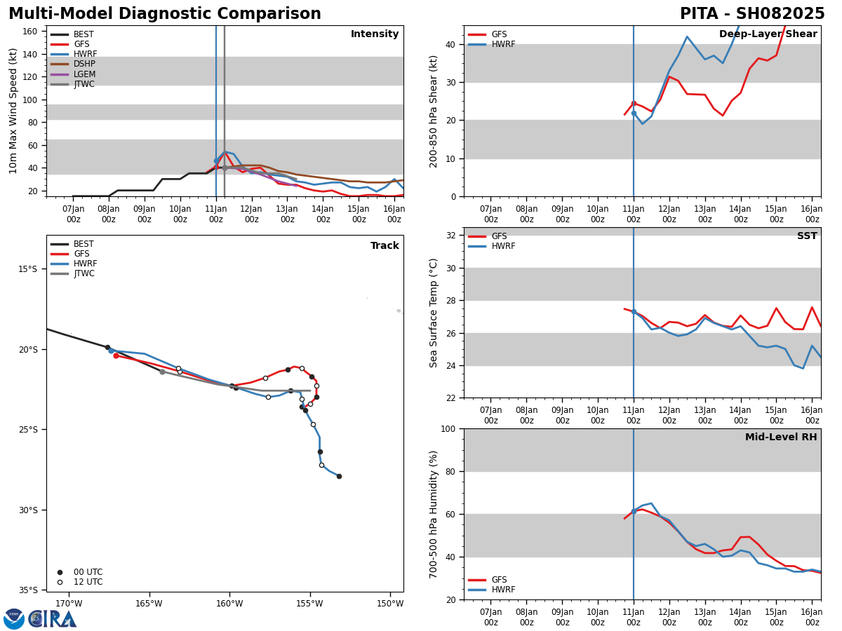
MODEL DISCUSSION: DETERMINISTIC MODEL GUIDANCE IS IN GOOD AGREEMENT
THROUGH TAU 24, BUT BEGINS TO LOSE THE VORTEX BY TAU 36, CAUSING
MODERATE BIFURCATION BY TAU 48. GFS INDICATES A GENERAL EAST-
NORTHEASTWARD TRACK, WHILE THE MAJORITY OF THE CONSENSUS DEPICTS AN
EAST-SOUTHEASTWARD TRACK. THE INTENSITY GUIDANCE AGREES ON STEADY
WEAKENING THROUGHOUT THE REMAINDER OF THE FORECAST PERIOD.
FORECAST CONFIDENCE:
TRACK 0 - 72 HR: MEDIUM
INTENSITY 0 - 72 HR: HIGH//
NNNN
CLICK ON THE IMAGERY BELOW TO GET IT ANIMATED AND ENLARGED
0825010700 150S1699E 15
0825010706 155S1707E 15
0825010712 160S1714E 15
0825010718 163S1739E 15
0825010800 161S1753E 15
0825010806 164S1761E 20
0825010812 168S1770E 20
0825010818 168S1784E 20
0825010900 166S1799W 20
0825010906 169S1787W 20
0825010912 173S1774W 30
0825010918 176S1762W 30
0825011000 176S1751W 30
0825011006 180S1734W 35
0825011012 185S1722W 35
0825011018 191S1703W 35
0825011100 199S1676W 40
0825011106 214S1642W 40
Model Diagnostic Plot
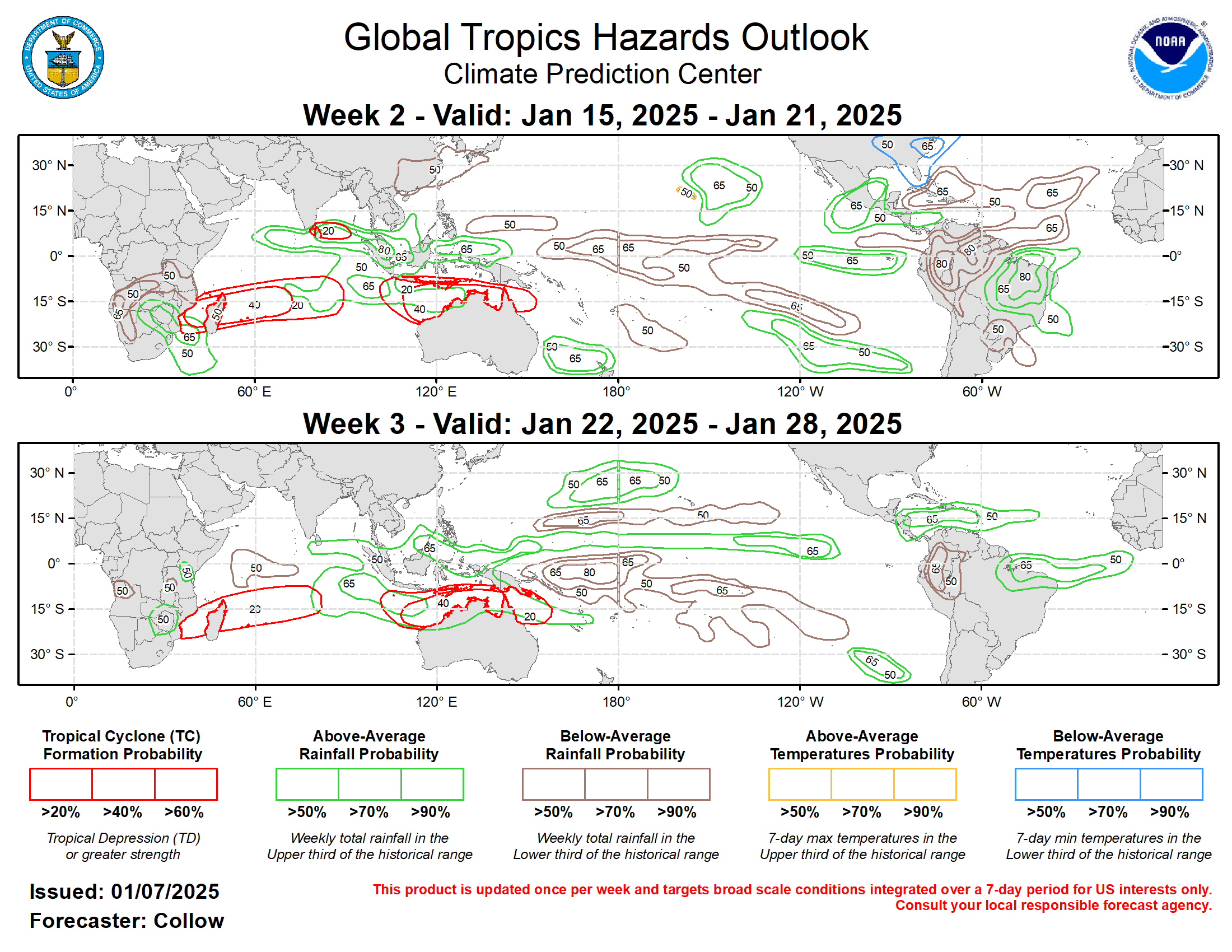
Last Updated - 01/07/25 3 WEEK TROPICAL CYCLONE FORMATION PROBABILITY
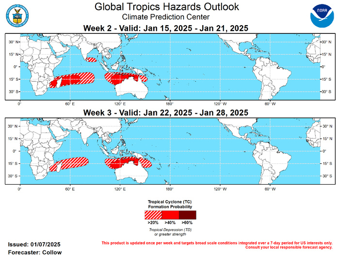
During the past week, the RMM-based MJO index propagated into the Western Hemisphere and weakened into the unit circle. By week-2, the intraseasonal signal is predicted to re-amplify over the Indian Ocean and constructively interfere with the low frequency enhanced convective state tied to the emerging La Nina and negative phase of the Indian Ocean Dipole (-IOD). The ECMWF and GEFS also indicate a more coherent wave-1 symmetry pattern developing in the spatial upper-level velocity potential field by the second half of January, with enhanced (suppressed) convection across the Indian Ocean and Maritime Continent (east of the Date Line). This evolution, along with climatology, favors enhanced chances of tropical cyclone (TC) development during the forecast period across the Indian Ocean and also spreading across the Maritime Continent and to the north of Australia. No new TCs have formed in the past week. The Joint Typhoon Warning Center (JTWC) is monitoring two areas of disturbed weather for potential TC formation over the next few days, specifically 94S over the south-central Indian Ocean (15 deg S, 80 deg E) and 96P over the southwestern Pacific (20 deg S, 170 deg W). The strongly enhanced convective envelope predicted over the Indian Ocean during week-2 supports at least a 20 percent chance of TC formation across the south-central and southwestern Indian Ocean and to the north of Australia. Higher chances (40-60 percent) are forecast across the more climatologically favored areas from the Mozambique Channel to roughly 70 deg E. Enhanced tropical cyclone formation probabilities in the GEFS and ECMWF ensembles also support 40-60 percent chances of TC formation along the Kimberley Coast and in the Gulf of Carpentaria. Dynamical models also depict multiple surface lows tracking across the Bay of Bengal toward India with associated above-normal precipitation. While seasonal climatology is low, TC development is not ruled out given the favorable environment aloft. Therefore, 20-40 percent chances are highlighted over the region. The week-3 TC formation outlook is generally similar to week-2, with a slight eastward progression of the enhanced convective envelope. This favors increasing TC development chances extending east of Australia, with the 20-40 percent region encompassing more of the Coral Sea. Conversely, TC development probabilities are reduced across the southwestern Indian Ocean, but remain in the 20-40 percent range given the enhanced low frequency convective signal. A 40-60 percent chance for TC formation remains highlighted across the Kimberley Coast and Gulf of Carpentaria.
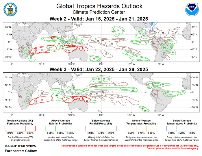
Above and below normal precipitation forecasts for weeks 2 and 3 are based on the anticipated continuation of low frequency variability (developing La Nina, -IOD), Indian Ocean MJO composites, anticipated TC tracks, and a skill weighted historical blend of CFSv2, GEFS, ECMWF ensemble forecast systems. The MJO propagation would favor moderation of temperatures across the eastern half of the contiguous U.S. (CONUS), although latest CPC outlooks (8-14 day and week 3-4) still favor below-normal temperatures over the central and eastern CONUS persisting through late January. However, it is plausible that a warmer pattern could begin to take shape by the end of the month based on lagged MJO composites .
