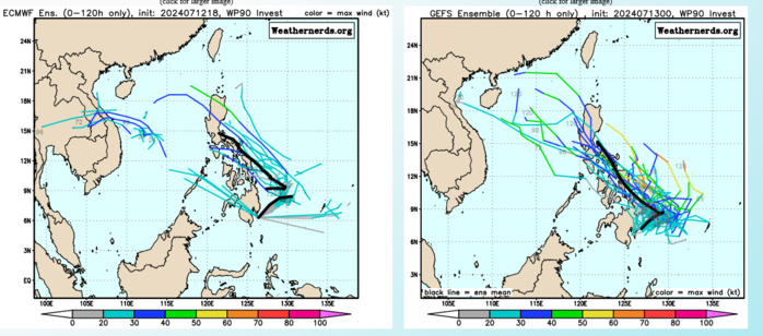
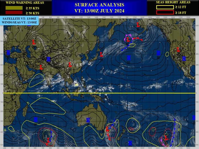
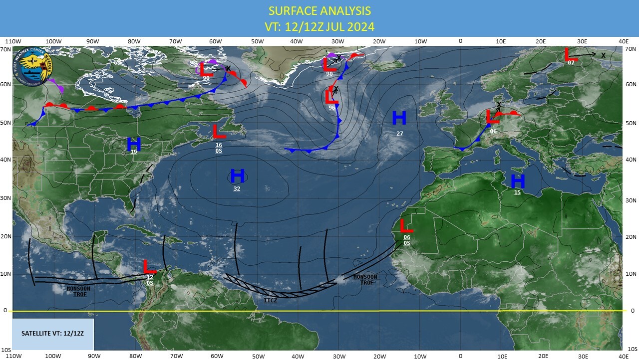
CLICK ON THE IMAGERIES BELOW TO GET THEM ENLARGED
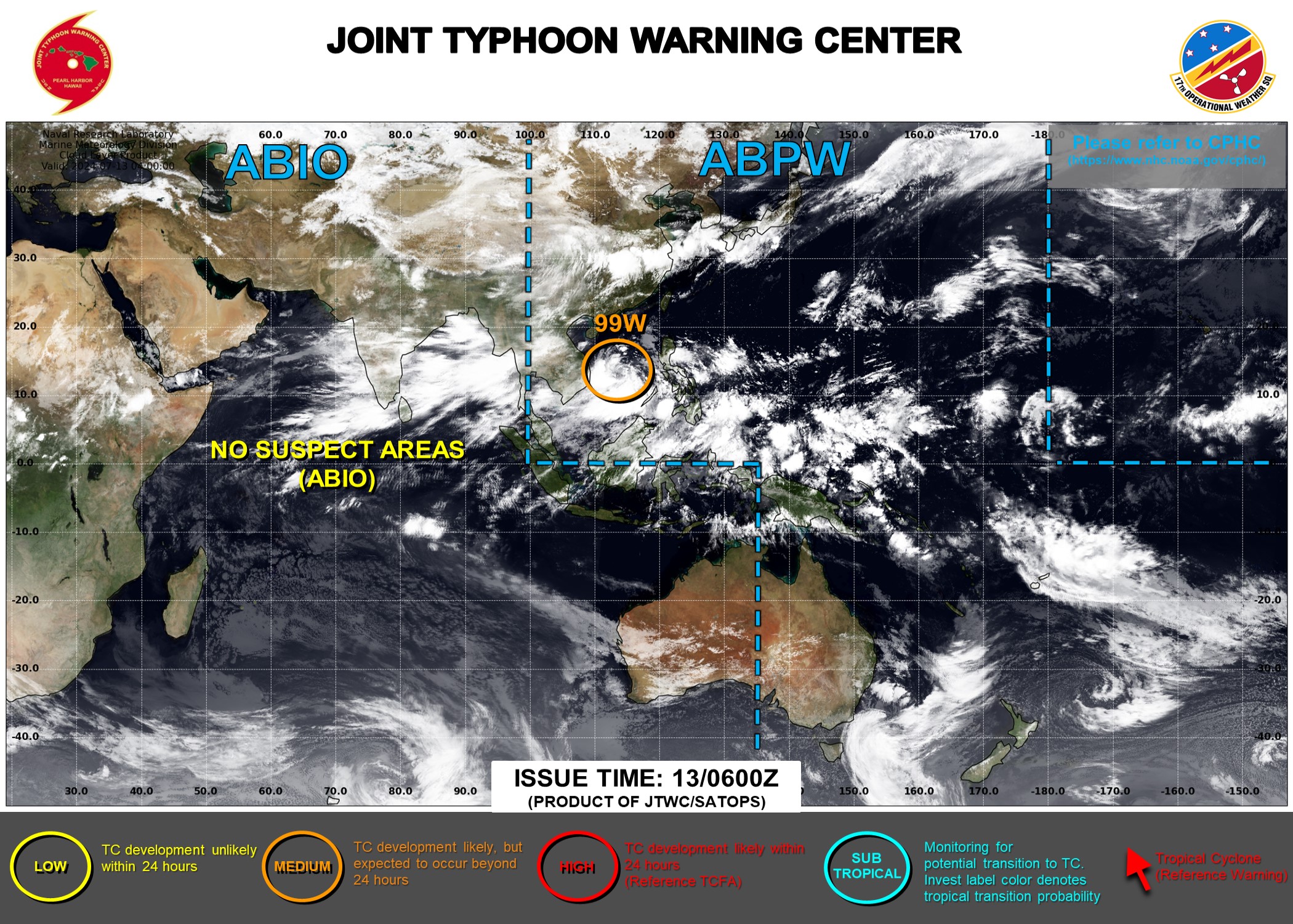
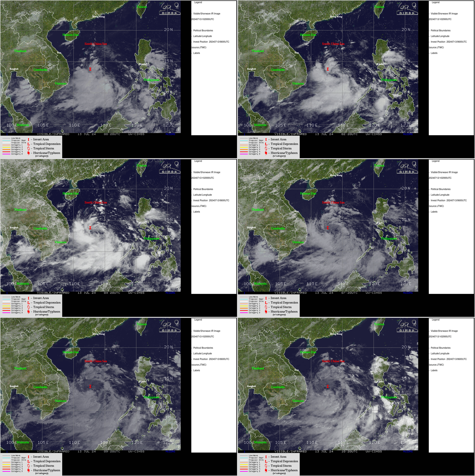
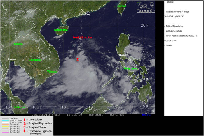
WESTERN NORTH PACIFIC/SOUTH CHINA SEA: INVEST 99W. ESTIMATED LOCATION AND INTENSITY AT 13/06UTC. INTENSITY IS 20 KNOTS. ADVISORY(ABPW) ISSUED AT 13/06UTC
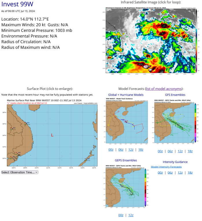
THE AREA OF CONVECTION (INVEST 99W) PREVIOUSLY LOCATED NEAR 13.1N 113.8E IS NOW LOCATED NEAR 14.0N 112.7E, APPROXIMATELY 287 NM EAST-SOUTHEAST OF DA NANG, VIETNAM. ANIMATED MULTISPECTRAL SATELLITE IMAGERY DEPICTS A STRONG MID-LEVEL CIRCULATION CENTER NEAR 13.0N 113.3E, WITH EXTENSIVE DEEP CONVECTIVE BANDING OVER THE SOUTHERN SEMICIRCLE ASSOCIATED WITH A SOUTHWESTERLY WIND SURGE EVENT. A 122320Z SSMIS 37 GHZ MICROWAVE IMAGE SHOWS DISORGANIZED CLUSTERS OF DEEP CONVECTION WITH NO DISCERNABLE LOW-LEVEL CIRCULATION CENTER. HOWEVER, A 130152Z ASCAT-C IMAGE REVEALS AN ELONGATED, WEAK CIRCULATION EMBEDDED WITHIN THE MONSOON TROUGH, WITH A SWATH OF 20 TO 25 KNOT SOUTHWESTERLY WINDS DISPLACED WELL TO THE SOUTH (GREATER THAN 180 NM). UPPER-LEVEL ANALYSIS INDICATES A MARGINALLY FAVORABLE ENVIRONMENT WITH STRONG EQUATORWARD OUTFLOW OFFSET BY MODERATE TO HIGH (20-25 KNOTS) VERTICAL WIND SHEAR. SEA SURFACE TEMPERATURES OF 29-30 C ARE CONDUCIVE. GLOBAL MODELS INDICATE A WEST- NORTHWESTWARD TO NORTHWESTWARD TRACK TOWARD VIETNAM OVER THE NEXT TWO DAYS WITH SLOW DEVELOPMENT INTO A TROPICAL DEPRESSION. MAXIMUM SUSTAINED SURFACE WINDS ARE ESTIMATED AT 15 TO 20 KNOTS. MINIMUM SEA LEVEL PRESSURE IS ESTIMATED TO BE NEAR 1003 MB. THE POTENTIAL FOR THE DEVELOPMENT OF A SIGNIFICANT TROPICAL CYCLONE WITHIN THE NEXT 24 HOURS IS UPGRADED TO MEDIUM.
CLICK ON THE IMAGERY BELOW TO GET IT ANIMATED AND ENLARGED
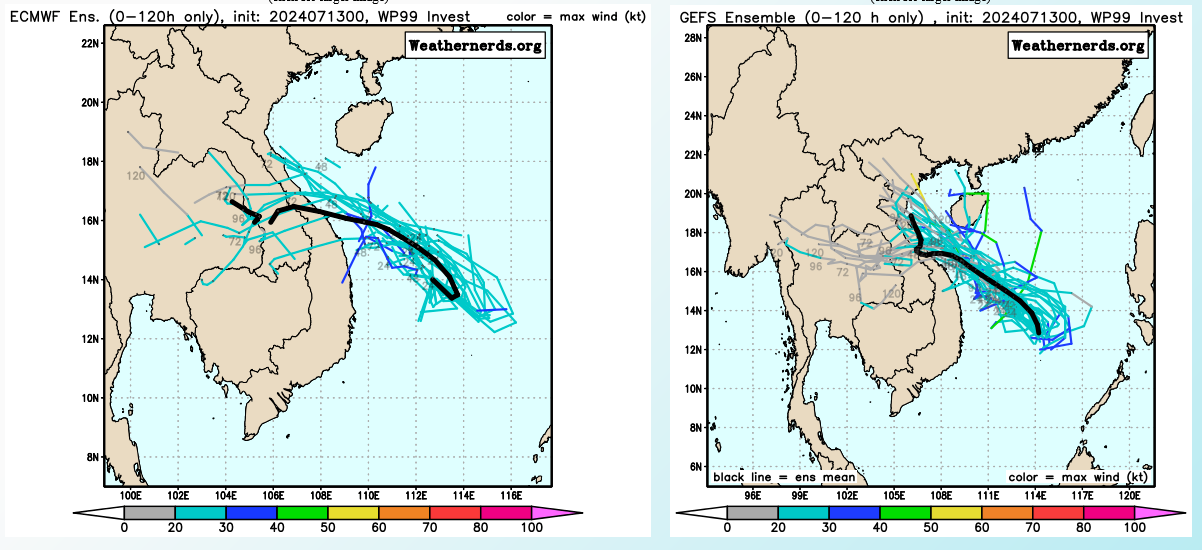
TC Ensemble Guidance

GLOBAL MODELS INDICATE A WEST- NORTHWESTWARD TO NORTHWESTWARD TRACK TOWARD VIETNAM OVER THE NEXT TWO DAYS WITH SLOW DEVELOPMENT INTO A TROPICAL DEPRESSION.
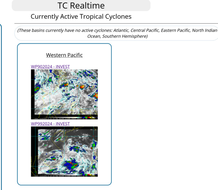
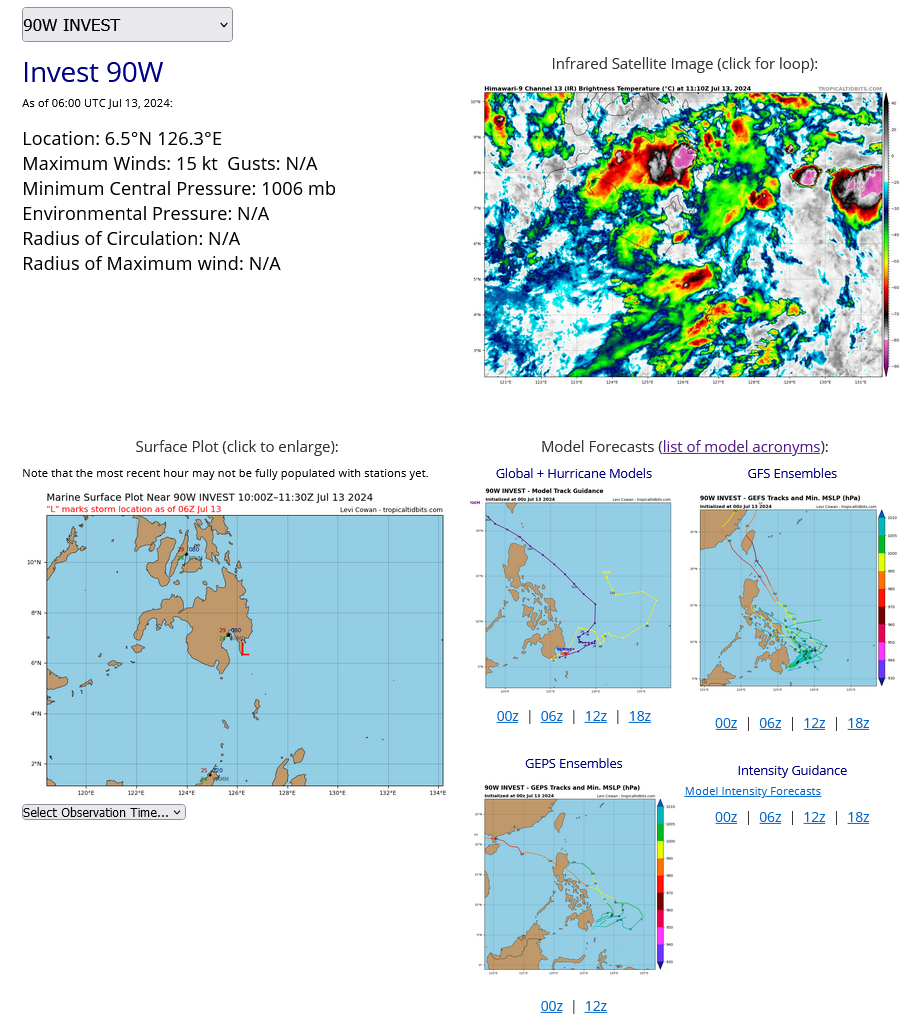
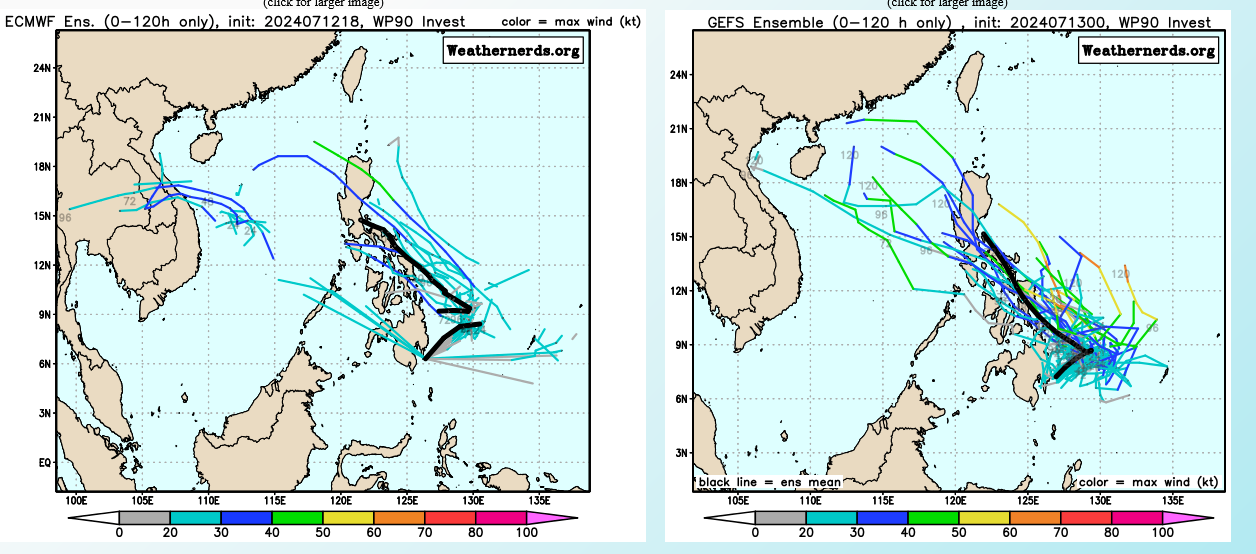
WESTERN NORTH PACIFIC:INVEST 90W. ESTIMATED LOCATION AND INTENSITY AT 13/06UTC. INTENSITY IS 15 KNOTS.
TC Ensemble Guidance
Last Updated - 07/09/24 3 WEEK TROPICAL CYCLONE FORMATION PROBABILITY
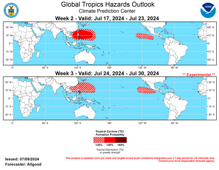
GTH Outlook Discussion Last Updated - 07/09/24 Valid - 07/17/24 - 07/30/24 The upper-level velocity potential anomaly field continues to exhibit a robust Wave-1 structure, with broad scale enhanced divergence over the eastern Indian Ocean, Maritime Continent and West Pacific, and convergence aloft over the Western Hemisphere. Some slow eastward propagation of these features has been observed since the end of June, but eastward propagation has not been well established in the RMM-based MJO index. It is possible that the emerging intraseasonal signal is constructively interfering with a low frequency base state that is increasingly evolving towards a La Niña type response, with suppressed convection over the East Pacific and enhancement over the Maritime Continent. Dynamical model forecasts of the MJO index generally depict eastward propagation of the signal across the Maritime Continent, with many ensemble members reaching the West Pacific, where MJO enhanced activity has not crossed for several months. The strong “Maritime Continent barrier” appears to remain influential, however, and by late Week-2 and Week-3, there is considerable spread among all of the ensemble model systems, with activity in every single MJO phase, and many ensemble members falling within the unit circle. The incoherence is likely due to increasingly destructive interference between the MJO, the base state and other modes of tropical variability. While most ensemble members depict weak activity beyond Week-2, a significant number of ensemble members show a propagating MJO signal. Therefore, MJO evolution during Weeks 2-3 is highly uncertain. One tropical cyclone developed globally during the past week: Tropical Storm Aletta over the East Pacific, which dissipated after two days and contributed only 0.2 ACE values to the well below-average East Pacific hurricane season to date. Hurricane Beryl, which formed over the Atlantic MDR prior to the June 3-9 period, strengthened to Category-5 intensity over the eastern Caribbean after causing considerable damage in the Lesser Antilles. Hurricane Beryl was the first Category-5 hurricane in June on record in the Atlantic basin, and later caused significant impacts to Jamaica, the Cayman Islands, and the Yucatan Peninsula. After weakening to tropical storm intensity, Beryl restrengthened and made landfall on the Texas Gulf Coast, bringing hurricane force gusts and torrential rainfall to the Houston metropolitan area. During Week-2, the potential for MJO activity to penetrate further over the Pacific than during the past few months favors a broadly enhanced monsoon trough extending over the West Pacific, which could provide a large area favorable for tropical cyclogenesis. The Week-2 outlook shows a 40-percent chance of TC formation over the South China Sea, in the vicinity of the Philippines, and over the West Pacific as far east as Guam. During Week-3, as enhanced convection shifts poleward, tropical cyclone activity remains favored (20-percent) in a region slightly to the north of the Week-2 hazard. MJO activity or Kelvin waves emerging ahead of the enhanced convective envelope may help generate East Pacific activity as well during late Week-2 or Week-3. Dynamical models and composites of historical tropical cyclone formations during MJO events favor formation centered near 120W, with a potential for systems tracking into the CPHC area of responsibility. The eastern portion of the basin may become more active during Week-3, especially if the MJO retains any coherence. Across the Atlantic basin, enhanced divergence over the central Pacific tends to increase westerly shear and is broadly unfavorable for tropical cyclone development. Given the extremely warm SSTs throughout much of the basin, however, tropical cyclogenesis is possible during any brief period of relaxed shear.
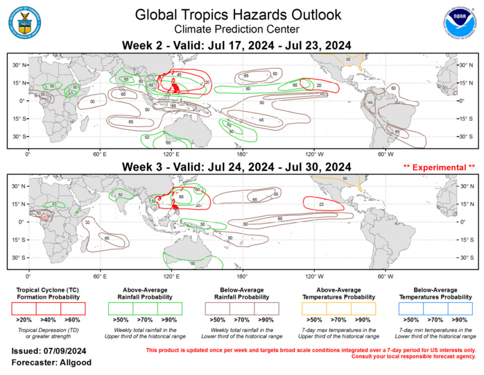
Forecasts for enhanced and suppressed precipitation are based on an anticipated continuation of low-frequency suppression across the central and eastern Pacific, and a skill-weighted consolidation of the GEFS, CFS, ECMWF, and ECCC dynamical model systems. MJO composites were considered for the outlook, especially during Week-2, but uncertainty increases considerably regarding MJO evolution during Week-3. Persistent ridging over north-central North America favors continued hot temperatures for portions of the contiguous United States. For hazardous weather conditions in your area during the next two weeks, please refer to your local NWS office, the Medium Range Hazards Forecast from the Weather Prediction Center, and the CPC Week-2 Hazards Outlook. Forecasts issued over Africa are made in coordination with the International Desk at CPC.
