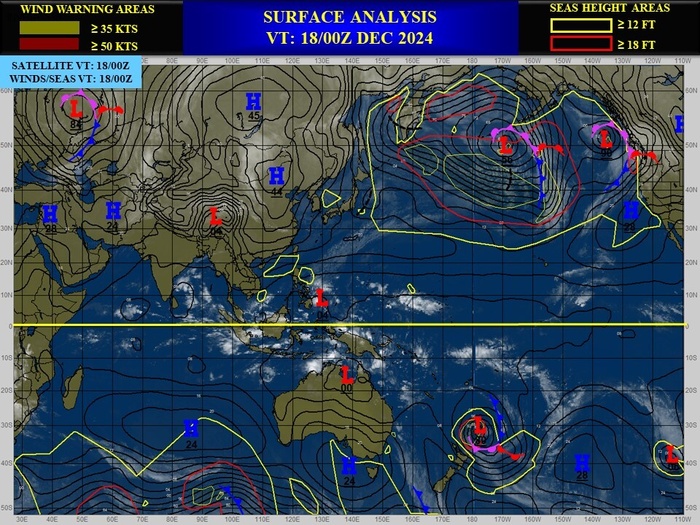
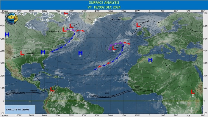
CLICK ON THE IMAGERIES BELOW TO GET THEM ENLARGED
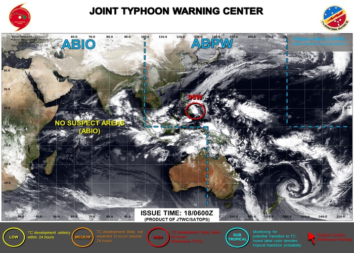
WESTERN NORTH PACIFIC: INVEST 96W. TROPICAL CYCLONE FORMATION ALERT RE-ISSUED AT 20241217/15UTC
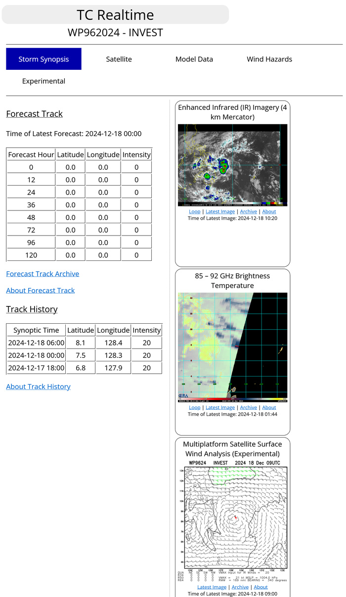
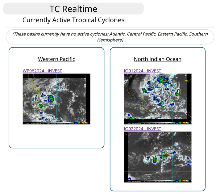
THE AREA OF CONVECTION (INVEST 96W) PREVIOUSLY LOCATED NEAR 6.7N 127.3E IS NOW LOCATED NEAR 7.5N 128.3E, APPROXIMATELY 82 NM EAST OF DAVAO. ANIMATED MULTISPECTRAL SATELLITE IMAGERY AND A 172203Z SSMIS 91GHZ MICROWAVE IMAGE DEPICT A DEFINED CIRCULATION WITH, FRAGMENTED, FORMATIVE BANDING ORGANIZING AROUND THE LOW LEVEL CIRCULATION CENTER. ENVIRONMENTAL ANALYSIS REVEALS THAT INVEST 96W IS IN A FAVORABLE ENVIRONMENT FOR FURTHER DEVELOPMENT, WITH WARM (28-29C) SEA SURFACE TEMPERATURES, GOOD POLEWARD OUTFLOW ALOFT, AND LOW TO MODERATE VERTICAL WIND SHEAR (15-20 KTS). GLOBAL MODELS ARE IN GOOD AGREEMENT THAT INVEST 96W WILL CONTINUE TO GENERALLY TRACK NORTHWESTWARD INTO THE SOUTHERN PHILIPPINES OVER THE NEXT 48 HOURS. MAXIMUM SUSTAINED SURFACE WINDS ARE ESTIMATED AT 15 TO 20 KNOTS. MINIMUM SEA LEVEL PRESSURE IS ESTIMATED TO BE NEAR 1004 MB. THE POTENTIAL FOR THE DEVELOPMENT OF A SIGNIFICANT TROPICAL CYCLONE WITHIN THE NEXT 24 HOURS REMAINS HIGH.
Model Diagnostic Plot
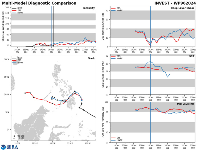
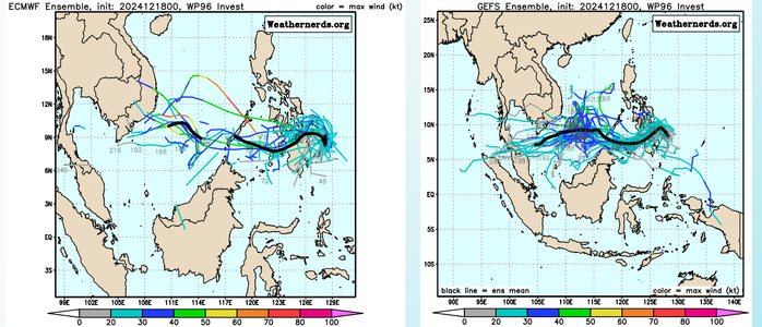
GLOBAL MODELS ARE IN GOOD AGREEMENT THAT INVEST 96W WILL CONTINUE TO GENERALLY TRACK NORTHWESTWARD INTO THE SOUTHERN PHILIPPINES OVER THE NEXT 48 HOURS.
Ensemble Forecasts
Last Updated - 12/17/24 3 WEEK TROPICAL CYCLONE FORMATION PROBABILITY
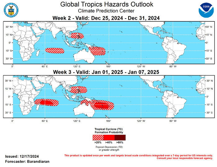
GTH Outlook Discussion Last Updated - 12/17/24 Valid - 12/25/24 - 01/07/25 The MJO has continued to be a significant player in the tropics. However, the emerging La Niña base state has been a growing source of interference with both the propagation and amplitude of the MJO. Dynamical model forecasts depict continued eastward propagation of the MJO signal with a slow phase. Extended range RMM-index solutions indicate the potential for a surge in the strength of the MJO during weeks 3&4 as it shifts into the Western Hemisphere and La Niña interference lessens. A continued eastward MJO propagation over the Pacific would favor a period of below-normal temperatures across the northeastern U.S. to start off the New Year, as well as a wet start for the West Coast. During the last week a sub-tropical system formed off the southern coast of Brazil, and was named Bigua by the Brazilian navy. While its status as a tropical cyclone (TC) is somewhat ambiguous, systems of this kind are rare in the South Atlantic and thus is a noteworthy inclusion to the weekly summary of TC activity. Other than this system, there has been no TC activity over the last week, although the Joint Typhoon Warning Center (JTWC) is monitoring an area of disturbed weather designated 96W, just east of the Philippines for TC development, which is favored to occur in the very near future. Please refer to the JTWC for more information regarding potential TC 96W. With the MJO forecast to be in phases 6-8 (Western Pacific/Western Hemisphere) during the forecast period, the northern coast of Australia and the South Pacific are favored to be active regions for TC activity during weeks 2-3. For both weeks the ECMWF and GEFS depict steadily increasing probabilities of TC genesis in these regions, with a slight risk (20% probability) of TC genesis off northeast coast of Australia and the South Pacific for both weeks, with a moderate risk (40%) posted for the South Pacific during week-3. A slight risk for TC genesis is also posted for the South China Sea portions of the Philippine Sea for both weeks due to favorable MJO positioning. Finally, a slight risk of TC genesis is posted for weeks 2&3 for the southwestern Indian Ocean with continued anomalous westerlies favored to persist through the forecast period. A moderate risk of TC genesis is posted for week-3 northeast of Madagascar, as the MJO moves into the Western Hemisphere, providing a more favorable environment for TC development over the region. MJO teleconnections generally favor wetter conditions for portions of the Pacific Northwest, and initially favor warm conditions over much of the Contiguous U.S. (CONUS). Extended RMM forecasts indicate that eastward propagation is favored to continue beyond week 3, colder conditions become favored over the Northeast U.S. as the MJO moves into phase 8.
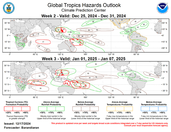
The precipitation outlook for weeks 2 and 3 is based on potential TC activity, the anticipated state of ENSO and the MJO, and informed by GEFS, CFS, Canadian, and ECMWF ensemble mean solutions. During week-2 above-normal temperatures are indicated for much of northern South America, and strongly favored for much of the CONUS and Mexico, as well as the Hawaiian Island. For hazardous weather conditions in your area during the coming two-week period, please refer to your local NWS office, the Medium Range Hazards Forecast produced by the Weather Prediction Center, and the CPC Week-2 Hazards Outlook. Forecasts made over Africa are made in coordination with the International Desk at CPC.
