CLICK ON THE IMAGERIES BELOW TO GET THEM ENLARGED.

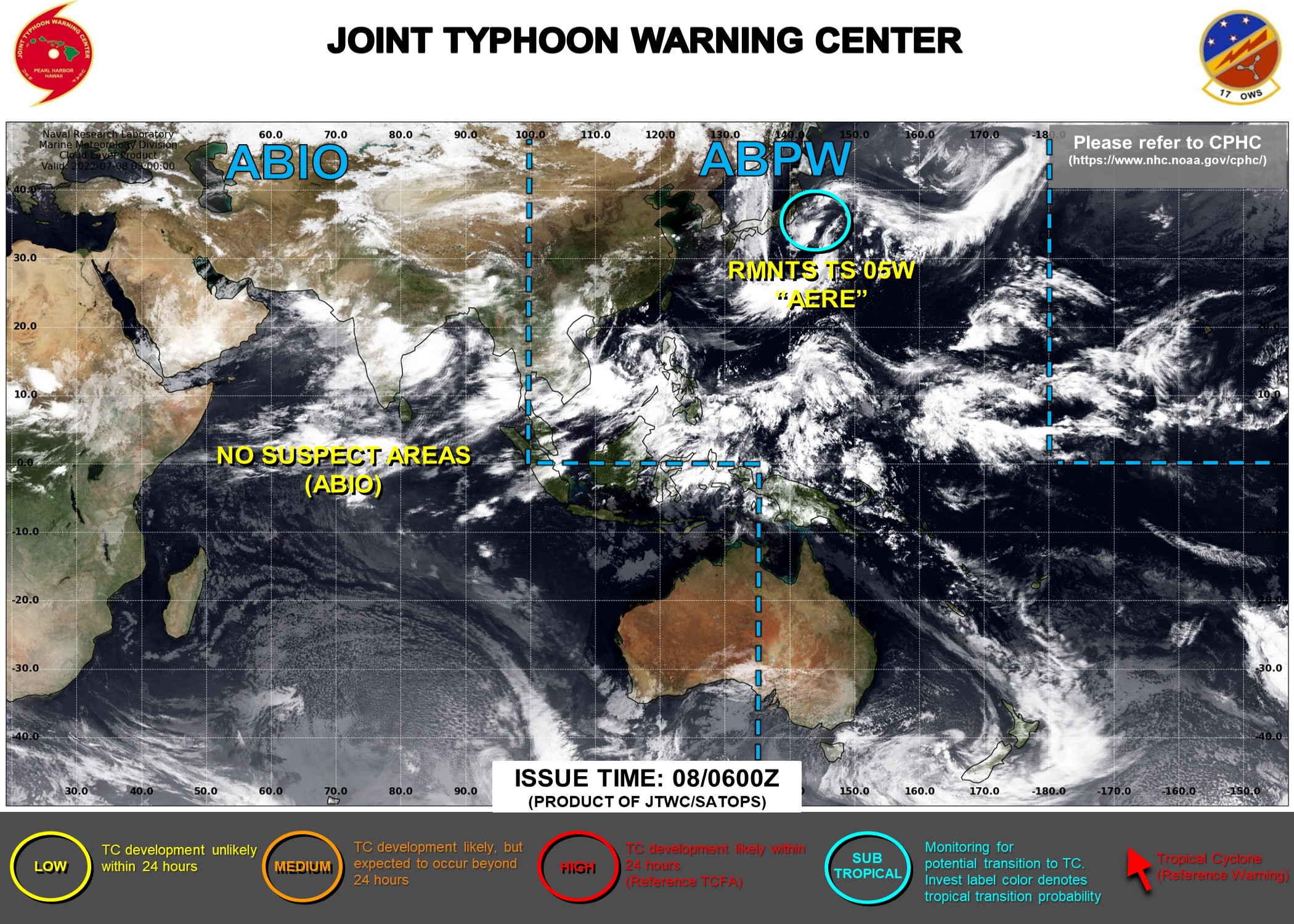
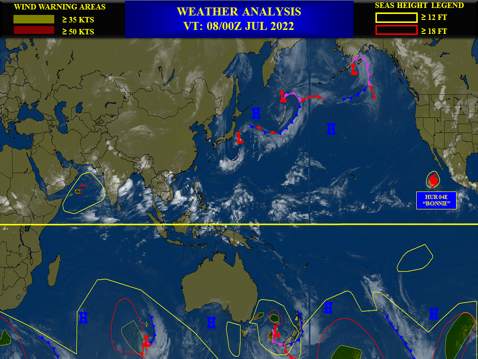
THE AREA OF CONVECTION (REMNANTS 05W) PREVIOUSLY LOCATED NEAR 33.9N 145.4E IS NOW LOCATED NEAR 34.3N 144.6E, APPROXIMATELY 460 KM EAST-SOUTHEAST OF TOKYO JAPAN. THE SYSTEM IS CURRENTLY CLASSIFIED AS A SUBTROPICAL STORM, GENERALLY CHARACTERIZED AS HAVING BOTH TROPICAL AND MID-LATITUDE CYCLONE FEATURES. ANIMATED MULTISPECTRAL SATELLITE IMAGERY (MSI) DEPICTS DEEP CONVECTION SHEARED TO THE WEST OF AN EXPOSED AND ELONGATED LOW LEVEL CIRCULATION CENTER (LLCC). A PARTIAL 080033Z ASCAT-C PASS REVEALS 30KT WINDS IN THE NORTHERN AND SOTHERN PERIPHERIES OF THE LLCC. ENVIRONMENTAL ANALYSIS INDICATES A MARGINAL ENVIRONMENT WITH COOL (26C) SEA SURFACE TEMPERATURES, OFFSET BY LOW TO MODERATE (15-20KT) VERTICAL WIND SHEAR AND GOOD POLEWARD AND EQUATORWARD OUTFLOW ALOFT, WHICH IS CONDUCIVE FOR TROPICAL TRANSITION. GLOBAL MODELS ARE IN TIGHT AGREEMENT THAT REMNANTS 05W WILL HAVE AN ASYMMETRIC WIND FIELD AS IT TRACKS NORTHWESTWARD TOWARDS SOUTHERN HOKKAIDO. MAXIMUM SUSTAINED SURFACE WINDS ARE ESTIMATED AT 30 TO 35 KNOTS. MINIMUM SEA LEVEL PRESSURE IS ESTIMATED TO BE NEAR 990 MB. FOR HAZARDS AND WARNINGS, REFERENCE THE FLEET WEATHER CENTER SAN DIEGO HIGH WINDS AND SEAS PRODUCT OR REFER TO LOCAL WMO DESIGNATED FORECAST AUTHORITY. THE POTENTIAL FOR THE SYSTEM TO TRANSITION INTO A SIGNIFICANT TROPICAL CYCLONE WITHIN THE NEXT 24 HOURS REMAINS LOW.
2 WEEK CYCLONIC DEVELOPMENT POTENTIAL
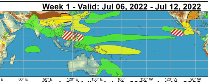
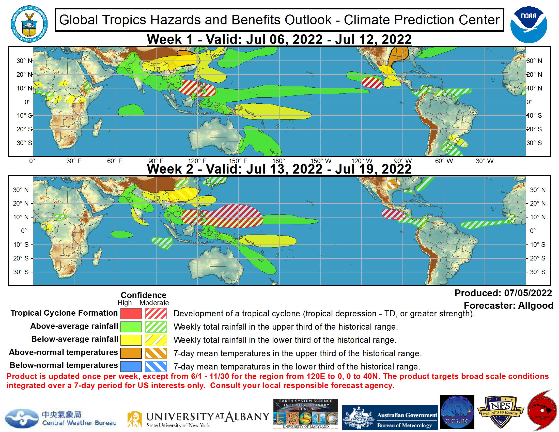
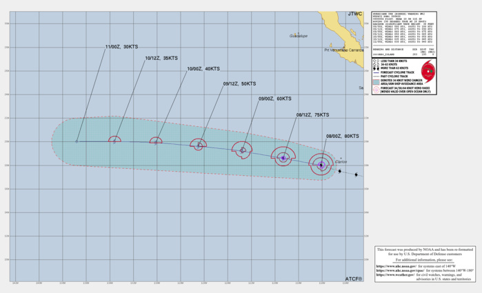
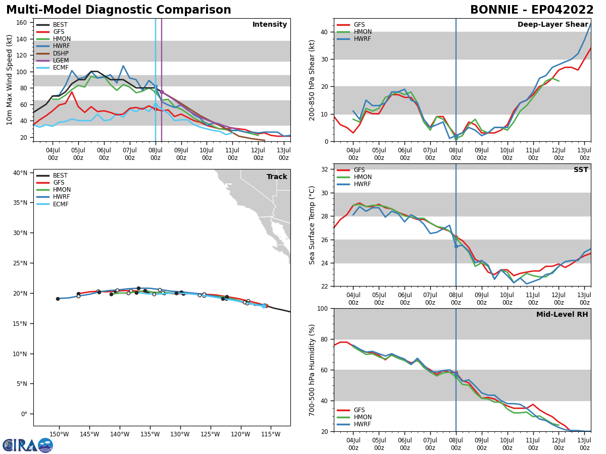
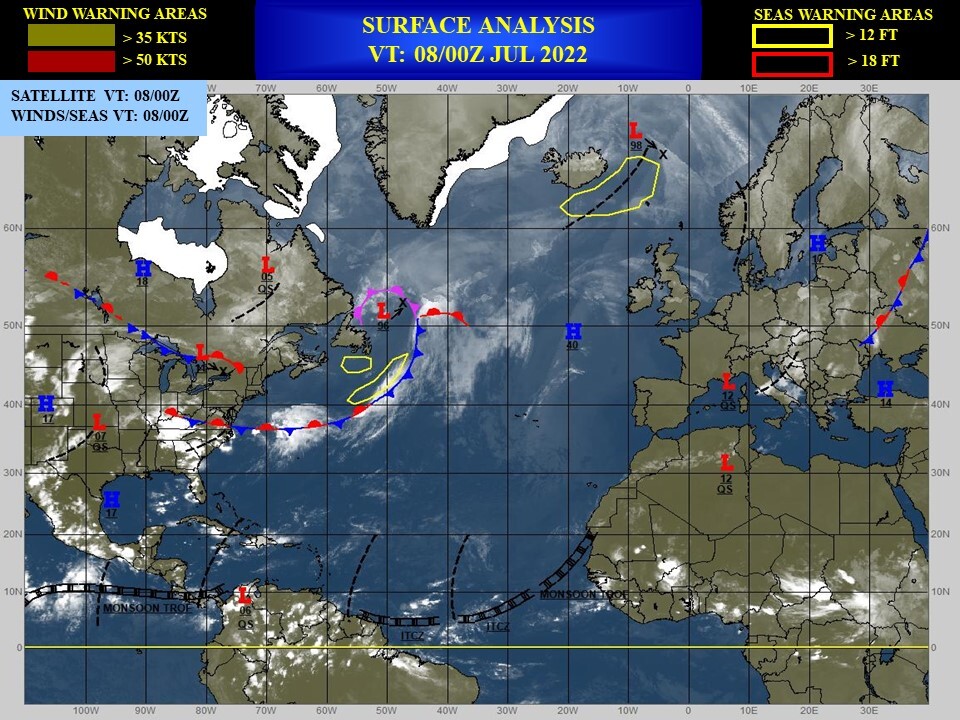
During the past week, four tropical cyclones formed globally. Typhoon Chaba developed over the South China Sea and made landfall over southern China.Tropical Storm Aere formed northeast of the Philippines and brought flooding rains to parts of Japan. Hurricane Bonnie formed over the southwestern Caribbean and crossed westward over Central America, emerging over the East Pacific and strengthening to hurricane intensity. Hurricane Bonnie is expected to remain well south of Mexico as it moves generally westward towards cooler waters. Tropical Storm Colin formed briefly near the coast of South Carolina, bringing spotty convection and some gusty winds to the South Atlantic coast. During Week-1, no additional tropical cyclones are favored to develop across the Atlantic basin. Across the West Pacific, an enhanced monsoon trough may provide a favorable environment for tropical cyclogenesis, with the best chances for formations at a fairly low latitude east of the Philippines or across the South China Sea. This region may remain active into Week-2. Dynamical models indicate a potential for tropical cyclone development further east in the vicinity of Guam during Week-2 as well. Across the East Pacific, conditions may become increasingly favorable for TC formation across the East Pacific during late Week-1 into Week-2, with dynamical models indicating one or more potential TCs forming south of Mexico. NOAA
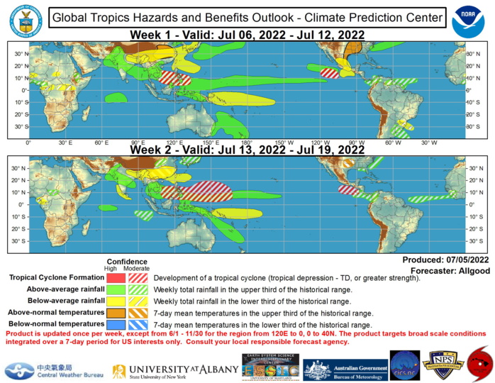
The Madden-Julian Oscillation (MJO) signal, based on both the RMM-based and CPC velocity potential indices, became more amplified during the past week with a signal propagating from the Indian Ocean to the Maritime Continent. The upper-level velocity potential field currently exhibits a robust Wave-1 pattern, consistent with MJO activity, and other fields such as zonal wind anomalies and OLR anomalies are also broadly consistent with a propagating MJO signal. The MJO is currently constructively interfering with the La Niña base state, with strongly enhanced trade winds now extending across the entire tropical Pacific basin. Despite the enhanced trade winds, enhanced convection was recently observed across the tropical North Pacific near 10N, aided in part by strong equatorial Rossby wave activity. Enhanced convection associated with both La Nina and the MJO is feeding into the Asian monsoon, and is sparking widespread flooding across southeastern Australia, including the Sydney metropolitan area. Dynamical model MJO index forecasts indicate uncertainty, with multiple GEFS ensemble members depicting robust MJO activity propagating to the West Pacific, but others showing a rapid weakening of the signal. The ECMWF is generally slower and weaker with the signal, with interference from equatorial Rossby wave activity and the La Nina base state preventing robust eastward propagation. As the suppressed phase of the MJO crosses the Western Hemisphere, conditions may become broadly less favorable for tropical cyclone (TC) development, while a healthy monsoon trough extending into the West Pacific may provide opportunities for TC formations. Forecasts for above- and below-average rainfall are based on tropical cyclone forecast tracks, dynamical model consensus, and precipitation composites of canonical MJO events with convectively active phase over the Maritime Continent and West Pacific. An enhanced monsoon trough is favored to extend from South Asia southeastward across Southeast Asia, the equatorial Maritime Continent, and across the western and central North Pacific. North of this region, dry, hot conditions are favored across mainland China. Widespread heavy rainfall is favored to continue across eastern Australia, the Coral Sea, and New Zealand, particularly during Week-1. This rainfall may aggravate the ongoing serious flooding situation in New South Wales. Enhanced rainfall across the western North Atlantic is expected to continue for the next two weeks, while hot conditions will persist across the central CONUS. NOAA.
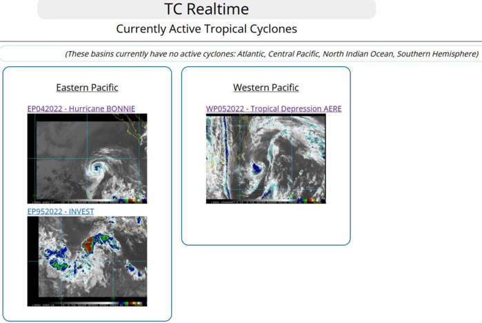
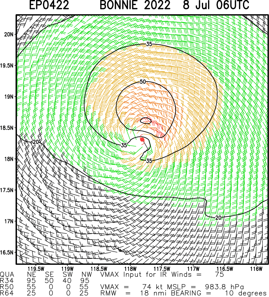
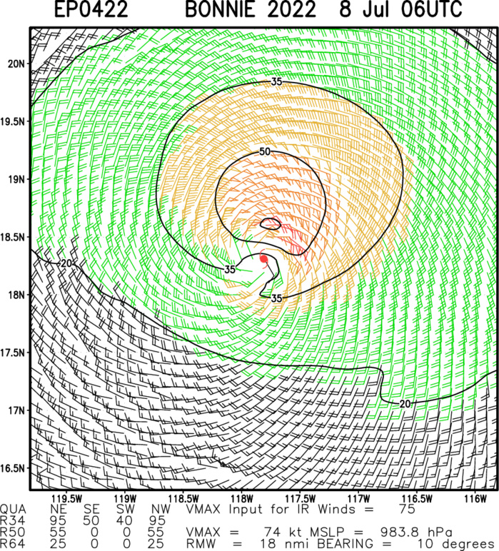
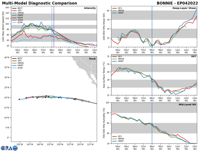
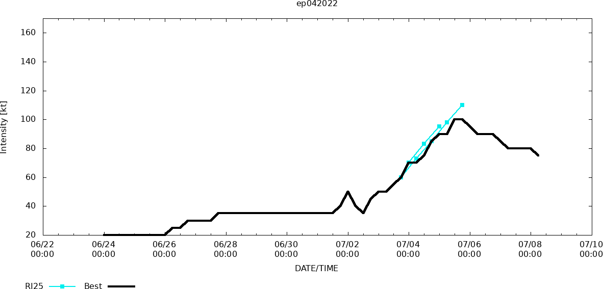
EASTERN NORTH PACIFIC: HU 04E(BONNIE). WARNING 42 ISSUED AT 08/4UTC.
EP, 04, 2022070700,166N, 1107W, 85, 977
EP, 04, 2022070706,169N, 1118W, 80, 980
EP, 04, 2022070712,172N, 1131W, 80, 980
EP, 04, 2022070718,175N, 1145W, 80, 980
EP, 04, 2022070800,180N, 1161W, 80, 980
EP, 04, 2022070706,169N, 1118W, 80, 980
EP, 04, 2022070712,172N, 1131W, 80, 980
EP, 04, 2022070718,175N, 1145W, 80, 980
EP, 04, 2022070800,180N, 1161W, 80, 980
