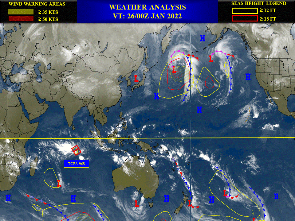
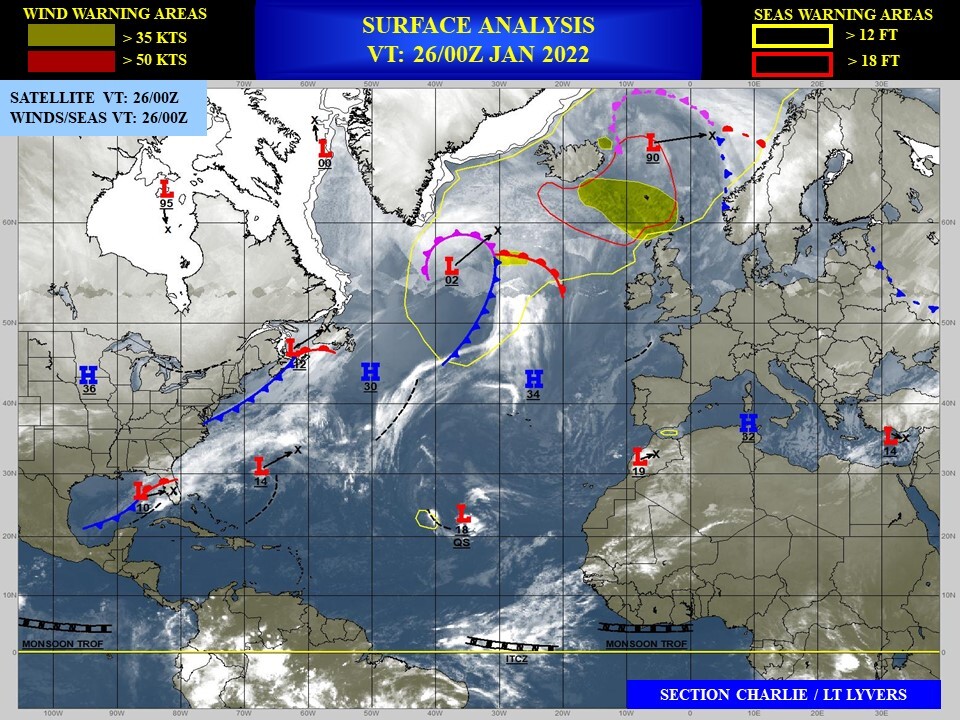
WEEK 1: 26 JAN TO 01 FEB 2022

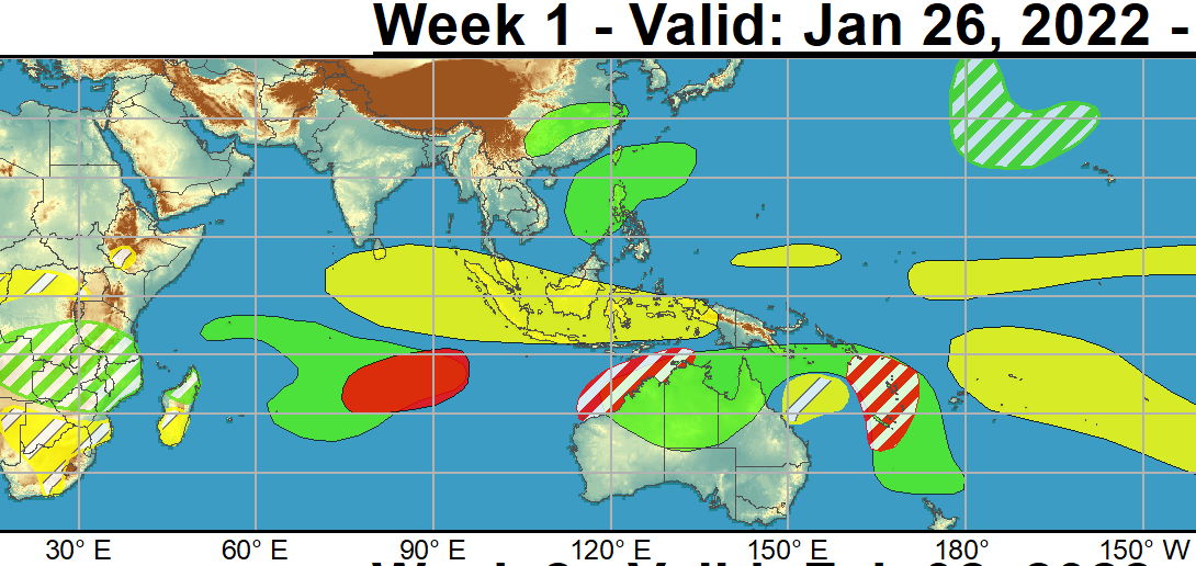
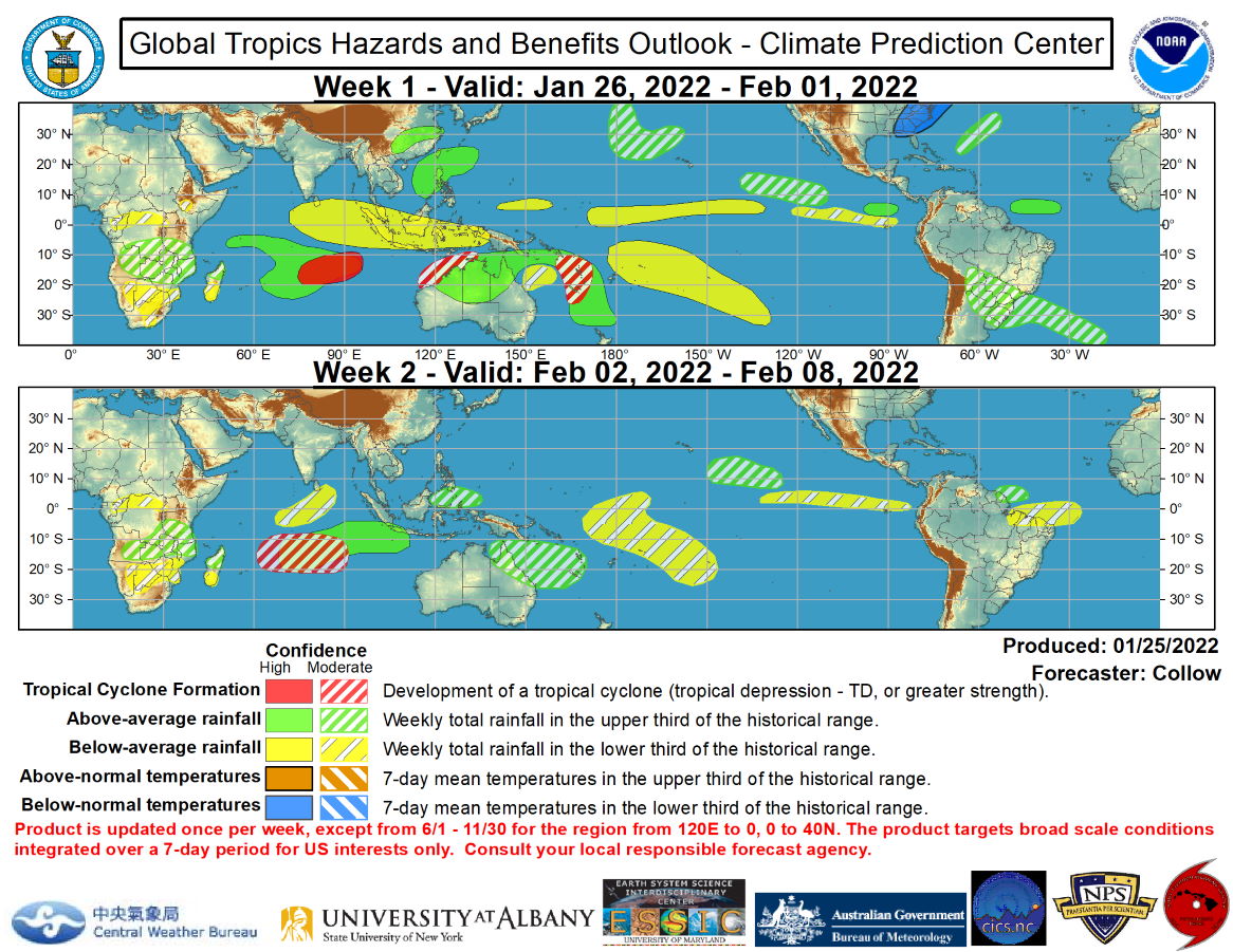
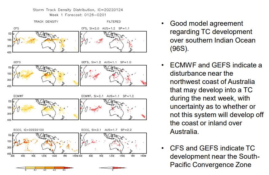
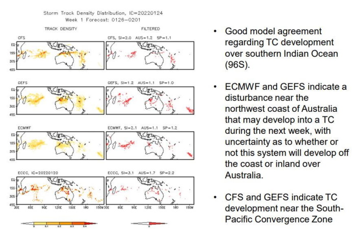
The only tropical cyclone (TC) formation in the past week was Tropical Storm Ana over the southwestern Indian Ocean on January 22. This system first impacted Madagascar as a tropical depression and quickly reorganized over the Mozambique channel, making a second landfall in Mozambique as a moderate strength tropical storm. TC development during the next week is favored over the southern Indian Ocean as well as over the southwestern Pacific, driven by increased Equatorial Rossby Wave activity. The Joint Typhoon Warning Center is currently monitoring a disturbance over the south-central Indian Ocean, which has been given an 80 percent chance of developing into a TC over the next few days as it tracks west-southwestward, corresponding with a high risk area for TC development. Conditions are forecast to remain favorable for TC formation across the southern Indian Ocean into week-2 with the CFS, GEFS, and ECMWF models indicating enhanced convection expanding across the basin, and a broad moderate confidence region is indicated during week-2. NOAA.
JTWC PH
ILES SOEURS
Joint Typhoon Warning Center
JTWC BIS
Issued at 25/1830UTC by NOAA.
In collaboration with the JTWC and several well known organizations.
Archives: HERE
ILES SOEURS
Joint Typhoon Warning Center
JTWC BIS
Issued at 25/1830UTC by NOAA.
In collaboration with the JTWC and several well known organizations.
Archives: HERE
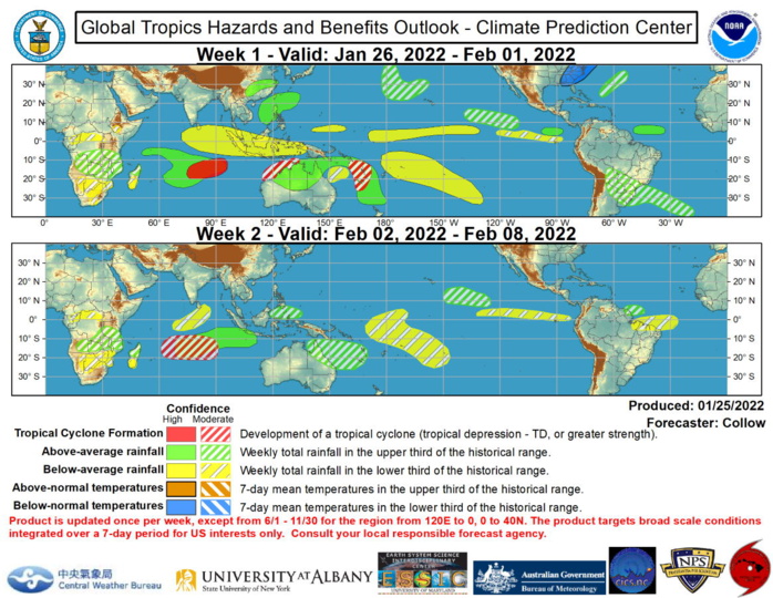
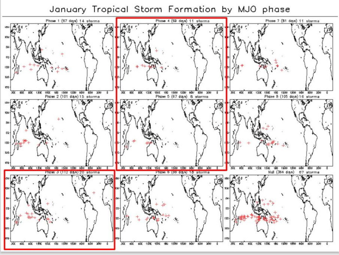
Following an eastward propagating Madden Julian Oscillation (MJO) across the western and central Pacific during December and early January, the RMM-based MJO index has retreated into the unit circle. There is some evidence of a wave-1 asymmetry in the combined upper-level velocity potential anomaly and satellite based infrared fields, with suppressed convection depicted across South America, the southern Atlantic Ocean, Africa, and Eurasia, and enhanced convection over eastern Asia and much of the Pacific, including Australia. However, there is a good deal of noise in the spatial pattern, with several localized extrema indicated across the globe, suggestive of the combined influence of several modes of tropical and extratropical variability. Dynamical models exhibit a large amount of spread regarding the evolution of the MJO during the next two weeks, with the general consensus that the MJO remains weak, with perhaps some amplification of the intraseasonal signal across the Maritime Continent (ECMWF) or Indian Ocean (JMA) by week-2 as the convective envelope begins to retrograde westward, and the low frequency La Nina base state reestablishes itself over the Pacific following a disruption due to the previous MJO event. The only tropical cyclone (TC) formation in the past week was Tropical Storm Ana over the southwestern Indian Ocean on January 22. This system first impacted Madagascar as a tropical depression and quickly reorganized over the Mozambique channel, making a second landfall in Mozambique as a moderate strength tropical storm. TC development during the next week is favored over the southern Indian Ocean as well as over the southwestern Pacific, driven by increased Equatorial Rossby Wave activity. The Joint Typhoon Warning Center is currently monitoring a disturbance over the south-central Indian Ocean, which has been given an 80 percent chance of developing into a TC over the next few days as it tracks west-southwestward, corresponding with a high risk area for TC development. Conditions are forecast to remain favorable for TC formation across the southern Indian Ocean into week-2 with the CFS, GEFS, and ECMWF models indicating enhanced convection expanding across the basin, and a broad moderate confidence region is indicated during week-2. Dynamical models also indicate increased potential for TC development in the vicinity of Vanuatu and New Caledonia where several GEFS and ECMWF ensemble members depict surface low pressure organizing within the South Pacific Convergence Zone and tracking southward. Another disturbance may develop into a TC near the northwestern coast of Australia, but there is some uncertainty within the dynamical model ensembles as to whether this system will develop off the coast or inland over Australia. Both of these areas are highlighted with a moderate confidence for TC development during week-1. The precipitation outlook is based on dynamical model consensus, anticipated TC tracks, the ongoing response to La Nina, and Rossby wave activity. Above-normal precipitation is favored to continue across much of Australia and the southwestern Pacific given the favorable convective pattern aloft. While drier than normal conditions are likely across the Maritime Continent during week-1, the predicted westward expansion of the convective signal and possible renewed MJO are both indicative of a trend toward near to above average rainfall in week-2. Anomalous mid-level troughing forecast over eastern North America is expected to bring periods of below-normal temperatures to much of the eastern third of the contiguous U.S. in week-1, with moderation favored by week-2. For hazardous weather conditions during the next two weeks across the U.S., please refer to your local NWS Forecast Office, the Weather Prediction Center's Medium Range Hazards Forecast, and CPC's Week-2 Hazards Outlook. Forecasts over Africa are made in consultation with the International Desk at CPC and can represent local-scale conditions in addition to global scale variability. NOAA.
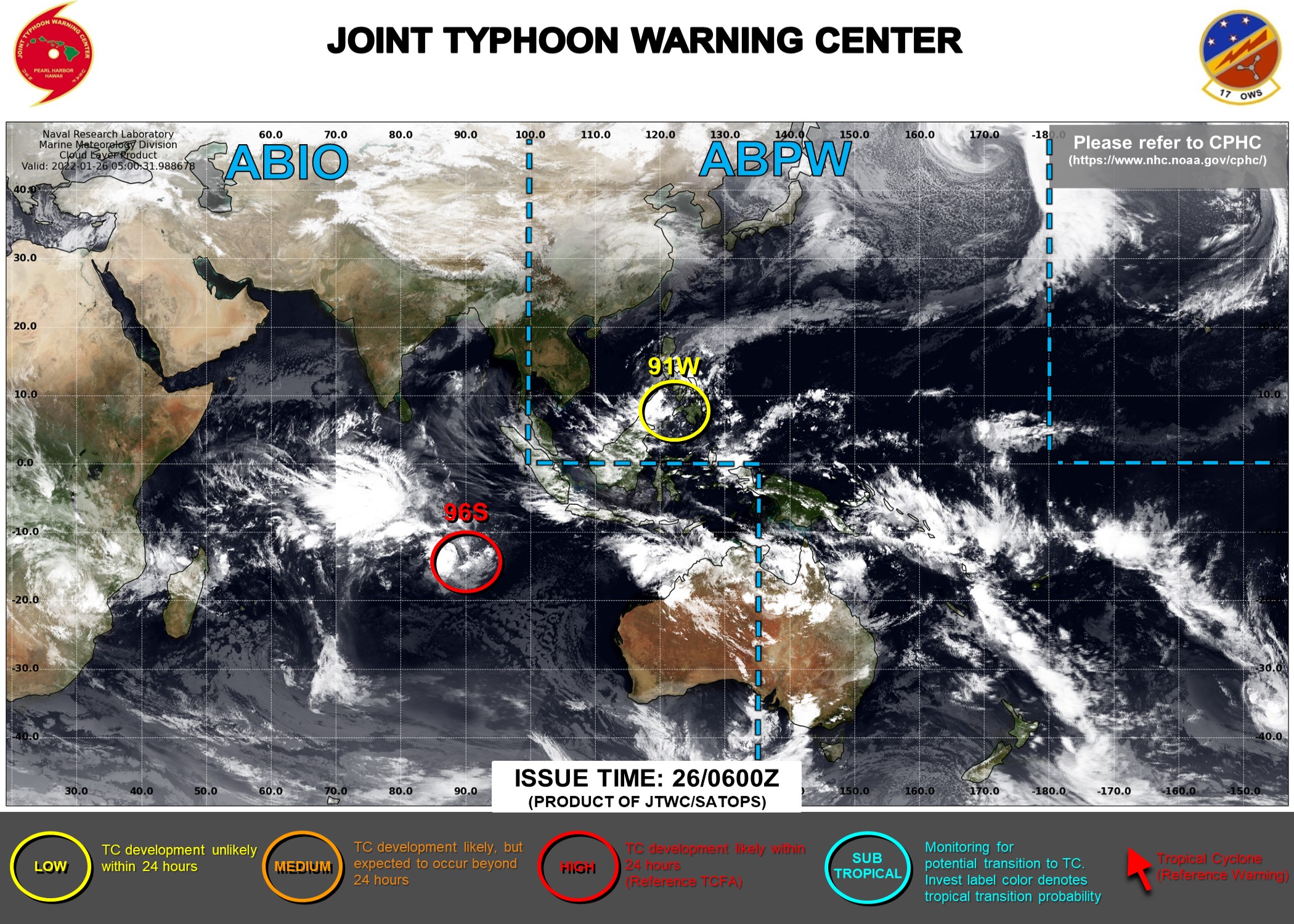
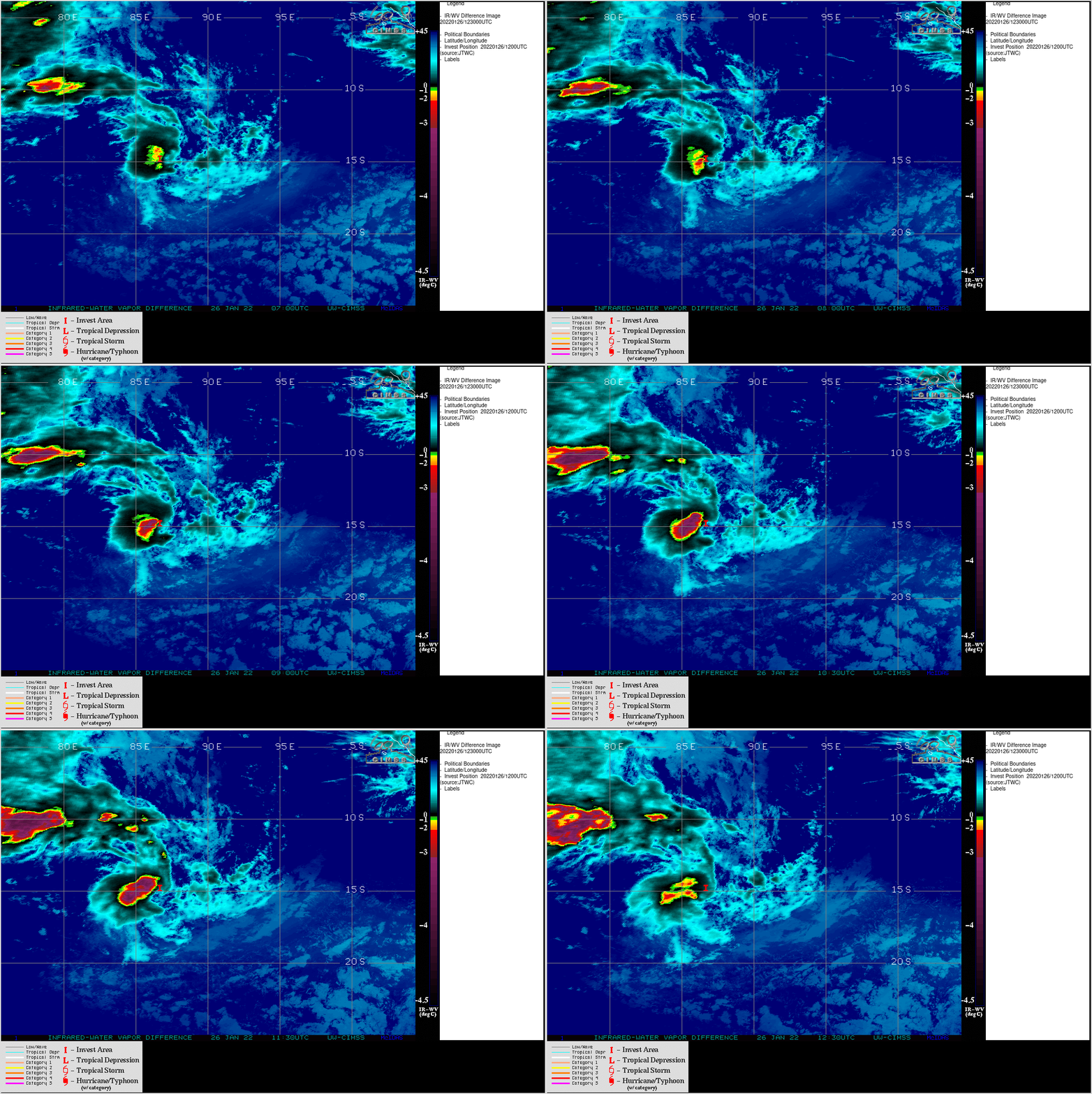
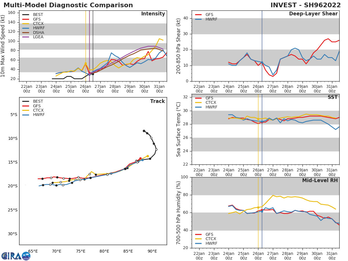
SOUTHERN HEMISPHERE/SOUTH INDIAN OCEAN: INVEST 96S. TROPICAL CYCLONE FORMATION ALERT RE-ISSUED AT 25/2130UTC. CLICK ON THE IMAGERY BELOW TO ANIMATE AND ENLARGE IT.
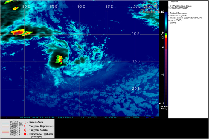
THE AREA OF CONVECTION (INVEST 96S) PREVIOUSLY LOCATED NEAR 12.9S 90.9E IS NOW LOCATED NEAR 13.2S 90.6E, APPROXIMATELY 690 KM WEST OF COCOS ISLANDS. ANIMATED ENHANCED INFRARED SATELLITE IMAGERY DEPICTS CONSOLIDATING CONVECTION OVERHEAD OF AN OBSCURED LOW LEVEL CIRCULATION. ENVIRONMENTAL ANALYSIS CONTINUES TO INDICATE MARGINAL CONDITIONS FOR DEVELOPMENT DEFINED BY FAIR OUTFLOW ALOFT AND WARM (29-30C) SEA SURFACE TEMPERATURES, OFFSET BY HIGH (30-40KT) VERTICAL WIND SHEAR (VWS) TO THE NORTH AND MODERATE TO HIGH (20- 30KT) VWS TO THE SOUTH. GLOBAL MODELS ARE IN GOOD AGREEMENT THAT 96S WILL CONSOLIDATE AS IT CONTINUES ON ITS SOUTH-SOUTHWESTWARD TRACK OVER THE NEXT 24-48 HOURS. MAXIMUM SUSTAINED SURFACE WINDS ARE ESTIMATED AT 20 TO 25 KNOTS. MINIMUM SEA LEVEL PRESSURE IS ESTIMATED TO BE NEAR 1005 MB. THE POTENTIAL FOR THE DEVELOPMENT OF A SIGNIFICANT TROPICAL CYCLONE WITHIN THE NEXT 24 HOURS REMAINS HIGH.
SH, 96, 2022012318, , BEST, 0, 83S, 883E, 20, 1006, DB
SH, 96, 2022012400, , BEST, 0, 88S, 890E, 20, 1005, DB
SH, 96, 2022012406, , BEST, 0, 93S, 896E, 20, 1005, DB
SH, 96, 2022012412, , BEST, 0, 98S, 898E, 20, 1004, DB
SH, 96, 2022012418, , BEST, 0, 103S, 901E, 25, 1002, TD
SH, 96, 2022012500, , BEST, 0, 110S, 904E, 25, 1002, TD
SH, 96, 2022012506, , BEST, 0, 115S, 907E, 20, 1003, DB
SH, 96, 2022012512, , BEST, 0, 122S, 909E, 20, 1003, DB
SH, 96, 2022012518, , BEST, 0, 132S, 906E, 20, 1005, DB
SH, 96, 2022012600, , BEST, 0, 142S, 896E, 25, 1005, TD
SH, 96, 2022012606, , BEST, 0, 144S, 881E, 30, 1000, TD
SH, 96, 2022012612, , BEST, 0, 148S, 867E, 30, 1000, TD
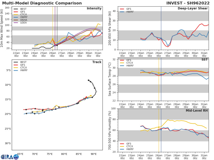
GLOBAL MODELS ARE IN GOOD AGREEMENT THAT 96S WILL CONSOLIDATE AS IT CONTINUES ON ITS SOUTH-SOUTHWESTWARD TRACK OVER THE NEXT 24-48 HOURS.
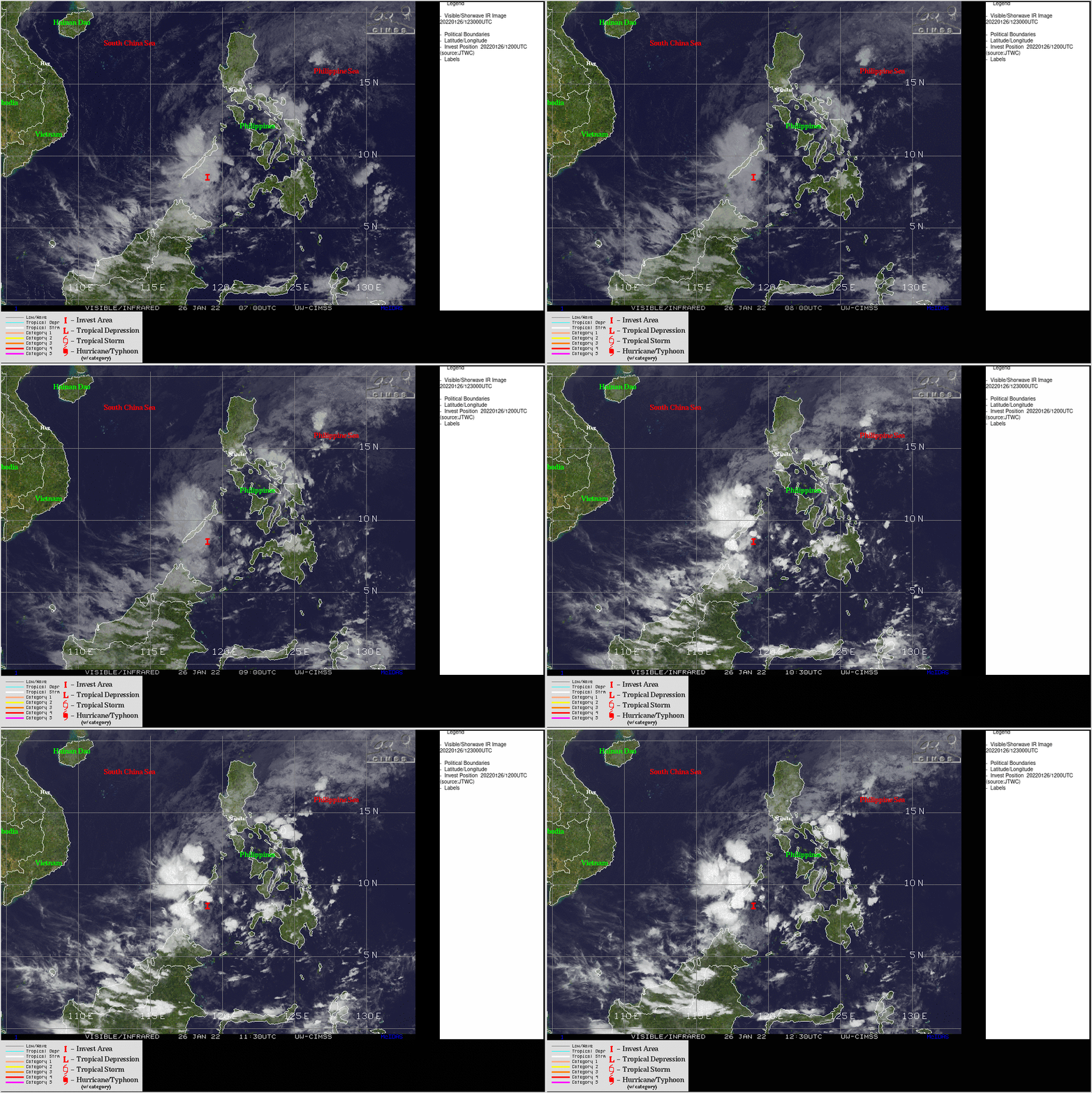
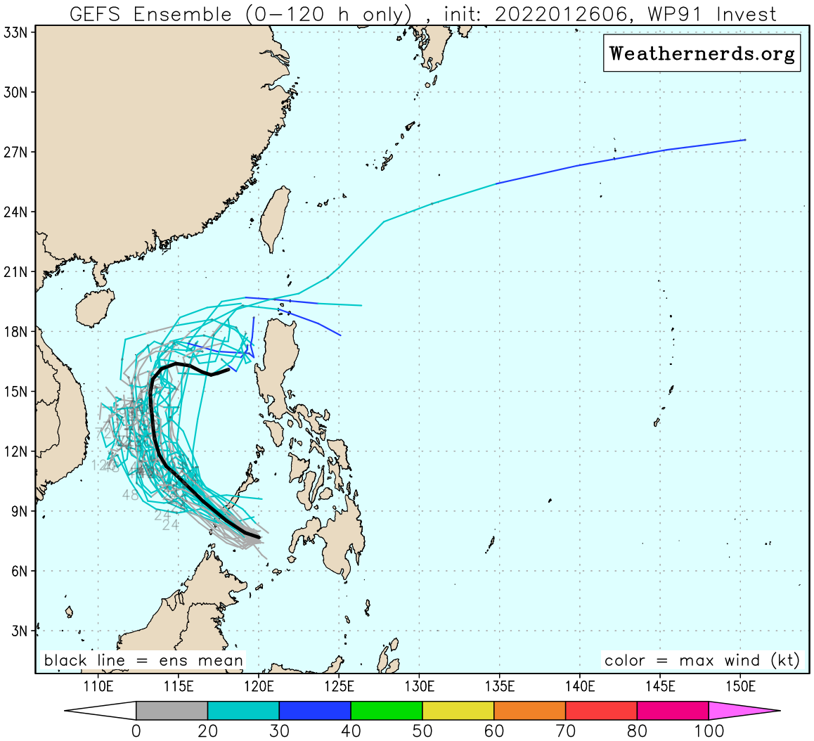
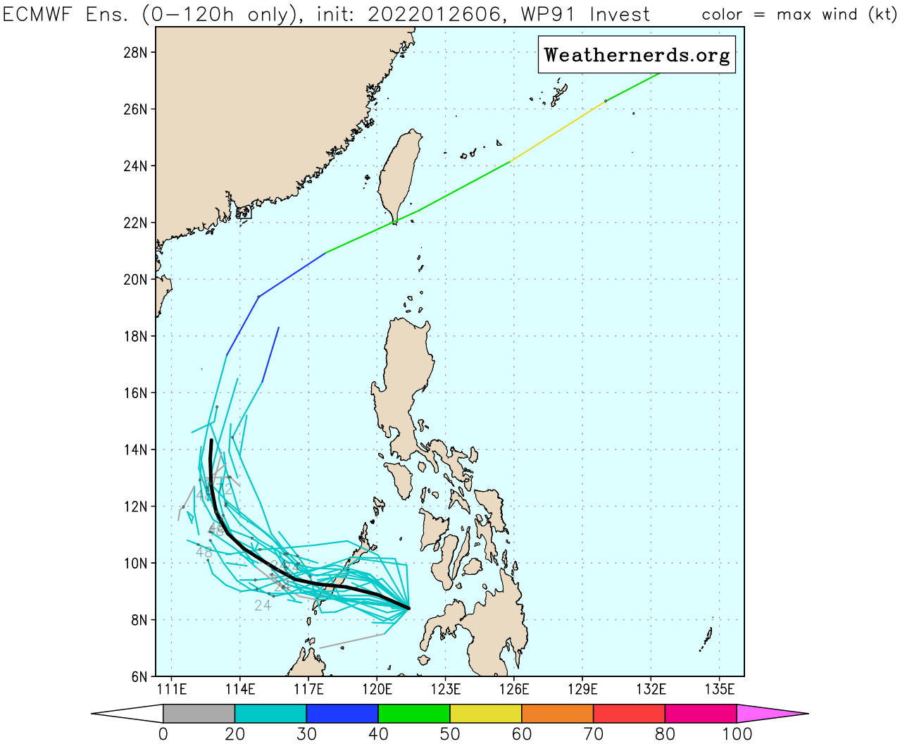
WESTERN NORTH PACIFIC/PHILIPPINES: INVEST 91W. ADVISORY(ABPW) ISSUED AT 26/06UTC. CLICK ON THE IMAGERY BELOW TO ANIMATE AND ENLARGE IT.

THE AREA OF CONVECTION (INVEST 91W) PREVIOUSLY LOCATED NEAR 8.2N 124.2E IS NOW LOCATED NEAR 8.4N 121.4E, APPROXIMATELY 330 KM EAST-SOUTHEAST OF PUERTU PRINCESA, PHILLIPINES. ANIMATED ENHANCED MULTISPECTRAL SATELLITE IMAGERY (MSI) AND A 250330Z ENHANCED INFRA RED IMAGERY (EIR) DEPICTS DISORGANIZED CONVECTION IN THE NORTHEAST AND SOUTHWEST QUADRANTS WRAPPING INTO A WEAKLY DEFINED LOW LEVEL CIRCULATION (LLC). ENVIRONMENTAL ANALYSIS INDICATES MARGINALLY FAVORABLE CONDITIONS DEFINED BY WARM SEA SURFACE TEMPERATURES (27- 28C), LOW TO MODERATE (15-20 KNOTS) VERTICAL WIND SHEAR AND FAIR POLEWARD OUTFLOW. GLOBAL MODELS ARE IN GENERAL AGREEMENT ON THE WESTWARD TRACK OF INVEST 91W AND DESPITE THE MARGINALLY FAVORABLE ENVIRONMENT, INDICATES THE SYSTEM IS NOT EXPECTED TO REACH WARNING CRITERIA IN THE NEXT 48 HOURS. MAXIMUM SUSTAINED SURFACE WINDS ARE ESTIMATED AT 18 TO 23 KNOTS. MINIMUM SEA LEVEL PRESSURE IS ESTIMATED TO BE NEAR 1007 MB. THE POTENTIAL FOR THE DEVELOPMENT OF A SIGNIFICANT TROPICAL CYCLONE WITHIN THE NEXT 24 HOURS REMAINS LOW.
WP, 91, 2022012318, , BEST, 0, 72N, 1317E, 15, 1004, DB,
WP, 91, 2022012400, , BEST, 0, 74N, 1304E, 20, 1003, DB,
WP, 91, 2022012406, , BEST, 0, 77N, 1287E, 20, 1007, DB,
WP, 91, 2022012412, , BEST, 0, 80N, 1269E, 20, 1007, DB,
WP, 91, 2022012418, , BEST, 0, 83N, 1262E, 20, 1004, DB
WP, 91, 2022012500, , BEST, 0, 85N, 1256E, 20, 1003, DB
WP, 91, 2022012506, , BEST, 0, 89N, 1248E, 20, 1003, DB
WP, 91, 2022012512, , BEST, 0, 87N, 1239E, 20, 1003, DB
WP, 91, 2022012518, , BEST, 0, 85N, 1223E, 20, 1007, DB
WP, 91, 2022012600, , BEST, 0, 84N, 1214E, 20, 1007, DB
WP, 91, 2022012606, , BEST, 0, 84N, 1201E, 20, 1005, DB
WP, 91, 2022012612, , BEST, 0, 87N, 1190E, 20, 1007, DB
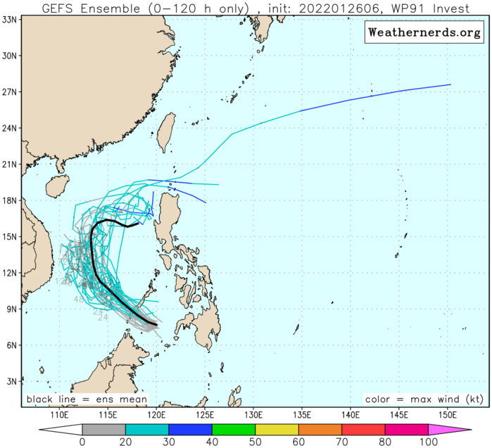
GLOBAL MODELS ARE IN GENERAL AGREEMENT ON THE WESTWARD TRACK OF INVEST 91W AND DESPITE THE MARGINALLY FAVORABLE ENVIRONMENT, INDICATES THE SYSTEM IS NOT EXPECTED TO REACH WARNING CRITERIA IN THE NEXT 48 HOURS.
