CLICK ON THE IMAGERIES BELOW TO GET THEM ENLARGED
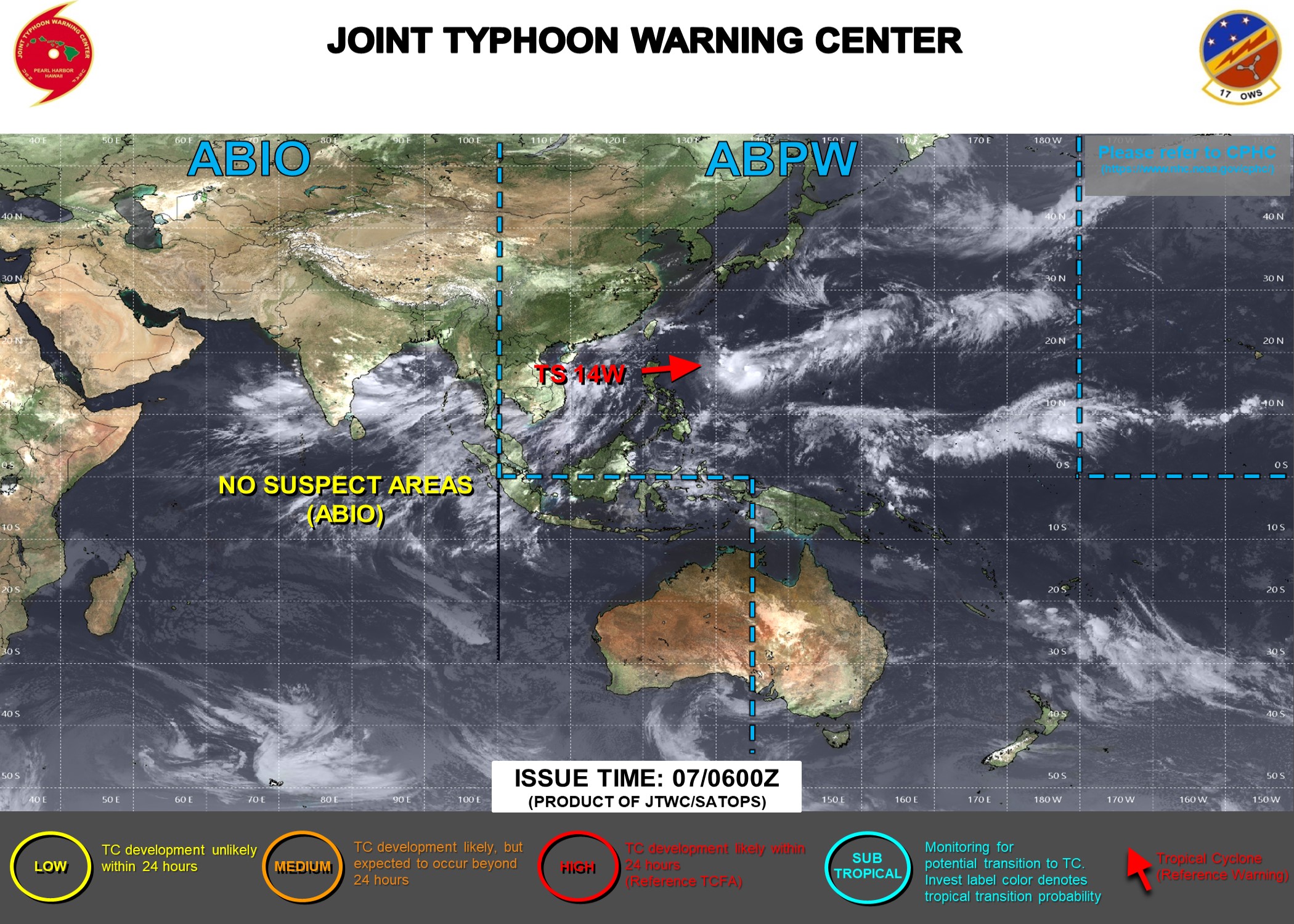
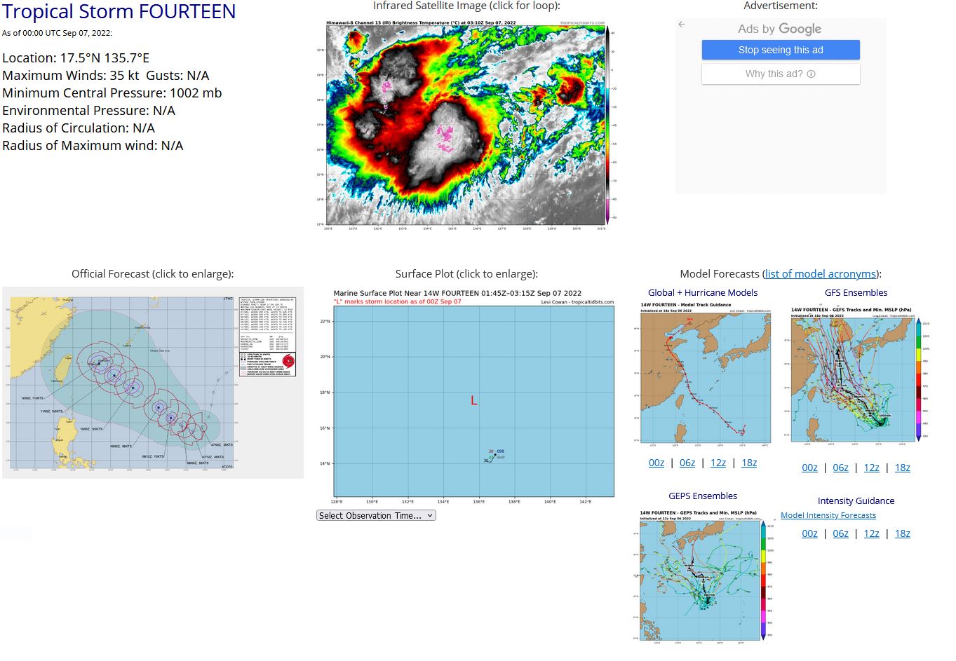
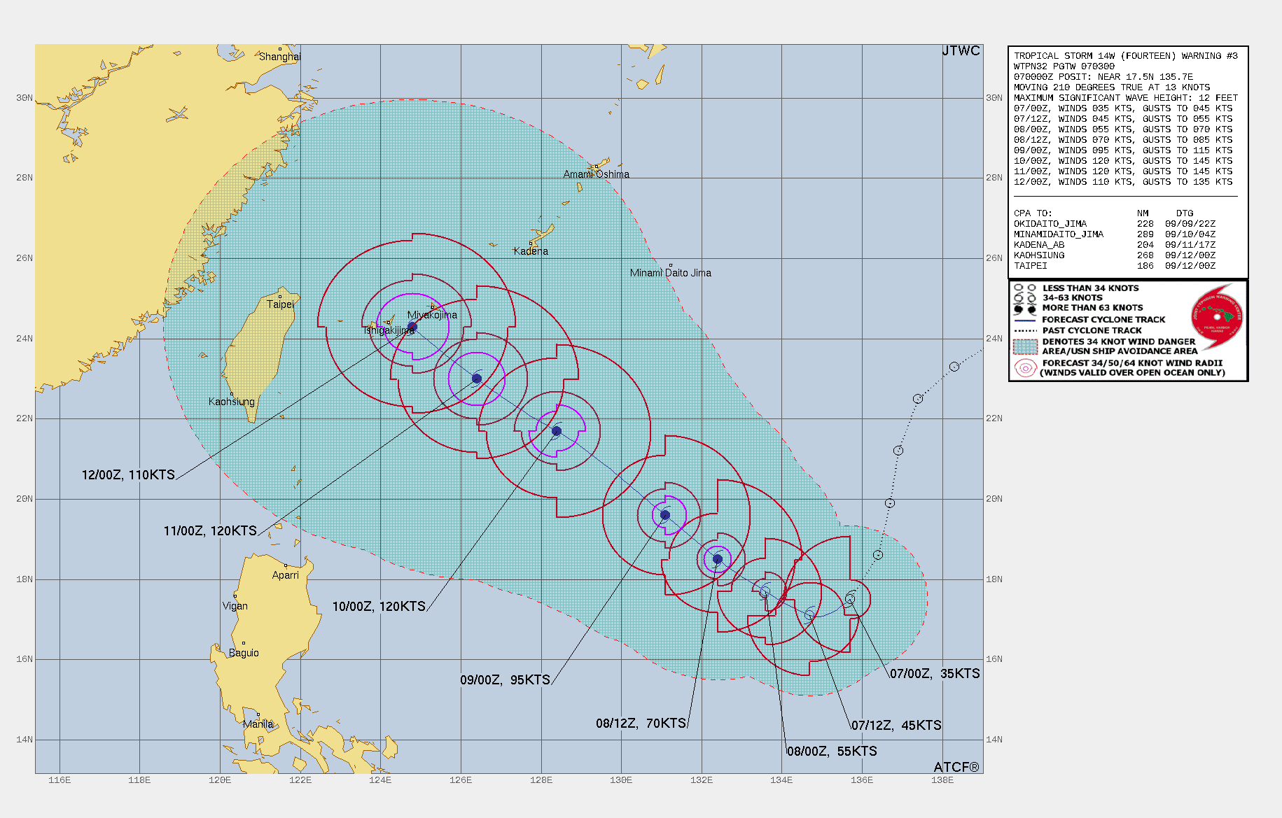
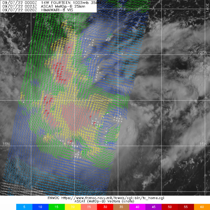
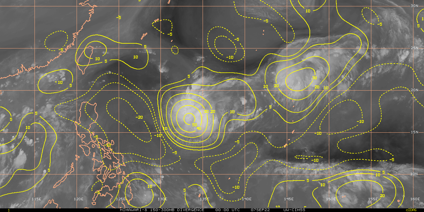
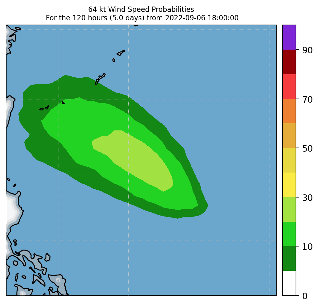
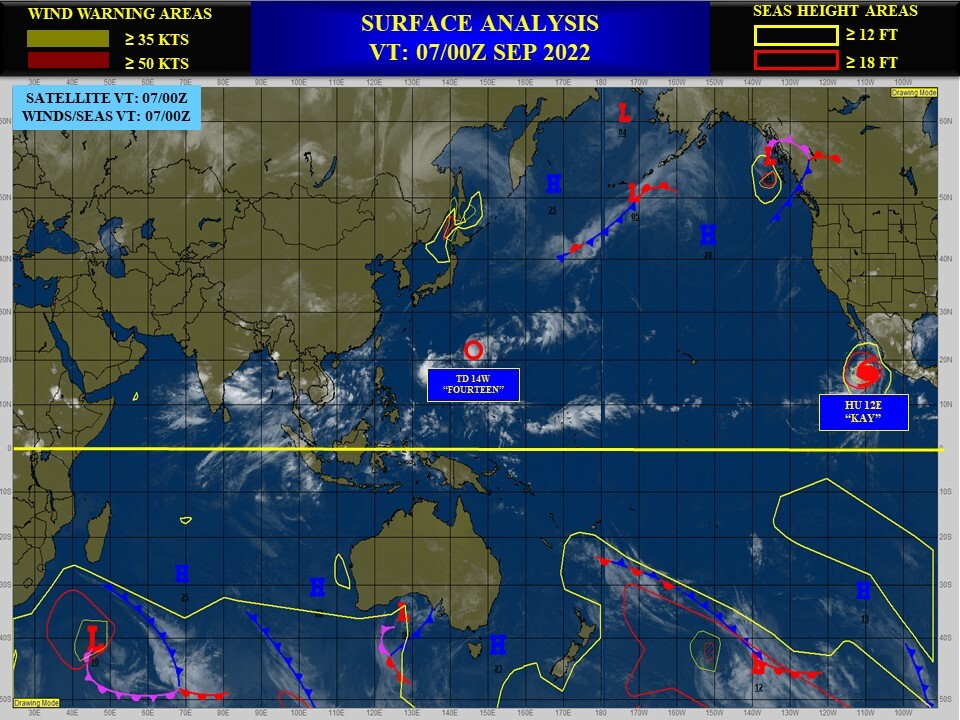
WESTERN NORTH PACIFIC: TS 14W. ESTIMATED LOCATION AND INTENSITY AT 07/00UTC. WARNING 3 ISSUED AT 07/03UTC.
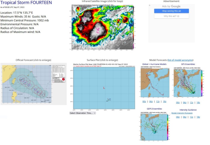
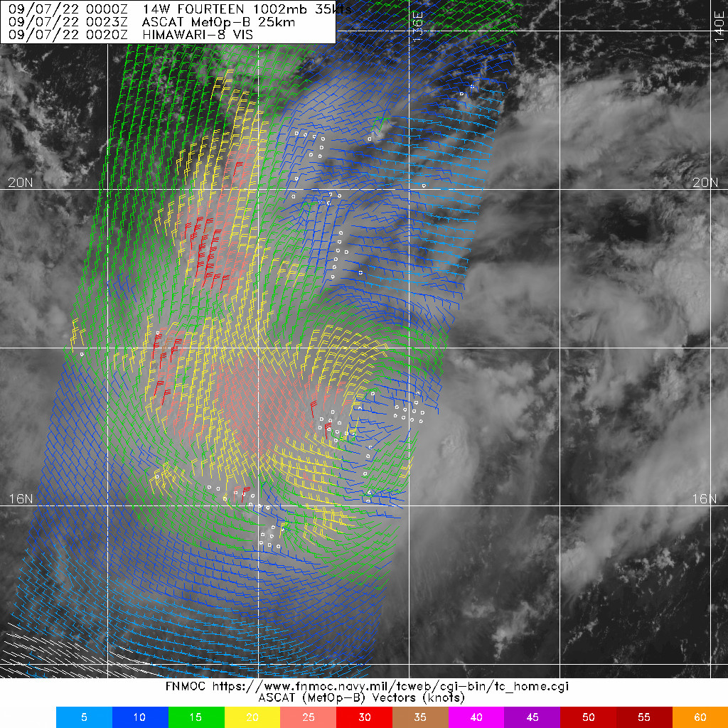
SATELLITE ANALYSIS, INITIAL POSITION AND INTENSITY DISCUSSION: ANIMATED MULTISPECTRAL SATELLITE IMAGERY (MSI) DEPICTS A CONSOLIDATING SYSTEM WITH DEEP CONVECTIVE BANDING OVER THE WESTERN SEMICIRCLE WRAPPING INTO A DEVELOPING CENTRAL DENSE OVERCAST, WHICH IS OBSCURING THE LOW-LEVEL CIRCULATION CENTER (LLCC). MSI ALSO SHOWS EXTENSIVE WELL-DEFINED LOW-LEVEL CLOUD LINES WRAPPING INTO THE LLCC. A 062137Z SSMIS 91GHZ COLOR COMPOSITE MICROWAVE IMAGE REVEALS A BROAD LLCC POSITIONED ALONG THE NORTHEASTERN EDGE OF A CURVED SPIRAL BAND. THE INITIAL POSITION IS PLACED WITH HIGH CONFIDENCE BASED ON A 070023Z ASCAT-B IMAGE, WHICH SHOWS AN ELONGATED BUT DEFINED CENTER WITH 30-35 KNOT WINDS OVER THE WESTERN PERIPHERY. THE INITIAL INTENSITY OF 35 KTS IS ASSESSED WITH HIGH CONFIDENCE BASED ON THE PGTW, KNES DVORAK ESTIMATES AND ASCAT DATA. ENVIRONMENTAL CONDITIONS ARE FAVORABLE WITH MODERATE EQUATORWARD OUTFLOW, IMPROVING EASTWARD OUTFLOW INTO THE TUTT POSITIONED TO THE NORTH AND NORTHEAST, AND LOW VERTICAL WIND SHEAR.
WP, 14, 2022090412,253N, 1444E, 15,1008
WP, 14, 2022090418,249N, 1435E, 15,1007
WP, 14, 2022090500,246N, 1421E, 15,1007
WP, 14, 2022090506,244N, 1407E, 15,1006
WP, 14, 2022090512,240N, 1394E, 20,1011
WP, 14, 2022090518,233N, 1383E, 20,1008
WP, 14, 2022090600,225N, 1374E, 20,1005
WP, 14, 2022090606,215N, 1370E, 25,1007
WP, 14, 2022090612,198N, 1366E, 30,1002
WP, 14, 2022090618,185N, 1365E, 30,1003
WP, 14, 2022090700,175N, 1357E, 35,1002
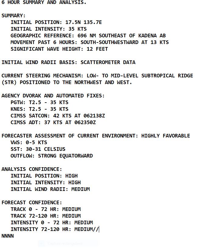
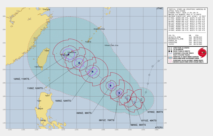
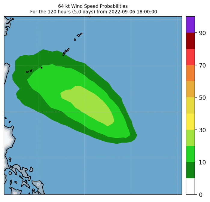
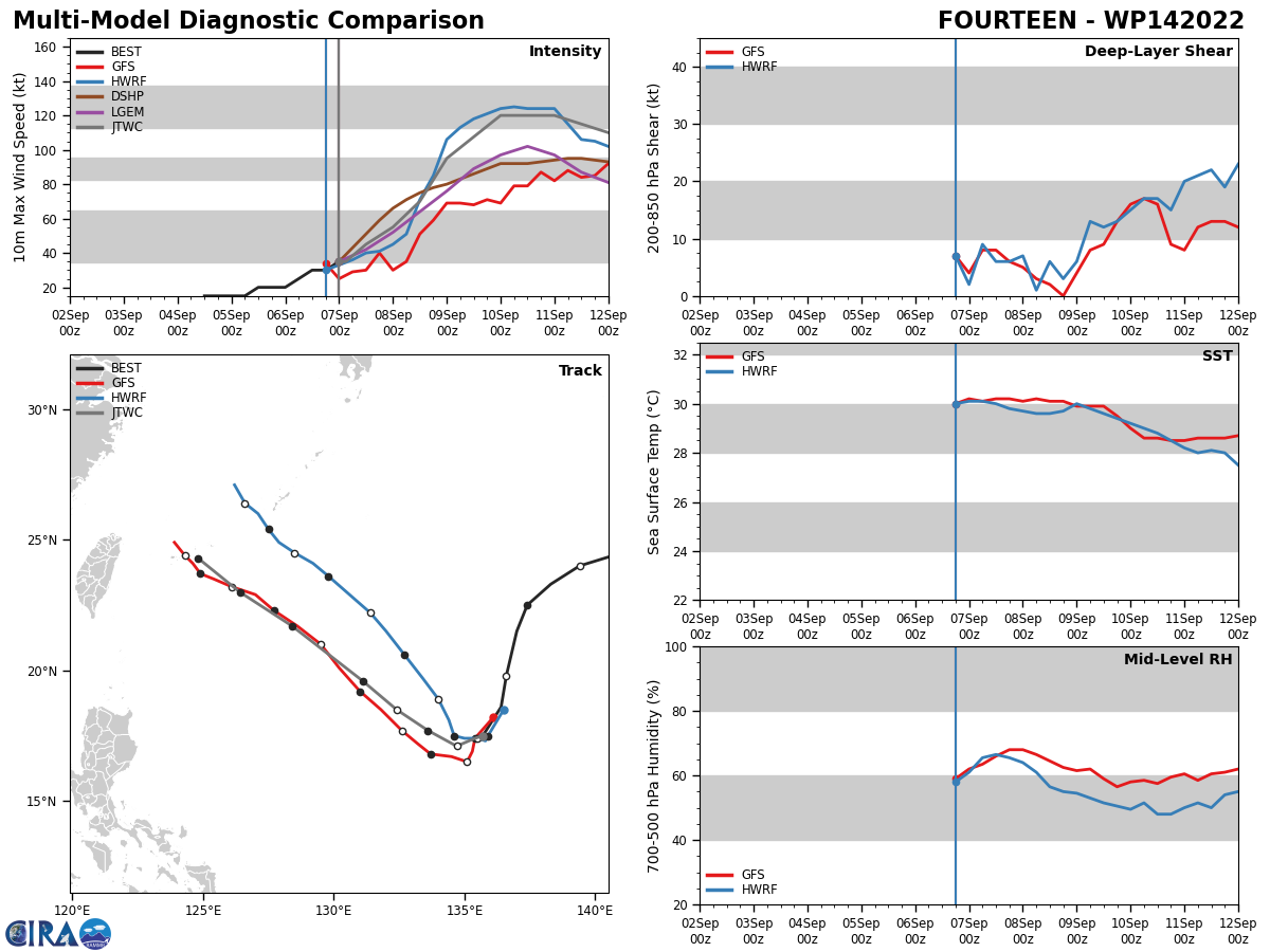
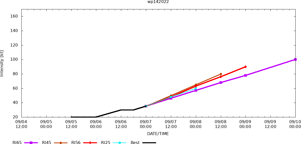
FORECAST REASONING. SIGNIFICANT FORECAST CHANGES: THERE ARE NO SIGNIFICANT CHANGES TO THE FORECAST FROM THE PREVIOUS WARNING. FORECAST DISCUSSION: TS 14W IS TRACKING SOUTHWESTWARD ALONG THE SOUTHEASTERN PERIPHERY OF THE SUBTROPICAL RIDGE (STR) POSITIONED TO THE WEST, AND WILL GRADUALLY TURN WEST-SOUTHWESTWARD THROUGH TAU 12. THE STR IS EXPECTED TO STRENGTHEN TO THE EAST AND REALIGN TO THE NORTH WHICH WILL TURN THE SYSTEM WEST-NORTHWESTWARD TO NORTHWESTWARD THROUGH TAU 120. A DEEP MIDLATITUDE SHORTWAVE TROUGH WILL DIG OVER EASTERN CHINA AFTER TAU 96, WHICH COULD DRIVE THE SYSTEM MORE NORTHWESTWARD. TS 14W WILL STEADILY INTENSIFY THROUGH TAU 24 WITH RAPID INTENSIFICATION LIKELY FROM TAU 24 TO TAU 48 AS POLEWARD OUTFLOW IMPROVES AND THE SYSTEM TRACKS OVER WARM SST (30-31C) AND VERY HIGH OCEAN HEAT CONTENT.
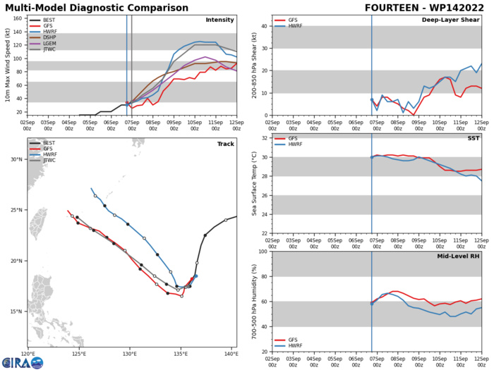
MODEL DISCUSSION: NUMERICAL MODEL GUIDANCE IS IN FAIR (IMPROVED) AGREEMENT THROUGH THE FORECAST PERIOD WITH A LARGE SPREAD OF 230- 300NM FROM TAU 72 TO TAU 120. THE PRIMARY OUTLIERS ARE AFUM, EGRR AND UEMN ON THE SOUTHERN EDGE OF THE AIDS ENVELOPE, AND AEMN ON THE NORTHERN EDGE. THE STATISTICALLY BETTER VORTEX TRACKERS (ECMWF, EEMN AND AVNO) ARE CLUSTERED CLOSELY TOGETHER AND INDICATE A TRACK TOWARD THE ISHIGAKI-JIMA REGION. THE JTWC FORECAST TRACK IS POSITIONED CLOSE TO THESE TRACKERS AND IS POSITIONED JUST NORTH OF THE MULTI-MODEL CONSENSUS. THE BULK OF THE ECMWF ENSEMBLE (EPS) SOLUTIONS SUPPORT THE JTWC FORECAST TRACK WITH MEDIUM OVERALL CONFIDENCE. THE RELIABLE INTENSITY GUIDANCE IS IN FAIR AGREEMENT AND SUPPORTS A RAPID INTENSIFICATION PHASE WITH HWRF INDICATING A PEAK INTENSITY NEAR 123 KNOTS AND COAMPS-TC (GFS VERSION) A PEAK INTENSITY OF 120 KNOTS, SIGNIFICANTLY ABOVE THE INTENSITY CONSENSUS PEAK OF 105 KNOTS. RAPID INTENSIFICATION (RI) GUIDANCE IS TRIGGERED LENDING ADDITIONAL SUPPORT TO THE IMMINENT RI PHASE.
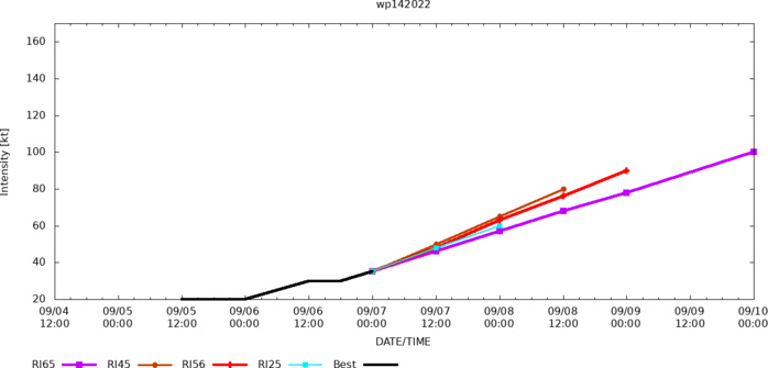
RAPID INTENSIFICATION (RI) GUIDANCE IS TRIGGERED LENDING ADDITIONAL SUPPORT TO THE IMMINENT RI PHASE.
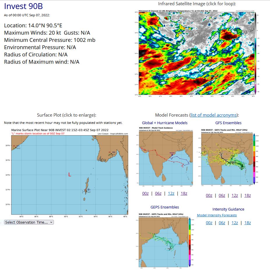
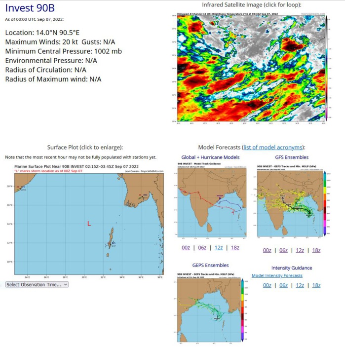
NORTH INDIAN/BAY OF BENGAL: INVEST 90B. ESTIMATED LOCATION AND INTENSITY AT 07/00UTC.
IO, 90, 2022090612,133N, 911E, 20,1002
IO, 90, 2022090618,137N, 908E, 20,1007
IO, 90, 2022090700,140N, 905E, 20,1002
IO, 90, 2022090618,137N, 908E, 20,1007
IO, 90, 2022090700,140N, 905E, 20,1002
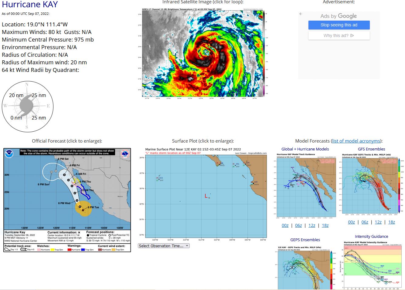
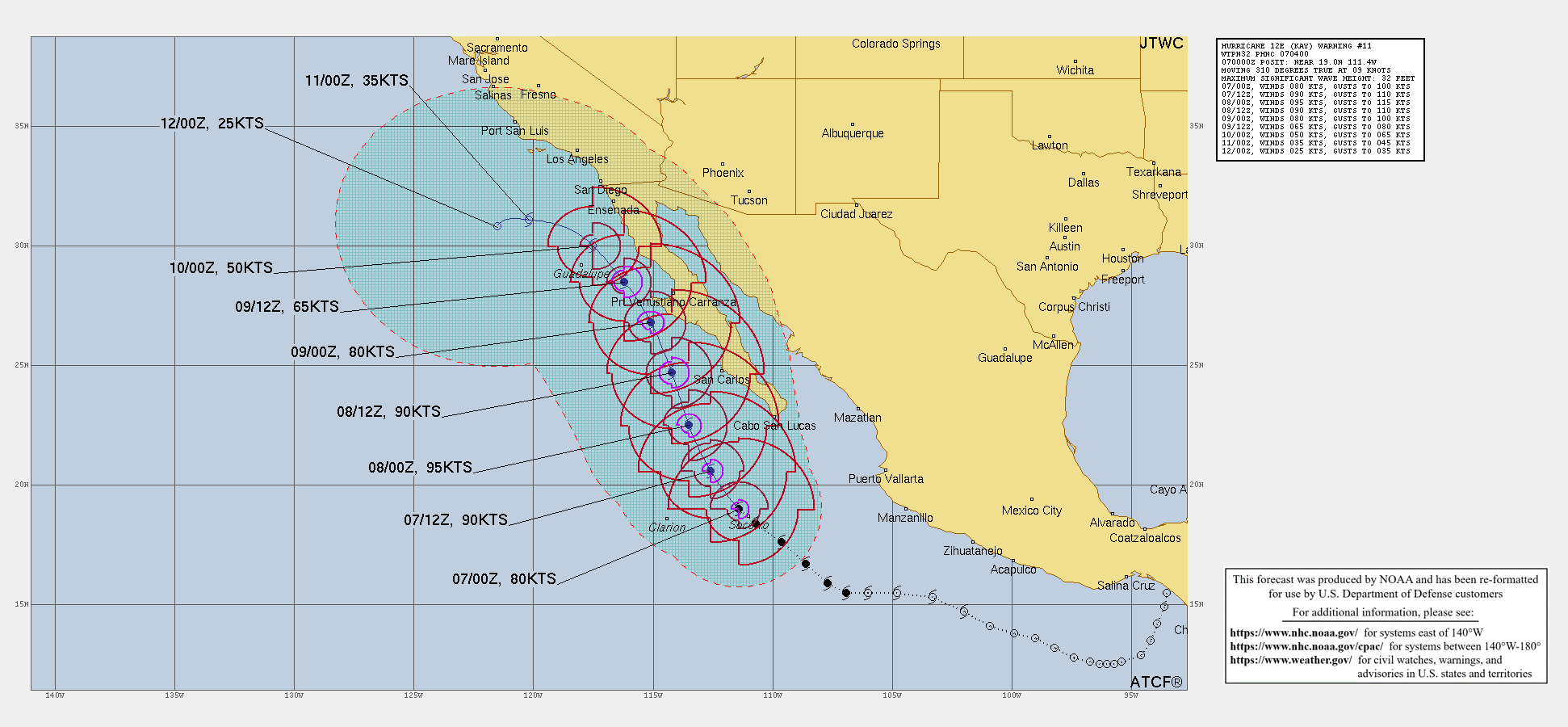
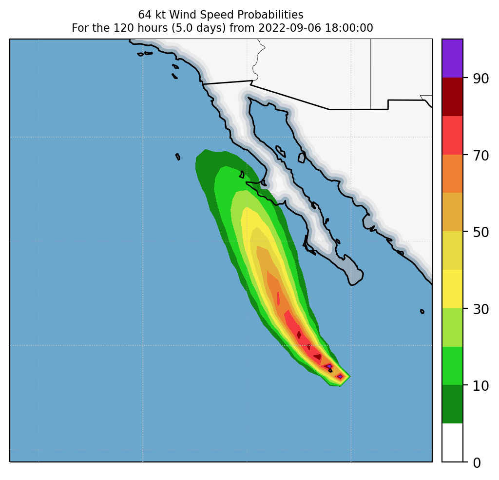
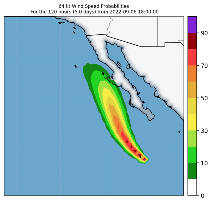
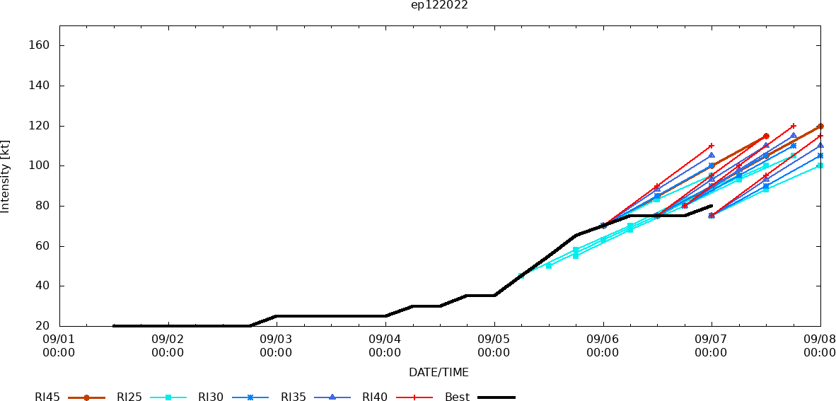
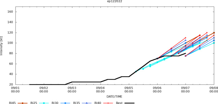
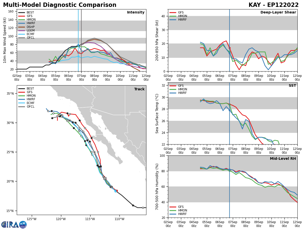
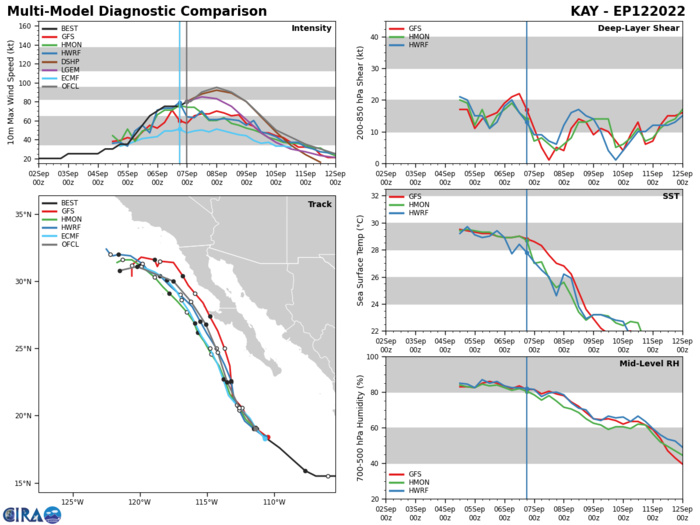
EASTERN NORTH PACIFIC: HU 12E(KAY). ESTIMATED LOCATION AND INTENSITY AT 07/00UTC. WARNING 11 ISSUED AT 07/00UTC. NHC COMMENTS.
EP, 12, 2022090606,167N, 1086W, 75, 977
EP, 12, 2022090612,176N, 1096W, 75, 977
EP, 12, 2022090618,184N, 1107W, 75, 978
EP, 12, 2022090700,190N, 1114W, 80, 975
EP, 12, 2022090612,176N, 1096W, 75, 977
EP, 12, 2022090618,184N, 1107W, 75, 978
EP, 12, 2022090700,190N, 1114W, 80, 975
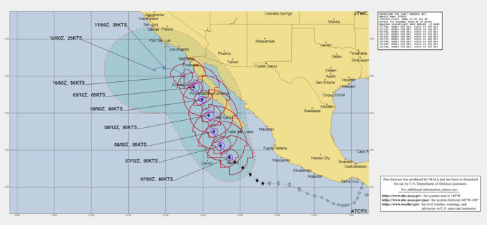
000 WTPZ42 KNHC 070243 TCDEP2 Hurricane Kay Discussion Number 11 NWS National Hurricane Center Miami FL EP122022 900 PM MDT Tue Sep 06 2022 Kay looks slightly better organized on satellite imagery with a broad eye-like feature surrounded by curved bands of strong convection. Upper-level outflow is strong over all but the northwestern portion of the circulation. The current intensity is bumped up slightly to 80 kt which is a compromise between highly varied subjective and objective Dvorak estimates. It should be noted there is a greater than usual amount of uncertainty in the advisory intensity. Vertical wind shear on Kay is forecast to be low, and the system is expected to remain in a fairly moist mid-level air mass for the next few days. These factors should lead to further short-term strengthening. However, SSTs will be decreasing significantly in 24 to 36 hours, which will likely result in a weakening trend commencing on Thursday. Later in the forecast period, very cool waters should result in Kay becoming a post-tropical cyclone after it passes near the northern Baja California in around 96 hours. This is consistent with simulated satellite imagery from the global models that show little or no associated deep convection around that time. The official intensity forecast is above the guidance models, especially for the first half of the forecast period. Kay continues northwestward, moving at about 320/11 kt. There is little change to the track forecast reasoning. A ridge to the northeast of the cyclone is expected to result in a mostly north-northwestward motion for the next few days. This should bring the core of the of Kay very near the west-central Baja California coast on Thursday and Friday. Later in the forecast period, low-level ridging is expected to cause the weakening cyclone to turn westward. The NHC track forecast is close to the previous one and also close to the corrected multi-model consensus. Kay is a very large tropical cyclone. It is producing an extensive area of high seas, with swells affecting portions of southwestern Mexico and the southern Baja California peninsula. Although Kay is likely to weaken before it makes its closest approach to the west-central coast of the Baja peninsula, it is forecast to remain a large and dangerous hurricane through that time. In addition, high wind, surf, and rainfall impacts will extend far from the center so users should not focus on the exact forecast track. KEY MESSAGES: 1. Heavy rainfall from Kay could lead to flash flooding, including landslides, across portions of the Baja California peninsula and mainland northwestern Mexico through Friday. 2. Tropical storm conditions are expected over portions of the Baja California peninsula beginning Wednesday morning, where a Tropical Storm Warning is in effect. 3. Hurricane conditions are possible along portions of the west-central Baja California coast on Thursday, where a hurricane watch has been issued. Additional tropical storm watches and warnings for the northern Baja California peninsula could be required later tonight and Wednesday. FORECAST POSITIONS AND MAX WINDS INIT 07/0300Z 19.5N 111.7W 80 KT 90 MPH 12H 07/1200Z 20.6N 112.6W 90 KT 105 MPH 24H 08/0000Z 22.5N 113.5W 95 KT 110 MPH 36H 08/1200Z 24.7N 114.2W 90 KT 105 MPH 48H 09/0000Z 26.8N 115.1W 80 KT 90 MPH 60H 09/1200Z 28.5N 116.2W 65 KT 75 MPH 72H 10/0000Z 30.0N 117.5W 50 KT 60 MPH 96H 11/0000Z 31.1N 120.2W 35 KT 40 MPH...POST-TROPICAL 120H 12/0000Z 30.8N 121.5W 25 KT 30 MPH...POST-TROP/REMNT LOW $$ Forecaster Pasch
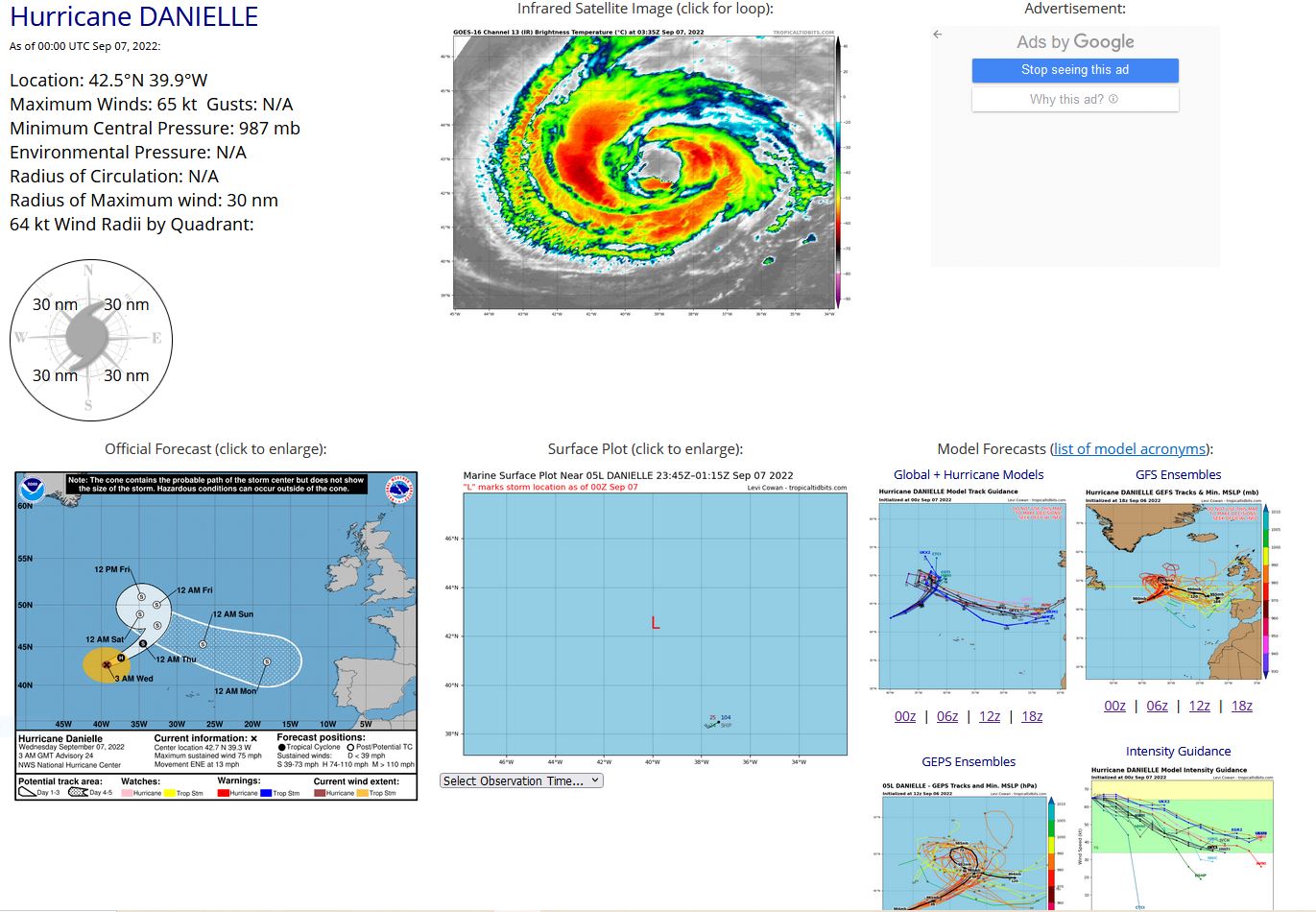
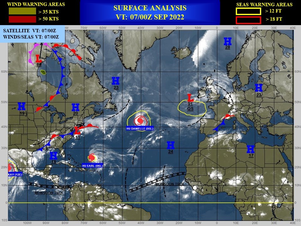
NORTH ATLANTIC: HU 05L(DANIELLE). ESTIMATED LOCATION AND INTENSITY AT 07/00UTC. NHC COMMENTS.
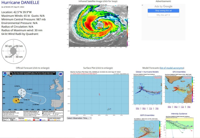
000 WTNT45 KNHC 070233 TCDAT5 Hurricane Danielle Discussion Number 24 NWS National Hurricane Center Miami FL AL052022 300 AM GMT Wed Sep 07 2022 This morning's conventional satellite presentation indicates little change in Danielle's cloud pattern since yesterday morning. However, a recent SSMI/S microwave image shows a subtle vertical tilt toward the east. The initial intensity is held at 65 kt for this advisory and is based on a blend of the subjective and AiDT objective satellite intensity estimates and an earlier STAR SAR/S1 surface wind retrieval that indicated winds of 70 kt. Danielle should remain over marginally warm waters for the next 12-18 hours. Subsequently, little change in strength is expected during that time. By early Thursday, Danielle will move over a sharp surface temperature gradient of 22C or less. This negative oceanic contribution, combined with the loss of dynamic forcing after the cyclone merges with the approaching baroclinic system, should induce a slow weakening trend through the end of the period. Danielle's initial motion is estimated to be east-northeastward, or 060/11 kt. There is no significant change to the NHC forecast philosophy. Danielle should continue accelerating in response to a vigorous baroclinic system approaching from the northwest Atlantic east of the Newfoundland coast. Danielle is forecast to interact with the system mentioned above late Thursday night. On Friday, the two systems are predicted to merge and become a larger and strong extratropical low with asymmetric deep warm core characteristics typical of warm seclusions. Over the weekend, the large post-tropical low is expected to turn east-southeastward and maintain this general motion through early next week. Danielle is producing a vast area of very rough seas over the central-north Atlantic. More information can be found in the High Seas Forecasts issued by the Ocean Prediction Center under AWIPS header NFDHSFAT1, WMO header FZNT01 KWBC, and online at ocean.weather.gov/shtml/NFDHSFAT1.php. The UK Met Office also has information in High Seas Forecasts for the west Central and east Central sections issued under WMO header FQNT21 EGRR and on the web at metoffice.gov.uk/weather/specialist-forecasts/coast-and-sea/high- seas-forecast FORECAST POSITIONS AND MAX WINDS INIT 07/0300Z 42.7N 39.3W 65 KT 75 MPH 12H 07/1200Z 43.6N 37.4W 65 KT 75 MPH 24H 08/0000Z 45.4N 34.5W 60 KT 70 MPH 36H 08/1200Z 47.6N 32.6W 55 KT 65 MPH...POST-TROP/EXTRATROP 48H 09/0000Z 50.0N 32.7W 55 KT 65 MPH...POST-TROP/EXTRATROP 60H 09/1200Z 50.9N 34.7W 50 KT 60 MPH...POST-TROP/EXTRATROP 72H 10/0000Z 48.9N 34.9W 45 KT 50 MPH...POST-TROP/EXTRATROP 96H 11/0000Z 45.3N 26.6W 40 KT 45 MPH...POST-TROP/EXTRATROP 120H 12/0000Z 43.1N 18.1W 35 KT 40 MPH...POST-TROP/EXTRATROP $$ Forecaster Roberts
AL, 05, 2022090606,419N, 423W, 65, 986
AL, 05, 2022090612,421N, 417W, 65, 986
AL, 05, 2022090618,423N, 409W, 65, 986
AL, 05, 2022090700,425N, 399W, 65, 987
AL, 05, 2022090612,421N, 417W, 65, 986
AL, 05, 2022090618,423N, 409W, 65, 986
AL, 05, 2022090700,425N, 399W, 65, 987
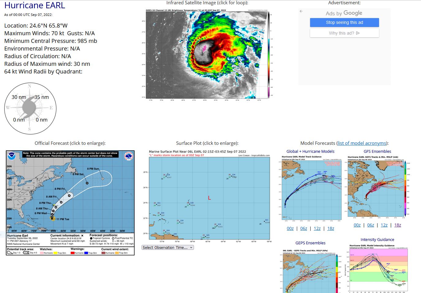
NORTH ATLANTIC: HU 06L(EARL). ESTIMATED LOCATION AND INTENSITY AT 07/00UTC. NHC COMMENTS.
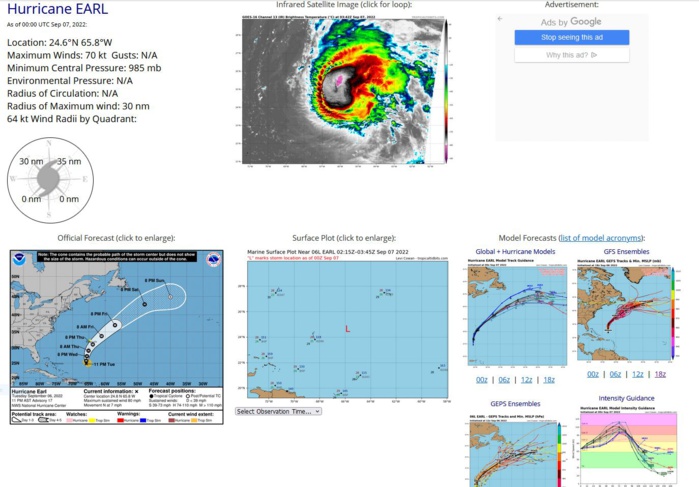
000 WTNT41 KNHC 070256 TCDAT1 Hurricane Earl Discussion Number 17 NWS National Hurricane Center Miami FL AL062022 1100 PM AST Tue Sep 06 2022 Earl continues to be become better organized this evening. An ongoing NOAA reconnaissance mission measured 700-mb flight-level winds as high as 80 kt, which supports an intensity of around 70 kt. There were some higher winds measured by the SFMR and dropsondes, however, we prefer to remain on the conservative side given the fluctuations Earl has been experiencing over the past 24 hours. Radar images show the eyewall is still open to the south, and Earl is likely is still experiencing the affects of strong shear. The aircraft fixes indicate that Earl is moving northward at 6 kt. A mid-level ridge over the hurricane is expected to continue weakening while a trough moves off the coast of the eastern United States. This trough is predicted to steer Earl to the northeast in about a day or so and accelerate its forward motion poleward. Once again, the track model guidance has shifted west slightly, and the NHC track forecast has moved to the west and is closest to the correct consensus model guidance. Despite the model-analyzed strong westerly deep-layer shear, Earl has intensified. This magnitude of shear is predicted to continue for another day or so before weakening briefly in about two days for a 24-hour period. Oceanic conditions under the hurricane are expected to be conducive for further intensification for the next few days as well. Therefore, the latest official forecast predicts the hurricane will continue to intensify for the next 24 hours, with a quicker rate of strengthening between 24 and 72 hours. Earl is expected to make its extratropical transition by day 5. KEY MESSAGES: 1. Although Earl's center is forecast to pass southeast of Bermuda, the wind field is expected to grow, with tropical-storm-force winds possibly spreading across the island on Thursday. 2. Swells generated by Earl are expected to reach Bermuda by Thursday morning. These swells are likely to cause life-threatening surf and rip current conditions through Friday. Please consult products from your local weather office. FORECAST POSITIONS AND MAX WINDS INIT 07/0300Z 24.8N 65.8W 70 KT 80 MPH 12H 07/1200Z 25.8N 65.8W 80 KT 90 MPH 24H 08/0000Z 27.3N 65.6W 85 KT 100 MPH 36H 08/1200Z 29.1N 65.1W 90 KT 105 MPH 48H 09/0000Z 31.1N 63.8W 100 KT 115 MPH 60H 09/1200Z 33.7N 61.1W 105 KT 120 MPH 72H 10/0000Z 37.0N 57.0W 110 KT 125 MPH 96H 11/0000Z 42.9N 47.9W 90 KT 105 MPH 120H 12/0000Z 44.9N 40.0W 60 KT 70 MPH...POST-TROP/EXTRATROP $$ Forecaster Bucci/Pasch
AL, 06, 2022090606,231N, 653W, 55, 995
AL, 06, 2022090612,235N, 657W, 55, 996
AL, 06, 2022090618,239N, 657W, 60, 994
AL, 06, 2022090700,246N, 658W, 70, 985
