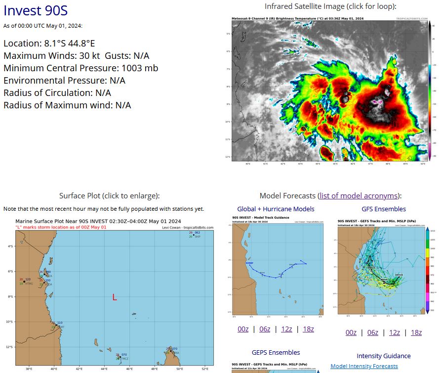
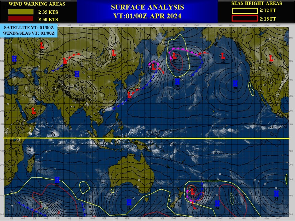
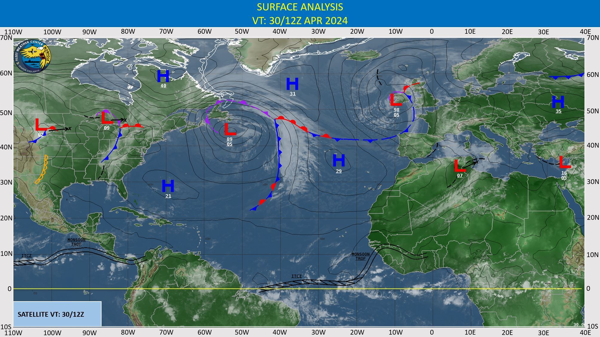
CLICK ON THE IMAGERIES BELOW TO GET THEM ENLARGED
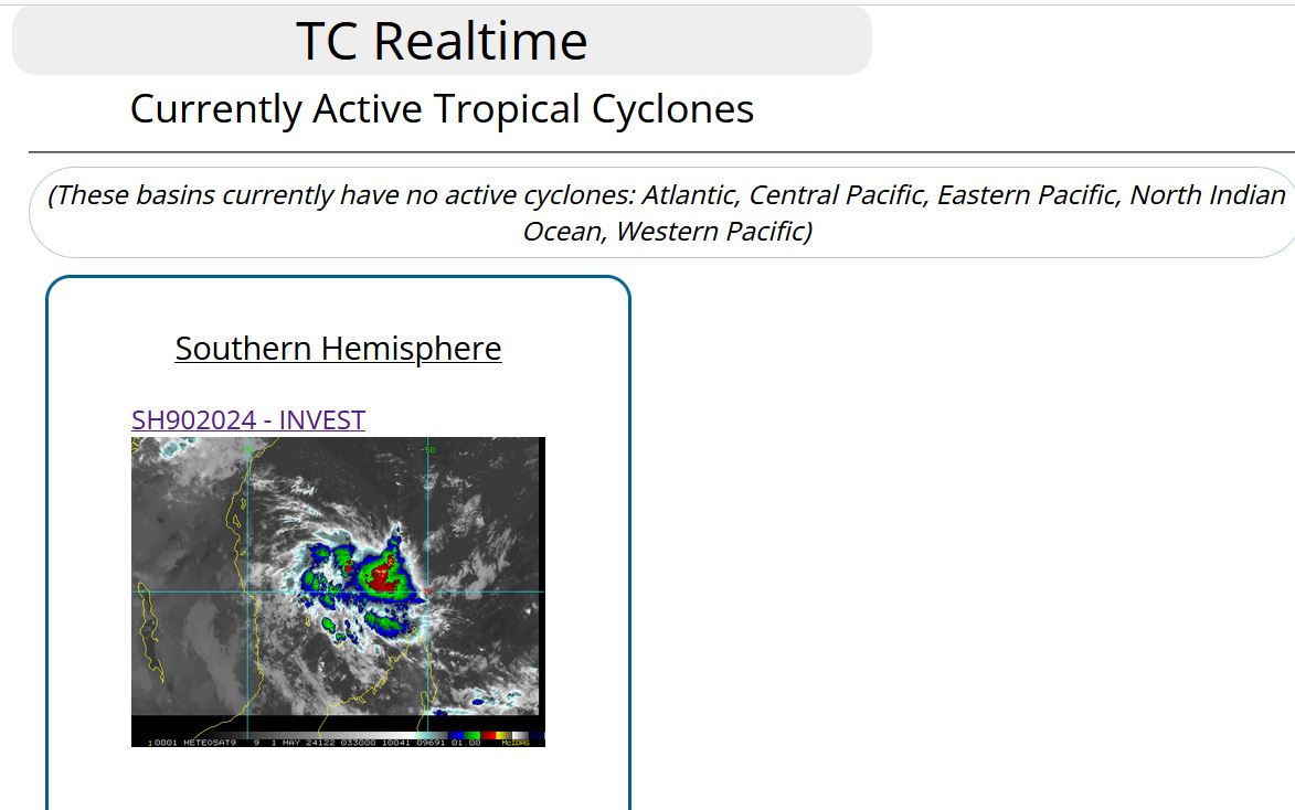
SOUTH INDIAN OCEAN/MOZ CHANNEL: INVEST 90S. ESTIMATED LOCATION AND INTENSITY AT 01/00UTC. INTENSITY IS 30 KNOTS: +5 KNOTS OVER 18 HOURS
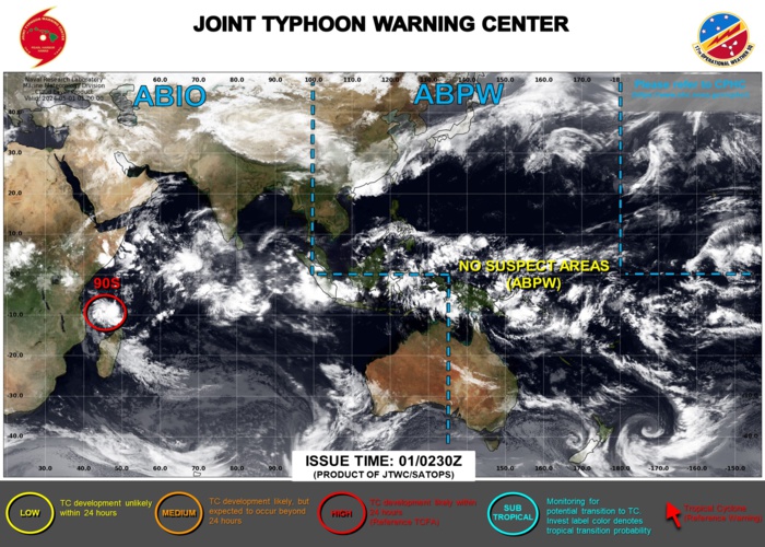
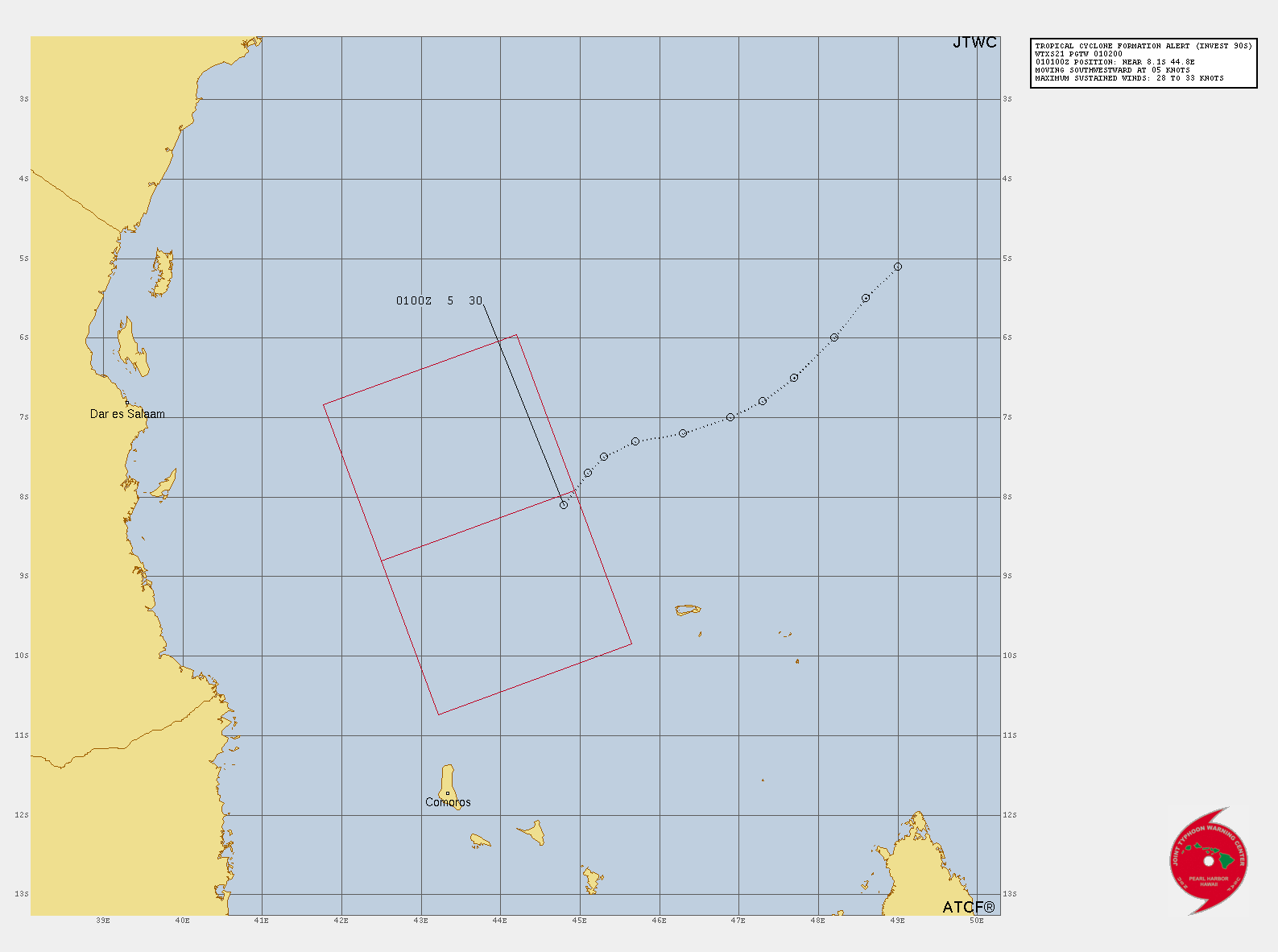
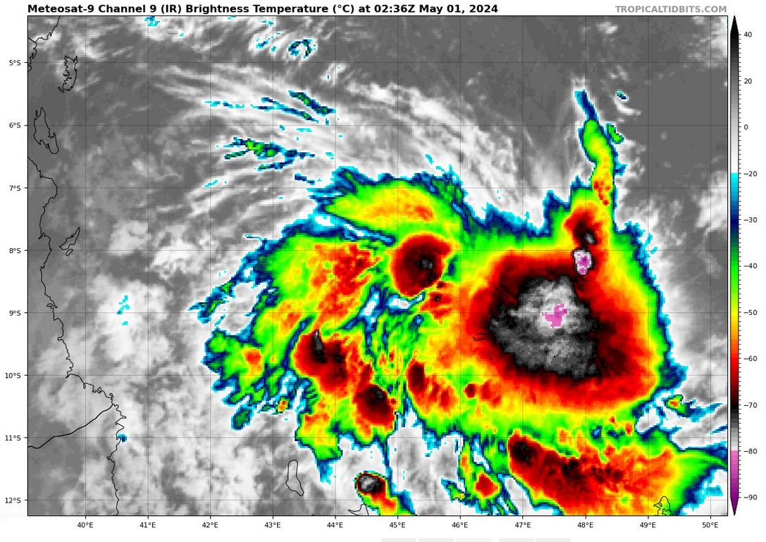
TROPICAL CYCLONE FORMATION ALERT(TCFA) ISSUED AT 01/0230UTC. CLICK ON THE IMAGERY BELOW TO GET IT ANIMATED AND ENLARGED
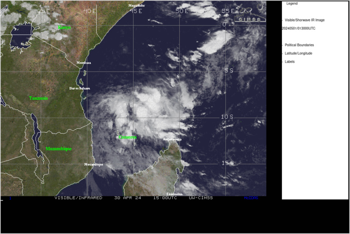
THE AREA OF CONVECTION (INVEST 90S) PREVIOUSLY LOCATED NEAR 6.7S 46.2E IS NOW LOCATED NEAR 8.1S 44.8E, APPROXIMATELY 239 NM NORTH- NORTHEAST OF COMOROS. ANIMATED ENHANCED INFRARED SATELLITE IMAGERY AND AN AMSR2 302208Z 91GHZ MICROWAVE IMAGE DEPICT FLARING AND DEEPENING CONVECTION AND A SLOWLY CONSOLIDATING LLCC WITHIN A BROAD AREA OF TURNING. ENVIRONMENTAL ANALYSIS INDICATES OVERALL FAVORABLE CONDITIONS WITH GOOD POLEWARD OUTFLOW AND WARM SSTS (29-30C) SLIGHTLY OFFSET BY LIGHT EASTERLY VERTICAL WIND SHEAR (05-10KTS). GLOBAL DETERMINISTIC MODELS HAVE BECOME MORE AGGRESSIVE WITH SIGNIFICANT INTENSIFICATION AND DEVELOPMENT OVER THE NEXT 12-24 HOURS AS THE SYSTEM TRACKS MORE WESTWARD TOWARD THE COAST OF TANZANIA WITHIN THE NEXT 72 HOURS. MAXIMUM SUSTAINED SURFACE WINDS ARE ESTIMATED AT 28 TO 33 KNOTS. MINIMUM SEA LEVEL PRESSURE IS ESTIMATED TO BE NEAR 1003 MB. THE POTENTIAL FOR THE DEVELOPMENT OF A SIGNIFICANT TROPICAL CYCLONE WITHIN THE NEXT 24 HOURS IS UPGRADED TO HIGH.
TCFA GRAPHIC
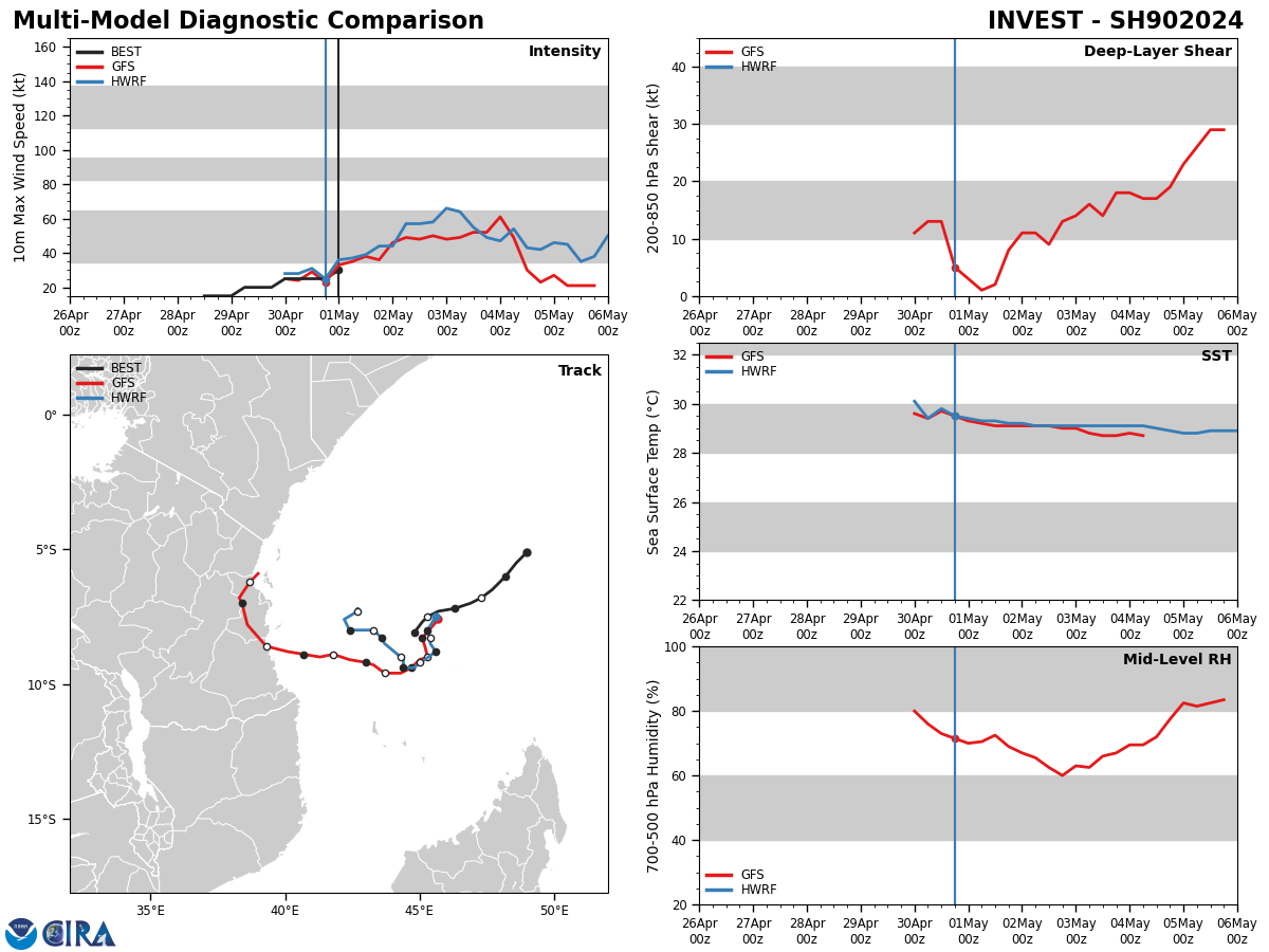
Model Diagnostic Plot
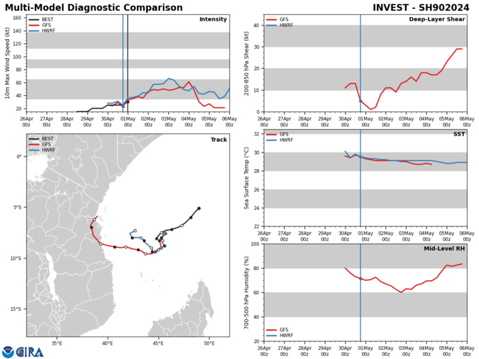
GLOBAL DETERMINISTIC MODELS HAVE BECOME MORE AGGRESSIVE WITH SIGNIFICANT INTENSIFICATION AND DEVELOPMENT OVER THE NEXT 12-24 HOURS AS THE SYSTEM TRACKS MORE WESTWARD TOWARD THE COAST OF TANZANIA WITHIN THE NEXT 72 HOURS.
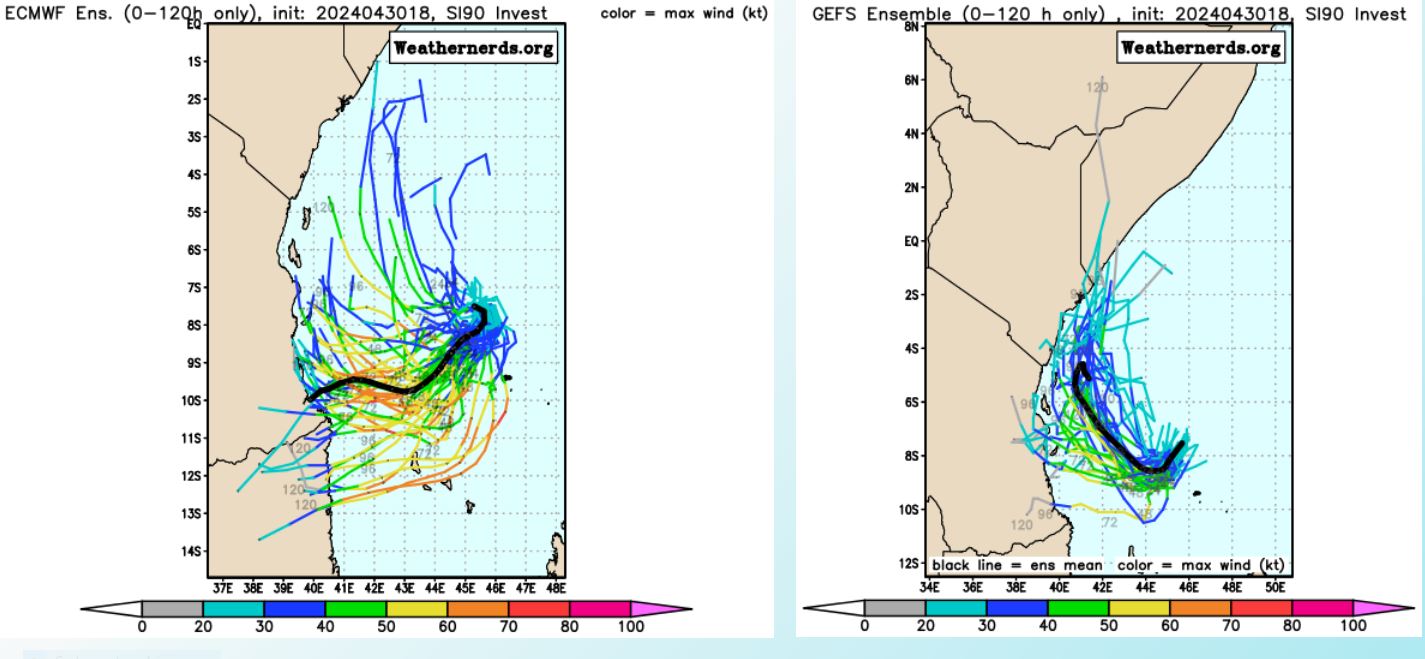
TC Ensemble Forecasts: 120H
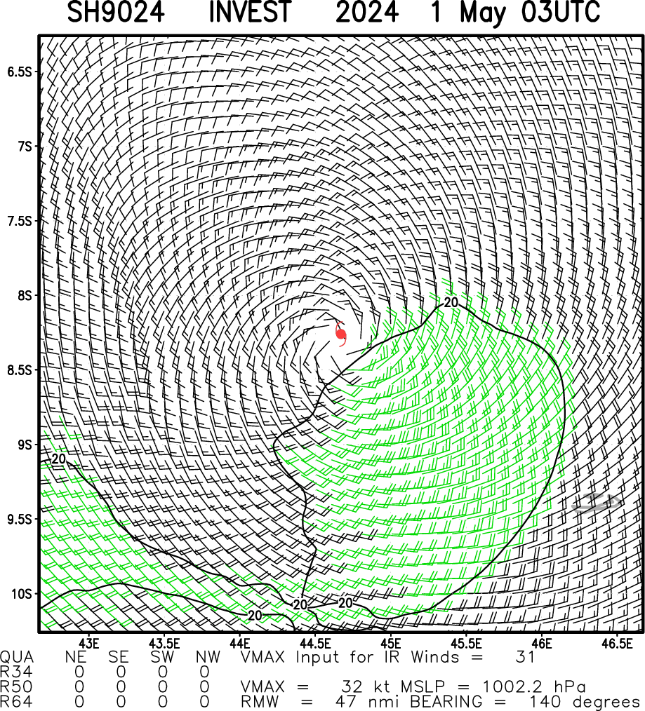
Multiplatform Satellite Surface Wind Analysis (Experimental)
UPDATED SATELLITE BULLETIN AT 01/0230UTC
TPXS10 PGTW 010341
A. TROPICAL DISTURBANCE 90S (N OF MADAGASCAR)
B. 01/0230Z
C. 8.44S
D. 45.49E
E. FIVE/MET9
F. T2.0/2.0/D1.0/21HRS STT: D0.5/03HRS
G. IR/EIR
H. REMARKS: 38A/PBO SBC/ANMTN. CNVCTN WRAPS .35 ON LOG10 SPIRAL
YIELDING A DT OF 2.0, MET OF 1.5, AND PT OF 2.0. DBO DT.
I. ADDITIONAL POSITIONS: NONE
FLEWALLEN
A. TROPICAL DISTURBANCE 90S (N OF MADAGASCAR)
B. 01/0230Z
C. 8.44S
D. 45.49E
E. FIVE/MET9
F. T2.0/2.0/D1.0/21HRS STT: D0.5/03HRS
G. IR/EIR
H. REMARKS: 38A/PBO SBC/ANMTN. CNVCTN WRAPS .35 ON LOG10 SPIRAL
YIELDING A DT OF 2.0, MET OF 1.5, AND PT OF 2.0. DBO DT.
I. ADDITIONAL POSITIONS: NONE
FLEWALLEN
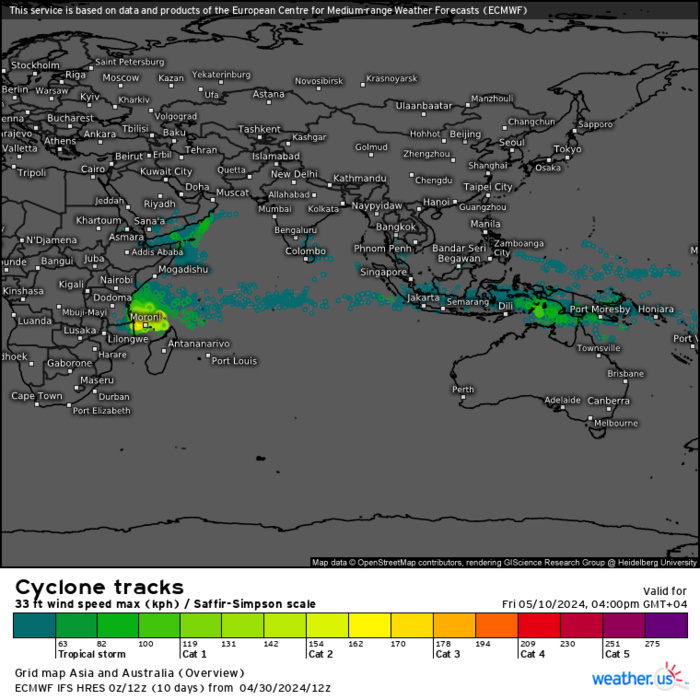
ECMWF Storm Tracks (Ensemble) : 04/30 18UTC+ 10 DAY
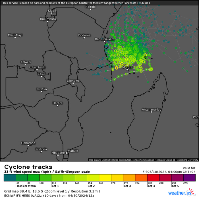
ECMWF Storm Tracks (Ensemble) : 04/30 18UTC+ 10 DAY
ECMWF Storm Tracks (Ensemble) : 04/30 18UTC+ 10 DAY
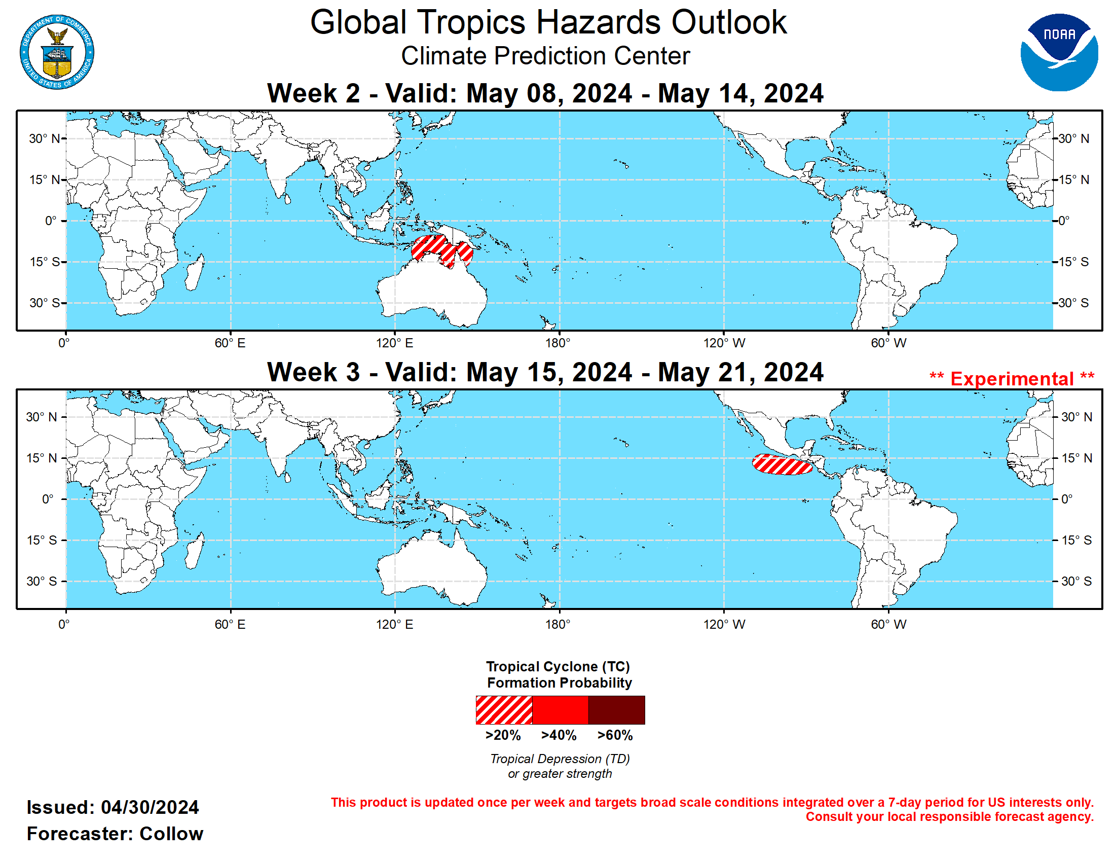
Last Updated - 04/30/24 3 WEEK TROPICAL CYCLONE FORMATION PROBABILITY

GTH Outlook Discussion Last Updated - 04/30/24 Valid - 05/08/24 - 05/21/24 During mid- to late-April, the Madden Julian Oscillation weakened into the RMM-based unit circle. However, during the past few days, the MJO has shown signs of re-emerging over the Indian Ocean, aided in part by an enhanced low frequency convective signal across the region. Dynamical models agree in terms of eastward propagation of the intraseasonal signal through the Maritime Continent during the first week of May, but diverge thereafter. The ECMWF ensemble depicts a fast, but weak propagation of the MJO into the Western Hemisphere by mid-May, while the GEFS is slower and more unclear in the MJO propagation east of the Date Line. No tropical cyclones (TCs) have developed in the past week, corresponding with the climatological quietest time of year for the global tropics. The Joint Typhoon Warning Center (JTWC) is monitoring a disturbance to the north of Madagascar (Invest 90S), which may develop into a TC during the next few days. By week-2, the evolution of the MJO favors enhanced chances of late-season TC development north of Australia, extending across parts of the Banda, Arafura, and Timor Seas and into the Gulf of Carpentaria where at least a 20 percent chance of TC formation is highlighted, although there is the potential that TC development occurs late in the week-1 period. A more robust eastward MJO propagation favors increasing chances of TC formation across the eastern North Pacific, corresponding with the May 15 start of the hurricane season in that region. Although early in the season, very warm sea surface temperatures (greater than 30 deg C off the west coast of Central America) combined with the convective environment potentially becoming more favorable, support a 20 percent chance or greater for TC formation is highlighted across the eastern North Pacific during week-3.
