CLICK ON THE IMAGERIES BELOW TO GET THEM ENLARGED
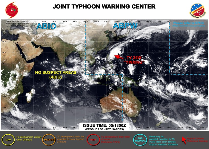
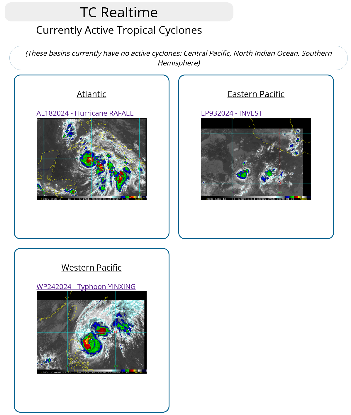
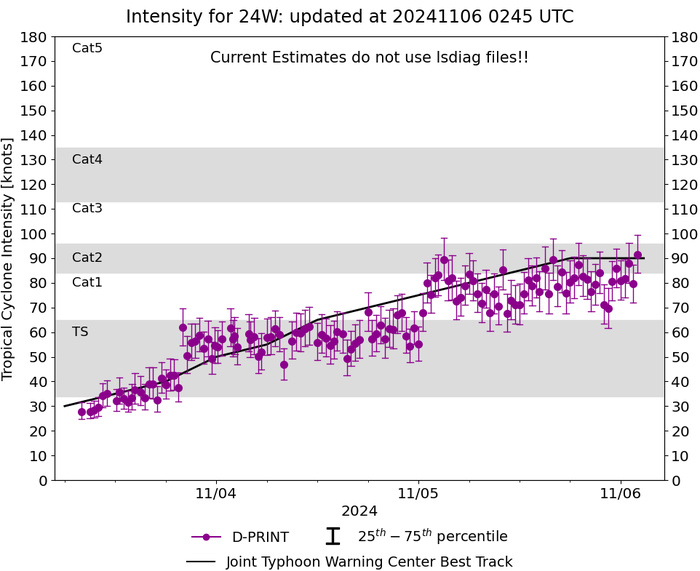
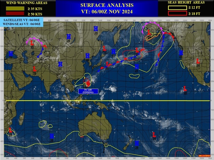
WESTERN NORTH PACIFIC: TY 24W(YINXING). 06/00UTC ESTIMATED INTENSITY IS 90 KNOTS/CAT 2 US: +15 KNOTS OVER 24 HOURS
2424110112 55N1472E 15
2424110118 57N1456E 15
2424110200 58N1440E 15
2424110206 62N1422E 15
2424110212 66N1413E 20
2424110218 73N1403E 20
2424110300 84N1393E 20
2424110306 98N1380E 30
2424110312 105N1363E 35
2424110318 111N1346E 40
2424110400 122N1331E 50
2424110406 131N1315E 55
2424110412 143N1301E 65
2424110418 153N1288E 70
2424110500 162N1274E 75
2424110506 168N1265E 80
2424110512 173N1257E 85
2424110518 179N1250E 90
2424110600 181N1247E 90
WARNING 12 ISSUED AT 06/03UTC

CLICK ON THE IMAGERY BELOW TO GET IT ANIMATED AND ENLARGED

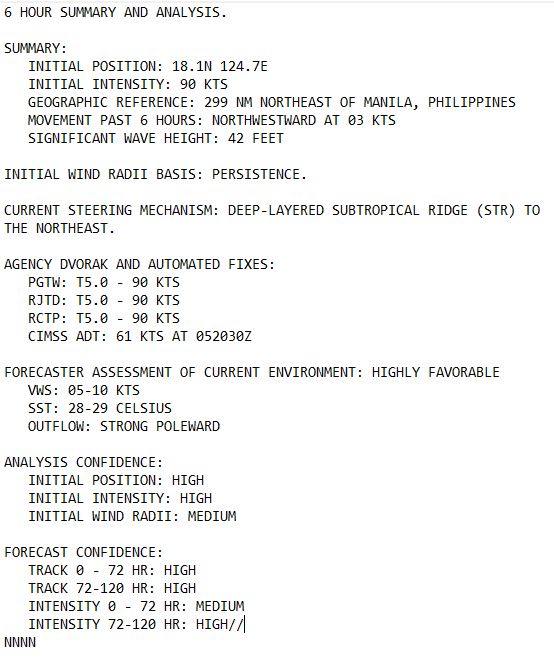
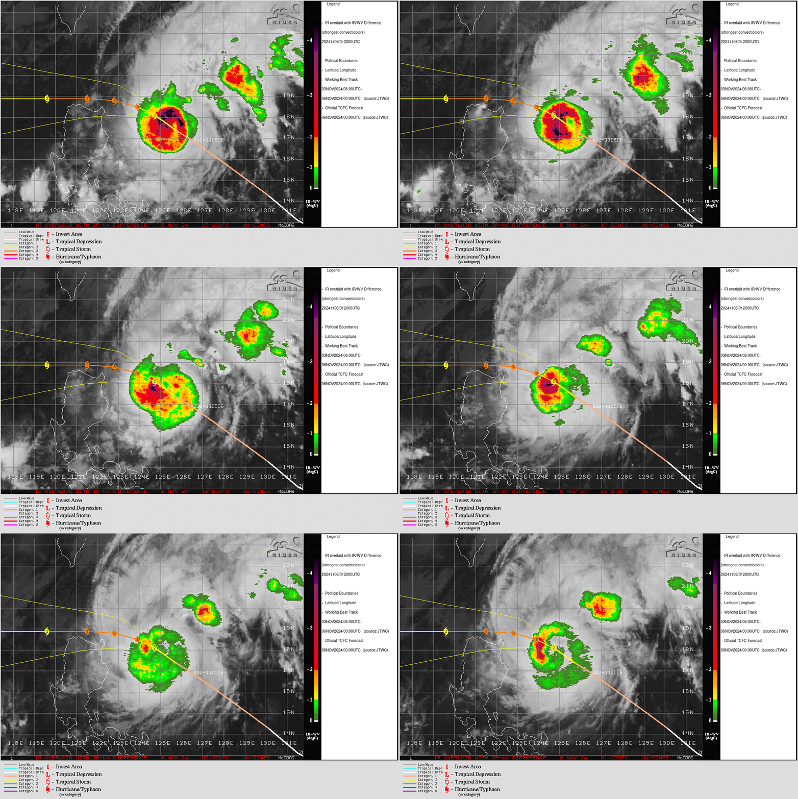
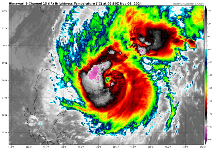
SATELLITE ANALYSIS, INITIAL POSITION AND INTENSITY DISCUSSION: ANIMATED ENHANCED INFRARED (EIR) SATELLITE IMAGERY SHOWS THE SYSTEM HAS MOSTLY MAINTAINED ITS STRUCTURE AND CONVECTIVE SIGNATURE OVER THE PAST SIX HOURS AS IT SLOWED DOWN ON ITS FORWARD MOTION IN THE PHILIPPINE SEA. THE HIGHLY SYMMETRICAL CENTRAL COLD COVER REMAINS COMPACT AND DEEP WITH OVERSHOOTING CLOUD TOPS AND A PINHOLE FORMATIVE EYE AS IT GOES THROUGH ITS DIURNAL MINIMUM CYCLE. THE EIR LOOP ALSO SHOWS A STEADFAST VIGOROUS POLEWARD OUTFLOW. THE INITIAL POSITION, ADJUSTED FOR A SLIGHT FORWARD TILT, IS PLACED WITH HIGH CONFIDENCE BASED ON THE TIGHT CLUSTER OF WARM PIXELS OVER THE FORMATIVE EYE. THE INITIAL INTENSITY IS ALSO PLACED WITH HIGH CONFIDENCE BASED ON IDENTICAL AND NEARLY CONCENTRIC DVORAK ESTIMATES FROM PGTW, RJTD, AND RCTP, AND REFLECTS THE SUSTAINED 6-HR WRAP AND EIR CONVECTIVE SIGNATURE. ANALYSIS INDICATES TY 24W IS APPROACHING THE COL AREA BETWEEN THE STEERING RIDGE TO THE NORTHEAST AND THE STR TO THE WEST; HOWEVER, THE ENVIRONMENT REMAINS HIGHLY FAVORABLE WITH LOW VWS, WARM ALONG-TRACK SSTS, AND ROBUST VENTILATION.
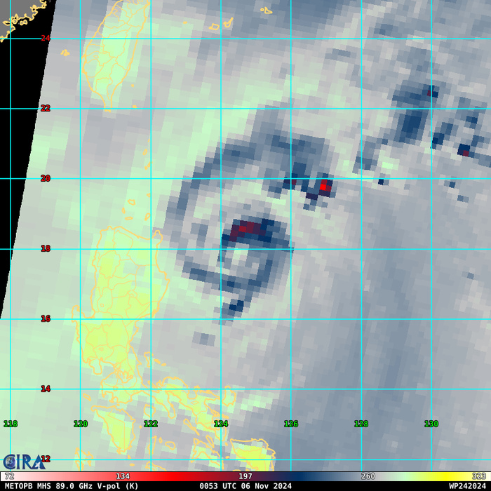
85 – 92 GHz Brightness Temperature
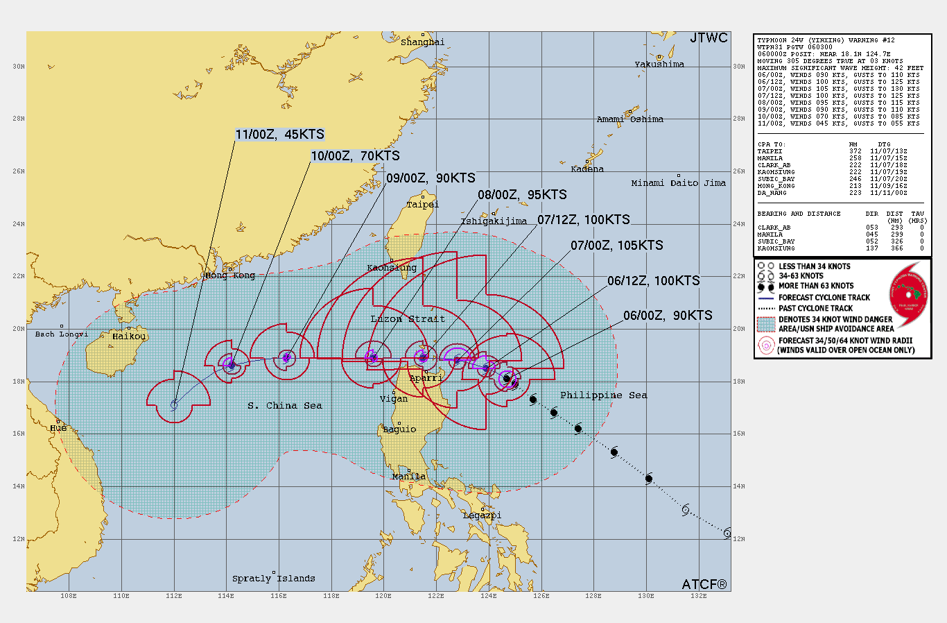
TC Warning Graphic

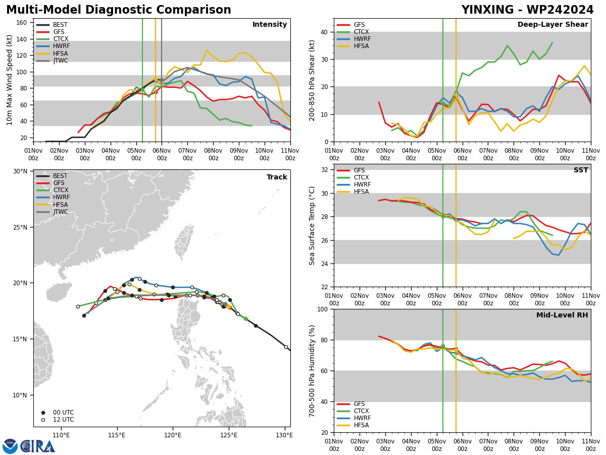
FORECAST REASONING. SIGNIFICANT FORECAST CHANGES: THERE ARE NO SIGNIFICANT CHANGES TO THE FORECAST FROM THE PREVIOUS WARNING. FORECAST DISCUSSION: TYPHOON YINXING WILL CONTINUE ON ITS CURRENT SLOW NORTHWESTWARD TRACK UP TO TAU 24; AFTERWARD, A SECONDARY STR BUILDING IN FROM THE WEST NEAR HAINAN WILL ASSUME STEERING AND DRIVE THE CYCLONE ON A MORE WESTWARD TRAJECTORY THROUGH THE LUZON STRAIT AND INTO THE SOUTH CHINA SEA (SCS). THE HIGHLY FAVORABLE ENVIRONMENT WILL PROMOTE INTENSIFICATION TO A PEAK OF 105KTS BY TAU 24 FUELED BY INCREASED POLEWARD OUTFLOW ENHANCED BY THE SOUTHWESTERLY JETS JUST TO THE NORTH AND AHEAD OF A TRANSITING MID-LATITUDE TROUGH. AFTERWARD, THE RELATIVE VWS WILL INCREASE, SST AND OHC VALUES DECREASE IN THE WAKE OF A PREVIOUS CYCLONE (23W), INTERACTION WITH LUZON, THEN THE DRIFT INTO A COLD NORTHEASTERLY SURGE IN THE SCS WILL SLOWLY THEN RAPIDLY ERODE THE SYSTEM DOWN TO 45KTS BY TAU 120. MODEL DISCUSSION: NUMERICAL MODELS ARE IN VERY TIGHT AGREEMENT WITH AN EVEN ACROSS-TRACK SPREAD TO A MERE 78NM BY TAU 72; AFTERWARD, THE MODELS SPREAD OUT TO 285NM AT TAU 120, LENDING HIGH CONFIDENCE UP TO TAU 72, THEN LOW CONFIDENCE AFTERWARD, TO THE JTWC TRACK FORECAST. THERE IS MEDIUM CONFIDENCE TO THE INTENSITY FORECAST UP TO TAU 72, THEN LOW CONFIDENCE AFTERWARD.
Model Diagnostic Plot
06/0230UTC SATELLITE ANALYSIS
TPPN10 PGTW 060254
A. TYPHOON 24W (YINXING)
B. 06/0230Z
C. 17.86N
D. 124.58E
E. THREE/GK2A
F. T5.5/5.5/D1.0/24HRS STT: D0.5/03HRS
G. IR/EIR/VIS/MSI
H. REMARKS: 11A/PBO RAGGED EYE/ANMTN. OW EYE SURROUNDED BY LG YIELDS
AN E# OF 5.0. ADDED 0.5 EYE ADJUSTMENT FOR B, TO YIELD A DT OF 5.5.
MET AND PT AGREE. DBO DT.
I. ADDITIONAL POSITIONS:
05/2115Z 17.75N 124.95E MMWI
EL-NAZLY
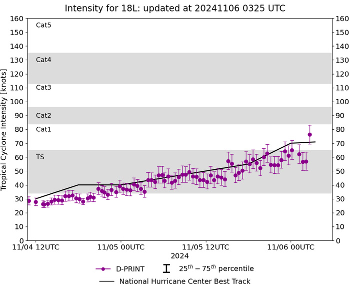
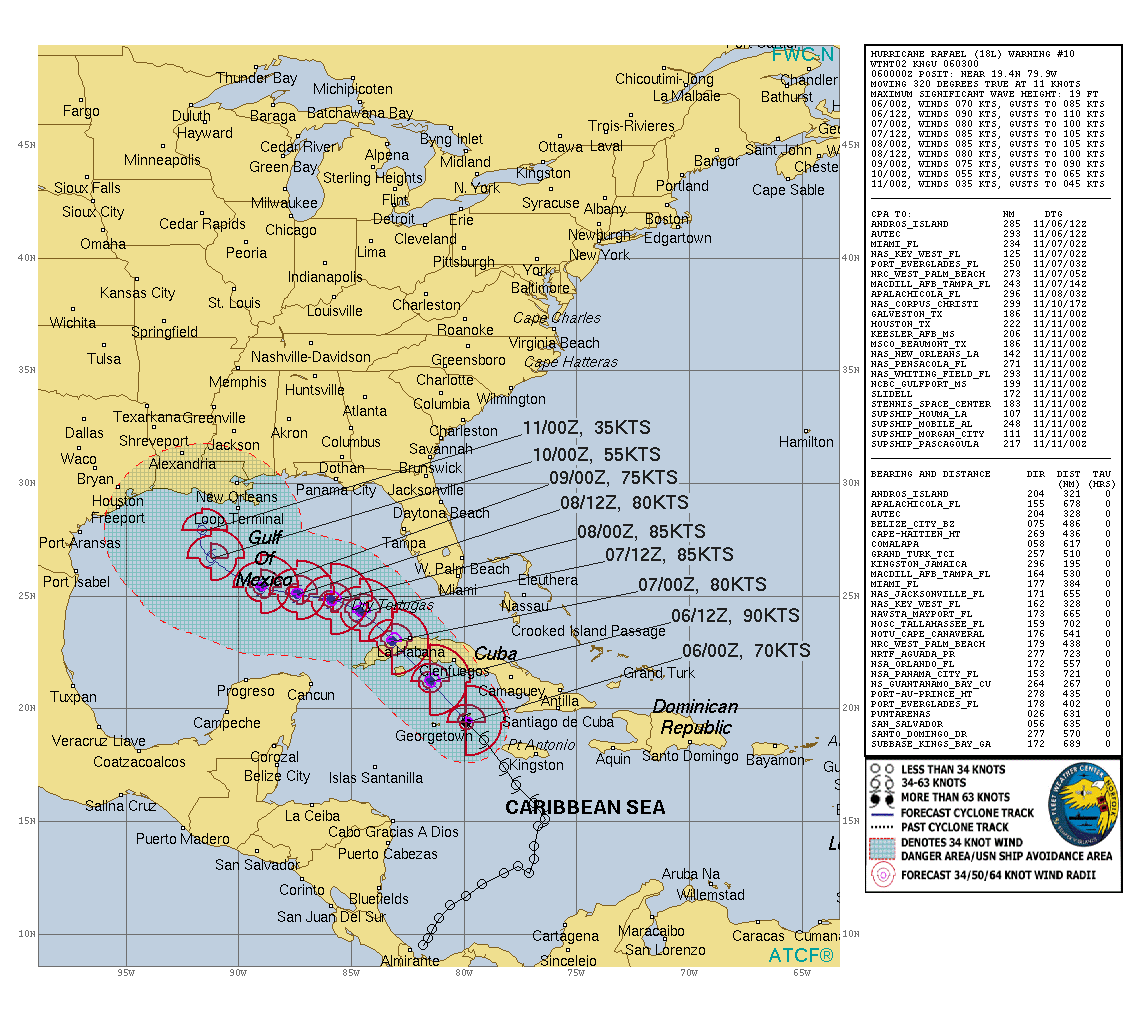
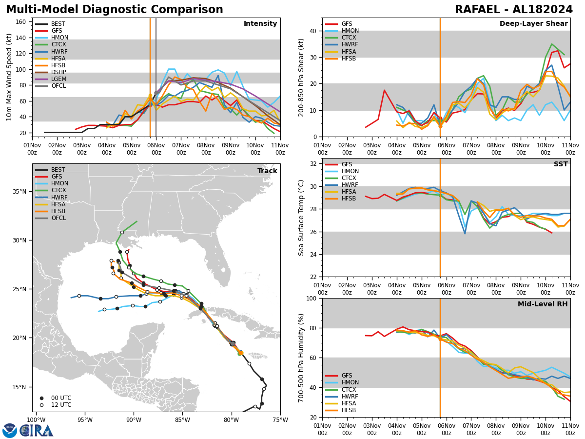
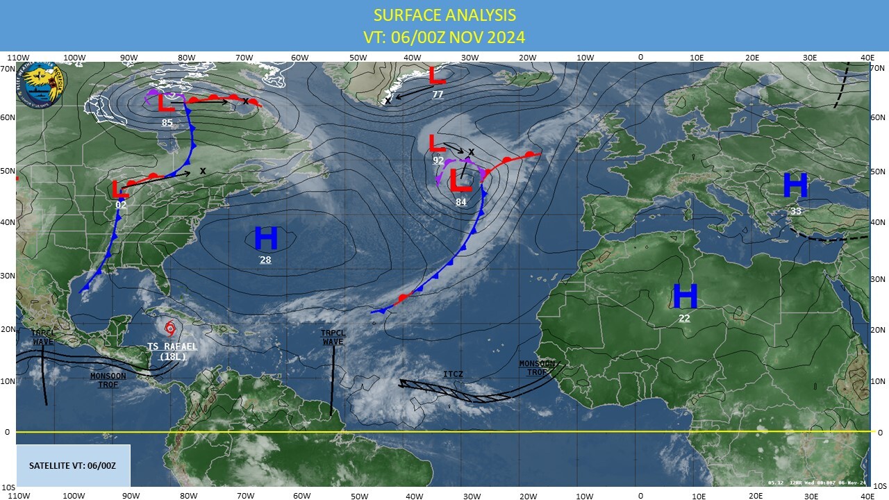
NORTH ATLANTIC/CARRIBEAN SEA: HU 18L(RAFAEL). 06/00Z ESTIMATED INTENSITY IS 70 KNOTS/CAT 1 US: + 30 KNOTS OVER 24 HOURS
1824110112 95N 818W 20
1824110118 98N 816W 20
1824110200 102N 814W 20
1824110206 107N 811W 20
1824110212 113N 806W 20
1824110218 117N 799W 20
1824110300 122N 792W 20
1824110306 127N 782W 25
1824110312 130N 776W 25
1824110318 127N 771W 30
1824110400 133N 769W 30
1824110406 139N 769W 30
1824110412 148N 767W 30
1824110418 151N 764W 40
1824110500 158N 769W 40
1824110506 166N 777W 45
1824110512 174N 782W 50
1824110518 186N 791W 55
1824110600 194N 799W 70
WARNING 10 ISSUED AT 06/03UTC
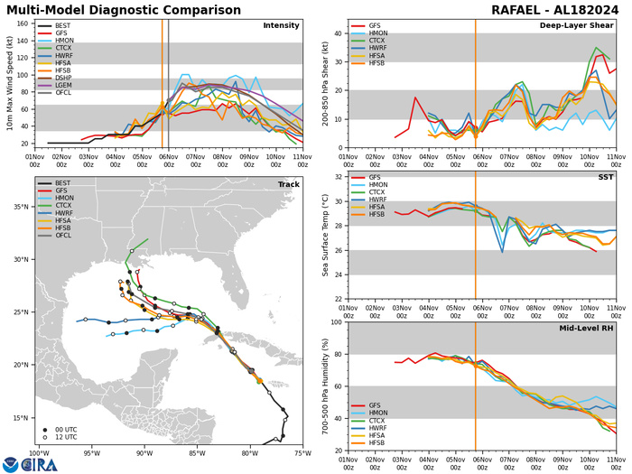
Model Diagnostic Plot
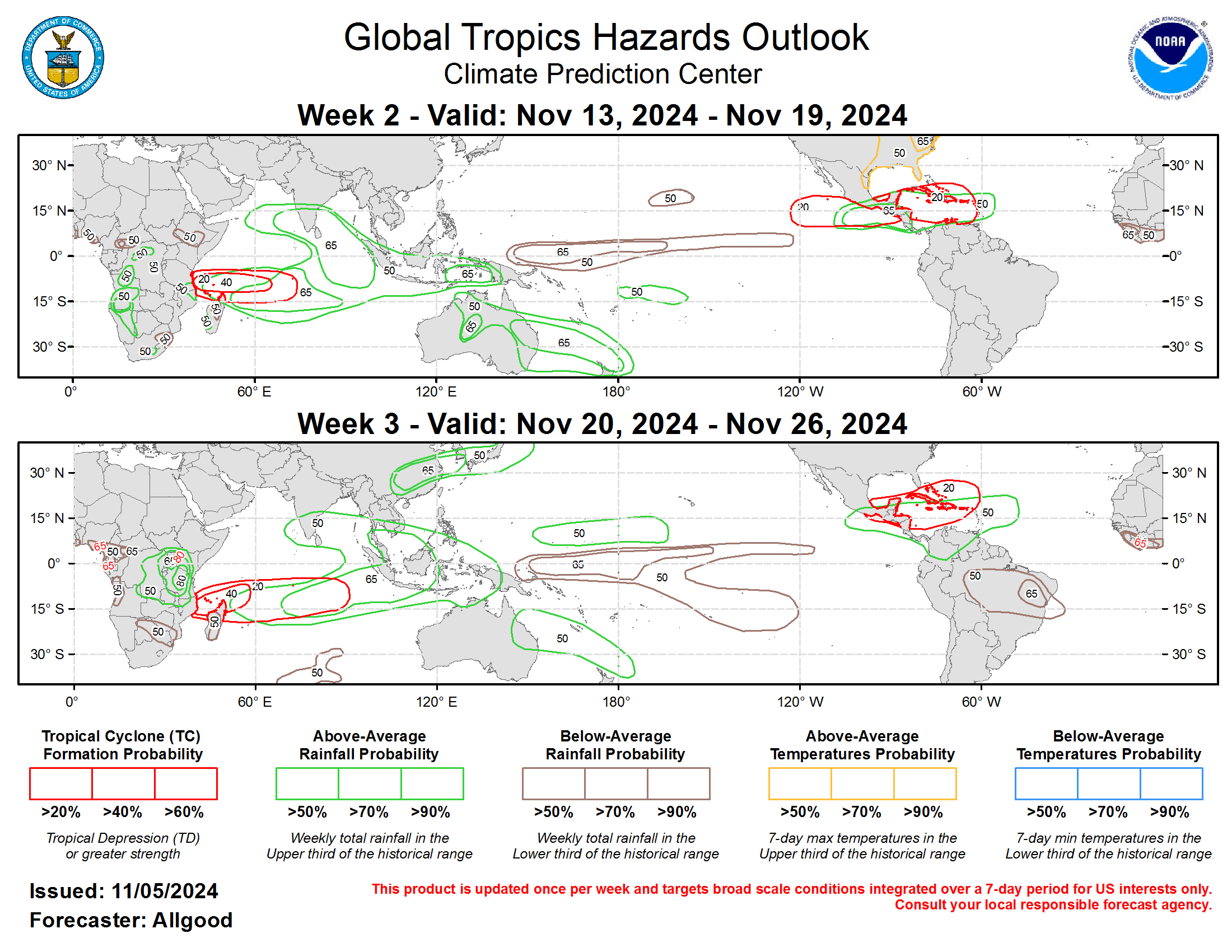
Last Updated - 11/05/24 3 WEEK TROPICAL CYCLONE FORMATION PROBABILITY
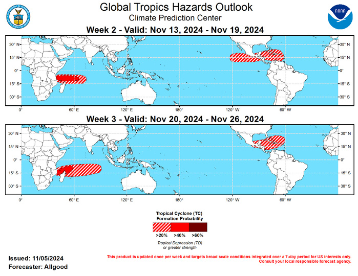
GTH Outlook Discussion Last Updated - 11/05/24 Valid - 11/13/24 - 11/26/24 Recent observations and both the RMM based and CPC velocity potential based MJO indices indicate that a robust MJO event continues into early November, with the enhanced convective phase crossing the Western Hemisphere. This intraseasonal signal is currently the dominant mode of tropical variability, despite destructive interference with the low frequency base state favoring suppressed convection over the equatorial central Pacific. As the MJO enhanced convective envelope crossed the Pacific at the end of October and the beginning of November, the trade wind regime weakened, easterly anomalies developed aloft, and a Pacific jet extension developed over the northeastern Pacific and portions of North America. There is uncertainty whether this enhanced MJO event will have a substantial impact on the oceanic thermocline of the Pacific. While a strong westerly wind burst was initiated over the Pacific, the strongest westerlies were located well north of the Equator, which reduces the impact. Still, it is possible that this recent activity may result in the initiation of a downwelling oceanic Kelvin wave, and there are some indications of an eastward expansion of the above-average West Pacific warm pool. Dynamical model MJO index forecasts are in good agreement supporting continued MJO activity during the outlook period, with the GEFS favoring a slower and more amplified evolution, and the ECMWF favoring a faster propagation of an overall weaker signal. Given the highly organized structure of the ongoing MJO event, there is fairly high confidence that the MJO will continue to play a large to dominant role in the global tropical convective pattern, with the enhanced convective phase continuing to cross the Western Hemisphere during Week-1, and the Indian Ocean and possibly the Maritime Continent during Weeks 2 and 3. Therefore, enhanced low-level westerlies over the eastern Pacific and Caribbean during the outlook period may yield a favorable environment for late season tropical cyclone development. As the suppressed envelope of the MJO crosses the Pacific during the outlook period, a trade wind surge is favored, which may help to strengthen the low frequency base state as the Boreal winter season approaches. Given the extent of warm water across the western Pacific, however, MJO activity may persist beyond the outlook period. Four tropical cyclones (TCs) formed during the past week. On November 2, Tropical Storm Lane developed over the East Pacific far southwest of the Baja California peninsula. The system dissipated shortly thereafter. Tropical Storm Patty also formed on November 2 over the central Atlantic near 40N. On November 3, Typhoon Yinxing formed east of the Philippines. This system continues to intensify, and forecasts from the Joint Typhoon Warning Center bring the center of circulation near or north of the island of Luzon during the next several days before emerging over the South China Sea. On November 4, Tropical Storm Rafael developed over the central Caribbean Sea. Forecasts from the National Hurricane Center indicate strengthening to hurricane intensity, with the TC bringing impacts to Jamaica and Cuba before emerging over the Gulf of Mexico, where increased shear may begin to weaken the system. Interests along the US Gulf Coast should continue to monitor forecasts from the NHC and their local NWS forecast offices. During the Week-2 period, continued low-level westerly anomalies across the eastern Pacific and Caribbean will provide a favorable environment for late season tropical cyclone development. Dynamical model forecasts do not consistently indicate any specific regions for development, but forecasts show potential closed lows forming from a broad cyclonic gyre over the western or central Caribbean as well as the western Atlantic in the vicinity of the Turks and Caicos islands. The MJO evolution also favors tropical cyclone development over the southwestern Indian Ocean, particularly in the region near or north of Madagascar. During Week-3, similar regions remain favored, though the potential for East Pacific development declines considerably as the MJO suppressed phase crosses the Pacific.

Forecasts for above- and below-average precipitation during Weeks 2 and 3 are based on historical composites of Indian Ocean and Maritime Continent MJO events, a low frequency state leaning towards La Niña, and a skill consolidated blend of dynamical model guidance. Widespread above-average precipitation is favored to develop across the Indian Ocean basin during the outlook period, with enhancement spreading across the equatorial Maritime Continent. Less wetness was indicated for the equatorial eastern Indian Ocean based on model guidance, which may be attributed to subsidence from tropical cyclone activity or equatorial Rossby wave activity. In contrast, suppressed rainfall is favored across the central Pacific due to constructive interference between the MJO suppressed phase and the low frequency base state. Above-normal temperatures are indicated for portions of the eastern U.S. during week-2. For hazardous weather conditions in your area during the coming two-week period, please refer to your local NWS office, the Medium Range Hazards Forecast produced by the Weather Prediction Center, and the CPC Week-2 Hazards Outlook. Forecasts made over Africa are made in coordination with the International Desk at CPC.
