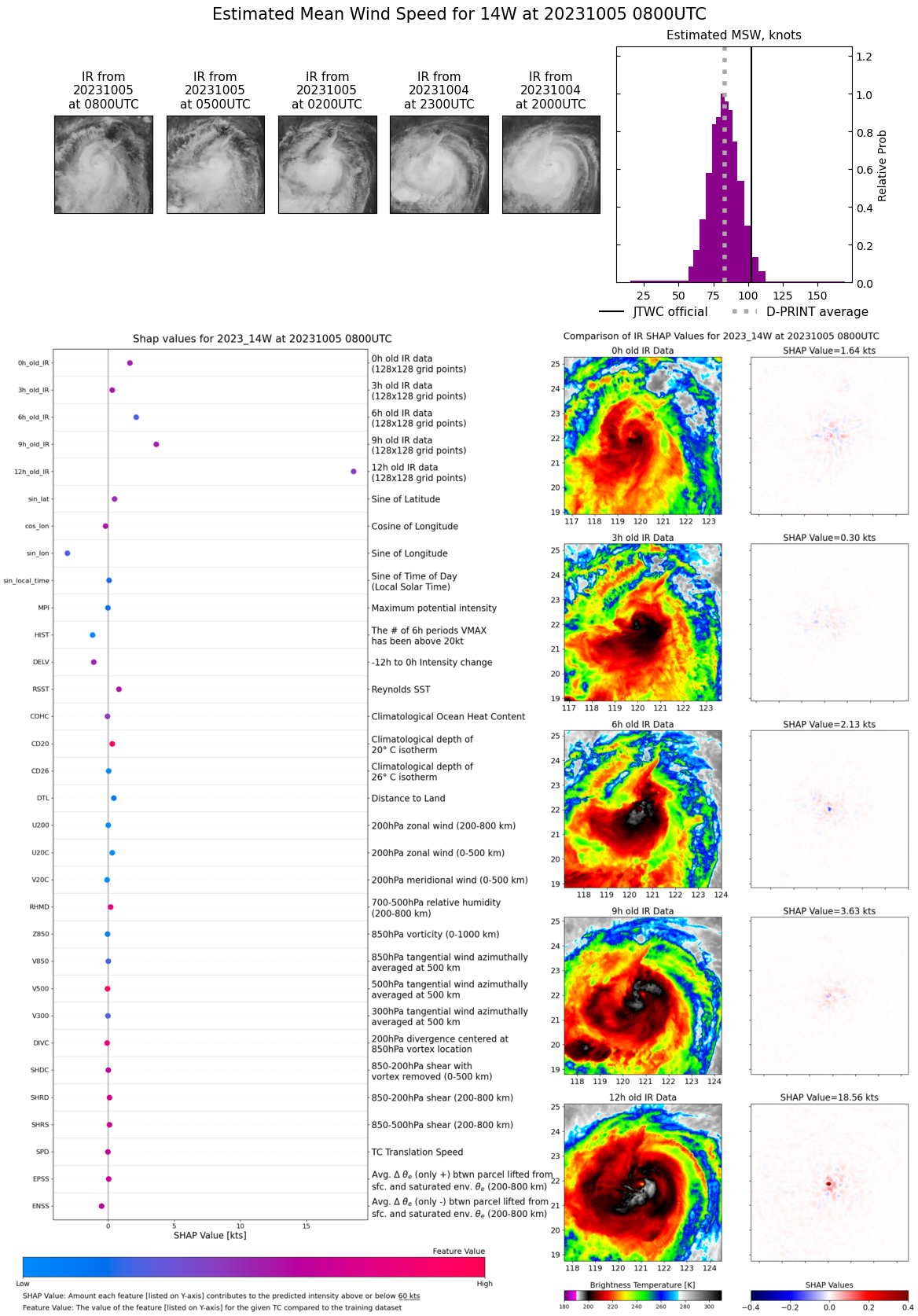
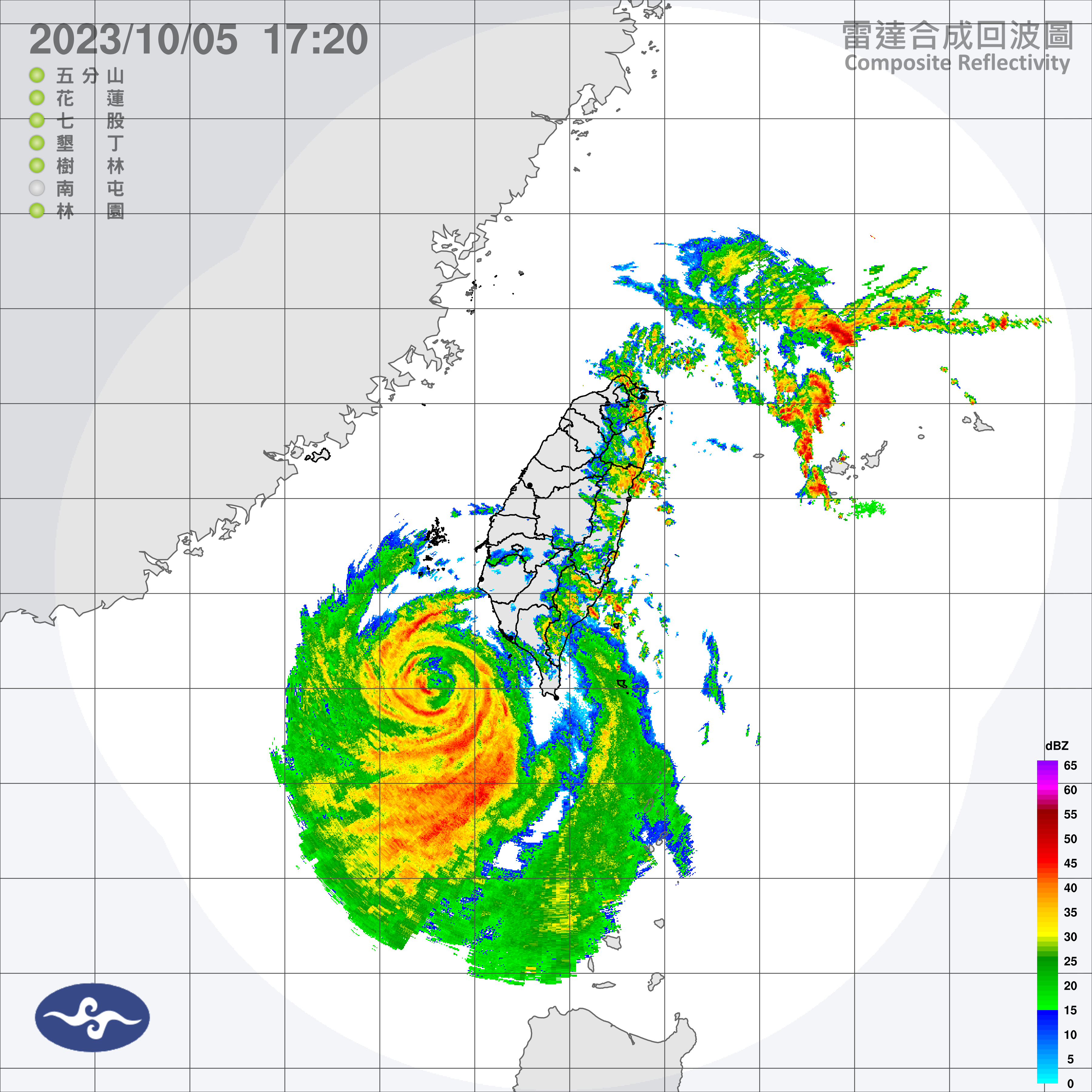
CLICK ON THE IMAGERIES BELOW TO GET THEM ENLARGED
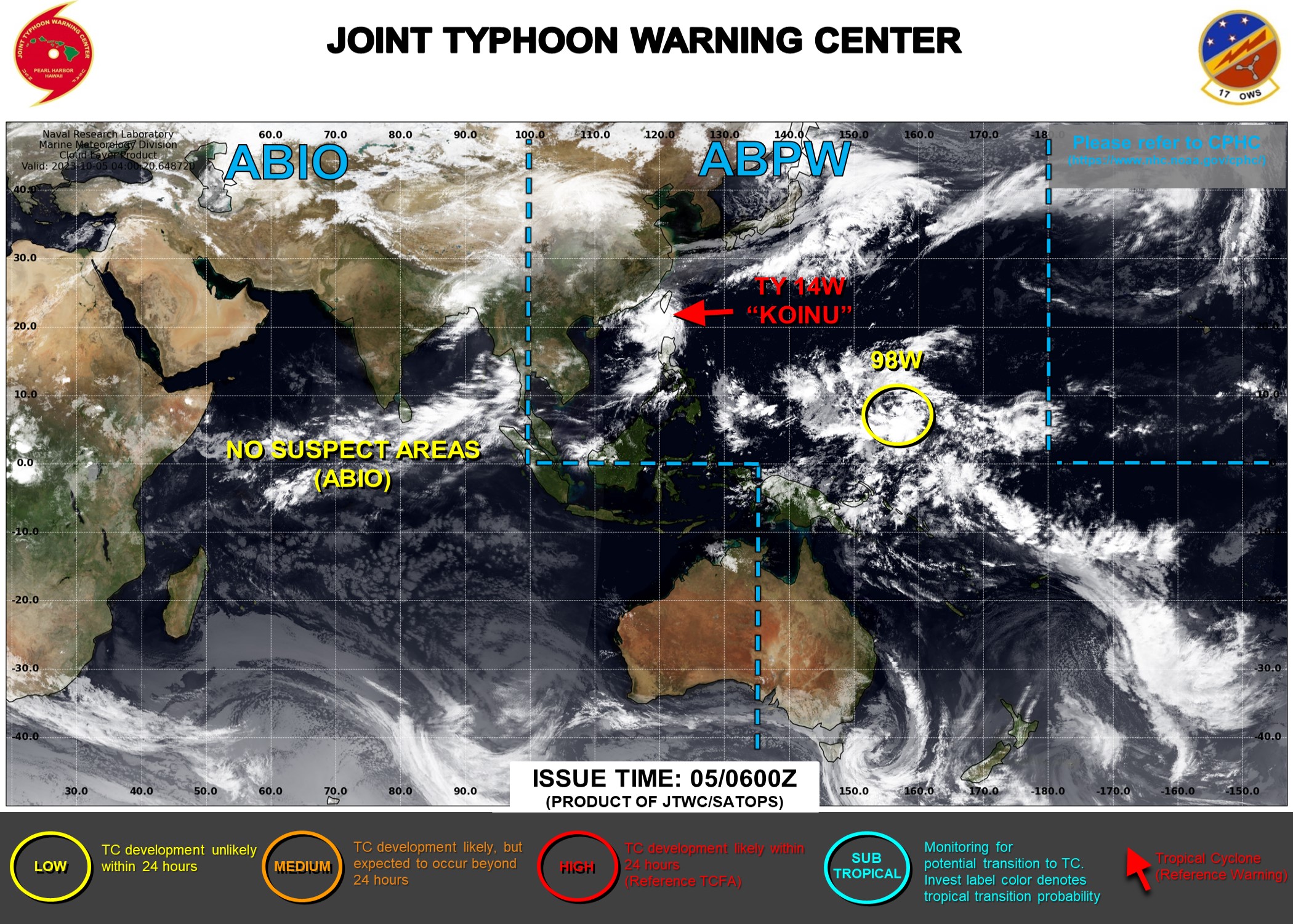
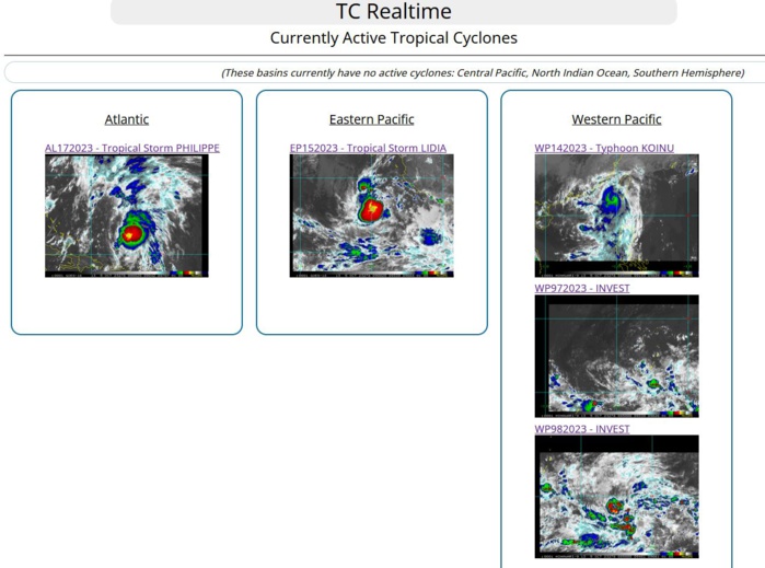
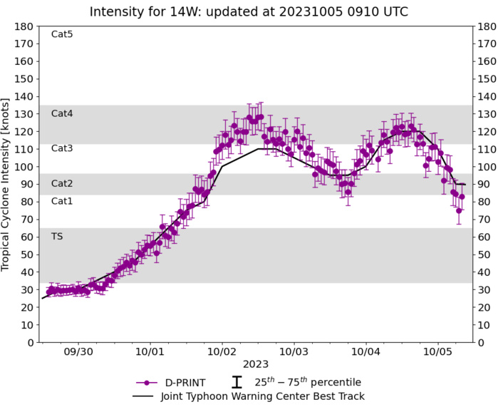
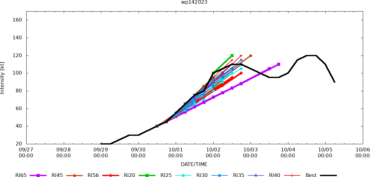
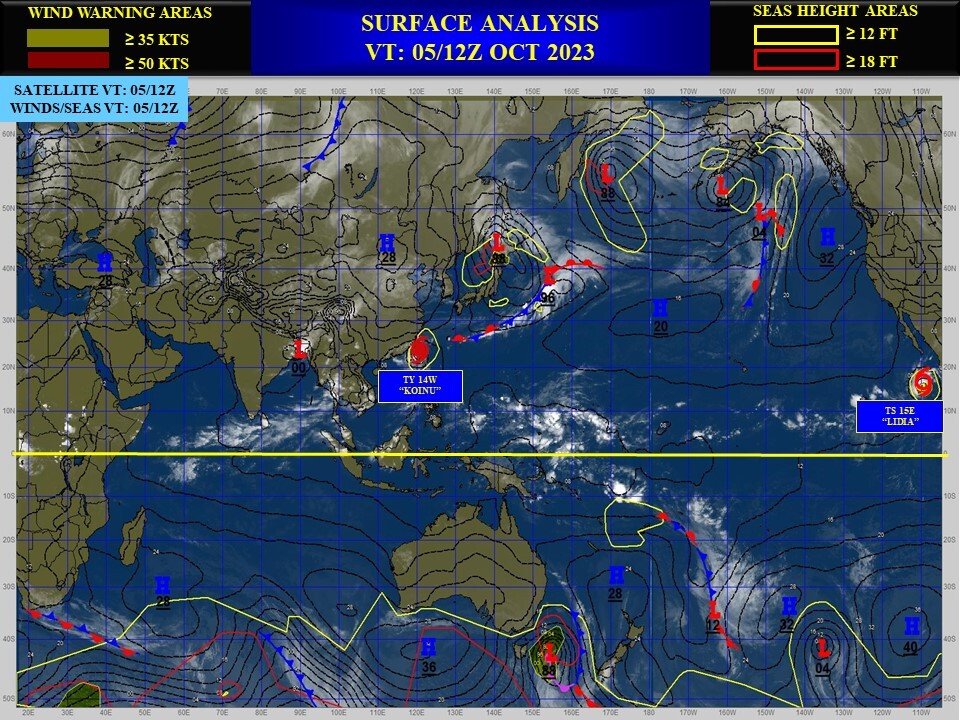
WESTERN NORTH PACIFIC: TY 14W(KOINU). CURRENT ESTIMATED INTENSITY IS 90 KNOTS/CAT 2 US: -25 KNOTS/24H.
1423100218 202N1256E 110
1423100300 206N1253E 105
1423100306 211N1250E 100
1423100312 215N1246E 95
1423100318 219N1242E 95
1423100400 221N1236E 100
1423100406 221N1227E 115
1423100412 220N1219E 120
1423100418 219N1212E 120
1423100500 220N1208E 110
1423100506 221N1201E 90
1423100300 206N1253E 105
1423100306 211N1250E 100
1423100312 215N1246E 95
1423100318 219N1242E 95
1423100400 221N1236E 100
1423100406 221N1227E 115
1423100412 220N1219E 120
1423100418 219N1212E 120
1423100500 220N1208E 110
1423100506 221N1201E 90
WARNING 24 ISSUED AT 05/09UTC.
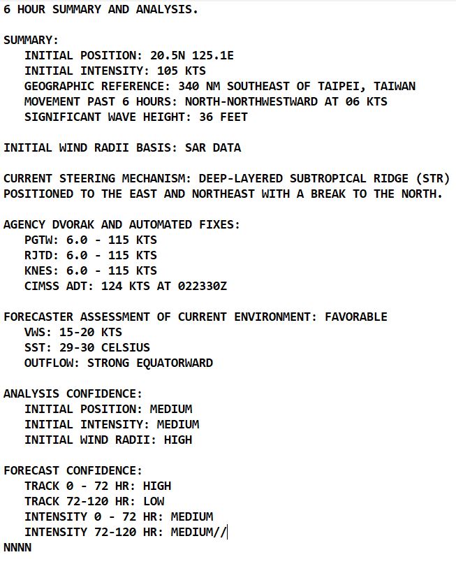

SATELLITE ANALYSIS, INITIAL POSITION AND INTENSITY DISCUSSION: ANIMATED MULTISPECTRAL SATELLITE IMAGERY (MSI) AND ANIMATED RADAR IMAGERY DEPICTS TYPHOON 14W (KOINU) HAS TRAVERSED WESTWARD PAST THE SOUTHERN TIP OF TAIWAN. WHILE THE SYSTEM HAS BEEN DEGRADED OVER THE PAST SIX HOURS, RADAR IMAGERY STILL DEPICTS DEEP CONVECTIVE LOW-LEVEL BANDING ON THE SOUTHERN SEMICIRCLE. A 050453Z AMSR2 89GHZ MICROWAVE IMAGE DEPICTS A WELL DEFINED LOW LEVEL CIRCULATION (LLCC) WITH FRAGMENTED BANDING OVER THE NORTHEASTERN QUADRANT. THE INITIAL POSITION IS PLACED WITH HIGH CONFIDENCE BASED ON RADAR IMAGERY AND THE AMSR2 MICROWAVE IMAGE. THE INITIAL INTENSITY OF 90 KTS IS HEDGED ABOVE SUBJECTIVE DVORAK CURRENT INTENSITY ESTIMATES BASED ON ADT AND AIDT ESTIMATES OF 97 AND 89 KNOTS, RESPECTIVELY. ENVIRONMENTAL CONDITIONS REMAIN MARGINAL, WITH WARM SSTS AND MODERATE EQUATORWARD OUTFLOW OFFSET BY LOW-MODERATE NORTHEASTERLY SHEAR, DRY AIR ENTRAINMENT.
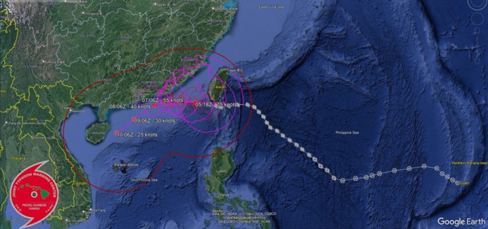
TC Warning Graphic
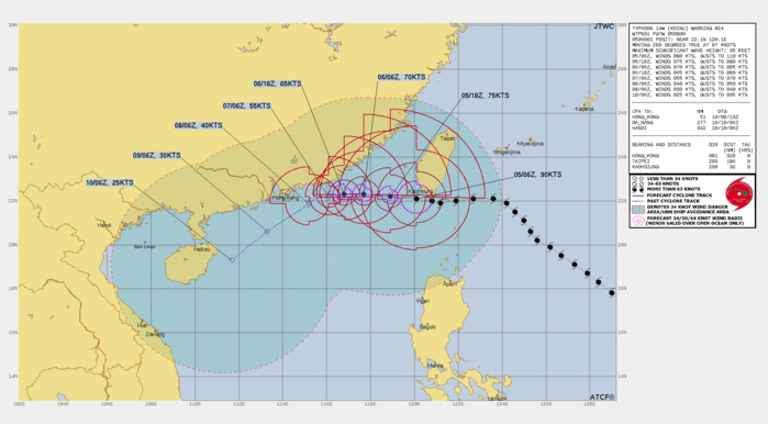
FORECAST REASONING. SIGNIFICANT FORECAST CHANGES: THERE ARE NO SIGNIFICANT CHANGES TO THE FORECAST FROM THE PREVIOUS WARNING. FORECAST DISCUSSION: TYPHOON 14W IS FORECAST TO CONTINUE ON A WESTWARD TRACK THROUGH TAU 48, THE SYSTEM WILL SLOW DOWN AS IT APPROACHES THE COAST OF CHINA, AS A STR OVER EAST-CENTRAL CHINA BECOMES THE DOMINATE STEERING FEATURE. THE SYSTEM WILL THEN TURN TO A MORE SOUTHWESTWARD TRACK THROUGH TAU 120. IN TERMS OF INTENSITY, THE SYSTEM WILL MOVE INTO AN AREA OF VERY WEAK UPPER-LEVEL OUTFLOW, COOLER SSTS, AS DRY AIR ENTRAINMENT IS ANTICIPATED TO INCREASE THROUGH TAU 72. THE LESS FAVORABLE ENVIRONMENTAL FACTORS, ALONG WITH POTENTIAL LAND INTERACTION OF THE OUTERMOST WIND FIELD, WILL ALSO CONTRIBUTE TO THE SYSTEMS DECAY BY TAU 96 THROUGH TAU 120.
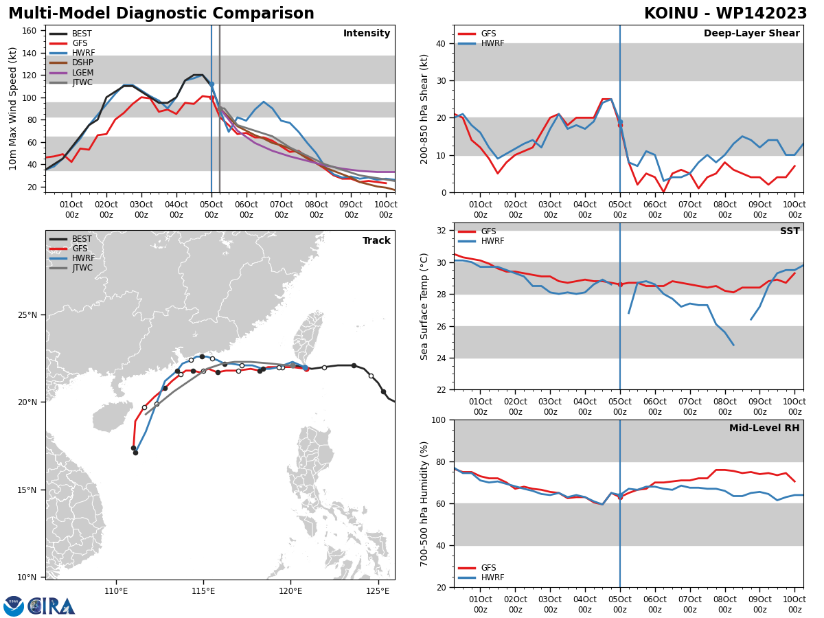
Model Diagnostic Plot
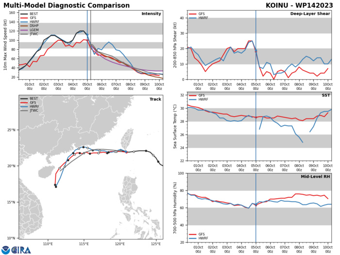
MODEL DISCUSSION: NUMERICAL MODELS ARE IN FAIR AGREEMENT WITH A BULK OF THE GUIDANCE GENERALLY FOLLOWING THE JTWC FORECAST TRACK THROUGH TAU 48, AFTER WHICH CROSS TRACK SPREADING INCREASES. THEREFORE, THE JTWC TRACK FORECAST IS PLACED INITIALLY WITH MEDIUM CONFIDENCE AND WITH LOW CONFIDENCE THEREAFTER. RELIABLE MODEL INTENSITY GUIDANCE IS IN GOOD AGREEMENT WITH MOST MEMBERS INDICATING A SHARP WEAKENING TREND THROUGH TAU 48, WHILE THE HAFS-A AND HWRF CONTINUE TO SHOW A RELATIVELY FLAT INTENSITY THROUGH TAU 48. WITH AFTER ALL MEMBERS SHOW A MORE GRADUAL DECLINE THROUGH TAU 120. FOR THIS REASON, THE JTWC INTENSITY FORECAST IS PLACED WITH OVERALL MEDIUM CONFIDENCE.
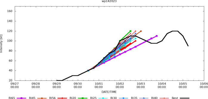
RIPA Forecast
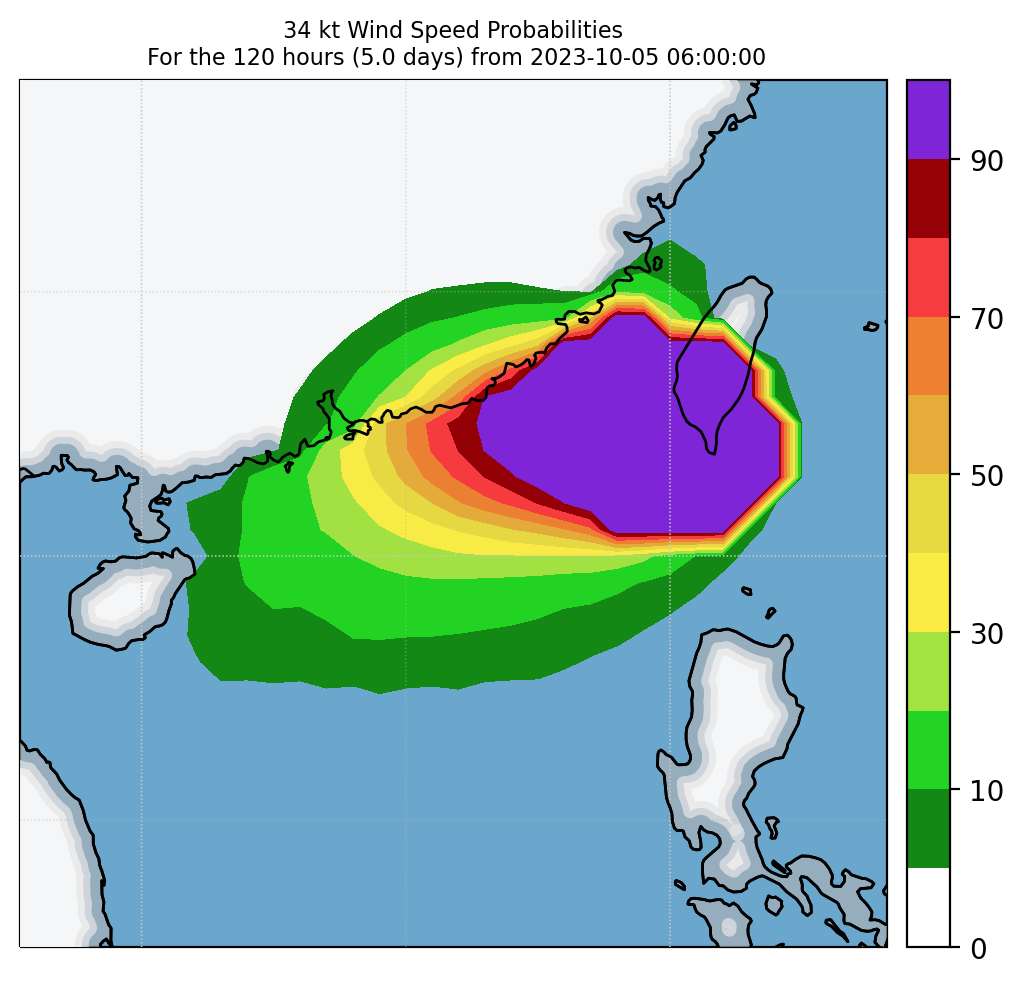
Experimental 34-kt Wind Speed Probabilities
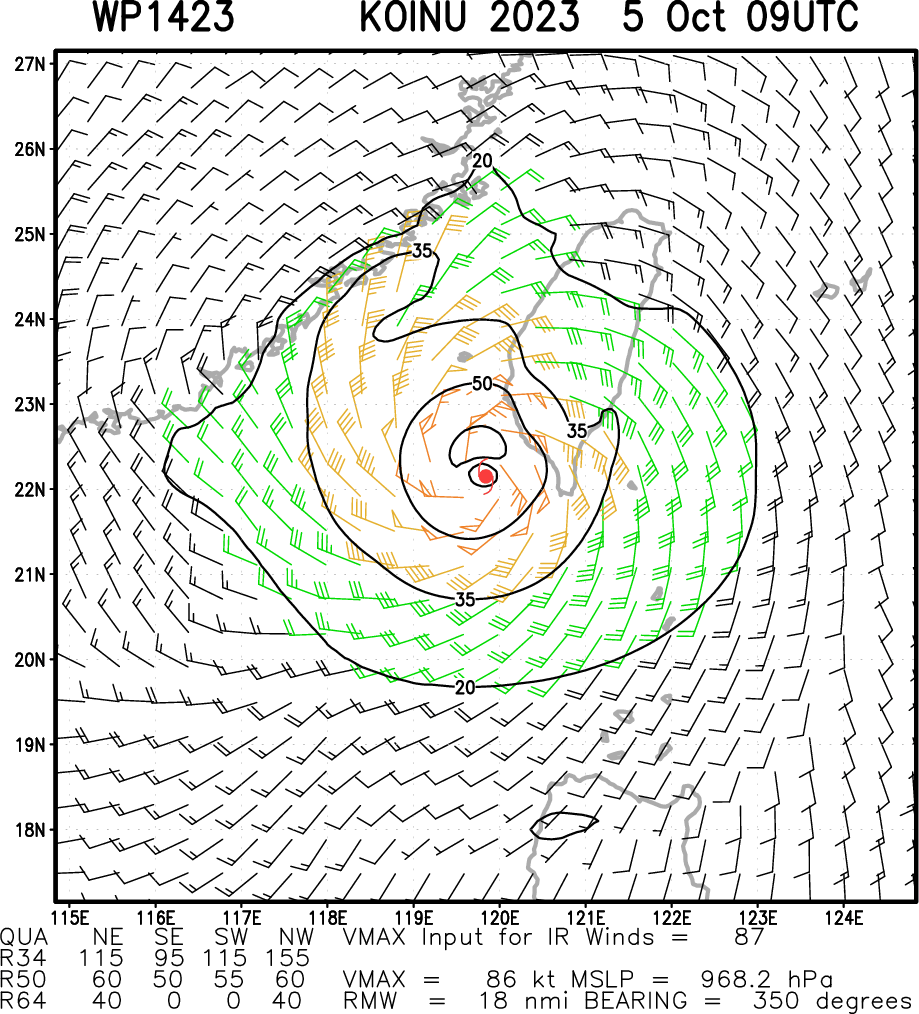
Multiplatform Satellite Surface Wind Analysis (Experimental)
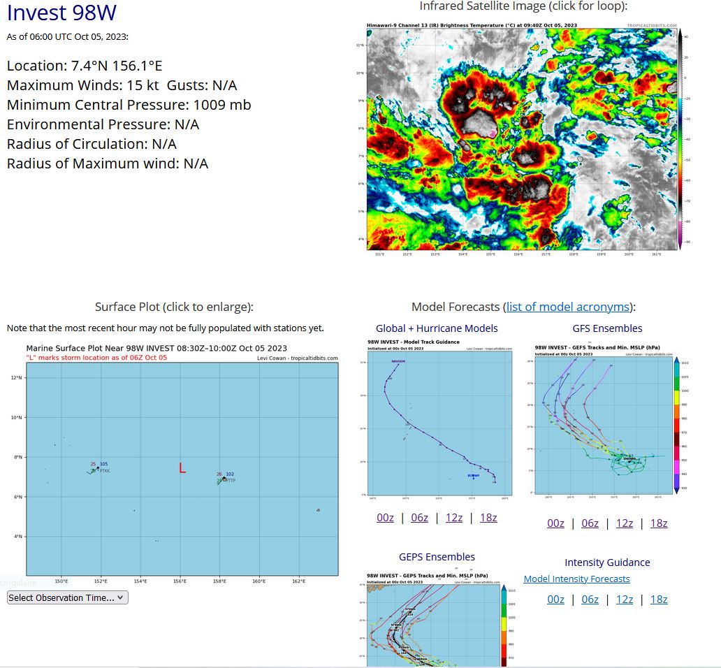
WESTERN NORTH PACIFIC: INVEST 98W. ADVISORY(ABPW) ISSUED AT 05/06UTC.

AN AREA OF CONVECTION (INVEST 98W) HAS PERSISTED NEAR 7.1N 157.1E, APPROXIMATELY 66 NM WEST OF POHNPEI. ANIMATED MULTISPECTRAL SATELLITE IMAGERY, ALONG WITH AN AMSR2 89GHZ MICROWAVE IMAGE, DEPICT AN ILL-DEFINED LOW-LEVEL CIRCULATION WITH A BROAD AREA OF FRAGMENTED CONVECTION ON THE SOUTHWEST QUADRANT. UPPER-LEVEL ANALYSIS INDICATES DIVERGENCE ALOFT WITH MODERATE EQUATORWARD OUTFLOW, LOW (10-15 KTS) VERTICAL WIND SHEAR (VWS), AND VERY WARM (30-31C) SEA SURFACE TEMPERATURES (SSTS). GLOBAL MODELS ARE IN GOOD AGREEMENT THAT 98W WILL TRACK GENERALLY WEST-NORTHWESTWARD AND CONTINUE TO DEVELOP OVER THE NEXT 24 TO 48 HOURS. MAXIMUM SUSTAINED SURFACE WINDS ARE ESTIMATED AT 13 TO 17 KNOTS. MINIMUM SEA LEVEL PRESSURE IS ESTIMATED TO BE NEAR 1009 MB. THE POTENTIAL FOR THE DEVELOPMENT OF A SIGNIFICANT TROPICAL CYCLONE WITHIN THE NEXT 24 HOURS IS LOW.
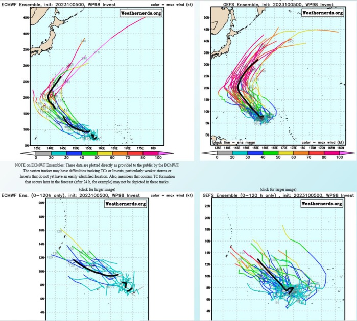
GLOBAL MODELS ARE IN GOOD AGREEMENT THAT 98W WILL TRACK GENERALLY WEST-NORTHWESTWARD AND CONTINUE TO DEVELOP OVER THE NEXT 24 TO 48 HOURS.
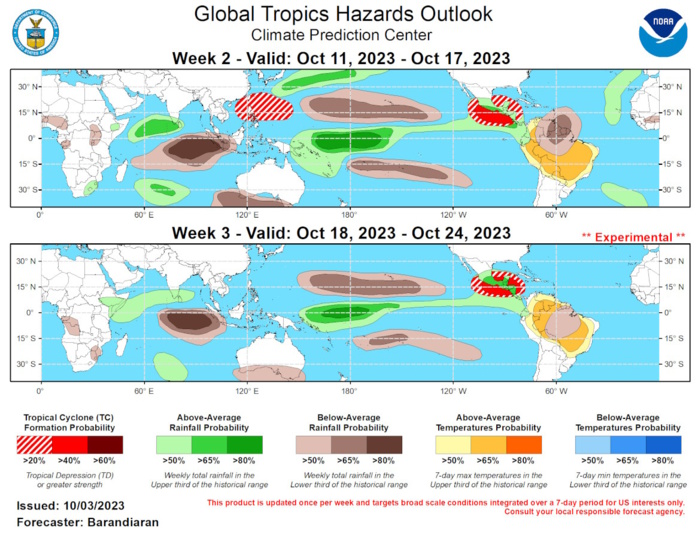
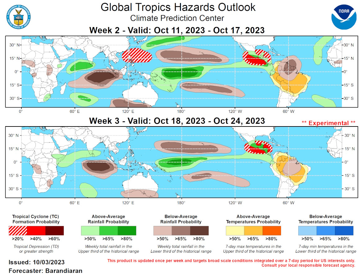
GTH Outlook Discussion Last Updated - 10/03/23 Valid - 10/11/23 - 10/24/23 The active El Nino base state continues to have a significant impact on the global tropics, but the Madden-Julian Oscillation (MJO) has been active recently as well, as depicted by 200-hPa velocity potential anomalies despite the RMM-index indicating a very low amplitude of the MJO signal. Currently the enhanced convective envelope is over the Western Pacific, and dynamical models generally agree on a continued eastward propagation of this convective feature into the Western Hemisphere over the coming weeks. With the potential for MJO activity moving through the Western Hemisphere during weeks 2 and 3, probabilities of tropical cyclone (TC) formation are enhanced for the Eastern Pacific, while suppressed convection around the Maritime Continent will likely suppress TC genesis potential over the Western Pacific. Four TCs have formed over the last week, each in a different basin. Tropical Storm Rina formed in the Main Development Region (MDR) of the Atlantic on September 28. It moved generally northwestward and dissipated quickly. Also on September 28, Typhoon Koinu formed in the Western Pacific east of Luzon. Koinu is still active, and in the coming days is forecast to pass near or over southern Taiwan before making landfall over southeastern Mainland China. For the latest information on Koinu please refer to the Joint Typhoon Warning Center (JTWC). On September 30, TC ARB02 formed in the Arabian Sea just west of the Indian coast. It quickly moved ashore and dissipated. Finally, early on October 3 Tropical Storm Lidia formed in the Eastern Pacific to the south of Mexico. It is currently tracking generally northwestward, but in the coming days Lidia is forecast to turn westward and away from the western coast of Mexico. For the latest information on Tropical Storm Lidia please refer to the National Hurricane Center (NHC). The consensus among dynamical models depicts the MJO moving into the Western Hemisphere during week-1 and propagating slowly over the coming month (phases 8-2), leading to a prolonged period of enhanced upper-level divergence over the Americas region. This would have the tendency to enhance tropical cyclone (TC) formation for the Eastern Pacific, where a moderate chance (40% probability) of TC genesis is posted. The Caribbean is also favored by this MJO configuration but models indicate increased wind shear over the Gulf of Mexico and Caribbean Sea, reducing the chances of TC formation somewhat. The Western Pacific typically has reduced TC activity when the MJO is in the Western Hemisphere, but nonetheless both the ECMWF and GEFS indicate elevated chances for TC development. Therefore, a slight chance (20%) is posted for much of the Western Pacific basin. Models favor the enhanced convective envelope to propagate quite slowly over the coming weeks, continuing to linger in the Western Hemisphere into week-3, albeit at a lower amplitude than what is depicted in the week-2 time period. With a similar overall large-scale environment, a moderate chance for TC formation continues for the Eastern Pacific and spreads into the Western Caribbean and southern Gulf of Mexico in week-3. For the Western Pacific, upper-level convergence is favored to increase during week-3, further reducing the probability of TC activity in the basin. The precipitation outlook for the next two weeks is based on anticipated TC tracks, the anticipated state of the MJO, and consensus of GEFS, CFS, Canadian, and ECMWF ensemble mean solutions. Above-normal precipitation continues for the Equatorial Eastern Pacific for both weeks, a response to the El Nino conditions, while suppressed precipitation is favored to the north and south of the El Nino-enhanced precipitation. Below-normal rainfall is also indicated for the western Maritime Continent and portions of the Indian Ocean throughout the forecast period. With enhanced TC activity anticipated, above-normal precipitation is favored for the Western Atlantic and especially for the Western Pacific and Southeast Asia. Above-normal temperatures are favored for much of northern South America throughout the forecast period.
