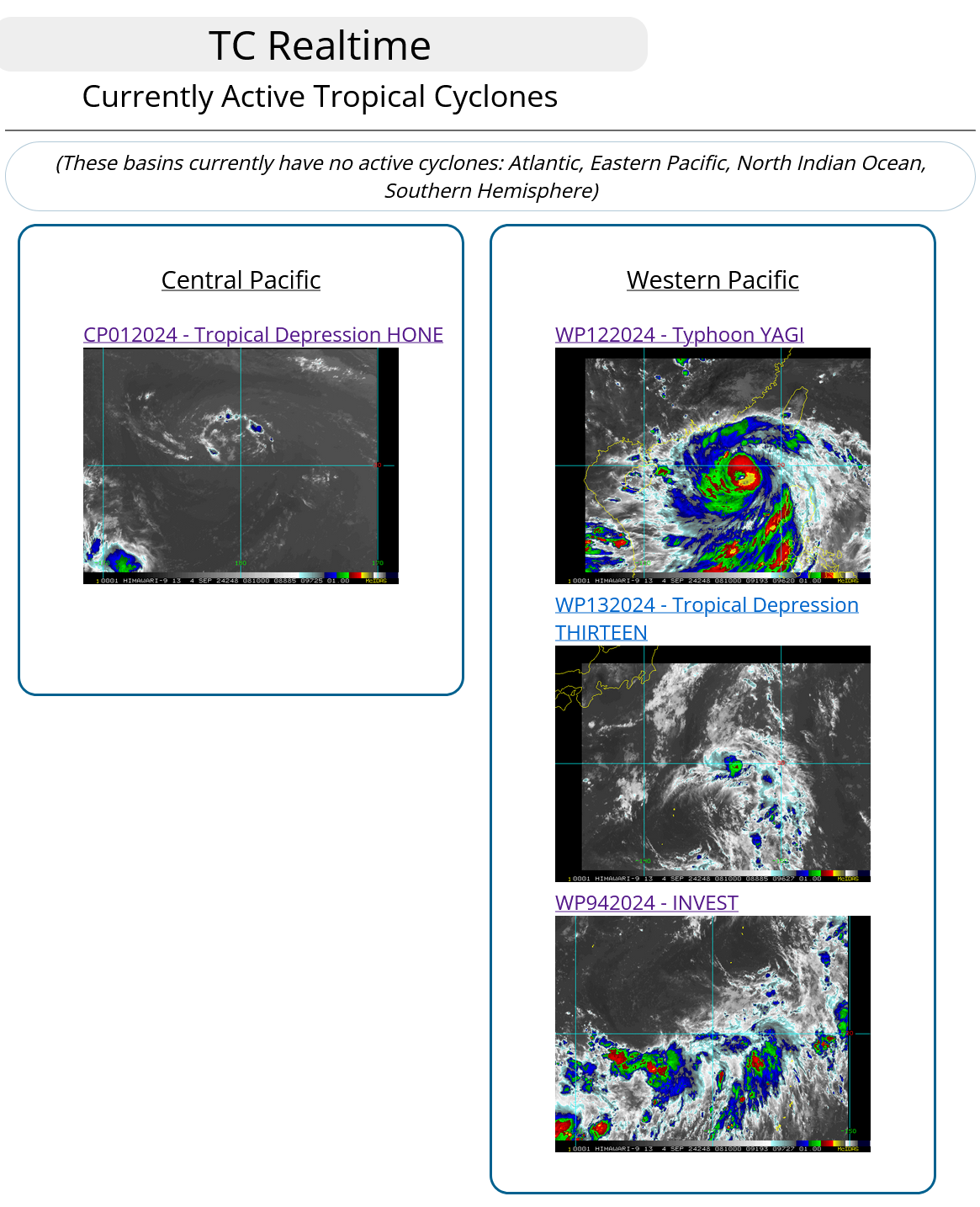
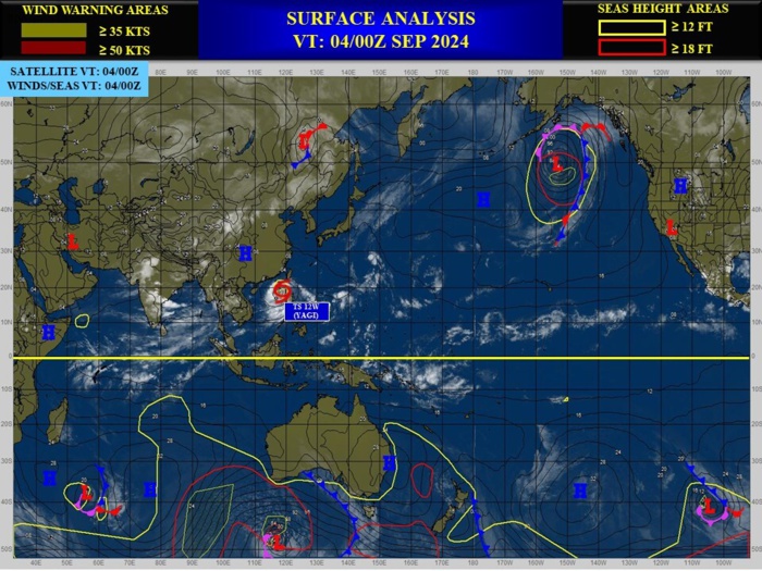
CLICK ON THE IMAGERIES BELOW TO GET THEM ENLARGED
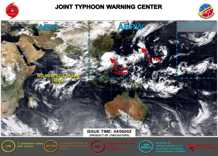
JTWC IS ISSUING 6HOURLY WARNINGS ON 12W AND 13W. 3HOURLY SATELLITE BULLETINS ARE ISSUED ON BOTH SYSTEMS AND ON SUBTROPICAL 01C.
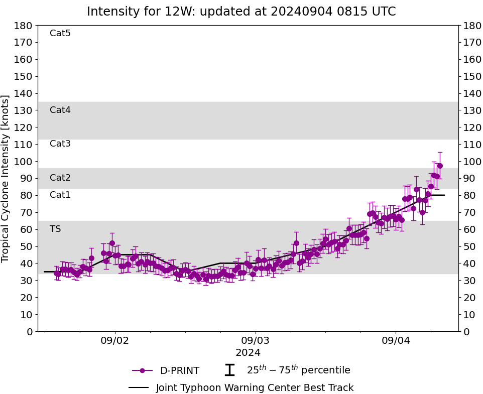
WESTERN NORTH PACIFIC: TY 12W(YAGI). 04/06UTC ESTIMATED INTENSITY IS 80 KNOTS/CAT 1 US: + 35 KNOTS OVER 24H.
1224090200 154N1225E 45
1224090206 164N1222E 45
1224090212 175N1217E 35
1224090218 182N1206E 40
1224090300 184N1196E 40
1224090306 185N1191E 45
1224090312 187N1189E 50
1224090318 189N1185E 60
1224090400 191N1177E 70
1224090406 192N1174E 80
1224090206 164N1222E 45
1224090212 175N1217E 35
1224090218 182N1206E 40
1224090300 184N1196E 40
1224090306 185N1191E 45
1224090312 187N1189E 50
1224090318 189N1185E 60
1224090400 191N1177E 70
1224090406 192N1174E 80
WARNING 12 ISSUED AT 0409UTC
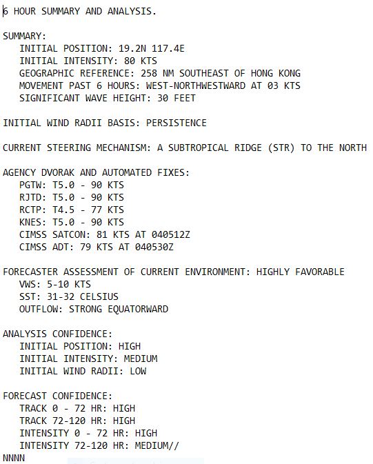

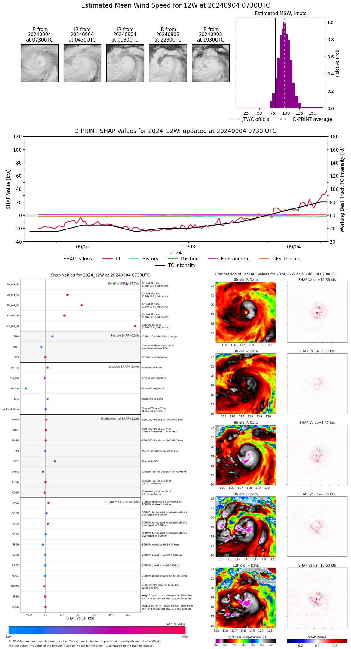
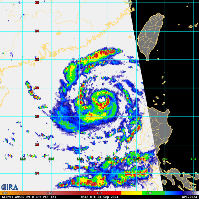
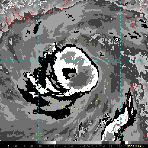
SATELLITE ANALYSIS, INITIAL POSITION AND INTENSITY DISCUSSION: ANIMATED MULTISPECTRAL SATELLITE IMAGERY (MSI) DEPICTS AN OMINOUS PINHOLE EYE FEATURE THAT HAS DEVELOPED IN PARALLEL WITH THE RAPID INTENSIFICATION THAT HAS OCCURRED OVER THE LAST 24 HOURS. WATER VAPOR IMAGERY REVEALS STRONG EQUATORWARD OUTFLOW IN TO A REGION OF UPPER-LEVEL DIFFLUENCE AND WEAK EASTWARD OUTFLOW INTO AN UPPER-LEVEL TROUGH. THE INITIAL POSITION IS PLACED WITH HIGH CONFIDENCE BASED ON A 040547Z GCOM W1 AMSR2 PASS WHICH DEPICTS A MICROWAVE EYE FEATURE ON BOTH THE 89GHZ AND 36GHZ IMAGES ALONGSIDE THE AFOREMENTIONED ANIMATED MSI. THE INITIAL INTENSITY OF 80 KTS IS ASSESSED WITH MEDIUM CONFIDENCE BASED ON THE AGENCY AND OBJECTIVE FIXES LISTED .
85 – 92 GHz Polarization-Corrected Brightness Temperature
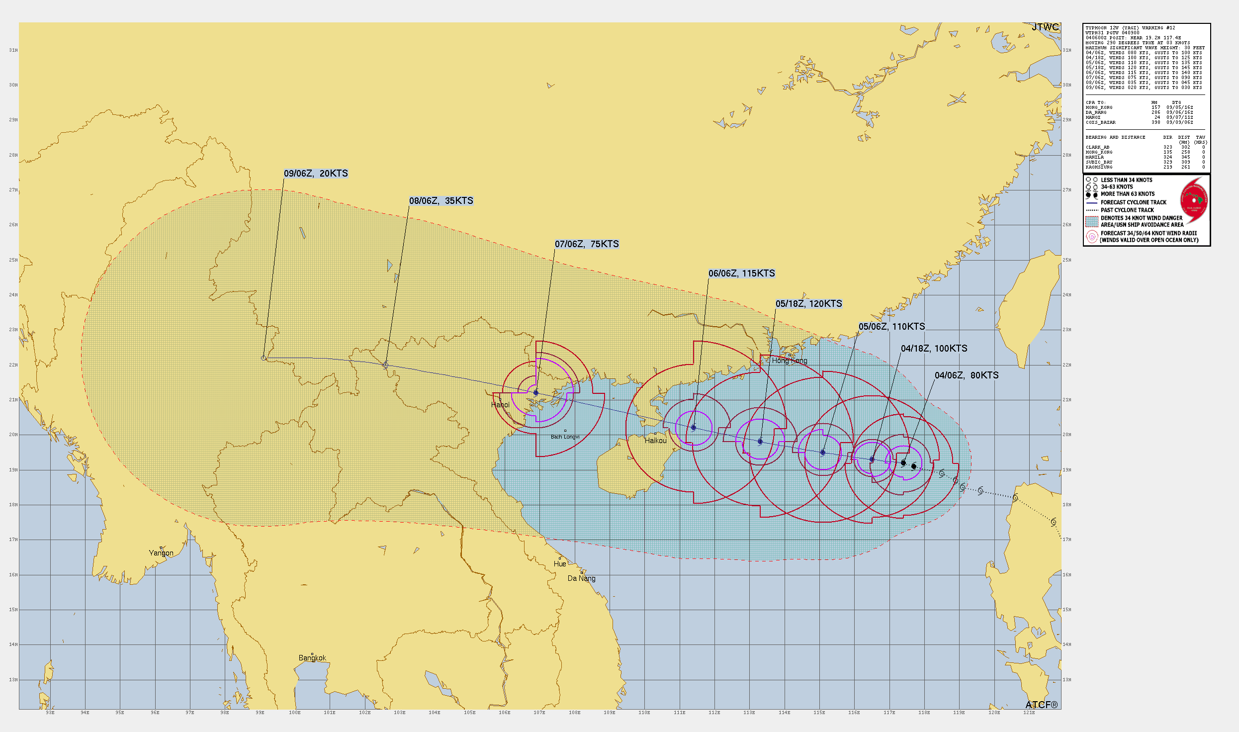
TC Warning Graphic
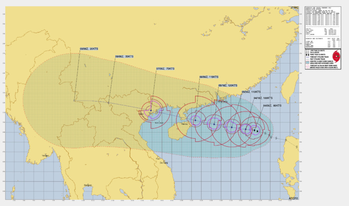
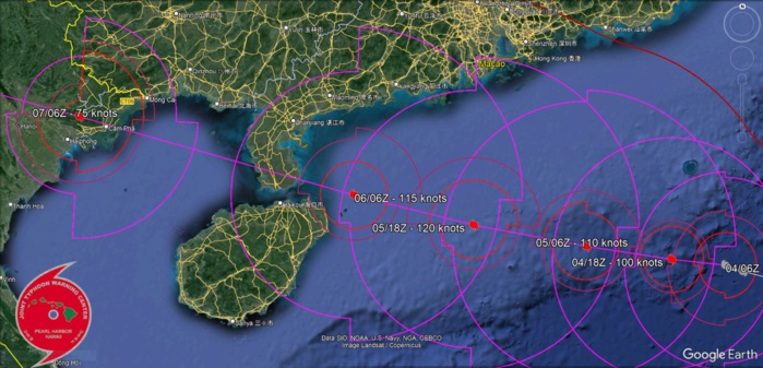
FORECAST REASONING. SIGNIFICANT FORECAST CHANGES: THERE ARE NO SIGNIFICANT CHANGES TO THE FORECAST FROM THE PREVIOUS WARNING. FORECAST DISCUSSION: TYPHOON (TY) 12W WILL CONTINUE TO BE DRIVEN WEST-NORTHWESTWARD THROUGH THE END OF THE FORECAST PERIOD WHILE UNDER THE STEERING INFLUENCE OF THE STR TO THE NORTH, PASSING OVER NORTHERN HAINAN AND THE LUICHOW PENINSULA SHORTLY AFTER TAU 48 AND MAKING LANDFALL IN VIETNAM JUST PRIOR TO TAU 72. RAPID INTENSIFICATION WILL CONTINUE WHILE IN THE WARM TUB OF THE SOUTH CHINA SEA WITH A HIGH OCEAN HEAT CONTENT, STRONG UPPER-LEVEL DIVERGENCE, AND LOW SHEAR THAT WILL CONTINUE UNTIL TAU 48. AFTER TAU 48, THE SHEAR WILL BECOME MODERATE AS THE SYSTEM APPROACHES THE COAST AND WILL WEAKEN DUE TO TOPOGRAPHIC INTERACTION. WEAKENING WILL BECOME EVEN MORE DRASTIC AFTER MAKING LANDFALL JUST PRIOR TO TAU 72 LEADING TO FULL DISSIPATION WHILE PASSING OVER THE MOUNTAINOUS TERRAIN OF NORTHERN VIETNAM, LAOS, AND MYANMAR.
Google Earth Overlay 72H FORECAST
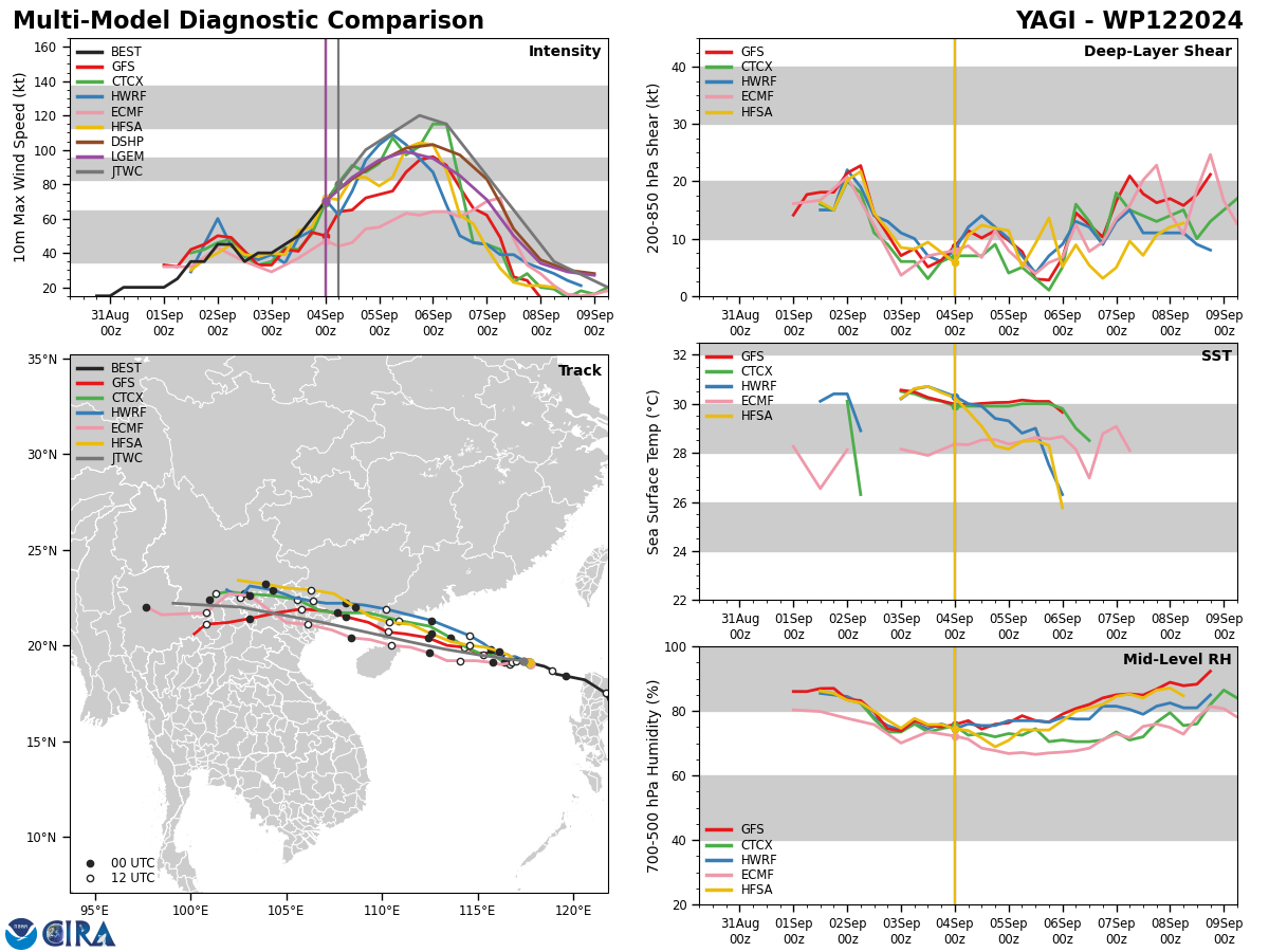
Model Diagnostic Plot

MODEL DISCUSSION: DETERMINISTIC MODEL GUIDANCE IS IN GOOD AGREEMENT THAT THE SYSTEM WILL TRACK WEST-NORTHWESTWARD THROUGH TAU 96. THE MODEL TRACKERS ONLY APPEAR TO STRUGGLE AFTER TY 12W PASSES OVER THE TALL MOUNTAINOUS TERRAIN, WHICH WILL CAUSE THE VORTEX TO SHALLOW AND BECOME DIFFICULT TO TRACK AND PREDICT. THE INTENSITY GUIDANCE IS IN MODERATE AGREEMENT THAT A PEAK WILL OCCUR AT TAU 36 BEFORE CONSISTENT WEAKENING, BUT SOME OF THE JTWC CONSENSUS MEMBERS FORECAST A PEAK AS LOW AS 90KTS (GFS) OR AS HIGH AS 135KTS (RICN AND RIPA).
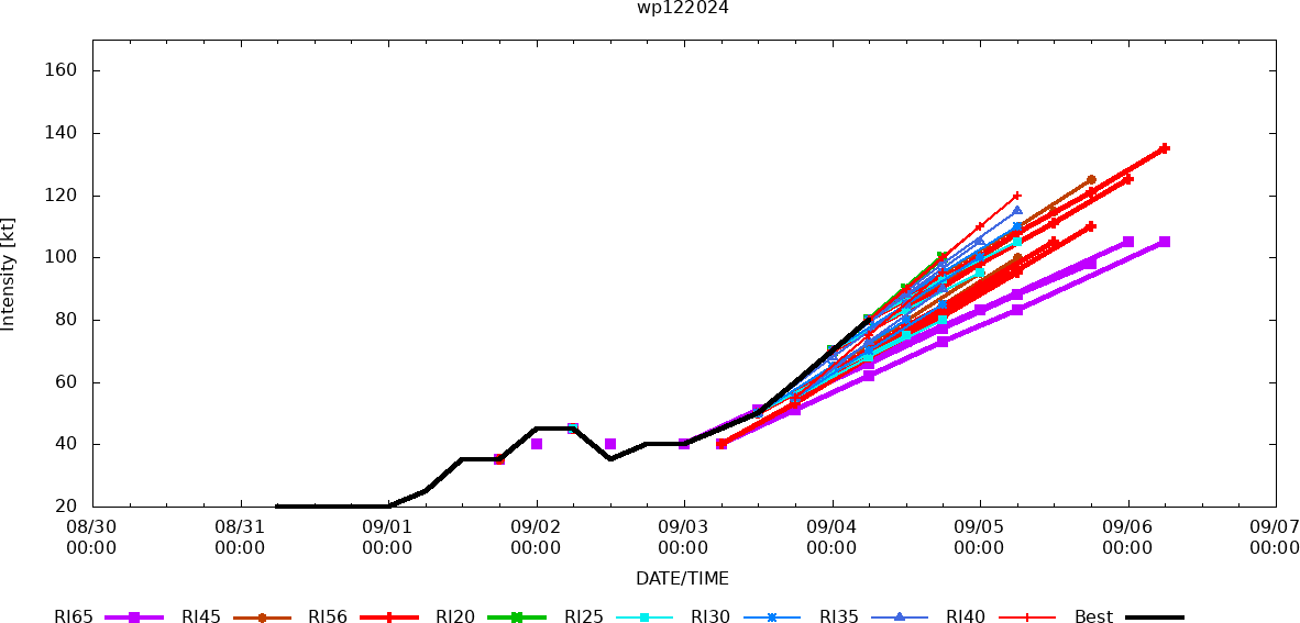
Rapid Intensification Guidance
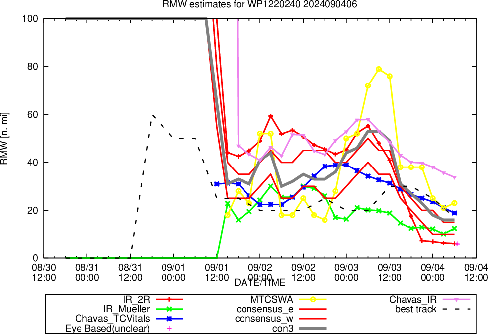
Radius of Maximum Wind (RMW)
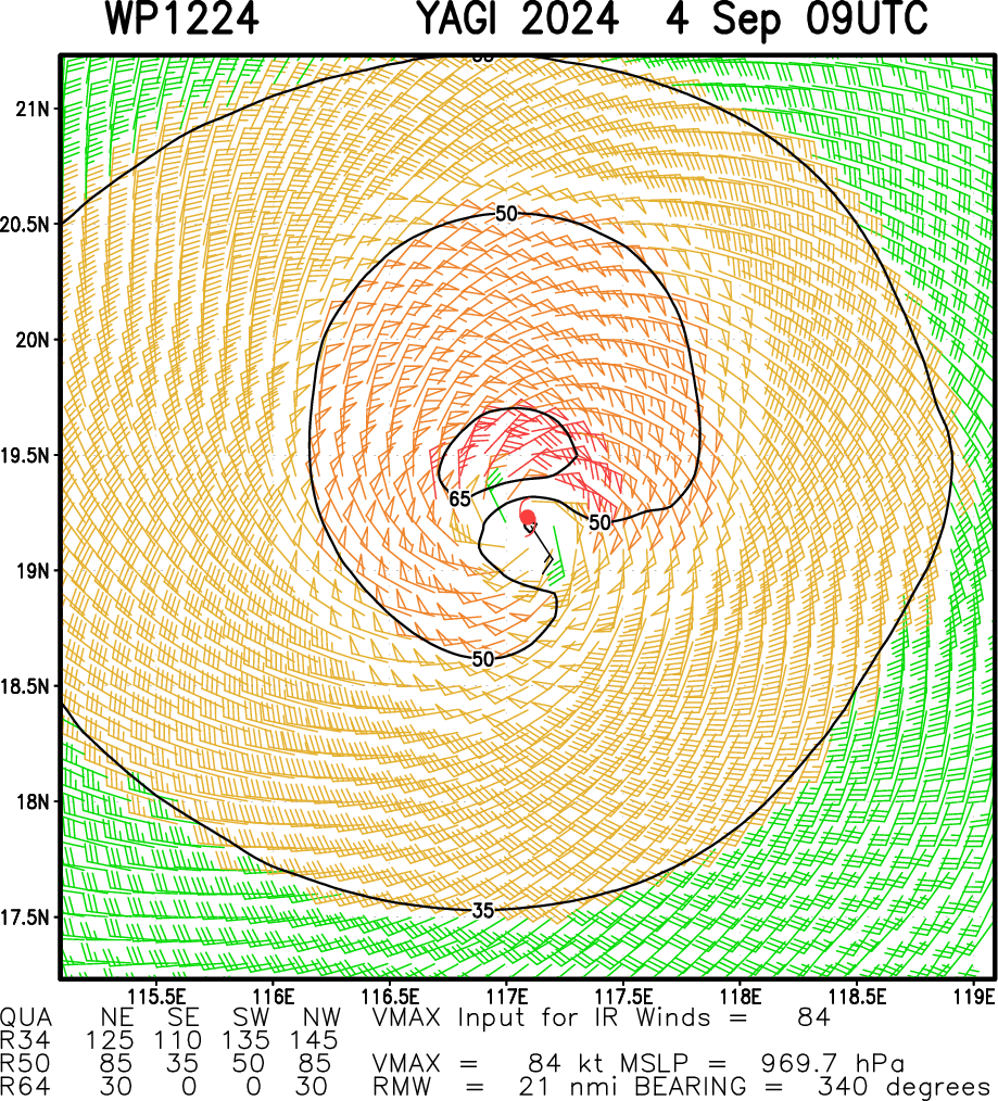
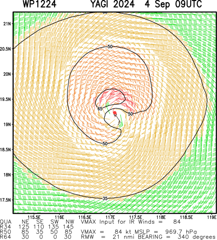
Multiplatform Satellite Surface Wind Analysis (Experimental)
040830UTC DVORAK ANALYSIS

TPPN11 PGTW 040848
A. TYPHOON 12W (YAGI)
B. 04/0830Z
C. 19.12N
D. 117.22E
E. ONE/GK2A
F. T6.0/6.0/D2.5/24HRS STT: D1.0/03HRS
G. IR/EIR/VIS/MSI
H. REMARKS: 03A/PBO EYE/ANMTN. OW EYE SURROUNDED BY B YIELDS AN E#
OF 5.5. ADDED 0.5 EYE ADJUSTMENT FOR W, TO YIELD A DT OF 6.0. MET
YIELDS 5.0. PT YIELDS 5.5. DBO DT. BROKE CONSTRAINTS DUE TO RAPID
INTENSIFICATION.
I. ADDITIONAL POSITIONS:
04/0546Z 19.15N 117.23E AMS2
04/0605Z 19.10N 117.50E ATMS
DESSINO
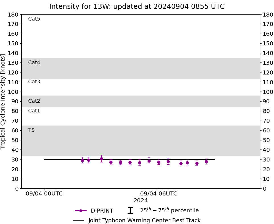
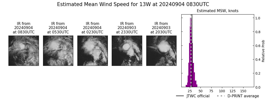
WESTERN NORTH PACIFIC: TD 13W. 04/06UTC ESTIMATED INTENSITY IS 30 KNOTS: + 10 KNOTS OVER 24 HOURS.
1324090200 232N1465E 15
1324090206 235N1465E 15
1324090212 238N1466E 15
1324090218 243N1469E 20
1324090300 247N1472E 20
1324090306 250N1472E 20
1324090312 256N1474E 20
1324090318 266N1472E 20
1324090400 277N1471E 30
1324090406 285N1470E 30
1324090206 235N1465E 15
1324090212 238N1466E 15
1324090218 243N1469E 20
1324090300 247N1472E 20
1324090306 250N1472E 20
1324090312 256N1474E 20
1324090318 266N1472E 20
1324090400 277N1471E 30
1324090406 285N1470E 30
WARNING 2 ISSUED AT 0409UTC
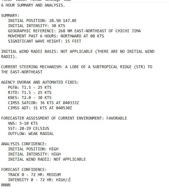

SATELLITE ANALYSIS, INITIAL POSITION AND INTENSITY DISCUSSION: ANIMATED MULTISPECTRAL SATELLITE IMAGERY (MSI) DEPICTS LOW-LEVEL CLOUDS WRAPPING IN TO A LOW-LEVEL CIRCULATION CENTER (LLCC) PARTIALLY OBSCURED BY CIRRUS CLOUDS. THE UPPER-LEVEL STRUCTURE IS DISORGANIZED DUE TO LOW TO MODERATE SOUTHEASTERLY WIND SHEAR. WATER VAPOR IMAGERY REVEALS WEAK RADIAL OUTFLOW CUT OFF BY AN UPPER-LEVEL CYCLONE NEARBY TO THE SOUTHWEST. THE INITIAL POSITION IS PLACED WITH HIGH CONFIDENCE BASED ON THE AFOREMENTIONED LLCC DEPICTED ON ANIMATED MSI.
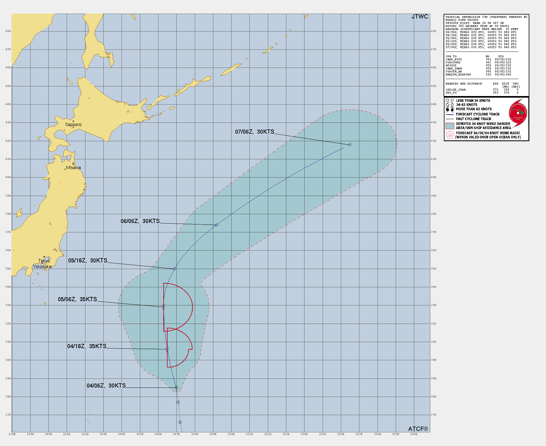
TC Warning Graphic
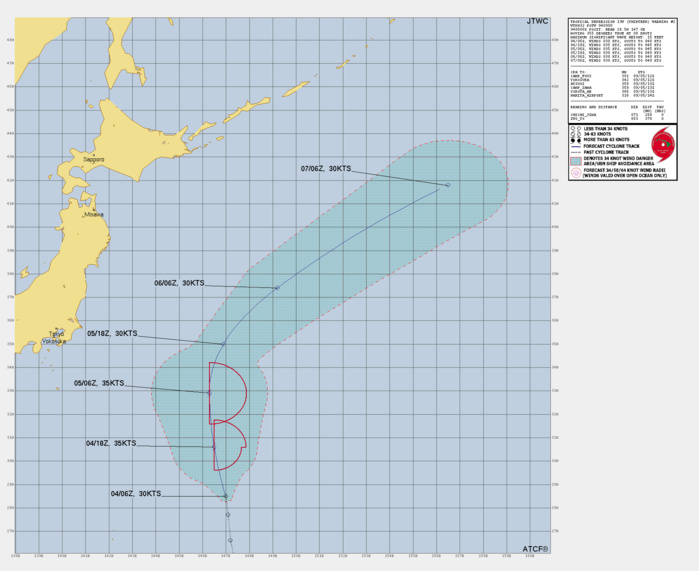
FORECAST REASONING. SIGNIFICANT FORECAST CHANGES: THERE ARE NO SIGNIFICANT CHANGES TO THE FORECAST FROM THE PREVIOUS WARNING. FORECAST DISCUSSION: TROPICAL DEPRESSION (TD) 13W WILL TRACK NORTH-NORTHWESTWARD FOR THE NEXT 24 HOURS BEFORE ROUNDING THE RIDGE AXIS BETWEEN TAU 24-36. THE SYSTEM WILL TRACK NORTHWESTWARD BETWEEN TAU 48-72 WHILE UNDERGOING EXTRATROPICAL TRANSITION AS THE SYSTEM BECOMES EMBEDDED UNDER A DEEP-LAYER TROUGH OFF OF THE EAST COAST OF JAPAN. DURING THE INITIAL 24-HOUR PERIOD, TD 13W WILL SLIGHTLY INTENSIFY TO 35KTS WHILE IN A FAVORABLE ENVIRONMENT OF LOW SHEAR, UPPER-LEVEL DIVERGENCE, AND WARM SEA SURFACE TEMPERATURES. AS THE SYSTEM APPROACHES THE UPPER-LEVEL TROUGH, VERTICAL WIND SHEAR WILL INCREASE. ADDITIONALLY, THE SYSTEM WILL PASS INTO COOL SEA SURFACE TEMPERATURES BELOW 26C BETWEEN TAU 48-72, FURTHER SUPPORTING THE COMPLETION OF EXTRATROPICAL TRANSITION.
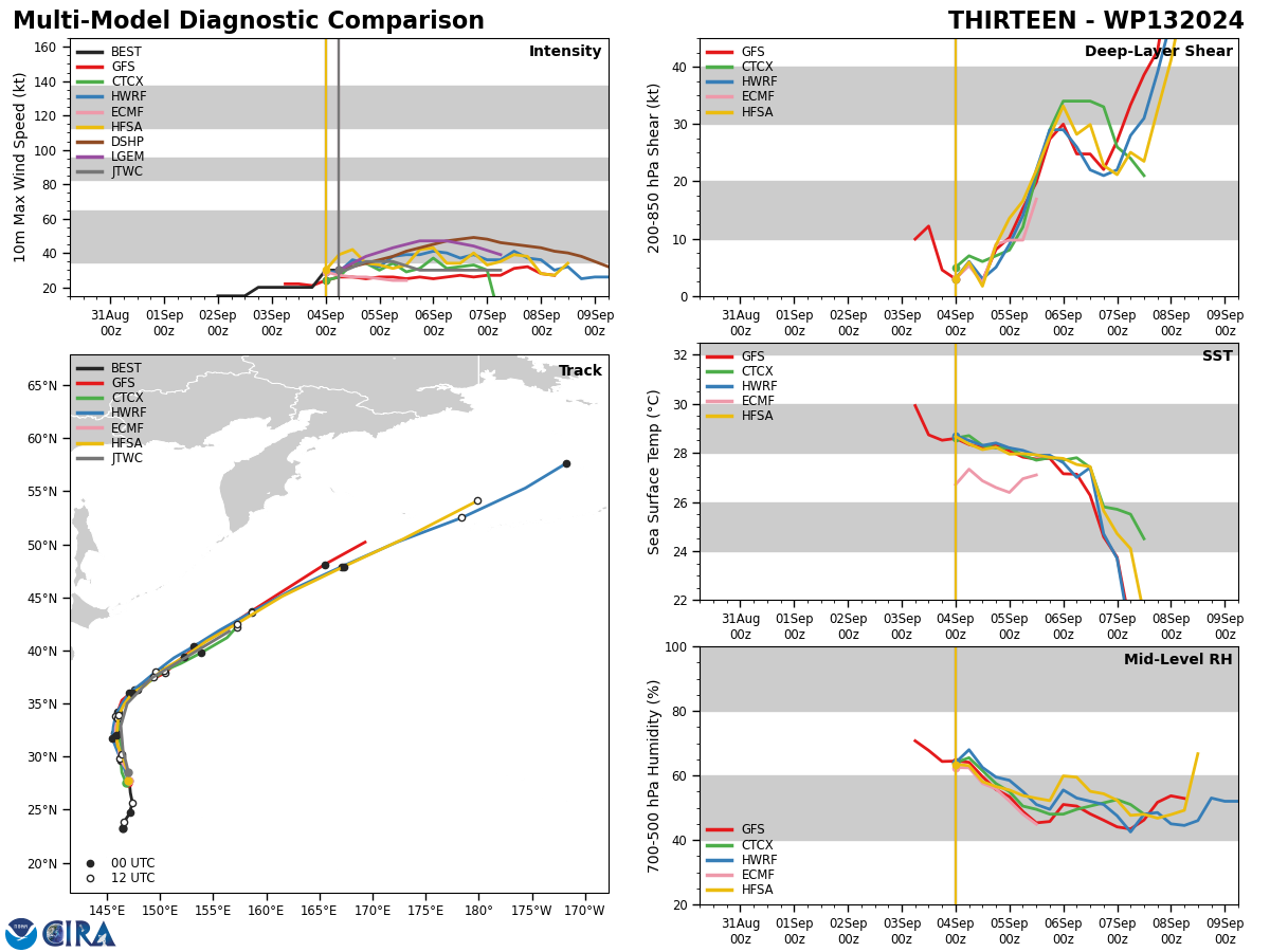
Model Diagnostic Plot
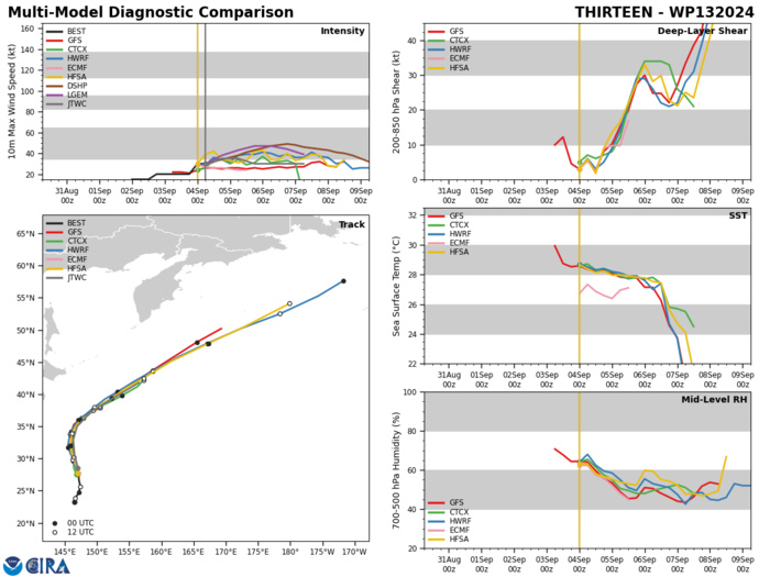
MODEL DISCUSSION: DETERMINISTIC MODEL GUIDANCE IS IN TIGHT AGREEMENT IN THE NEAR-TERM TRACK GUIDANCE, WITH A MAXIMUM ALONG-TRACK SPREAD OF 170NM BY TAU 72 DUE TO VARYING INTERPRETATIONS OF HOW QUICKLY THE SYSTEM WILL SPEED UP AFTER ROUNDING THE STR. SEVERAL MODELS LOSE TRACK OF THE VORTEX PRIOR TO TAU 72, SUCH AS NAVGEM AND ECMWF. THE INTENSITY GUIDANCE IS ALSO IN GOOD AGREEMENT HOVERING BETWEEN 30-35KTS THROUGHOUT THE FORECAST PERIOD.
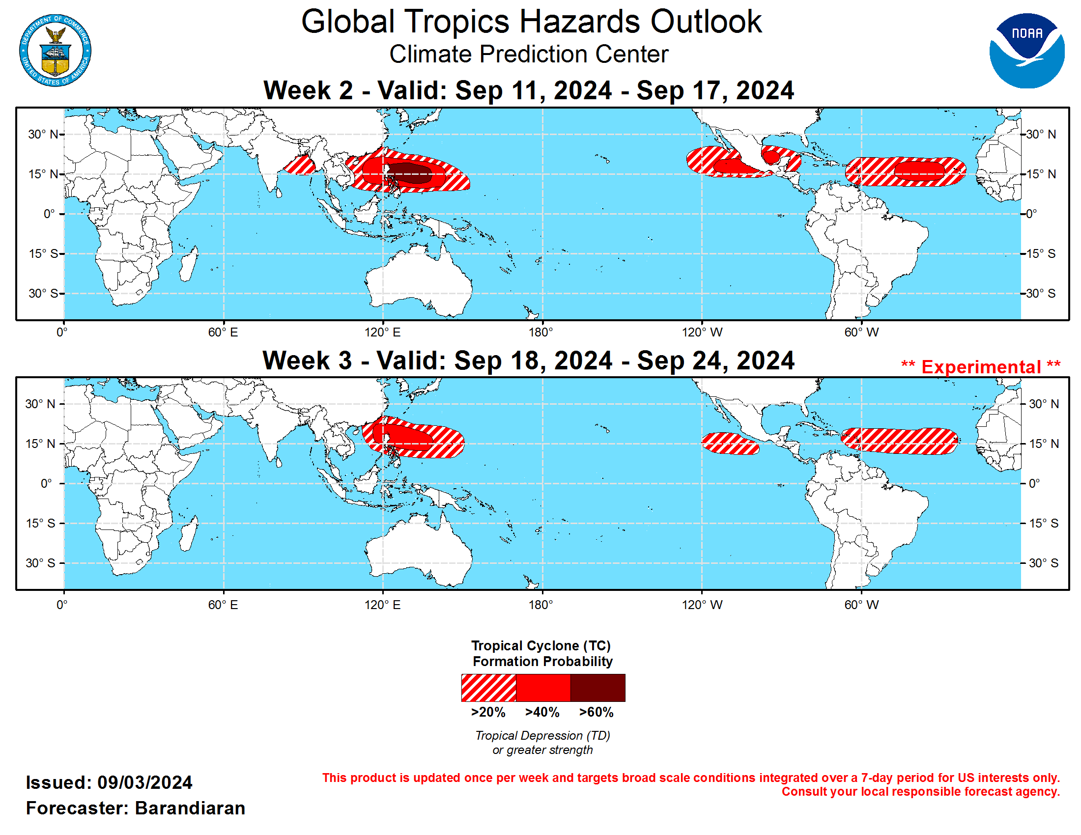
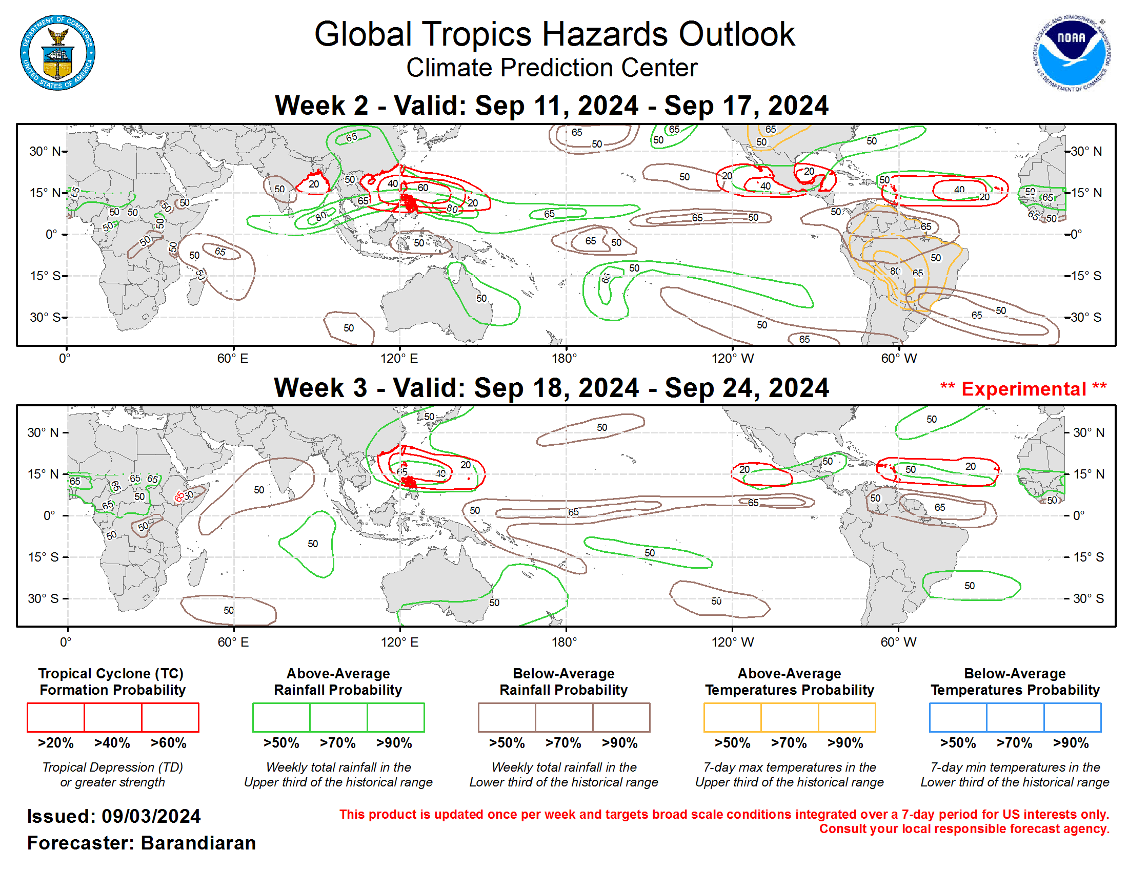
Last Updated - 09/03/24 3 WEEK TROPICAL CYCLONE FORMATION PROBABILITY

GTH Outlook Discussion Last Updated - 09/03/24 Valid - 09/11/24 - 09/24/24 The MJO has been fairly coherent since early August, having propagated from the Western Hemisphere into the Indian Ocean. The RMM signal has strengthened lately after the MJO emerged from destructive interference from Rossby wave activity. RMM forecasts suggest this modulating signal is likely to continue, as dynamical models indicate the potential for further interference from Rossby waves, or the development of fast-moving Kelvin waves. The large-scale environment is expected to continue to be favorable for Tropical Cyclone (TC) Development in the Western Pacific during the next several weeks. Should the MJO remain coherent over the Maritime Continent and Western Pacific, this historically supports increasingly less favorable conditions for TC formation in the East Pacific and the Main Development Region of the Tropical Atlantic. However, any lowered TC potential is counteracted by an active climatology as well as other modes of tropical variability that contribute to genesis. One tropical cyclone (TC) formed over the last week. On September 1 TC Yagi formed over the Philippine Sea and tracked over the Philippines and into the South China Sea. The Joint Typhoon Warning Center (JTWC) is forecasting Yagi to intensity to typhoon strength while continuing to track west and make landfall in the coming days near Hainan. For the latest on TC Yagi please refer to the JTWC. With the MJO favored to be over the Maritime Continent/Western Pacific for both weeks 2&3, TC activity in the West Pacific basin is very likely to be enhanced, on top of an already active climatology as well as very warm SSTs, with anomalies > 2C almost universal, not just for the Western Pacific but for nearly all of the tropical waters of the northern hemisphere. Therefore a high risk (>60% probability) of TC genesis is posted for the Philippine Sea, a moderate risk (>40%) is posted for the eastern South China Sea (SCS) and east to the Marianas islands, and a slight risk (20%) for the remainder of the SCS and portions of the Bay of Bengal, all for week-2. The Western Pacific continues to be favored for TC activity into week-3, with a moderate risk for TC genesis highlighted for the Philippine Sea and a slight risk eastward to the Marianas and west into the SCS. The TC outlook for the western hemisphere has been, and continues to be, a murky picture. As mentioned above, very warm SSTs argue for high chances of TC activity, while the predicted phase of the MJO (4-5) generally suppresses TC activity over the East Pacific and Atlantic. The synoptic picture over Africa indicates at least decent potential for easterly wave generation, yet ensemble guidance is having a hard time latching onto any given potential wave, at least in today’s solutions. The fundamentals are there though, and the models are not entirely devoid of signal. During week-2 three areas are the focus of those signals, and each is given a moderate risk for TC genesis: the southern coast of Mexico and south of Baja California, the Bay of Campeche, and west of the Cape Verde islands (i.e. the Atlantic Main Development Region, MDR). A slight risk of TC genesis is also posted for the western Caribbean and much of the Eastern Pacific Basin, as well as the remainder of the MDR. The ECMWF indicates an increasing potential for TC genesis south of Mexico into week-3, although this is not supported by the GEFS, so a slight risk of TC genesis is posted for the East Pacific for week-3, as well as for the Atlantic MDR, where both the GEFS and ECMWF continue to give at least some indication of TC activity during week-3.
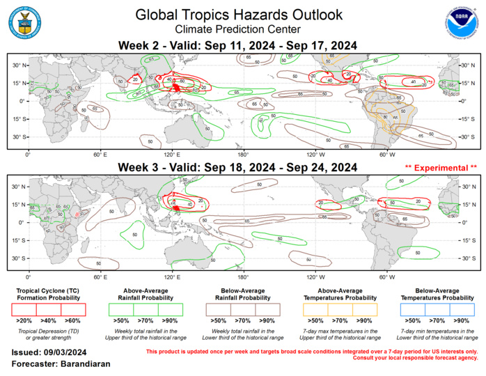
The precipitation outlook for weeks 2 and 3 is based on potential TC activity, the anticipated state of ENSO and the MJO, and informed by GEFS and ECMWF ensemble mean solutions. Enhanced precipitation is favored over portions of Southeast Asia throughout the forecast period with enhanced TC activity anticipated in the region. Increased chances for above-normal precipitation are also indicated for portions of Central America for both weeks. Below-normal precipitation is favored over the equatorial Central Pacific for both weeks, a pattern reminiscent of the canonical La Nina footprint, as well as for the western Indian Ocean as the MJO moves into the Western Pacific. Above-normal temperatures are indicated for the extended Amazon Basin, particularly in the lee of the Andes during week-2, as well as portions of the central U.S.
