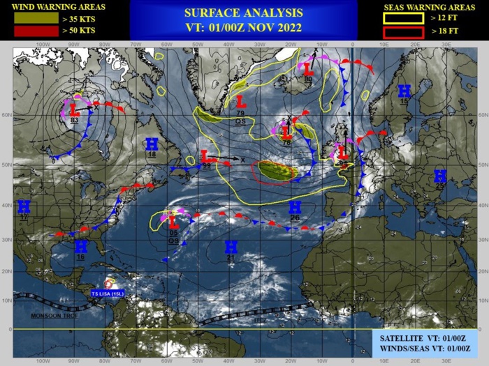
CLICK ON THE IMAGERIES BELOW TO GET THEM ENLARGED
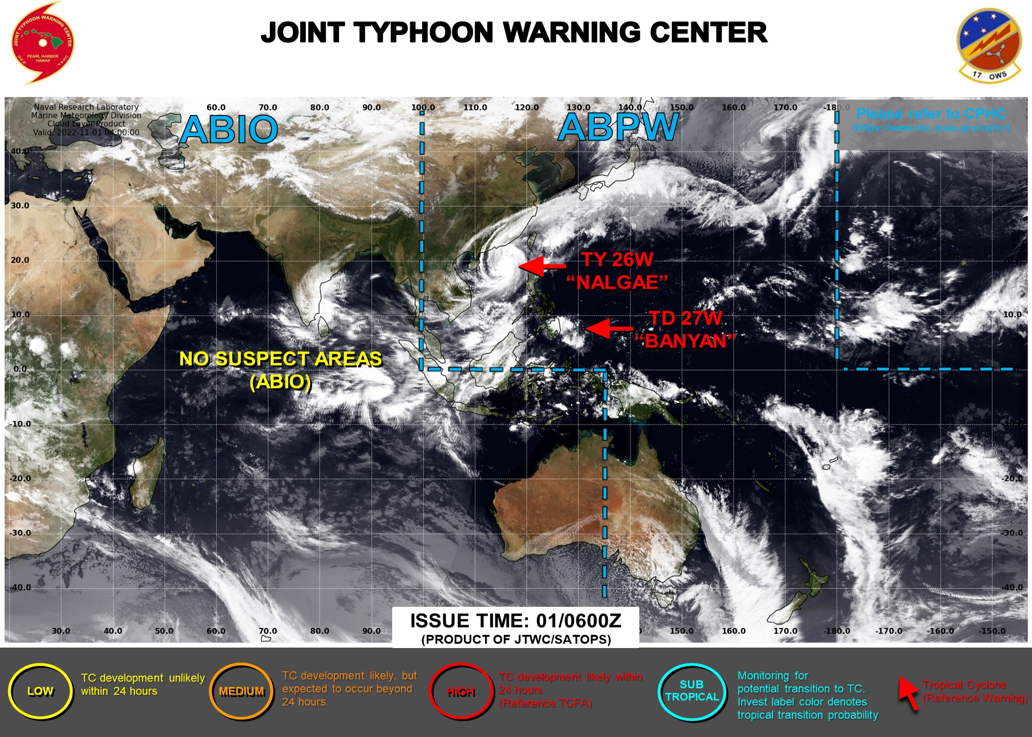
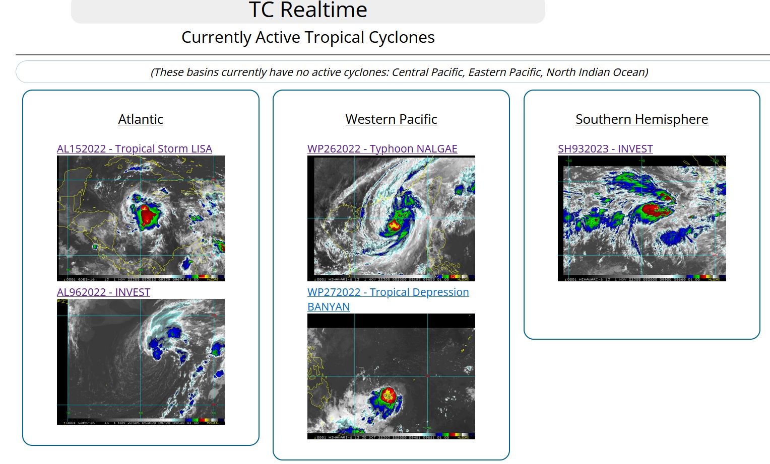
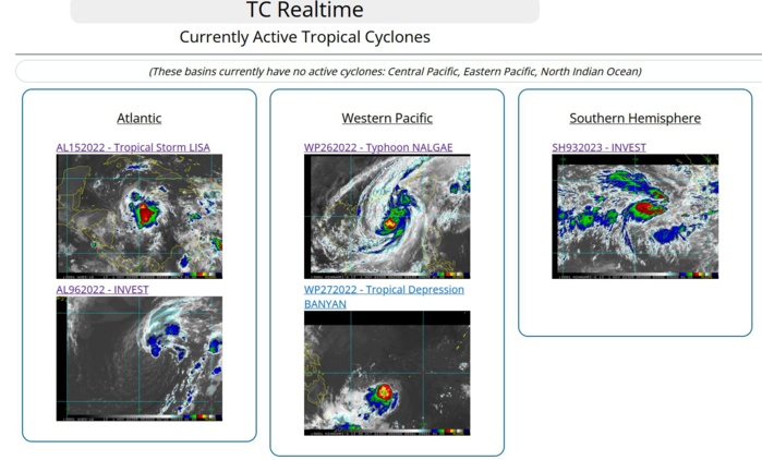
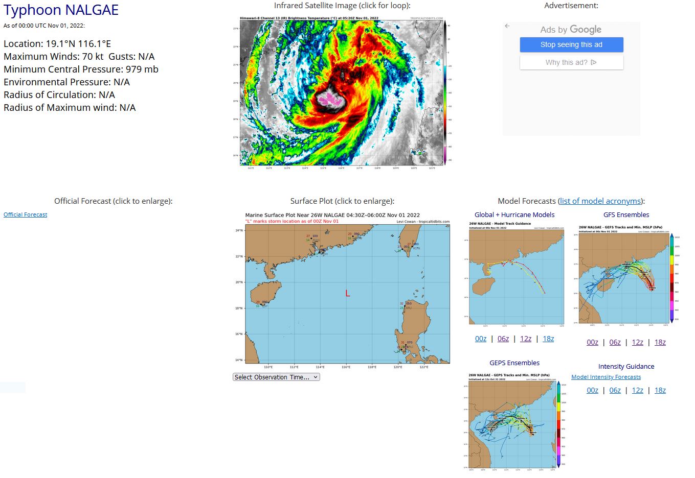
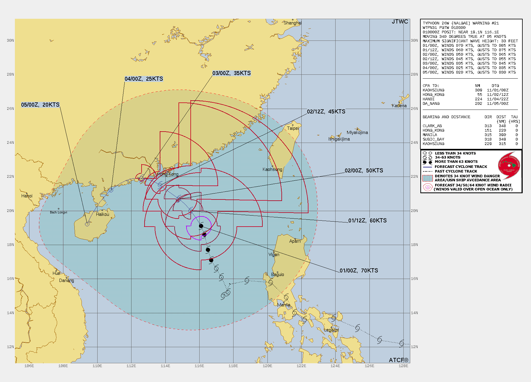
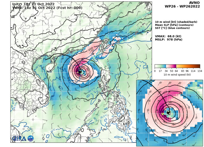
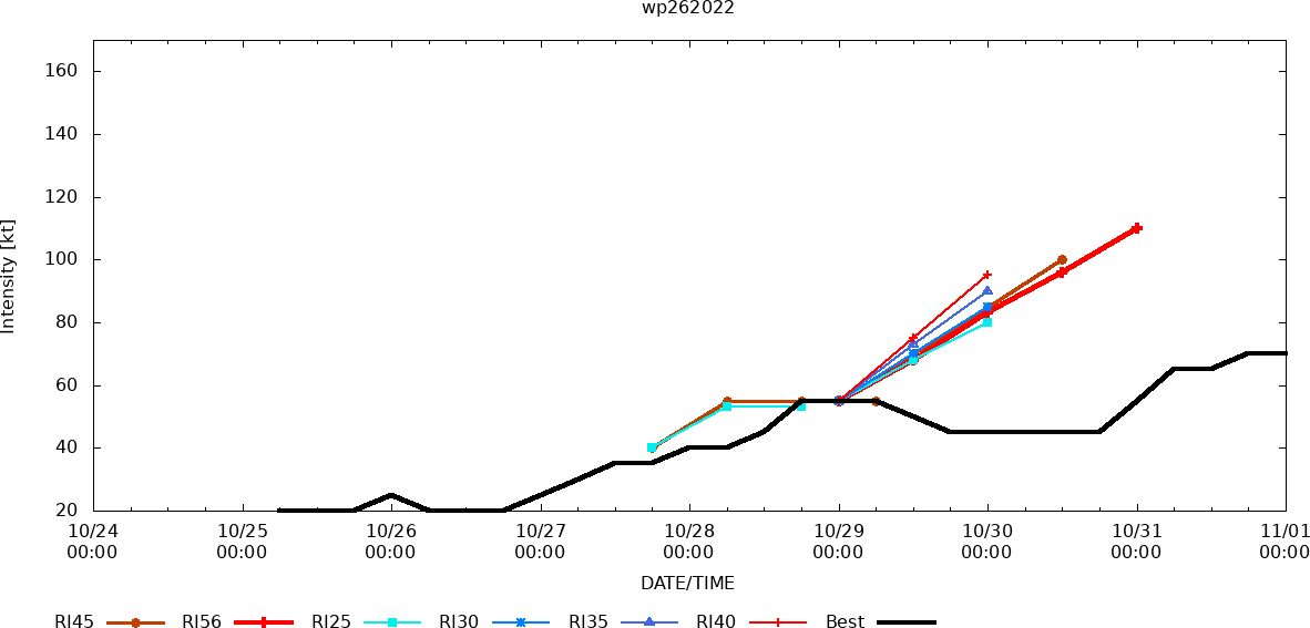
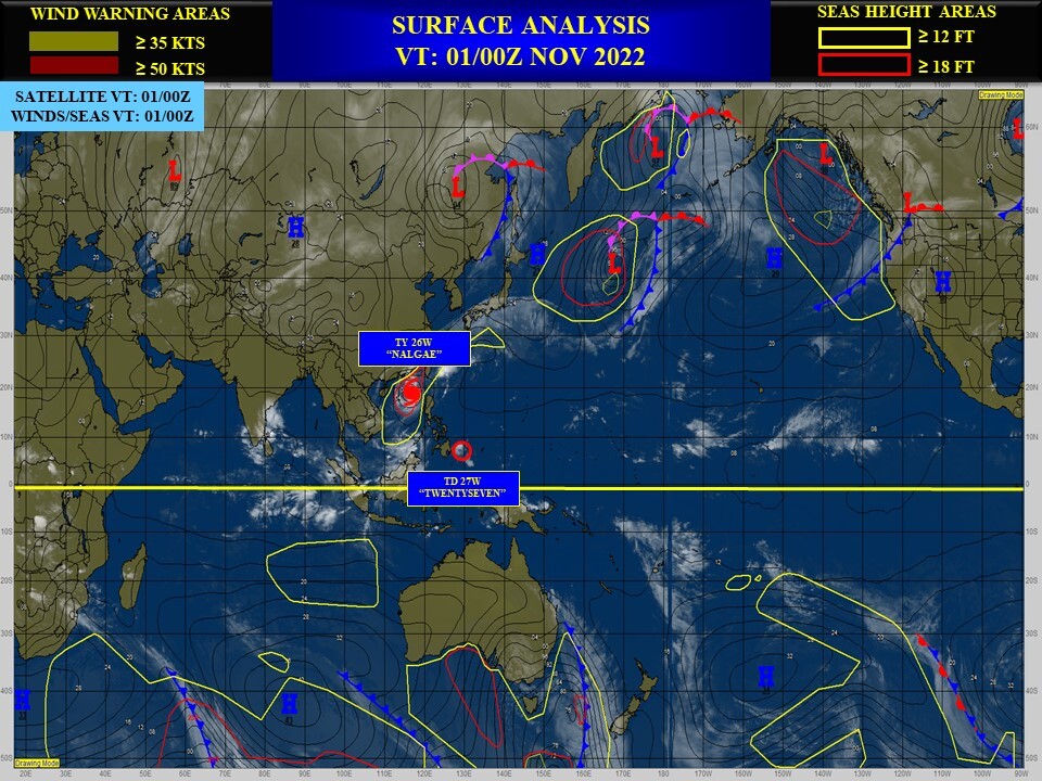
WESTERN NORTH PACIFIC: TY 26W(NALGAE). ESTIMATED LOCATION AND INTENSITY AT 01/00UTC. WARNING 21 ISSUED AT 01/03UTC.
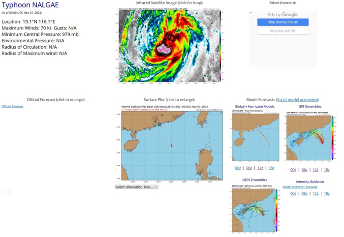
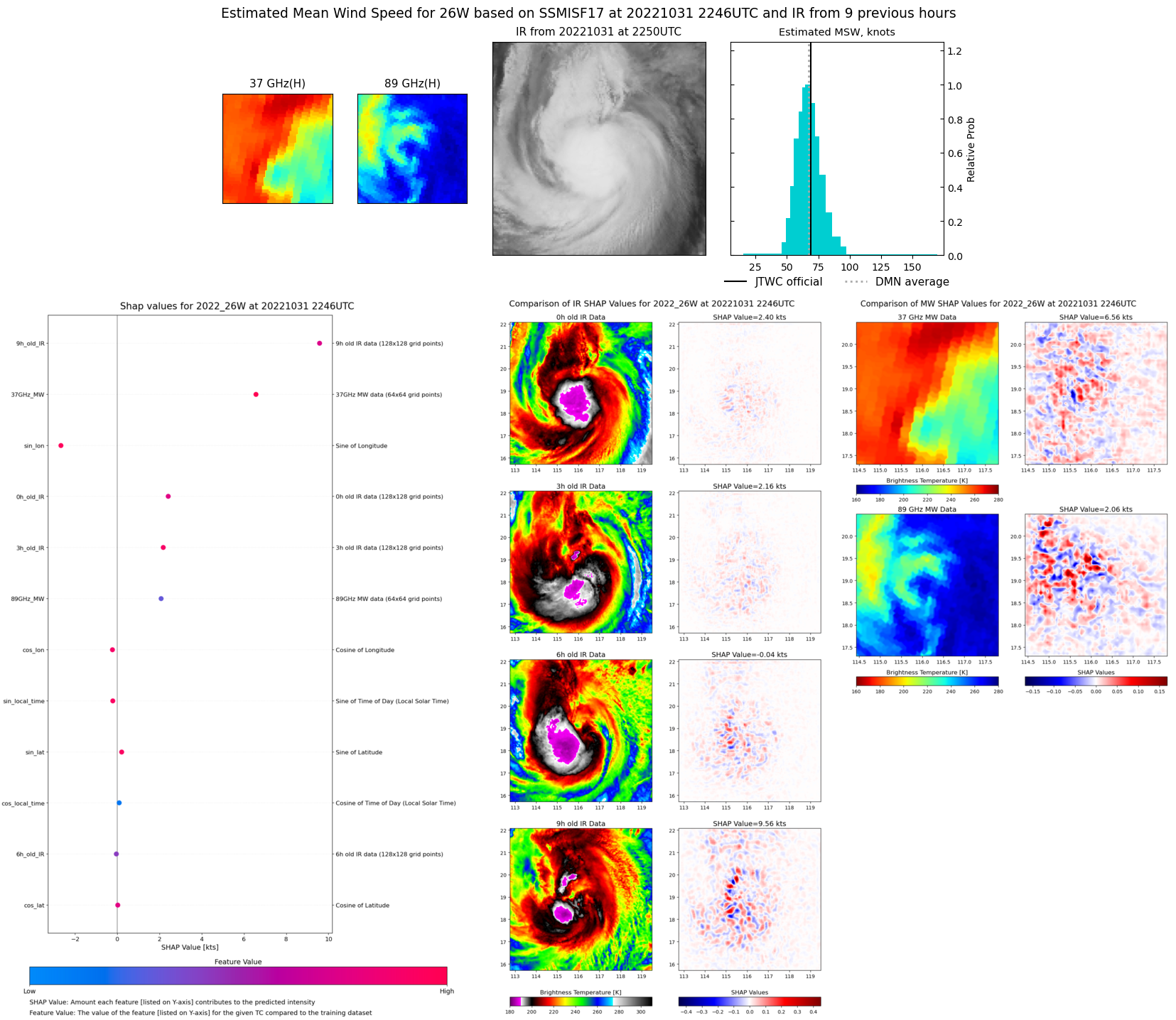
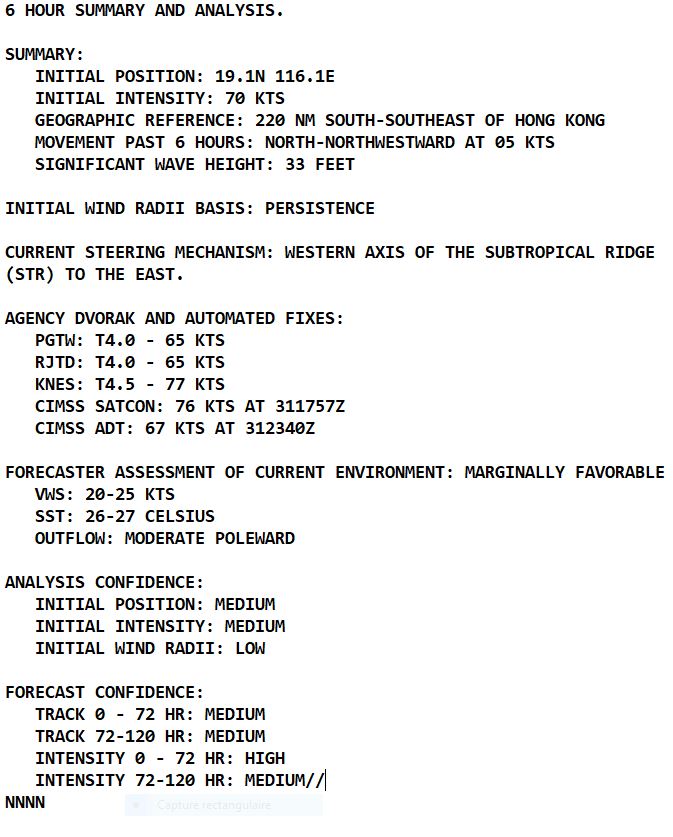
SATELLITE ANALYSIS, INITIAL POSITION AND INTENSITY DISCUSSION: ANIMATED MULTISPECTRAL SATELLITE IMAGERY (MSI) DEPICTS A RELATIVELY SYMMETRICAL SYSTEM WITH FEEDER BANDS IN THE WESTERN AND EASTERN SEMI-CIRCLES WRAPPING INTO AN ASSESSED LOW LEVEL CIRCULATION CENTER (LLCC). A 312245Z 91GHZ SSMIS PASS SHOWS THE AFOREMENTIONED BANDING AS WELL AS THE DEEPEST CONVECTION PRESENT IN THE WESTERN SEMI-CIRCLE. THE INITIAL POSITION IS PLACED WITH MEDIUM CONFIDENCE BASED OF THE VISIBLE SATELLITE LOOP, THE AVAILABLE SSMIS IMAGERY AND SEVERAL AGENCY FIXES. THE INITIAL INTENSITY OF 70 KNOTS IS SET BASED ON CONSISTENCY FROM THE PREVIOUS FORECAST AND THE OVERALL STRUCTURE. THE INITIAL INTENSITY SET SLIGHTLY HIGHER THAN THE PGTW DVORAK ESTIMATE OF 4.0, AIDT OF 67 KNOTS, AND SET SLIGHTLY LOWER THAN SATCON WHICH IS AT 76 KNOTS.
WP, 26, 2022103100,166N, 1170E, 55, 985
WP, 26, 2022103106,171N, 1167E, 65, 984
WP, 26, 2022103112,177N, 1165E, 65, 983
WP, 26, 2022103118,186N, 1163E, 70, 980
WP, 26, 2022110100,191N, 1161E, 70, 979
WP, 26, 2022103106,171N, 1167E, 65, 984
WP, 26, 2022103112,177N, 1165E, 65, 983
WP, 26, 2022103118,186N, 1163E, 70, 980
WP, 26, 2022110100,191N, 1161E, 70, 979
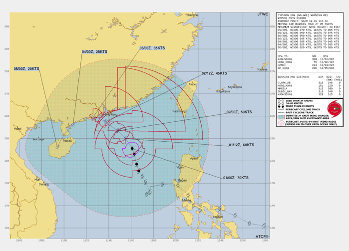
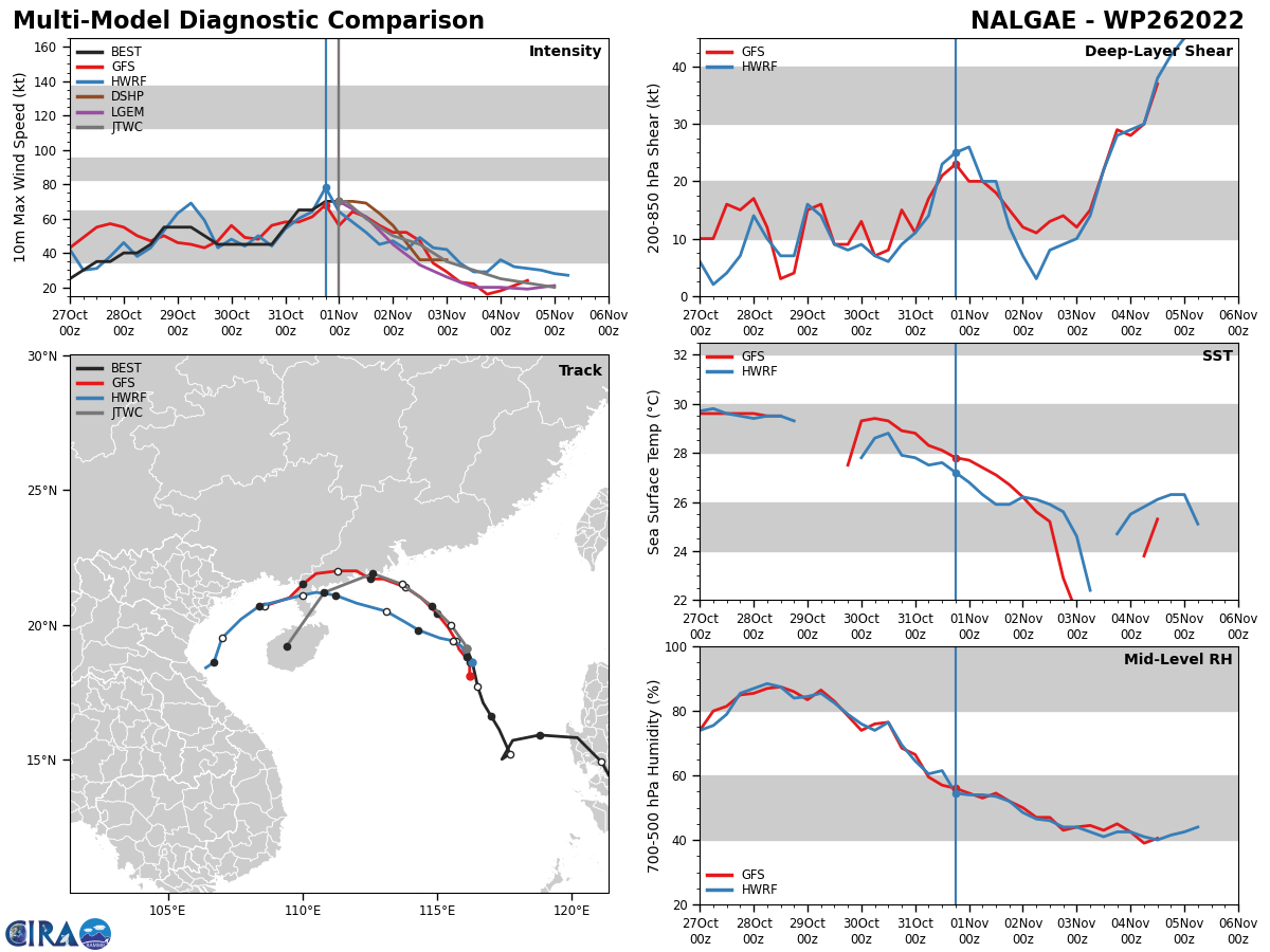
FORECAST REASONING. SIGNIFICANT FORECAST CHANGES: THERE ARE NO SIGNIFICANT CHANGES TO THE FORECAST FROM THE PREVIOUS WARNING. FORECAST DISCUSSION: TY NALGAE CONTINUES ITS NORTH-NORTHWEST TRACK ALONG THE WESTERN PERIPHERY OF THE STR TO THE EAST, REMAINING AT ITS PEAK INTENSITY OF 70 KNOTS. TY 26W WILL BEGIN TO SHOW SIGNS OF WEAKENING THROUGHOUT THE REMAINDER OF THE FORECAST PERIOD DUE TO THE INTRODUCTION OF DRY AIR FROM THE NORTH AND WEST. MOREOVER, THE FURTHER NORTHWARD THE SYSTEM MOVES, IT WILL ENCOUNTER COOLER SSTS OF 25-26 C. THESE COOLER WATERS ARE BEING INTRODUCED INTO THE REGION DUE TO THE INTENSE NORTHEASTERLY WIND FLOW THROUGH THE TAIWAN STRAIT. IN ADDITION, TY 26W WILL BE ENTERING AN AREA OF INCREASED VERTICAL WIND SHEAR (VWS) DURING THIS TIME. AFTER TAU 36, THOSE INTENSE WINDS FROM THE NORTHEAST WILL BE THE MAIN STEERING MECHANISM OF THE SYSTEM AS IT MAKES A DRAMATIC TURN WESTWARD AND BEGIN TO FURTHER DECREASE IN INTENSITY DUE TO LAND INTERACTION WITH SOUTHEAST CHINA. IN ADDITION TO LAND INTERACTION, THE AFOREMENTIONED DRY AIR WILL BE FULLY ENTRAINED INTO THE SYSTEM, HAMPERING ANY FURTHER DEVELOPMENT. BY TAU 96, TY NALGAE WILL FULLY DISSIPATE OVER THE ISLAND OF HAINAN.
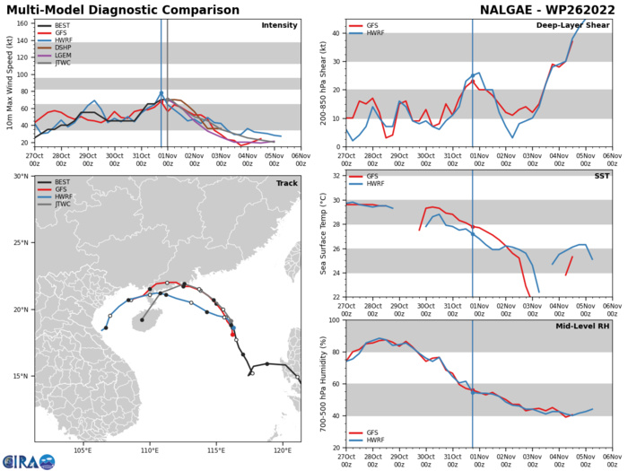
MODEL DISCUSSION: NUMERICAL MODEL GUIDANCE REMAINS IN GOOD AGREEMENT WITH THE CONSENSUS ENVELOPE CONTINUING TO MARCH SLIGHTLY MORE POLEWARD THAN PREVIOUS RUNS. UEMI AND AFUI ARE THE OUTLIERS SHOWING A MORE NORTHERLY PROGRESSION OVER THE FIRST 48 HOURS, FOLLOWED BY A SHARP TURN TO THE SOUTH-SOUTHWEST JUST AS THEY DID IN THE PREVIOUS RUN. DUE TO THESE OUTLIERS, THE JTWC TRACK WAS PLACED WITH MEDIUM CONFIDENCE SLIGHTLY TO THE LEFT OF THE CONSENSUS TRACK AND SLIGHTLY MORE POLEWARD THAN THE PREVIOUS JTWC FORECAST TRACK. THE JTWC TRACK NOW SKIRTS ALONG THE COAST OF SOUTHEAST CHINA BEFORE MAKING LANDFALL AND DISSIPATION OVER THE ISLAND OF HAINAN. INTENSITY CONSENSUS IS IN REALLY GOOD AGREEMENT UP TO TAU 72, WITH SOME DISAGREEMENT BETWEEN TAUS 72 TO 96. THIS IS MORE THAN LIKELY DUE TO VARIOUS SOLUTIONS TAKING THE SYSTEM OVER LAND SOONER RATHER THAN LATER. THE JTWC INTENSITY FORECAST IS SET WITH HIGH CONFIDENCE THROUGH TAU 72 AND MEDIUM CONFIDENCE THROUGH TAU 96.
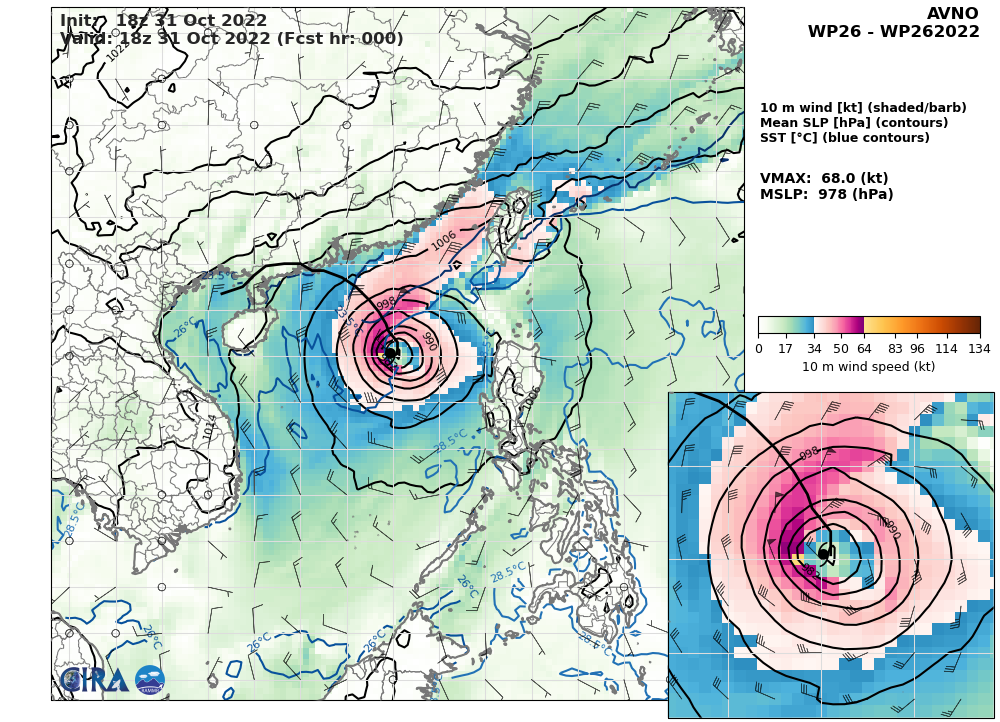
AVN AT 31/18UTC: 68KT AT +0H
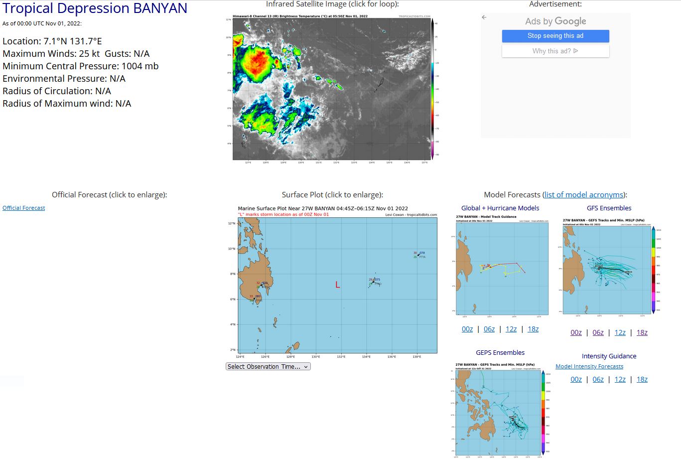
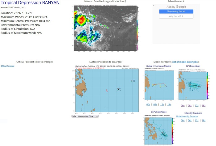
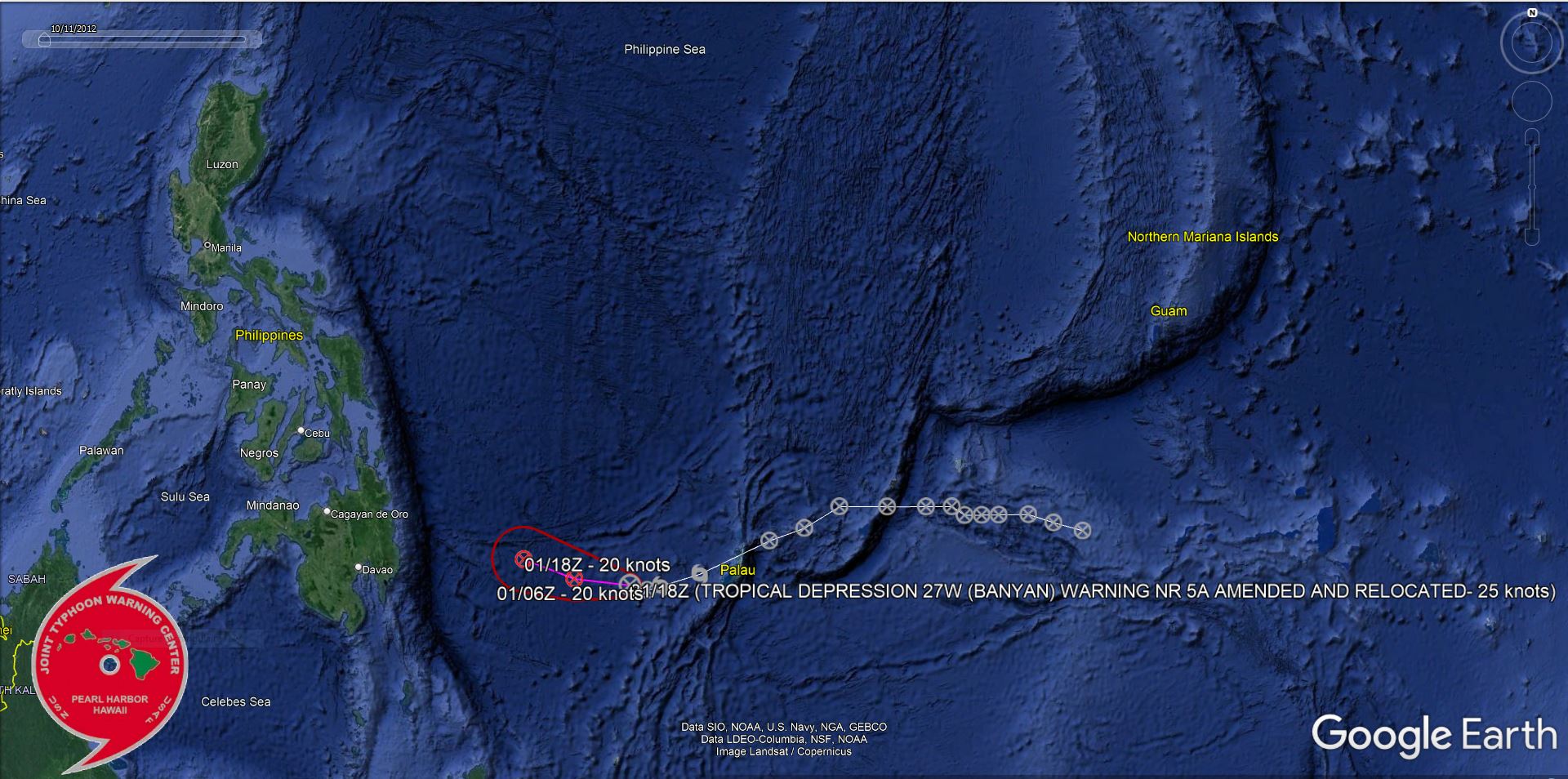
WESTERN NORTH PACIFIC: REMNANTS OF TS 27W(BANYAN).ESTIMATED LOCATION AND INTENSITY AT 01/00UTC.
WARNING 5/FINAL WAS ISSUED AT 31/21UTC.
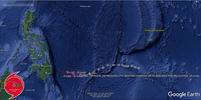
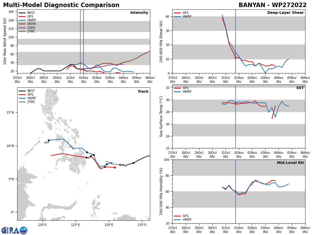
S BEEN SOMEWHAT QUASI-STATIONARY OVER THE PAST 12 HOURS AND IS LOCATED APPROX 109 NM TO THE EAST AS PREVIOUSLY SPECIFIED. STRONG UPPER-LEVEL WIND FLOW HAS DISPLACED THE CONVECTION WELL OFF TO THE WEST AS THE SYSTEM HAS BECOME COMPLETELY DECOUPLED. COPIOUS AMOUNTS OF DRY AIR FROM THE NORTH ALLOWED FOR A BETTER VIEW OF THE LOWER LEVELS OVER THE PAST HOUR AND THIS SYSTEM IS FULLY EXPOSED WITH LITTLE-TO-NO CHANCE OF REDEVELOPMENT. DETERMINISTIC AND ENSEMBLE MODEL GUIDANCE AGREES IN FURTHER DECAY OF TD 27W. THE PGTW DVORAK ESTIMATE IS NOW 1.5. THIS IS THE FINAL WARNING ON THIS SYSTEM BY THE JOINT TYPHOON WRNCEN PEARL HARBOR HI. THE SYSTEM WILL BE CLOSELY MONITORED FOR SIGNS OF REGENERATION. MAXIMUM SIGNIFICANT WAVE HEIGHT AT 311800Z IS 13 FEET.
ESTIMATED PEAK INTENSITY WAS 35KT.
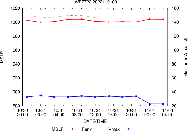
WP, 27, 2022102800,84N, 1426E, 15, 1005 DB
WP, 27, 2022102806,86N, 1419E, 20, 1005 DB
WP, 27, 2022102812,88N, 1413E, 25, 1004, DB
WP, 27, 2022102818,88N, 1406E, 25, 1004, DB
WP, 27, 2022102900,88N, 1402E, 20, 1004, DB
WP, 27, 2022102906,88N, 1398E, 20, 1004, DB
WP, 27, 2022102912,90N, 1395E, 20, 1005, DB
WP, 27, 2022102918,90N, 1389E, 20, 1003, DB
WP, 27, 2022103000,90N, 1380E, 20, 1003, DB
WP, 27, 2022103006,90N, 1369E, 20, 1003, DB
WP, 27, 2022103012,85N, 1361E, 25, 1003, DB
WP, 27, 2022103018,82N, 1353E, 30, 1002, TD
WP, 27, 2022103100,74N, 1337E, 35, 1000, TS
WP, 27, 2022103106,71N, 1328E, 35, 1000, TS
WP, 27, 2022103112,70N, 1325E, 25, 1007, TD
WP, 27, 2022103118,71N, 1321E, 25, 1005, TD
WP, 27, 2022110100,71N, 1317E, 25, 1004, TD
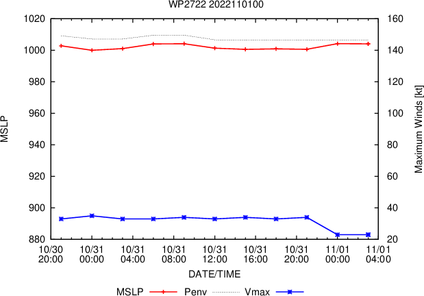
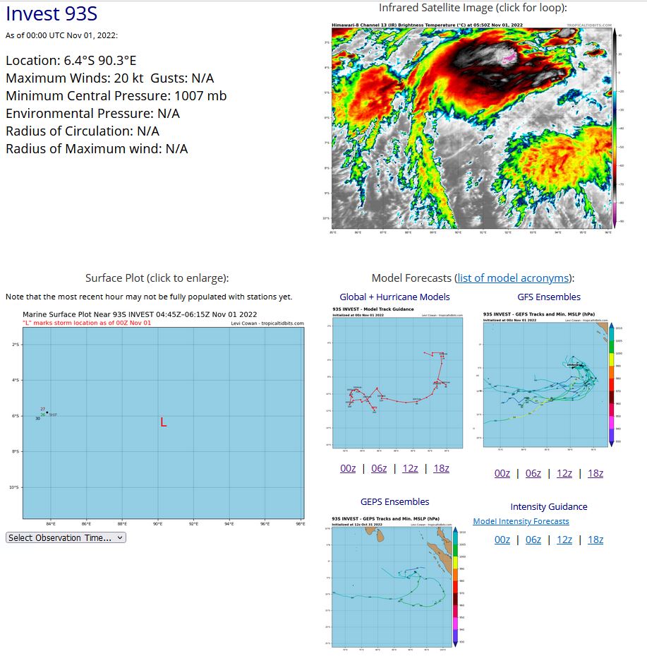
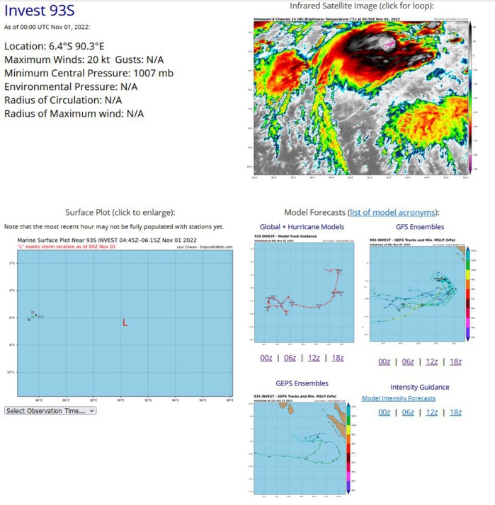
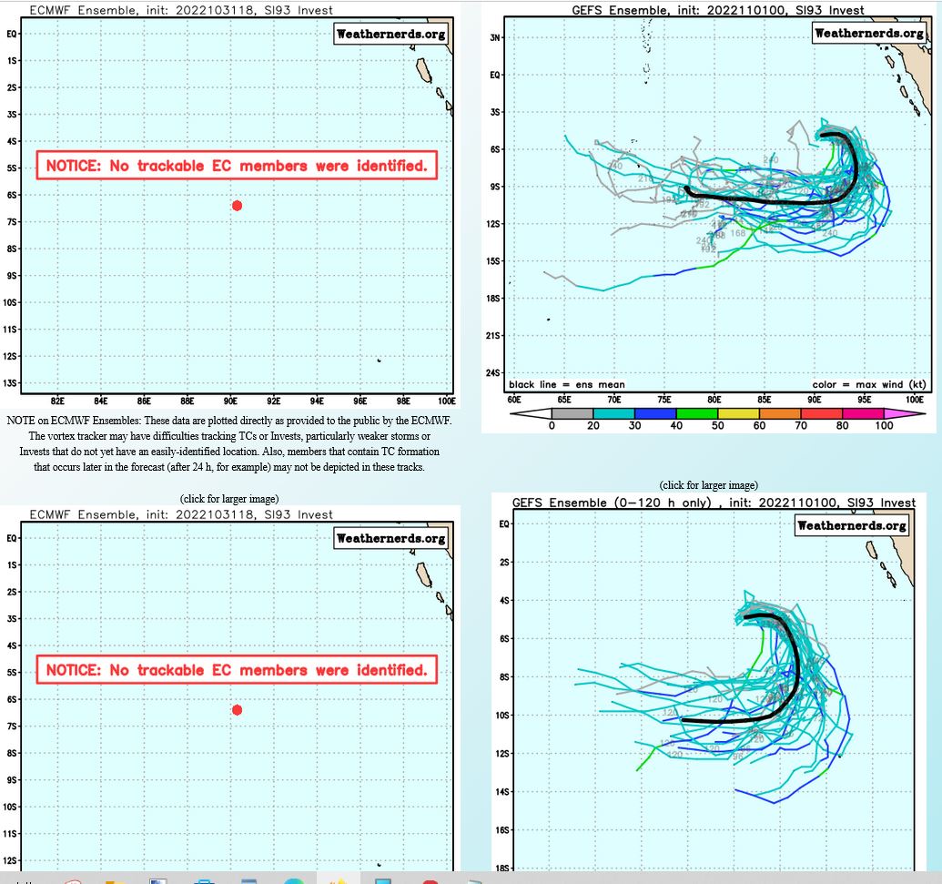
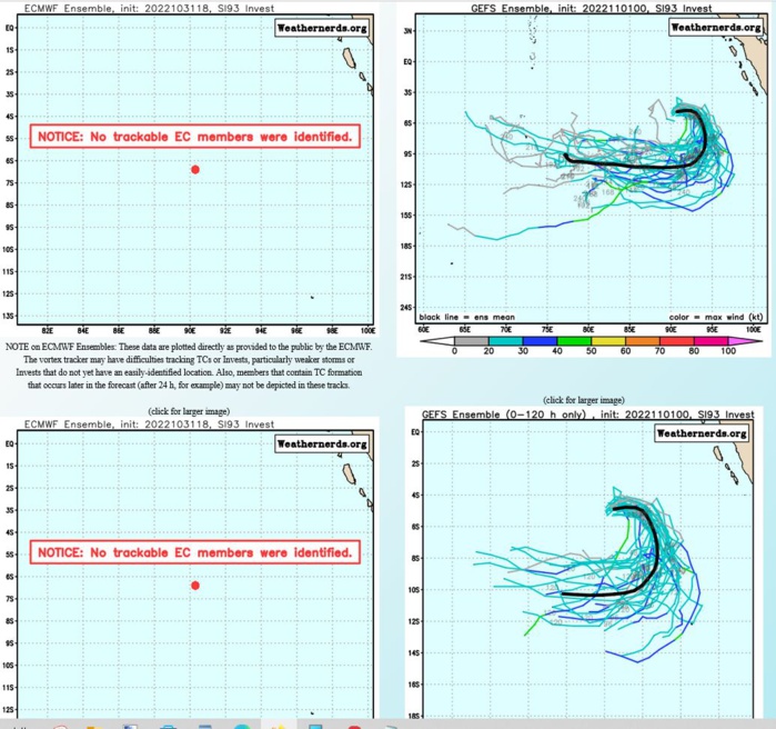
SOUTH INDIAN OCEAN: INVEST 93S. ESTIMATED LOCATION AND INTENSITY AT 01/00UTC.
SH, 93, 2022102800,36S, 776E, 15, 1007, DB
SH, 93, 2022102806,42S, 788E, 15, 1007, DB
SH, 93, 2022102812,52S, 796E, 15, 1006, DB
SH, 93, 2022102818,57S, 801E, 15, 1010, DB
SH, 93, 2022102900,63S, 807E, 20, 1006, DB
SH, 93, 2022102906,73S, 813E, 20, 1006, DB
SH, 93, 2022102912,79S, 822E, 20, 1006, DB
SH, 93, 2022102918,78S, 834E, 20, 1007, DB
SH, 93, 2022103000,76S, 847E, 20, 1006, DB
SH, 93, 2022103006,73S, 857E, 20, 1006, DB
SH, 93, 2022103012,71S, 862E, 20, 1007, DB
SH, 93, 2022103018,69S, 871E, 20, 1007, DB
SH, 93, 2022103100,69S, 879E, 20, 1007, DB
SH, 93, 2022103106,68S, 886E, 20, 1007, DB
SH, 93, 2022103112,63S, 893E, 20, 1007, DB
SH, 93, 2022103118,63S, 899E, 20, 1007, DB
SH, 93, 2022110100,64S, 903E, 20, 1007, DB
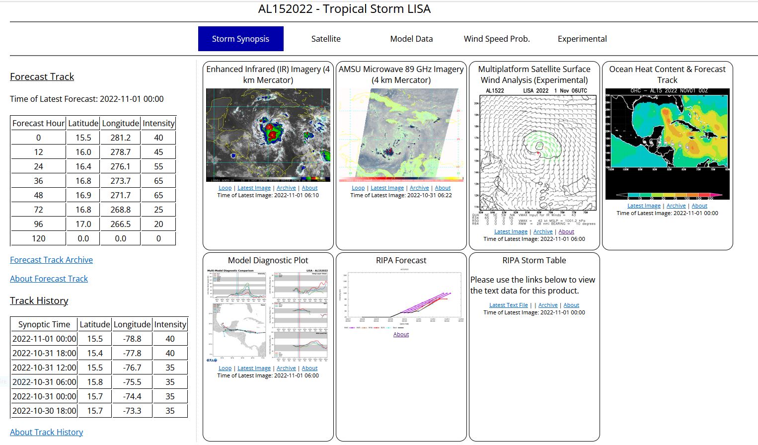
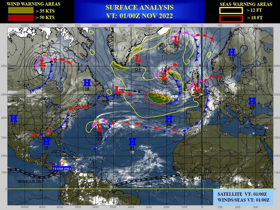
NORTH ATLANTIC OCEAN:TS 15L(LISA). ESTIMATED LOCATION AND INTENSITY AT 01/00UTC. NHC COMMENTS.
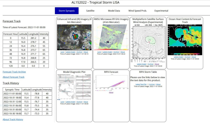
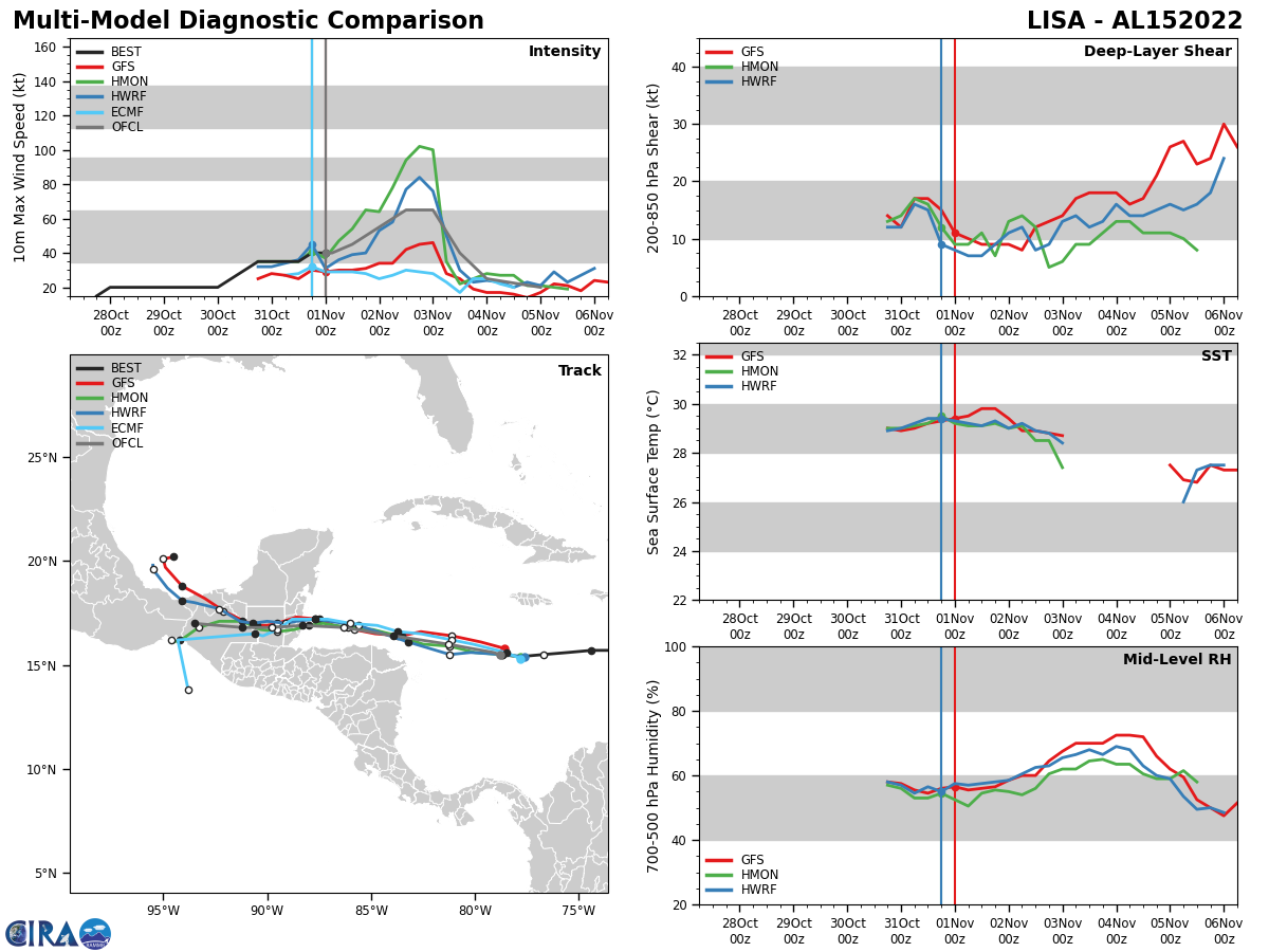
Tropical Storm Lisa Discussion Number 6 NWS National Hurricane Center Miami FL AL152022 1100 PM EDT Mon Oct 31 2022 Lisa is gradually becoming better organized with the associated convection deepening and expanding around the center. However, the system still lacks banding features. The Air Force Hurricane Hunters are currently investigating Lisa and so far have found flight-level winds as high as 46 kt and peak SFMR winds of about 35 kt. This data supports maintaining the initial intensity of 40 kt. The tropical storm is moving westward at about 10 kt. The track forecast reasoning seems fairly straightforward. A low- to mid-level ridge situated to the north of Lisa is expected to build westward. This pattern should keep the storm on a steady westward path, bringing the core of the cyclone near or just north of the Bay Islands of Honduras late Tuesday night/early Wednesday and across Belize by late Wednesday. The models are in fairly good agreement through landfall, and the NHC track forecast is very similar to the previous one during the next couple of days. After landfall, the models diverge with some solutions showing a northwest track and others a southwest motion. The NHC track forecast continues to split the difference, and it is a touch south of the previous one to be a little closer to the various consensus models. The environmental conditions appear relatively favorable for Lisa to strengthen during the next 36 to 48 hours. SSTs are quite warm beneath the cyclone and the vertical wind shear is expected to be low to moderate. There is some dry air near the system, however, which might slow the rate of intensification. The NHC intensity forecast follows the trend of the consensus models and continues to show Lisa becoming a hurricane when it is over the Gulf of Honduras early Wednesday, and it is expected to maintain that intensity when it makes landfall. Rapid weakening is expected after the system moves inland, and even though the forecast shows a 96-h point, it is certainty possible that Lisa could have dissipated by then. Key Messages: 1. Hurricane conditions are possible in the Bay Islands of Honduras early Wednesday and along the coast of Belize by Wednesday afternoon, where a Hurricane Watch is in effect. 2. Tropical storm conditions are expected along portions of the north coast of Honduras, where a Tropical Storm Warning has been issued. A Tropical Storm Watch is in effect for the remainder of the coast of Honduras, the Caribbean coast of Guatemala, and the southeastern Yucatan Peninsula of Mexico, where tropical storm conditions are possible. 3. Localized flash flooding is expected across portions of the eastern Yucatan Peninsula, Belize, and northern Honduras, including the Bay Islands, starting late Tuesday continuing through Thursday. 4. There is potential for a dangerous storm surge near where the core of Lisa crosses the coast of Belize.
AL, 15, 2022103000,146N, 703W, 20, 1007, DB
AL, 15, 2022103006,151N, 711W, 25, 1007, DB
AL, 15, 2022103012,155N, 722W, 30, 1007, DB
AL, 15, 2022103018,157N, 733W, 35, 1005, LO
AL, 15, 2022103100,157N, 744W, 35, 1005, LO
AL, 15, 2022103106,156N, 755W, 35, 1005, LO
AL, 15, 2022103112,155N, 767W, 35, 1003, TS
AL, 15, 2022103118,154N, 778W, 40, 1002, TS
AL, 15, 2022110100,155N, 788W, 40, 1002, TS
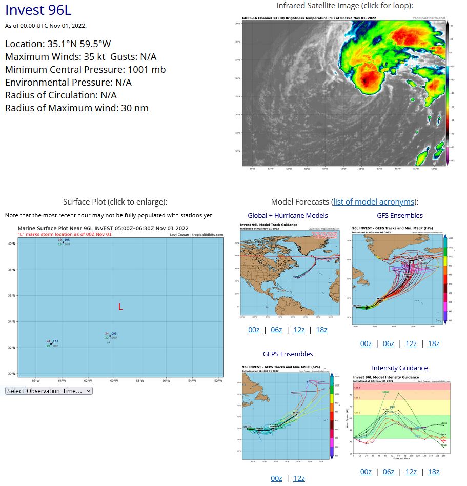
NORTH ATLANTIC OCEAN: INVEST 96L. ESTIMATED LOCATION AND INTENSITY AT 01/00UTC. NHC COMMENTS.
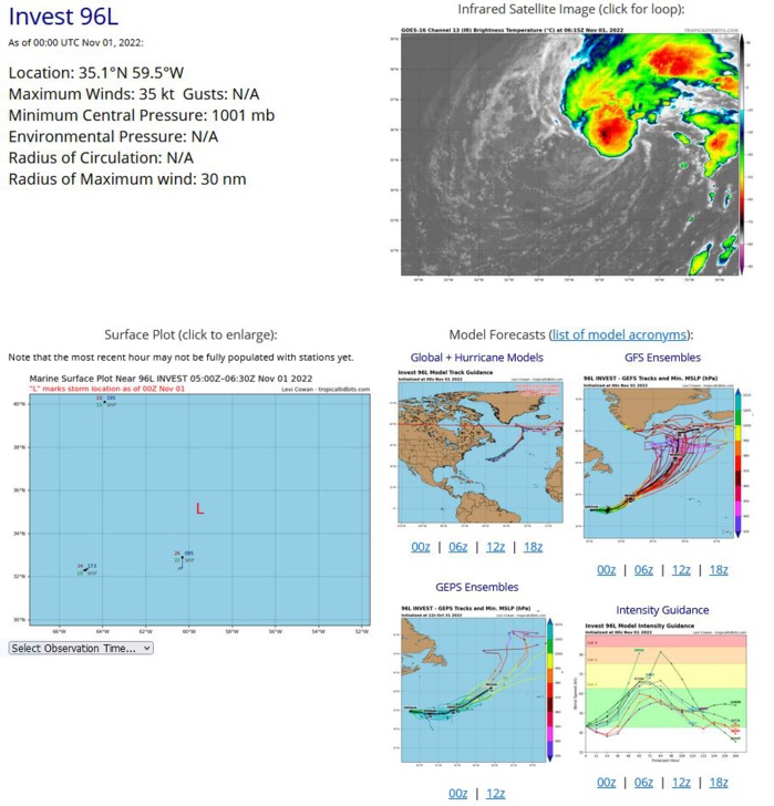
Central Subtropical Atlantic: A non-tropical area of low pressure is located about 425 miles northeast of Bermuda. Shower and thunderstorm activity has continued to persist near and to the north of the center of the low overnight. Some additional development is possible through late Wednesday or Wednesday night, and the system could become a tropical or subtropical storm while it moves generally east-northeastward. By early Thursday, the system is expected to become fully extratropical and merge with a larger non-tropical low over the north-central Atlantic. For more information on this system, including Gale Warnings, see High Seas Forecasts issued by the National Weather Service. * Formation chance through 48 hours...medium...50 percent. * Formation chance through 5 days...medium...50 percent.
AL, 96, 2022103018,344N, 625W, 30, 1005, EX
AL, 96, 2022103100,351N, 628W, 30, 1005, EX
AL, 96, 2022103106,348N, 630W, 30, 1005, EX
AL, 96, 2022103112,348N, 616W, 30, 1002, EX
AL, 96, 2022103118,351N, 609W, 35, 1001, EX
AL, 96, 2022110100,351N, 595W, 35, 1001, EX
