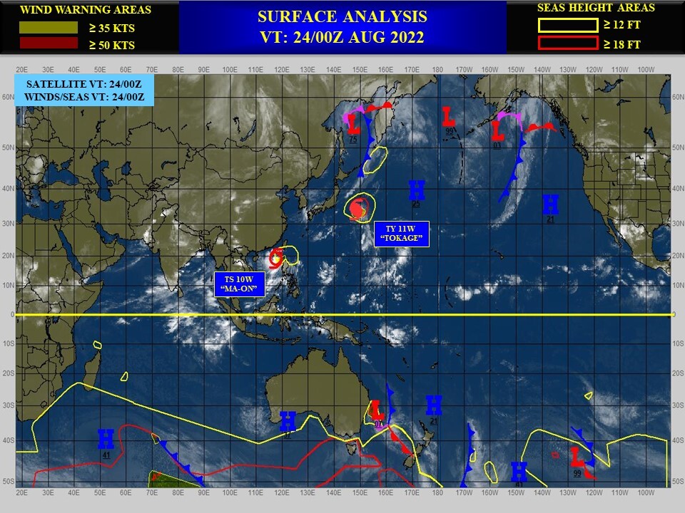
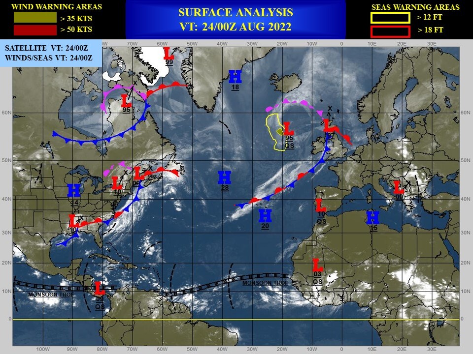
CLICK ON THE IMAGERIES BELOW TO GET THEM ENLARGED
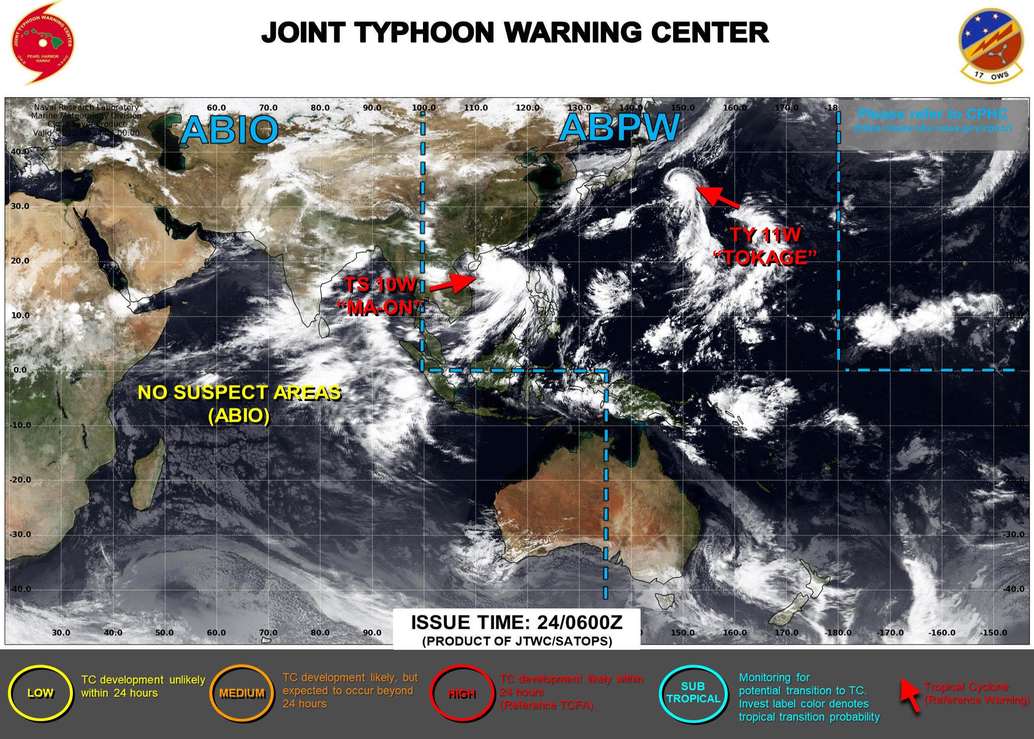
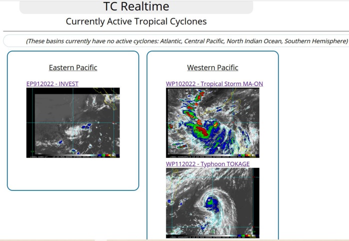
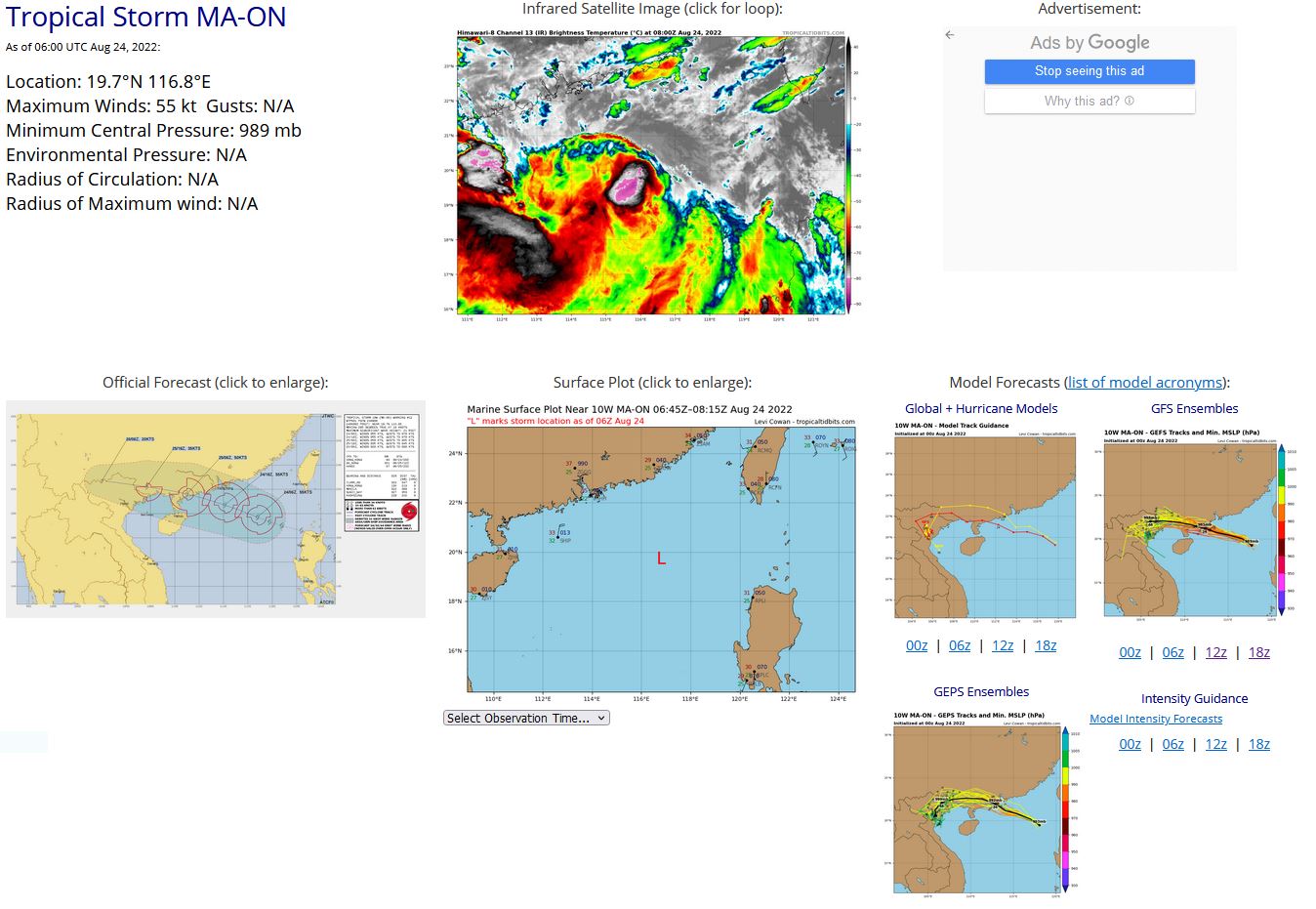
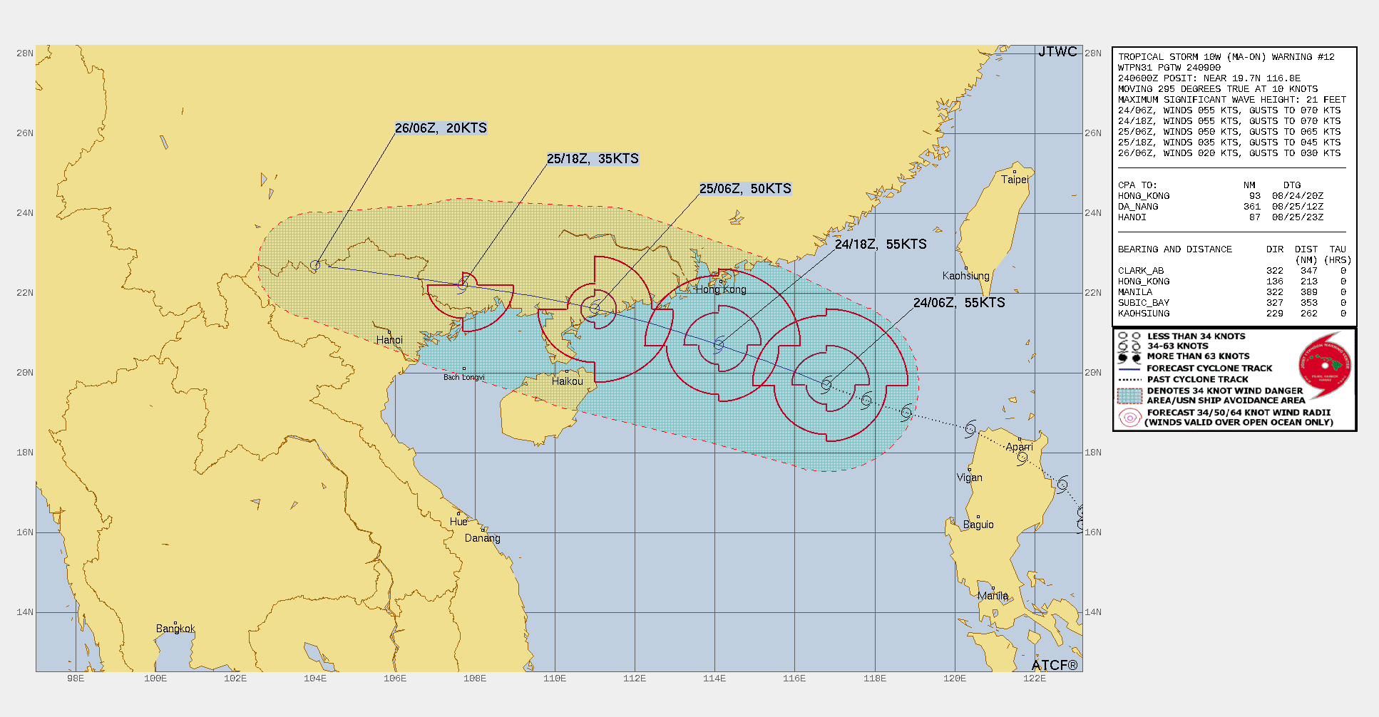
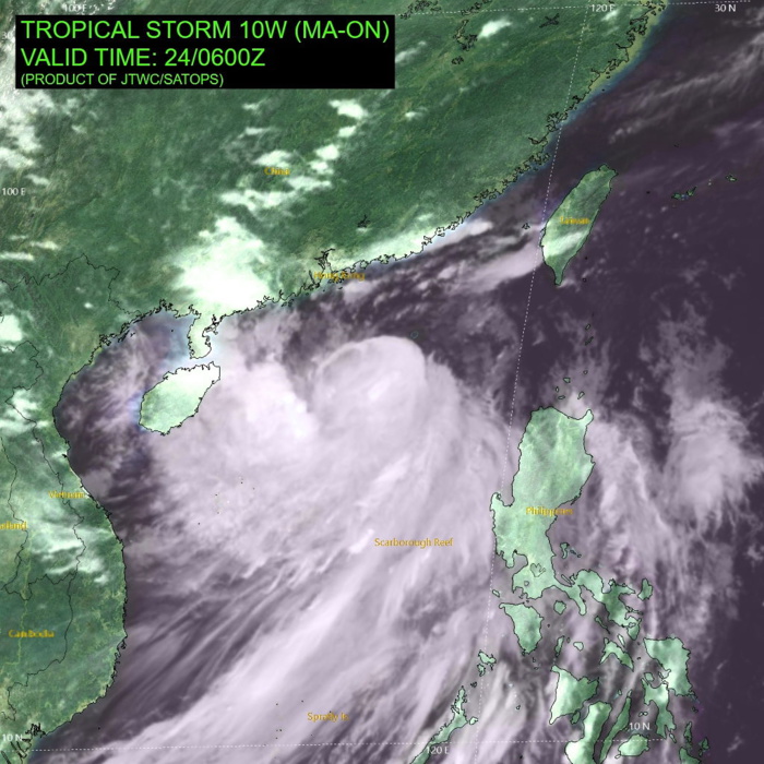
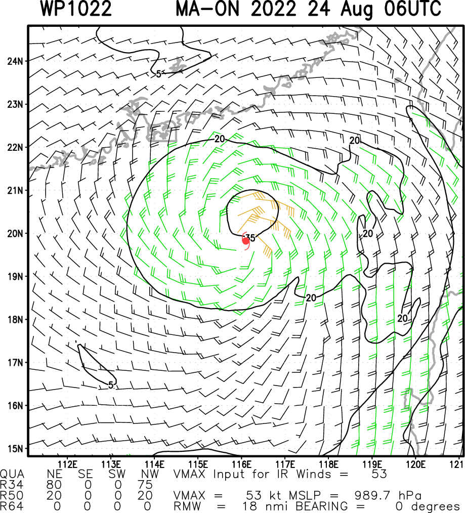
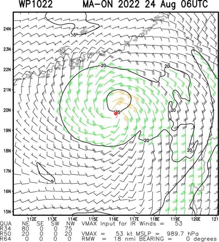
WESTERN NORTH PACIFIC: TS 10W(MA-ON). ESTIMATED LOCATION AND INTENSITY AT 24/06UTC.WARNING 12 ISSUED AT 24/09UTC.

SATELLITE ANALYSIS, INITIAL POSITION AND INTENSITY DISCUSSION: ANIMATED MULTISPECTRAL SATELLITE IMAGERY (MSI) INDICATES AN EXPOSED LOW-LEVEL CIRCULATION CENTER (LLCC) DECOUPLED FROM THE RAPIDLY-DECAYING DEEP CONVECTION, WHICH IS SHEARING TO THE SOUTHWEST DUE TO HIGH NORTHEASTERLY VERTICAL WIND SHEAR (VWS). A 240552Z ATMS 88.2GHZ MICROWAVE IMAGE SHOWS LIMITED CURVED BANDING OVER THE SOUTHERN SEMICIRCLE WITH A WEAKLY-DEFINED LLCC ON THE NORTHERN EDGE OF THE CONVECTION. THE INITIAL POSITION IS PLACED WITH MEDIUM CONFIDENCE BASED ON MSI. ENVIRONMENTAL CONDITIONS HAVE DEGRADED OVER THE PAST SIX HOURS WITH PERSISTENT, STRONG VWS OFFSET SLIGHTLY BY VIGOROUS EQUATORWARD OUTFLOW AND WARM SST VALUES. THE INITIAL INTENSITY OF 55 KTS IS ASSESSED WITH MEDIUM CONFIDENCE BASED ON THE PGTW DVORAK ESTIMATE. BASED ON THE RAPIDLY WEAKENING CONVECTIVE STRUCTURE, BOTH THE KNES AND RJTD DVORAK INTENSITY ESTIMATES ARE ASSESSED AS BEING TOO HIGH AND WERE POSITIONED IN THE DEEP CONVECTION SOUTH OF THE NOW DECOUPLED AND EXPOSED LLCC.
WP, 10, 2022082300,172N, 1227E, 60, 986
WP, 10, 2022082306,179N, 1217E, 55, 989
WP, 10, 2022082312,186N, 1204E, 50, 992
WP, 10, 2022082318,190N, 1188E, 50, 991
WP, 10, 2022082400,193N, 1178E, 55, 989
WP, 10, 2022082406,197N, 1168E, 55, 989
WP, 10, 2022082306,179N, 1217E, 55, 989
WP, 10, 2022082312,186N, 1204E, 50, 992
WP, 10, 2022082318,190N, 1188E, 50, 991
WP, 10, 2022082400,193N, 1178E, 55, 989
WP, 10, 2022082406,197N, 1168E, 55, 989
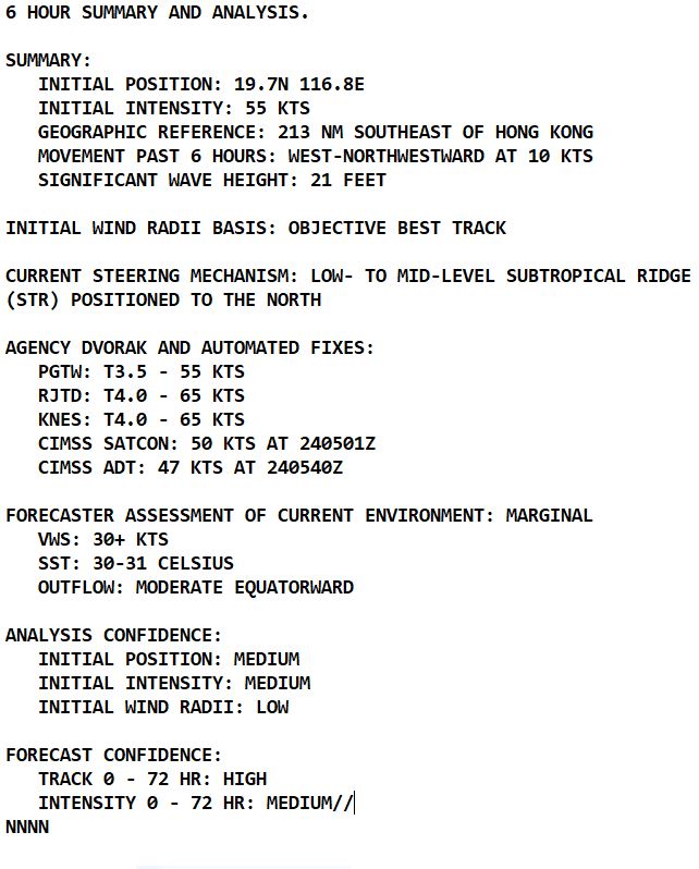
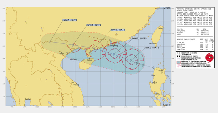
FORECAST REASONING. SIGNIFICANT FORECAST CHANGES: THERE ARE NO SIGNIFICANT CHANGES TO THE FORECAST FROM THE PREVIOUS WARNING. FORECAST DISCUSSION: TS 10W IS FORECAST TO TRACK GENERALLY WEST-NORTHWESTWARD THROUGH THE FORECAST PERIOD WITH LANDFALL EXPECTED NEAR TAU 24. TS 10W WILL GRADUALLY WEAKEN OVER THE NEXT DAY AS IT TRACKS UNDER HIGH NORTHEASTERLY VERTICAL WIND SHEAR. AFTER TAU 24, THE SYSTEM WILL RAPIDLY DISSIPATE AS IT TRACKS INLAND.
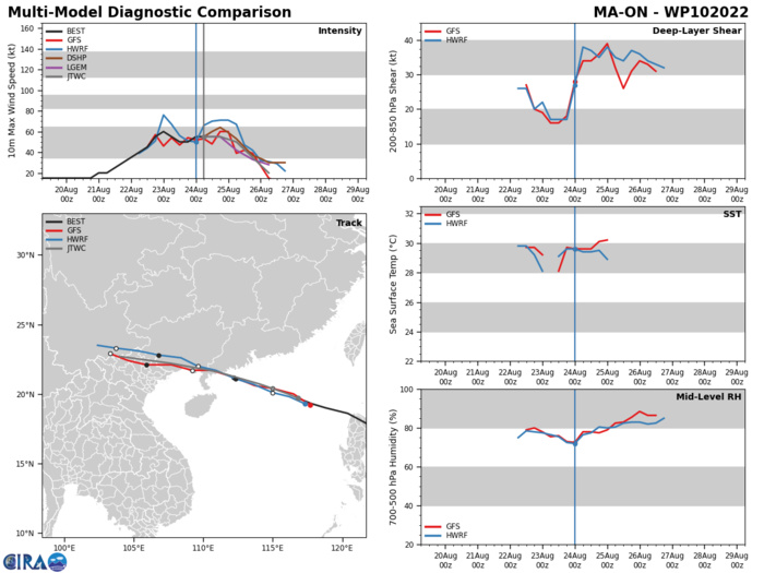
MODEL DISCUSSION: NUMERICAL MODEL GUIDANCE IS IN TIGHT AGREEMENT WITH A 30-40NM SPREAD IN SOLUTIONS THROUGH THE FORECAST PERIOD, THEREFORE THERE IS HIGH CONFIDENCE IN THE JTWC FORECAST TRACK. THERE IS MEDIUM CONFIDENCE IN THE JTWC INTENSITY FORECAST DUE TO THE SPREAD IN INTENSITY GUIDANCE AT TAU 12. PEAK INTENSITIES RANGE FROM 53 TO 70 KNOTS WITH HWRF ON THE HIGH END OF THE GUIDANCE, HOWEVER, THE 240000Z HWRF SHIPS OUTPUT INDICATES SHEAR MAGNITUDE IN THE 35-40 KNOT RANGE, WHICH SHOULD HINDER INTENSIFICATION. THE JTWC FORECAST IS PLACED AT THE LOWER RANGE OF GUIDANCE WITH THE EXPECTATION THAT THE SYSTEM WILL CONTINUE TO STRUGGLE TO ORGANIZE.
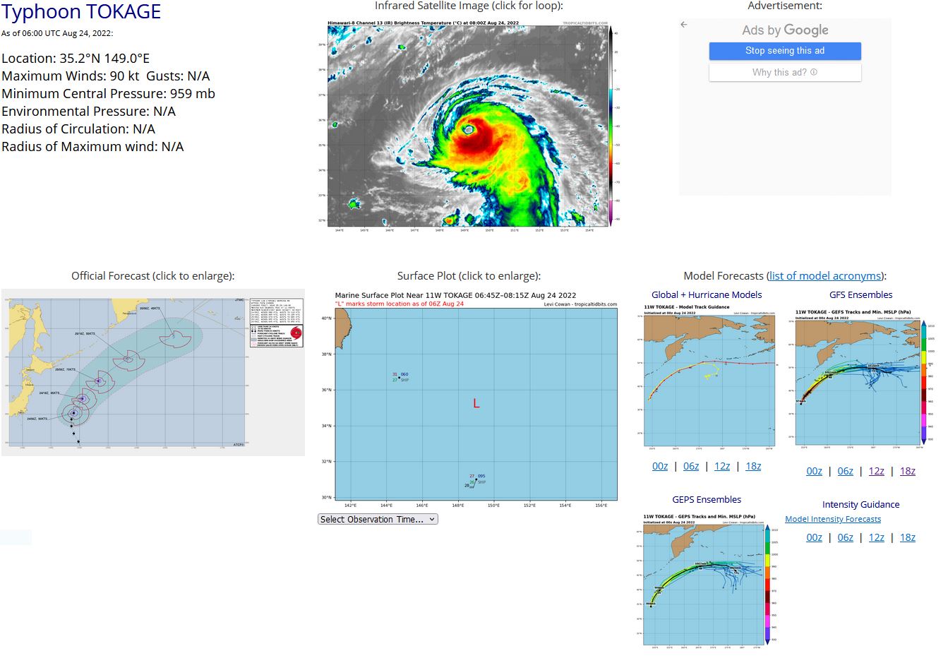
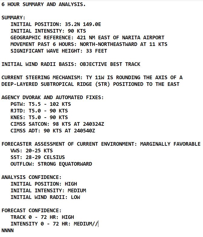
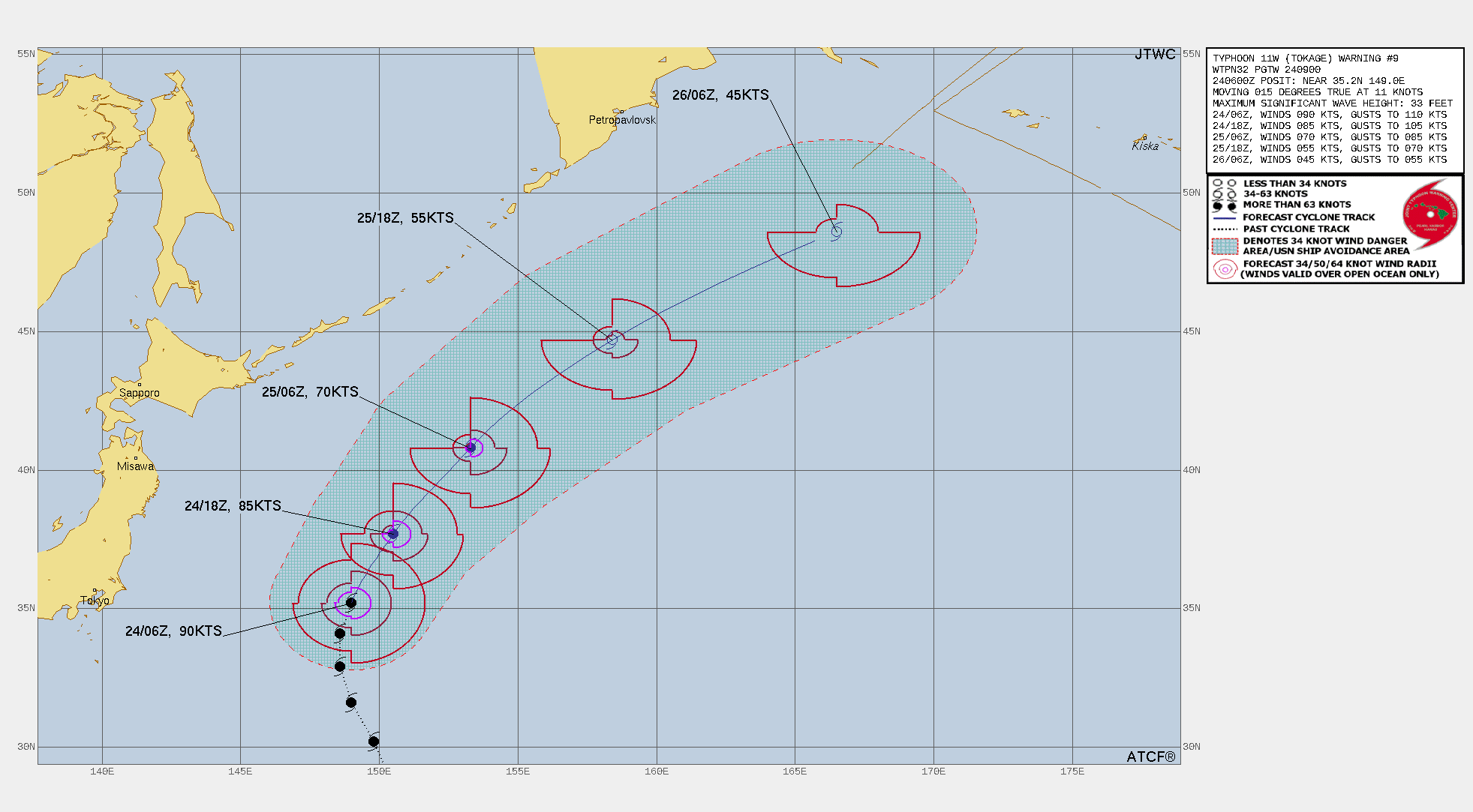
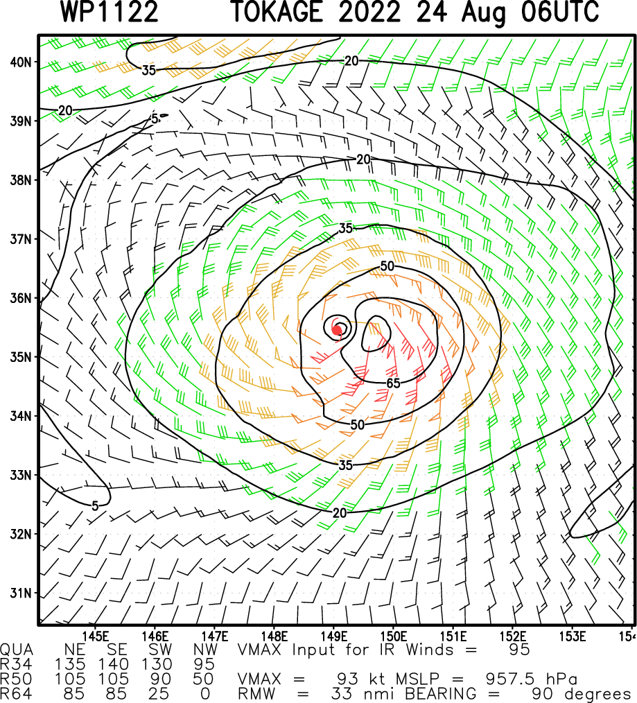
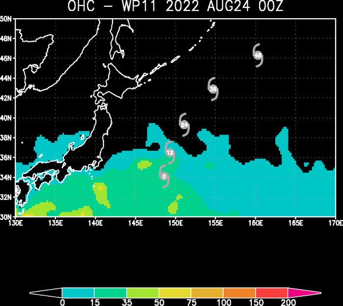
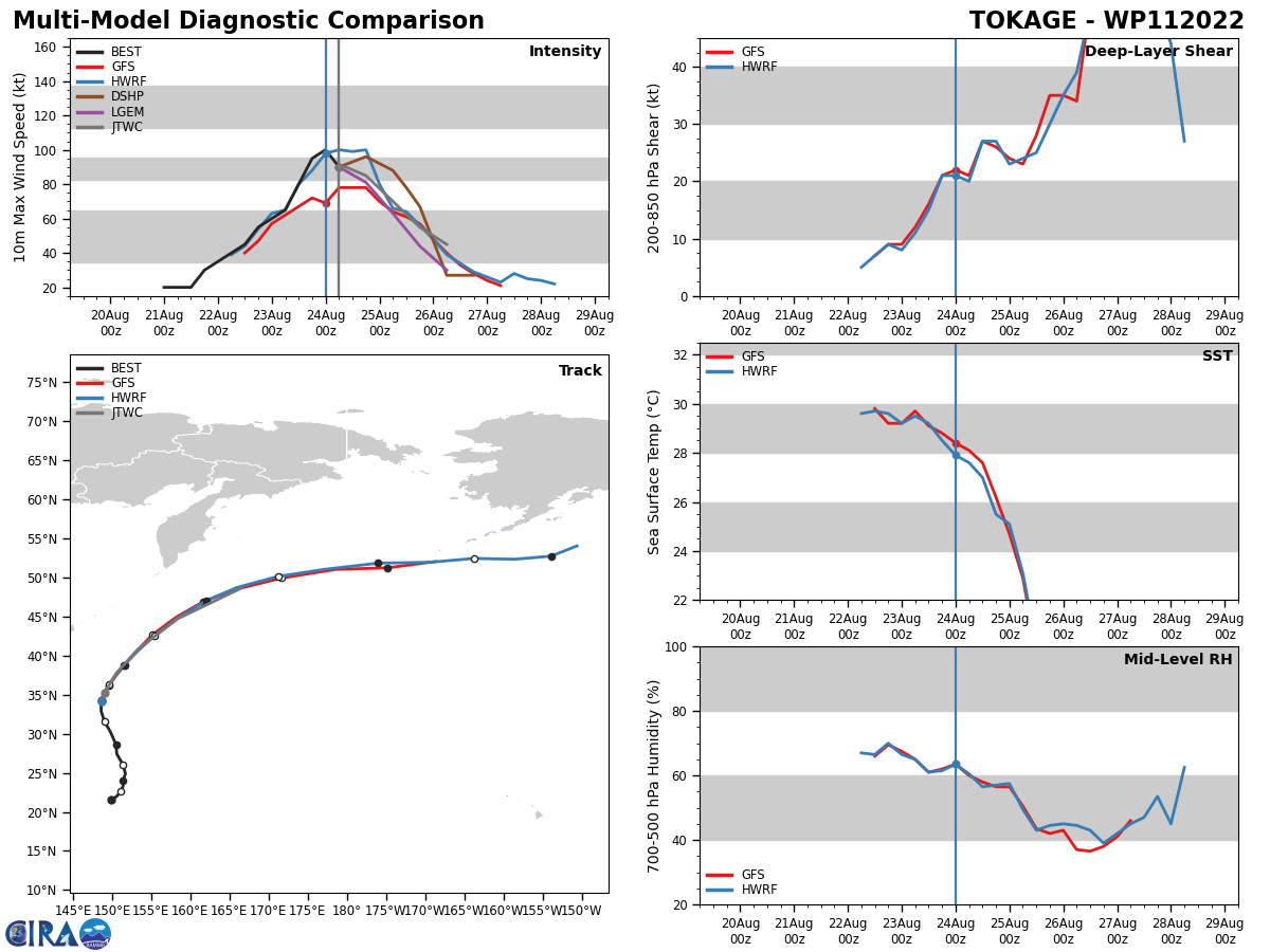
WESTERN NORTH PACIFIC: TY 11W(TOKAGE). ESTIMATED LOCATION AND INTENSITY AT 24/06UTC.WARNING 9 ISSUED AT 24/09UTC.

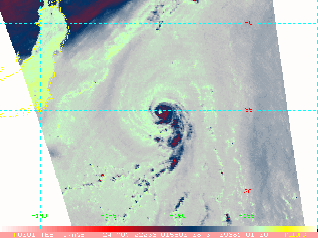
SATELLITE ANALYSIS, INITIAL POSITION AND INTENSITY DISCUSSION: ANIMATED MULTISPECTRAL SATELLITE IMAGERY (MSI) DEPICTS A COMPACT SYSTEM WITH A SYMMETRIC EYEWALL SURROUNDING AN EXPANDING 17NM ROUND EYE, WHICH SUPPORTS THE INITIAL POSITION WITH HIGH CONFIDENCE. ANIMATED ENHANCED INFRARED SATELLITE IMAGERY REVEALS STEADY OVERALL WEAKENING OF THE CONVECTIVE STRUCTURE WITH WARMING CLOUD TOPS AND THE BULK OF THE DEEP CONVECTION CONFINED TO THE SOUTHERN SEMICIRCLE. ANIMATED WATER VAPOR IMAGERY INDICATES THE MIDLATITUDE WESTERLIES ARE IMPINGING ON THE WESTERN PERIPHERY OF THE SYSTEM AS EVIDENCED IN THE 240602Z SSMIS 91GHZ MICROWAVE IMAGE, WHICH SHOWS EROSION OF THE WESTERN QUADRANT OF THE EYEWALL. UPPER-LEVEL ANALYSIS DEPICTS A SHORTWAVE TROUGH POSITIONED OVER THE WESTERN PERIPHERY OF THE SYSTEM ALTHOUGH STRONG DIFFLUENCE AND ROBUST EQUATORWARD OUTFLOW IS STILL PRESENT, WHICH IS MAINTAINING THE CORE CONVECTION AND EYE FOR NOW.
WP, 11, 2022082300,286N, 1505E, 60, 987
WP, 11, 2022082306,302N, 1498E, 65, 982
WP, 11, 2022082312,316N, 1490E, 80, 971
WP, 11, 2022082318,329N, 1486E, 95, 959
WP, 11, 2022082400,341N, 1486E,100, 952
WP, 11, 2022082406,352N, 1490E, 90, 959
WP, 11, 2022082306,302N, 1498E, 65, 982
WP, 11, 2022082312,316N, 1490E, 80, 971
WP, 11, 2022082318,329N, 1486E, 95, 959
WP, 11, 2022082400,341N, 1486E,100, 952
WP, 11, 2022082406,352N, 1490E, 90, 959


FORECAST REASONING. SIGNIFICANT FORECAST CHANGES: THERE ARE NO SIGNIFICANT CHANGES TO THE FORECAST FROM THE PREVIOUS WARNING. FORECAST DISCUSSION: TY 11W IS FORECAST TO RECURVE AND ACCELERATE NORTH-NORTHEASTWARD TO NORTHEASTWARD AS IT ROUNDS THE STR AXIS OVER THE NEXT 12 TO 36 HOURS. TY 11W SHOULD BEGIN TO WEAKEN RAPIDLY AS IT BEGINS TO ENCOUNTER THE MIDLATITUDE WESTERLIES AND INCREASING (25 KNOTS) VERTICAL WIND SHEAR (VWS), AND COMMENCES EXTRA-TROPICAL TRANSITION (ETT). AFTER TAU 36, THE SYSTEM WILL COMPLETE ETT AS IT BECOMES EMBEDDED WITHIN THE MIDLATITUDE WESTERLIES AND GAINS FRONTAL CHARACTERISTICS.
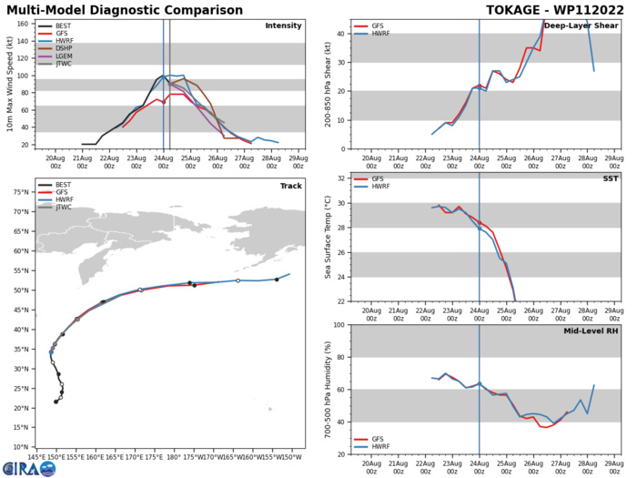
MODEL DISCUSSION: NUMERICAL MODEL GUIDANCE REMAINS IN GOOD AGREEMENT WITH A SPREAD IN MULTI-MODEL SOLUTIONS OF 70NM AT TAU 24 TO 90NM AT TAU 36. AFTER TAU 36, GUIDANCE DIVERGES WITH MORE UNCERTAINTY IN THE EXACT TRACK OF THE EXTRA-TROPICAL LOW. RELIABLE INTENSITY GUIDANCE SUPPORTS RAPID WEAKENING AFTER TAU 12, HOWEVER, THE SYSTEM IS EXPECTED TO MAINTAIN GALE-FORCE WINDS AFTER TRANSITIONING TO A COLD-CORE LOW.
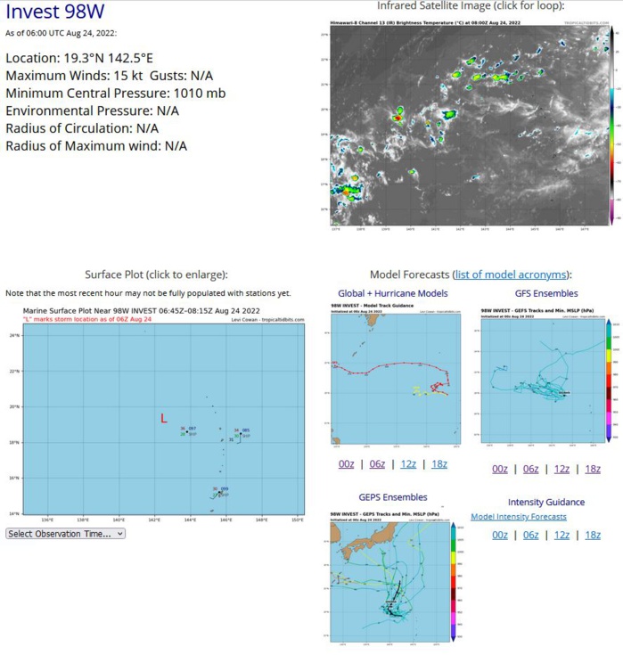
WESTERN NORTH PACIFIC: INVEST 98W. ESTIMATED LOCATION AND INTENSITY AT 24/06UTC.
WP, 98, 2022082312,188N, 1431E, 15,1010
WP, 98, 2022082318,191N, 1430E, 15,1010
WP, 98, 2022082400,193N, 1428E, 15,1010
WP, 98, 2022082406,193N, 1425E, 15,1010
WP, 98, 2022082318,191N, 1430E, 15,1010
WP, 98, 2022082400,193N, 1428E, 15,1010
WP, 98, 2022082406,193N, 1425E, 15,1010
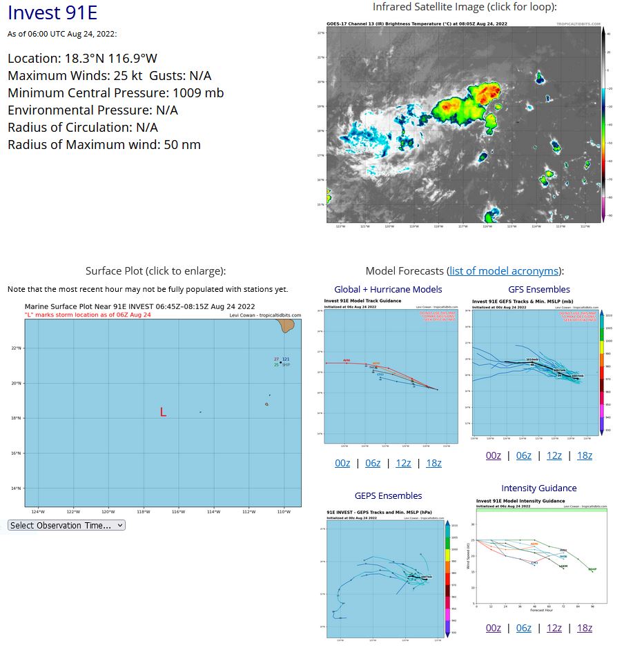
EASTERN NORTH PACIFIC: INVEST 91E. ESTIMATED LOCATION AND INTENSITY AT 24/06UTC.
EP, 91, 2022082300,185N, 1157W, 30,1011
EP, 91, 2022082306,185N, 1160W, 30,1011
EP, 91, 2022082312,185N, 1163W, 30,1010
EP, 91, 2022082318,185N, 1166W, 25,1009
EP, 91, 2022082400,184N, 1168W, 25,1009
EP, 91, 2022082406,183N, 1169W, 25,1009
EP, 91, 2022082306,185N, 1160W, 30,1011
EP, 91, 2022082312,185N, 1163W, 30,1010
EP, 91, 2022082318,185N, 1166W, 25,1009
EP, 91, 2022082400,184N, 1168W, 25,1009
EP, 91, 2022082406,183N, 1169W, 25,1009
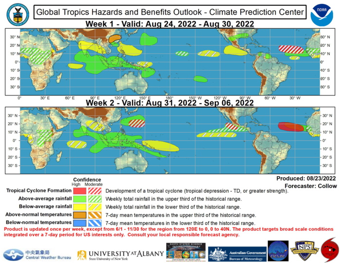
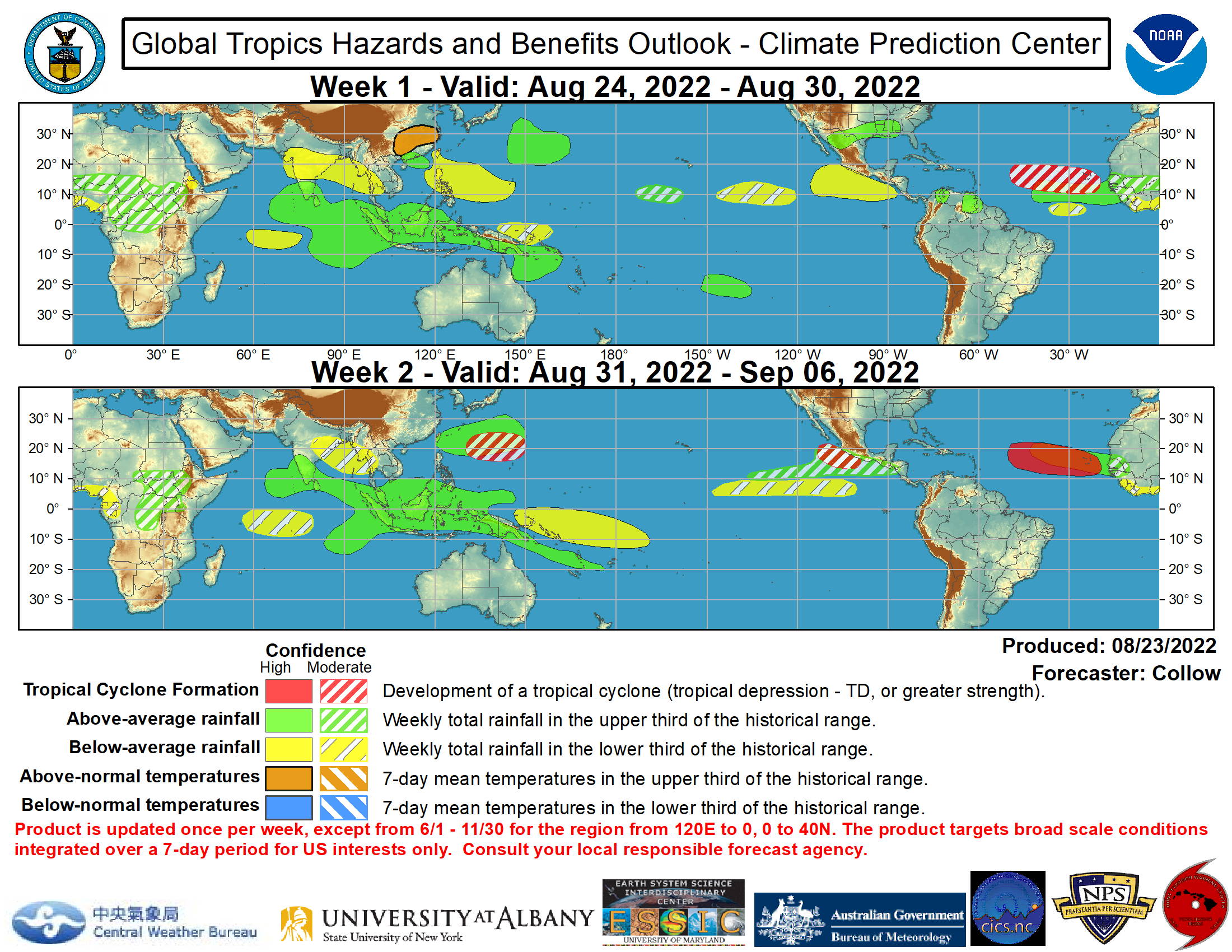
Global Tropics Hazards and Benefits Outlook Discussion Last Updated: 08.23.22 Valid: 08.24.22 - 09.06.22 The Madden Julian Oscillation (MJO) has remained weak for much of August, with the low frequency La Nina base state being the dominant signal across the tropics. Increased Convectively-Coupled Kelvin Wave (KW) activity has led to an increase in convection across Africa, with easterly waves beginning to emerge into the Atlantic. This area of enhanced convection is forecast to consolidate across Africa and the Indian Ocean, along with a slowing of the phase speed, becoming more consistent with a renewed MJO event. Both the ECMWF and GEFS ensembles indicate an enhanced MJO signal shifting from the Indian Ocean toward the Maritime Continent during the next 2 weeks. The eastward extent of the propagation as well as the amplitude are uncertain given the background La Nina state, with the GEFS more robust compared to the ECMWF and JMA ensembles. A tropical cyclone (TC) developed over the Bay of Bengal (04B) on 8/19 and impacted eastern India. Two TCs also formed over the West Pacific this past week. Tropical Storm Ma-on developed on 8/20 over the Philippine Sea, made landfall over the northern Philippines, and is forecast to track west-northwestward, impacting southeastern China at typhoon strength later this week. Typhoon Tokage developed on 8/21 to the east of Japan. It is forecast to recurve northeastward over the northwest Pacific, remaining offshore of Japan. The suppressed convective envelope across the Pacific tied to La Nina favors a reduction in TC activity across the entire Pacific during the next week. By week-2 TC activity may begin to increase across the Pacific as the MJO becomes more active across the Maritime Continent and the suppressed convection weakens across the Pacific. Therefore, moderate confidence (40 percent chance) areas for TC development are indicated over both the western and eastern Pacific basins during week-2. The Atlantic Basin is forecast to become more active as the peak of the Atlantic Hurricane Season approaches. The National Hurricane Center (NHC) is currently monitoring two tropical disturbances over the east-central Atlantic. Development probabilities for the lead wave have decreased over the past few days, and a second wave behind the first is currently given a 20 percent chance of TC development in the next 5 days, with easterly waves forecast to continue to emerge off of Africa later in week-1 and into week-2. For this reason, a moderate confidence (40 percent chance) area of TC formation is depicted across the central and eastern portions of the Main Development Region of the Atlantic for week-1, and a high confidence area (70 percent chance) is depicted for week-2 when easterly wave activity is forecast to peak. There is also some potential for TC development beginning to emerge in the GEFS and ECMWF ensembles across the Caribbean or southern Gulf of Mexico, with NHC indicating a 20 percent chance of TC development over the eastern Caribbean in the next 5 days. This is too low to include a related moderate confidence shape in today’s outlook, but interests in these areas are encouraged to consult NHC for the latest updates on this potential. The temperature and precipitation outlook during the next two weeks is based on a consensus of GEFS, CFS, and ECMWF model solutions, La Nina precipitation composites, and also considerations of an enhanced MJO propagating east from the Indian Ocean to the Maritime Continent. Later in week-2, the MJO may begin to constructively interfere with the ongoing La Nina, resulting in more widespread enhanced rainfall throughout the Maritime Continent. Anomalously warm temperatures are likely across eastern China during week-1, with maximum temperatures 35-40 deg C forecast before a relatively cooler pattern takes shape in week-2.NOAA
