CLICK ON THE IMAGERIES BELOW TO GET THEM ENLARGED
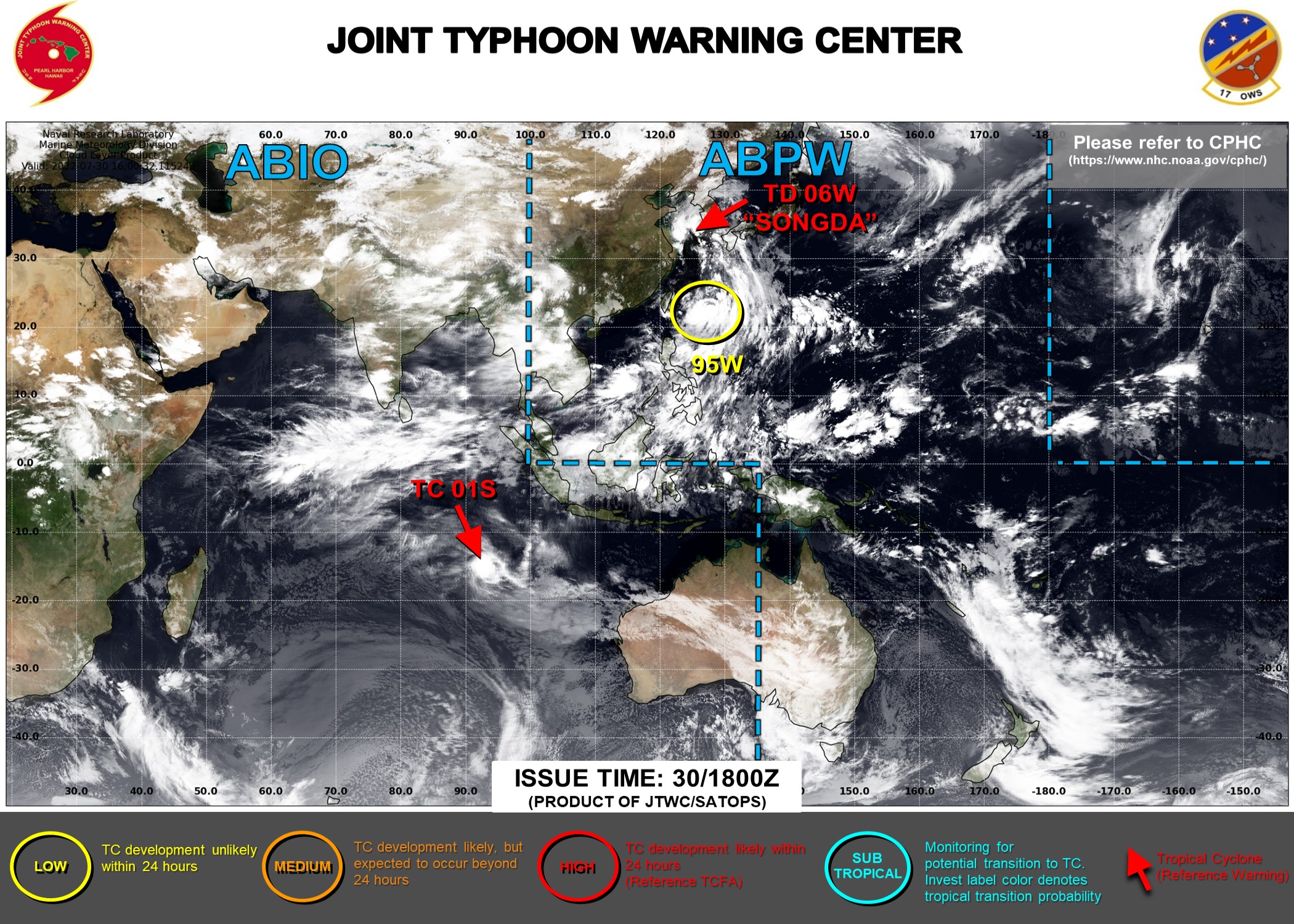
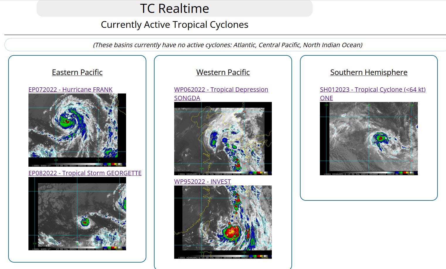
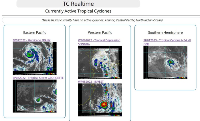
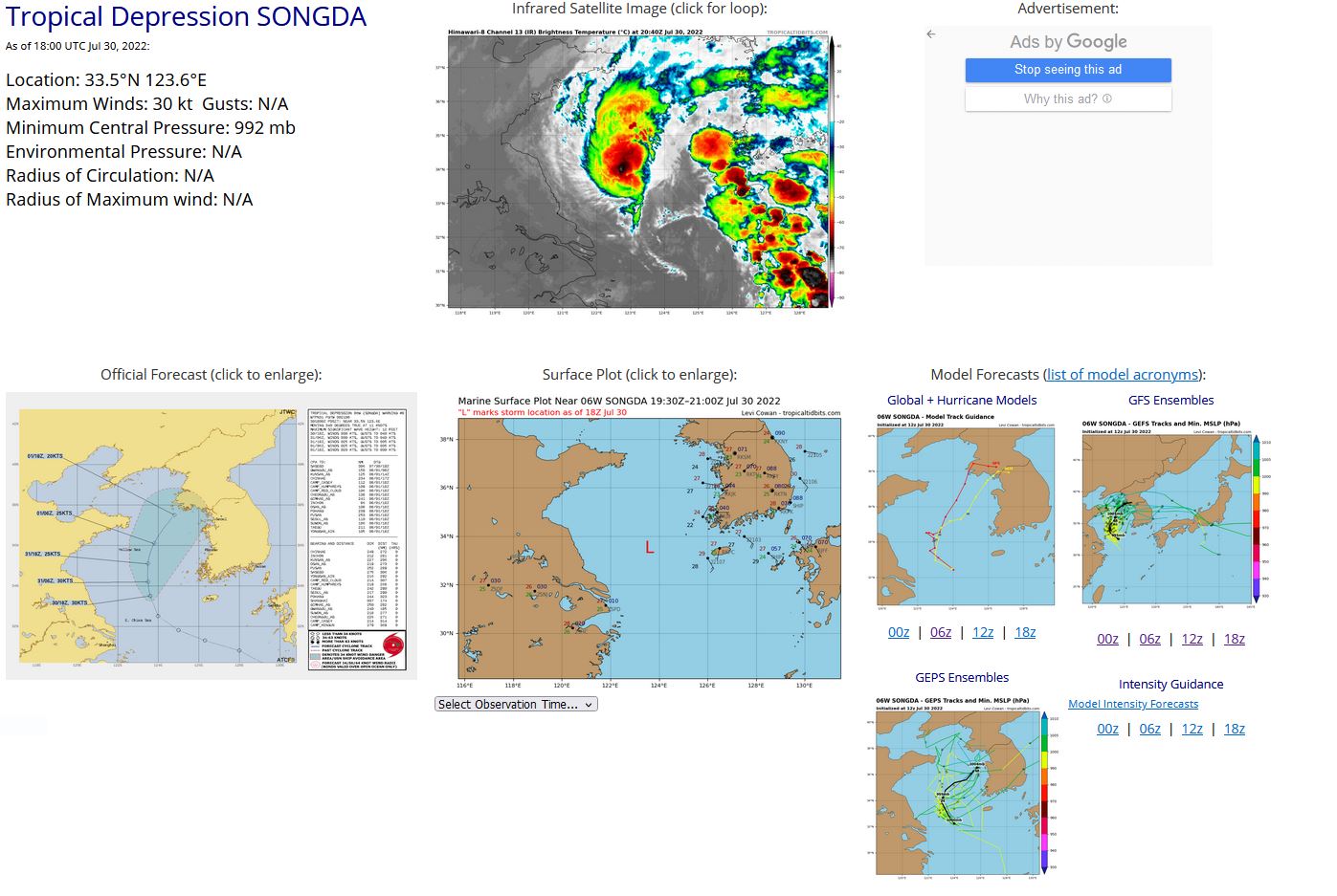
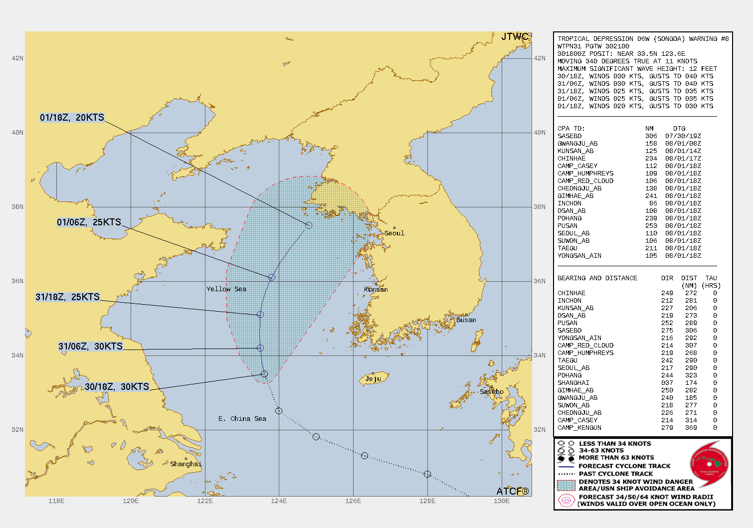
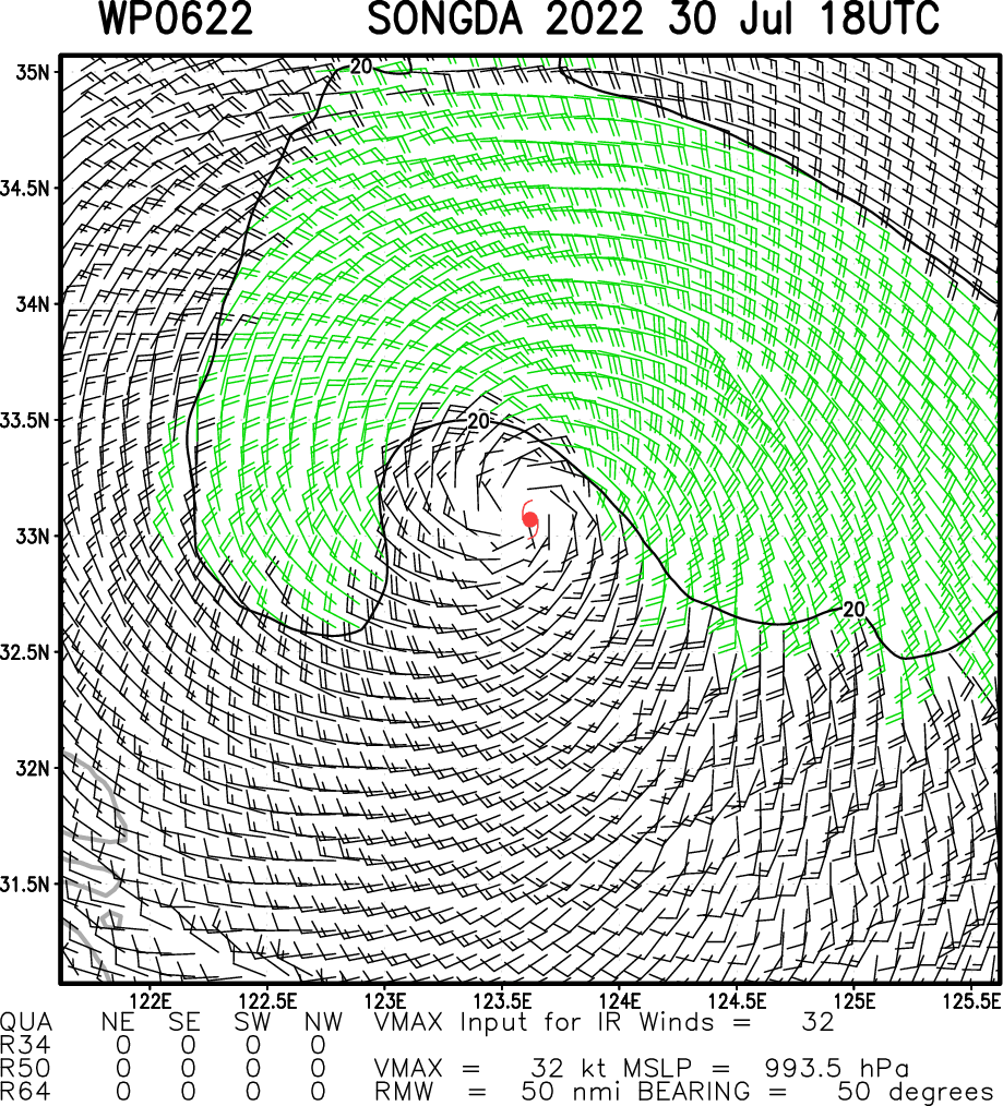
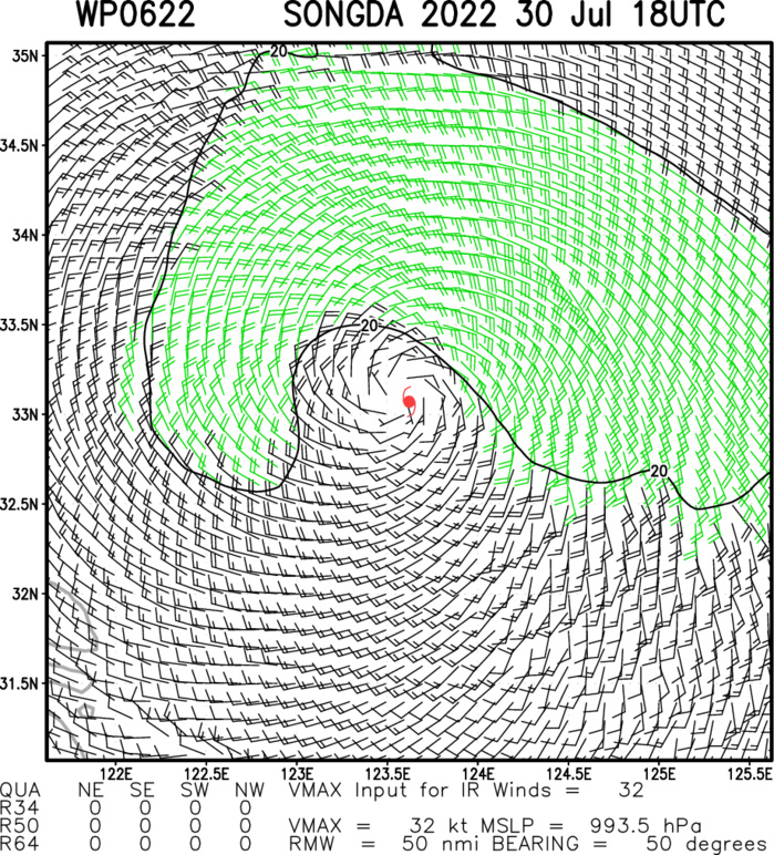
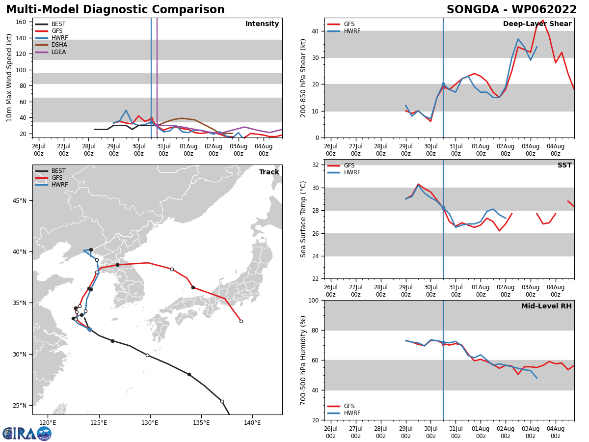
WESTERN NORTH PACIFIC: TD 06W(SONGDA). WARNING 8 ISSUED AT 30/21UTC.
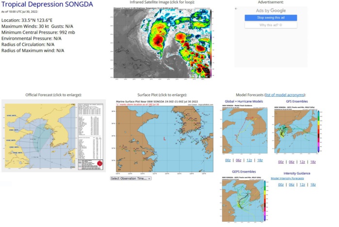
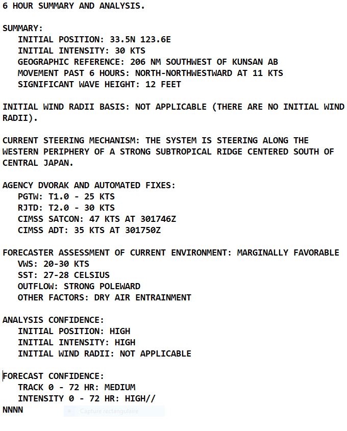
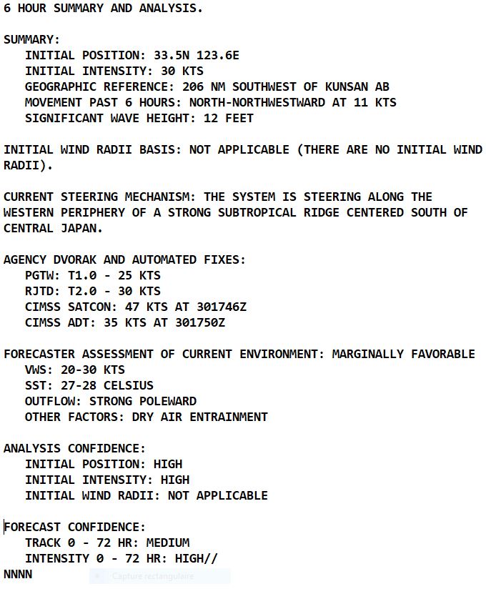
SATELLITE ANALYSIS, INITIAL POSITION AND INTENSITY DISCUSSION: AFTER A BRIEF PERIOD OF FAVORABLE CONDITIONS, ENVIRONMENTAL CONDITIONS ARE DEGRADING WITH MODERATE TO HIGH VERTICAL WIND SHEAR ASSOCIATED WITH STRONG SOUTHERLY FLOW AHEAD OF AN UPPER-LEVEL TROUGH OVER NORTHEAST CHINA. ANIMATED ENHANCED INFRARED (EIR) SATELLITE IMAGERY DEPICTS A LINEAR BAND OF DEEP CONVECTION SHEARING POLEWARD WITH A COMPACT, PARTIALLY-EXPOSED LOW-LEVEL CIRCULATION (LLCC) POSITIONED ALONG THE SOUTHERN EDGE OF THE DEEP CONVECTION. A 301942Z SSMIS 91GHZ MICROWAVE IMAGE ALSO REVEALS A LINE OF DISORGANIZED DEEP CONVECTION WITH SHALLOW BANDING WRAPPING INTO THE CENTER. THE INITIAL POSITION IS PLACED WITH HIGH CONFIDENCE BASED ON ANIMATED EIR. THE INITIAL INTENSITY OF 30 KTS IS ASSESSED WITH HIGH CONFIDENCE BASED ON RECENT ASCAT DATA AND THE RJTD DVORAK ESTIMATE.
WP, 06, 2022072906,290N, 1318E, 30
WP, 06, 2022072912,299N, 1297E, 30
WP, 06, 2022072918,308N, 1280E, 25
WP, 06, 2022073000,313N, 1263E, 30
WP, 06, 2022073006,318N, 1250E, 30
WP, 06, 2022073012,325N, 1240E, 30
WP, 06, 2022073018,335N, 1236E, 30
WP, 06, 2022072912,299N, 1297E, 30
WP, 06, 2022072918,308N, 1280E, 25
WP, 06, 2022073000,313N, 1263E, 30
WP, 06, 2022073006,318N, 1250E, 30
WP, 06, 2022073012,325N, 1240E, 30
WP, 06, 2022073018,335N, 1236E, 30
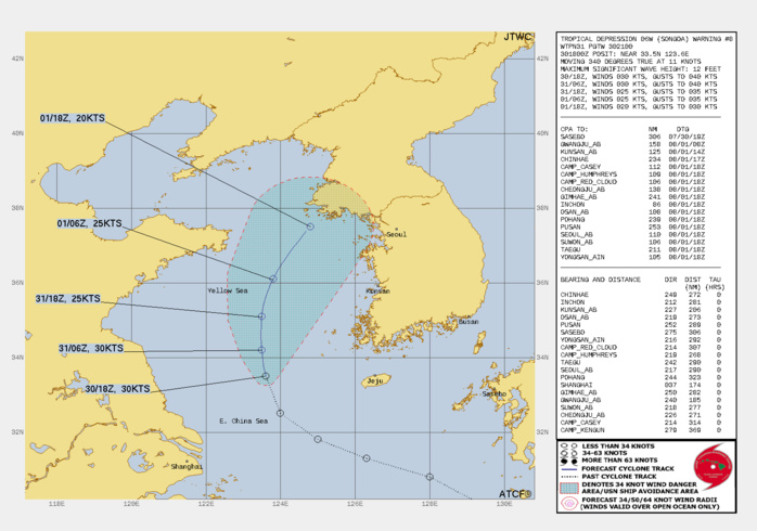
FORECAST REASONING. SIGNIFICANT FORECAST CHANGES: THERE ARE NO SIGNIFICANT CHANGES TO THE FORECAST FROM THE PREVIOUS WARNING. FORECAST DISCUSSION: TD 06W IS FORECAST TO TRACK POLEWARD ALONG THE WESTERN PERIPHERY OF THE LOW-LEVEL SUBTROPICAL RIDGE (STR) THROUGH TAU 36. AFTER TAU 36, THE SYSTEM WILL RECURVE NORTH-NORTHEASTWARD AS IT ROUNDS THE NORTHWEST PERIPHERY OF THE STR. ENVIRONMENTAL CONDITIONS WILL DEGRADE THROUGH THE FORECAST PERIOD WITH INCREASING VERTICAL WIND SHEAR AND DRY AIR ENTRAINMENT, THEREFORE, THE SYSTEM WILL WEAKEN AND DISSIPATE PRIOR TO MAKING LANDFALL ALONG THE SOUTHWESTERN COAST OF NORTH KOREA.
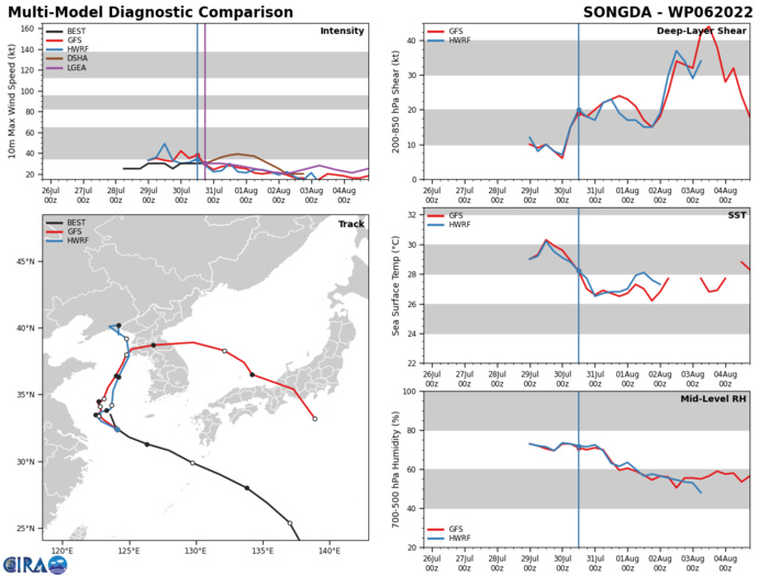
MODEL DISCUSSION: NUMERICAL MODEL GUIDANCE IS IN FAIR AGREEMENT WITH THE BULK OF THE GUIDANCE SUPPORTING THE JTWC FORECAST TRACK. THERE IS SOME UNCERTAINTY IN THE TIMING OF THE NORTH-NORTHEAST TURN WITH MEDIUM CONFIDENCE OVERALL. OVERALL, THERE IS HIGH CONFIDENCE IN THE JTWC INTENSITY FORECAST WITH RELIABLE INTENSITY GUIDANCE INDICATING A STEADY DECREASE IN INTENSITY THROUGH THE FORECAST PERIOD.
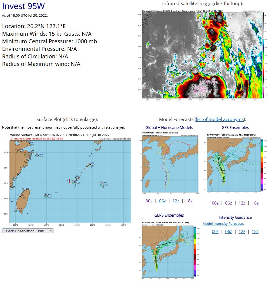
WESTERN NORTH PACIFIC: INVEST 95W. ADVISORY(ABPW) ISSUED AT 30/06UTC.
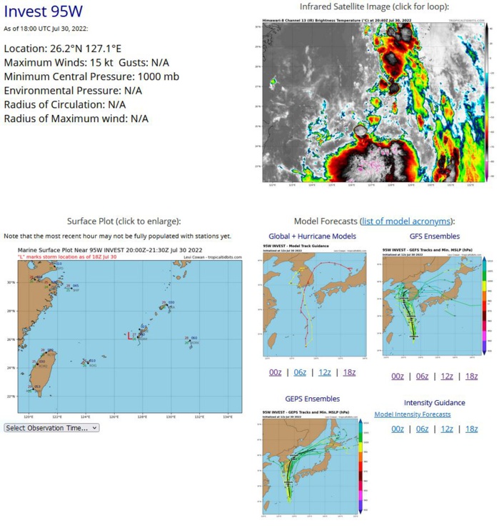
THE AREA OF CONVECTION (INVEST 95W) PREVIOUSLY LOCATED NEAR 21.3N 130.8E IS NOW LOCATED NEAR 21.8N 128.4E, APPROXIMATELY 272 NM SOUTH OF KADENA AB, OKINAWA, JAPAN. ANIMATED MULTISPECTRAL SATELLITE IMAGERY AND A 292217Z GMI 89 GHZ IMAGE DEPICT SHALLOW RAIN BANDS WRAPPING INTO A PARTIALLY EXPOSED LOW LEVEL CIRCULATION. THE ENVIRONMENT IS RELATIVELY FAVORABLE FOR DEVELOPMENT WITH MODERATE (15- 20KTS) VERTICAL WIND SHEAR, HIGH (30-31C) SEA SURFACE TEMPERATURES AND MODERATE POLEWARD OUTFLOW. DETERMINISTIC AND ENSEMBLE MODELS ARE IN FAIR AGREEMENT THE SYSTEM WILL TRACK GENERALLY NORTHWARD OVER THE NEXT 48-72 HOURS BUT WITH NO SIGNIFICANT CONSOLIDATION. MAXIMUM SUSTAINED SURFACE WINDS ARE ESTIMATED AT 13 TO 17 KNOTS. MINIMUM SEA LEVEL PRESSURE IS ESTIMATED TO BE NEAR 1001 MB. THE POTENTIAL FOR THE DEVELOPMENT OF A SIGNIFICANT TROPICAL CYCLONE WITHIN THE NEXT 24 HOURS REMAINS LOW.
WP, 95, 2022072906,215N, 1301E, 15
WP, 95, 2022072912,216N, 1294E, 15
WP, 95, 2022072918,217N, 1288E, 15
WP, 95, 2022073000,226N, 1280E, 15
WP, 95, 2022073006,238N, 1277E, 15
WP, 95, 2022073012,250N, 1274E, 15
WP, 95, 2022073018,262N, 1271E, 15
WP, 95, 2022072912,216N, 1294E, 15
WP, 95, 2022072918,217N, 1288E, 15
WP, 95, 2022073000,226N, 1280E, 15
WP, 95, 2022073006,238N, 1277E, 15
WP, 95, 2022073012,250N, 1274E, 15
WP, 95, 2022073018,262N, 1271E, 15
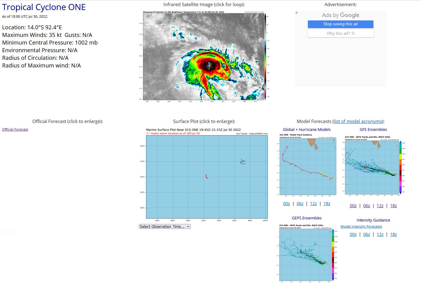
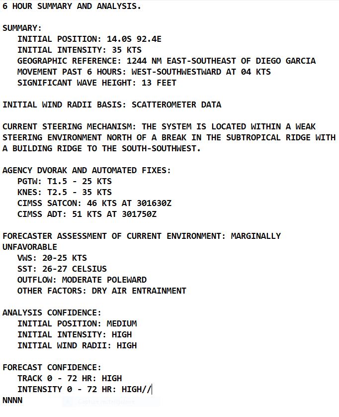
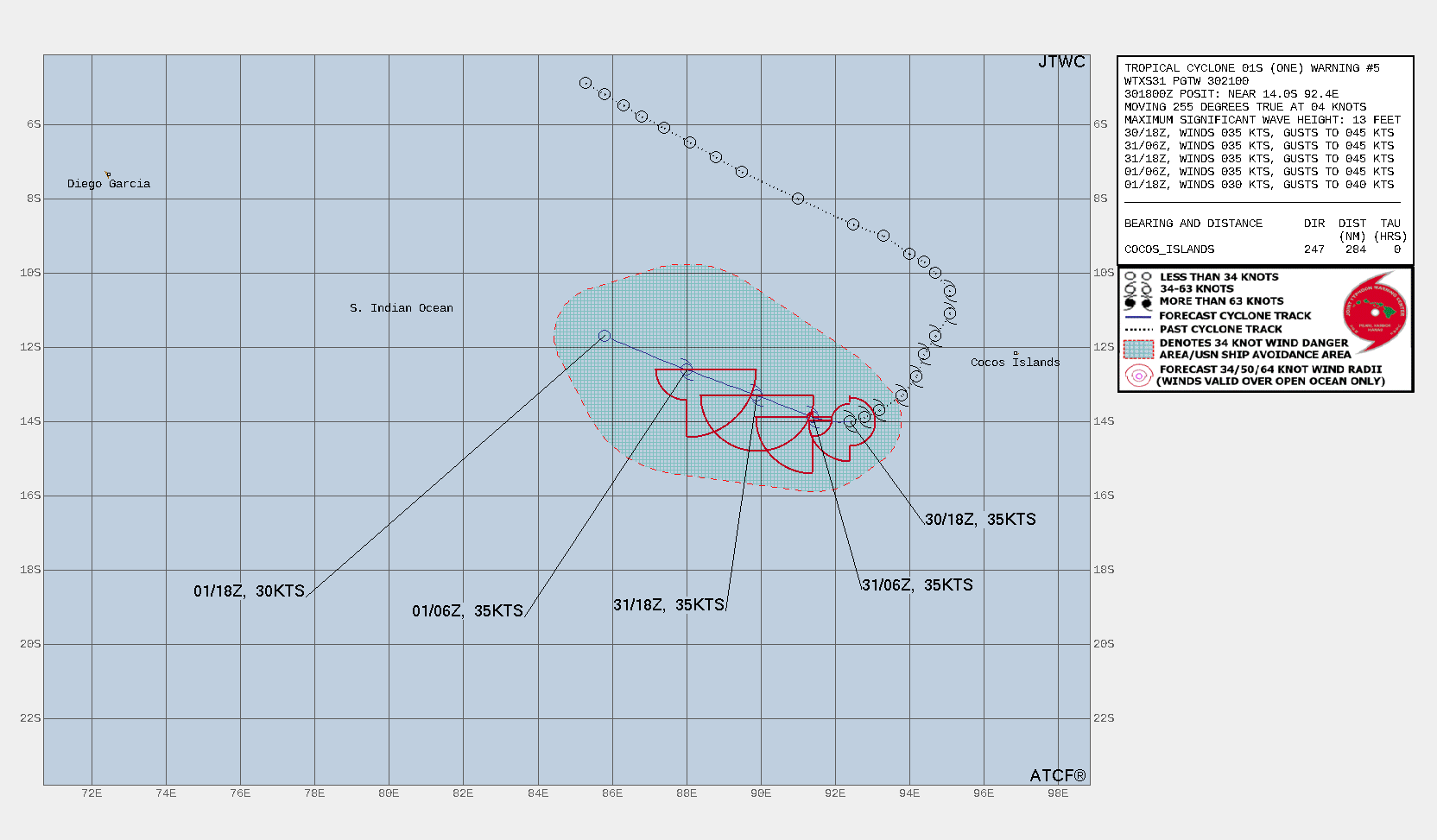
SOUTH INDIAN OCEAN: TC 01S. WARNING 5 ISSUED AT 30/21UTC.
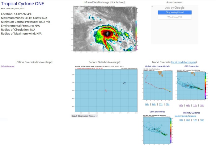
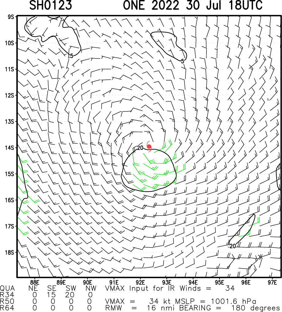
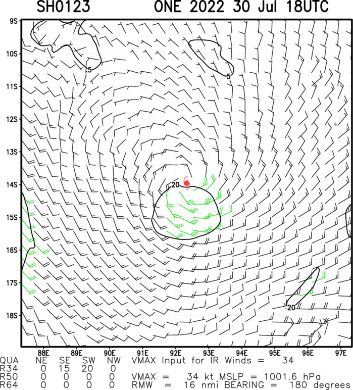
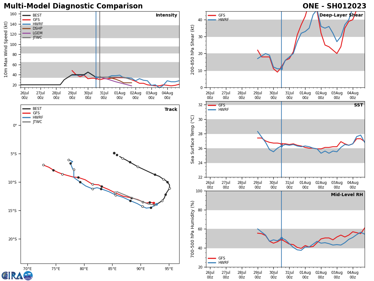
SATELLITE ANALYSIS, INITIAL POSITION AND INTENSITY DISCUSSION: ANIMATED ENHANCED INFRARED (EIR) SATELLITE IMAGERY DEPICTS A PARTIALLY-EXPOSED LOW-LEVEL CIRCULATION (LLC) POSITIONED ALONG THE NORTHERN EDGE OF A LARGE, SYMMETRIC AREA OF DEEP CONVECTION. A 301449Z AMSU-B 89GHZ MICROWAVE IMAGE SHOWS A DISORGANIZED CLUSTER OF DEEP CONVECTION SHEARED OVER THE SOUTHERN SEMICIRCLE OF THE LLC WITH WEAK LOW-LEVEL STRUCTURE OVER THE NORTHERN SEMICIRCLE. A 301544Z ASCAT-C BULLSEYE IMAGE, WHICH WAS USED TO SET THE 34-KNOT WIND RADII, REVEALS A SWATH OF 34-37 KNOT GALE-FORCE WINDS OVER THE WEST AND SOUTHWEST QUADRANTS WITH LESS THAN 30 KNOT WINDS ELSEWHERE. THE INITIAL INTENSITY OF 35 KTS IS ASSESSED WITH HIGH CONFIDENCE BASED ON THE ASCAT DATA PRIMARILY. THE INITIAL POSITION IS PLACED WITH MEDIUM CONFIDENCE BASED ON EXTRAPOLATION FROM THE ASCAT-C IMAGE. ENVIRONMENTAL CONDITIONS ARE UNFAVORABLE WITH MODERATE TO HIGH (20-30 KNOTS) NORTHERLY VERTICAL WIND SHEAR, OFFSET BY MODERATE POLEWARD OUTFLOW, MARGINALLY-FAVORABLE SST VALUES (26C) AND DRY AIR ENTRAINMENT.
SH, 01, 2022072906,117S, 947E, 40
SH, 01, 2022072912,122S, 944E, 40
SH, 01, 2022072918,128S, 942E, 40
SH, 01, 2022073000,133S, 938E, 45
SH, 01, 2022073006,137S, 932E, 40
SH, 01, 2022073012,139S, 928E, 35
SH, 01, 2022073018,140S, 924E, 35
SH, 01, 2022072912,122S, 944E, 40
SH, 01, 2022072918,128S, 942E, 40
SH, 01, 2022073000,133S, 938E, 45
SH, 01, 2022073006,137S, 932E, 40
SH, 01, 2022073012,139S, 928E, 35
SH, 01, 2022073018,140S, 924E, 35
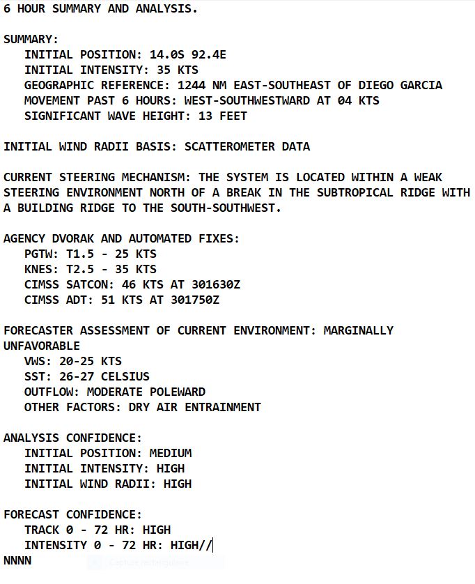
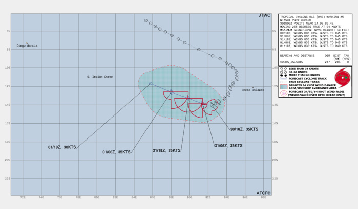
FORECAST REASONING. SIGNIFICANT FORECAST CHANGES: THERE ARE NO SIGNIFICANT CHANGES TO THE FORECAST FROM THE PREVIOUS WARNING. FORECAST DISCUSSION: TC 01S HAS SLOWED DUE TO A RELATIVELY WEAK STEERING ENVIRONMENT ASSOCIATED WITH THE PASSAGE OF A DEEP MIDLATITUDE MAJOR TROUGH TO THE SOUTH. THE SUBTROPICAL RIDGE IS BUILDING TO THE SOUTH-SOUTHWEST AND IS EXPECTED TO CONTINUE TO BUILD AS THE MIDLATITUDE TROUGH PROPAGATES EASTWARD OVER THE NEXT 24 HOURS. TC 01S WILL ACCELERATE WEST-NORTHWESTWARD THROUGH THE FORECAST PERIOD AS THE STEERING RIDGE TO THE SOUTH STRENGTHENS. THE SYSTEM WILL STEADILY WEAKEN DUE TO SIGNIFICANT DRY AIR AND INCREASING VERTICAL WIND SHEAR WITH DISSIPATION ANTICIPATED BY TAU 48.
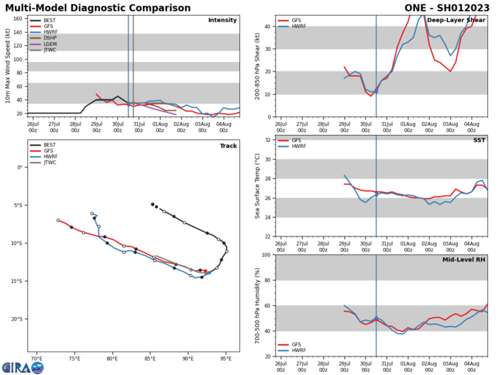
MODEL DISCUSSION: NUMERICAL MODEL GUIDANCE IS IN TIGHT AGREEMENT (THE MODEL SPREAD THROUGH TAU 48 IS 50NM OR LESS) LENDING HIGH CONFIDENCE TO THE JTWC FORECAST TRACK. THE RELIABLE INTENSITY GUIDANCE IS ALSO IN GOOD AGREEMENT SUPPORTING THE JTWC INTENSITY FORECAST.
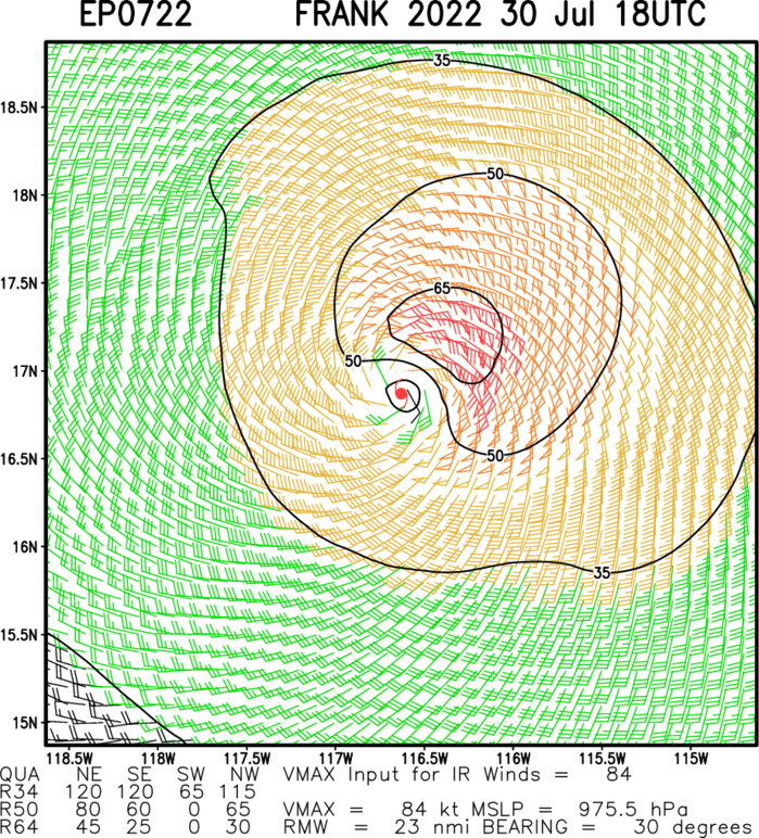
EASTERN NORTH PACIFIC: HU 07E(FRANK). ESTIMATED LOCATION AND INTENSITY AT 30/18UTC. NHC COMMENTS.
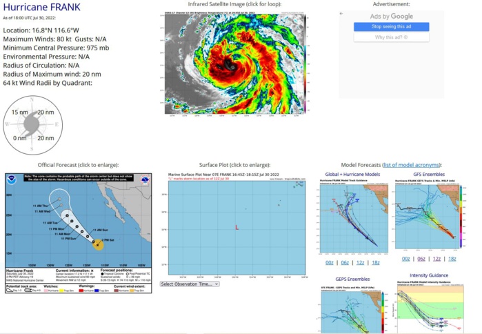
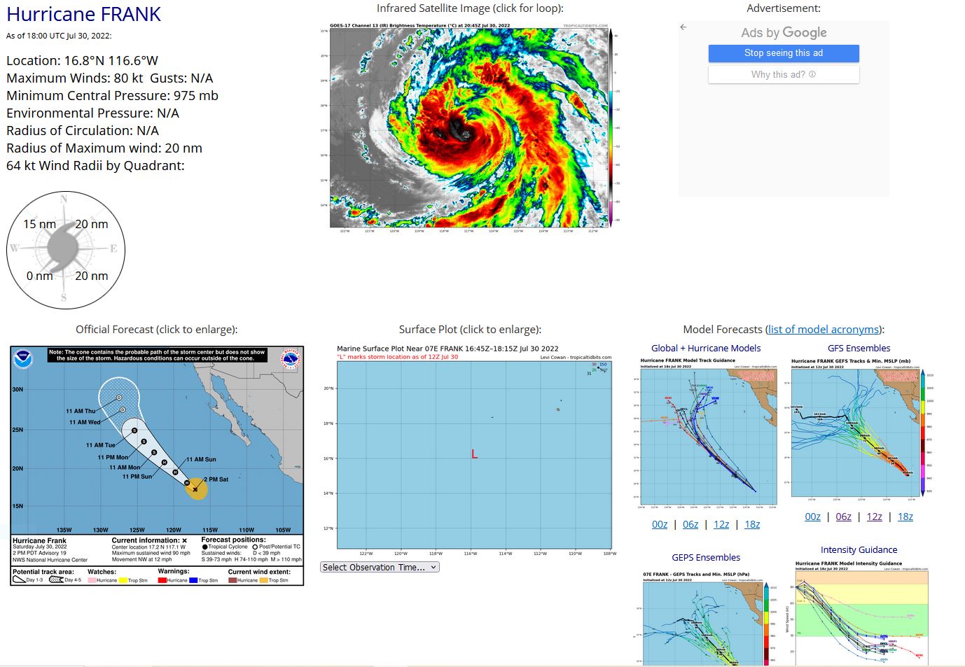
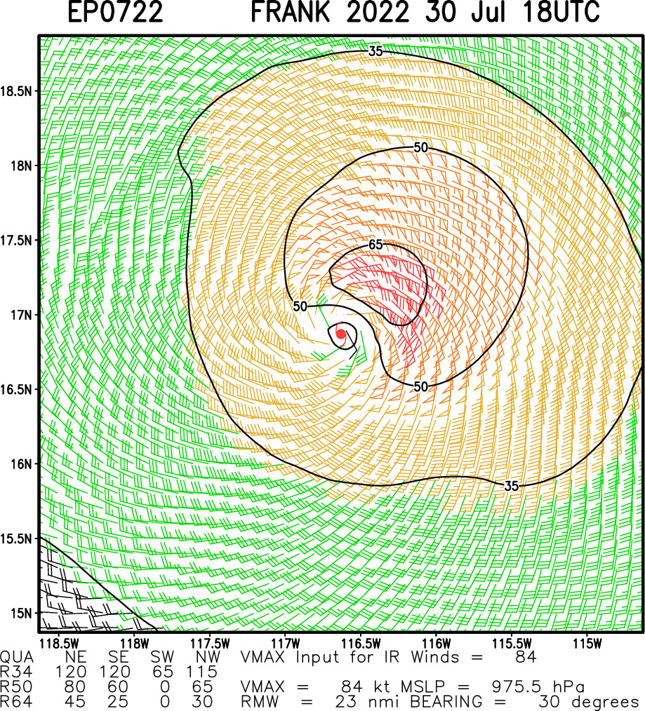
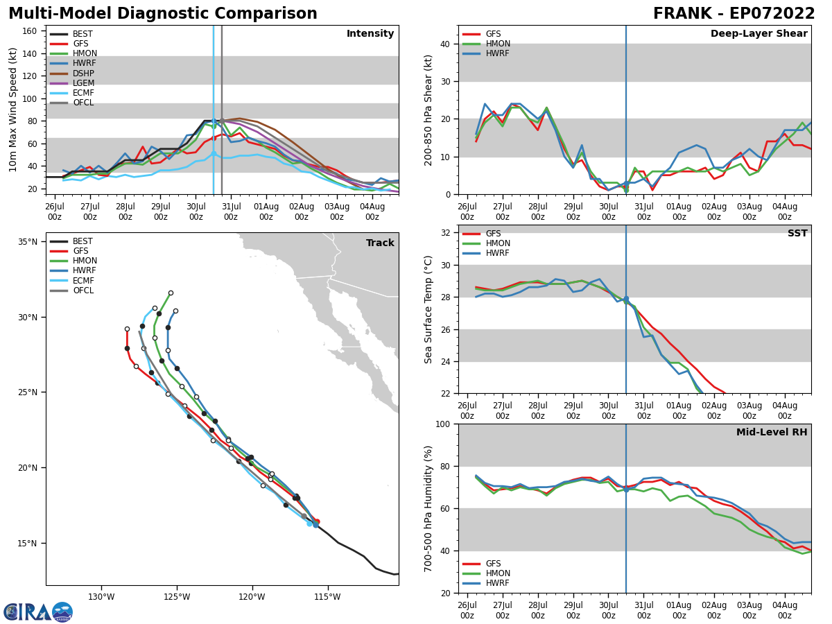
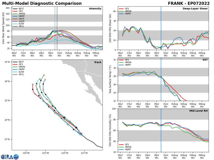
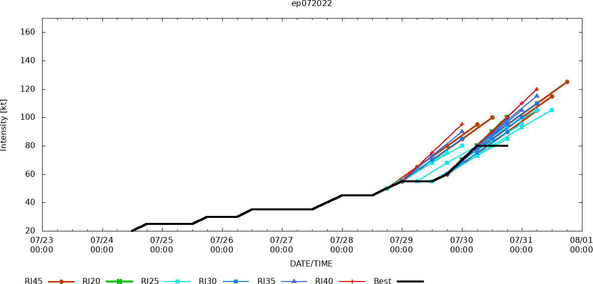
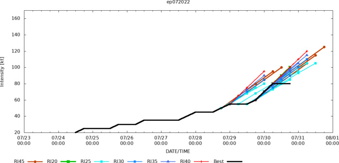
Hurricane Frank Discussion Number 19 NWS National Hurricane Center Miami FL EP072022 200 PM PDT Sat Jul 30 2022 Frank's convective pattern is currently comprised of an inner area of eyewall convection that is now almost surrounded by outer convective bands. However, an eye has not appeared since the last advisory, and the inner core convection is a bit sporadic and asymmetric. The various satellite intensity estimates are again unchanged since the last advisory, so the initial intensity remains at 80 kt. The hurricane is now moving over decreasing sea surface temperatures and it has just about run out of time to intensify. The center should reach the 26C isotherm in 12-18 h and reach 21C water by 72 h. This should cause steady to rapid weakening to occur after 12 h, with Frank forecast to decay to a remnant low by 96 h. The new intensity forecast is adjusted downward from the previous advisory and it follows the trend of the intensity guidance. It should be noted that near the end of the forecast period, the GFS model continues to show some rejuvenation of convection as the post-tropical cyclone interacts with an upper-level trough to its northwest. Frank continues moving northwestward or 310/10 kt, and there is again little change to the track forecast scenario. The cyclone should continue on a northwestward track for most of the forecast period while it moves along the southwestern periphery of a large mid-level ridge toward a developing break in the ridge west of California. The track guidance has made yet another slight shift to the north and east at 96 and 120 h, and the latest forecast shows a similar slight shift at those times. Otherwise, it is another update of the previous forecast that lies close to the consensus
EP, 07, 2022072906,133N, 1118W, 55
EP, 07, 2022072912,141N, 1126W, 55
EP, 07, 2022072918,145N, 1133W, 60
EP, 07, 2022073000,150N, 1143W, 70
EP, 07, 2022073006,156N, 1150W, 80
EP, 07, 2022073012,162N, 1158W, 80
EP, 07, 2022073018,168N, 1166W, 80
EP, 07, 2022072912,141N, 1126W, 55
EP, 07, 2022072918,145N, 1133W, 60
EP, 07, 2022073000,150N, 1143W, 70
EP, 07, 2022073006,156N, 1150W, 80
EP, 07, 2022073012,162N, 1158W, 80
EP, 07, 2022073018,168N, 1166W, 80
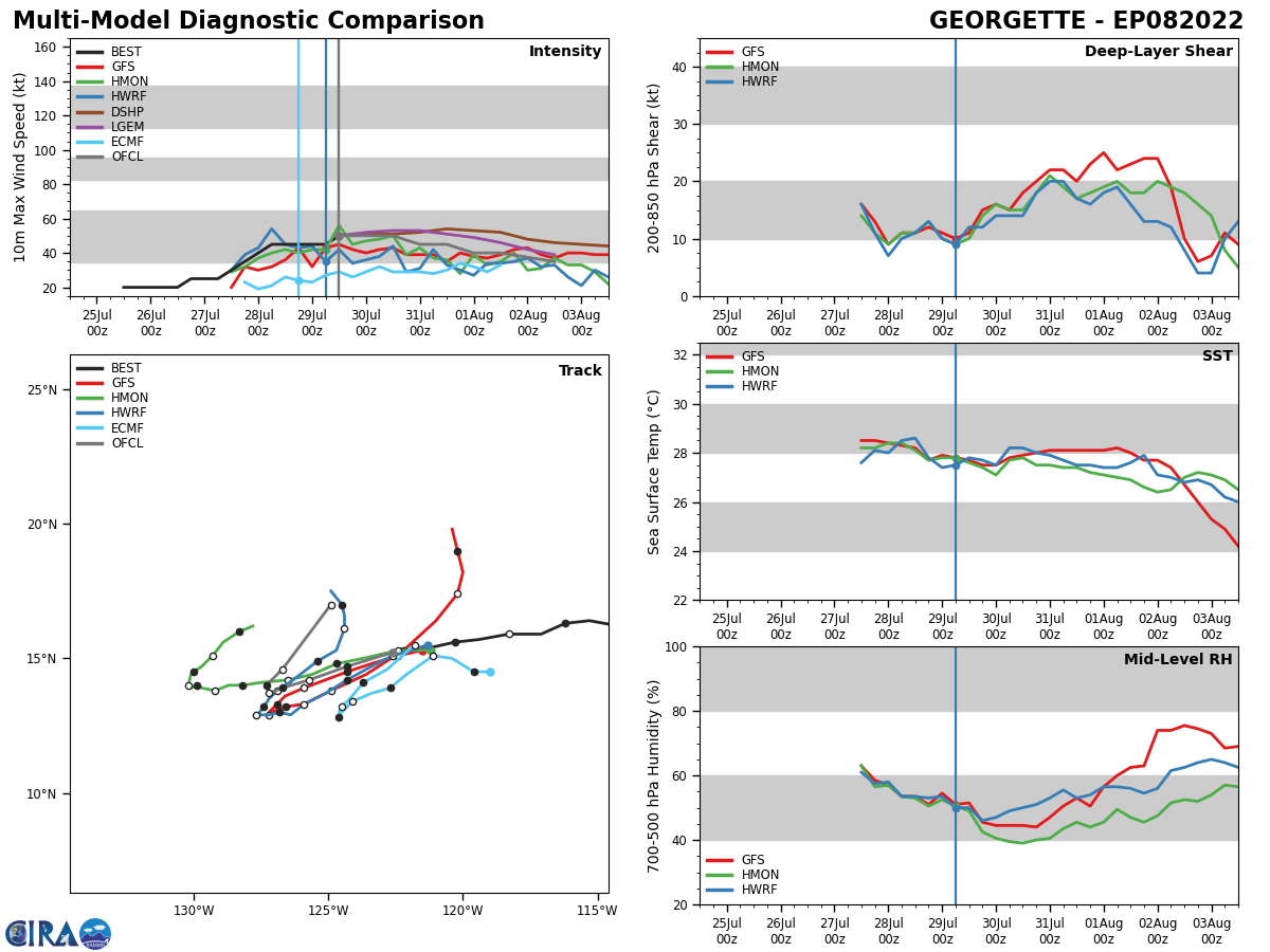
EASTERN NORTH PACIFIC: TS 08E(GEORGETTE). ESTIMATED LOCATION AND INTENSITY AT 30/18UTC. NHC COMMENTS.
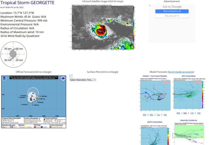
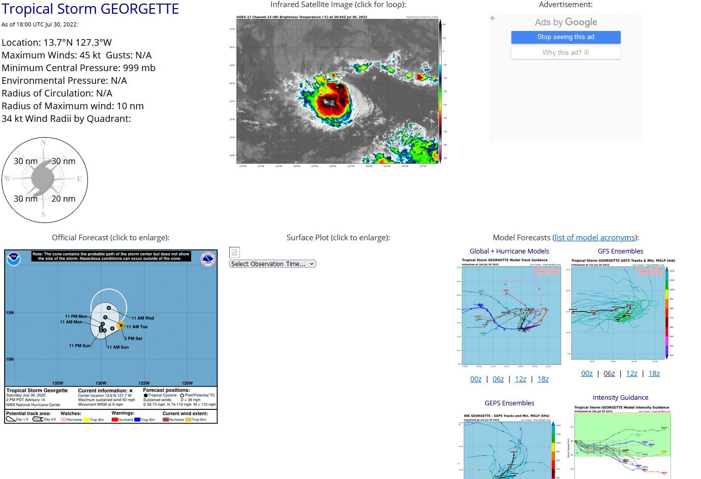
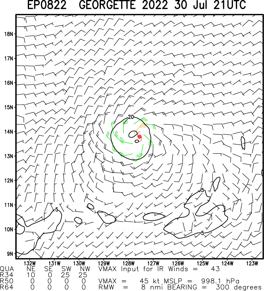
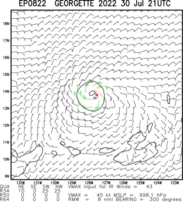
Tropical Storm Georgette Discussion Number 14 NWS National Hurricane Center Miami FL EP082022 200 PM PDT Sat Jul 30 2022 Georgette has maintained a consistent structure today, characterized by persistent convective activity to the south and southwest of the estimated center. A subjective Dvorak estimate from TAFB indicates that the storm has maintained its intensity, and recent microwave imagery suggests that the low-level circulation remains well defined. Thus the initial intensity is held constant at 45 kt, consistent with the prior advisory. East-northeasterly steering flow continues to influence the west-southwestward motion, which has not changed much since the prior advisory. The current estimated motion is 255/8 kt. Later tonight, the steering currents are expected to weaken, resulting in a slower forward speed by tomorrow. In association with the slowing forward speed, track guidance diverges after 24-36 hours, and the spread among the guidance members suggests high uncertainty in the track forecast after 36 hours. Some members of the guidance suite indicate a sharp turn toward the northeast, while others suggest a continued west-southwestward motion prior to turning northward later in the forecast period. The official track forecast is a compromise between these solutions, close to the HCCA and slightly to the west of the prior NHC forecast. The intensity forecast has not changed much since the prior advisory. East-northeasterly vertical wind shear, close proximity to the much larger Hurricane Frank, and a relatively dry airmass to the northeast of Georgette are expected to inhibit significant intensification throughout the forecast period. The intensity is forecast to remain steady for the next day or so, with gradual weakening forecast to occur after the storm turns toward the northeast. The official intensity forecast is in line with the consensus aids.
EP, 08, 2022072906,154N, 1212W, 45
EP, 08, 2022072912,152N, 1226W, 50
EP, 08, 2022072918,148N, 1236W, 45
EP, 08, 2022073000,146N, 1246W, 45
EP, 08, 2022073006,143N, 1255W, 45
EP, 08, 2022073012,141N, 1264W, 45
EP, 08, 2022073018,137N, 1273W, 45
EP, 08, 2022072912,152N, 1226W, 50
EP, 08, 2022072918,148N, 1236W, 45
EP, 08, 2022073000,146N, 1246W, 45
EP, 08, 2022073006,143N, 1255W, 45
EP, 08, 2022073012,141N, 1264W, 45
EP, 08, 2022073018,137N, 1273W, 45
