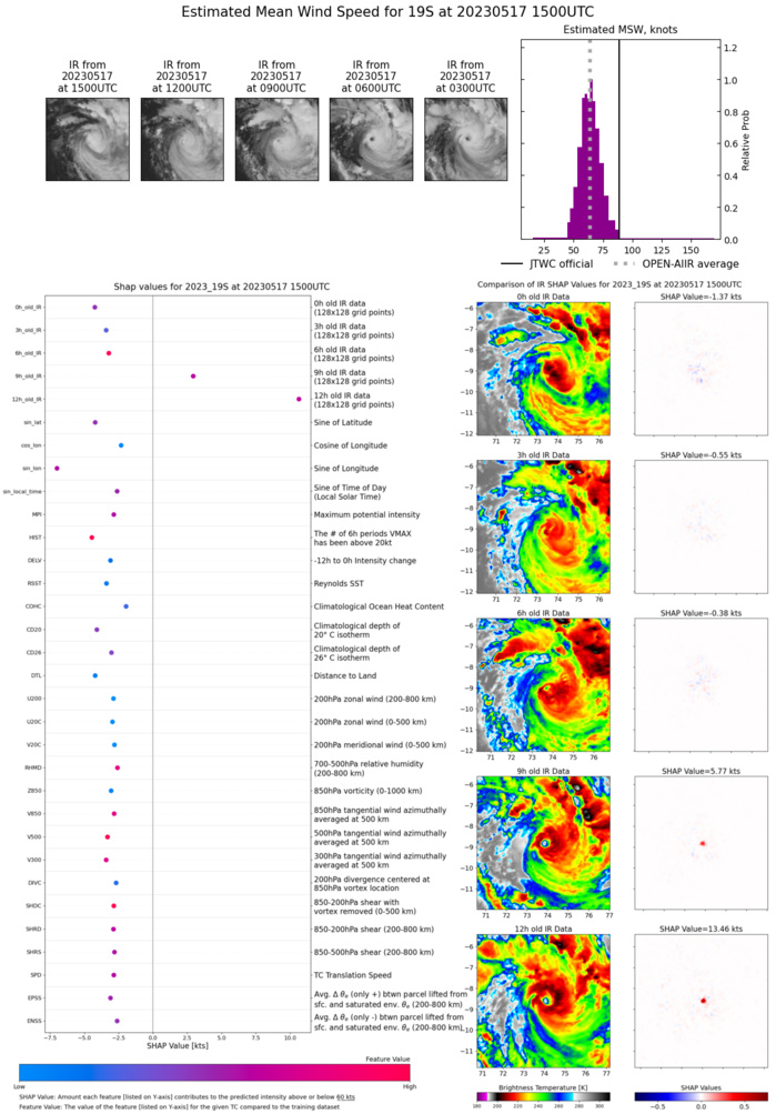
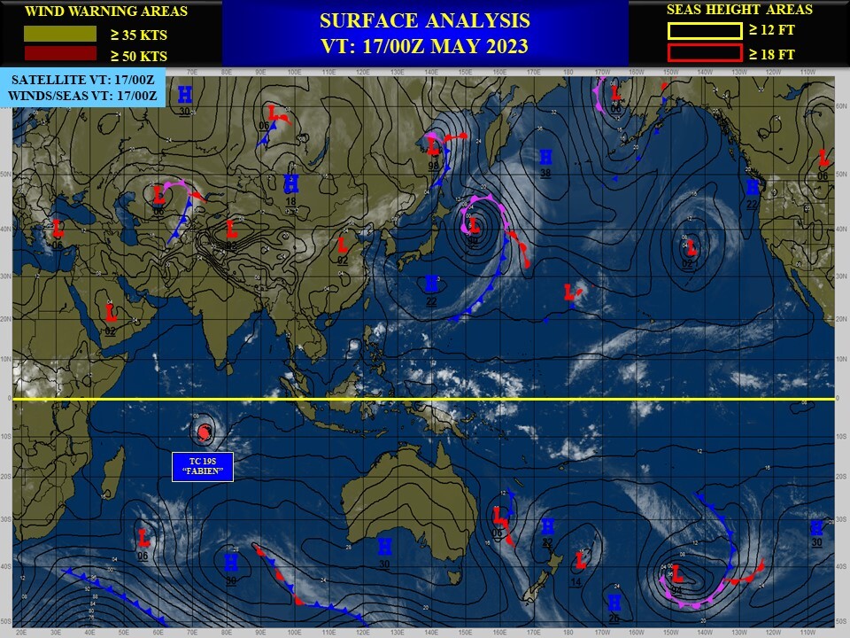
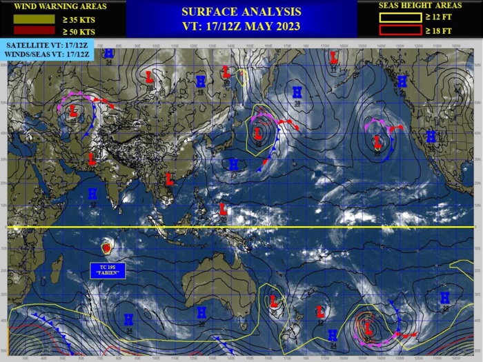
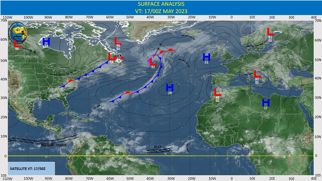
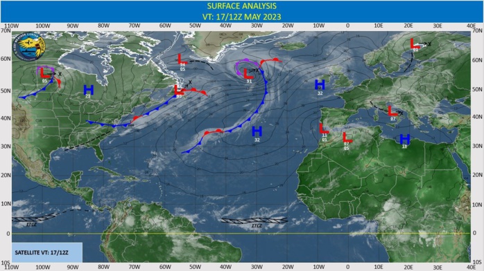
CLICK ON THE IMAGERIES BELOW TO GET THEM ENLARGED
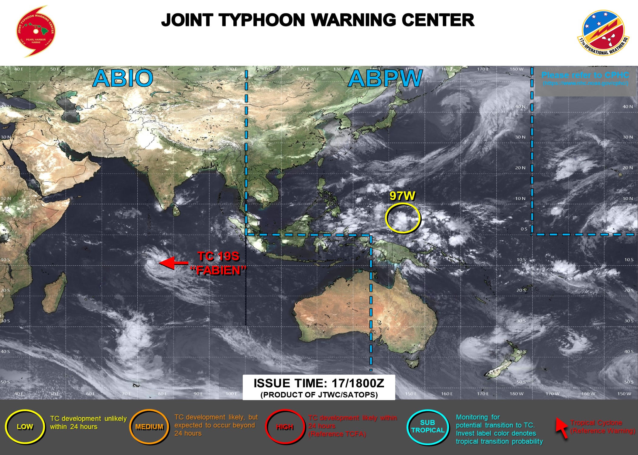
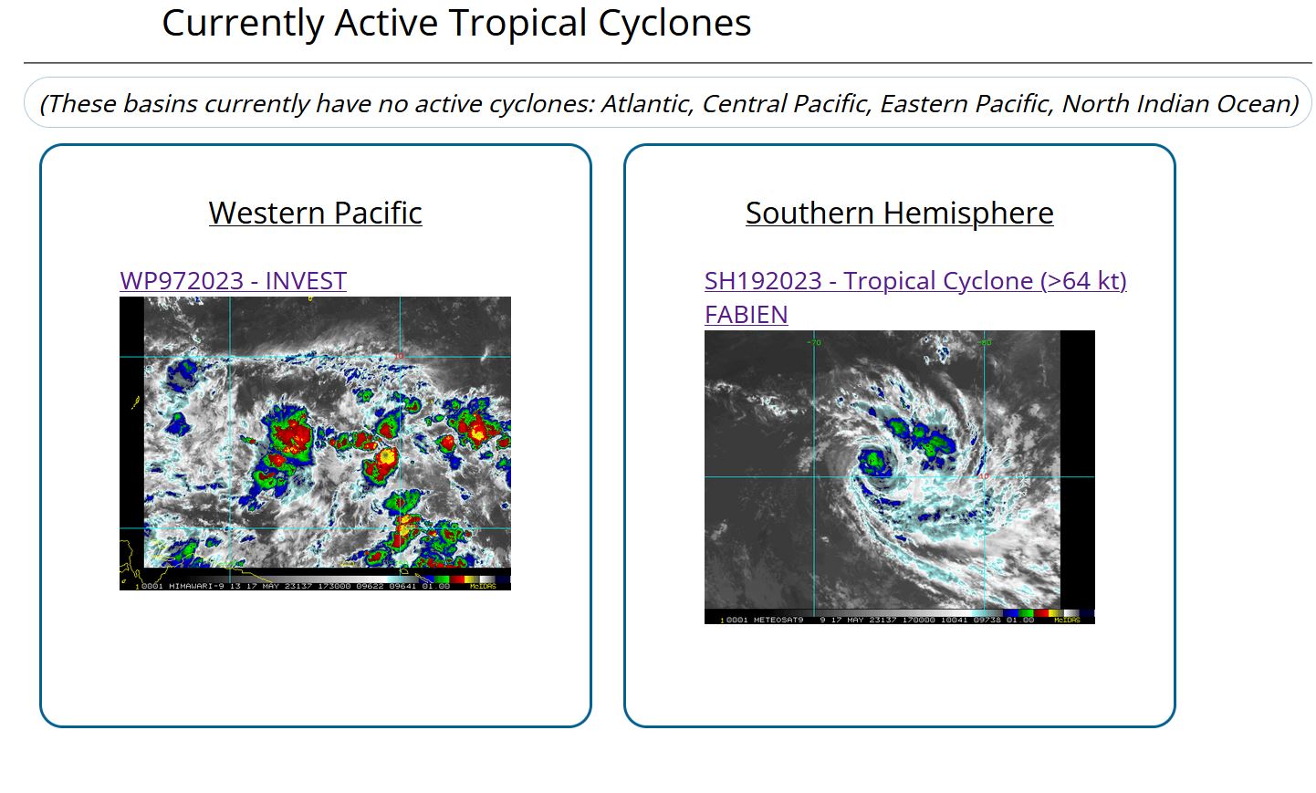
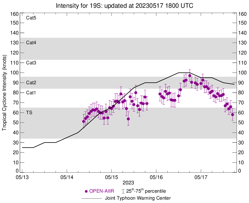
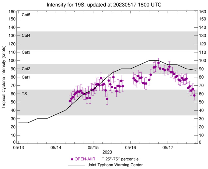
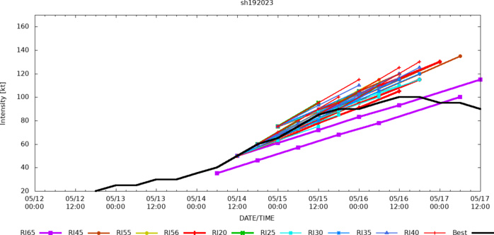
SOUTH INDIAN OCEAN: TC 19S(FABIEN). CURRENT ESTIMATED INTENSITY IS 90 KNOTS AT 17/12UTC. CATEGORY 2 US.
1923051518 59S 767E 90
1923051600 62S 761E 90
1923051606 67S 755E 95
1923051612 73S 751E 100
1923051618 79S 745E 100
1923051700 84S 741E 95
1923051706 88S 738E 95
1923051712 89S 733E 90
1923051600 62S 761E 90
1923051606 67S 755E 95
1923051612 73S 751E 100
1923051618 79S 745E 100
1923051700 84S 741E 95
1923051706 88S 738E 95
1923051712 89S 733E 90
WARNING 14 ISSUED AT 17/15UTC.

CLICK ON THE IMAGERY BELOW TO GET IT ANIMATED AND ENLARGED.
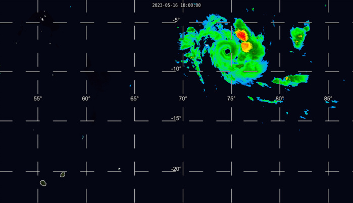
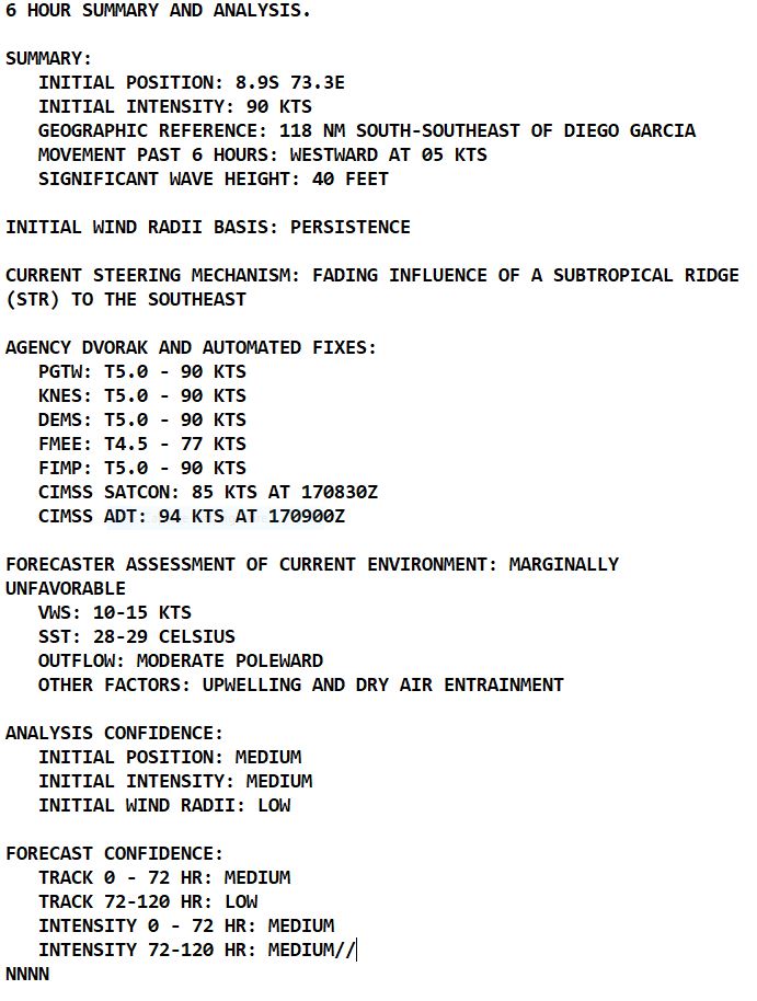
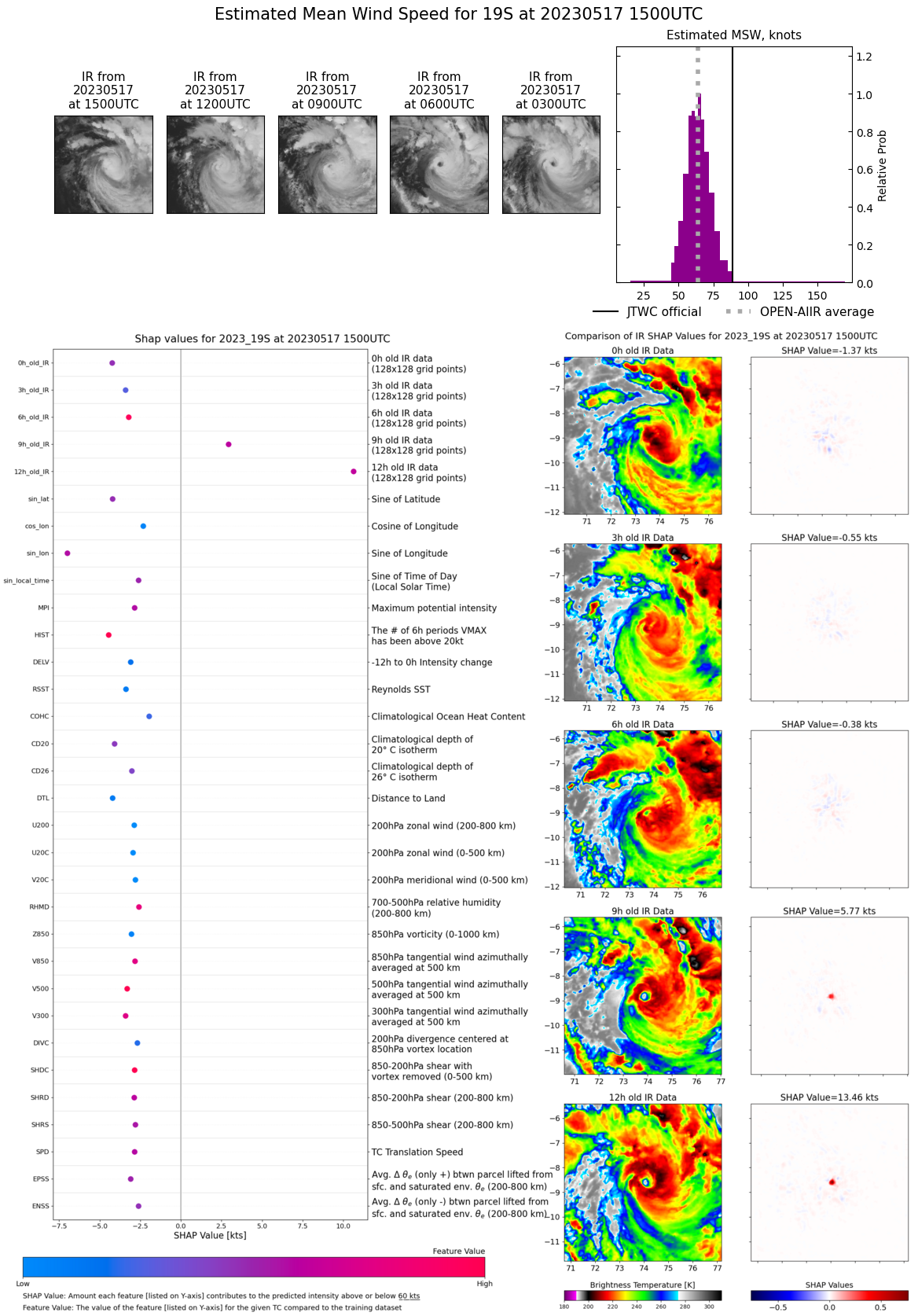
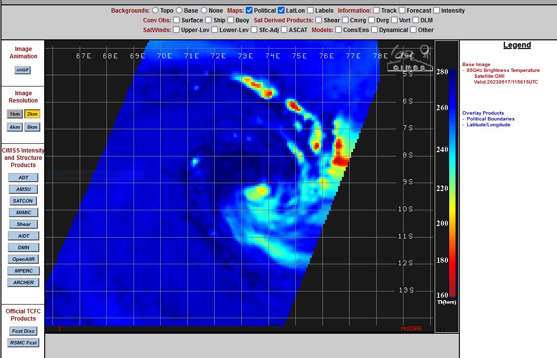
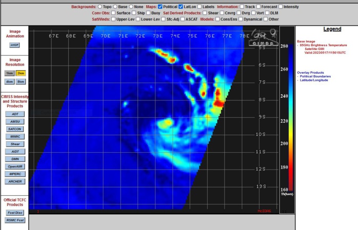
SATELLITE ANALYSIS, INITIAL POSITION AND INTENSITY DISCUSSION: AS THE SUN ONCE AGAIN SETS ON TC 19S, ANIMATED MULTISPECTRAL SATELLITE IMAGERY (MSI) DEPICTS AN ERODING CONVECTIVE COVER THAT IS EXPOSING THE LLCC BELOW. WITH THE LAST FEW FRAMES OF DAYTIME IMAGERY, THE LLCC AND UPPER LEVEL CIRCULATION CENTER (ULCC) ARE BEGINNING TO DECOUPLE AS UPPER LEVEL WIND SHEAR INCREASES. A 171156Z GMI 89GHZ COLOR COMPOSITE MICROWAVE IMAGE SHOWS SIGNIFICANTLY REDUCED CONVECTIVE ACTIVITY DUE TO DRY AIR INTRUSION AS THE NORTHWESTERN QUADRANT OF THE CIRCULATION IS DEVOID OF ANY DEEP CONVECTIVE STRUCTURES. THE INITIAL POSITION IS PLACED WITH MEDIUM CONFIDENCE BASED ON MSI AND GMI IMAGERY. THE INITIAL INTENSITY OF 90KTS IS ASSESSED WITH MEDIUM CONFIDENCE BASED ON DVORAK INTENSITY ESTIMATES AND AUTOMATED INTENSITY ESTIMATES FALLING DUE TO SCENE TYPE CHANGE FROM THE LOSS OF THE EYE AND OVERALL STRUCTURAL INTEGRITY BECOMING NOTICEABLY COMPROMISED. THE BULK OF THE INTENSITY GUIDANCE REMAINS CLOSE TO THE JTWC INITIAL INTENSITY OF 90KTS, FOR THIS REASON THE VALUE IS SET WITH OVERALL MEDIUM CONFIDENCE.
GMI AT 171156UTC.
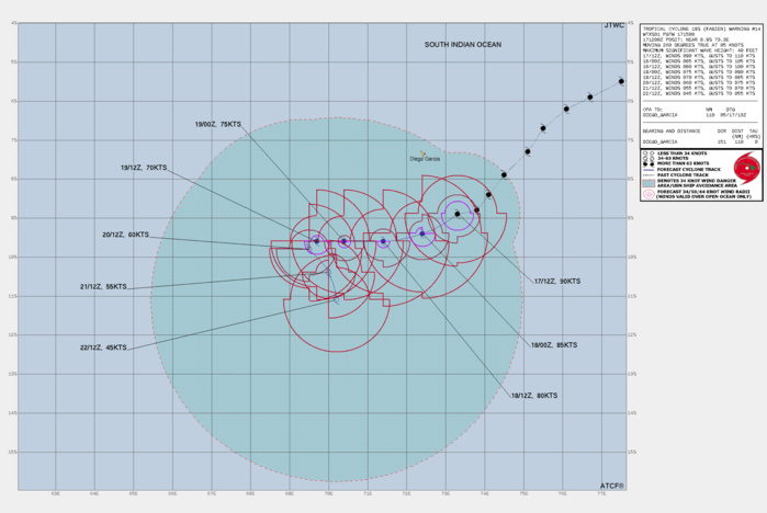
FORECAST REASONING. SIGNIFICANT FORECAST CHANGES: THERE ARE NO SIGNIFICANT CHANGES TO THE FORECAST FROM THE PREVIOUS WARNING. FORECAST DISCUSSION: TC 19S (FABIEN) IS FORECAST TO CONTINUE TRACKING GENERALLY WEST-SOUTHWESTWARD UNDER THE FADING INFLUENCE OF THE STR TO THE SOUTHEAST. AS EVIDENCED BY THE ERODING WESTERN SECTOR OF THE SYSTEMS CONVECTIVE CORE, 19S IS EXPERIENCING INCREASING DRY AIR ENTRAINMENT AND VERTICAL WIND SHEAR. THIS COUPLED WITH UPWELLING OF COOLER WATERS AS THE SYSTEM TRANSITS OVER SHALLOW OCEAN HEAT CONTENT (OHC) REGIONS WILL CONSPIRE TO WEAKEN THE SYSTEM OVER THE NEXT 12-24 HOURS. BY TAU 24 AS THE ENVIRONMENT SURROUNDING 19S CONTINUES TO DEGRADE, THE SYSTEM WILL TRANSITION PRIMARY STEERING INFLUENCE TO A BUILDING STR OVER MADAGASCAR. AS A RESULT, 19S WILL STEADY UP ON A GENERALLY WESTWARD TRACK AS THE SYSTEM CONTINUES TO WEAKEN THROUGH TAU 48. BY TAU 72, 19S WILL ENTER A COMPLEX AND COMPETING STEERING ENVIRONMENT AS THE STR TO THE SOUTHWEST AND A BUILDING NEAR-EQUATORIAL RIDGE (NER) TO THE NORTH COMPETE FOR STEERING CONTROL. AS A RESULT, THE SYSTEMS FORWARD PROGRESS WILL BE HALTED AFTER WHICH A SHARP DIRECTIONAL CHANGE IS FORECAST TO TAKE PLACE. FURTHERMORE, BY TAU 72, VERTICAL WIND SHEAR (VWS) IS FORECAST TO SIGNIFICANTLY INCREASE RESULTING IN AN INTENSITY NEAR 45KTS BY TAU 120.
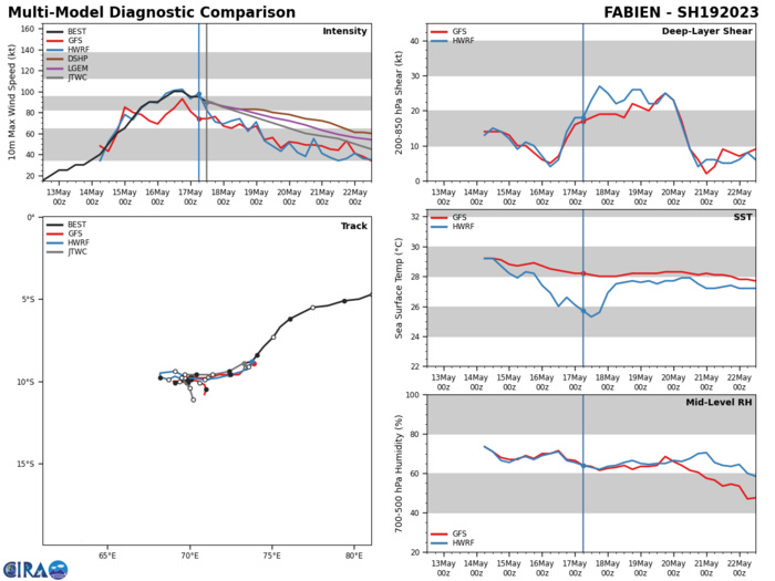
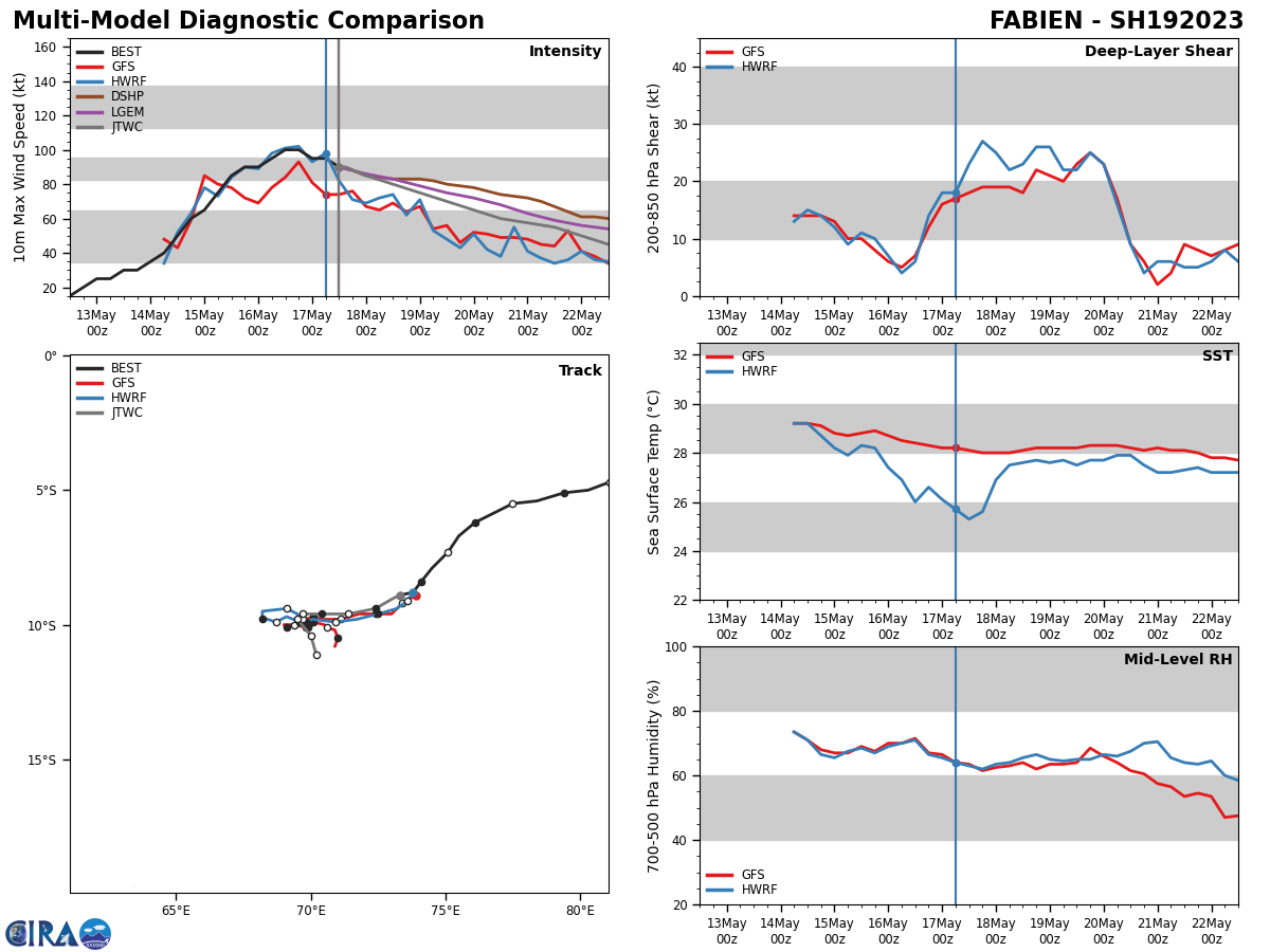
MODEL DISCUSSION: NEAR-TERM MODEL GUIDANCE HAS CONTINUED TO IMPROVE WITH A GENERALLY TIGHTER CROSS-TRACK AND ALONG-TRACK CONSENSUS THROUGH TAU 72. AFTER TAU 72 HOWEVER, MODEL OUTPUT REMAINS IN POOR AGREEMENT AS MEMBERS ATTEMPT TO RESOLVE THE COMPLEX STEERING PATTERN DISCUSSED ABOVE. FOR THIS REASON THE JTWC FORECAST TRACK IS PLACED WITH MEDIUM CONFIDENCE INITIALLY AND WITH LOW CONFIDENCE IN THE EXTENDED TRACK FORECAST. RELIABLE MODEL INTENSITY GUIDANCE IS IN FAIR AGREEMENT WITH A BULK OF THE GUIDANCE GENERALLY FOLLOWING THE TREND OF THE JTWC FORECAST INTENSITY. HWRF AND COAMPS-TC (NAVGEM VERSION) TAKE A MORE AGGRESSIVE WEAKENING TREND THROUGH THE DURATION OF THE FORECAST PERIOD. FOR THIS REASON THE JTWC FORECAST INTENSITY IS PLACED CLOSE TO THE MULTI-MODEL CONSENSUS WITH OVERALL MEDIUM CONFIDENCE.
RIPA Forecast AND RIPA Storm Table ATTACHED BELOW
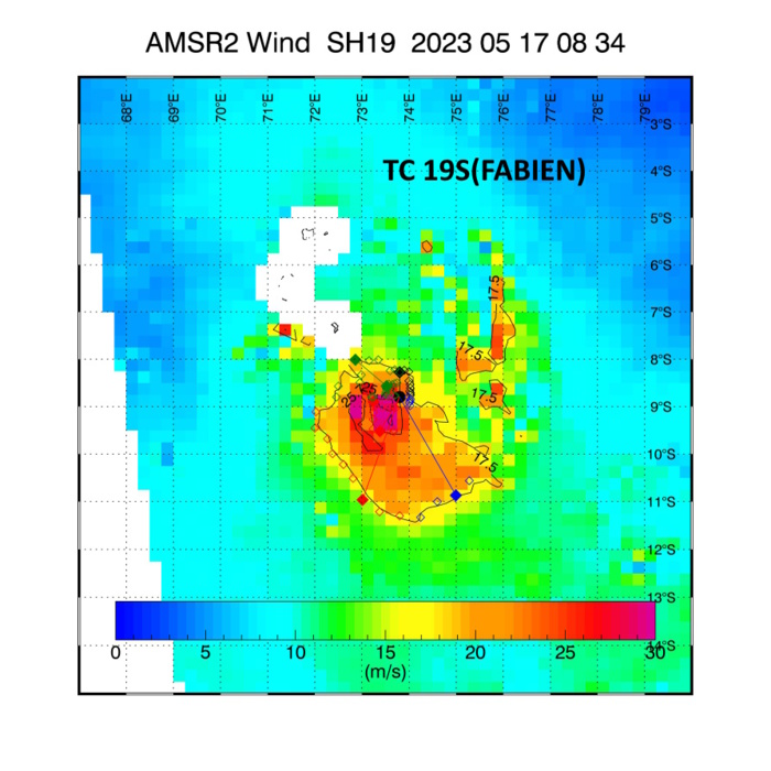
AMSR-2 AT 170834UTC: 10 MINUTE MAXIMUM SUSTAINED WINDS: 68 KNOTS
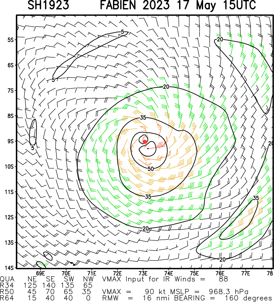
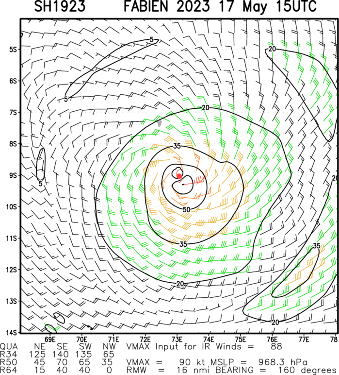
Multiplatform Satellite Surface Wind Analysis (Experimental)
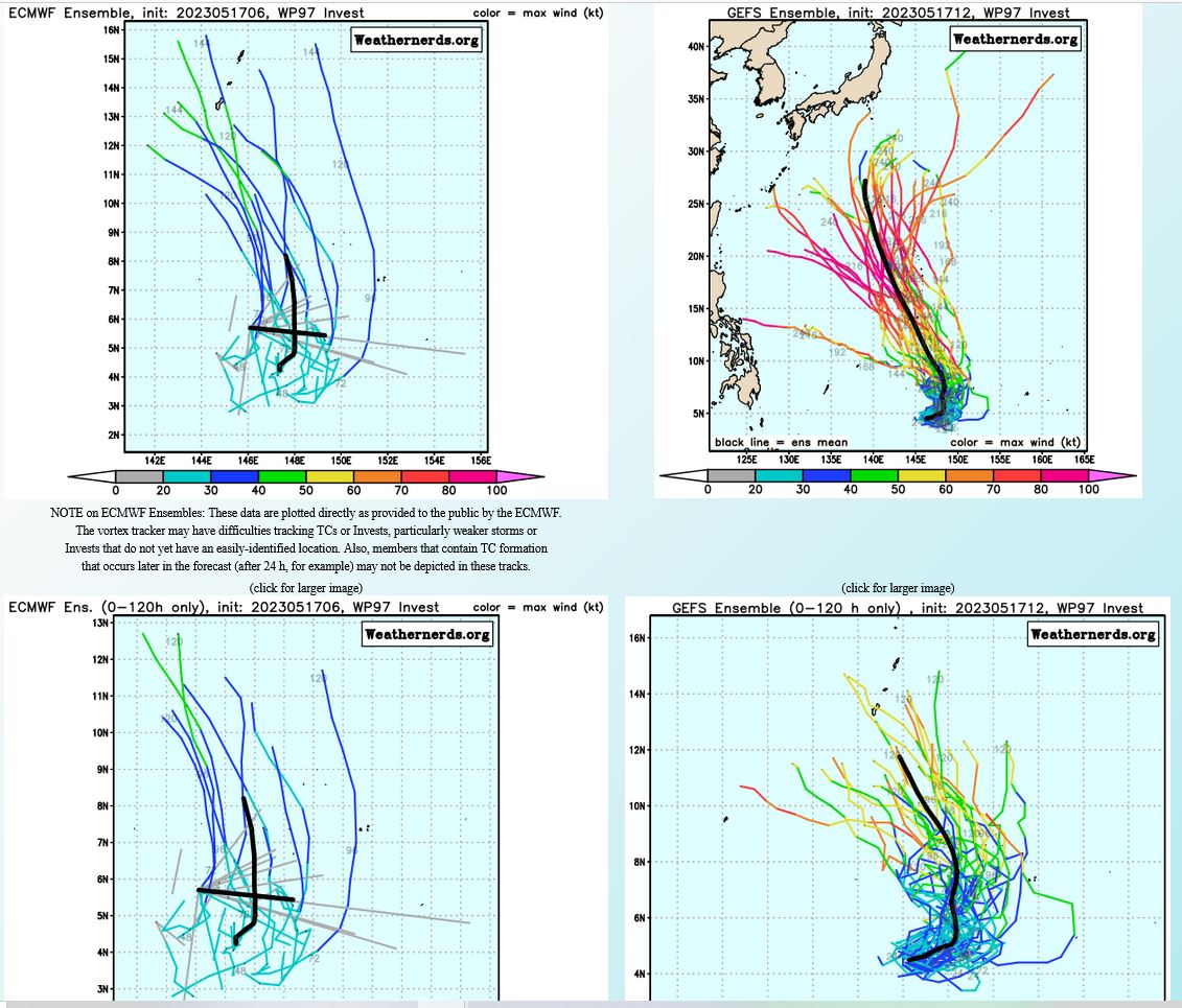
WESTERN NORTH PACIFIC: INVEST 97W. ESTIMATED LOCATION AND INTENSITY AT 1712UTC. ADVISORY(ABPW) ISSUED AT 1300Z.
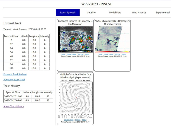
AN AREA OF CONVECTION (INVEST 97W) HAS PERSISTED NEAR 5.7N 146.1E, APPROXIMATELY 468 NM SOUTH OF GUAM. ENHANCED INFRARED SATELLITE IMAGERY AND A 170721Z GMI 89GHZ MICROWAVE PASS REVEALS FORMATIVE BANDING TO THE NORTH AND SOUTH OF AN ASSESSED LOW-LEVEL CIRCULATION (LLC) WITH THE MAJORITY OF CONVECTION OFFSET TO THE SOUTHWEST. RECENT SCATTEROMETRY DATA REVEALS A WEAK LLC WITH SOME 25KT WINDS, ASSOCIATED WITH UPPER-LEVEL WESTERLIES, TO THE SOUTH OF THE LLC. ENVIRONMENT ANALYSIS DEPICTS A MARGINALLY FAVORABLE ENVIRONMENT FOR FORMATION CHARACTERIZED BY LOW TO MODERATE (15-20 KTS) VERTICAL WIND SHEAR AND WARM (30-31C) SST, OFFSET BY WEAK OUTFLOW ALOFT. GLOBAL MODELS ARE IN GENERAL AGREEMENT THAT THE SYSTEM WILL TRACK NORTHWESTWARD, BUT DISAGREE ON INTENSITY, WITH GFS AND NAVGEM BEING THE MOST AGGRESSIVE OVER THE NEXT 24-48 HOURS. MAXIMUM SUSTAINED SURFACE WINDS ARE ESTIMATED AT 10 TO 15 KNOTS. MINIMUM SEA LEVEL PRESSURE IS ESTIMATED TO BE NEAR 1009 MB. THE POTENTIAL FOR THE DEVELOPMENT OF A SIGNIFICANT TROPICAL CYCLONE WITHIN THE NEXT 24 HOURS IS LOW.

GLOBAL MODELS ARE IN GENERAL AGREEMENT THAT THE SYSTEM WILL TRACK NORTHWESTWARD, BUT DISAGREE ON INTENSITY, WITH GFS AND NAVGEM BEING THE MOST AGGRESSIVE OVER THE NEXT 24-48 HOURS.
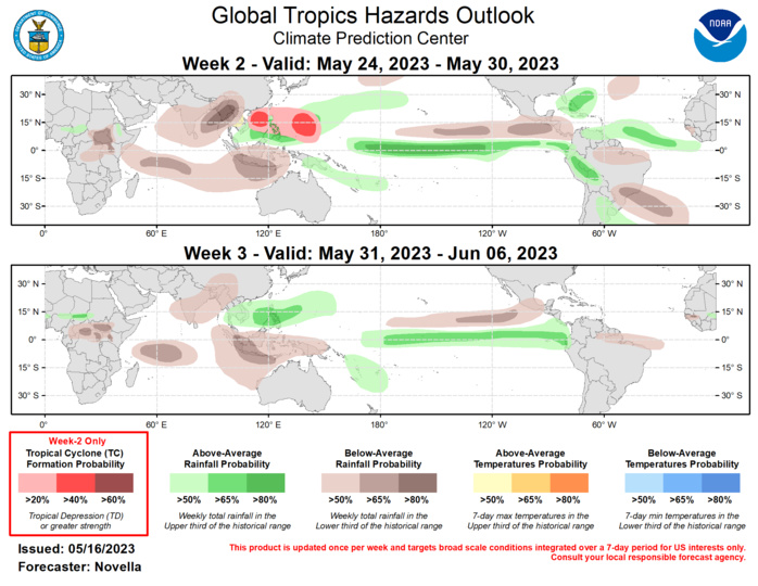
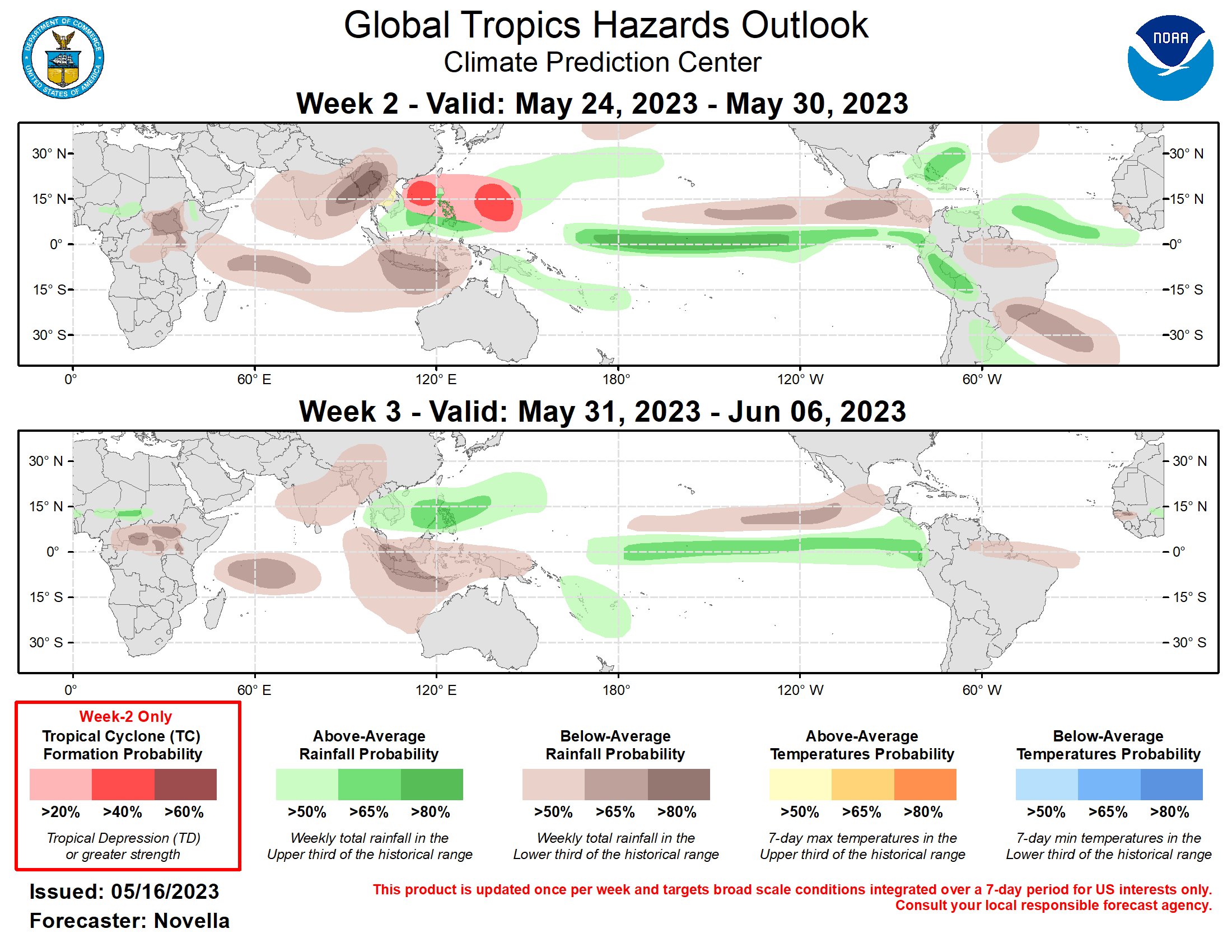
The Madden Julian Oscillation (MJO) remains active where the enhanced phase propagated eastward from the Maritime Continent into the western Pacific during the last week. Following a period of destructively interfering Kelvin and Rossby wave activity resulting in a weakened MJO signal, models favor the MJO to regain amplitude over the western Pacific during week-1. However, RMM forecasts begin to differ on the strength and evolution of the MJO thereafter. The GEFS favors a slower mean solution and struggles to propagate the MJO out of the western Pacific, whereas the CFS and ECMWF are more progressive, shifting the MJO into the Western Hemisphere during the outlook period, albeit at a lower amplitude. To reconcile these differences, the outlook relies more on the upper-level velocity potential forecasts which generally place the enhanced phase of the MJO over the Western Hemisphere towards the end of May, though there is less confidence in the forecast that the MJO will be as robust as it had been during its previous two cycles over this part of the tropics earlier this spring. Regardless of its eventual strength, the large-scale environment is expected to be favorable (unfavorable) for tropical cyclogenesis in the western Pacific (Indian Ocean) in the outlook. Tied to the MJO, zonal wind observations centered on the equator showed a strong uptick in anomalous lower-level westerlies near 90E earlier in May. This resulted in a cyclonic environment supportive for the formation of tropical cyclones (TCs) Mocha (5/11) and Fabien (5/14) to the north and south of the equator in the Indian Ocean during the past week. Despite being a relatively short-lived system, TC Mocha rapidly strengthened to a category 5 strength over the Bay of Bengal. Mocha slightly weakened and made landfall over Myanmar this past weekend, bringing many adverse impacts to portions of Myanmar. As Mocha dissipated over high terrain, TC Fabien formed over the south-central Indian Ocean and has steadily gained intensity in the past few days. The Joint Typhoon Warning Center (JTWC) expects Fabien to peak at category 3 intensity, and then gradually weaken while tracking westward over open waters this week. The anomalous low-level westerlies look to become firmly entrenched throughout the western Pacific, conducive for TC development in the basin. There is good agreement in the ensembles favoring an area of deepening low pressure over the Philippine Sea, with elevated chances in the probabilistic guidance near the Mariana Islands. Given the good support, high (60%) chances for TC development were considered, however there is some uncertainty in the timing of development, with some deterministic solutions signaling genesis here late in week-1. Therefore, 40% chances are posted near the Mariana Islands, as well as another 40% chance area posted for the South China Sea where there are indications in the ensembles depicting a secondary area of increased TC potential later in week-2. In the western Hemisphere, extended range lower-level wind guidance remains fairly bullish on the persistence of enhanced easterlies and high wind shear to the south of Mexico unfavorable for TC development across the eastern Pacific. In the Atlantic, there is decent continuity in the deterministic solutions favoring an area of deepening low pressure off the coast of the southeastern U.S. that could acquire tropical characteristics during week-2. However, ensembles and probabilistic guidance from the GEFS and ECMWF are less supportive of formation, and no corresponding TC areas are issued. The precipitation outlook for weeks 2 and 3 is based on a historical skill weighted blend of GEFS, CFS, ECMWF, and Canadian ensemble guidance, anticipated TC tracks and state of the MJO. Forecasts made over Africa are made in coordination with the International Desk at CPC. Below-normal precipitation is predominately favored throughout much of the Indian Ocean into early June associated with the suppressed phase of the MJO, where a reduction or delayed absence of monsoonal precipitation may lead to well above-normal temperatures over parts of India and southeastern Asia. Above-normal precipitation is expected to continue for the equatorial eastern Pacific and the coasts of Ecuador and Peru for both weeks, which is likely to worsen antec
