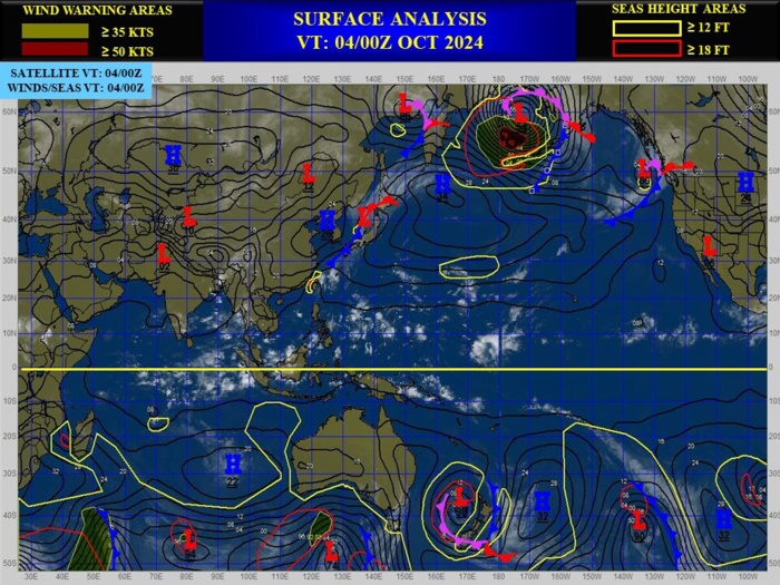
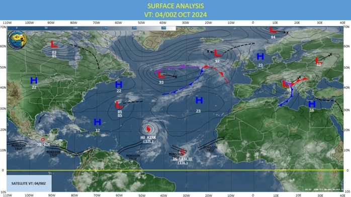
CLICK ON THE IMAGERIES BELOW TO GET THEM ENLARGED
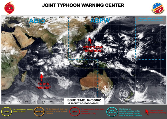
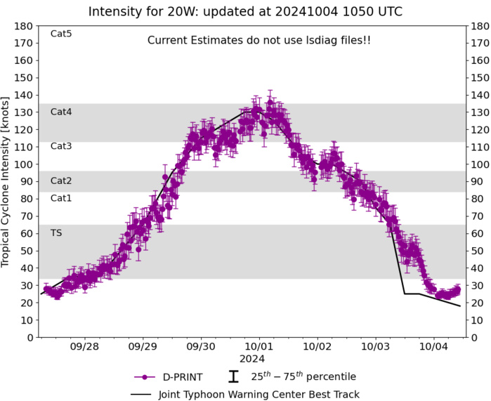
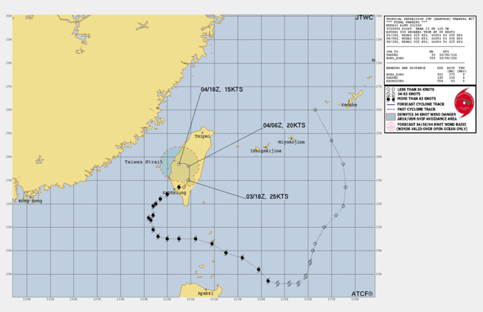
WESTERN NORTH PACIFIC: 20W(KRATHON). ESTIMATED PEAK INTENSITY WAS 130 KNOTS/SUPER TYPHOON CAT 4 US
2024092512 260N1263E 15
2024092518 247N1270E 15
2024092600 237N1275E 15
2024092606 227N1276E 15
2024092612 219N1275E 20
2024092618 215N1272E 20
2024092700 210N1267E 20
2024092706 203N1263E 25
2024092712 200N1262E 30
2024092718 195N1261E 35
2024092800 189N1259E 35
2024092806 186N1256E 35
2024092812 186N1252E 45
2024092818 186N1247E 55
2024092900 187N1243E 65
2024092906 192N1239E 80
2024092912 197N1232E 95
2024092918 199N1225E 105
2024093000 203N1219E 115
2024093006 205N1212E 120
2024093012 205N1205E 125
2024093018 205N1200E 130
2024100100 206N1196E 130
2024100106 209N1194E 125
2024100112 213N1193E 115
2024100118 214N1192E 105
2024100200 215N1194E 100
2024100206 219N1194E 100
2024100212 220N1195E 95
2024100218 222N1197E 90
2024100300 224N1200E 75
2024100306 227N1205E 65
2024100312 227N1207E 25
2024100318 230N1209E 25
WARNING 27/FINAL ISSUED AT 03/18UTC
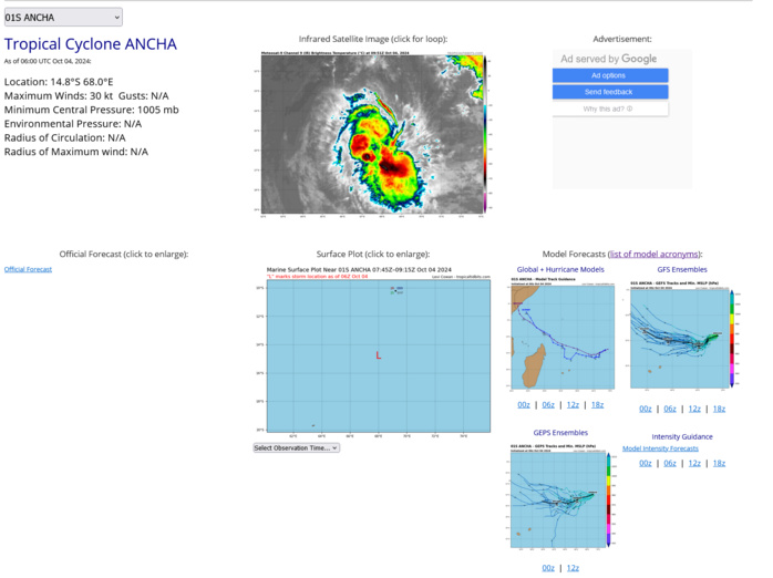
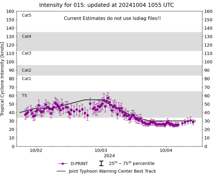
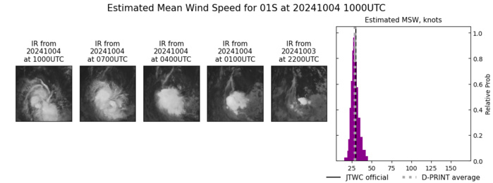
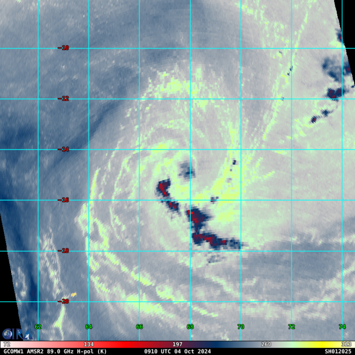
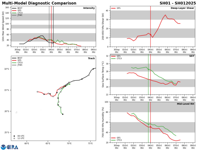
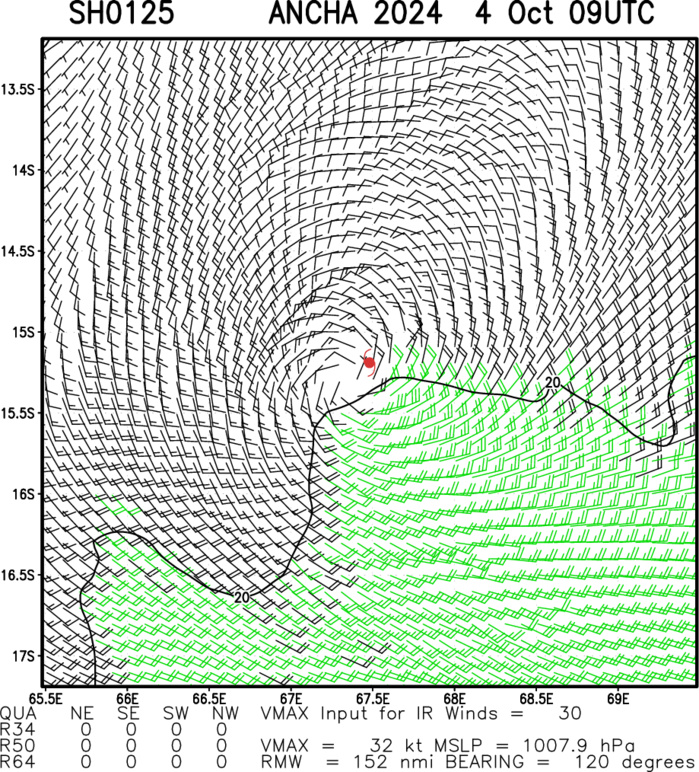
SOUTH INDIAN OCEAN: TC 01S(ANCHA). 04/06UTC ESTIMATED LOCATION AND INTENSITY.
ESTIMATED PEAK INTENSITY WAS 55 KNOTS
0124093006 84S 802E 25
0124093012 88S 788E 25
0124093018 94S 778E 25
0124100100 95S 773E 30
0124100106 96S 769E 35
0124100112 98S 765E 35
0124100118 99S 761E 40
0124100200 100S 757E 45
0124100206 104S 752E 45
0124100212 115S 746E 50
0124100218 119S 740E 55
0124100300 124S 730E 55
0124100306 127S 724E 45
0124100312 128S 711E 35
0124100318 132S 700E 30
0124100400 141S 695E 30
0124100406 148S 680E 30
85 – 92 GHz Brightness Temperature
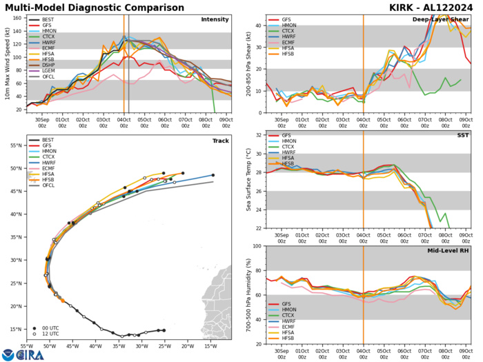
Model Diagnostic Plot
Multiplatform Satellite Surface Wind Analysis (Experimental)
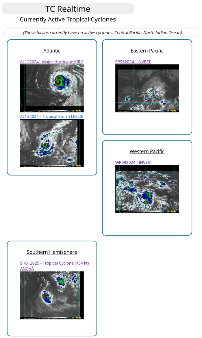
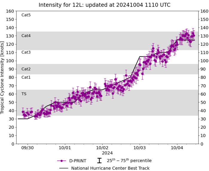
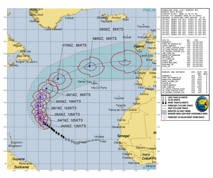
NORTH ATLANTIC: HU 12L(KIRK). ESTIMATED INTENSITY IS 125 KNOTS/CAT 4 US : + 20 KNOTS OVER 24 HOURS
1224100218 185N 435W 80
1224100300 190N 441W 105
1224100306 196N 447W 105
1224100312 201N 455W 110
1224100318 207N 463W 110
1224100400 211N 471W 125
1224100406 219N 478W 125
1224100300 190N 441W 105
1224100306 196N 447W 105
1224100312 201N 455W 110
1224100318 207N 463W 110
1224100400 211N 471W 125
1224100406 219N 478W 125
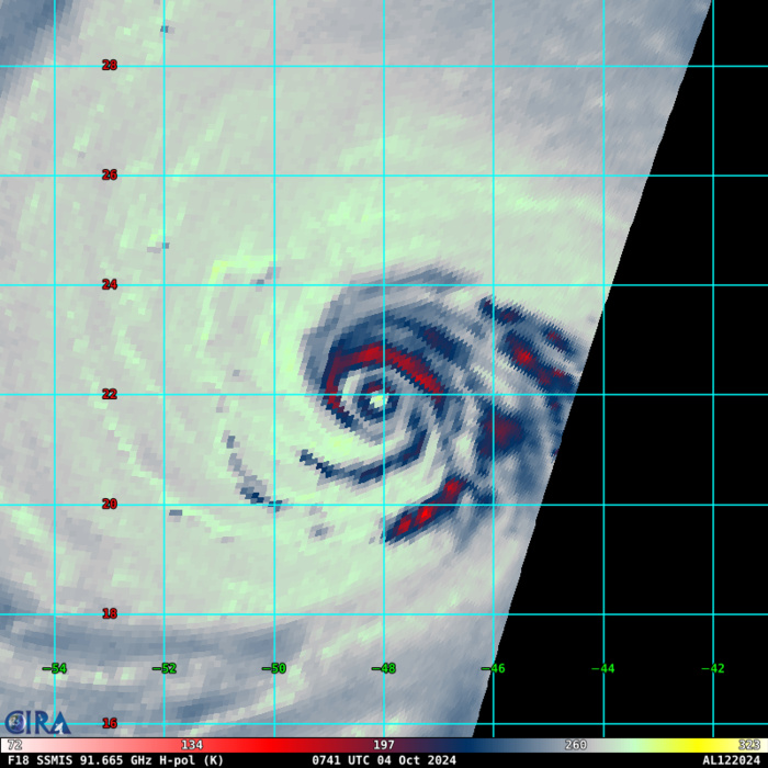
85 – 92 GHz Brightness Temperature : EYE-WALL REPLACEMENT CYCLE
WARNING 20 ISSUED AT 04/09UTC
Last Updated - 10/01/24 3 WEEK TROPICAL CYCLONE FORMATION PROBABILITY
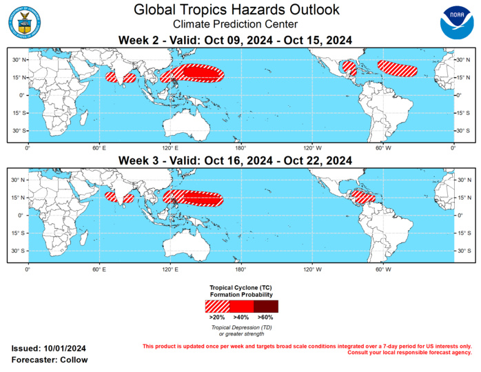
GTH Outlook Discussion Last Updated - 10/01/24 Valid - 10/09/24 - 10/22/24 The MJO is currently active and situated across the Western Hemisphere leading to an uptick in tropical cyclone (TC) activity across the North Atlantic. By week-2, dynamical models depict an eastward propagation of the MJO into the Indian Ocean and Maritime Continent and the suppressed phase moving over the Americas. This favors a reduction in TC development chances across the Atlantic and East Pacific, although a Convectively-Coupled Kelvin Wave (CCKW) may destructively interfere with the suppressed MJO phase leading to an enhancement of TC development chances over the Caribbean later in October. The highest chances for TC formation are forecast over the Western Pacific tied to the incoming MJO combined with an enhanced low frequency convective signal likely related to the emerging La Nina. While formation occurred in the prior week, category-4 Hurricane Helene made landfall on the Florida Big Bend region on 9/26, with extensive damage and catastrophic flooding extending through the Southeast and Carolinas. Hurricane Issac formed on 9/26 over the North Atlantic and Tropical Storm Joyce (9/27) was a weak, short-lived system across the Main Development Region (MDR). Tropical Storm Kirk developed on 9/29 and is forecast to become a powerful hurricane over the open waters of the Atlantic. The easterly wave behind Kirk is strongly favored to develop into a TC during week-1. The National Hurricane Center (NHC) continues to monitor a tropical disturbance over the northwestern Caribbean that may develop into a tropical cyclone during week-1. However, recent model runs have slowed down potential development, carrying elevated chances into the week-2 period. Of particular concern is this new system could bring heavy rainfall to parts of the Gulf Coast and some of the same regions impacted by Helene. Given some emerging timing uncertainty, a 20-40% chance of TC development is indicated during week-2 over this area. While TC development in the MDR is favored to slow down due to the October climatology along with a more suppressed convective environment aloft, it is plausible to get an additional easterly wave to spin up into a TC given how active it has been recently, favoring 20-40% chances for TC development in week-2 over the MDR. By week-3, TC development is most favored in the Caribbean where a 20-40% chance is highlighted, consistent with climatology and the aforementioned CCKW. Across the Eastern Pacific, Hurricane John regenerated off the southern coast of Mexico on 9/25 causing prolonged impacts across the region. Two additional areas are being monitored for development by NHC with high chances during week-1. By week-2, the suppressed phase of the MJO favors a reduction in TC activity. The Western Pacific has been active as well with the formations of Cimaron (9/25), Jebi (9/27), and Krathon (9/28). Cimaron was a weak tropical storm that meandered to the south of Japan. Jebi briefly attained typhoon status before weakening as it skirted Japan. Krathon is the most significant of these systems to have formed, becoming a super typhoon and resulting in flooding across parts of the Philippines and is now forecast to move toward Taiwan. The large scale environment is likely to remain favorable for TC development through much of October, due to the upstream MJO combined with the low frequency enhanced convective footprint providing an additional boost. As a result, 40-60% chances of TC development are forecast for weeks 2 and 3 across the Western Pacific east of the Philippines, with a 20-40% chance extending into the South China Sea. As the MJO moves into the Indian Ocean by week-2, TC development is possible in the Bay of Bengal and Arabian Sea (20-40% chance for both weeks 2 and 3). This is supported by increased filtered TC track densities in the GEFS and ECENS models. An early start to the South Indian Ocean season is also possible, with Invest 91S being monitored for possible development near 10 deg S, 75 deg W. Any development is most likely to occur during week-1, with decreasing chances by week-2 precluding a related TC formation area in the forecast.
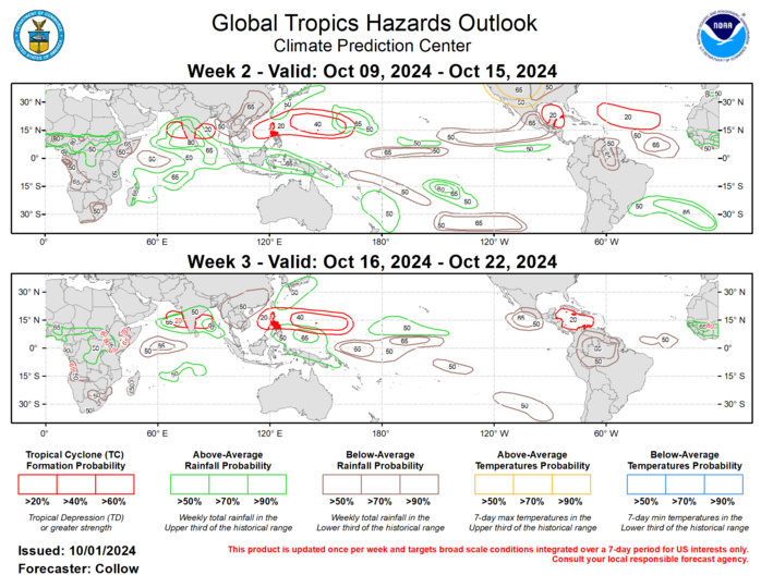
Forecasts for above- and below-normal precipitation are based on composites of MJO activity in the Indian Ocean and Maritime Continent combined with the low frequency enhanced convection over the region. The suppressed phase of the MJO favors increased chances for below-normal precipitation across the Eastern Pacific and extending into parts of the Americas. Above-normal temperatures are forecast across the western half of the contiguous U.S. during week-2. For hazardous weather concerns in your area during the next two weeks, please refer to your local NWS office, the Medium Range Hazards Forecast from the Weather Prediction Center (WPC), and the CPC Week-2 Hazards Outlook. Forecasts issued over Africa are made in coordination with the International Desk at CPC.
