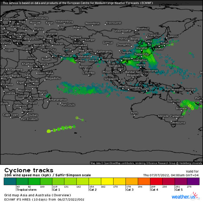
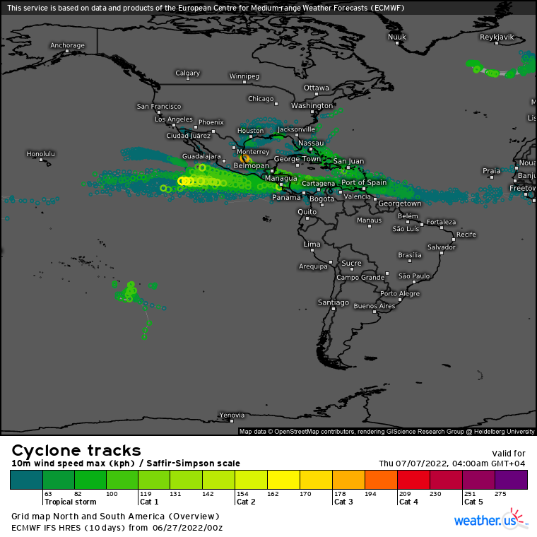
CLICK ON THE IMAGERIES BELOW TO GET THEM ENLARGED.
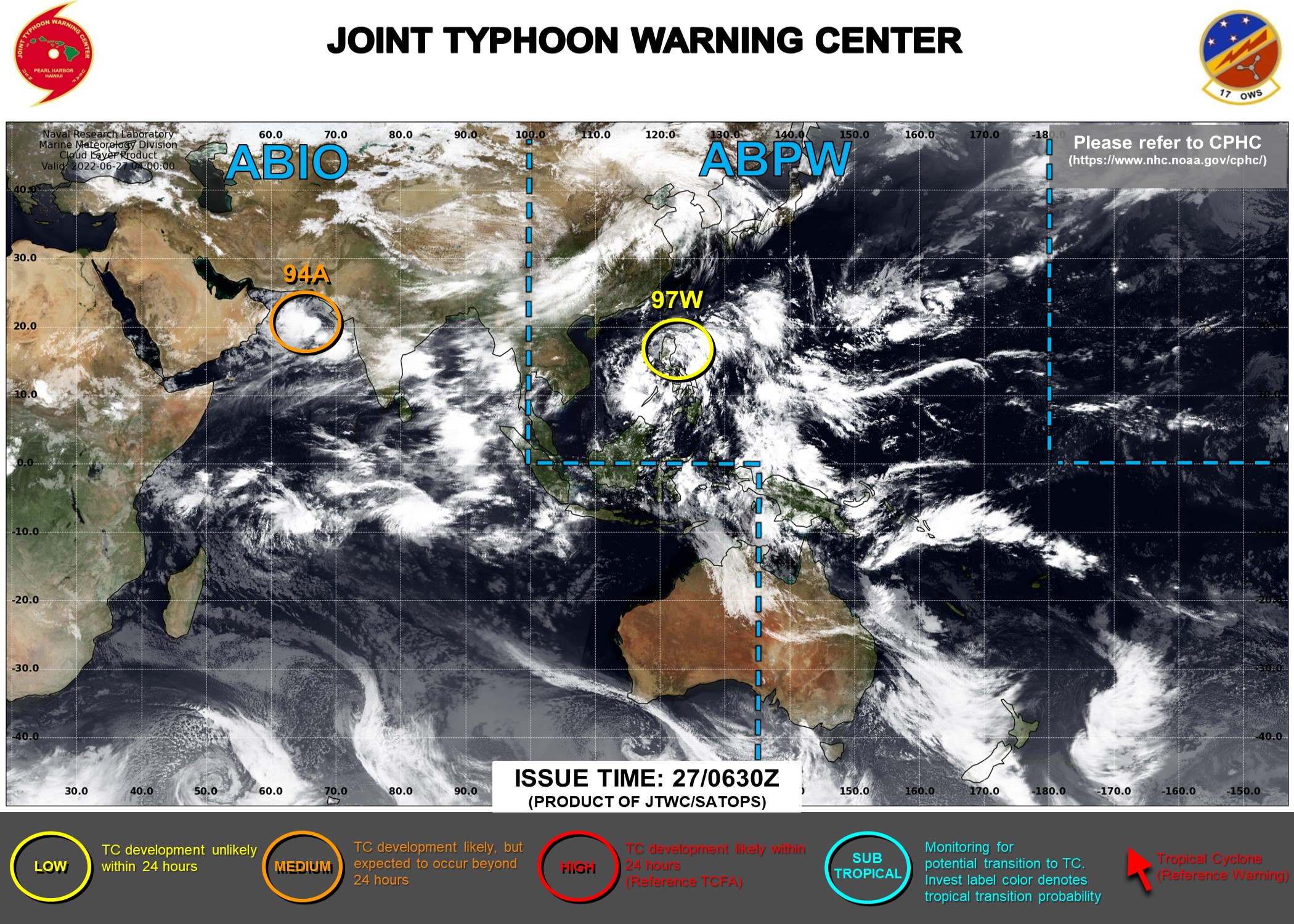
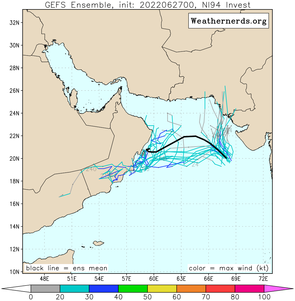
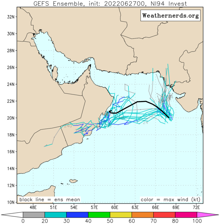
NORTH INDIAN OCEAN: ARABIAN SEA: INVEST 94A. UP-GRADED TO MEDIUM. ADVISORY(ABIO) ISSUED AT 27/0630UTC.
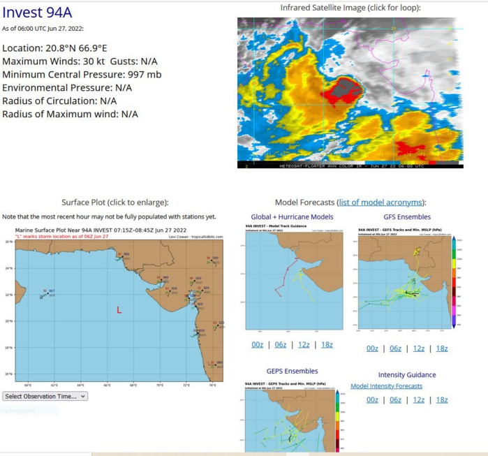
AN AREA OF CONVECTION (INVEST 94A) HAS PERSISTED NEAR 20.4N 67.9E, APPROXIMATELY 1020 KM EAST-SOUTHEAST OF MUSCAT, OMAN. ANIMATED MULTISPECTRAL SATELLITE IMAGERY (MSI) SHOWS THAT AN UNSEASONAL NORTH ARABIAN SEA TROPICAL CIRCULATION HAS DEVELOPED TO THE SOUTHWEST OF THE GUJARAT PENINSULA. MSI INDICATES A FAIRLY CONSOLIDATED LOW LEVEL CIRCULATION (LLC) WITH FLARING DEEP CONVECTION OVER THE ASSESSED CENTER EXTENDING ALONG THE NORTHWEST AND SOUTHEAST PERIPHERY OF THE SYSTEM. RECENT SCATTEROMETER DATA FROM 260323Z SHOWS A SMALL, WELL-DEFINED LLCC SOUTHWEST OF THE GUJARAT PENINSULA, WITH 25-30 KNOT WINDS WRAPPING INTO THE LLCC FROM THE NORTHWEST SECTOR. HIGHER WINDS UP TO 40 KNOTS ARE PRESENT FURTHER WEST IN THE GRADIENT FLOW BUT ARE NOT ASSOCIATED WITH THE CIRCULATION CENTER. 94A HAS BLOSSOMED AFTER TRACKING AWAY FROM UNDER THE IMMENSE (25 TO 40 KNOT) VWS INDUCED BY THE TROPICAL EASTERLY JET (TEJ) INTO AN AREA OF UPPER-LEVEL DIVERGENCE, AND THIS TRANSFORMATION HAS THE SYSTEM IN A BUBBLE OF LOW (10 TO 15 KNOT) VWS WITH NICE EQUATORWARD OUTFLOW. SSTS REMAIN WARM, PROVIDING AMPLE ENERGY FOR CONVECTIVE DEVELOPMENT. THE SYSTEM IS EXPECTED TO MOVE WEST-NORTHWESTWARD OVER THE NEXT 24 TO 48 HOURS, AND WHILE THE ENVIRONMENT IS GENERALLY FAVORABLE AT PRESENT, AS THE SYSTEM MOVES WEST IT WILL ENCOUNTER STEADILY INCREASING VWS, AND IS FORECAST TO STEADILY WEAKEN OVER THE NEXT 24 HOURS. GLOBAL DETERMINISTIC AND ENSEMBLE MODELS CONCUR, AND ALL SUPPORT THE FACT THAT THE SYSTEM HAS LIKELY ALREADY PEAKED AND MAY MAINTAIN ITS CURRENT INTENSITY FOR A SHORT PERIOD BEFORE STEADILY WEAKENING AS IT MOVES TOWARDS OMAN. MAXIMUM SUSTAINED SURFACE WINDS ARE ESTIMATED AT 27 TO 33 KNOTS. MINIMUM SEA LEVEL PRESSURE IS ESTIMATED TO BE NEAR 997 MB. THE POTENTIAL FOR THE DEVELOPMENT OF A SIGNIFICANT TROPICAL CYCLONE WITHIN THE NEXT 24 HOURS IS UPGRADED TO MEDIUM.
IO, 94, 2022062612,201N, 700E, 25
IO, 94, 2022062618,202N, 689E, 30
IO, 94, 2022062700,204N, 679E, 30
IO, 94, 2022062706,208N, 669E, 30
IO, 94, 2022062618,202N, 689E, 30
IO, 94, 2022062700,204N, 679E, 30
IO, 94, 2022062706,208N, 669E, 30
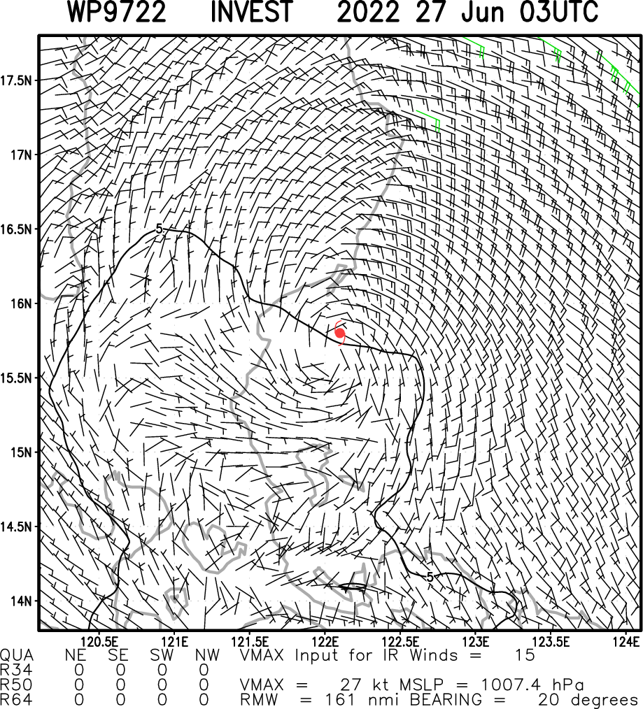
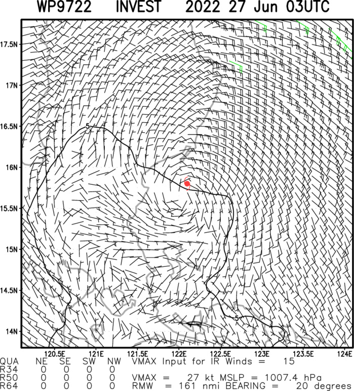
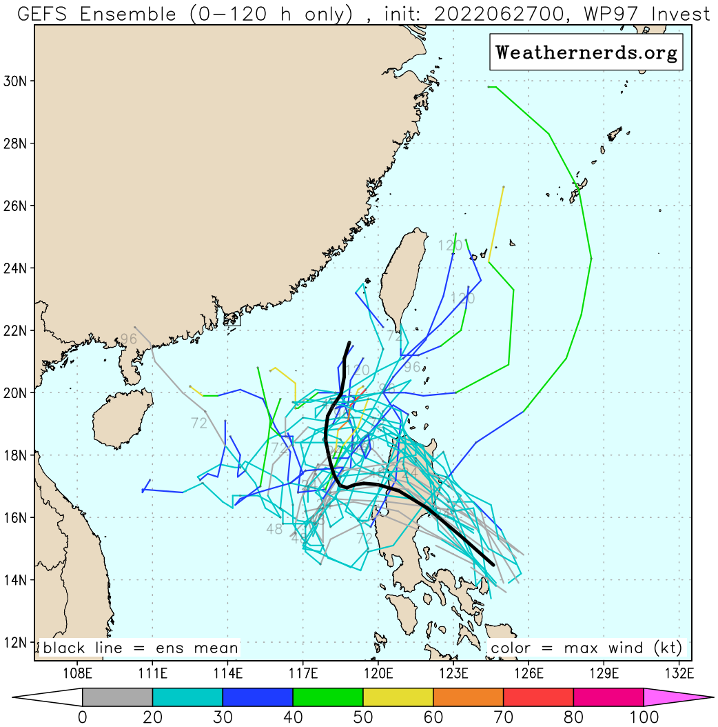
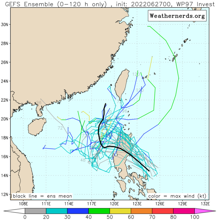
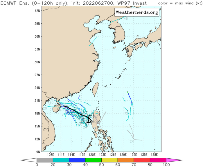
WESTERN NORTH PACIFIC: PHILIPPINE SEA/SOUTH CHINA SEA: INVEST 97W. ADVISORY(ABPW) ISSUED AT 27/06UTC.
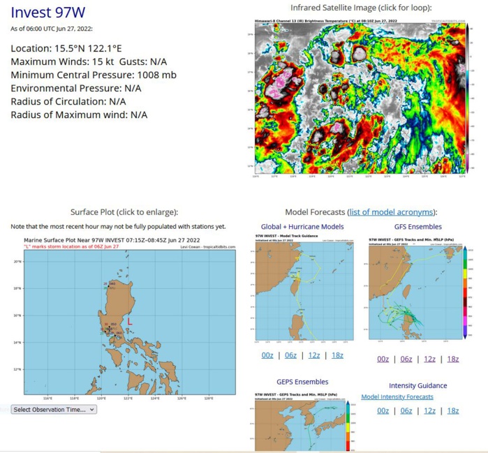
ANIMATED ENHANCED MULTISPECTRAL SATELLITE IMAGERY DEPICTS A BROAD EASTERLY WAVE WITH WIDESPREAD DISORGANIZED CONVECTION APPROACHING LUZON. A 270154Z ASCAT METOP-B PARTIAL PASS SHOWS STRAIGHT LINE 10- 15KNOT WINDS WITH FEW EMBEDDED 20 KNOT WINDS ALONG NORTHERN PORTIONS OF 97W. THE SYSTEM IS ANALYZED AS AN OPEN WAVE AT THE SUFACE, THE MIDDLE AND UPPER ATMOSPHERE SHOW HINDRANCE FROM SHEAR. THE SYSTEM IS EXPECTED TO TRACK OVER LUZON AS IF IT WAS A SPEED BUMP AND EMERGERGE ON THE WESTERN SIDE IN THE SOUTH CHINA SEA WITH GAINED VORTICITY AND LESS SHEAR, THUS IT IS ANTICIPATED TO RAPIDLY CONSOLIDATE. ENVIRONMENTAL ANALYSIS INDICATES CONDITIONS FAVORABLE FOR DEVELOPMENT OVER THE NEXT 48-72 HOURS DESPITE MODERATE TO HIGH (20 TO 30 KNOT) VWS. SEA SURFACE TEMPERATURES ARE A ZESTY 30-31C, AND EQUATORWARD OUTFLOW IS RESPECTABLE. GLOBAL DETERMINISTIC AND ENSEMBLE MODELS CONCUR, AND ALL SUPPORT DEVELOPMENT OF THIS SYSTEM AS IT PASSES OVER LUZON AND ENTERS INTO THE SOUTH CHINA SEA.
WP, 97, 2022062518,137N, 1304E, 15
WP, 97, 2022062600,138N, 1289E, 15
WP, 97, 2022062606,141N, 1271E, 15
WP, 97, 2022062612,149N, 1252E, 15
WP, 97, 2022062618,151N, 1243E, 15
WP, 97, 2022062700,153N, 1232E, 15
WP, 97, 2022062706,155N, 1221E, 15
WP, 97, 2022062600,138N, 1289E, 15
WP, 97, 2022062606,141N, 1271E, 15
WP, 97, 2022062612,149N, 1252E, 15
WP, 97, 2022062618,151N, 1243E, 15
WP, 97, 2022062700,153N, 1232E, 15
WP, 97, 2022062706,155N, 1221E, 15
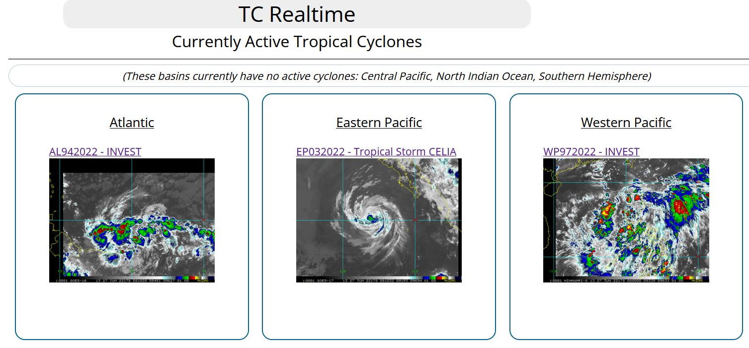
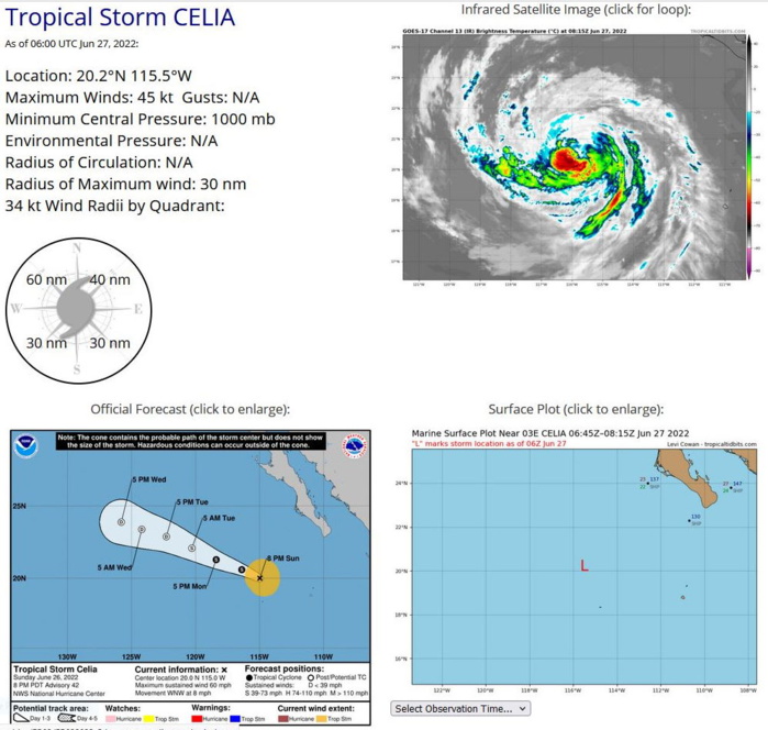
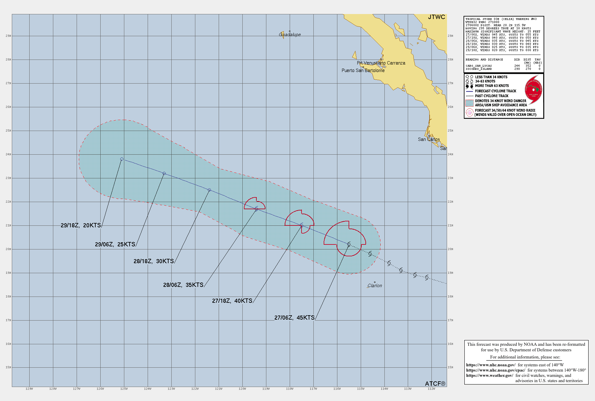
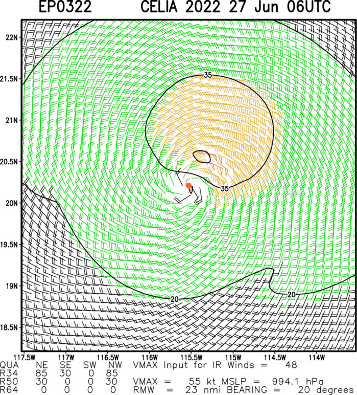
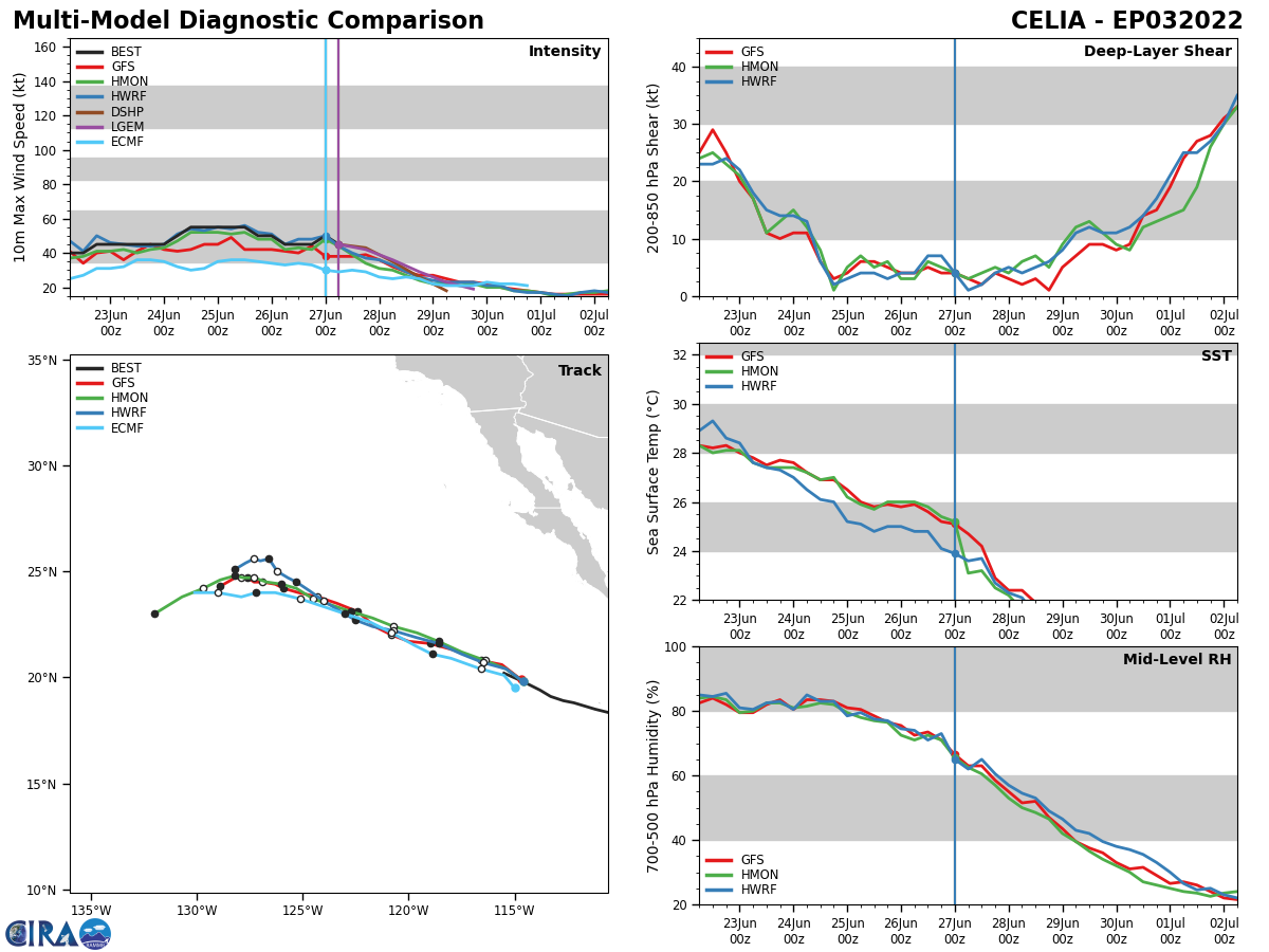
EASTERN NORTH PACIFIC: TS 03E(CELIA). WARNING 43 ISSUED AT 27/10UTC. NHC COMMENTS.
EP, 03, 2022062606,189N, 1127W, 45
EP, 03, 2022062612,191N, 1133W, 45
EP, 03, 2022062618,194N, 1138W, 45
EP, 03, 2022062700,198N, 1146W, 50
EP, 03, 2022062706,202N, 1155W, 45
EP, 03, 2022062612,191N, 1133W, 45
EP, 03, 2022062618,194N, 1138W, 45
EP, 03, 2022062700,198N, 1146W, 50
EP, 03, 2022062706,202N, 1155W, 45
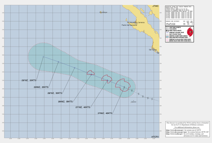
387 WTPZ43 KNHC 270853 TCDEP3 Tropical Storm Celia Discussion Number 43 NWS National Hurricane Center Miami FL EP032022 200 AM PDT Mon Jun 27 2022 Celia appears to be deteriorating based on geostationary satellite imagery. The storm continues to have small bursts of convection on the western and southern portion of the circulation, however any significant convection in the northern semicircle has disappeared. A scatterometer pass over the inner core at 0430 UTC showed only a small area of tropical-storm-force winds, mostly in the northwest quadrant of the storm, with peak winds of only 35-40 kt. Therefore, the initial intensity has been lowered to 45 kt to account for potential undersampling. Dynamic and statistical model guidance all forecast Celia to gradually weaken as the system moves over cooler waters and into a dry, stable environment. The official forecast predicts the system will become a post-tropical remnant low by 36 h, when it will likely be devoid of deep convection, and dissipated within a few days. The storm is moving west-northwest at 10 kt. A mid-level ridge extending over the eastern North Pacific is expected to continue steering Celia at this approximate speed and direction until the system dissipates. The NHC forecast is quite similar to the previous forecast advisory and remains within the tightly clustered model guidance. Despite not becoming a hurricane, Celia is now tied for the 5th longest-lasting June tropical cyclone in the eastern Pacific. FORECAST POSITIONS AND MAX WINDS INIT 27/0900Z 20.4N 116.0W 45 KT 50 MPH 12H 27/1800Z 21.0N 117.5W 40 KT 45 MPH 24H 28/0600Z 21.7N 119.4W 35 KT 40 MPH 36H 28/1800Z 22.5N 121.4W 30 KT 35 MPH...POST-TROP/REMNT LOW 48H 29/0600Z 23.2N 123.3W 25 KT 30 MPH...POST-TROP/REMNT LOW 60H 29/1800Z 23.8N 125.1W 20 KT 25 MPH...POST-TROP/REMNT LOW 72H 30/0600Z...DISSIPATED $$ Forecaster Bucci/Blake
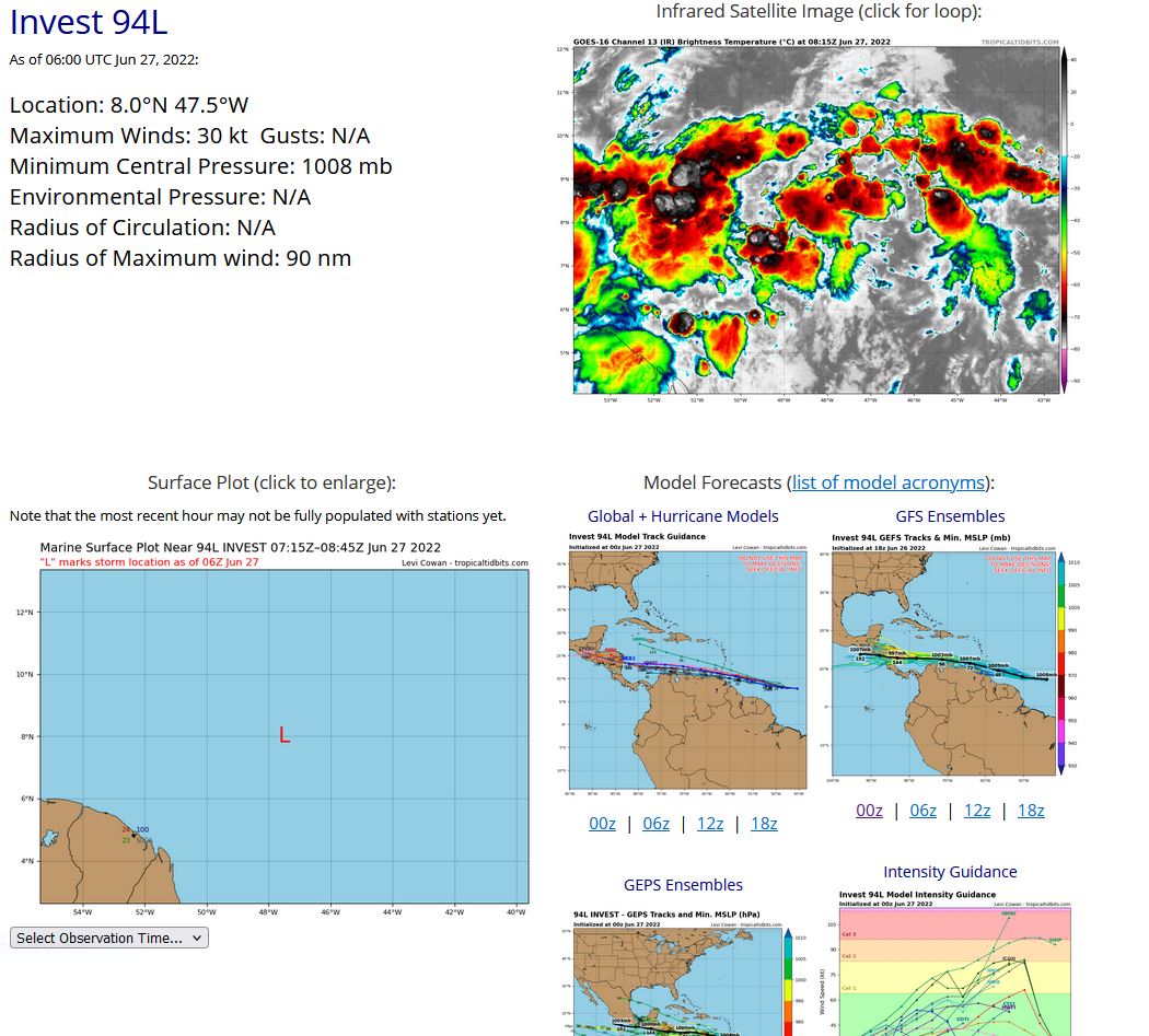
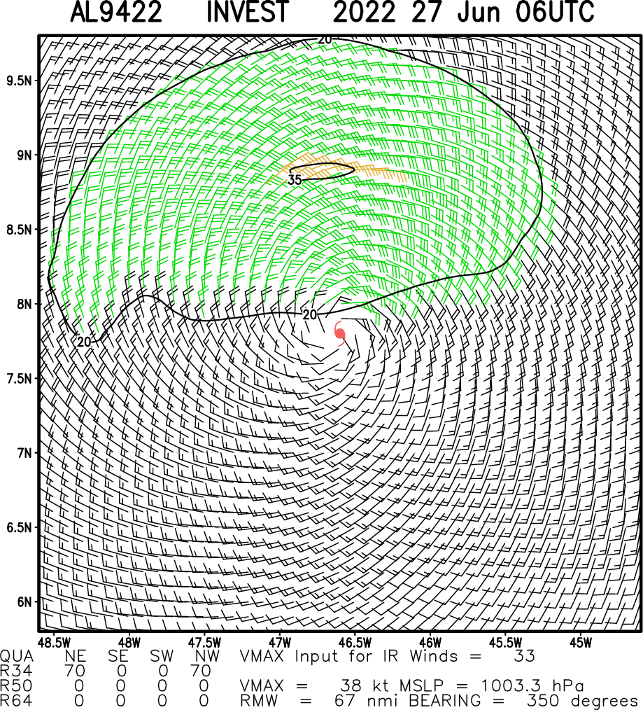
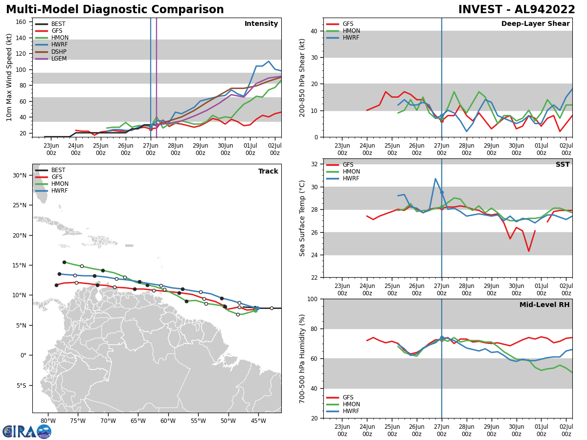
NORTH ATLANTIC/CARRIBEAN SEA: INVEST 94L. COMMENTS FROM NHC.

ZCZC MIATWOAT ALL TTAA00 KNHC DDHHMM Tropical Weather Outlook NWS National Hurricane Center Miami FL 200 AM EDT Mon Jun 27 2022 For the North Atlantic...Caribbean Sea and the Gulf of Mexico: 1. Central Tropical Atlantic: Shower and thunderstorm activity has increased in association with a tropical wave located about 950 miles east-southeast of the southern Windward Islands. Environmental conditions appear conducive for further development, and a tropical depression is likely to form during the next couple of days before the system reaches the Windward Islands Tuesday night or possibly while moving westward across the southern Caribbean Sea Wednesday through Friday. A NOAA Hurricane Hunter aircraft is scheduled to investigate the system this afternoon. Interests in the Windward Islands and along the northeastern coast of Venezuela should monitor the progress of this system, and tropical storm watches or warnings could be required for portions of these areas later today. Regardless of development, locally heavy rainfall is possible over the Windward Islands and the northeastern coast of Venezuela Tuesday night and Wednesday. * Formation chance through 48 hours...high...70 percent. * Formation chance through 5 days...high...90 percent.
AL, 94, 2022062506,81N, 342W, 20
AL, 94, 2022062512,82N, 353W, 20
AL, 94, 2022062518,81N, 369W, 20
AL, 94, 2022062600,80N, 383W, 20
AL, 94, 2022062606,78N, 405W, 25
AL, 94, 2022062612,78N, 428W, 25
AL, 94, 2022062618,78N, 445W, 30
AL, 94, 2022062700,79N, 456W, 30
AL, 94, 2022062706,80N, 475W, 30
AL, 94, 2022062512,82N, 353W, 20
AL, 94, 2022062518,81N, 369W, 20
AL, 94, 2022062600,80N, 383W, 20
AL, 94, 2022062606,78N, 405W, 25
AL, 94, 2022062612,78N, 428W, 25
AL, 94, 2022062618,78N, 445W, 30
AL, 94, 2022062700,79N, 456W, 30
AL, 94, 2022062706,80N, 475W, 30
