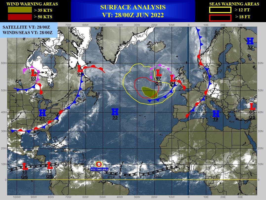
CLICK ON THE IMAGERIES BELOW TO GET THEM ENLARGED.
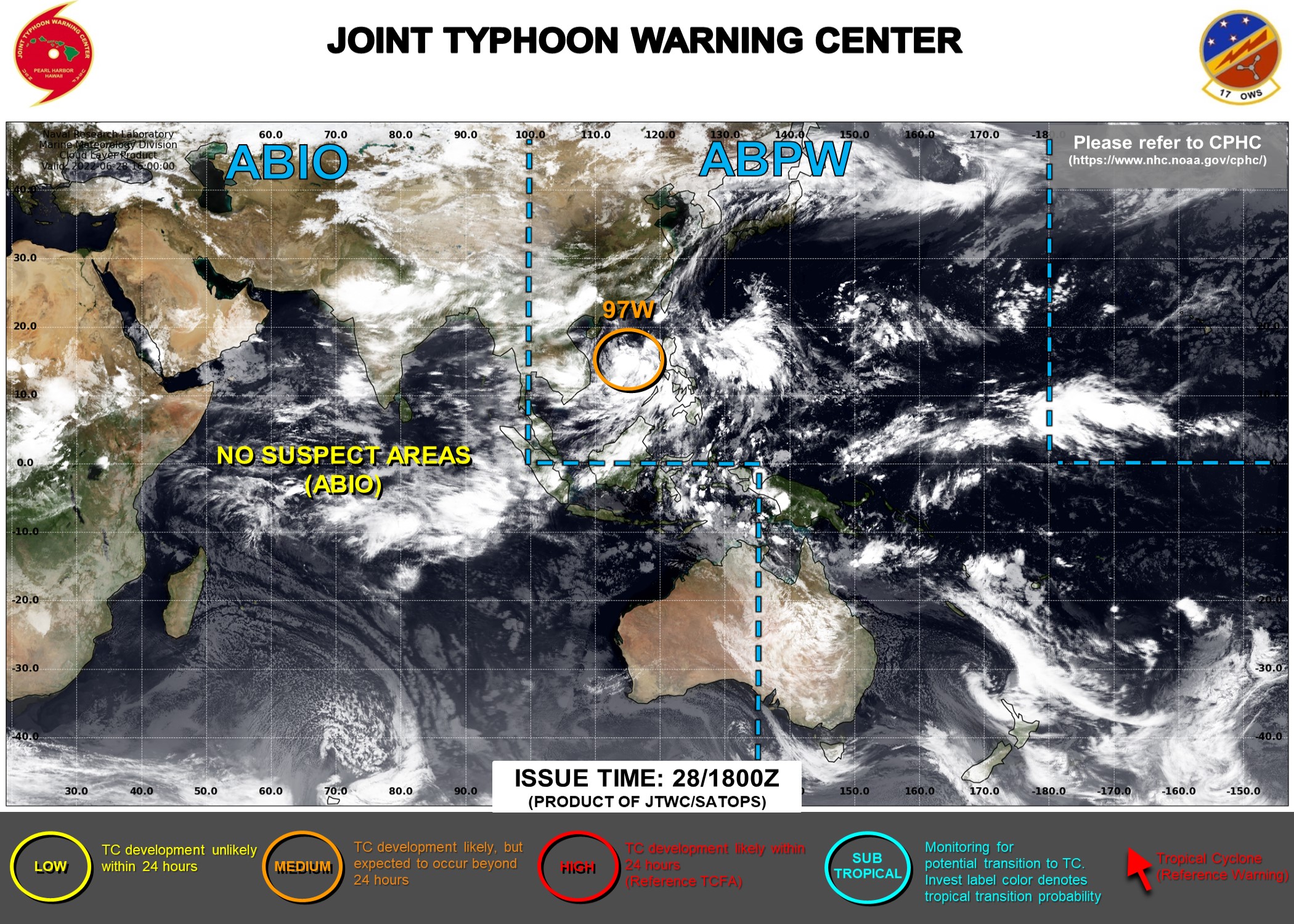
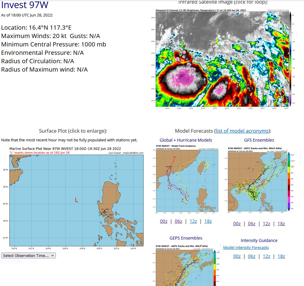
WESTERN NORTH PACIFIC: SOUTH CHINA SEA: INVEST 97W. ADVISORY(ABPW) ISSUED AT 28/1330UTC.
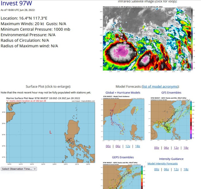
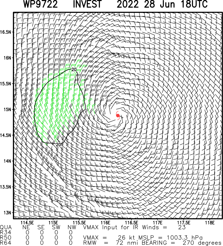
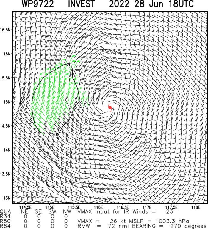
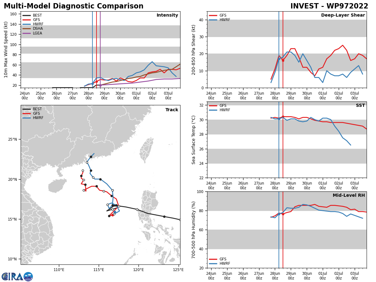
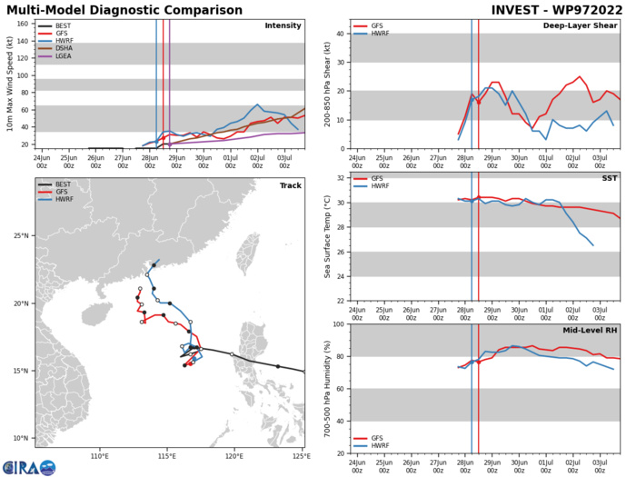
THE AREA OF CONVECTION (INVEST 97W) PREVIOUSLY LOCATED NEAR 16.7N 117.0E IS NOW LOCATED NEAR 15.5N 116.5E, APPROXIMATELY 490 KM WEST-NORTHWEST OF MANILA. ENHANCED INFRARED SATELLITE IMAGERY DEPICTS DISORGANIZED CONVECTION FLARING NEAR THE ASSESSED POSITION, OBSCURING IT FROM CLEAR VIEW AND EXTENDING ACROSS THE WESTERN AND SOUTHERN PERIPHERY OF THE RATHER ILL-DEFINED LOW LEVEL CIRCULATION, CHARACTERISTIC OF A MONSOON DEPRESSION. A LACK OF RECENT MICROWAVE OR SCATTEROMETER DATA MAKES EXACT POSITIONING DIFFICULT, BUT A TIMELY 281200Z SHIP OBSERVATION REPORTED 20KT WINDS AND 1000 MB PRESSURE JUST 85KM NORTHWEST OF THE 12Z BEST TRACK POSITION. THE SAME SHIP, TRAVELING SOUTH TO NORTH, REPORTED SIMILAR CONDITIONS AT 280900Z AS IT PASSED WITHIN 65KM OF THE CENTER, LENDING GOOD CONFIDENCE TO BOTH THE INITIAL POSITION AND INTENSITY. ENVIRONMENTAL ANALYSIS REVEALS FAVORABLE CONDITIONS FOR DEVELOPMENT DEFINED BY; STRONG EQUATORWARD OUTFLOW ALOFT, LOW TO MODERATE (15-20KT) VERTICAL WIND SHEAR, AND VERY WARM (30-31C) SEA SURFACE TEMPERATURES. THE SYSTEM IS EXPECTED TO DRIFT AIMLESSLY OVER THE NEXT 12 TO 24 HOURS, BEFORE MODELS SUGGEST IT STARTS TO MOVE TOWARDS THE NORTHWEST. WHILE GLOBAL MODELS INCLUDING ECMWF, NAVGEM AND GFS ARE IN GOOD AGREEMENT THAT INVEST 97W WILL ULTIMATELY DEVELOP, THE LARGE SCALE OF THE SYSTEM, THE LARGE RADIUS OF MAXIMUM WINDS AND DISORGANIZED CONVECTIVE SUGGEST A SLOW PACE OF CONSOLIDATION AND INTENSIFICATION, LIKELY REACHING TROPICAL DEPRESSION STRENGTH IN ABOUT 36-48 HOURS. MAXIMUM SUSTAINED SURFACE WINDS ARE ESTIMATED AT 18 TO 22 KNOTS. MINIMUM SEA LEVEL PRESSURE IS ESTIMATED TO BE NEAR 1000 MB. THE POTENTIAL FOR THE DEVELOPMENT OF A SIGNIFICANT TROPICAL CYCLONE WITHIN THE NEXT 24 HOURS IS UPGRADED TO MEDIUM.
WP, 97, 2022062706,157N, 1211E, 10, 1010
WP, 97, 2022062712,162N, 1198E, 15, 1010
WP, 97, 2022062718,165N, 1184E, 15, 1005
WP, 97, 2022062800,167N, 1170E, 15, 1005
WP, 97, 2022062806,160N, 1160E, 15, 1003
WP, 97, 2022062812,162N, 1167E, 20, 1000
WP, 97, 2022062818,164N, 1173E, 20, 1000
WP, 97, 2022062712,162N, 1198E, 15, 1010
WP, 97, 2022062718,165N, 1184E, 15, 1005
WP, 97, 2022062800,167N, 1170E, 15, 1005
WP, 97, 2022062806,160N, 1160E, 15, 1003
WP, 97, 2022062812,162N, 1167E, 20, 1000
WP, 97, 2022062818,164N, 1173E, 20, 1000
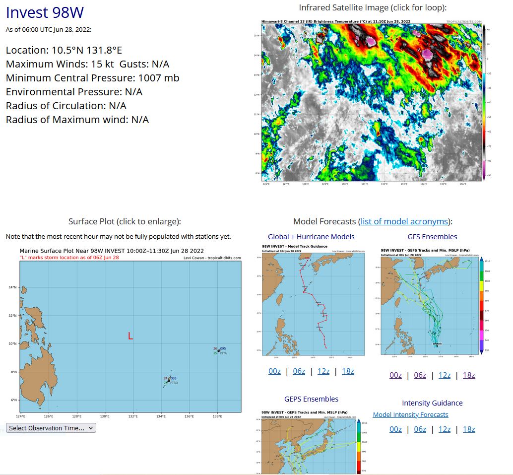
WESTERN NORTH PACIFIC: PHILIPPINE SEA: INVEST 98W.
WP, 98, 2022062706,59N, 1345E, 15, 1010
WP, 98, 2022062712,60N, 1340E, 15, 1010
WP, 98, 2022062718,74N, 1334E, 15, 1007
WP, 98, 2022062800,89N, 1325E, 15, 1007
WP, 98, 2022062806,105N,1318E, 15, 1007
WP, 98, 2022062712,60N, 1340E, 15, 1010
WP, 98, 2022062718,74N, 1334E, 15, 1007
WP, 98, 2022062800,89N, 1325E, 15, 1007
WP, 98, 2022062806,105N,1318E, 15, 1007
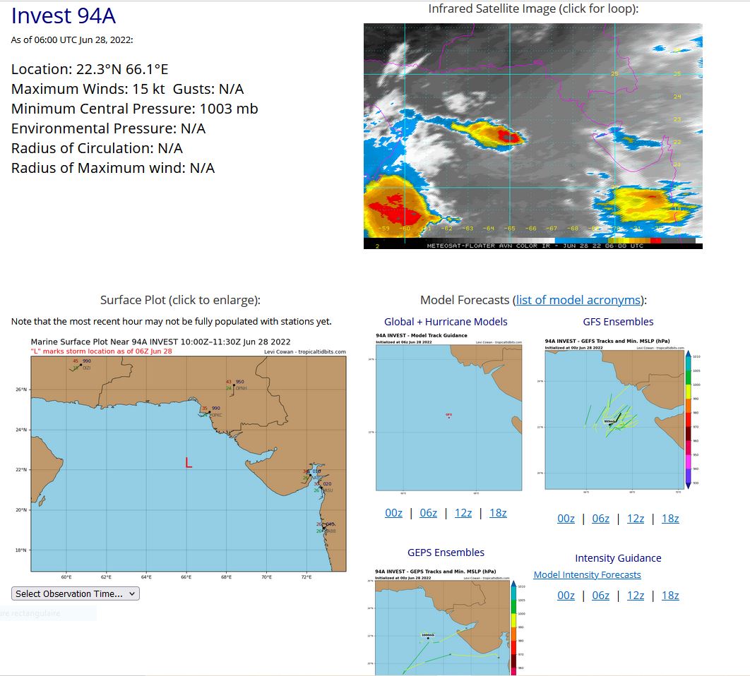
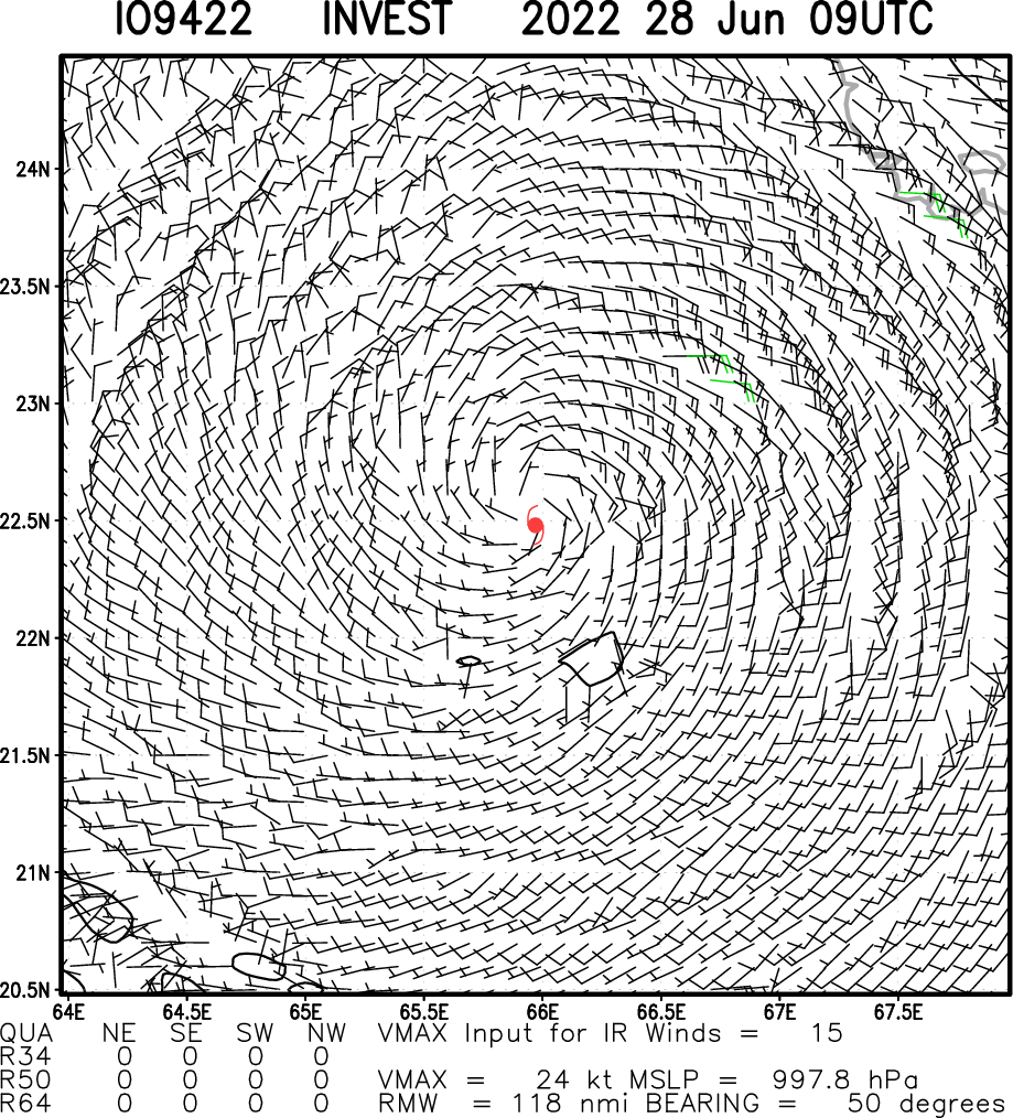
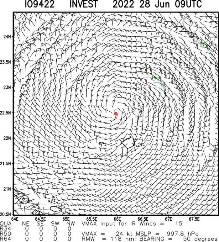
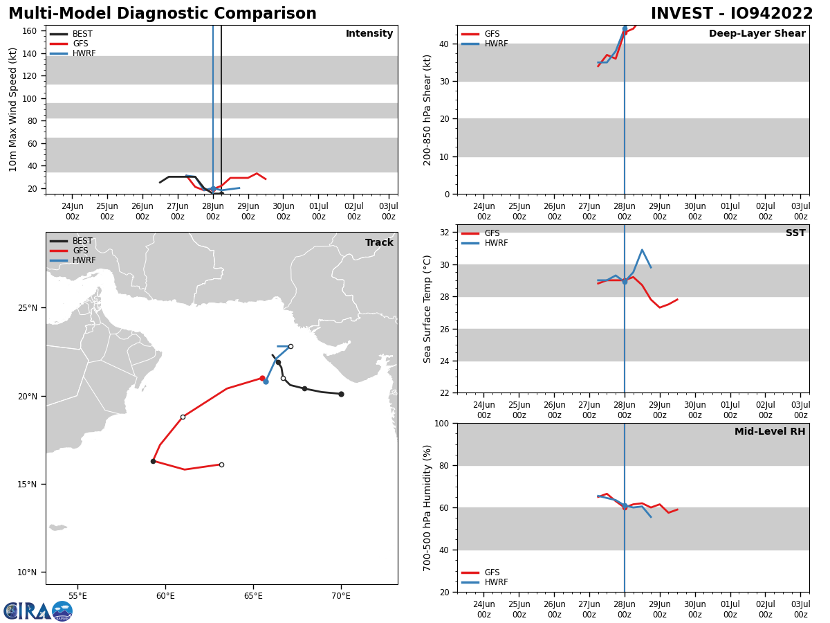
NORTH INDIAN OCEAN: ARABIAN SEA: INVEST 94A. ADVISORY(ABIO) ISSUED AT 28/06UTC.
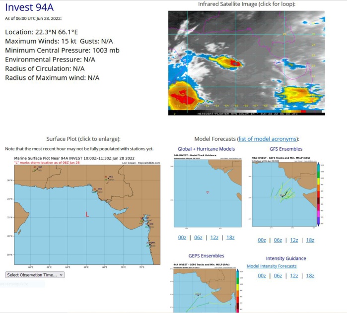
THE AREA OF CONVECTION (INVEST 94A) PREVIOUSLY LOCATED NEAR 20.4N 67.9E HAS DISSIPATED AND IS NO LONGER SUSPECT FOR THE DEVELOPMENT OF A SIGNIFICANT TROPICAL CYCLONE IN THE NEXT 24 HOURS.
IO, 94, 2022062706,206N, 671E, 30, 997
IO, 94, 2022062712,210N, 667E, 30, 997
IO, 94, 2022062718,216N, 666E, 20, 1003
IO, 94, 2022062800,219N, 664E, 15, 1003
IO, 94, 2022062806,223N, 661E, 15, 1003
IO, 94, 2022062712,210N, 667E, 30, 997
IO, 94, 2022062718,216N, 666E, 20, 1003
IO, 94, 2022062800,219N, 664E, 15, 1003
IO, 94, 2022062806,223N, 661E, 15, 1003
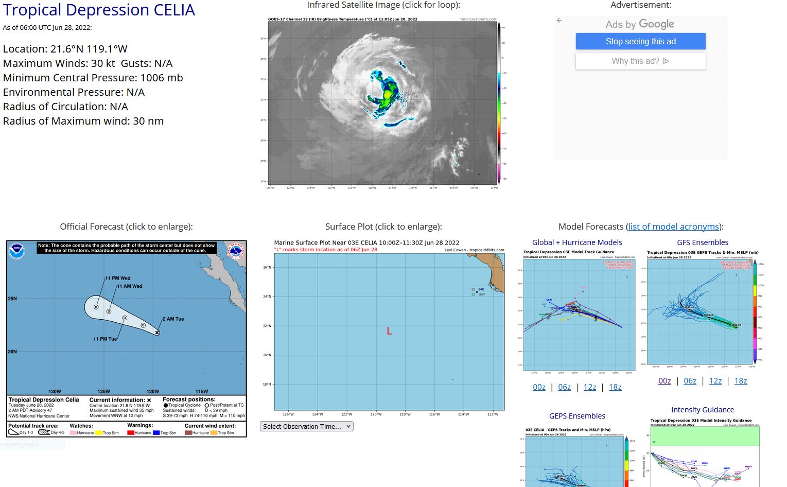
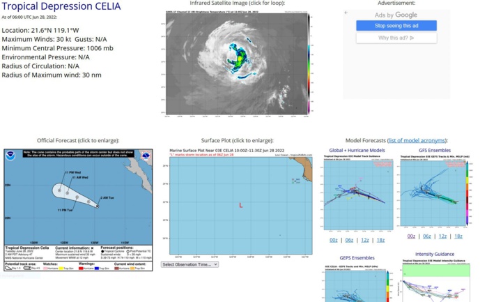
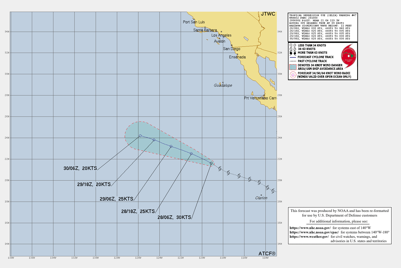
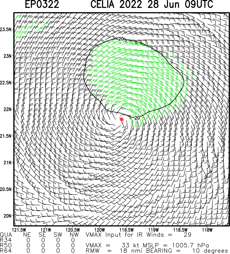
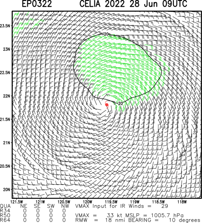
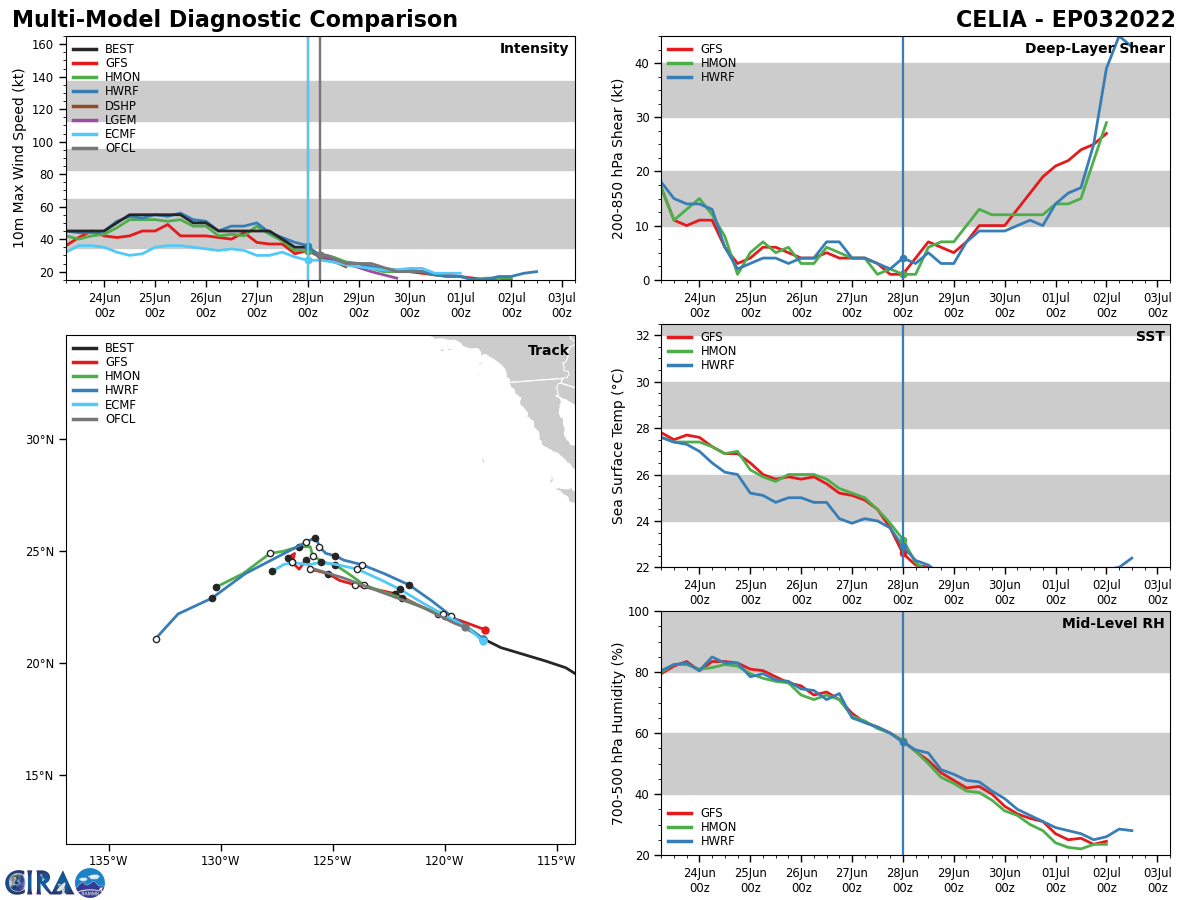
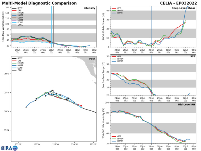
EASTERN NORTH PACIFIC: TS 03E(CELIA). WARNING 47 ISSUED AT 28/10UTC. NHC COMMENTS.
EP, 03, 2022062700,198N, 1146W, 45, 998
EP, 03, 2022062706,201N, 1155W, 45, 1000
EP, 03, 2022062712,204N, 1165W, 40, 1002
EP, 03, 2022062718,207N, 1175W, 35, 1004
EP, 03, 2022062800,211N, 1183W, 35, 1004
EP, 03, 2022062706,201N, 1155W, 45, 1000
EP, 03, 2022062712,204N, 1165W, 40, 1002
EP, 03, 2022062718,207N, 1175W, 35, 1004
EP, 03, 2022062800,211N, 1183W, 35, 1004
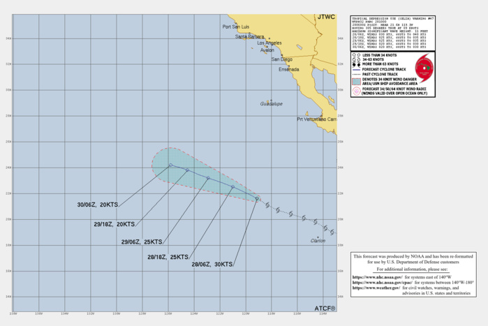
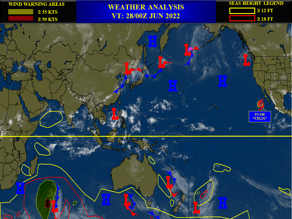
555 WTPZ43 KNHC 280840 TCDEP3 Tropical Depression Celia Discussion Number 47 NWS National Hurricane Center Miami FL EP032022 200 AM PDT Tue Jun 28 2022 Celia's convective organization has been gradually decaying overnight, and only a few small cells with cloud-top temperatures below -60 C remain near the center. Subjective satellite estimates are gradually decreasing, and the latest objective satellite estimate from ADT is down to T2.0/30 kt. Assuming the wind-field has spun-down further from the earlier scatterometer-derived wind values, Celia is downgraded to a tropical depression with winds of 30 kt. The cyclone's motion remains west-northwestward at 295/10 kt. The low- to mid-level steering should keep Celia on this same general track for the next several days. This track brings Celia over even cooler waters into a more stable environment, and if more organized convection does not soon return over Celia's vortex, it is likely to become a post-tropical cyclone later today. The latest NHC track and intensity forecast is little changed from the previous advisory, though the system is now made a post-tropical remnant low in 12 h, with the remnant low opening up into a trough by Thursday. FORECAST POSITIONS AND MAX WINDS INIT 28/0900Z 21.8N 119.6W 30 KT 35 MPH 12H 28/1800Z 22.5N 121.0W 25 KT 30 MPH...POST-TROP/REMNT LOW 24H 29/0600Z 23.2N 122.9W 25 KT 30 MPH...POST-TROP/REMNT LOW 36H 29/1800Z 23.8N 124.5W 20 KT 25 MPH...POST-TROP/REMNT LOW 48H 30/0600Z 24.2N 125.8W 20 KT 25 MPH...POST-TROP/REMNT LOW 60H 30/1800Z...DISSIPATED $$ Forecaster Papin
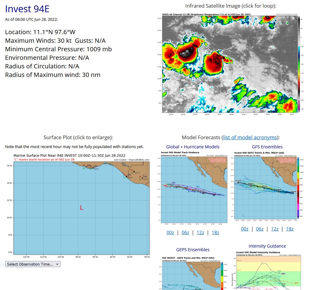
EASTERN NORTH PACIFIC: INVEST 94E. NHC COMMENTS.
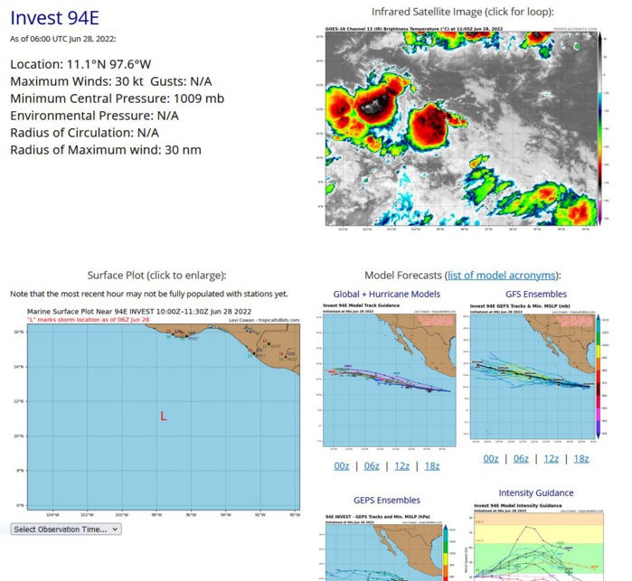
ZCZC MIATWOEP ALL TTAA00 KNHC DDHHMM Tropical Weather Outlook NWS National Hurricane Center Miami FL 1100 PM PDT Mon Jun 27 2022 For the eastern North Pacific...east of 140 degrees west longitude: Active Systems: The National Hurricane Center is issuing advisories on Tropical Storm Celia, located several hundred miles west-southwest of the southern tip of the Baja California Peninsula. 1. Offshore of Southern Mexico: A small but well-defined area of low pressure located a few hundred miles offshore of the coast of southern Mexico continues to produce disorganized shower and thunderstorm activity mainly north and west of the center. Environmental conditions are forecast to become more conducive for gradual development during the next few days, and a tropical depression could form by this weekend while the system moves westward to west-northwestward at 10 to 15 mph. * Formation chance through 48 hours...low...30 percent. * Formation chance through 5 days...medium...40 percent. Forecaster Papin
EP, 94, 2022062706,104N, 937W, 20, 1011
EP, 94, 2022062712,105N, 944W, 20, 1011
EP, 94, 2022062718,107N, 955W, 25, 1010
EP, 94, 2022062800,109N, 964W, 25, 1010
EP, 94, 2022062806,111N, 976W, 30, 1009
EP, 94, 2022062712,105N, 944W, 20, 1011
EP, 94, 2022062718,107N, 955W, 25, 1010
EP, 94, 2022062800,109N, 964W, 25, 1010
EP, 94, 2022062806,111N, 976W, 30, 1009
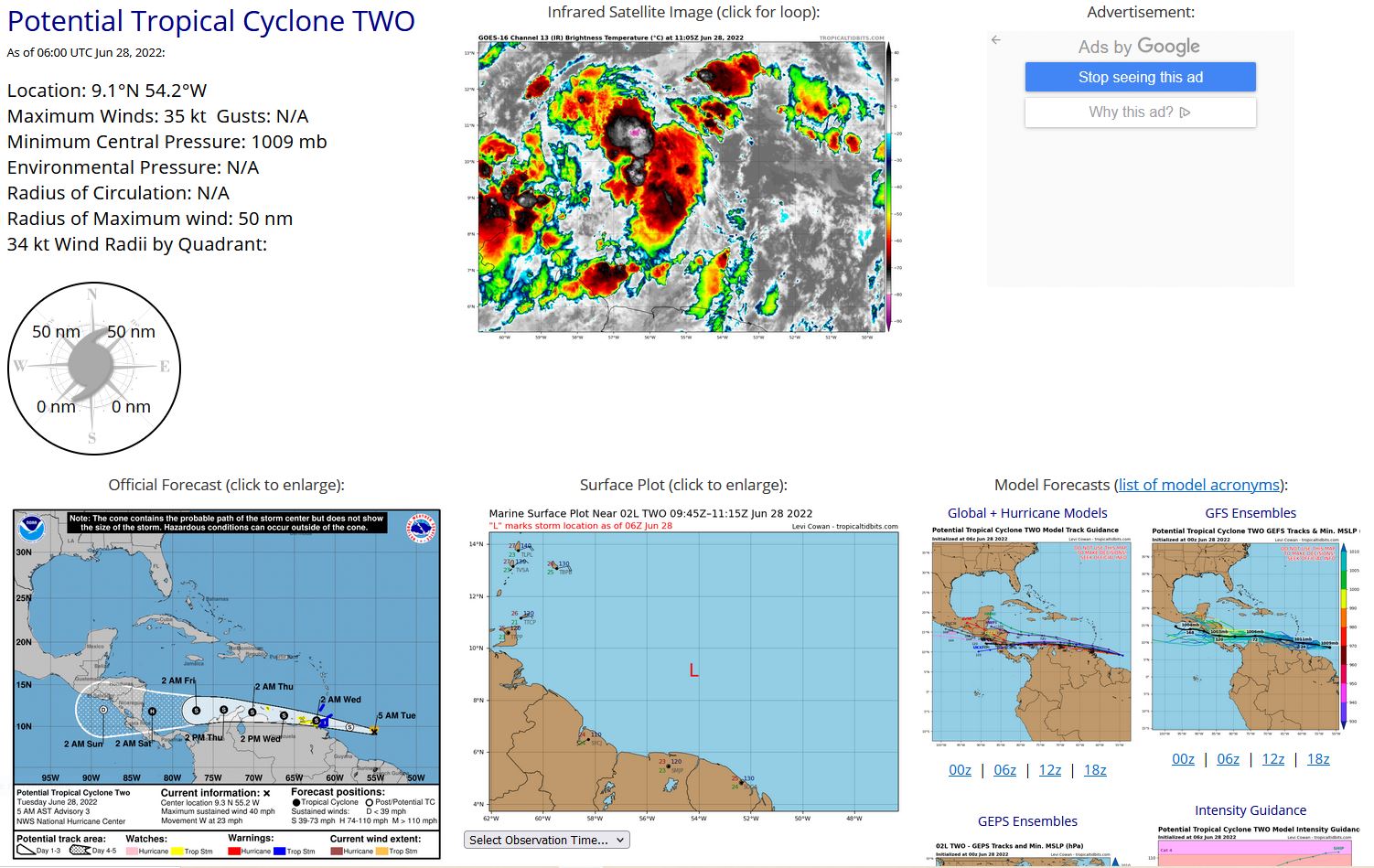
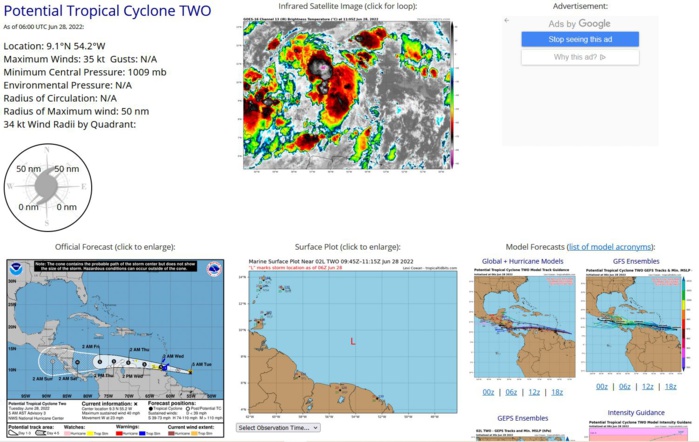
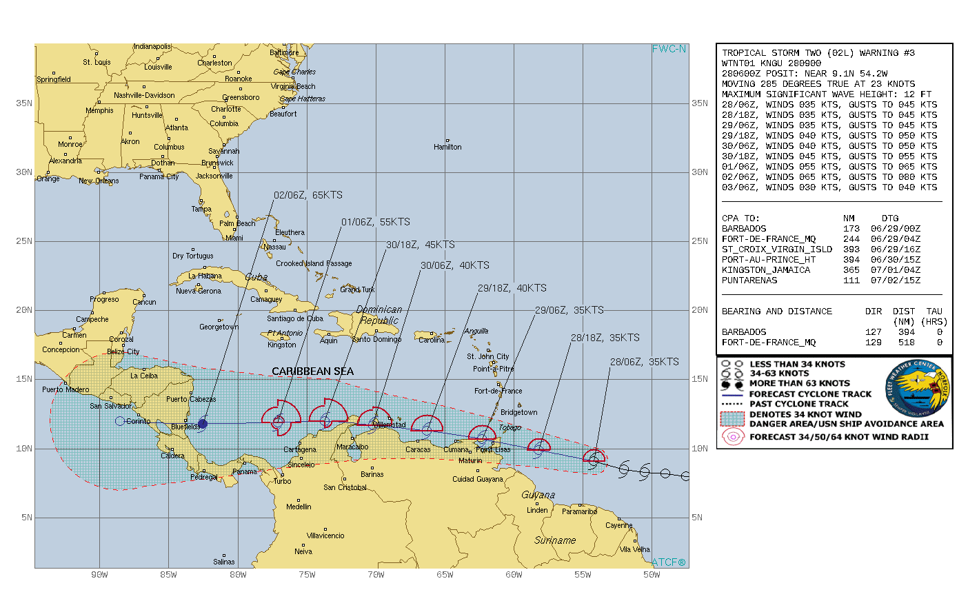
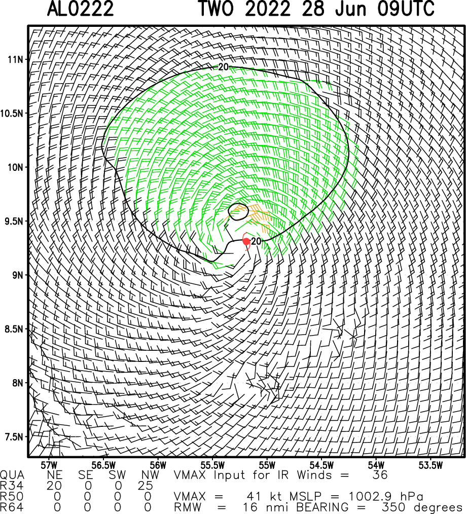
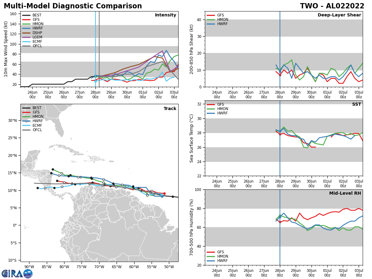
NORTH ATLANTIC/CARRIBEAN SEA: TC 02L. COMMENTS FROM NHC.
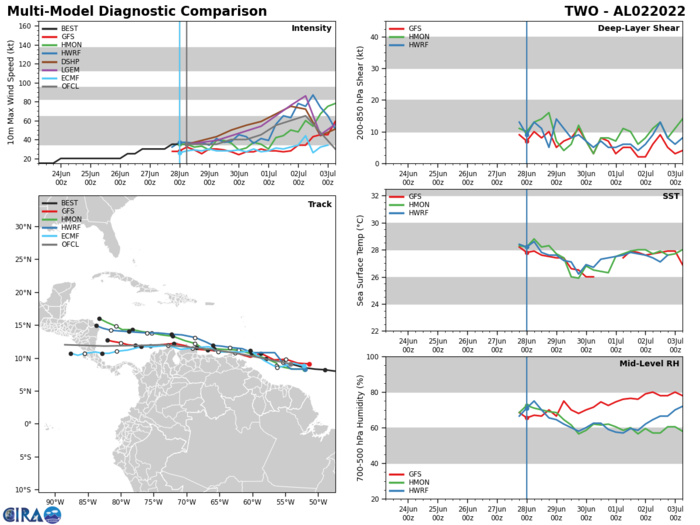
AL, 02, 2022062706,80N, 475W, 30, 1008
AL, 02, 2022062712,82N, 490W, 30, 1009
AL, 02, 2022062718,83N, 505W, 35, 1009
AL, 02, 2022062800,85N, 520W, 35, 1009
AL, 02, 2022062806,91N, 542W, 35, 1009
AL, 02, 2022062712,82N, 490W, 30, 1009
AL, 02, 2022062718,83N, 505W, 35, 1009
AL, 02, 2022062800,85N, 520W, 35, 1009
AL, 02, 2022062806,91N, 542W, 35, 1009
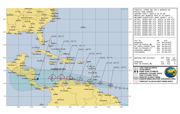
798 WTNT42 KNHC 280838 TCDAT2 Potential Tropical Cyclone Two Discussion Number 3 NWS National Hurricane Center Miami FL AL022022 500 AM AST Tue Jun 28 2022 Overnight satellite imagery indicates that the disturbance continues to struggle. While there is a ball of convection near the best surface center, GOES 1-min data shows no signs of a well-defined center, and the mid-level circulation seems displaced a degree or more west of the low-level wave axis. Maximum winds are held at 35 kt for this advisory, pending Air Force Hurricane Hunter data later this morning. The system appears to have sped up, with a rough motion estimate of 280/20 kt. A strong ridge to the north should keep the disturbance moving generally westward or west-northwestward at a quick pace through the forecast period. It is a close call on whether or not the system can stay far enough offshore of South America to become a tropical cyclone and potentially strengthen, or if it moves inland over South America and eventually forms later in the southwestern Caribbean Sea. The new NHC forecast brushes most of the coast of Venezuela, and consequently shows little change in strength for a couple of days as a low-end tropical storm. After that time, low shear and warm waters could support the system becoming a hurricane over the southwestern Caribbean Sea, but that will largely depend on what's left of the system after interacting with land. No changes were made to the end of the forecast with such high uncertainty. KEY MESSAGES: 1. Heavy rainfall is expected across the Windward Islands and northeastern Venezuela tonight through Wednesday. Localized flash flooding will be possible. 2. Winds to tropical-storm-force are expected over portions of the southern Windward Islands tonight. Tropical storm conditions are possible along the northeastern coast of Venezuela tonight and Wednesday, and on Bonaire by Wednesday evening. 3. There is higher-than-normal uncertainty on the system's forecast intensity once it reaches the southwestern Caribbean Sea late Thursday and Friday, which will depend on how much it interacts with land from tonight through Thursday. FORECAST POSITIONS AND MAX WINDS INIT 28/0900Z 9.3N 55.2W 35 KT 40 MPH...POTENTIAL TROP CYCLONE 12H 28/1800Z 9.9N 58.2W 35 KT 40 MPH...POTENTIAL TROP CYCLONE 24H 29/0600Z 10.7N 62.3W 35 KT 40 MPH...TROPICAL CYCLONE 36H 29/1800Z 11.3N 66.3W 40 KT 45 MPH 48H 30/0600Z 11.7N 70.2W 40 KT 45 MPH 60H 30/1800Z 12.0N 73.7W 45 KT 50 MPH 72H 01/0600Z 11.9N 77.1W 55 KT 65 MPH 96H 02/0600Z 11.8N 82.5W 65 KT 75 MPH 120H 03/0600Z 12.0N 88.5W 30 KT 35 MPH...POST-TROP/REMNT LOW $$ Forecaster Blake
NORTH ATLANTIC/GULF OF MEXICO: INVEST 95L. COMMENTS FROM NHC.
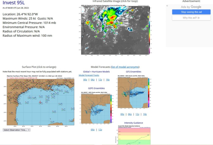
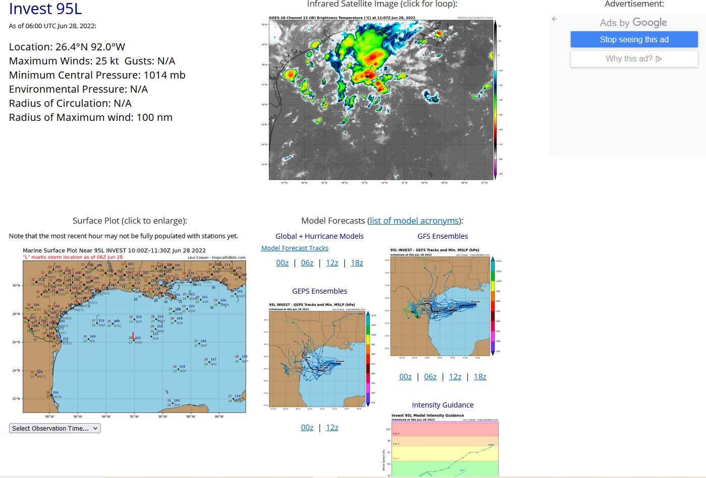
ZCZC MIATWOAT ALL TTAA00 KNHC DDHHMM Tropical Weather Outlook NWS National Hurricane Center Miami FL 800 AM EDT Tue Jun 28 2022 For the North Atlantic...Caribbean Sea and the Gulf of Mexico: East of the Windward Islands: The National Hurricane Center is issuing advisories on Potential Tropical Cyclone Two, located a few hundred miles east of the southern Windward Islands. * Formation chance through 48 hours...high...70 percent. * Formation chance through 5 days...high...90 percent. 1. Northern Gulf of Mexico: An area of low pressure is centered over the northwestern Gulf of Mexico. Shower and thunderstorm activity associated with the low has increased overnight but remains disorganized. Some additional development of this system is possible as it moves slowly westward or west-southwestward and approaches the coast of Texas during the next two days. Regardless of development, heavy rain will be possible along portions of the Texas coast later this week. For more information about the potential for heavy rain, please see products issued by your National Weather Service office. * Formation chance through 48 hours...low...30 percent. * Formation chance through 5 days...low...30 percent.
AL, 95, 2022062706,279N, 903W, 15
AL, 95, 2022062712,275N, 909W, 15
AL, 95, 2022062718,271N, 913W, 15
AL, 95, 2022062800,267N, 916W, 15
AL, 95, 2022062806,264N, 920W, 25
AL, 95, 2022062712,275N, 909W, 15
AL, 95, 2022062718,271N, 913W, 15
AL, 95, 2022062800,267N, 916W, 15
AL, 95, 2022062806,264N, 920W, 25
