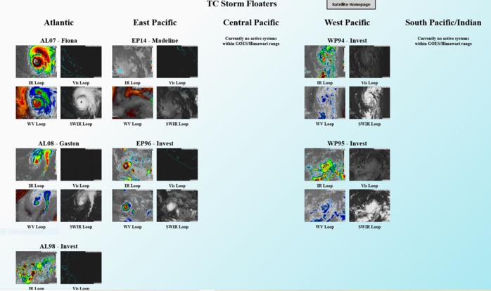
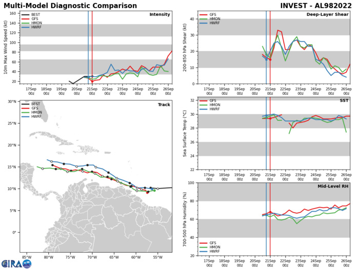
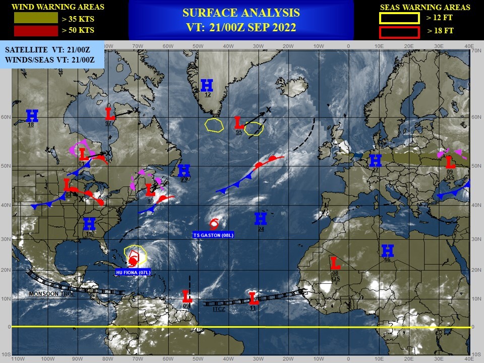
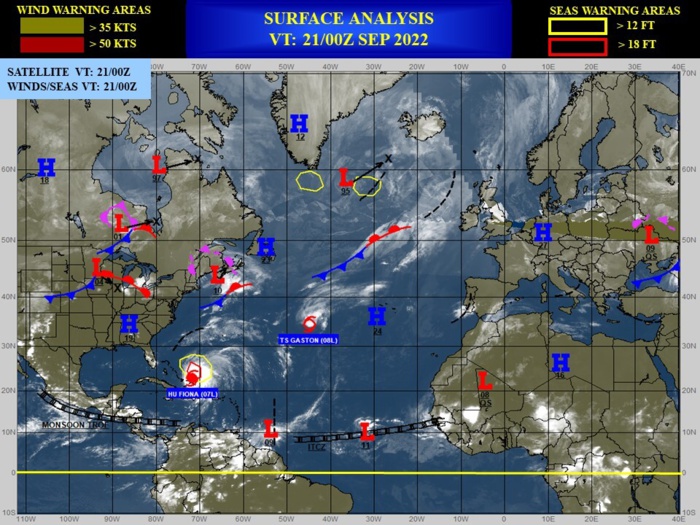
CLICK ON THE IMAGERIES BELOW TO GET THEM ENLARGED
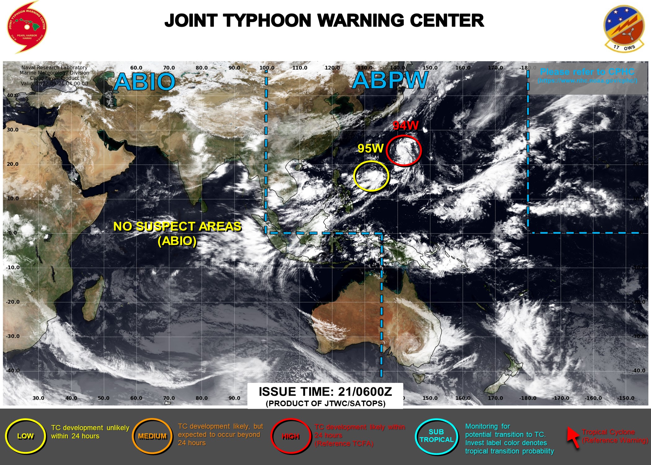
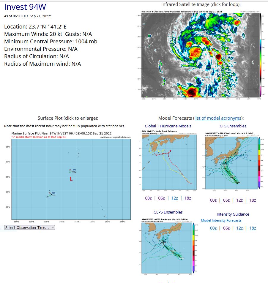
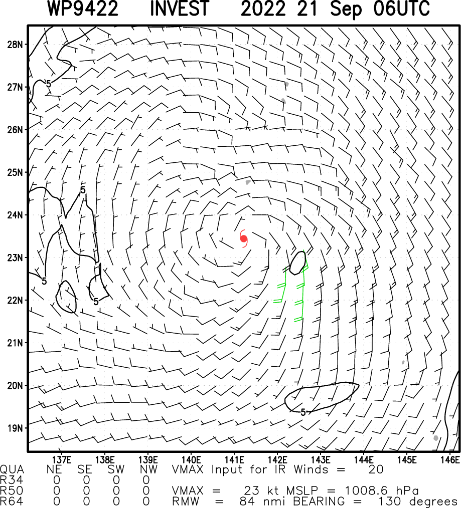
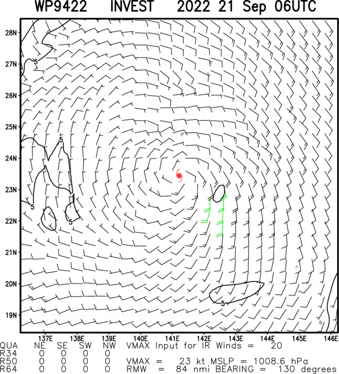
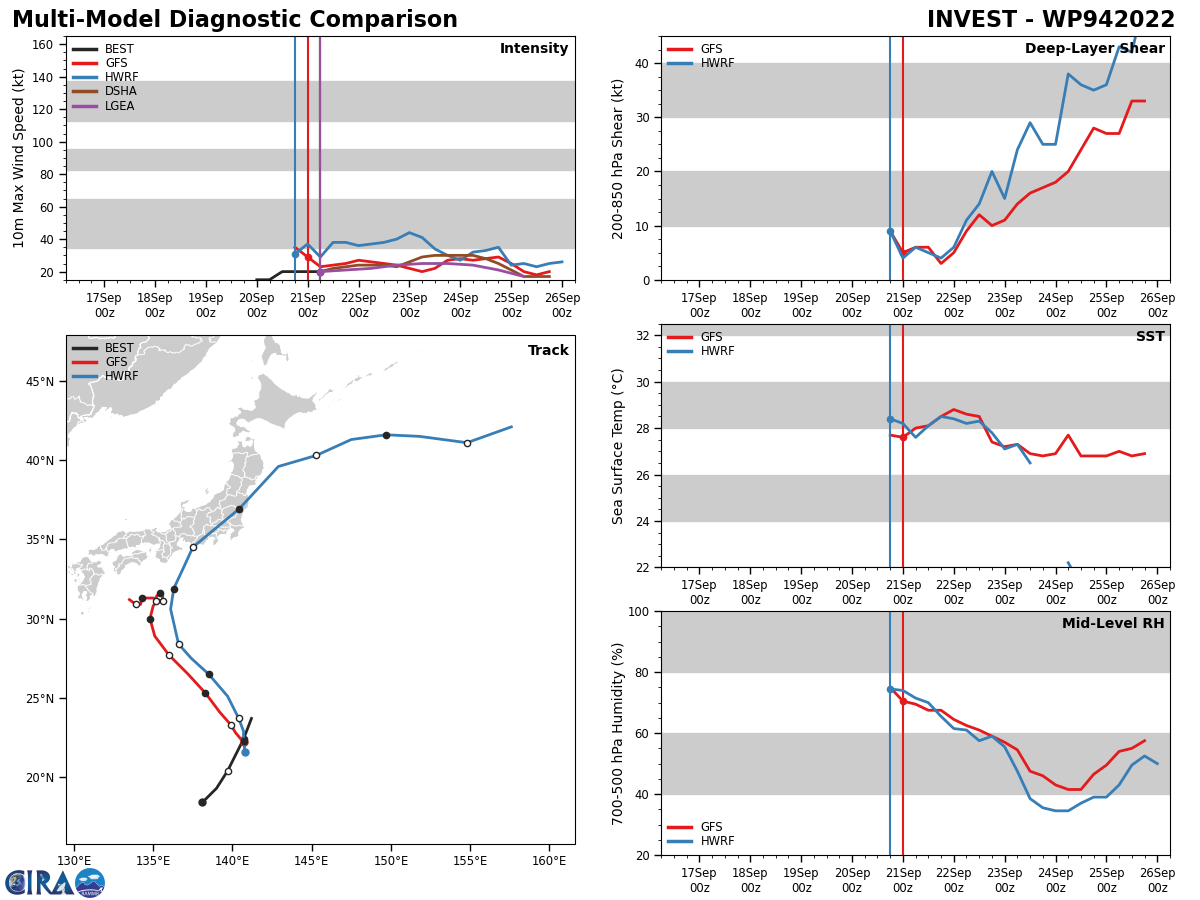
WESTERN NORTH PACIFIC: INVEST 94W. ESTIMATED LOCATION AND INTENSITY AT 21/06UTC. TROPICAL CYCLONE FORMATION ALERT ISSUED AT 21/0130UTC.
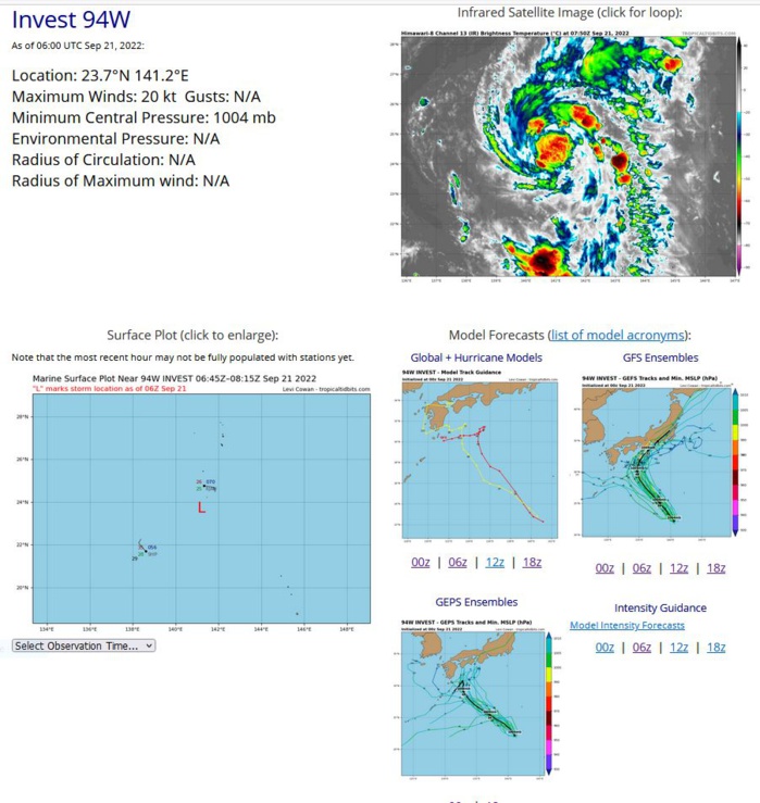
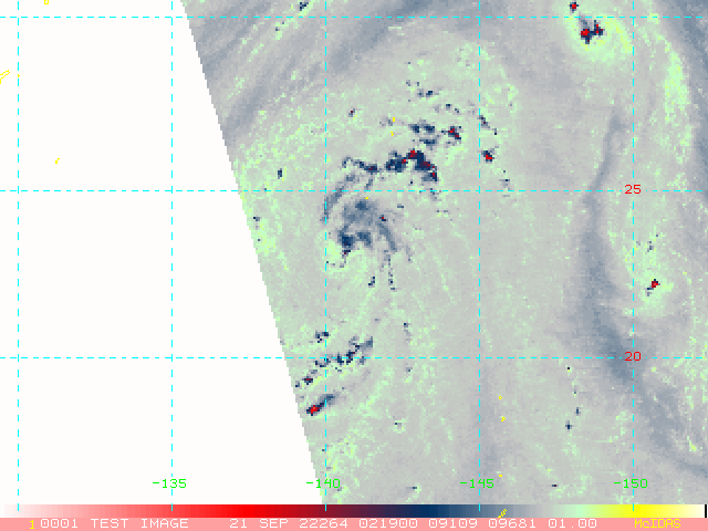
THE AREA OF CONVECTION (INVEST 94W) PREVIOUSLY LOCATED NEAR 20.4N 139.7E IS NOW LOCATED NEAR 22.4N 140.7E, APPROXIMATELY 153 NM SOUTH-SOUTHWEST OF IWO TO. ENHANCED INFRARED SATELLITE IMAGERY DEPICTS A LOW LEVEL CIRCULATION (LLC) WITH PERSISTENT DEEP CONVECTIVE BANDING OVER THE EASTERN PERIPHERY. A 201923Z SSMIS 91GHZ MICROWAVE IMAGE REVEALS A PARTIALLY EXPOSED LLC WITH THE BULK OF DEEP CONVECTION OVER THE EASTERN SEMICIRCLE. THE SYSTEM IS CURRENTLY OVER WARM (29-30C) SST AND LOW (10- 15KT) VERTICAL WIND SHEAR WITH A TROUGH SITUATED SLIGHTLY TO THE WEST OF 94W INCREASING THE POLEWARD OUTFLOW, LEADING TO AN OVERALL FAVORABLE ENVIRONMENT FOR DEVELOPMENT. GLOBAL MODELS ARE IN GENERAL AGREEMENT THAT INVEST 94W WILL TRACK NORTH-NORTHWESTWARD WITH GRADUAL INTENSIFICATION OVER THE NEXT 24-48 HOURS. GFS CONTINUES TO BE THE MOST AGGRESSIVE MODEL. MAXIMUM SUSTAINED SURFACE WINDS ARE ESTIMATED AT 18 TO 23 KNOTS. MINIMUM SEA LEVEL PRESSURE IS ESTIMATED TO BE NEAR 1004 MB. THE POTENTIAL FOR THE DEVELOPMENT OF A SIGNIFICANT TROPICAL CYCLONE WITHIN THE NEXT 24 HOURS REMAINS HIGH.
WP, 94, 2022092000,184N, 1381E, 15,1006
WP, 94, 2022092006,193N, 1390E, 15,1006
WP, 94, 2022092012,204N, 1397E, 20,1005
WP, 94, 2022092018,214N, 1402E, 20,1004
WP, 94, 2022092100,224N, 1407E, 20,1004
WP, 94, 2022092106,237N, 1412E, 20,1004
WP, 94, 2022092006,193N, 1390E, 15,1006
WP, 94, 2022092012,204N, 1397E, 20,1005
WP, 94, 2022092018,214N, 1402E, 20,1004
WP, 94, 2022092100,224N, 1407E, 20,1004
WP, 94, 2022092106,237N, 1412E, 20,1004
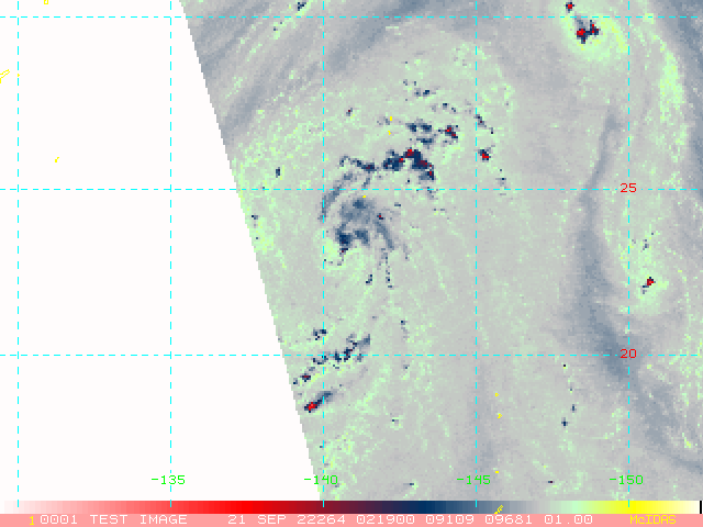
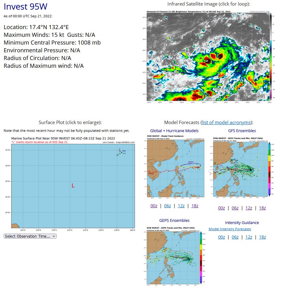
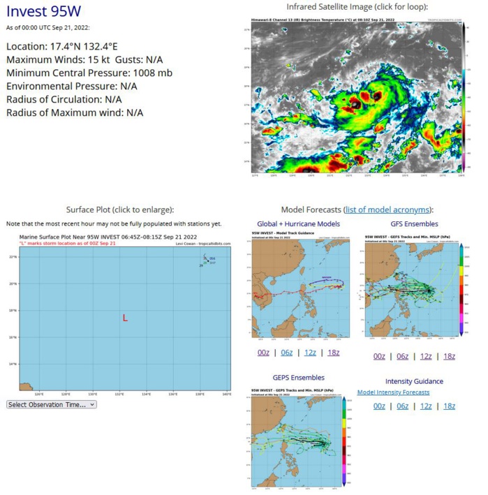
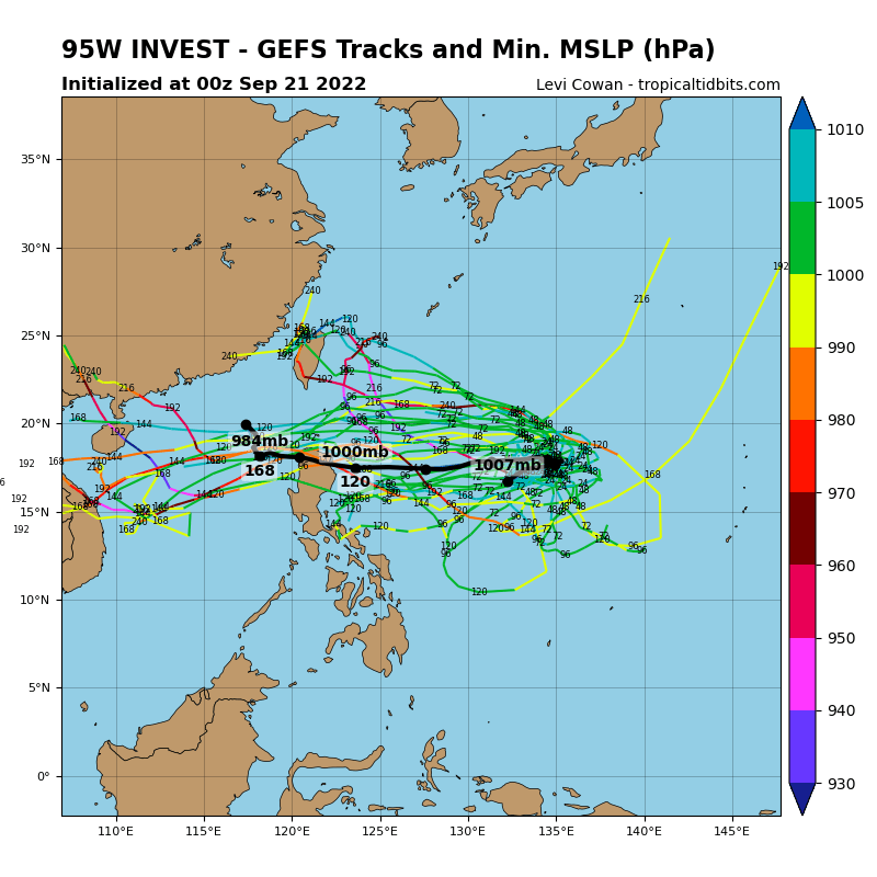
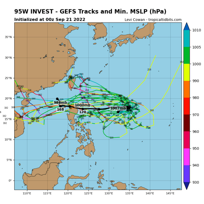
WESTERN NORTH PACIFIC: INVEST 95W. ESTIMATED LOCATION AND INTENSITY AT 21/00UTC. ADVISORY(ABPW) ISSUED AT 21/06UTC.
WP, 95, 2022092012,171N, 1311E, 15 1008
WP, 95, 2022092018,173N, 1318E, 15,1008
WP, 95, 2022092100,174N, 1324E, 15,1008
WP, 95, 2022092018,173N, 1318E, 15,1008
WP, 95, 2022092100,174N, 1324E, 15,1008
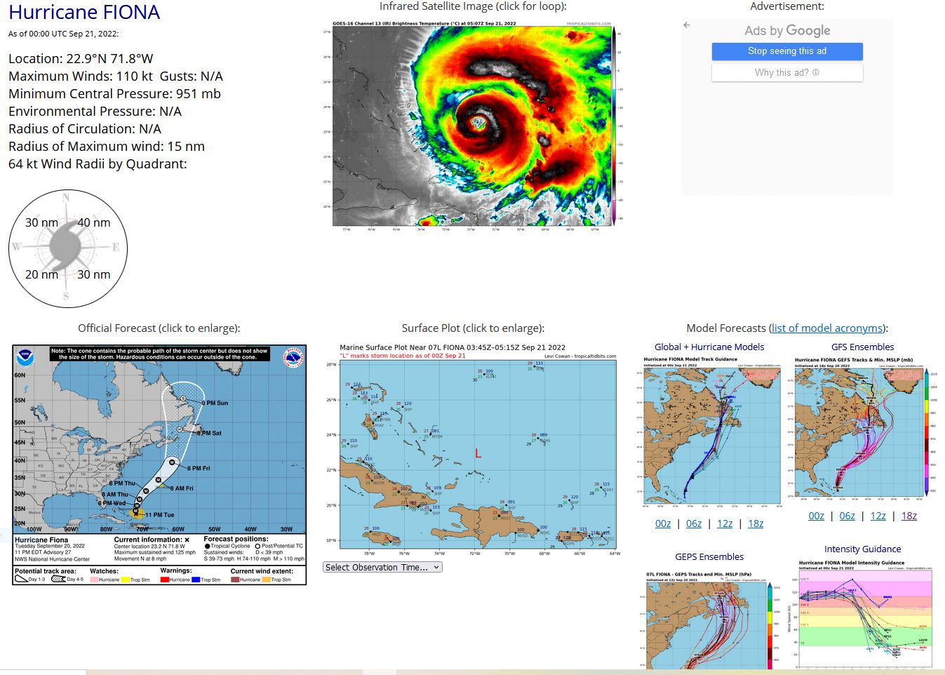
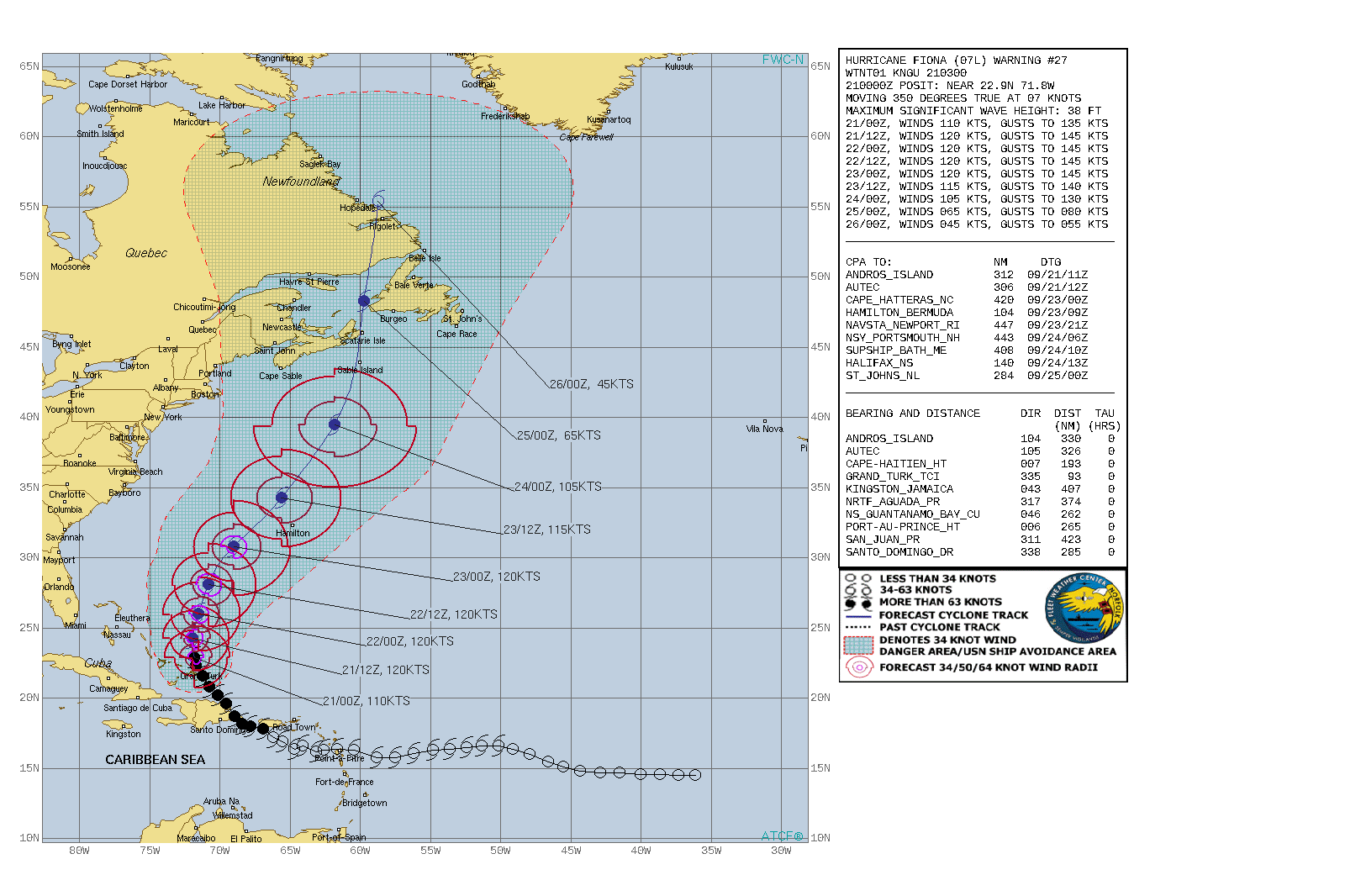
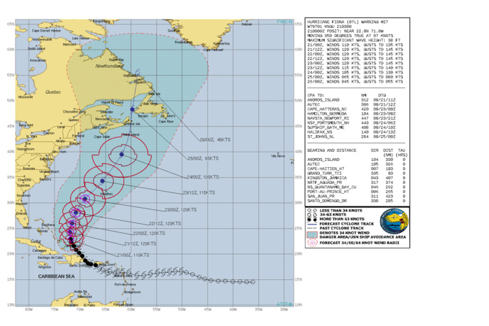
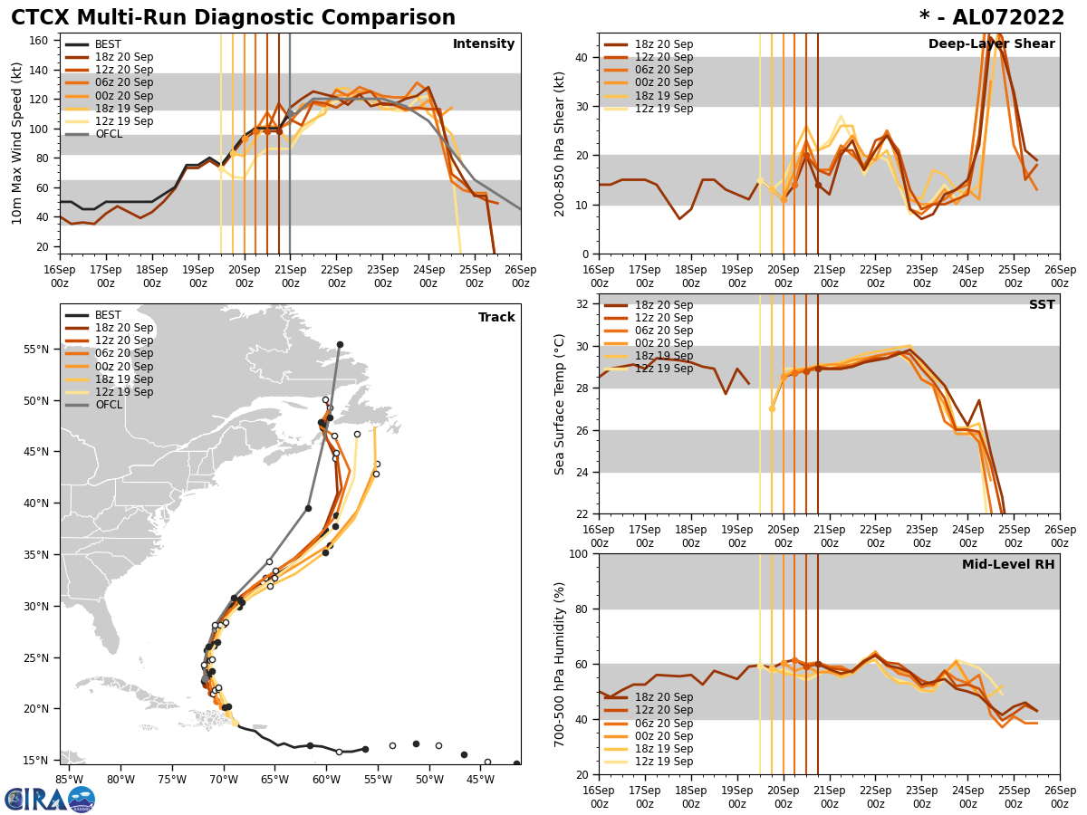
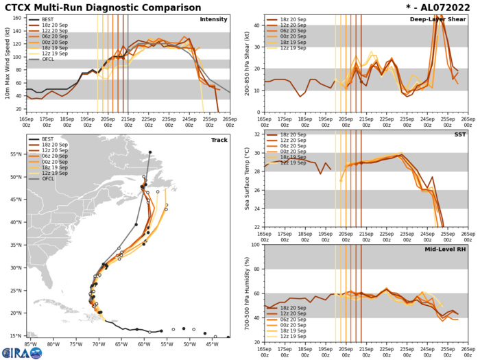
NORTH ATLANTIC: HU 07L(FIONA). ESTIMATED LOCATION AND INTENSITY AT 21/00UTC. WARNING 27 ISSUED AT 21/03UTC. NHC COMMENTS.
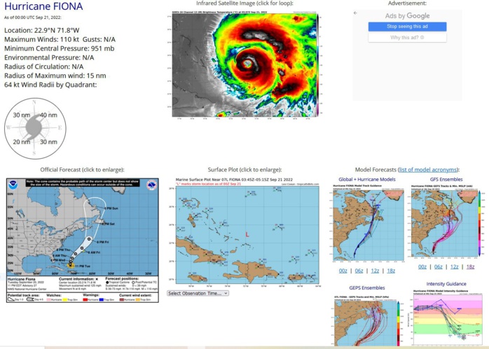
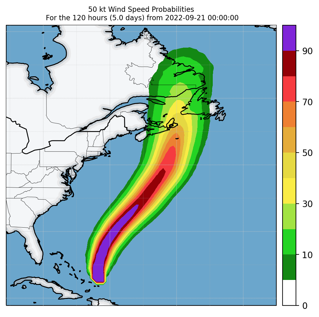
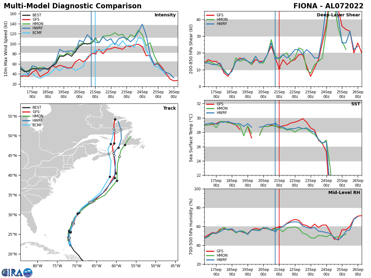
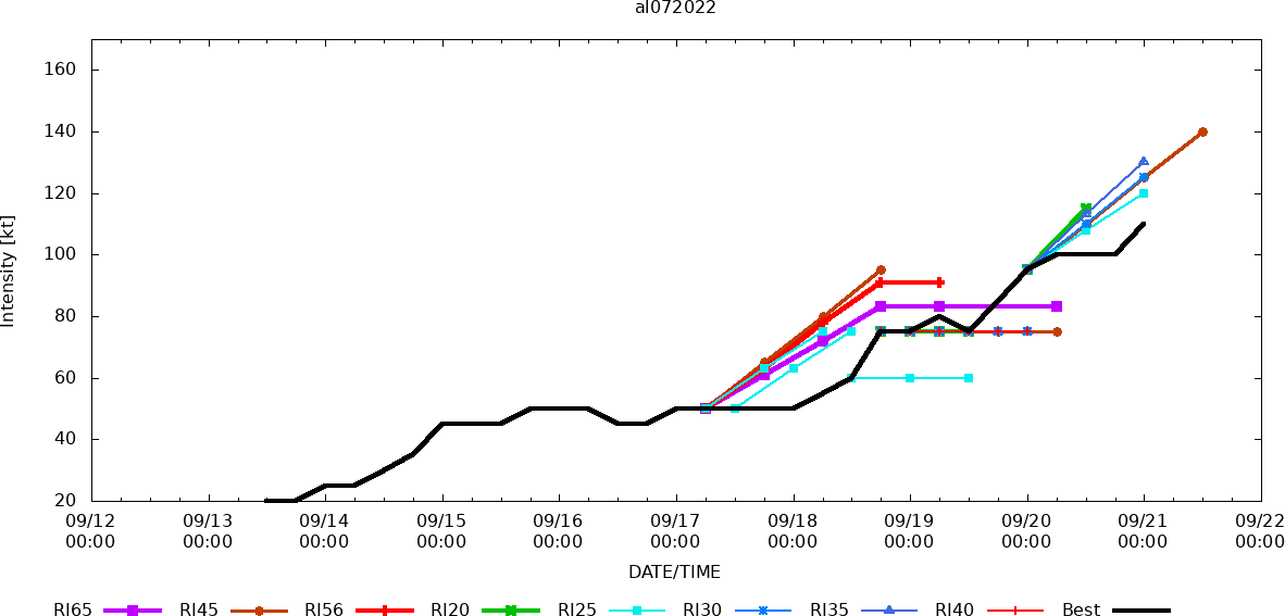
286 WTNT42 KNHC 210247 TCDAT2 Hurricane Fiona Discussion Number 27 NWS National Hurricane Center Miami FL AL072022 1100 PM EDT Tue Sep 20 2022 Data from a NOAA Hurricane Hunter aircraft that has been investigating Fiona this evening show that the hurricane has strengthened since this afternoon. The aircraft has measured peak 700-mb flight-level winds of 120 kt, and SFMR winds of around 110 kt earlier in the evening. Based on those data, the intensity was increased to 110 kt on the intermediate advisory at 0000 UTC. Since that time, the satellite presentation has continued to improve with the eye becoming better defined and the surrounding ring of deep convection expanding with colder cloud top temperatures. The pressure has fallen a few more millibars and is now down to 947 mb, however the plane has not found any higher winds during several passes through the northeastern and northern portion of the eyewall. It is worth noting that the latest subjective and objective satellite estimates suggest a stronger intensity, and this may be a case in which the winds are lagging the improved satellite presentation, which is not too uncommon. The vertical wind shear over the hurricane is expected to remain low to moderate during the next couple of days. During that time, the hurricane will be traversing SSTs of 29-30 degrees Celsius, and remain in a moist environment. These conditions should allow for some additional strengthening during the next 12 to 24 hours, but after that time, difficult-to-predict eyewall replacement cycles are likely to cause some fluctuations in intensity. By day 3, the system is forecast to interact with a vigorous mid-troposphere trough and the system is expected to become a large and powerful extratropical cyclone near Atlantic Canada. The latest satellite and aircraft fixes indicate that the hurricane is now moving just west of due north or 350/7 kt. Fiona should move generally northward around the western periphery of a mid-level ridge during the next 24 hours. After that time, the hurricane is forecast to turn north-northeastward and begin to gradually accelerate as the aforementioned trough approaches from the northwest. Very little cross-track changes were made to the latest NHC forecast, but it is slightly slower than the previous advisory to be in better agreement with the bulk of the dynamical models. Key Messages: 1. Heavy rains south of Fiona will continue to impact the Turks and Caicos through tonight with additional flooding possible. 2. Tropical storm conditions are possible on Bermuda by late Thursday. 3. Fiona is expected to affect portions of Atlantic Canada as a powerful hurricane-force cyclone late Friday and Saturday, and could produce significant impacts from high winds, storm surge, and heavy rainfall. Interests in these areas should closely monitor the progress of Fiona and updates to the forecast. FORECAST POSITIONS AND MAX WINDS INIT 21/0300Z 23.2N 71.8W 110 KT 125 MPH 12H 21/1200Z 24.3N 71.9W 120 KT 140 MPH 24H 22/0000Z 26.0N 71.5W 120 KT 140 MPH 36H 22/1200Z 28.1N 70.8W 120 KT 140 MPH 48H 23/0000Z 30.8N 69.0W 120 KT 140 MPH 60H 23/1200Z 34.3N 65.6W 115 KT 130 MPH 72H 24/0000Z 39.5N 61.8W 105 KT 120 MPH 96H 25/0000Z 48.3N 59.7W 65 KT 75 MPH...POST-TROP/EXTRATROP 120H 26/0000Z 55.4N 58.7W 45 KT 50 MPH...POST-TROP/EXTRATROP $$ Forecaster Brown
0722092000 202N 701W 95
0722092006 208N 707W 100
0722092012 216N 712W 100
0722092018 223N 717W 100
0722092100 229N 718W 110
0722092006 208N 707W 100
0722092012 216N 712W 100
0722092018 223N 717W 100
0722092100 229N 718W 110
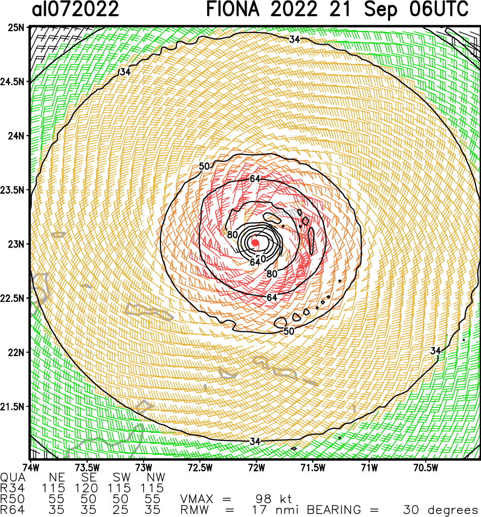
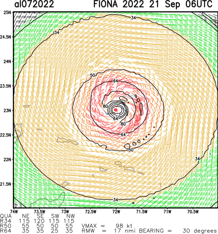
Aircraft-based Tropical Cyclone Surface Wind Analysis
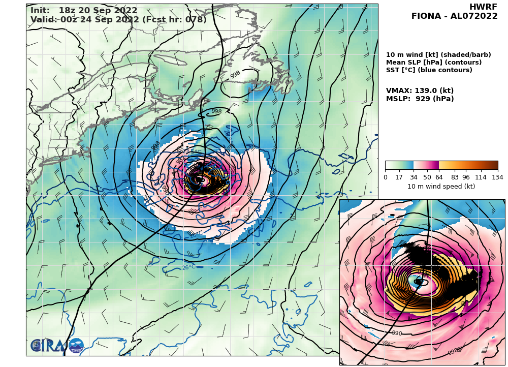
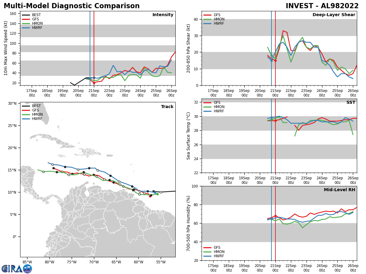
HWRF AT 20/18UTC: 139KT AT +78H.
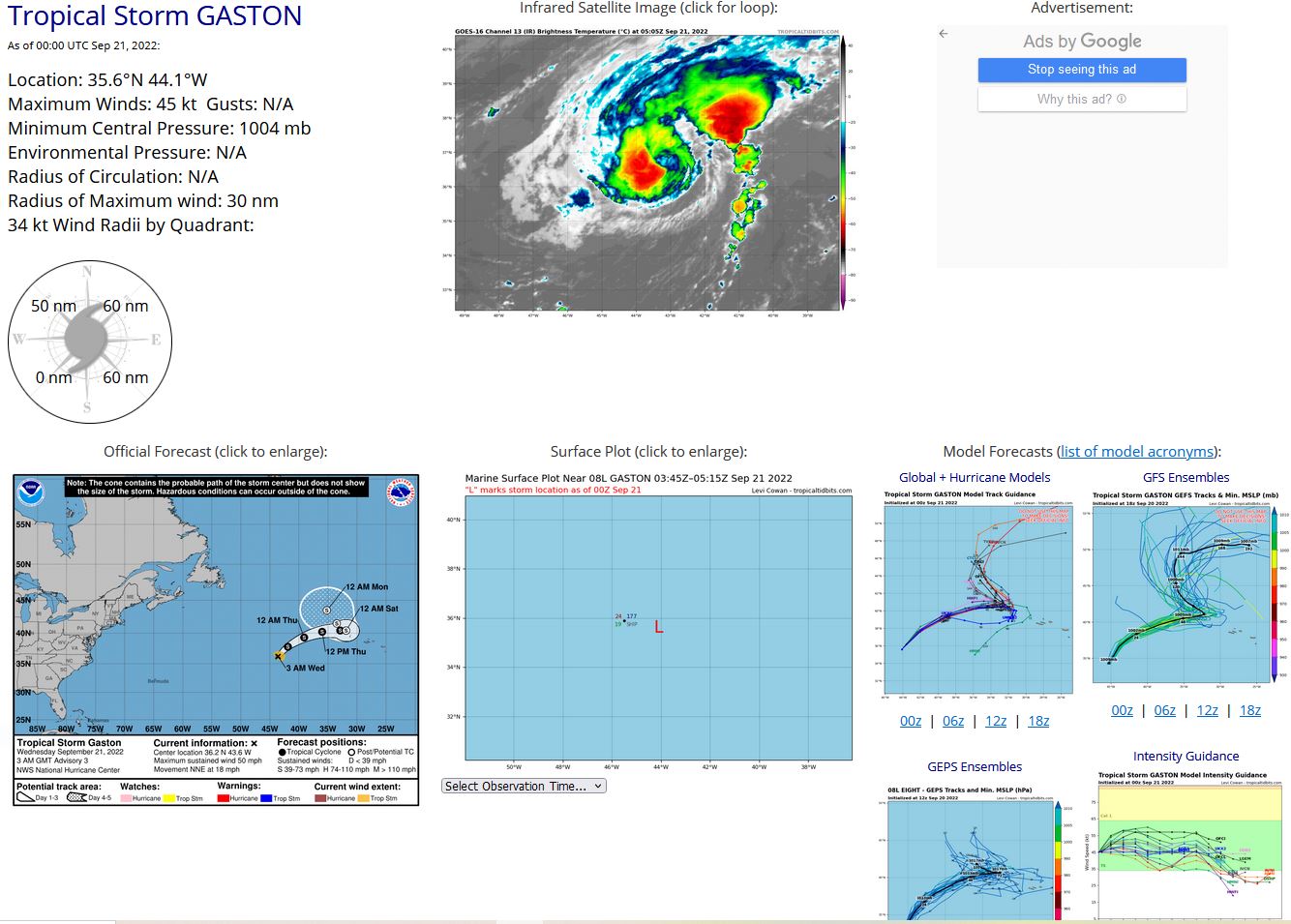
NORTH ATLANTIC: TS 08L(GASTON). ESTIMATED LOCATION AND INTENSITY AT 21/00UTC. NHC COMMENTS.
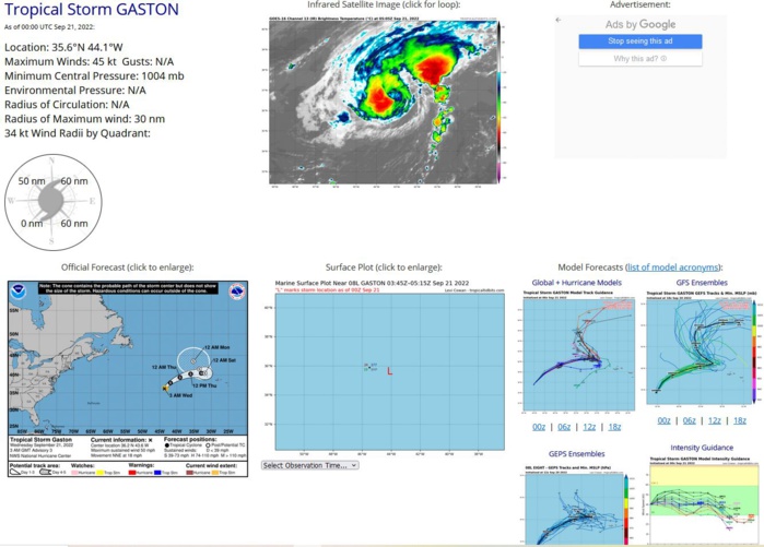
503 WTNT43 KNHC 210257 TCDAT3 Tropical Storm Gaston Discussion Number 3 NWS National Hurricane Center Miami FL AL082022 300 AM GMT Wed Sep 21 2022 The satellite presentation of Gaston has improved slightly since the previous advisory, with deep convection persisting over the low-level circulation center. The latest current intensity estimates reflect what has been seen in the satellite imagery, with TAFB and SAB coming in at 45 knots, while the ADT and AiDT values from UW-CIMSS showing 35 knots and 46 knots respectively. Based on a blend of these data along with the improved satellite appearance, the initial intensity has been raised to 45 knots. Gaston continues on a path toward the north-northeast, with the initial motion estimated to be 020/16 kt. A turn to northeast is expected today, followed by a turn to the east by Thursday as the tropical storm moves along the the northern periphery of a subtropical ridge. By late this week, Gaston is expected to stall to the west of the Azores in weak steering currents as a mid-level ridge builds to the north of cyclone. A turn to the northwest or north is expected over the weekend as Gaston moves in the steering flow between Hurricane Fiona to the west and the building mid-level ridge to the east. The latest NHC track forecast has changed little and lies very close to the previous advisory track, and closely follows the consensus track guidance. The period for additional intensification is quickly closing, as Gaston is moving over the 26C isotherm, and will move over progressively cooler water through the remainder of the forecast period. Additionally, the impact of the vertical wind shear will increase in a couple days as the tropical cyclone stalls out while westerly shear holds in the 25 to 30 knot range. As a result, the intensity forecast calls for slight strengthening today, followed by little change in strength for another day or so after that. The combination of cool SSTs, dry mid-level air, and increasing vertical wind shear should then lead to slow weakening through the remainder of the week. The latest NHC was adjusted upward through the first 24 hours to account for the strengthening which has already occurred, with only minor adjustments made through the remainder of the forecast period, closely following the consensus intensity aids. Interests in the Azores should continue to monitor the forecast for Gaston. FORECAST POSITIONS AND MAX WINDS INIT 21/0300Z 36.2N 43.6W 45 KT 50 MPH 12H 21/1200Z 37.8N 41.9W 50 KT 60 MPH 24H 22/0000Z 39.3N 39.1W 50 KT 60 MPH 36H 22/1200Z 40.2N 36.0W 50 KT 60 MPH 48H 23/0000Z 40.4N 32.9W 45 KT 50 MPH 60H 23/1200Z 40.4N 31.9W 45 KT 50 MPH 72H 24/0000Z 40.4N 31.9W 45 KT 50 MPH...POST-TROP/EXTRATROP 96H 25/0000Z 41.5N 33.5W 45 KT 50 MPH...POST-TROP/EXTRATROP 120H 26/0000Z 43.5N 35.2W 40 KT 45 MPH...POST-TROP/EXTRATROP $$ Forecaster D. Zelinsky/Jelsema
0822091800 223N 445W 15
0822091806 234N 448W 20
0822091812 248N 451W 20
0822091818 266N 456W 20
0822091900 278N 460W 25
0822091906 284N 462W 25
0822091912 287N 463W 25
0822091918 296N 458W 25
0822092000 304N 458W 25
0822092006 313N 460W 25
0822092012 324N 458W 30
0822092018 341N 449W 35
0822092100 356N 441W 45
0822091806 234N 448W 20
0822091812 248N 451W 20
0822091818 266N 456W 20
0822091900 278N 460W 25
0822091906 284N 462W 25
0822091912 287N 463W 25
0822091918 296N 458W 25
0822092000 304N 458W 25
0822092006 313N 460W 25
0822092012 324N 458W 30
0822092018 341N 449W 35
0822092100 356N 441W 45
