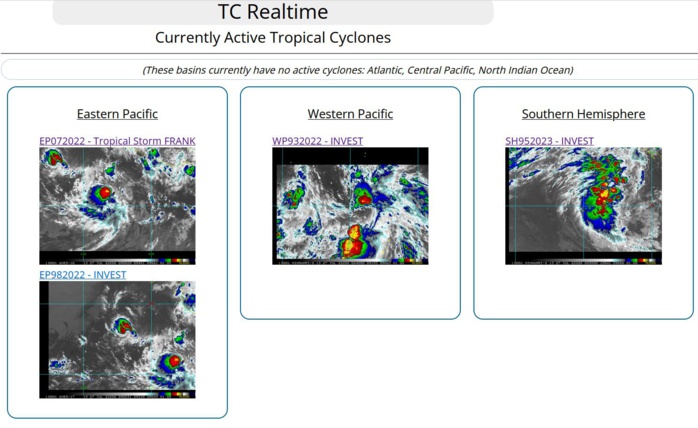
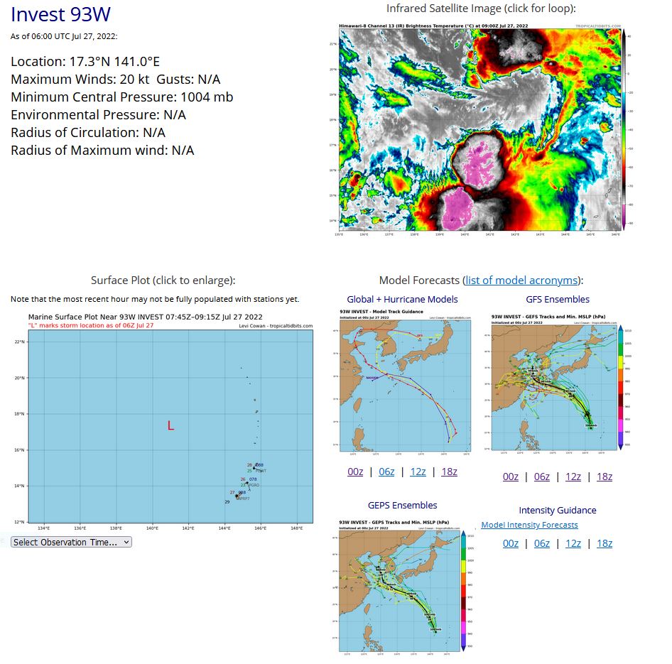
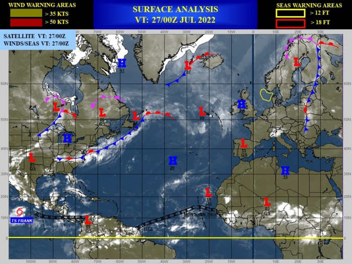
CLICK ON THE IMAGERIES BELOW TO GET THEM ENLARGED.
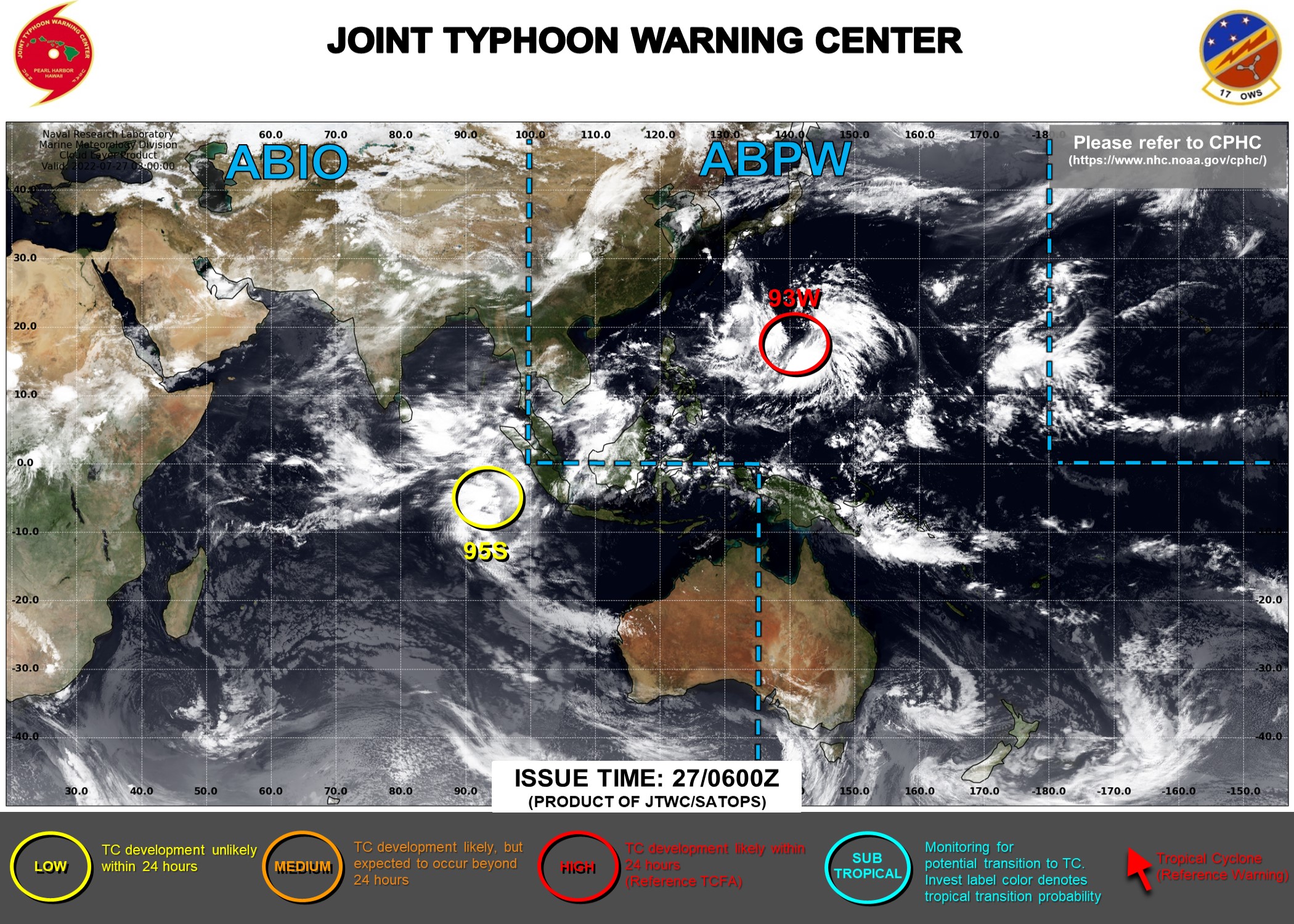
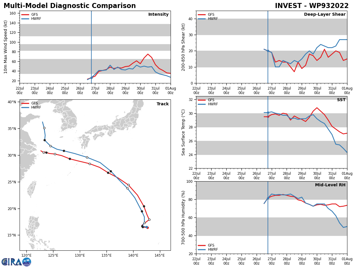
WESTERN NORTH PACIFIC: INVEST 93W. TROPICAL CYCLONE FORMATION ALERT ISSUED AT 26/22UTC. ADVISORY(ABPW) ISSUED AT 27/06UTC.

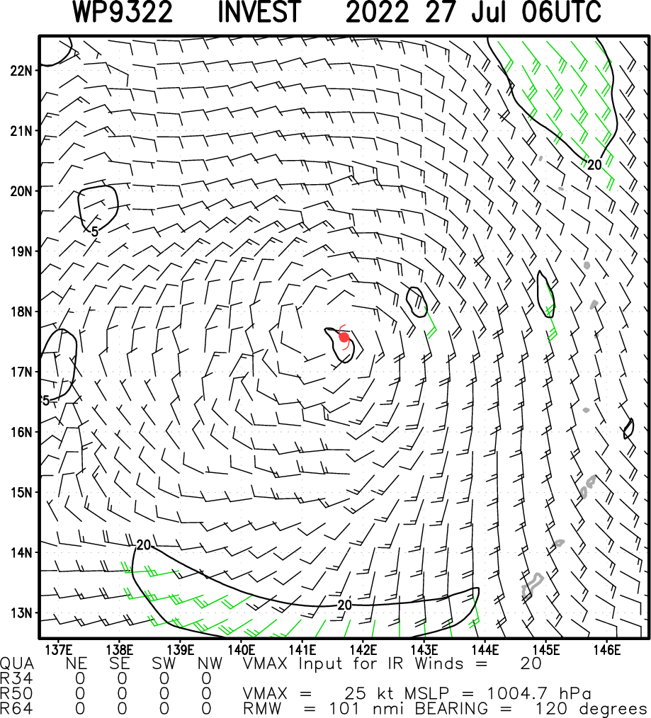
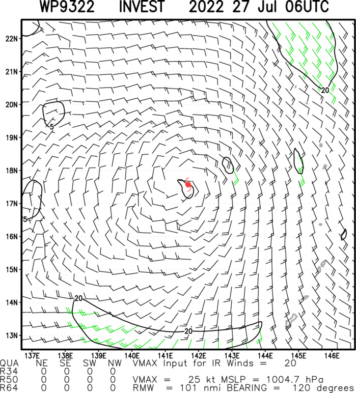
THE AREA OF CONVECTION (INVEST 93W) PREVIOUSLY LOCATED NEAR 16.1N 142.6E IS NOW LOCATED NEAR 17.0N 142.1E, APPROXIMATELY 235 NM NORTHWEST OF SAIPAN, CNMI. ANIMATED ENHANCED INFRARED SATELLITE IMAGERY SHOWS A DEEPENING AND EXPANDING SYSTEM WITH SIGNS OF FORMATIVE BANDING IN THE NORTHWEST QUADRANT FEEDING INTO AN ASSESSED LOW LEVEL CIRCULATION (LLC). A 261214Z ASCAT-C PASS SHOWS A SHARP TROUGH AT THE SURFACE WITH 20 KNOT WINDS IN THE SOUTHEAST QUADRANT ALONG WITH A SMALL PATCH OF 25 KNOT WINDS LIKELY ASSOCIATED WITH THUNDERSTORM ACTIVITY. ANALYSIS INDICATES AN OVERALL FAVORABLE ENVIRONMENT WITH A WESTWARD TRANSITING TROPICAL UPPER TROPOSPHERIC TROUGH THAT IS ENHANCING POLEWARD OUTFLOW. ADDITIONALLY, VERTICAL WIND SHEAR IS LOW (10-15KTS) TOWARDS THE CENTER OF THE LLC WITH VERY WARM (29- 30C) SEA SURFACE TEMPERATURES. NUMERICAL MODELS ARE IN GENERAL AGREEMENT THAT THE SYSTEM WILL TRACK NORTHWESTWARD AND DEEPEN OVER THE NEXT 24-48 HOURS. MAXIMUM SUSTAINED SURFACE WINDS ARE ESTIMATED AT 18 TO 23 KNOTS. MINIMUM SEA LEVEL PRESSURE IS ESTIMATED TO BE NEAR 1004 MB. THE POTENTIAL FOR THE DEVELOPMENT OF A SIGNIFICANT TROPICAL CYCLONE WITHIN THE NEXT 24 HOURS REMAINS HIGH.
WP, 93, 2022072600,152N, 1446E, 15
WP, 93, 2022072606,156N, 1437E, 15
WP, 93, 2022072612,159N, 1429E, 20
WP, 93, 2022072618,161N, 1426E, 20
WP, 93, 2022072700,166N, 1417E, 20
WP, 93, 2022072706,173N, 1410E, 20
WP, 93, 2022072606,156N, 1437E, 15
WP, 93, 2022072612,159N, 1429E, 20
WP, 93, 2022072618,161N, 1426E, 20
WP, 93, 2022072700,166N, 1417E, 20
WP, 93, 2022072706,173N, 1410E, 20
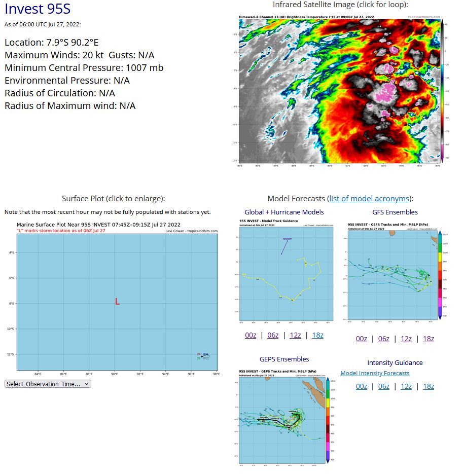
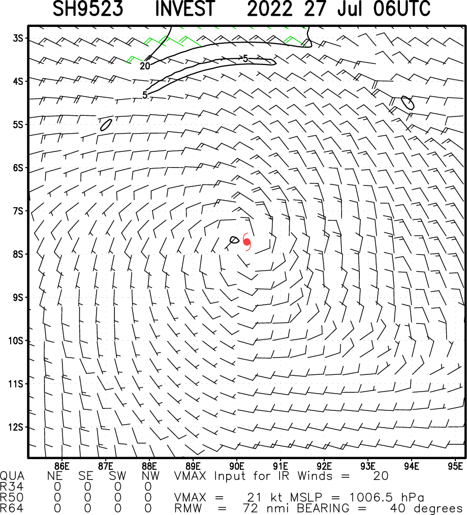
SOUTH INDIAN OCEAN: INVEST 95S. ADVISORY(ABPW) ISSUED AT 27/01UTC.

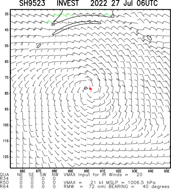
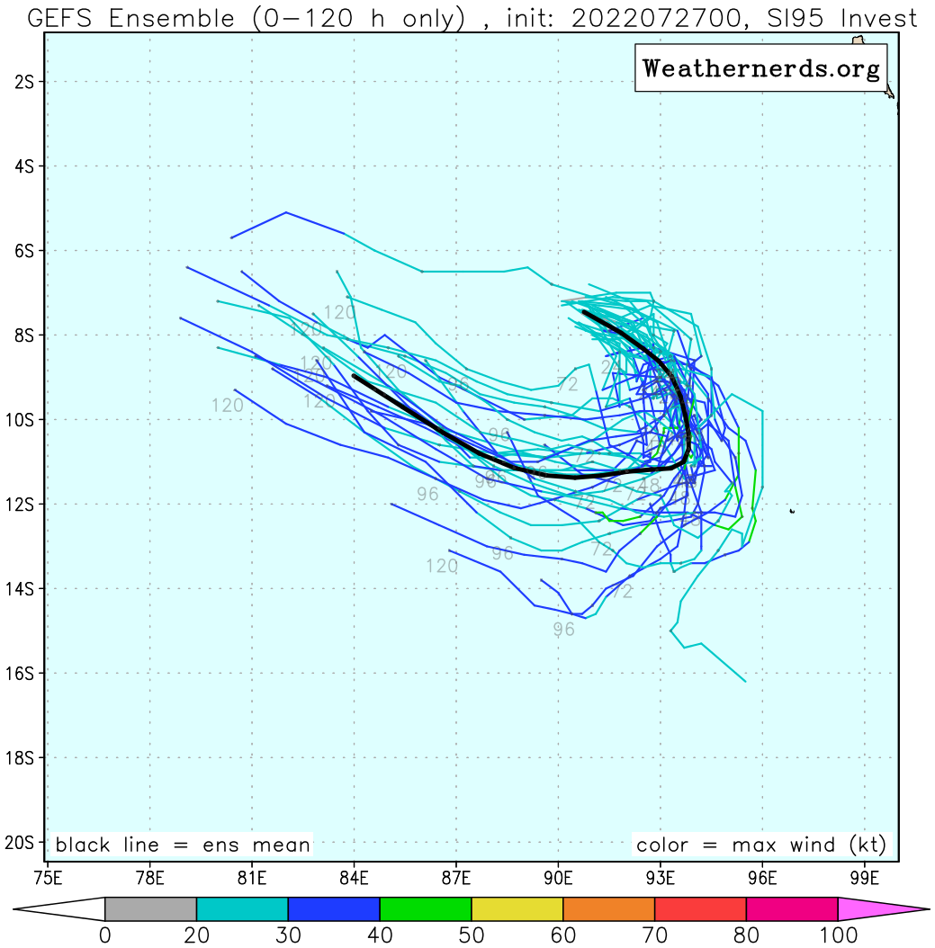
AN AREA OF CONVECTION (INVEST 95S) HAS PERSISTED NEAR 7.3S 89.5E, APPROXIMATELY 524 NM WEST-NORTHWEST OF COCOS ISLANDS. ANIMATED MULTISPECTRAL SATELLITE IMAGERY (MSI) AND A 261915Z ASMR2 89GHZ IMAGE SHOW A BROAD SYSTEM WITH SCATTERED CONVECTION IN THE WESTERN PERIPHERY. THERE IS WEAK FORMATIVE BANDING WITHIN THE NORTH-NORTHWESTERN QUADRANT WRAPPING INTO AN ASSESSED LOW LEVEL CIRCULATION (LLC). ENVIRONMENTAL ANALYSIS INDICATES A MARGINAL ENVIRONMENT FOR DEVELOPMENT SUPPORTED BY STRONG POLEWARD OUTFLOW AND WARM (28-29C) SEA SURFACE TEMPERATURES OFFSET BY STRONG (20-25KTS) VERTCAL WIND SHEAR. ENSEMBLE AND DETERMINISTIC MODELS ARE IN GENERAL AGREEMENT THAT THE SYSTEM WILL TRACK SOUTH- SOUTHWERTWARD AND DEEPEN OVER THE NEXT 24-48 HOURS. MAXIMUM SUSTAINED SURFACE WINDS ARE ESTIMATED AT 15 TO 20 KNOTS. MINIMUM SEA LEVEL PRESSURE IS ESTIMATED TO BE NEAR 1007 MB. THE POTENTIAL FOR THE DEVELOPMENT OF A SIGNIFICANT TROPICAL CYCLONE WITHIN THE NEXT 24 HOURS IS UPGRADED TO LOW.
SH, 95, 2022072600,58S, 868E, 20
SH, 95, 2022072606,61S, 874E, 20
SH, 95, 2022072612,65S, 881E, 20
SH, 95, 2022072618,69S, 888E, 20
SH, 95, 2022072700,73S, 895E, 20
SH, 95, 2022072706,79S, 902E, 20
SH, 95, 2022072606,61S, 874E, 20
SH, 95, 2022072612,65S, 881E, 20
SH, 95, 2022072618,69S, 888E, 20
SH, 95, 2022072700,73S, 895E, 20
SH, 95, 2022072706,79S, 902E, 20
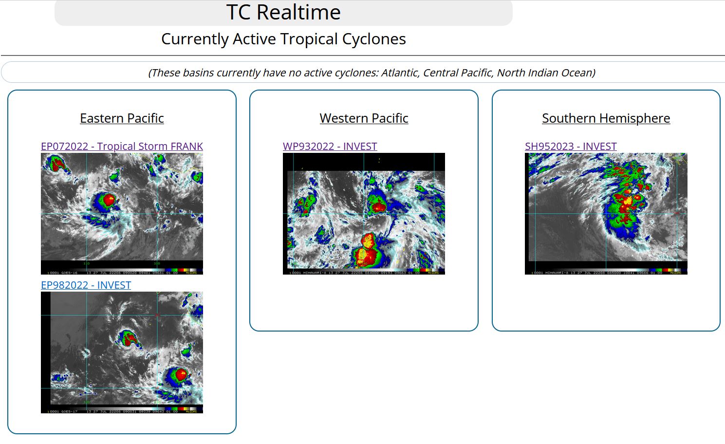
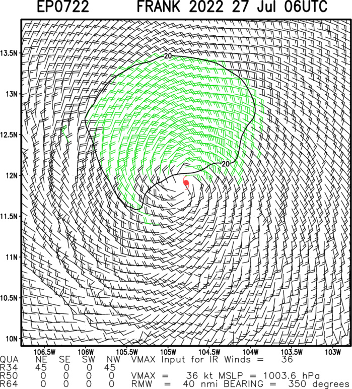
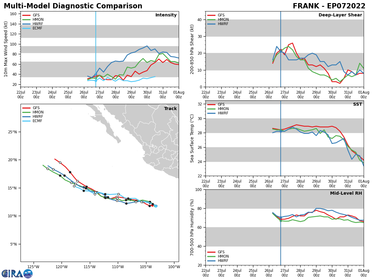
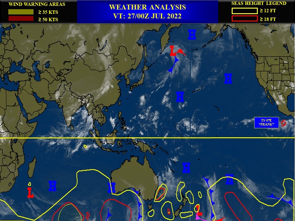
EASTERN NORTH PACIFIC: TS 07E(FRANK). WARNING 5 ISSIUED AT 27/10UTC. NHC COMMENTS.
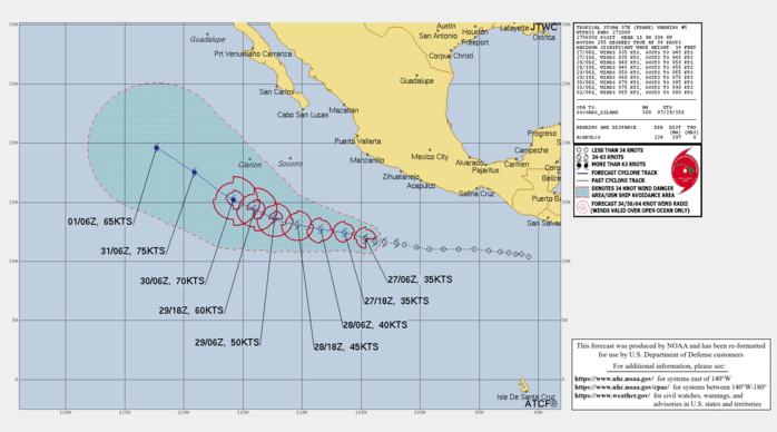
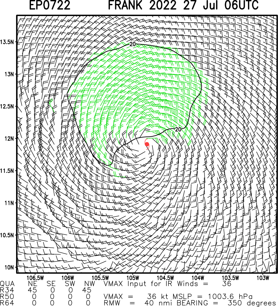
Tropical Storm Frank Discussion Number 5 NWS National Hurricane Center Miami FL EP072022 400 AM CDT Wed Jul 27 2022 Frank remains a highly sheared tropical cyclone. Shortwave infrared satellite imagery indicates that the center is exposed well to the northeast of the primary convective mass. This is due to around 25 kt of northeasterly vertical wind shear as indicated by the SHIPS guidance. Recent ASCAT overpasses only caught the far western portion of the circulation and they were not helpful in estimating Frank's initial intensity. Therefore, the initial wind speed remains at 35 kt, which is in agreement with the latest subjective and objective Dvorak satellite intensity estimates. The strong northeasterly shear that is plaguing Frank is not expected to change much today. The global model guidance, however suggests the shear will gradually abate beginning tonight with upper-level conditions becoming more conducive for strengthening in 24 to 36 hours. Given the current structure of the tropical cyclone, it may take some time for the system to take advantage of the more favorable environment. Therefore, the NHC wind speed forecast only calls for gradual strengthening between 24 and 48 hours, with a slightly faster rate of intensification after that time. The NHC forecast is once again on the conservative side and lies between the SHIPS and lower LGEM model guidance. Frank is moving westward at about 8 kt. A subtropical ridge to the north of the cyclone should continue to steer Frank westward to west-northwestward over the next 48 to 72 hours. After that time, a west-northwestward to northwestward motion is forecast as the cyclone reaches the western periphery of the ridge. The new NHC track forecast is once again close to the multi-model consensus aids and the GFS ensemble mean.
EP, 07, 2022072600,112N, 1003W, 30
EP, 07, 2022072606,114N, 1013W, 30
EP, 07, 2022072612,115N, 1020W, 35
EP, 07, 2022072618,116N, 1030W, 35
EP, 07, 2022072700,117N, 1038W, 35
EP, 07, 2022072706,119N, 1046W, 35
EP, 07, 2022072606,114N, 1013W, 30
EP, 07, 2022072612,115N, 1020W, 35
EP, 07, 2022072618,116N, 1030W, 35
EP, 07, 2022072700,117N, 1038W, 35
EP, 07, 2022072706,119N, 1046W, 35
