CLICK ON THE IMAGERIES BELOW TO GET THEM ENLARGED
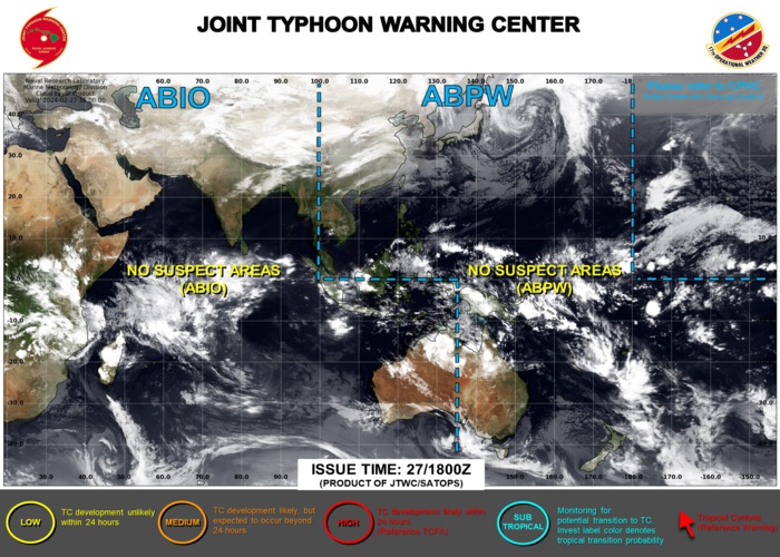
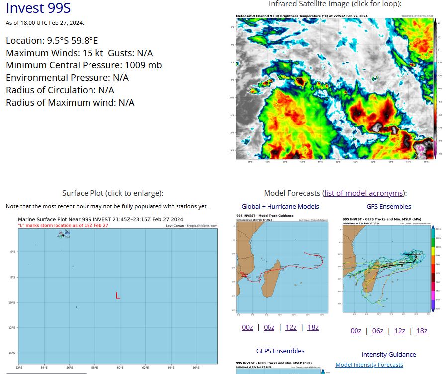
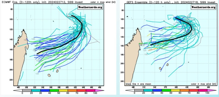
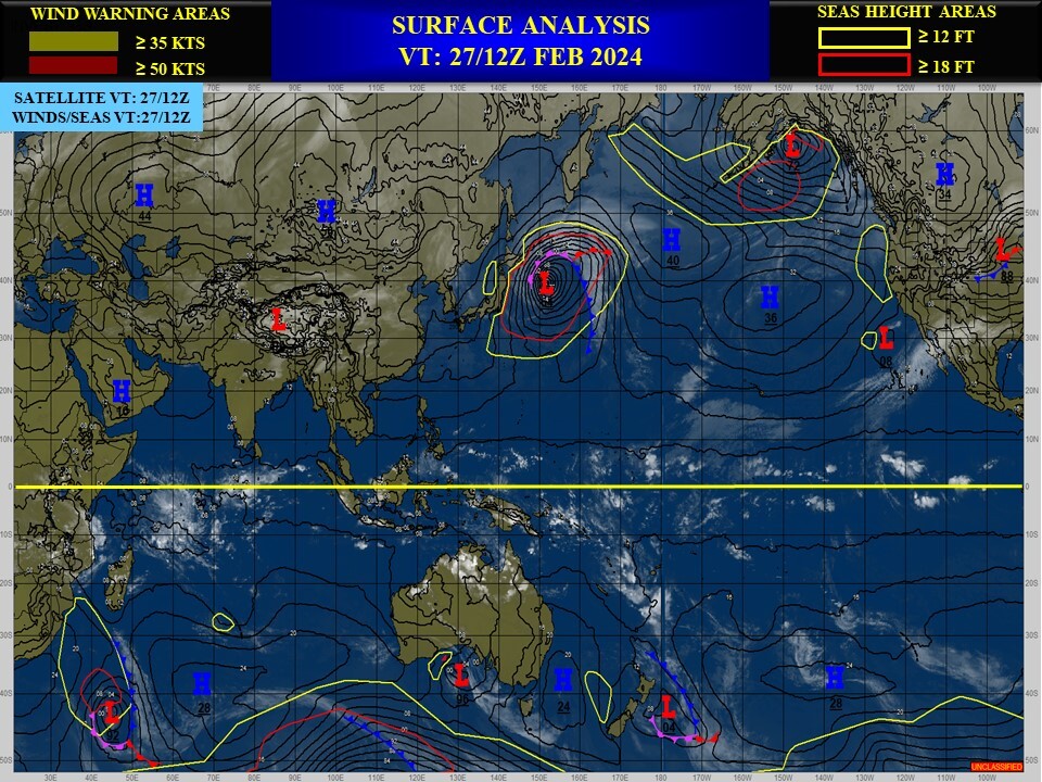
SOUTH INDIAN OCEAN: INVEST 99S. ESTIMATED INTENSITY IS 15 KNOTS AT 27/18UTC.
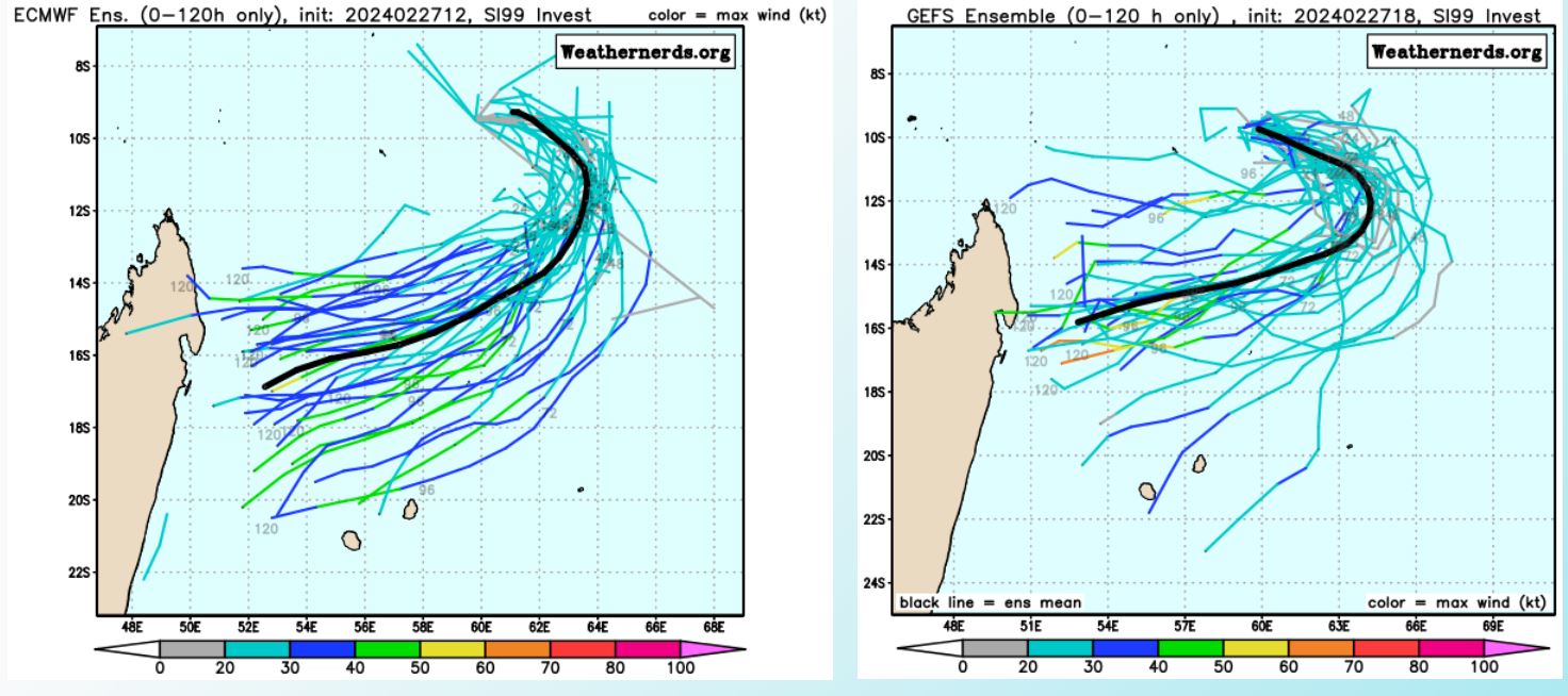
TC Ensemble Forecasts
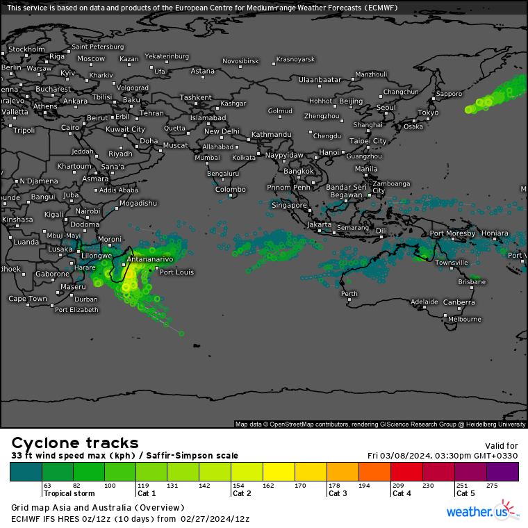
ECMWF Storm Tracks (Ensemble) : 02/27 12UTC+ 10 DAYS
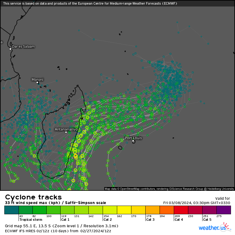
ECMWF Storm Tracks (Ensemble) : 02/27 12UTC+ 10 DAYS
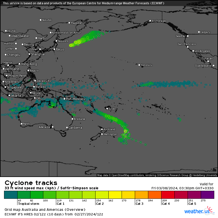
ECMWF Storm Tracks (Ensemble) : 02/27 12UTC+ 10 DAYS
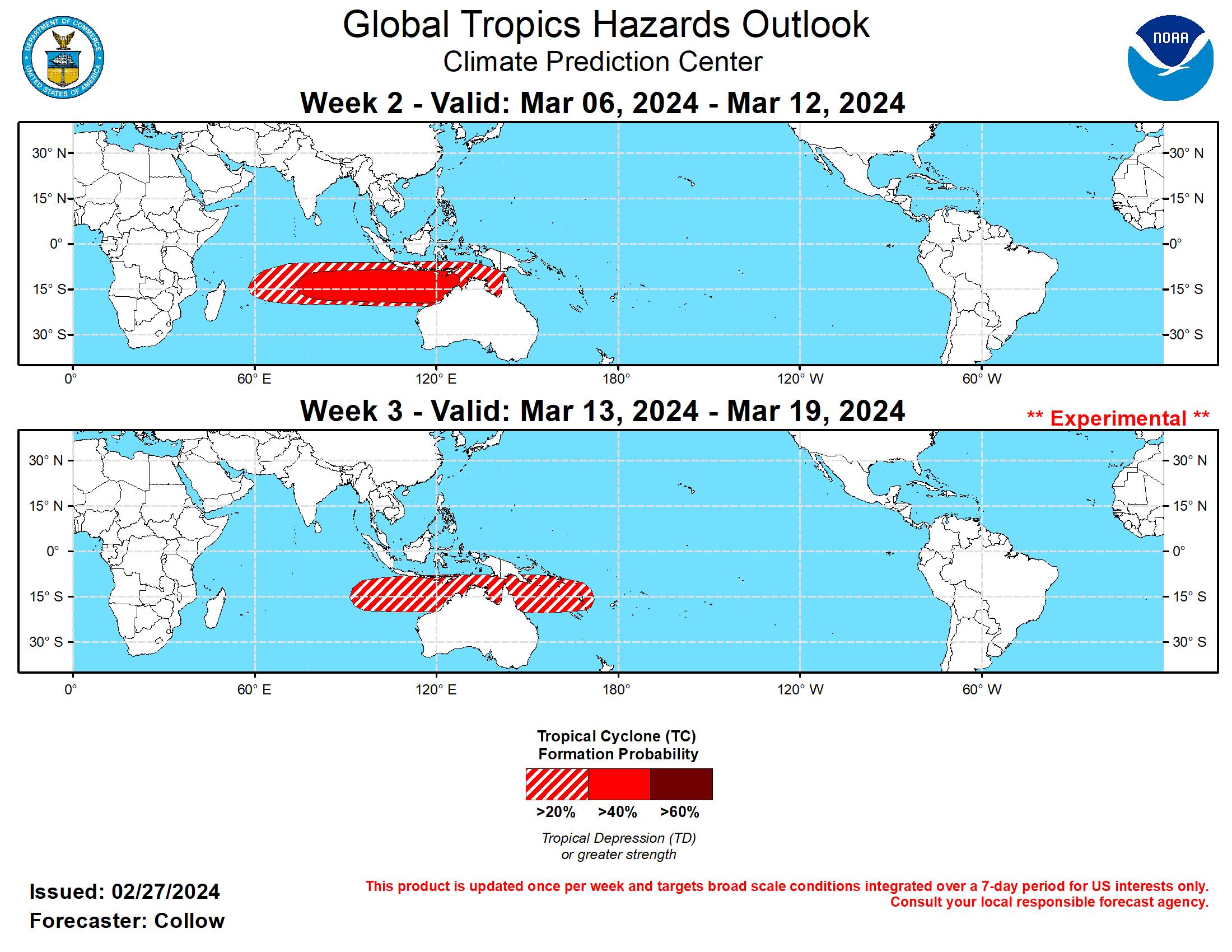
Last Updated - 02/27/24 3 WEEK TROPICAL CYCLONE DEVELOPMENT PROBABILITY

USA.gov is the U.S. Government's official Web portal to all Federal, state and local government Web resources and services. HOME > Climate & Weather Linkage > Global Tropics Outlook Weeks 2-3 Global Tropics Hazards Outlook (GTH) For week-1 tropical cylone information and forecasts, please visit the National Hurricane Center and the Joint Typhoon Warning Center. For week-1 precipitation and temperature related products, please visit the Weather Prediction Center or refer to your local NWS office. ATTENTION: The Climate Prediction Center is soliciting comments from August 1, 2023 through January 31, 2024 on the implementation of the Week 2 and experimental Week 3 Global Tropics Hazards Outlook. Here is the Survey. GTH Outlook Map and Data Last Updated - 02/27/24 GIS Ready Formats Hazard Week-2 Week-3 Tropical Cyclone Formation Probability KMZ KML SHP KMZ KML SHP Enhanced Precipitation Probability KMZ KML SHP KMZ KML SHP Suppressed Precipitation Probability KMZ KML SHP KMZ KML SHP Above Average Temperatures Probability KMZ KML SHP KMZ KML SHP Below Average Temperatures Probability KMZ KML SHP KMZ KML SHP Tropical Cyclone Only GTH Map Precipitation Only GTH Map Temperature Only GTH Map Lines Only GTH Map Latest Product (PDF Format) Latest Briefing (PDF Format) GTH Archive GTH Outlook Discussion Last Updated - 02/27/24 Valid - 03/06/24 - 03/19/24 The RMM-based Madden Julian Oscillation (MJO) has retreated into the unit circle during the past week. However, increased divergence in the upper-level velocity potential fields and negative outgoing longwave radiation (OLR) anomalies are more suggestive of an active MJO across Africa and crossing into the western Indian Ocean. It is plausible that the 120-day mean removal is resulting in a rightward skewing of the RMM-based plots due to the strong Indian Ocean Dipole event last Fall. The GEFS and ECMWF ensembles indicate continued eastward MJO propagation with a quick phase speed, although the amplitude may be overdone due to the aforementioned rightward bias. The degree of interference from Rossby Wave activity is likely to play a role in the propagation speed but all models indicate the MJO remaining active with increased potential for a global circumnavigation by the end of March. The global tropics have been quiet for the past week, with no new tropical cyclone (TC) formations. TC activity is forecast to increase across the Indian Ocean with potential development to the east of Madagascar during the next few days as the MJO propagates into the Indian Ocean. By week-2, the convective envelope is forecast to continue moving eastward, with the highest chances for TC formation (greater than 40 percent) favored across the south-central and southeastern Indian Ocean to the northwest of Australia. The faster phase speed depicted in the ECMWF may allow for favorable conditions to extend along the north coast of Australia and into the Gulf of Carpentaria, supporting at least a 20 percent chance for TC formation in those regions. For week-3, a broad region with at least a 20 percent chance of TC formation is highlighted from the southeastern Indian Ocean, along the northern coast of Australia, and through the Coral Sea to Vanuatu. As with week-2, uncertainties regarding the phase speed of the MJO warrant a larger shape, but confidence is too low to increase probabilities, due in part to the longer lead time and less than expected TC activity during previous episodes of favorable conditions over this area.
