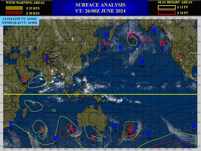
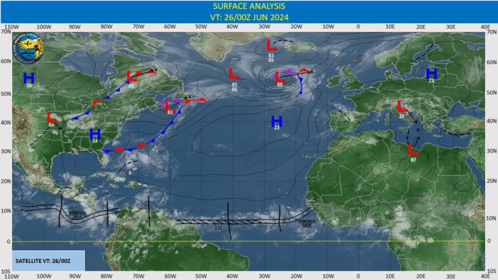
CLICK ON THE IMAGERIES BELOW TO GET THEM ENLARGED
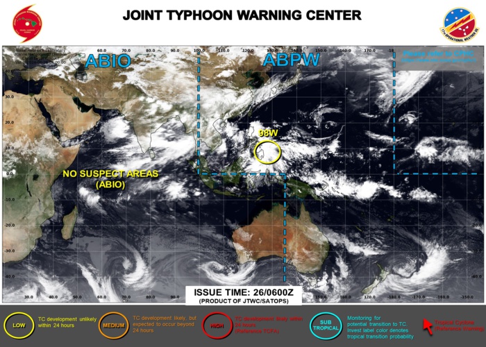
WESTERN NORTH PACIFIC: INVEST 98W. ESTIMATED LOCATION AND INTENSIY AT 26/00UTC. INTENSITY IS 20 KNOTS. ADVISORY(ABPW) ISSUED AT 26/06UTC
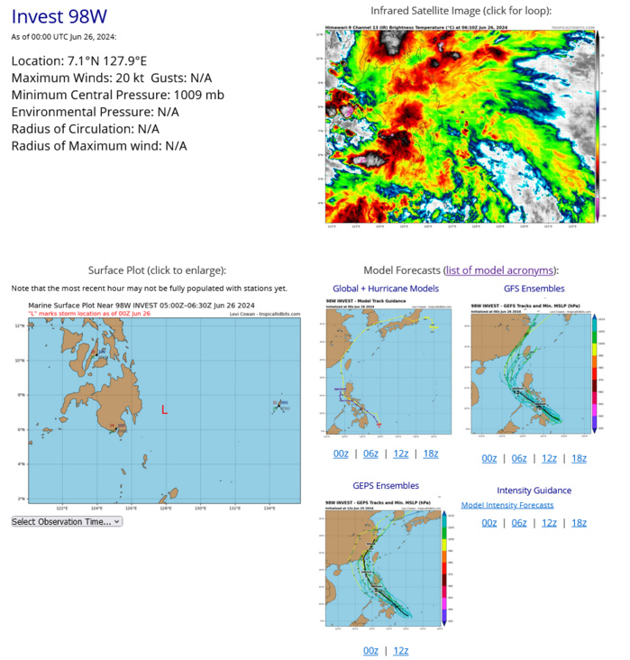
AN AREA OF CONVECTION (INVEST 98W) HAS PERSISTED NEAR 7.1N 128.9E, APPROXIMATELY 140 NM EAST OF DAVAO. ANIMATED MULTISPECTRAL SATELLITE IMAGERY (MSI) AND A 252203Z SSMIS 91GHZ MICROWAVE IMAGE DEPICT A POORLY ORGANIZED, YET FULLY OBSCURED LOW LEVEL CIRCULATION (LLC) WITH PERSISTENT DEEP CONVECTION ON THE NORTHERN AND SOUTHERN PERIPHERIES. ENVIRONMENTAL ANALYSIS REVEALS FAVORABLE CONDITIONS FOR FURTHER DEVELOPMENT, CHARACTERIZED BY GOOD UPPER LEVEL OUTFLOW, LOW TO MODERATE (15-20 KTS) VERTICAL WIND SHEAR, AND WARM (29-30 C) SEA SURFACE TEMPERATURES. DETERMINISTIC GUIDANCE IS SPLIT ON INTENSIFICATION WITH A SMALL AGREEMENT ON A GENERAL NORTHWESTWARD TRACK OVER THE NEXT 48 HOURS. GFS SHOWS INVEST 98W CONTINUING WESTWARD OVER MINDANAO THEN A NORTHWARD TURN IN THE SULU SEA WHICH IS MORE PLAUSIBLE WITH THE OVERALL FLOW. MAXIMUM SUSTAINED SURFACE WINDS ARE ESTIMATED AT 18 TO 23 KNOTS. MINIMUM SEA LEVEL PRESSURE IS ESTIMATED TO BE NEAR 1009 MB. THE POTENTIAL FOR THE DEVELOPMENT OF A SIGNIFICANT TROPICAL CYCLONE WITHIN THE NEXT 24 HOURS IS LOW.
TC GUIDANCE
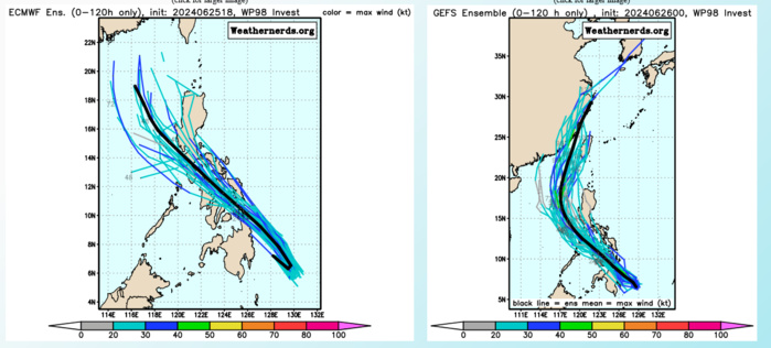
DETERMINISTIC GUIDANCE IS SPLIT ON INTENSIFICATION WITH A SMALL AGREEMENT ON A GENERAL NORTHWESTWARD TRACK OVER THE NEXT 48 HOURS. GFS SHOWS INVEST 98W CONTINUING WESTWARD OVER MINDANAO THEN A NORTHWARD TURN IN THE SULU SEA WHICH IS MORE PLAUSIBLE WITH THE OVERALL FLOW.
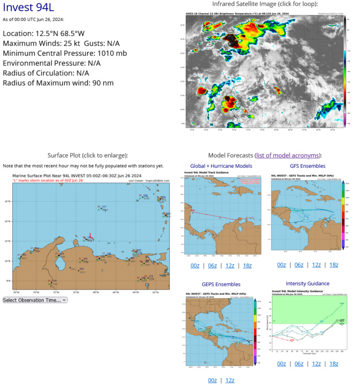
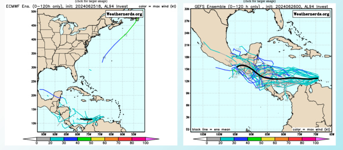
NORTH ATLANTIC: INVEST 94L. ESTIMATED LOCATION AND INTENSITY AT 26/00UTC. INTENSITY IS 25 KNOTS
TC GUIDANCE
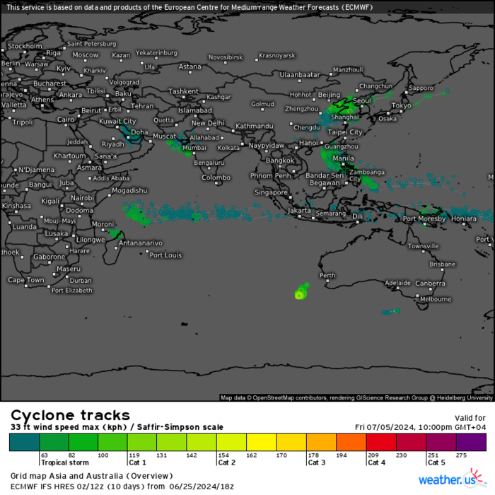
ECMWF Storm Tracks (Ensemble) : 06/25 18UTC+ 10 DAYS
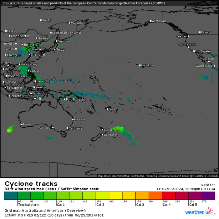
ECMWF Storm Tracks (Ensemble) : 06/25 18UTC+ 10 DAYS
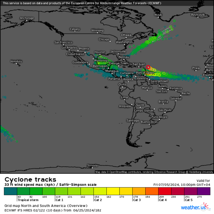
ECMWF Storm Tracks (Ensemble) : 06/25 18UTC+ 10 DAYS
Last Updated - 06/26/24 3 WEEK TROPICAL CYCLONE FORMATION PROBABILITY
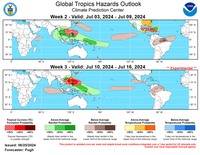
GTH Outlook Discussion Last Updated - 06/25/24 Valid - 07/03/24 - 07/16/24 The MJO has remained weak since the beginning of June according to the RMM-based index along with a less coherent 200-hPa velocity potential anomaly structure. As of June 24th, the GEFS and ECMWF ensemble mean forecasts favor a strengthening MJO during early July. These dynamical models depict an increase in the amplitude of the RMM-based index with an eastward propagation to the Maritime Continent and West Pacific. Likewise, a more coherent wave-1 pattern of anomalous upper-level divergence (convergence) is forecast to develop over the eastern (western) Hemisphere. The magnitude of these anomalies are also forecast to increase with time. Only one tropical cyclone (TC) has developed globally so far during June and that was Tropical Storm Alberto in the western Gulf of Mexico on June 19. Alberto tracked westward into northeastern Mexico and resulted in heavy rainfall across Coahuila, Nuevo Leon, and Tamaulipas. As of 8am EDT on June 25, the National Hurricane Center (NHC) is monitoring a tropical wave tracking westward across the Caribbean Sea. NHC states that there is a 20 percent chance that this system becomes a tropical cyclone during the next week. Since any development could be delayed until the beginning of week-2 (July 3) and there are likely to be additional easterly waves, a 20 to 40 percent chance of TC development is posted for the southwestern Gulf of Mexico and Caribbean Sea from July 3 to 9. This elevated chance of TC development extends east of Hispaniola and Puerto Rico since consecutive ECMWF model runs favor TC genesis in that region during the first week of July. By week-3, the large-scale environment is expected to become less favorable for TC development across the Atlantic basin and forecast confidence is too low for the East Pacific during weeks 2 and 3. A strengthening and eastward propagating MJO would provide a more favorable large-scale environment for TC development across the West Pacific during early to mid-July. Based o MJO composites and dynamical model output, TC formation probabilities increase from week 2 to 3.
