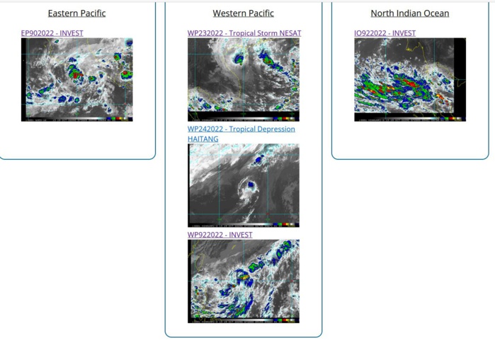
CLICK ON THE IMAGERIES BELOW TO GET THEM ENLARGED
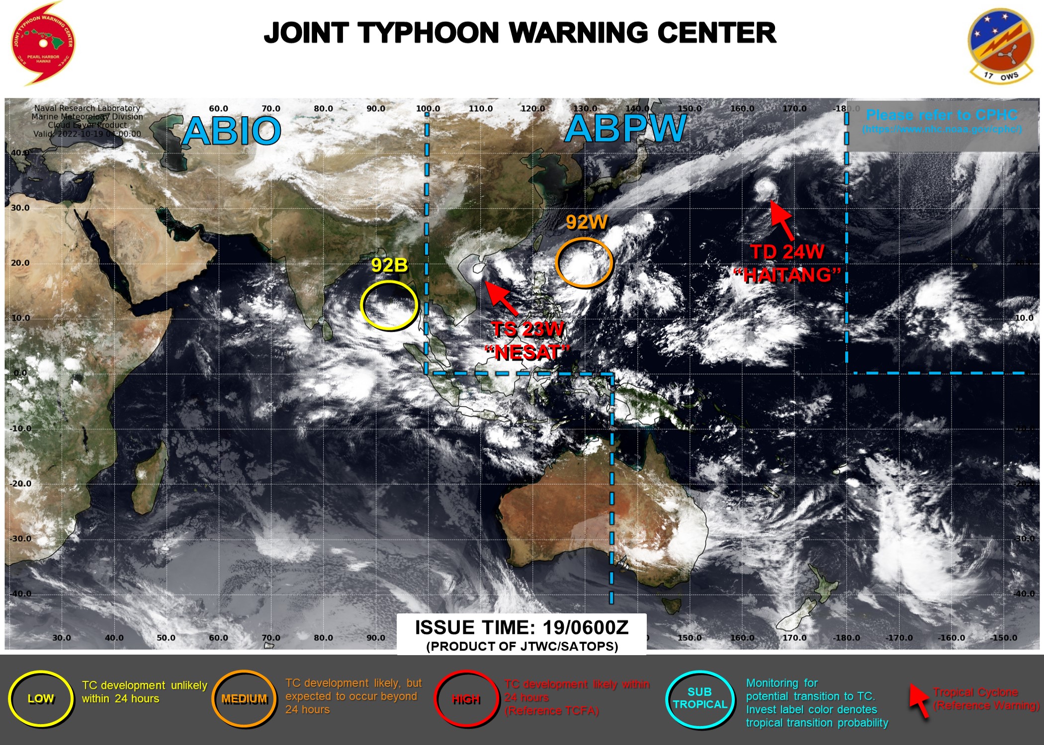
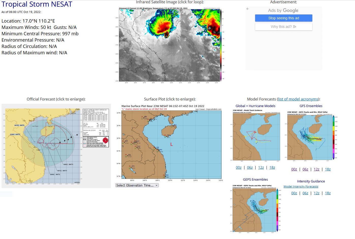
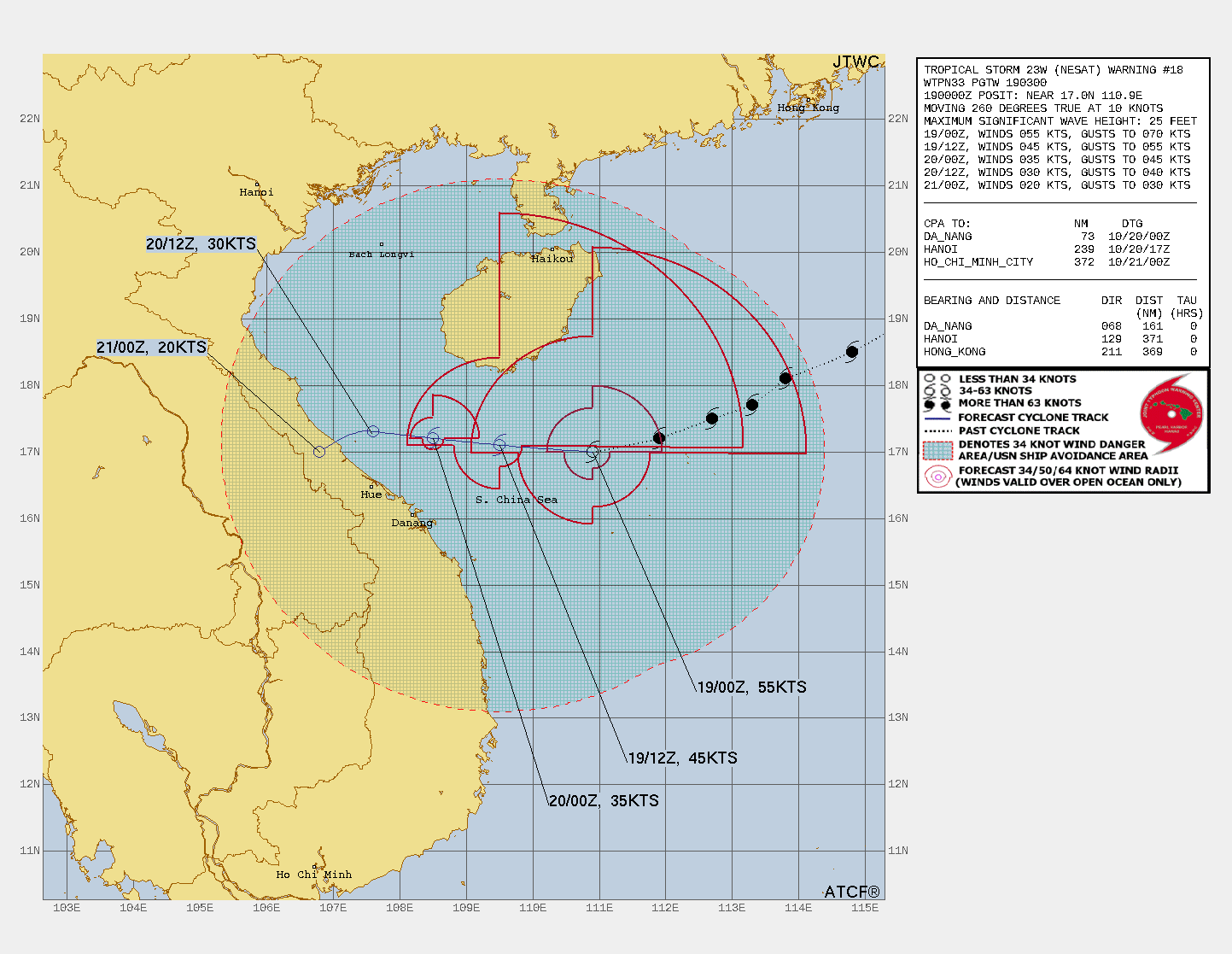
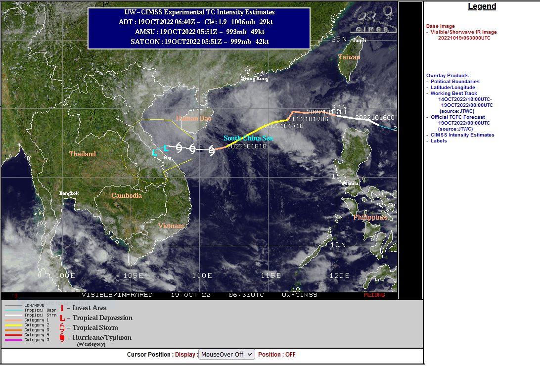
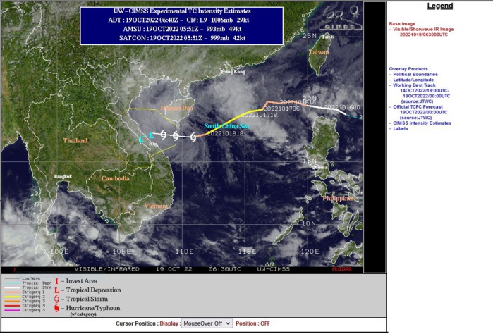
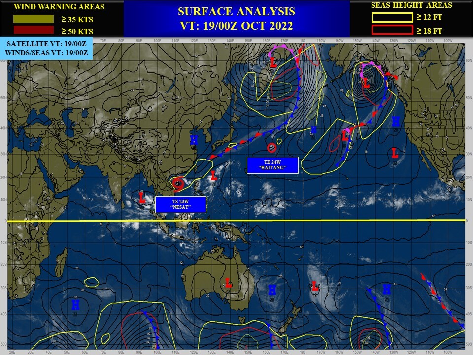
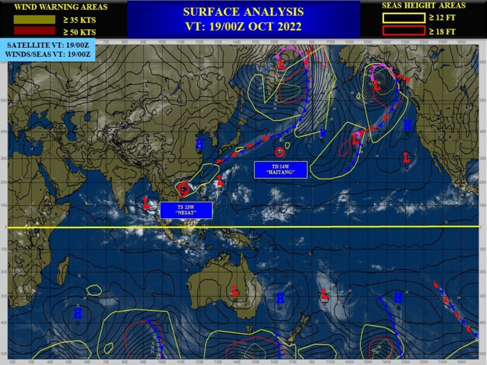
WESTERN NORTH PACIFIC: TY 23W(NESAT). ESTIMATED LOCATION AND INTENSITY AT 19/06UTC. WARNING 18 ISSUED AT 19/03UTC.
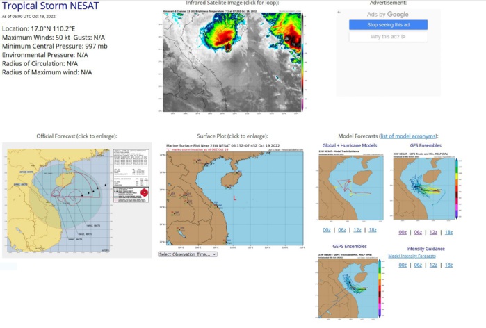
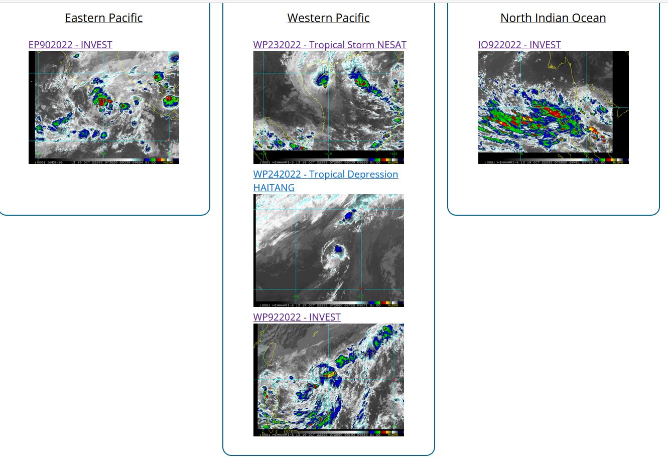
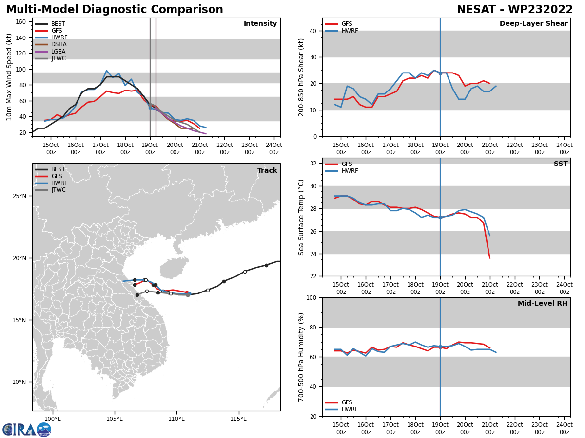
SATELLITE ANALYSIS, INITIAL POSITION AND INTENSITY DISCUSSION: ANIMATED MULTISPECTRAL SATELLITE IMAGERY (MSI) SHOWS THE SYSTEM CONTINUED TO RAPIDLY DECAY AS IT TRACKED TOWARD VIETNAM IN THE SOUTH CHINA SEA. THE RAGGED LOW LEVEL CIRCULATION HAS BECOME FULLY EXPOSED AS THE RAPIDLY COLLAPSING CENTRAL CONVECTION IS SHEARED FURTHER NORTHWESTWARD. THE INITIAL POSITION IS PLACED WITH HIGH CONFIDENCE BASED ON THE PARTIALLY EXPOSED LLC. THE INITIAL INTENSITY IS BASED ON AN OVERALL ASSESSMENT OF AGENCY AND AUTOMATED DVORAK ESTIMATES AND REFLECTS THE RAPID WEAKENING.
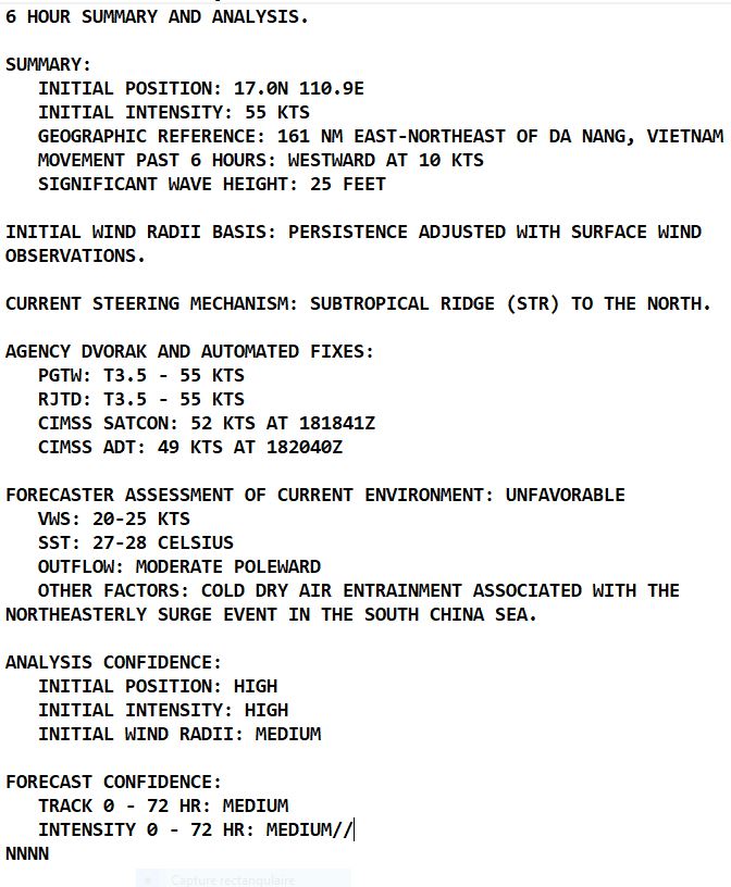
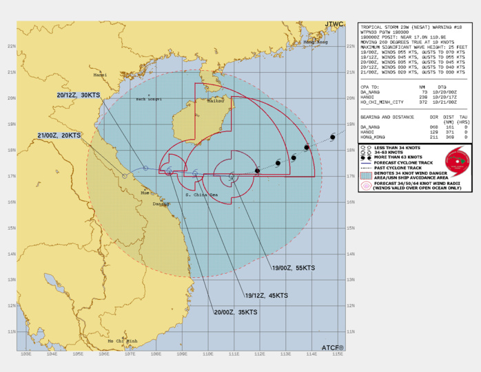
FORECAST REASONING. SIGNIFICANT FORECAST CHANGES: THERE ARE NO SIGNIFICANT CHANGES TO THE FORECAST FROM THE PREVIOUS WARNING. FORECAST DISCUSSION: TS NESAT WILL CONTINUE ON ITS WESTWARD TRACK UNDER THE STEERING INFLUENCE OF THE STR, MAKING A FINAL LANDFALL JUST NORTHWEST OF HUE, VIETNAM, JUST BEFORE TAU 48. THE HARSH ENVIRONMENT, CAUSED MOSTLY BY STRONG VERTICAL WIND SHEAR, COLD DRY AIR INTRUSION NEAR THE SURFACE, AND LAND INTERACTION WITH THE ISLAND OF HAINAN AND EVENTUALLY WITH VIETNAM, WILL CONTINUE TO RAPIDLY ERODE THE SYSTEM, LEADING TO DISSIPATION BY TAU 48, POSSIBLY SOONER.
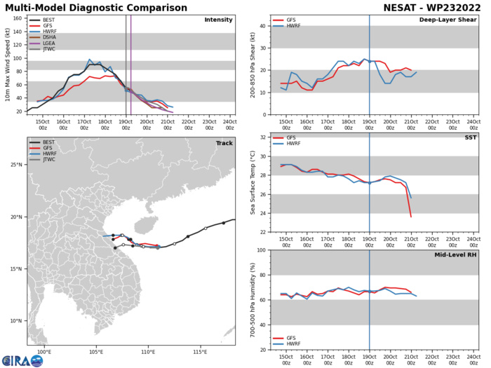
MODEL DISCUSSION: NUMERICAL MODELS ARE IN OVERALL GOOD AGREEMENT UP TO TAU 24; AFTERWARD, THE MEMBERS SIGNIFICANTLY DIVERGE, AN INDICATION OF DIFFICULTY IN TRACKING A WEAK VORTEX. IN VIEW OF THIS, THERE IS ONLY MEDIUM CONFIDENCE IN THE JTWC TRACK AND INTENSITY FORECASTS.
WP, 23, 2022101718,185N, 1148E, 90, 964, TY
WP, 23, 2022101800,181N, 1138E, 85, 966, TY
WP, 23, 2022101806,177N, 1133E, 80, 972, TY
WP, 23, 2022101812,174N, 1125E, 75, 976, TY
WP, 23, 2022101818,171N, 1117E, 65, 983, TY
WP, 23, 2022101900,170N, 1109E, 55, 988, TS
WP, 23, 2022101906,170N, 1102E, 50, 997, TS
WP, 23, 2022101800,181N, 1138E, 85, 966, TY
WP, 23, 2022101806,177N, 1133E, 80, 972, TY
WP, 23, 2022101812,174N, 1125E, 75, 976, TY
WP, 23, 2022101818,171N, 1117E, 65, 983, TY
WP, 23, 2022101900,170N, 1109E, 55, 988, TS
WP, 23, 2022101906,170N, 1102E, 50, 997, TS
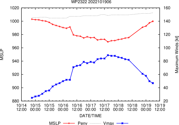
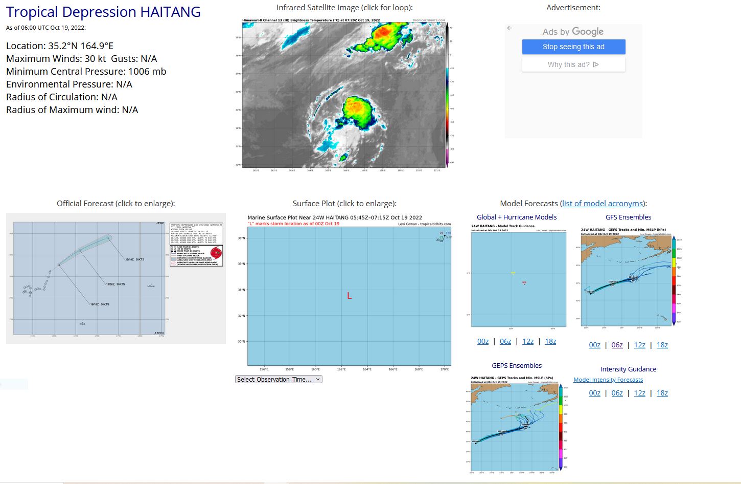
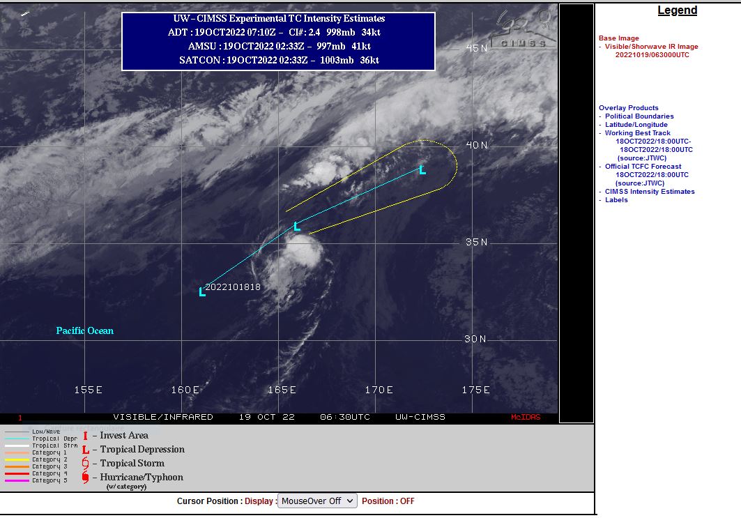
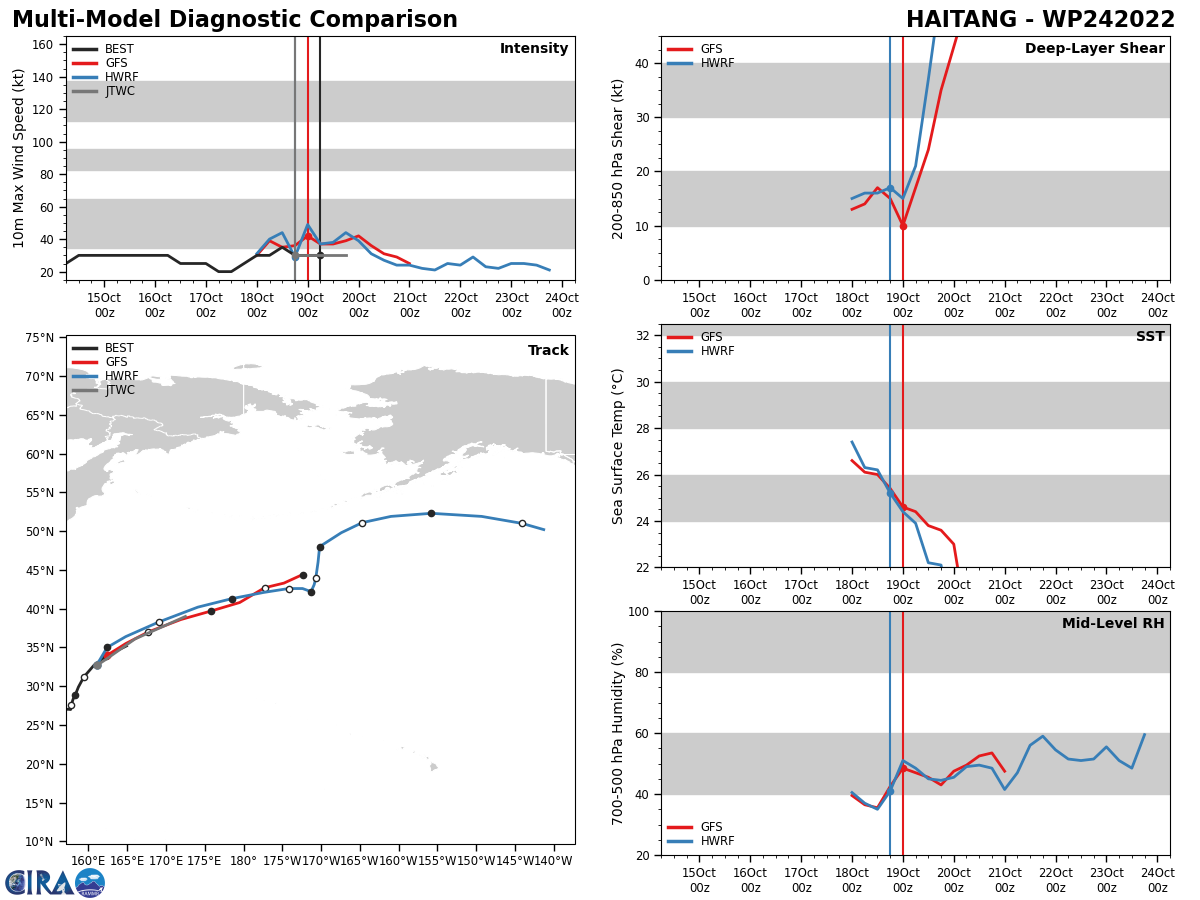
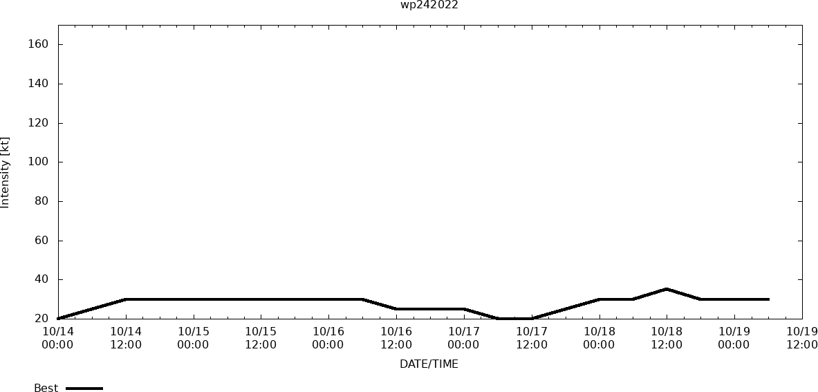
WESTERN NORTH PACIFIC: REMNANTS OF 24W(HAITANG). ESTIMATED LOCATION AND INTENSITY AT 19/06UTC.WARNING 4/FINAL ISSUED AT 18/21UTC.
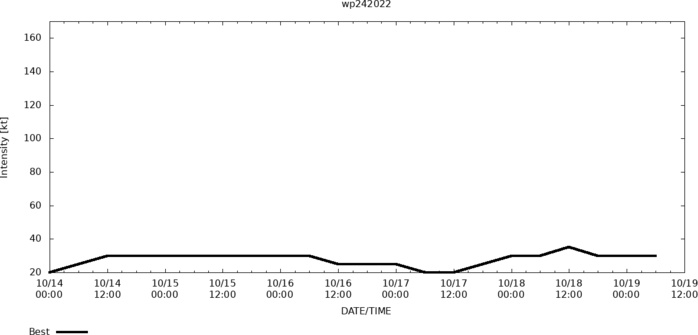
WP, 24, 2022101400,254N, 1544E, 20, 1007, DB
WP, 24, 2022101406,263N, 1545E, 25, 1004, SD
WP, 24, 2022101412,273N, 1545E, 30, 1004, SD
WP, 24, 2022101418,278N, 1542E, 30, 1001, SD
WP, 24, 2022101500,276N, 1536E, 30, 1001, SD
WP, 24, 2022101506,274N, 1531E, 30, 1000, SD
WP, 24, 2022101512,263N, 1529E, 30, 1000, SD
WP, 24, 2022101518,265N, 1531E, 30, 1004, SD
WP, 24, 2022101600,265N, 1534E, 30, 1003, SD
WP, 24, 2022101606,261N, 1545E, 30, 1003, SD
WP, 24, 2022101612,270N, 1557E, 25, 1005, SD
WP, 24, 2022101618,272N, 1562E, 25, 1006, SD
WP, 24, 2022101700,271N, 1567E, 25, 1007, SD
WP, 24, 2022101706,270N, 1577E, 20, 1008, SD
WP, 24, 2022101712,276N, 1578E, 20, 1007, DB
WP, 24, 2022101718,283N, 1580E, 25, 1005, TD
WP, 24, 2022101800,289N, 1583E, 30, 1004, TD
WP, 24, 2022101806,299N, 1587E, 30, 1001, TD
WP, 24, 2022101812,312N, 1594E, 35, 1004, TS
WP, 24, 2022101818,327N, 1607E, 30, 1006, TD
WP, 24, 2022101900,339N, 1623E, 30, 1006, TD
WP, 24, 2022101906,352N, 1649E, 30, 1006, TD
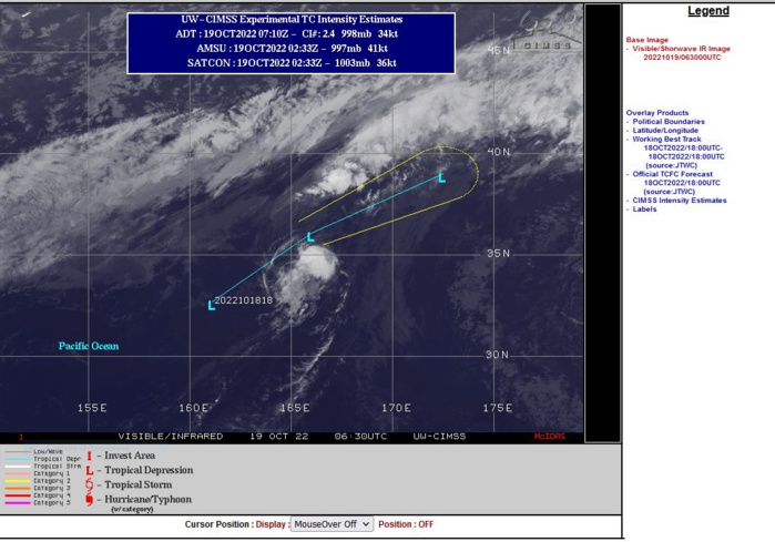
REMARKS: 182100Z POSITION NEAR 33.5N 162.3E. 18OCT22. TROPICAL DEPRESSION 24W (HAITANG), LOCATED APPROXIMATELY 632 NM NORTHEAST OF MINAMI TORI SHIMA, JAPAN HAS TRACKED NORTHEASTWARD AT 25 KNOTS OVER THE PAST SIX HOURS. THIS IS THE FINAL WARNING ON THIS SYSTEM BY THE JOINT TYPHOON WRNCEN PEARL HARBOR HI. THE SYSTEM WILL BE CLOSELY MONITORED FOR SIGNS OF REGENERATION. MAXIMUM SIGNIFICANT WAVE HEIGHT AT 181800Z IS 11 FEET.
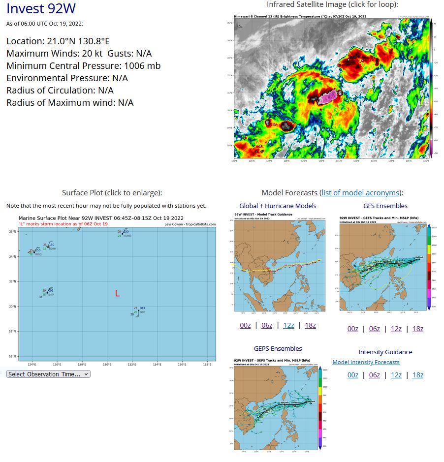
WESTERN NORTH PACIFIC: INVEST 92W. ESTIMATED LOCATION AND INTENSITY AT 19/06UTC.ADVISORY(ABPW) ISSUED AT 19/06UTC.
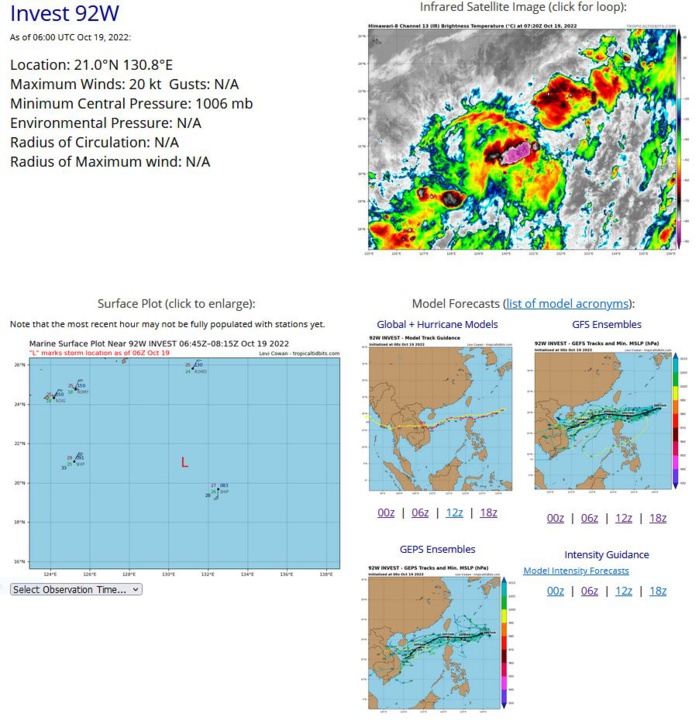
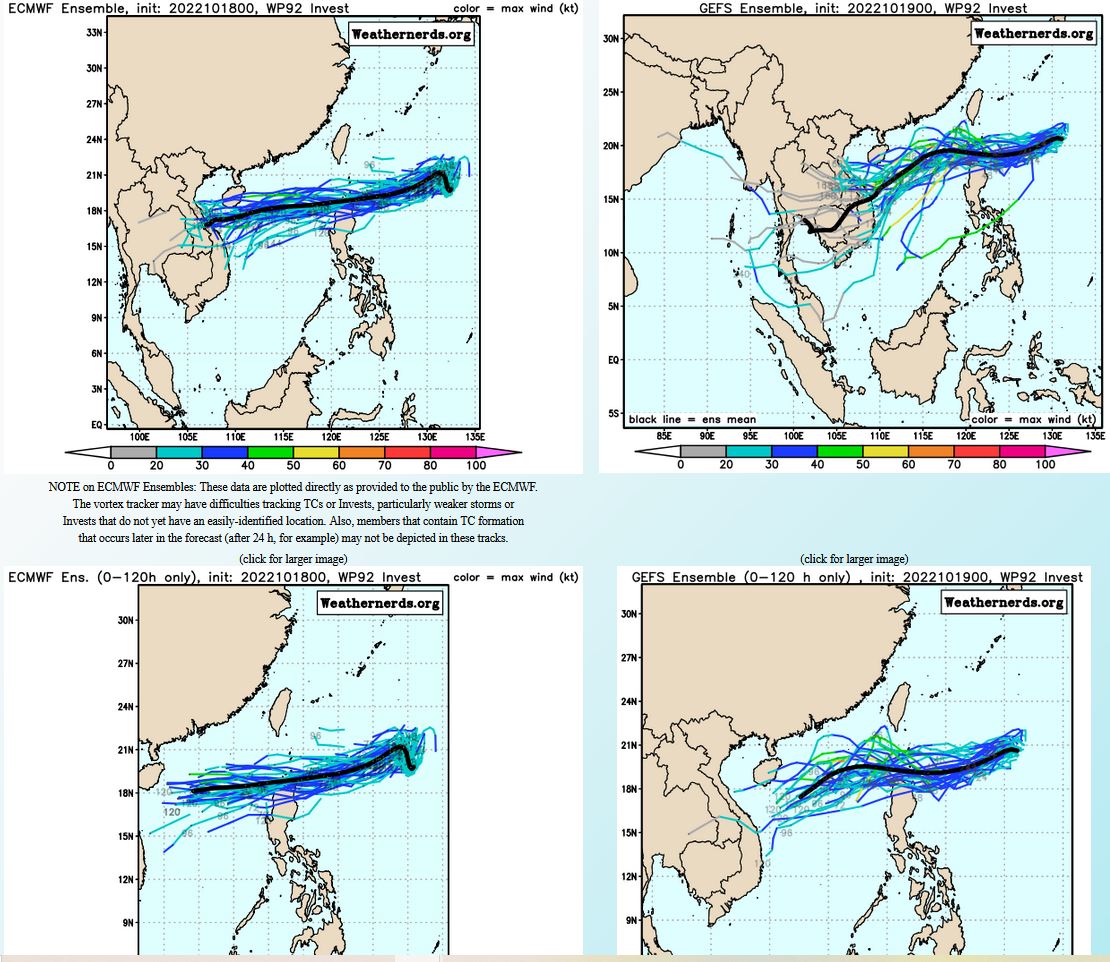
THE AREA OF CONVECTION (INVEST 92W) PREVIOUSLY LOCATED NEAR 19.8N 132.5E IS NOW LOCATED NEAR 21.0N 130.8E, APPROXIMATELY 540 NM EAST-NORTHEAST OF APARRI, PHILIPPINES. ANIMATED ENHANCED INFRARED SATELLITE IMAGERY REVEALS A BROAD LOW-LEVEL CIRCULATION WITH DEEP CONVECTION ALONG A SOUTHWEST TO NORTHEAST AXIS ASSOCIATED WITH STRONG EQUATORWARD OUTFLOW. ENVIRONMENTAL ANALYSIS INDICATES A FAVORABLE ENVIRONMENT FOR INTENSIFICATION WITH 5-10KT VWS, STRONG UPPER LEVEL DIVERGENCE, AND WARM (28-29C) SEA SURFACE TEMPERATURES. A 190500Z SHIP OBSERVATION LOCATED APPROXIMATELY 118 NM TO THE SOUTHEAST REPORTS 30KT WINDS FROM THE SOUTH AND PRESSURE OF 1008.5MB. NUMERICAL MODEL DATA DISCLOSES SIMILAR AGREEMENT WITH PRESSURE, WINDS, AND A WEST- SOUTHWESTWARD TRACK IN THE SHORT TERM. MAXIMUM SUSTAINED SURFACE WINDS ARE ESTIMATED AT 15 TO 20 KNOTS. MINIMUM SEA LEVEL PRESSURE IS ESTIMATED TO BE NEAR 1006 MB. THE POTENTIAL FOR THE DEVELOPMENT OF A SIGNIFICANT TROPICAL CYCLONE WITHIN THE NEXT 24 HOURS IS UPGRADED TO MEDIUM.
WP, 92, 2022101818,207N, 1321E, 15, 1006, DB
WP, 92, 2022101900,210N, 1316E, 20, 1006, DB
WP, 92, 2022101906,210N, 1308E, 20, 1006, DB
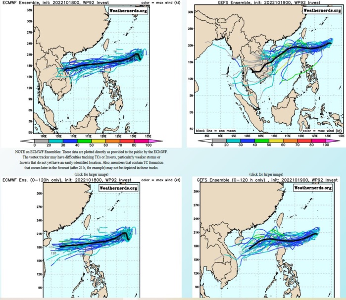
NUMERICAL MODEL DATA DISCLOSES SIMILAR AGREEMENT WITH PRESSURE, WINDS, AND A WEST- SOUTHWESTWARD TRACK IN THE SHORT TERM.
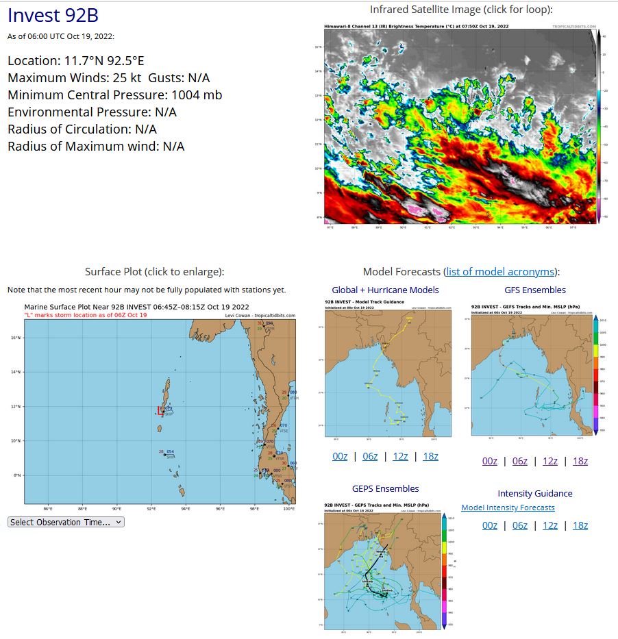
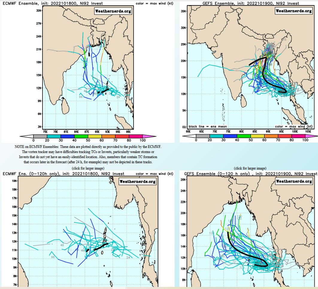
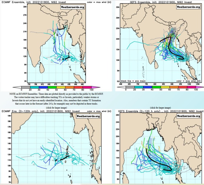
NORTH INDIAN OCEAN: INVEST 92B. ESTIMATED LOCATION AND INTENSITY AT 19/06UTC.ADVISORY(ABIO) ISSUED AT 18/18UTC.
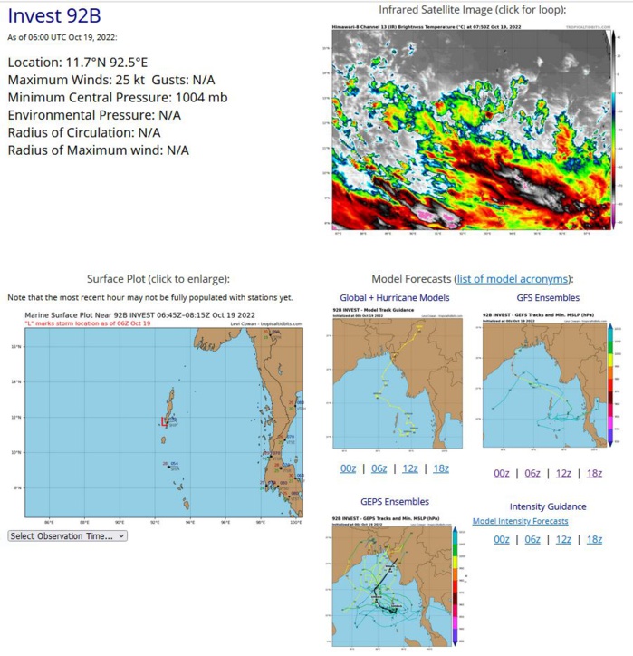
THE AREA OF CONVECTION (INVEST 92B) PREVIOUSLY LOCATED NEAR 12.1N 94.1E IS NOW LOCATED NEAR 11.7N 93.1E, APPROXIMATELY 21 NM EAST OF PORT BLAIR, ANDAMAN ISLANDS. ANIMATED ENHANCED INFRARED SATELLITE IMAGERY(EIR) SHOWS A PERSISTENT, DISORGANIZED DISTURBANCE IN THE SOUTHEASTERN REGION OF THE ANDAMAN SEA WITH FRAGMENTED RAIN BANDS WRAPPING INTO A WEAK, ELONGATED, AND ILL-DEFINED LOW LEVEL CIRCULATION (LLC). A PARTIAL 181545Z ASCAT-B SHOWS THE WESTERN EDGE OF THE LLC WITH A SMALL PATCH OF 20-KT WIND BARBS ALONG THE SOUTHERN PERIPHERY. UPPER- LEVEL ANALYSIS INDICATES INVEST 92B IS IN AN AREA WITH LOW (5-10 KNOT) VWS AND MODERATE DIVERGENCE. SEA SURFACE TEMPERATURES ARE ALSO CONDUCIVE AT 28-30C. HOWEVER, DUE TO THE LACK OF CONSOLIDATION WITH THE DISTURBANCE, THE ENVIRONMENT IS OVERALL JUST MARGINALLY FAVORABLE. GLOBAL MODELS ARE IN GOOD AGREEMENT THAT 92B WILL CONTINUE TO TRACK GENERALLY NORTHWESTWARD. MAXIMUM SUSTAINED SURFACE WINDS ARE ESTIMATED AT 20 TO 25 KNOTS. MINIMUM SEA LEVEL PRESSURE IS ESTIMATED TO BE NEAR 1006 MB. THE POTENTIAL FOR THE DEVELOPMENT OF A SIGNIFICANT TROPICAL CYCLONE WITHIN THE NEXT 24 HOURS REMAINS LOW.
IO, 92, 2022101818,115N, 932E, 20, 1006, DB
IO, 92, 2022101900,116N, 929E, 25, 1005, TD
IO, 92, 2022101906,117N, 925E, 25, 1004, TD
IO, 92, 2022101900,116N, 929E, 25, 1005, TD
IO, 92, 2022101906,117N, 925E, 25, 1004, TD
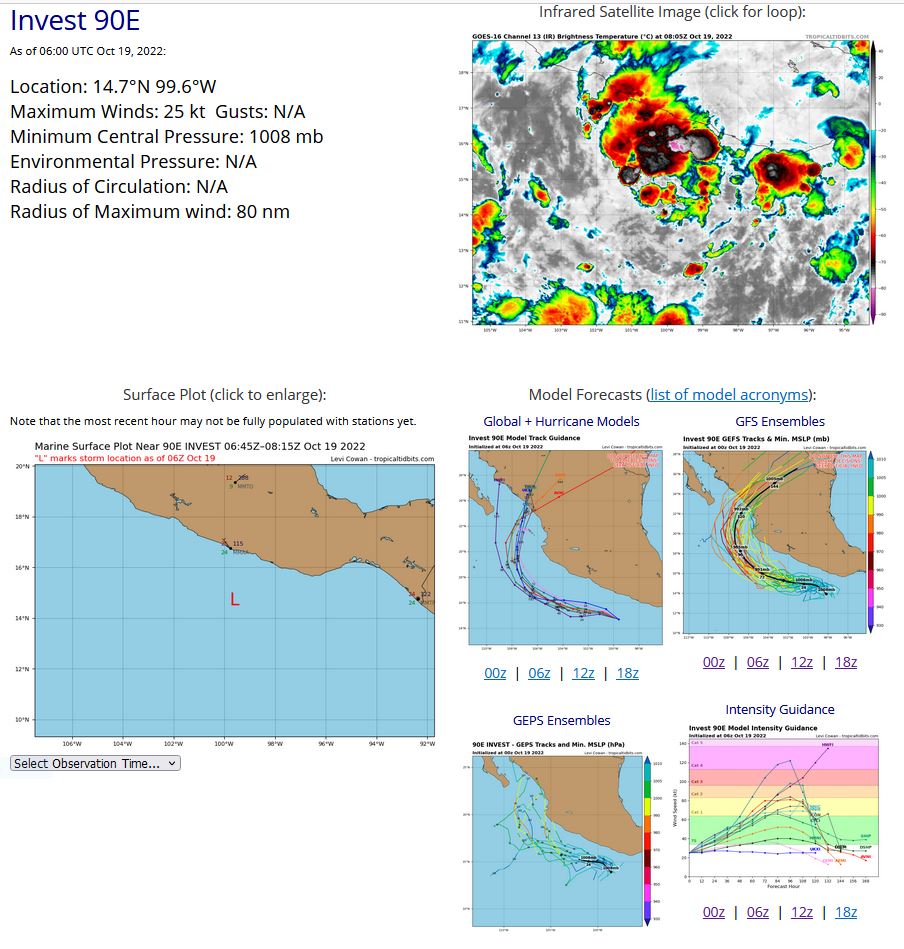
EASTERN NORTH PACIFIC: INVEST 90E. ESTIMATED LOCATION AND INTENSITY AT 19/06UTC.NHC REMARKS.
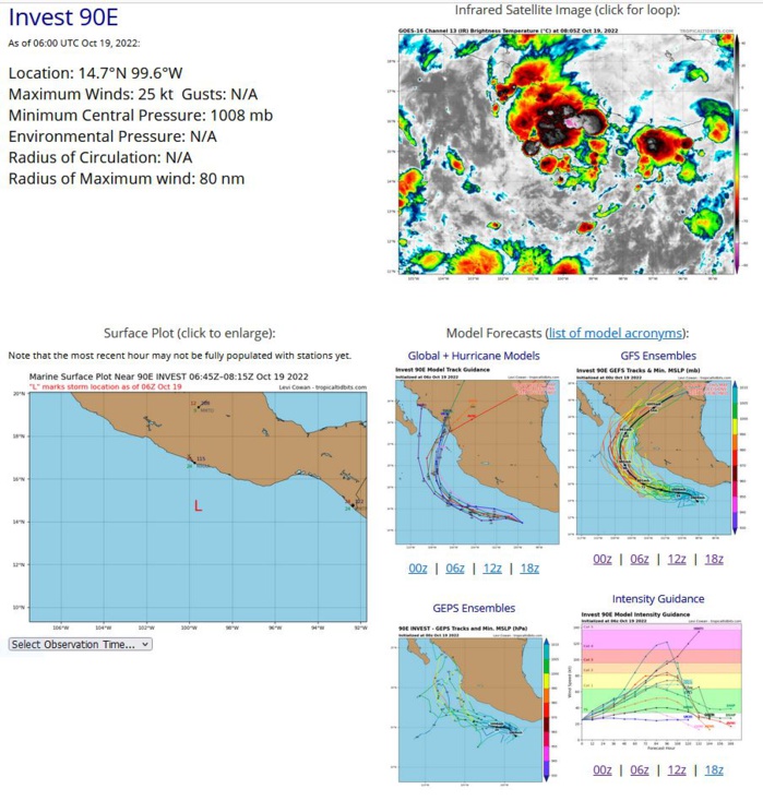
Tropical Weather Outlook NWS National Hurricane Center Miami FL 1100 PM PDT Tue Oct 18 2022 For the eastern North Pacific...east of 140 degrees west longitude: 1. Offshore of Southern Mexico: Shower and thunderstorm activity is starting to become more concentrated in association with a trough of low pressure located a couple hundred miles south of the southern coast of Mexico. Environmental conditions appear conducive for additional development and a tropical depression is expected to form in the next day or two as the system moves generally west-northwestward, parallel to the southwestern coast of Mexico. Interests along the southwestern coast of Mexico should monitor the progress of this system. Additional information on this system, including gale warnings, can be found in High Seas Forecasts issued by the National Weather Service. * Formation chance through 48 hours...high...90 percent. * Formation chance through 5 days...high...90 percent.
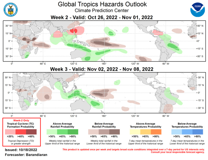
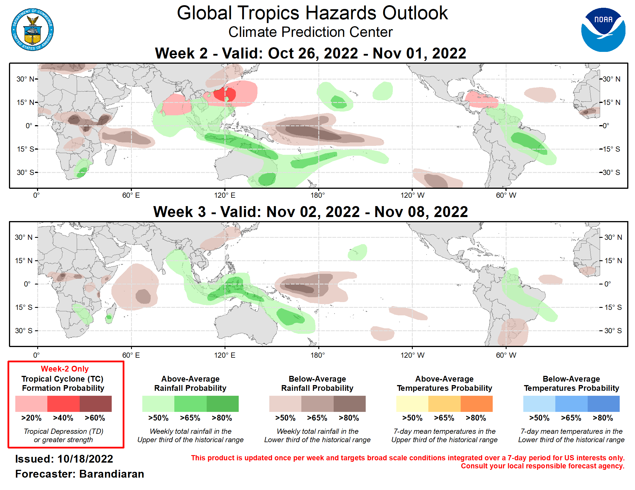
There has been a recent uptick in Madden-Julian Oscillation (MJO) activity over the western Pacific, with the RMM index steadily propagating eastward during the month of October. Looking ahead however, the consensus among dynamical model RMM forecasts is for a halt to eastward propagation of tropical convection where the RMM index depicts a nearly stationary MJO signal in phases 6 and 7 with a weakened amplitude near the unit circle for the coming three week period. The large scale environment is expected to remain conducive for TC genesis in the West Pacific, with lower odds for development in the East Pacific and Atlantic Basins. Tropical cyclone (TC) activity has been high over the last week in the West Pacific. Tropical Depression 21W formed several hundred miles east of Taipan on Oct 12 and meandered in open waters before dissipating a few days later. TC Sonca formed in the South China Sea Oct 13 and came ashore over Vietnam on Oct 15th. Typhoon Nesat formed in the Philippine Sea Oct 14 and is currently moving westward towards the Vietnam coast. TC Haitang formed several hundred miles SE of Mainland Japan on Oct 17. It is currently tracking northwest and is not anticipated to affect land. For the latest on Nesat and Haitang please refer to advisories from the Joint Typhoon Warning Center. Looking ahead to week 2, the near-stationary MJO and La Niña base state provide favorable conditions for continued TC formation for the West Pacific and the Bay of Bengal (BoB). Chances of cyclogenesis for the BoB peak in week 1 but ECMWF solutions hold on to a modest probability of continued TC activity in the BoB into week-2 and beyond. Model guidance from the ECMWF and GEFS also indicate heightened probabilities of TC formation during the week-2 time period covering a broad area from the South China Sea eastward into Philippine Sea and Pacific waters south of Japan. In the Caribbean Sea, both the GEFS and ECMWF show an increased probability of TC formation in week two, with relaxing vertical shear and SSTs still warm enough to fuel TC genesis. The precipitation outlook for the next two weeks is based on anticipated TC tracks, ongoing La Nina conditions, and consensus of GEFS, CFS, and ECMWF ensemble mean solutions. Suppressed (enhanced) rainfall continues near and to the west of the Date Line (over the Maritime Continent) due to ongoing La Nina conditions and anticipated MJO phase. Probabilities of above-normal precipitation also favored along the northern and eastern coasts of Australia especially during week-2, which will likely be problematic given the recent widespread flooding that has been plaguing the region. Portions of Brazil and the northern coastal countries of South America are also favored for above-normal precipitation for both weeks 2 and 3. For hazardous weather conditions in your area during the coming two-week period, please refer to your local NWS office, the Medium Range Hazards Forecast produced by the Weather Prediction Center, and the CPC Week-2 Hazards Outlook. Forecasts made over Africa are made in coordination with the International Desk at CPC.
