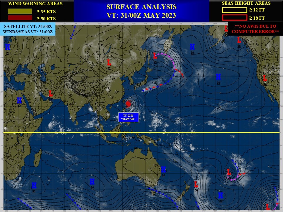
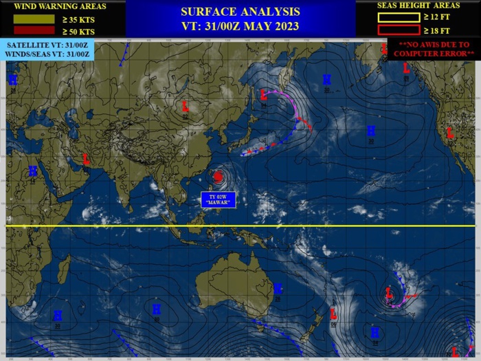
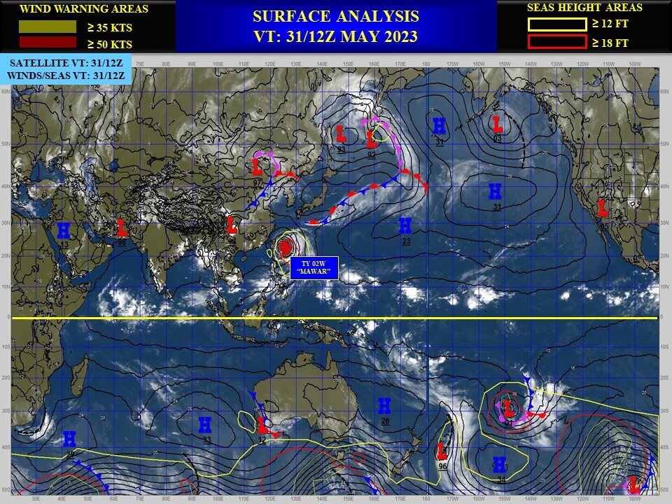
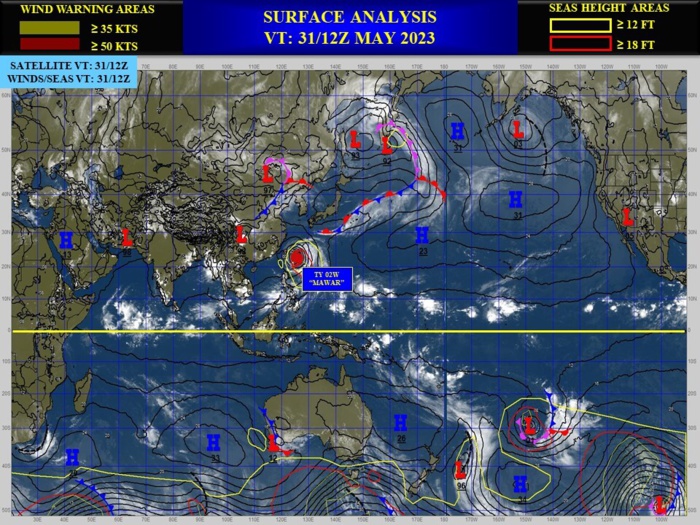
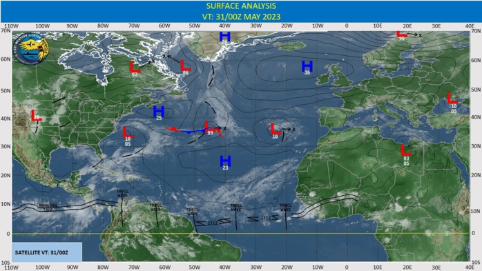
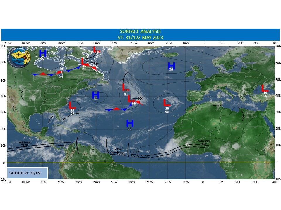
CLICK ON THE IMAGERIES BELOW TO GET THEM ENLARGED
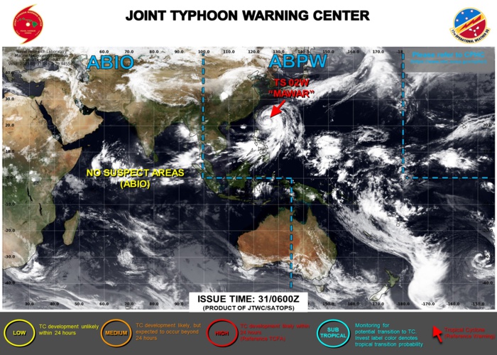
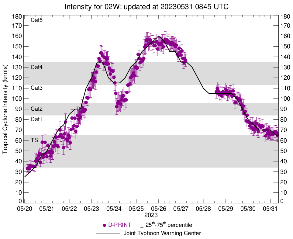
WESTERN NORTH PACIFIC: TY 02W(MAWAR). CURRENT ESTIMATED INTENSITY IS 65 KNOTS(CAT 1 US) AT 31/06UTC: -10 KNOTS OVER 24HOURS.
0223052906 194N1258E 105
0223052912 197N1256E 100
0223052918 201N1254E 90
0223053000 203N1251E 80
0223053006 205N1250E 75
0223053012 208N1250E 70
0223053018 213N1251E 70
0223053100 218N1252E 70
0223053106 223N1253E 65
0223052912 197N1256E 100
0223052918 201N1254E 90
0223053000 203N1251E 80
0223053006 205N1250E 75
0223053012 208N1250E 70
0223053018 213N1251E 70
0223053100 218N1252E 70
0223053106 223N1253E 65
WARNING 46 ISSUED AT 31/09UTC.
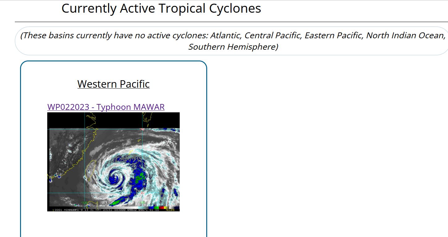
CLICK ON THE IMAGERY BELOW TO GET IT ANIMATED AND ENLARGED.
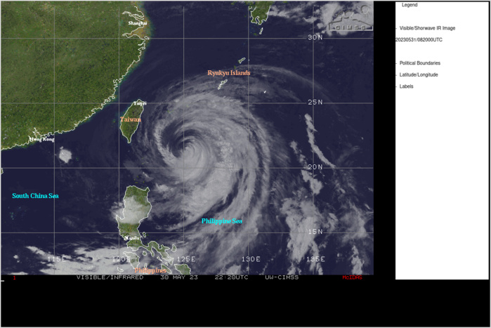
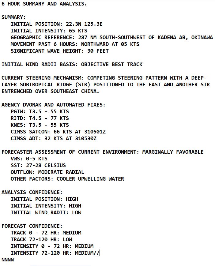
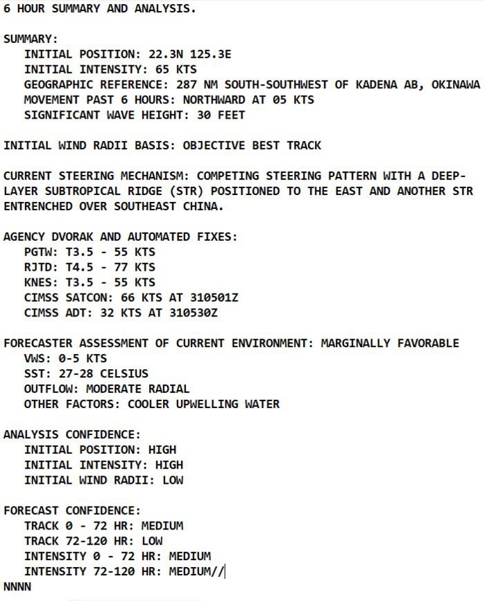
SATELLITE ANALYSIS, INITIAL POSITION AND INTENSITY DISCUSSION: ANIMATED MULTISPECTRAL SATELLITE IMAGERY (MSI) AND ANIMATED RADAR IMAGERY DEPICT TIGHTLY CURVED BANDING WRAPPING INTO A WELL-DEFINED BANDING EYE, WHICH SUPPORTS THE INITIAL POSITION WITH HIGH CONFIDENCE. DESPITE MARGINAL SST VALUES (27C) AND POSSIBLE UPWELLING COOLER WATER, THE CORE CONVECTIVE STRUCTURE HAS IMPROVED SLIGHTLY WITH A FORMATIVE EYE EVIDENT IN ENHANCED INFRARED (EIR) SATELLITE IMAGERY DUE TO MODERATE RADIAL OUTFLOW. THE INITIAL INTENSITY IS ASSESSED AT 65 KNOTS BUT COULD BE SLIGHTLY HIGHER AS INDICATED IN A 302139Z RADARSAT-2 SAR BULLSEYE IMAGE SHOWING MAXIMUM WINDS OF 72 KNOTS. THIS ESTIMATE IS MORE IN LINE WITH THE RJTD CURRENT INTENSITY ESTIMATE OF 4.5 (77 KNOTS), THE 310600Z D-PRINT ESTIMATE OF 68 KNOTS AND THE LATEST SATCON ESTIMATE. ADT AND AIDT ESTIMATES ARE ASSESSED AS ERRONEOUSLY LOW.
TC Warning Graphic
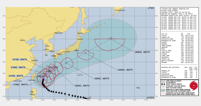
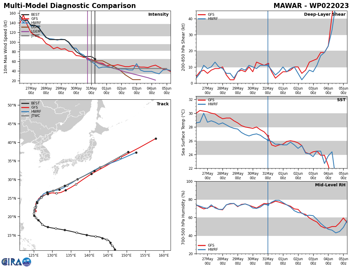
FORECAST REASONING. SIGNIFICANT FORECAST CHANGES: THE 301800Z AND 310000Z BEST TRACK INTENSITY ANALYSES WERE INCREASED FROM 60 TO 70 KNOTS BASED ON A 302139Z RADARSAT-2 SAR BULLSEYE IMAGE SHOWING MAXIMUM WINDS OF 72 KNOTS. THEREFORE, FORECAST INTENSITIES HAVE BEEN INCREASED SLIGHTLY THROUGH TAU 48. FORECAST DISCUSSION: TYPHOON (TY) 02W IS EMBEDDED WITHIN A COMPETING STEERING PATTERN WITH ZONAL 500MB FLOW PREVAILING TO THE NORTH OVER THE KOREAN PENINSULA AND JAPAN. A 310000Z SOUNDING FROM MINAMIDAITO-JIMA (25.8N 131.2E) REVEALS SOUTHERLY FLOW FROM 850 TO 350MB, WHICH WILL STEER THE SYSTEM NORTHWARD TO NORTH-NORTHEASTWARD THROUGH TAU 24. TY 02W IS EXPECTED TO WEAKEN GRADUALLY AS SST VALUES DECREASE TO 26C, HOWEVER, THE SYSTEM WILL REMAIN A 600NM DIAMETER STORM-FORCE LOW AS IT TRACKS OVER THE OKINAWA REGION IN THE NEXT TWO DAYS. AFTER TAU 48, TY 02W WILL ACCELERATE EAST-NORTHEASTWARD TO NORTHEASTWARD WHILE WEAKENING WITHIN THE SUBTROPICAL WESTERLIES ALONG THE NORTHWESTERN PERIPHERY OF A BROAD SUBTROPICAL RIDGE. AFTER TAU 72, TY 02W WILL RAPIDLY ACCELERATE WHILE UNDERGOING EXTRA-TROPICAL TRANSITION (ETT) AS IT INTERACTS WITH THE JET AND STRONG BAROCLINIC ZONE SOUTH AND EAST OF HONSHU. TY 02W WILL COMPLETE ETT BY TAU 120 AS IT GAINS FRONTAL CHARACTERISTICS.
Model Diagnostic Plot

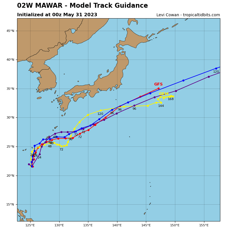
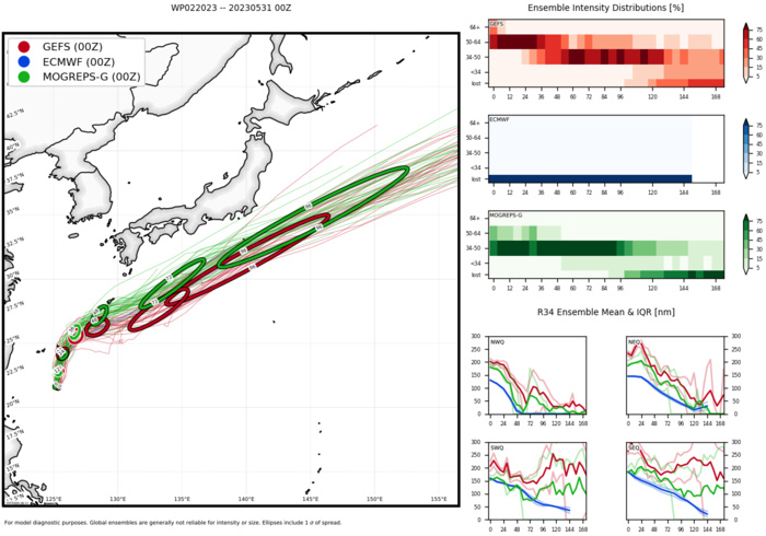
MODEL DISCUSSION: DETERMINISTIC MODEL GUIDANCE IS IN FAIR AGREEMENT THROUGH TAU 36 WITH A CROSS-TRACK SPREAD OF 55NM AT TAU 24 AND 70NM AT TAU 36. SEVERAL MODELS SHOW A TRACK NORTH OF OKINAWA (AFUI, EGRI, UEMI) WITH THE BULK OF THE CONSENSUS MEMBERS JUST SOUTH OF OKINAWA (JGSI, ECMI, AVNI, AEMI, NVGI). THE JTWC FORECAST TRACK REMAINS HIGHLY CONSISTENT WITH THE PREVIOUS FORECAST AND IS IN LINE WITH THE MORE ACCURATE DETERMINISTIC GUIDANCE, HOWEVER, A TRACK OVER OR CLOSER TO OKINAWA IS POSSIBLE ESPECIALLY CONSIDERING THE CURRENT NORTH-SOUTH CONFIGURATION OF THE STEERING RIDGE. BOTH THE 310000Z ECMWF (EPS) AND GFS (GEFS) ENSEMBLES DEPICT A SIMILAR SPREAD WITH MODERATE UNCERTAINTY (MEDIUM CONFIDENCE IN THE JTWC FORECAST TRACK) IN THE EXACT TRACK NEAR OKINAWA. IN THE EXTENDED PERIOD, THERE IS LOW CONFIDENCE IN THE JTWC FORECAST TRACK DUE TO ALONG-TRACK SPEED DIFFERENCES IN THE MODELS.
Global + Hurricane Models
Ensemble Track Ellipses
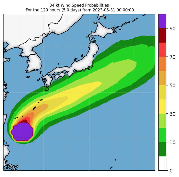
Experimental 34-kt Wind Speed Probabilities
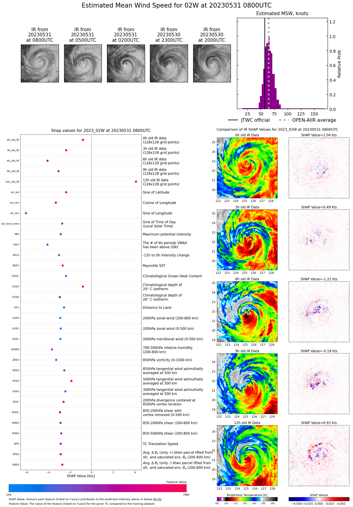
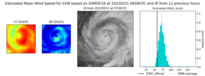
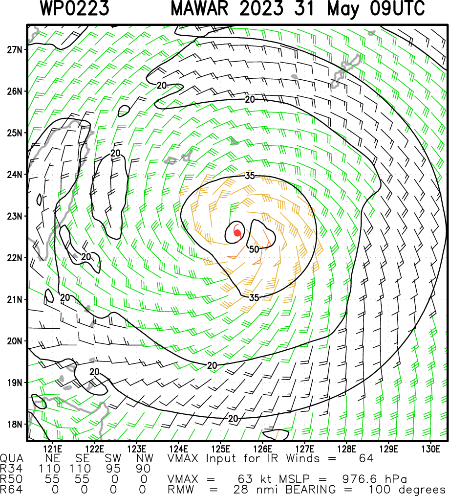
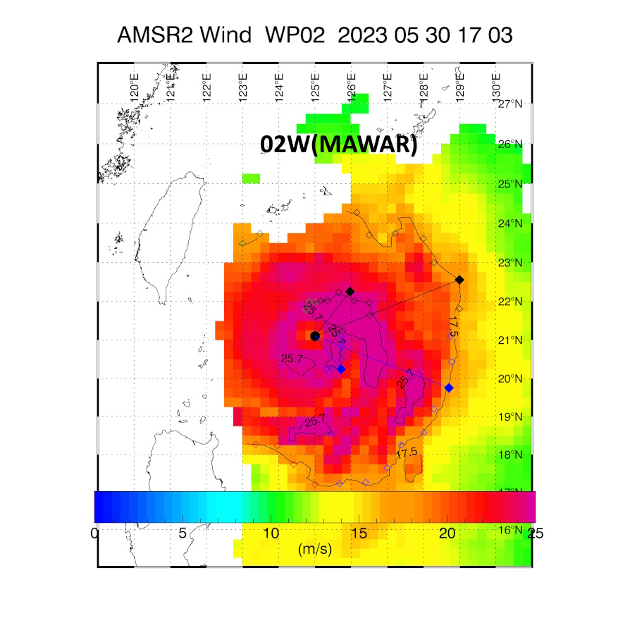
Multiplatform Satellite Surface Wind Analysis (Experimental)
MAXIMUM 10 MINUTE WINDS: 57 KNOTS.
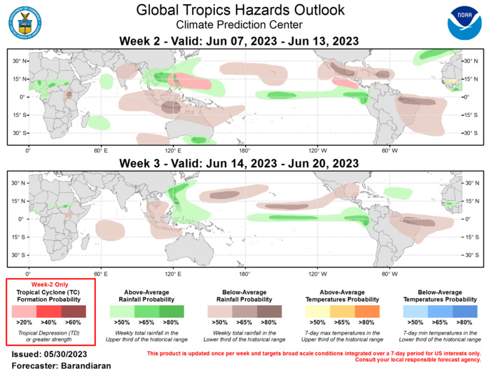
Last Updated - 05/30/23 Valid - 06/07/23 - 06/20/23 The Madden-Julian Oscillation (MJO) has continued to be active despite interference from Typhoon Mawar and is currently at the edge of phases 7 and 8 in RMM space, with the enhanced convective envelope over the Eastern Pacific and the Americas. Ensemble model solutions for the RMM index generally agree on continued propagation of the MJO signal through the week-3, although there is a wide range on the amplitude of the signal. Regardless of amplitude though, the week 2 and 3 forecast for the MJO is favorable for development of tropical cyclones (TCs) over the Eastern Pacific. There were no new TCs that formed in the last week. Typhoon Mawar continues to be active in the Western Pacific basin. Mawar is currently northeast of the Philippines and is moving slowly northward. In the coming week it is forecast to track northeast near Okinawa and become extratropical as it continues south of the main islands of Japan. For the latest information concerning Typhoon Mawar please refer to the Joint Typhoon Warning Center (JTWC). During week-2 the consensus among model guidance places the MJO in phases 1-2 (Western Hemisphere/Africa) which generally enhances probabilities of TC formation for the Eastern Pacific basin. It is still early in the season and in some ways the synoptic picture over Mexico is more reminiscent of early spring than the beginning of June, but nonetheless both the ECMWF and GEFS TC guidance indicate the potential for a mid-June TC. Additionally, despite phase 2 being less favorable in the Western Pacific for TCs, the ECMWF also has increased chances for TC genesis during week-2. Finally, the northern Indian Ocean (both Bay of Bengal and Arabian Sea) is being highlighted for the potential of TC genesis. Internal forecast tools favor week-2 for formation, while the medium-range ECMWF solutions suggest week-1 is most likely. Due to this discrepancy in timing, the potential for TC genesis over the Indian Ocean is not included in the forecast at this time. The precipitation outlook for the next two weeks is based on anticipated TC tracks, the anticipated state of the MJO, and consensus of GEFS, CFS, and ECMWF ensemble mean solutions. Above-normal precipitation continues for the Equatorial Eastern Pacific and the coasts of Ecuador and Peru for both weeks, which is likely to worsen antecedent wet conditions in the region. The Western Pacific is also favored for above-normal precipitation, while portions of the Maritime Continent and northern Australia tilt towards drier conditions, especially during week-2. Below-normal precipitation is also favored for the Caribbean and Mexico for week-2, as well as for eastern Brazil for both weeks.
