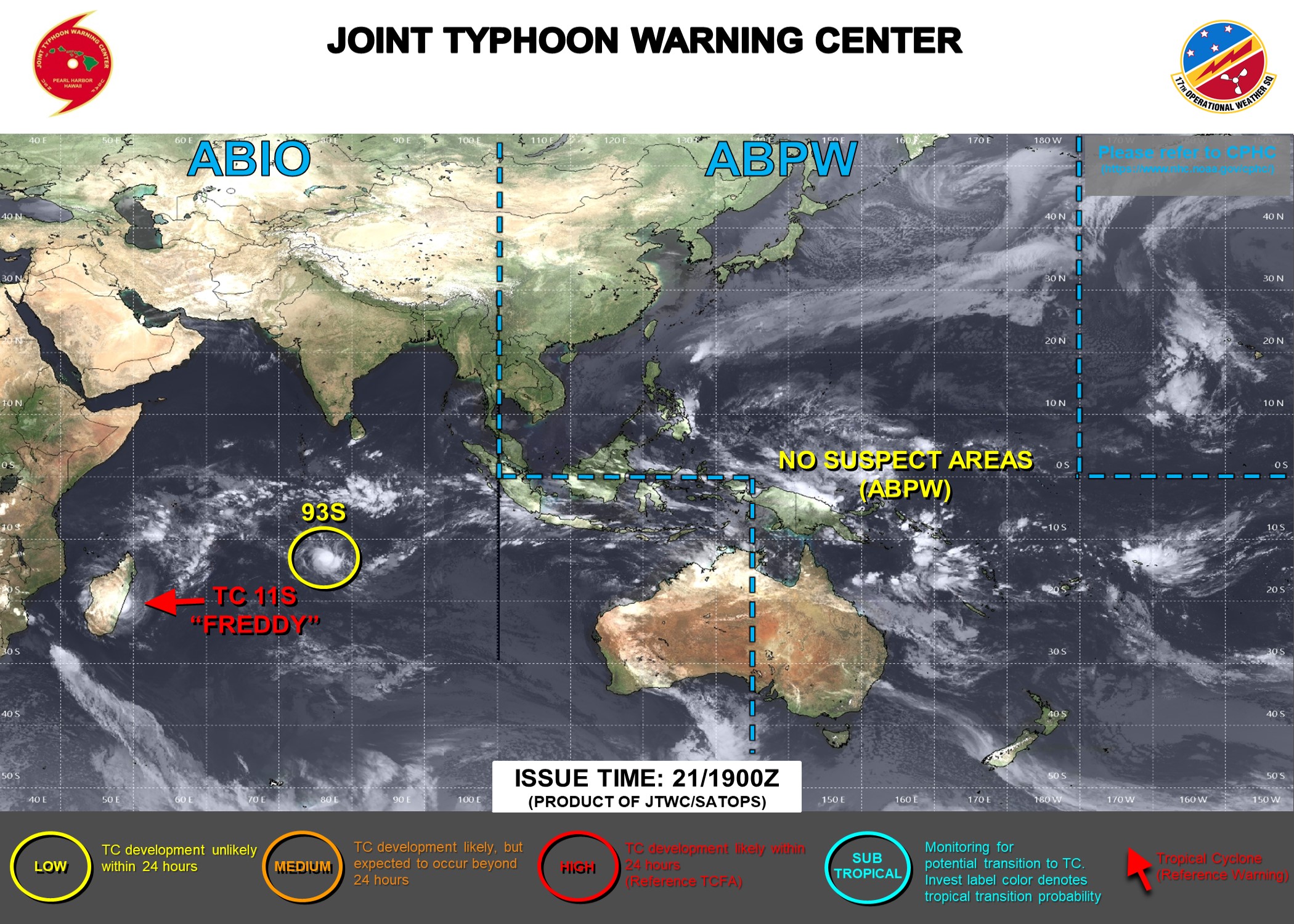
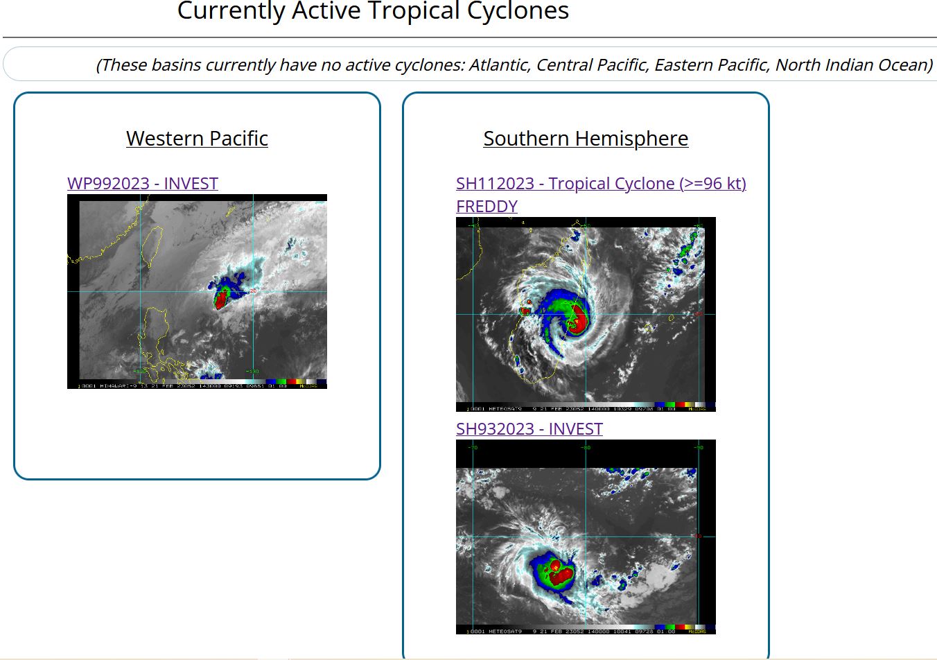
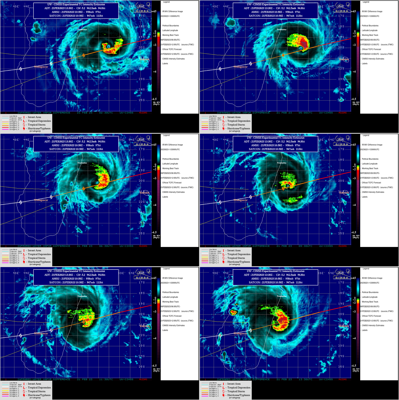
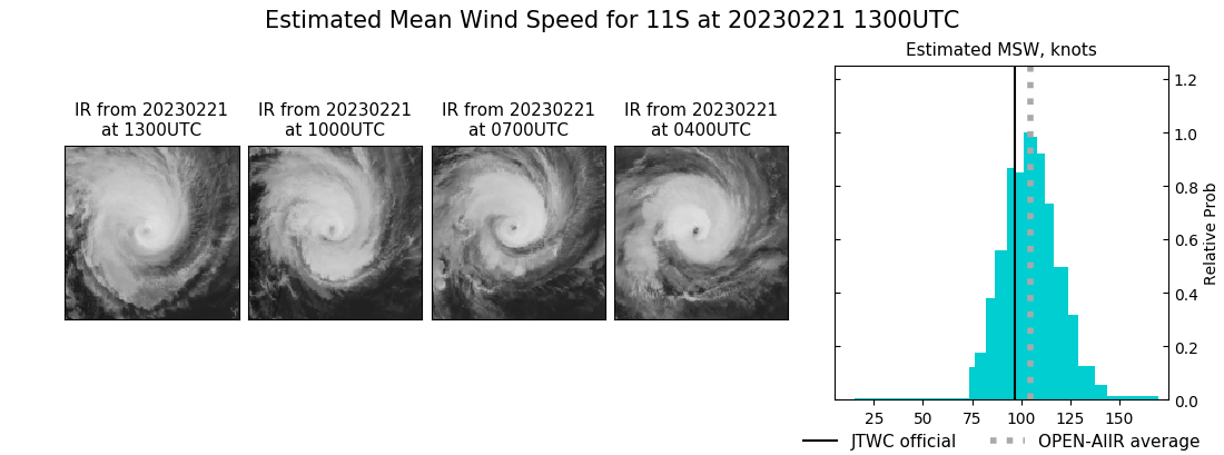
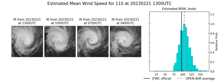
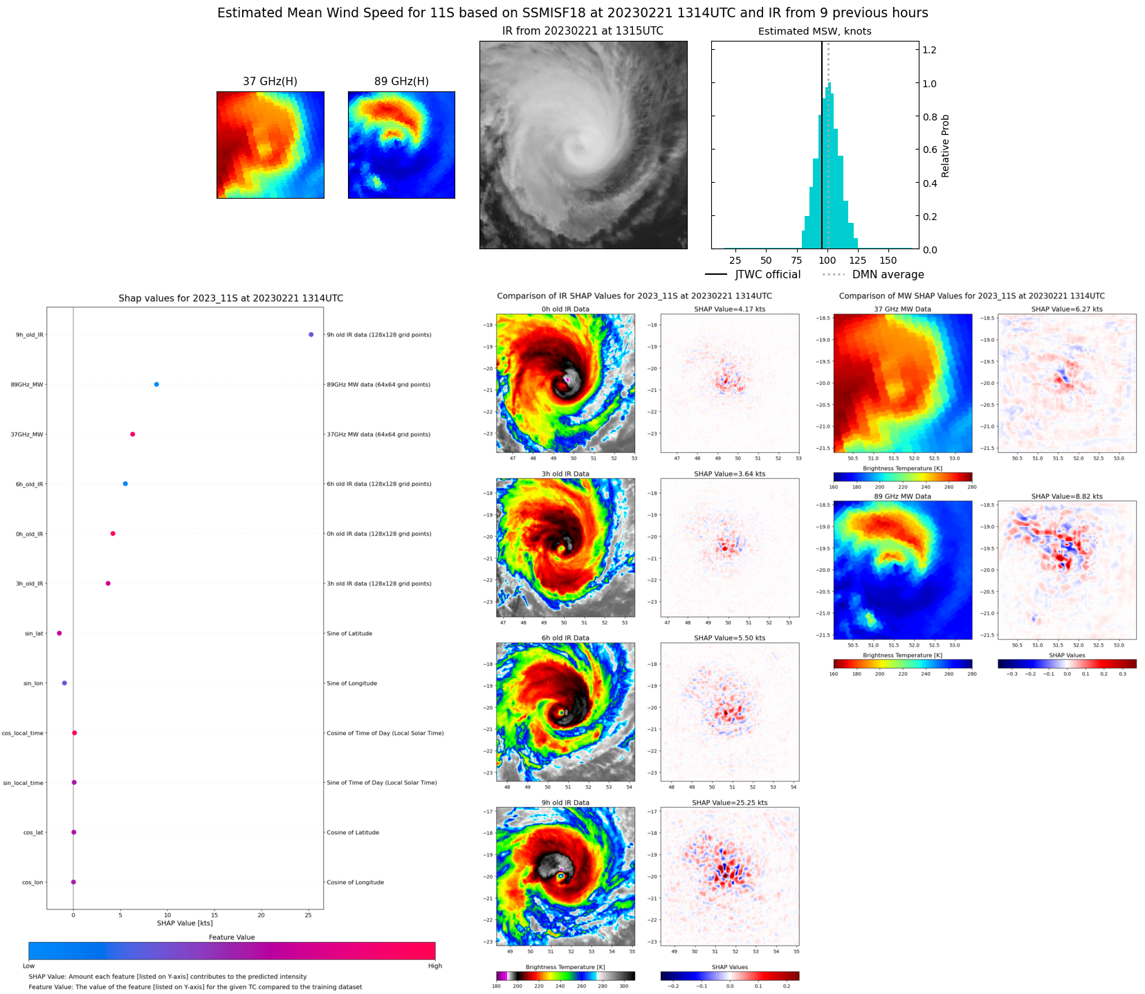
CLICK ON THE IMAGERIES BELOW TO GET THEM ENLARGED
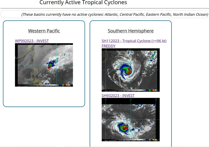
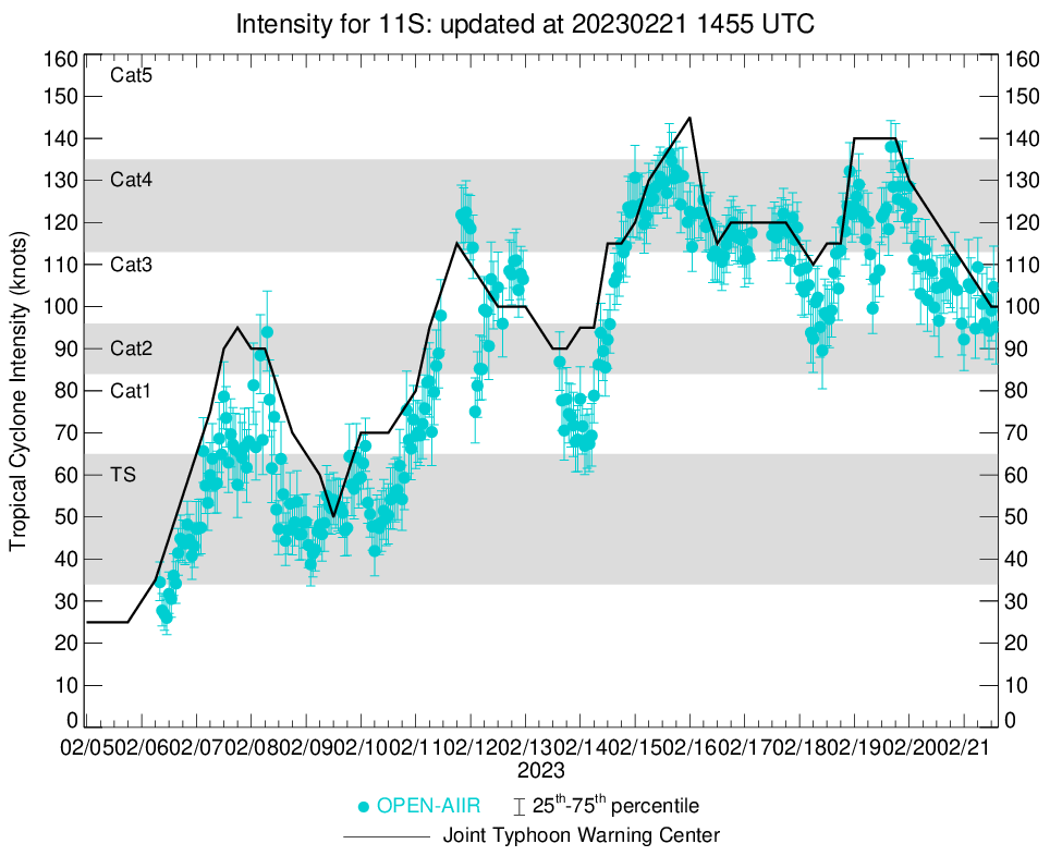
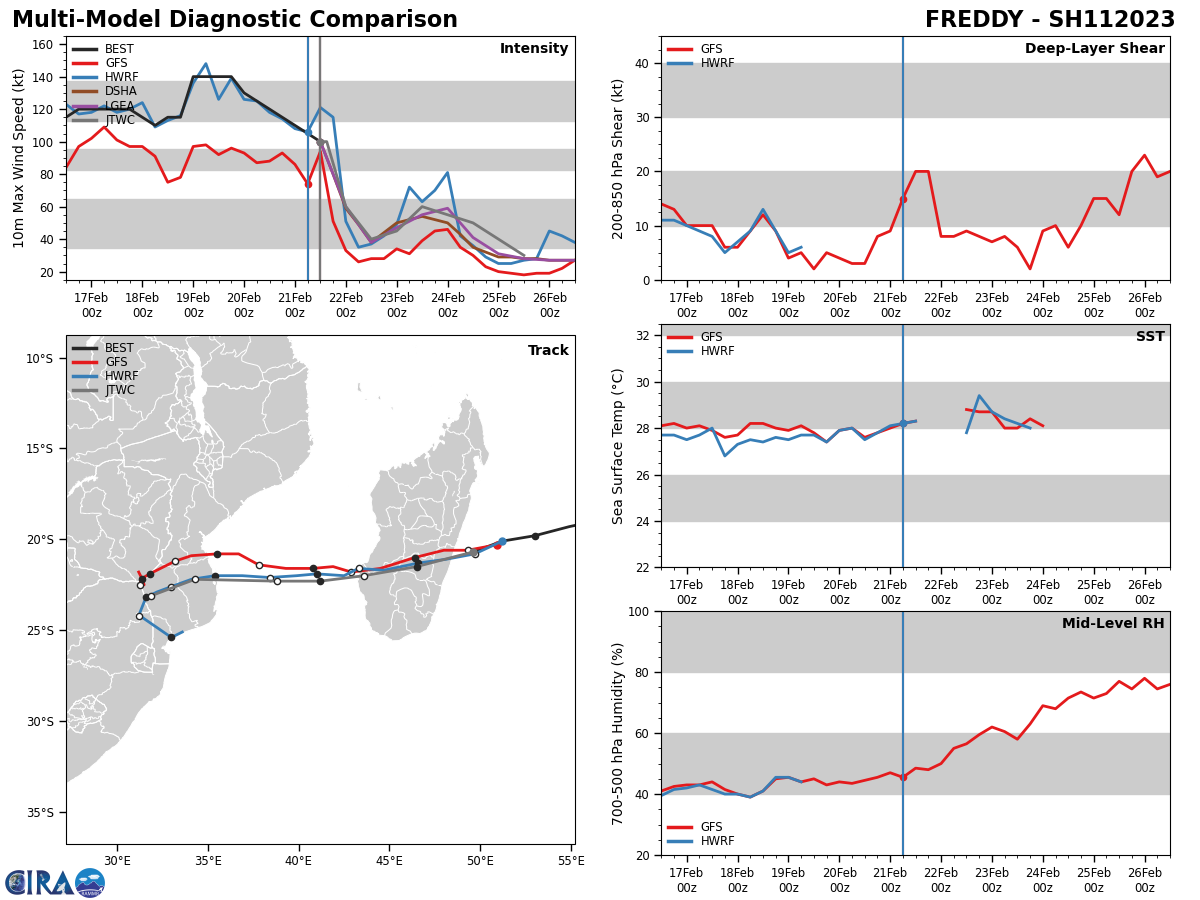
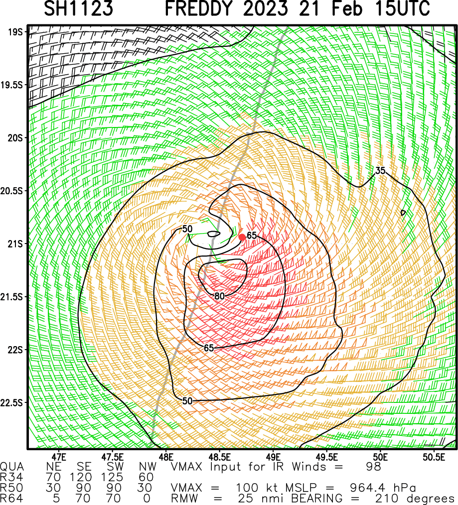
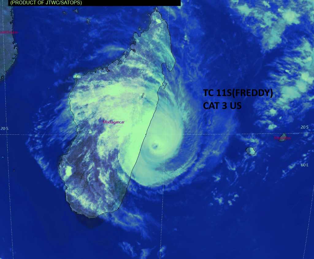
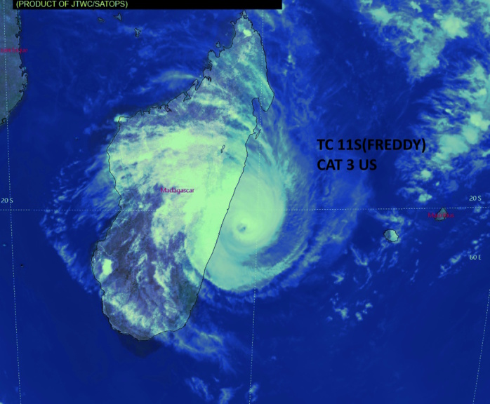
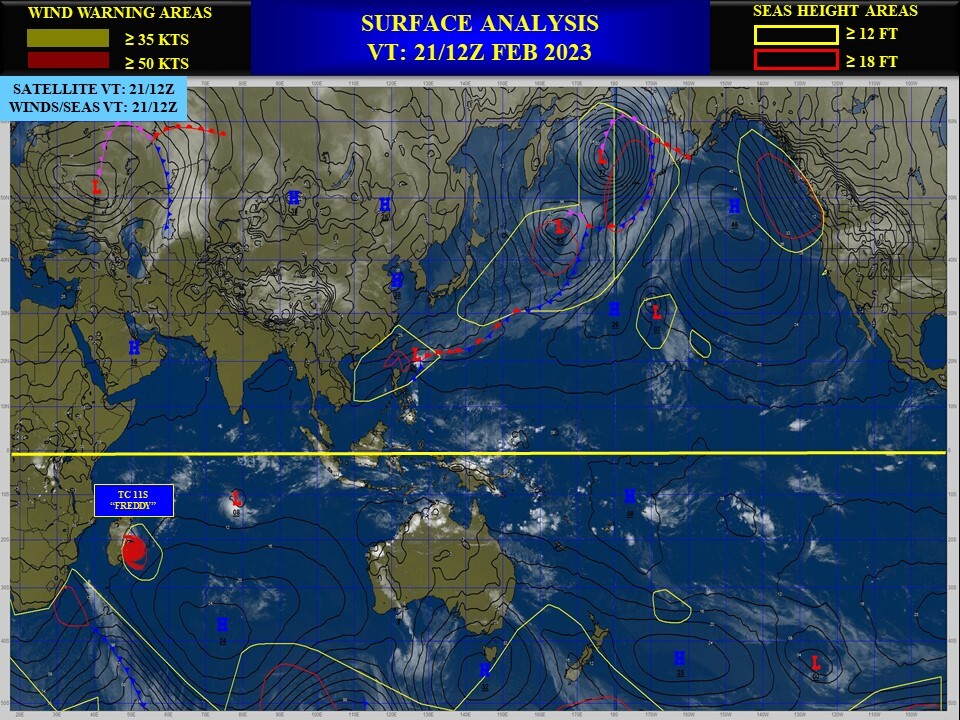
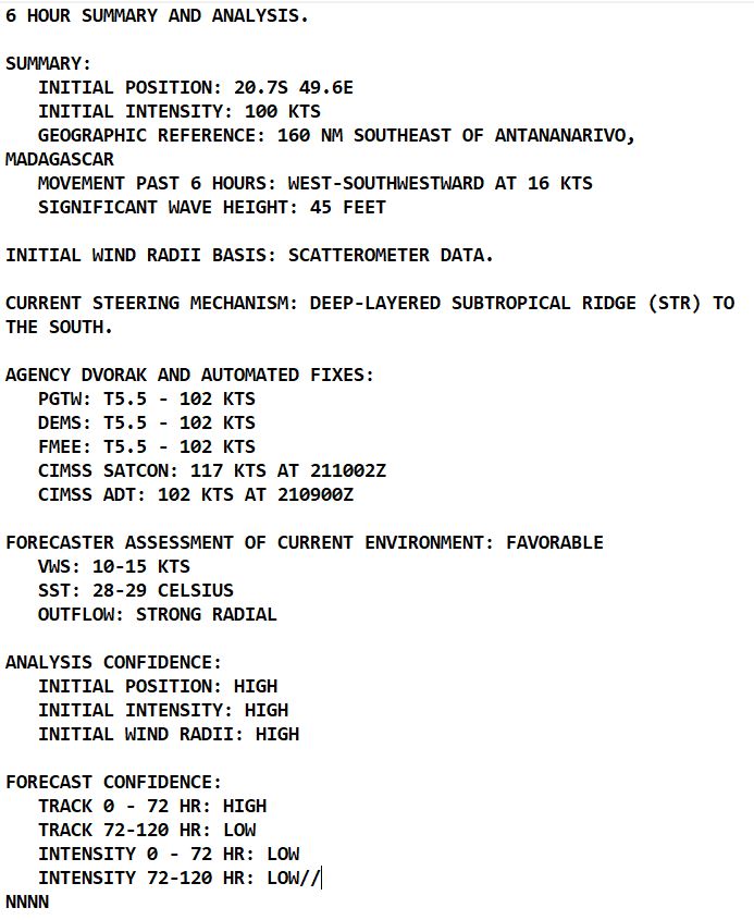
SOUTH INDIAN OCEAN: TC 11S(FREDDY). CURRENT ESTIMATED INTENSITY IS 100 KNOTS CAT 3 US .
1123021918 177S 624E 140
1123022000 181S 606E 130
1123022006 185S 587E 125
1123022012 189S 568E 120
1123022018 193S 549E 115
1123022100 198S 530E 110
1123022106 201S 512E 105
1123022112 207S 496E 100
1123022000 181S 606E 130
1123022006 185S 587E 125
1123022012 189S 568E 120
1123022018 193S 549E 115
1123022100 198S 530E 110
1123022106 201S 512E 105
1123022112 207S 496E 100
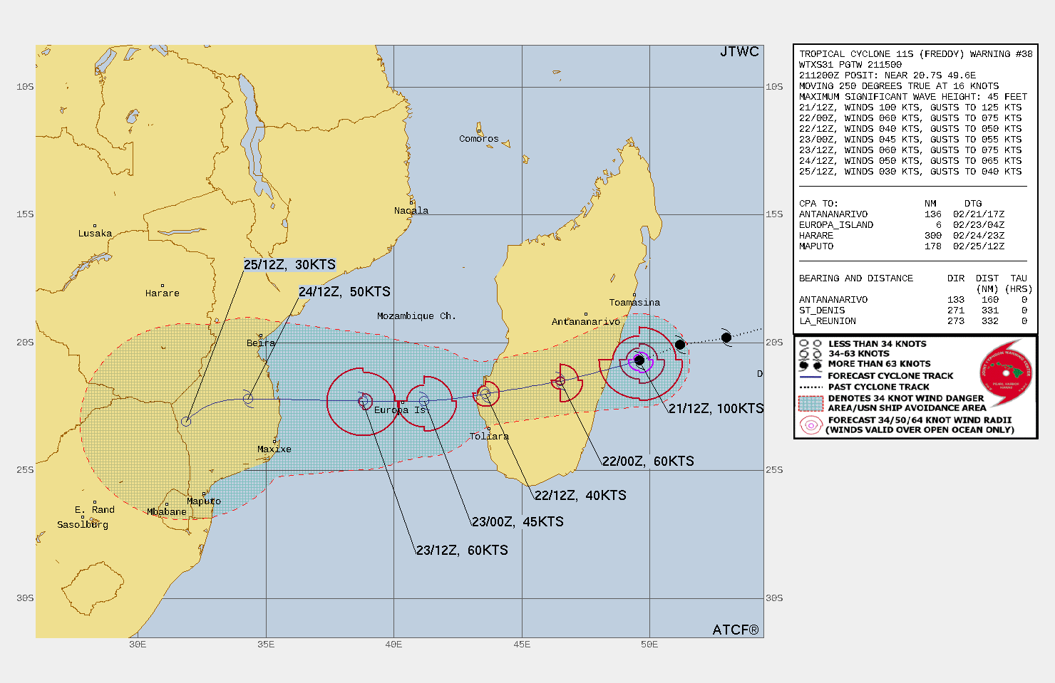
WARNING 38 ISSUED AT 21/15UTC
CLICK ON THE IMAGERY BELOW TO GET IT ANIMATED AND ENLARGED.
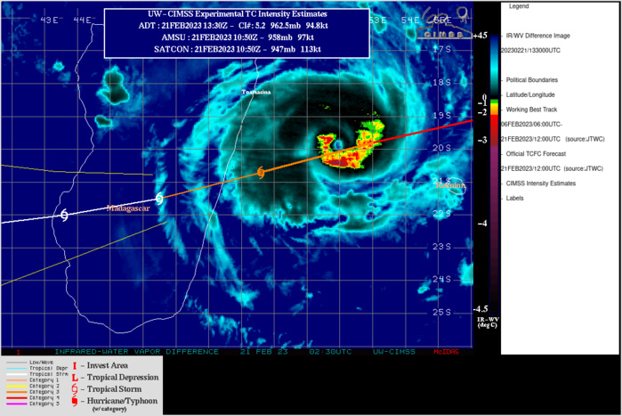
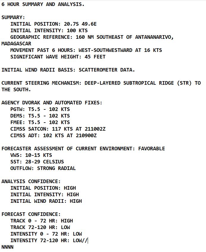
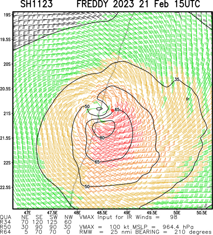
SATELLITE ANALYSIS, INITIAL POSITION AND INTENSITY DISCUSSION: ANIMATED ENHANCED INFRARED (EIR) SATELLITE IMAGERY SHOWS THE SYSTEM REMAINS COMPACT AND SYMMETRICAL WITH A DEFINED 6-NM PINHOLE EYE AS IT IS ABOUT TO MAKE LANDFALL INTO CENTRAL MADAGASCAR. THE EYE HAS SINCE BECOME CLOUD-COVERED AND THE WESTERN HALF OF THE SYSTEM HAS INTRUDED INTO MADAGASCAR WITH EARLY INDICATIONS OF UNRAVELING. THE INITIAL POSITION IS PLACED WITH HIGH CONFIDENCE BASED ON THE EYE FEATURE IN THE EIR LOOP. THE INITIAL INTENSITY IS ALSO ASSESSED WITH HIGH CONFIDENCE BASED ON CLOSELY-CLUSTERED AGENCY AND AUTOMATED DVORAK ESTIMATES AND REFLECTS THE SLIGHT 12-HOUR WEAKENING. THE ENVIRONMENT, FOR NOW, REMAINS FAVORABLE WITH LIGHT VWS, STRONG RADIAL OUTFLOW AND WARM SSTS.
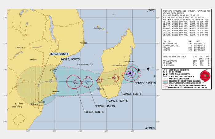
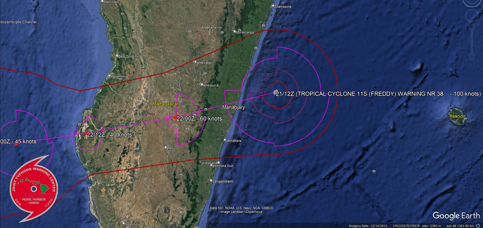
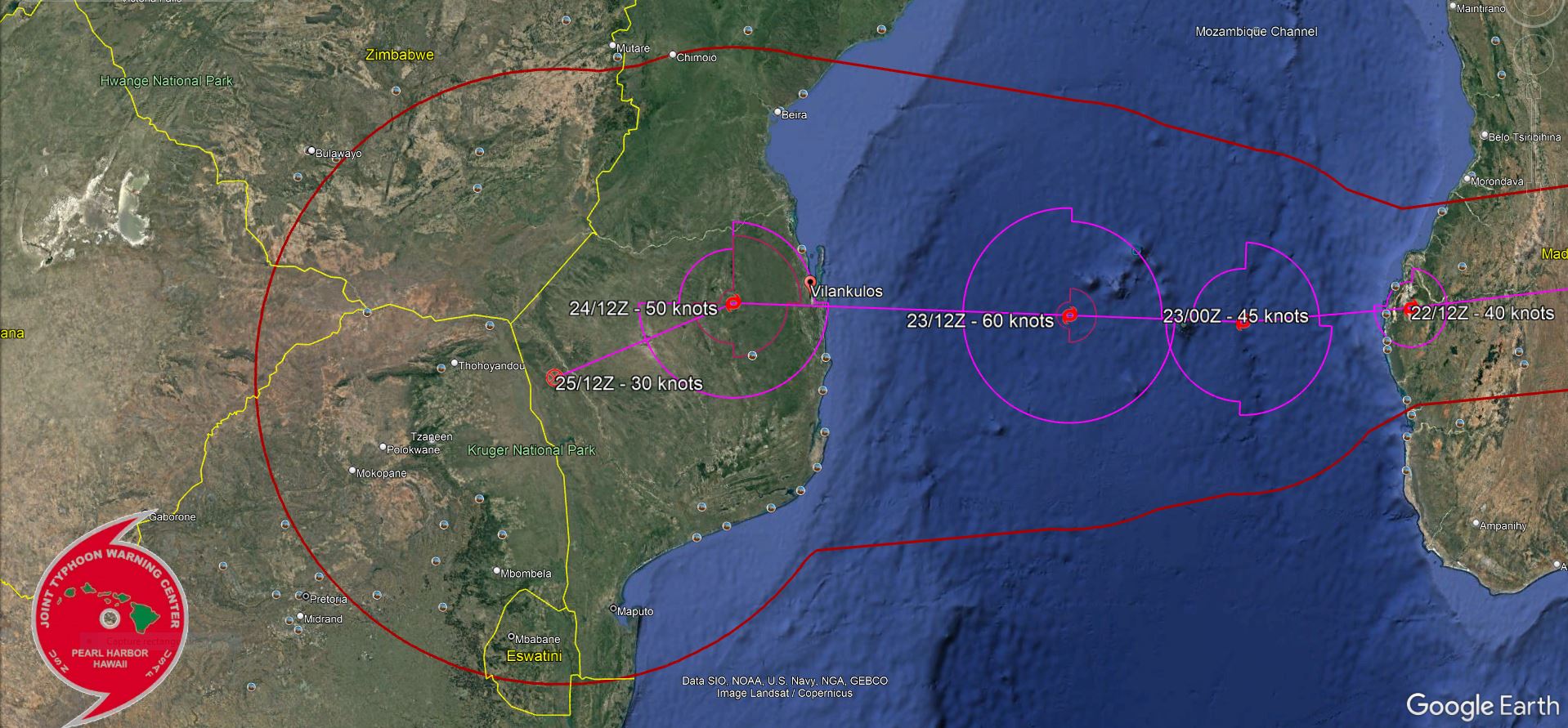
FORECAST REASONING. SIGNIFICANT FORECAST CHANGES: THERE ARE NO SIGNIFICANT CHANGES TO THE FORECAST FROM THE PREVIOUS WARNING. FORECAST DISCUSSION: TC FREDDY WILL CONTINUE ON A WEST-SOUTHWESTWARD TRACK, MAKE LANDFALL OVER THE NEXT FEW HOURS AND CROSS MADAGASCAR, EXIT INTO THE MOZAMBIQUE CHANNEL SHORTLY AFTER TAU 24, THEN MAKE A FINAL LANDFALL OVER SOUTHERN MOZAMBIQUE AROUND TAU 66. THE RUGGED TERRAIN OF MADAGASCAR WILL SIGNIFICANTLY ERODE THE CYCLONE DOWN TO 40KTS BY TAU 24. AFTERWARD, THE WARM WATERS OF THE MOZAMBIQUE CHANNEL WILL FUEL A MODEST INTENSIFICATION TO 60KTS BY TAU 48. AFTER ITS FINAL LANDFALL, THE RUGGED TERRAIN OF MOZAMBIQUE WILL RAPIDLY ERODE THE SYSTEM DO DISSIPATION BY TAU 96.
LANDFALL NEAR MANANJARY
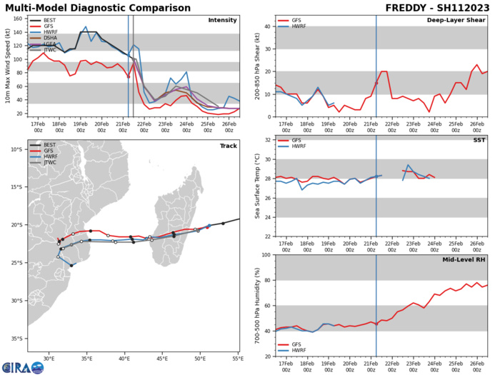
MODEL DISCUSSION: NUMERICAL TRACK MODELS ARE IN VERY TIGHT AGREEMENT WITH A GRADUAL AND EVEN SPREAD TO 108NM AT TAU 72; AFTERWARD, THE MODELS ERRATICALLY SPREAD OUT, AN INDICATION OF A WEAK VORTEX. IN VIEW OF THIS, THERE IS HIGH CONFIDENCE IN THE JTWC TRACK FORECAST UP TO TAU 72 THEN LOW CONFIDENCE AFTERWARD. GIVEN THE UNCERTAINTIES ASSOCIATED WITH LAND CROSSINGS, THERE IS LOW CONFIDENCE IN THE JTWC INTENSITY FORECAST UP TO TAU 96
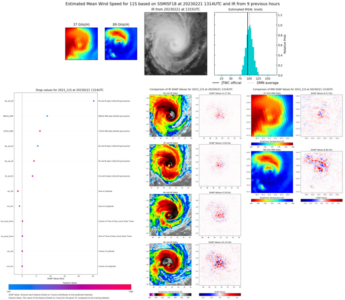
Multiplatform Satellite Surface Wind Analysis (Experimental)
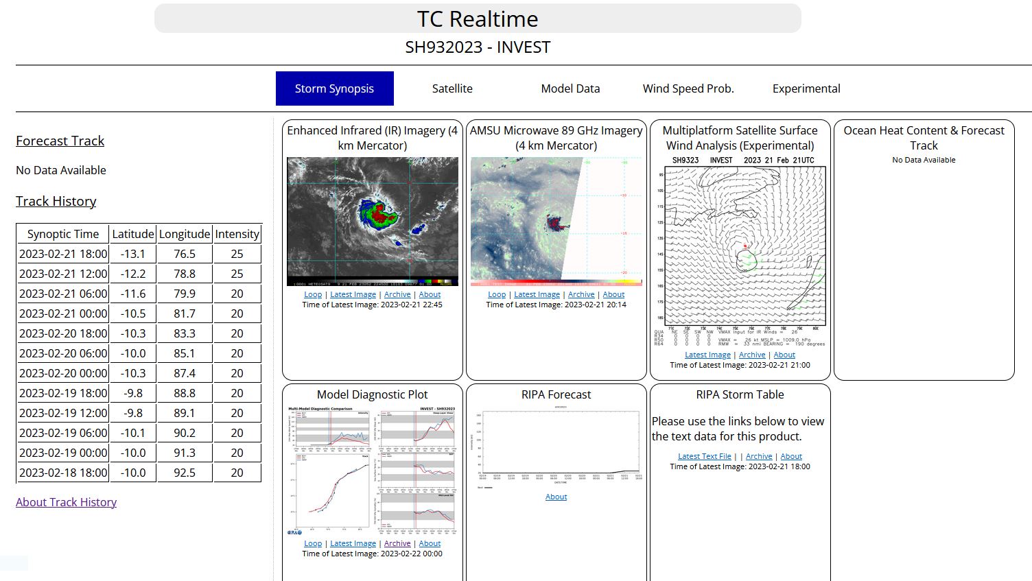
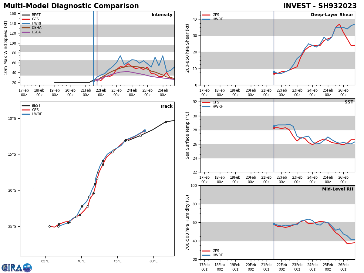
SOUTH INDIAN OCEAN: INVEST 93S. ESTIMATED LOCATION AND INTENSITY AT 21/18UTC. ADVISORY(ABIO) ISSUED AT 21/19UTC.
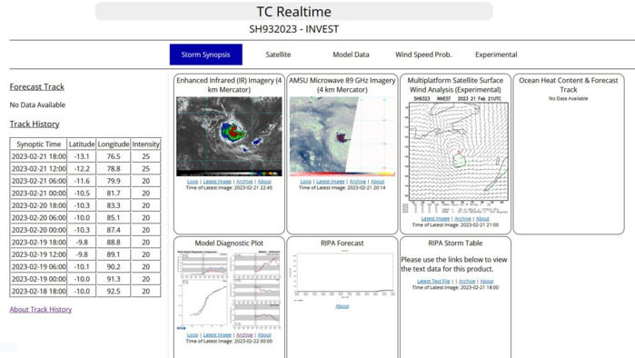
AN AREA OF CONVECTION (INVEST 93S) HAS PERSISTED NEAR 13.1S 76.5E, APPROXIMATELY 456 NM NORTHWEST OF DIEGO GARCIA. AN ANIMATED ENHANCED INFRARED (EIR) SATELLITE AND A 211330Z SCATTEROMETER IMAGE REVEALS A BROAD ELONGATED CIRCULATION THAT IS HIDDEN BENEATH PERSISTENT DEEP CONVECTION WITH VERTICAL HOT TOWERS AND ASSOCIATED RAIN FLAGGED WINDS AT 30-35KT TO THE SOUTHWEST; BUT WITH WEAKER WINDS TO THE NORTHEAST. VERTICAL WIND SHEAR (VWS) IS FAVORABLE AT 10-15KT, DUAL CHANNEL OUTFLOW BOTH EQUATORWARD AND POLEWARD, WITH STRONG DIVERGENCE ALOFT, AND SEA SURFACE TEMPERATURES (SST) AT 28-29C. MODEL GUIDANCE GENERALLY INDICATES DEVELOPMENT WITHIN THE NEXT 48-72 HOURS. MAXIMUM SUSTAINED SURFACE WINDS ARE ESTIMATED AT 21 TO 26 KNOTS. MINIMUM SEA LEVEL PRESSURE IS ESTIMATED TO BE NEAR 1004 MB. THE POTENTIAL FOR THE DEVELOPMENT OF A SIGNIFICANT TROPICAL CYCLONE WITHIN THE NEXT 24 HOURS IS UPGRADED TO LOW.
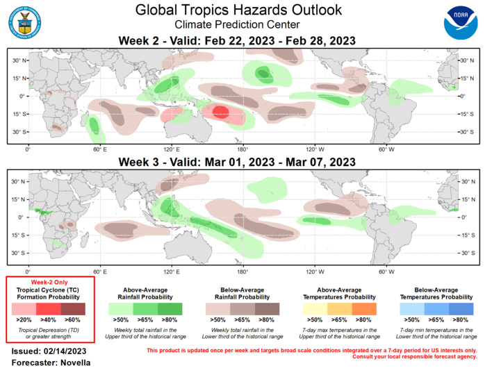
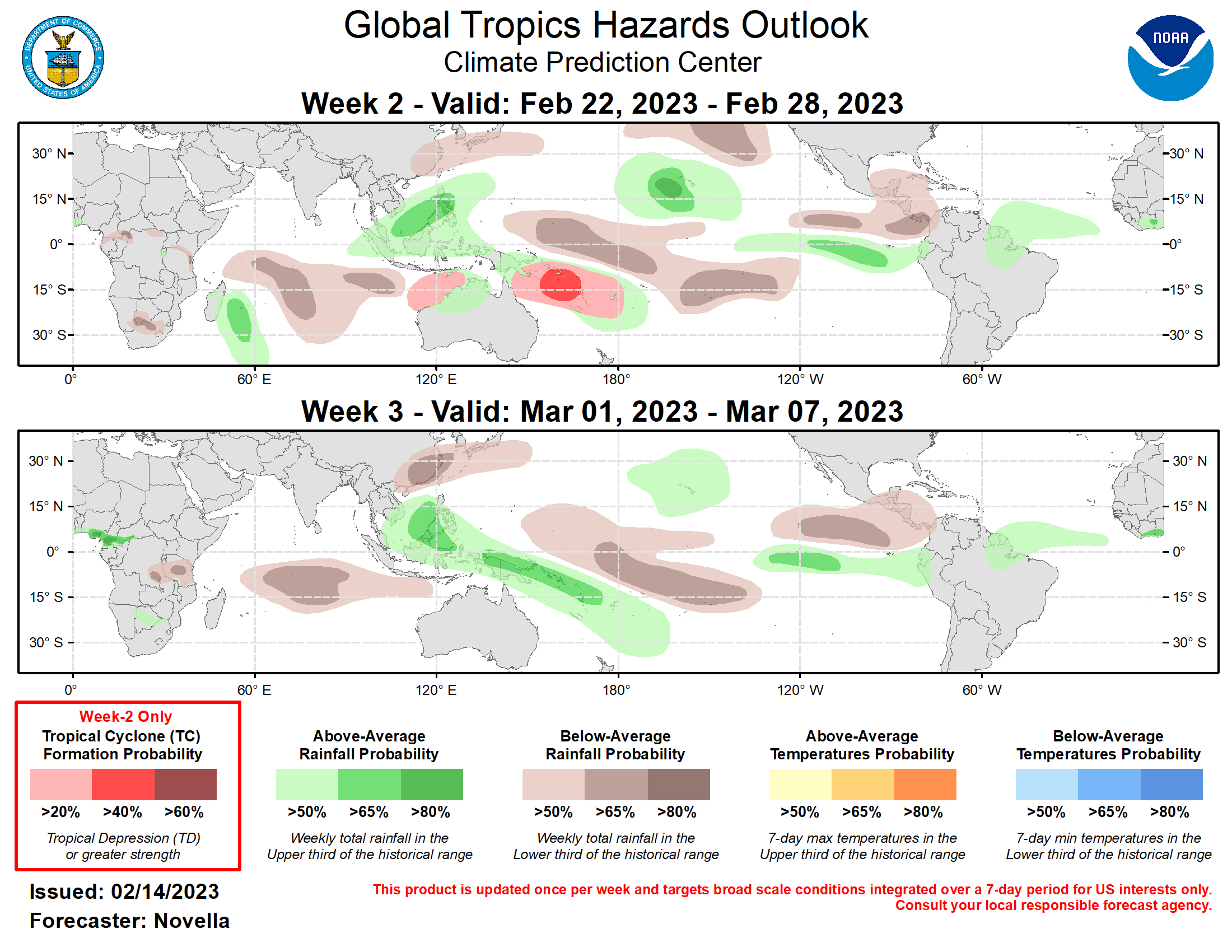
Outlook Discussion Last Updated - 02/21/23 Valid - 03/01/23 - 03/14/23 Both the RMM-based and CPC upper-level velocity potential based MJO indices continue to reflect robust MJO activity, with the enhanced convective envelope now crossing the Pacific Ocean. Westerly low-level zonal wind anomalies have recently developed along the Equator near the Date Line, which reflects MJO-related destructive interference with the La Niña base state, and could help initiate a downwelling oceanic Kelvin wave that further erodes the cold ENSO conditions. Over the past several days, the upper-level velocity potential field has become somewhat more inconsistent with the other diagnostic fields, showing a faster propagation of the enhanced convective envelope over the Western Hemisphere. It is possible that this activity is related to Kelvin wave activity propagating ahead of the main MJO convective envelope. This competing signal may partly explain the dynamical model MJO index forecasts, which generally depict a weakening of the index during Week-1, followed by a strong resurgence of MJO activity over the West Pacific beginning in Week-2. As the Kelvin wave crosses the Indian Ocean, it would potentially interfere with the ongoing MJO event, and then conversely begin constructively interfering with the MJO as it returns to the Pacific. Despite the strong MJO-related anomalies, due to the lack of a clear progression of the signal across the Western Hemisphere in the model forecasts, the impact of the intraseasonal signal on the evolution of the extratropical pattern is uncertain. Additionally, despite the interference with the base state, dynamical models continue to depict strong subsidence along the Equator near the Date Line. Long-lived Tropical Cyclone Freddy, which formed on 6 February and currently at Category-3 intensity on the Saffir-Simpson scale, is approaching landfall on the eastern coast of Madagascar, where substantial wind, surge, and flooding impacts are anticipated. Forecasts from the Joint Typhoon Warning Center (JTWC) depict rapid weakening of the cyclone over the higher terrain of Madagascar, before the system emerges over the Mozambique Channel. A second landfall is anticipated along the Mozambique coast. During Week-2, there is a slight chance of additional tropical cyclone development in the vicinity of La Reunion Island, Madagascar, or the Mozambique Channel following the passage of the previously mentioned Kelvin wave, despite the potentially unfavorable environment generated by the MJO suppressed envelope. Tropical cyclone formations are also possible north of Australia or across the Coral Sea, which is more consistent with forecasted MJO activity. The MJO would also support tropical cyclogenesis along the South Pacific Convergence Zone (SPCZ) region, but dynamical model forecasts do not depict a high potential for tropical cyclone activity in this region. Forecasts for above- and below-normal precipitation probabilities are based on a consensus of GEFS, ECMWF, and CFS model guidance, MJO activity, and the ongoing La Niña base state. The MJO supports suppressed convection across the central Indian Ocean, with enhanced convection across the Pacific primarily limited to the eastern portion of the basin due to interference with the low frequency suppressed signal near the Date Line. A wet pattern is favored for both Week-2 and Week-3 across Hawaii and in the vicinity of American Samoa, with suppressed convection favored southeast of Guam. Strong ridging favors drier conditions across the Gulf of Mexico and the Caribbean during Week-2, which may exacerbate abnormal dryness and developing drought conditions in Florida and Puerto Rico.
