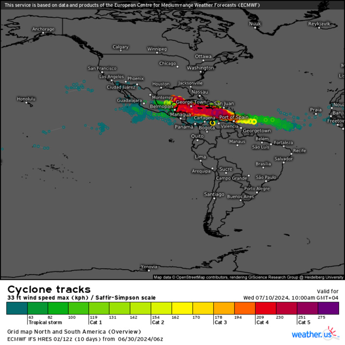
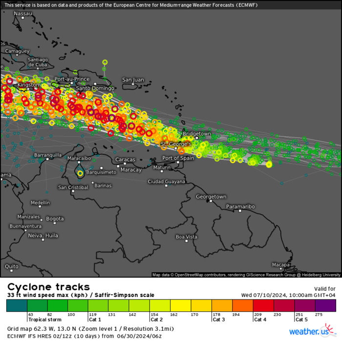
CLICK ON THE IMAGERIES BELOW TO GET THEM ENLARGED
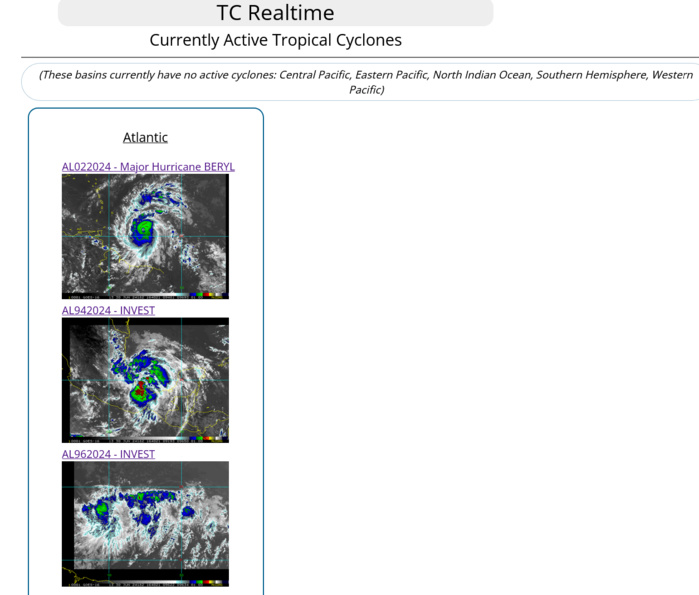
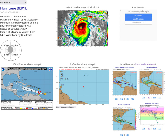
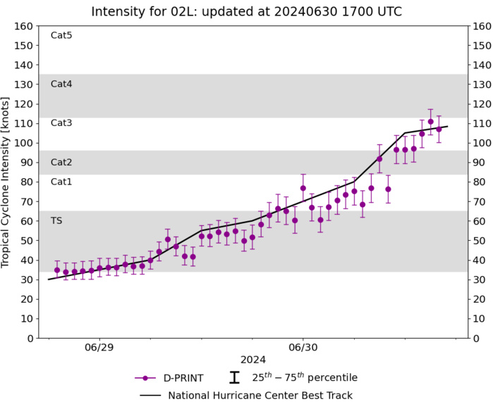
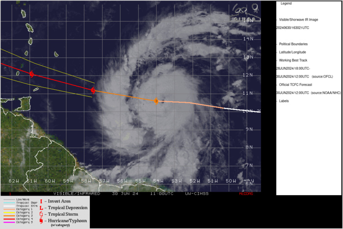
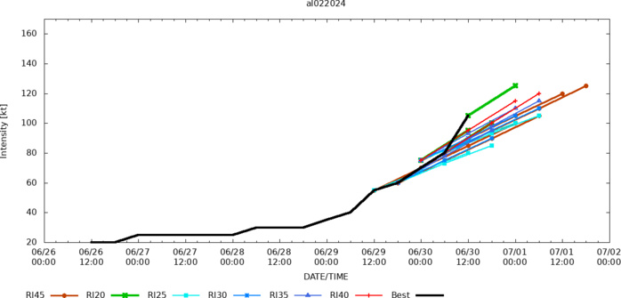
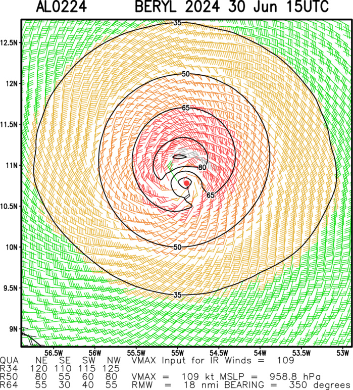
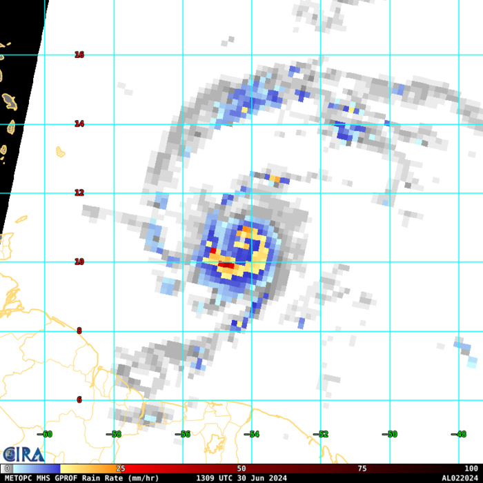
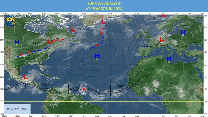
NORTH ATLANTIC OCEAN: HU 02L(BERYL). ESTIMATED LOCATION AND INTENSITY AT 30/12UTC. INTENSITY IS 105 KNOTS/CAT 3 US: +50 KNOTS OVER 24H
0224062600 94N 255W 15
0224062606 96N 270W 15
0224062612 98N 288W 20
0224062618 99N 301W 20
0224062700 100N 315W 25
0224062706 100N 325W 25
0224062712 99N 338W 25
0224062718 97N 354W 25
0224062800 95N 366W 25
0224062806 92N 380W 30
0224062812 89N 394W 30
0224062818 90N 410W 30
0224062900 92N 427W 35
0224062906 97N 446W 40
0224062912 98N 469W 55
0224062918 100N 485W 60
0224063000 102N 503W 70
0224063006 105N 522W 80
0224063012 106N 540W 105
ESTIMATED INTENSITY IS 110 KNOTS AT 30/17UTC
CLICK ON THE IMAGERY BELOW TO GET IT ANIMATED AND ENLARGED
TC Warning Graphic: WARNING 8 ISSUED AT 30/15UTC+ NHC DISCUSSION
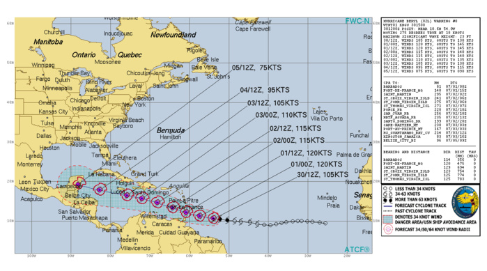
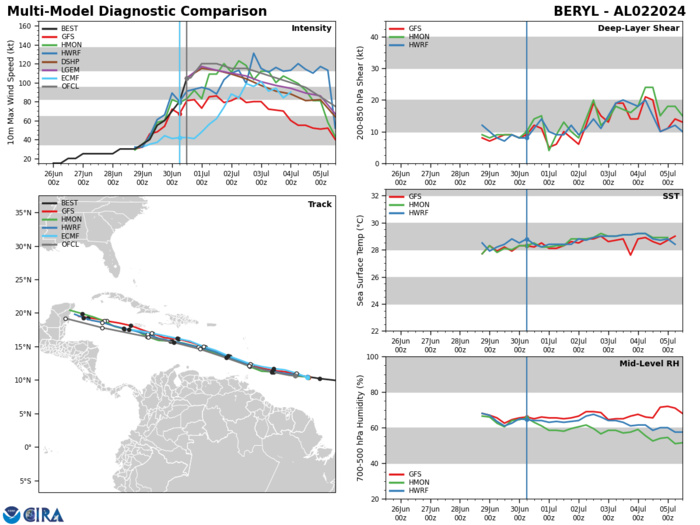
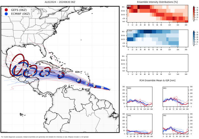
Hurricane Beryl Discussion Number 8 NWS National Hurricane Center Miami FL AL022024 1100 AM AST Sun Jun 30 2024 Data from the Air Force and NOAA Hurricane Hunters this morning indicate that Beryl continues to rapidly intensify. Based on the data collected, the minimum pressure has fallen significantly to 964 mb and the maximum wind speed is now up to 105 kt. Although Beryl is still on the small side, the wind field is a little larger than previously noted with the tropical-storm-force winds estimated to extend up to 100 n mi from the center and hurricane-force winds up to 25 n mi from the eye. Satellite images show that Beryl has a classic major hurricane pattern with a clear and circular eye and symmetric convective pattern surrounding it. Beryl continues to move swiftly westward at 18 kt steered by a strong subtropical ridge to its north. The hurricane has been moving a little to the south of most of the model predictions over the past day or two. A continued quick west to west-northwest motion is forecast during the next several days as the ridge remains the primary steering feature. This should take the core of Beryl across the Windward Islands Monday morning and then across much the Caribbean Sea during the following few days. The NHC track forecast has been nudged to the south of the previous prediction and lies close to the various consensus aids. The major hurricane has rapidly intensified since it formed a couple of days ago, and given the continued conducive environmental conditions and compact inner core, it will likely strengthen some more through tonight. Beryl is expected to be a very dangerous category 4 hurricane when it moves through Windward Islands. The models show a gradual increase in shear when the system moves across the Caribbean Sea and that should cause Beryl's intensity to level off and then gradually weaken. However, Beryl is expected to remain a significant hurricane through the next 5 days. The intensity forecast is a little above the previous one and in good agreement with the HCCA and IVCN models. Key Messages: 1. Beryl is expected to be an extremely dangerous Category 4 hurricane when it reaches the Windward Islands. This is a very dangerous situation and residents in these areas should listen to local government and emergency management officials for any preparedness and/or evacuation orders. All preparations should be rushed to completion today. 2. Potentially catastrophic hurricane-force winds, a life-threatening storm surge, and damaging waves are expected when Beryl passes over portions of the Windward Islands with the highest risk of the core in St. Vincent and the Grenadines, and Grenada beginning early Monday morning. Hurricane Warnings are in effect for much of the Windward Islands. 3. Heavy rainfall and localized flooding are expected across the Windward Islands through Monday. 4. Beryl is expected to remain a powerful hurricane as it moves across the Caribbean Sea later this week and interests in Hispaniola, Jamaica, the Cayman Islands and the remainder of the northwestern Caribbean should monitor its progress, There is large forecast uncertainty at days 4 and 5 and users should not focus on the specific details of the track or intensity forecast. FORECAST POSITIONS AND MAX WINDS INIT 30/1500Z 10.7N 54.9W 105 KT 120 MPH 12H 01/0000Z 11.2N 57.5W 120 KT 140 MPH 24H 01/1200Z 12.1N 60.9W 120 KT 140 MPH 36H 02/0000Z 13.3N 64.3W 115 KT 130 MPH 48H 02/1200Z 14.6N 68.2W 115 KT 130 MPH 60H 03/0000Z 15.6N 72.1W 110 KT 125 MPH 72H 03/1200Z 16.4N 75.9W 105 KT 120 MPH 96H 04/1200Z 17.8N 82.8W 95 KT 110 MPH 120H 05/1200Z 19.2N 88.3W 75 KT 85 MPH...INLAND $$ Forecaster Cangialosi
