CLICK ON THE IMAGERIES BELOW TO GET THEM ENLARGED
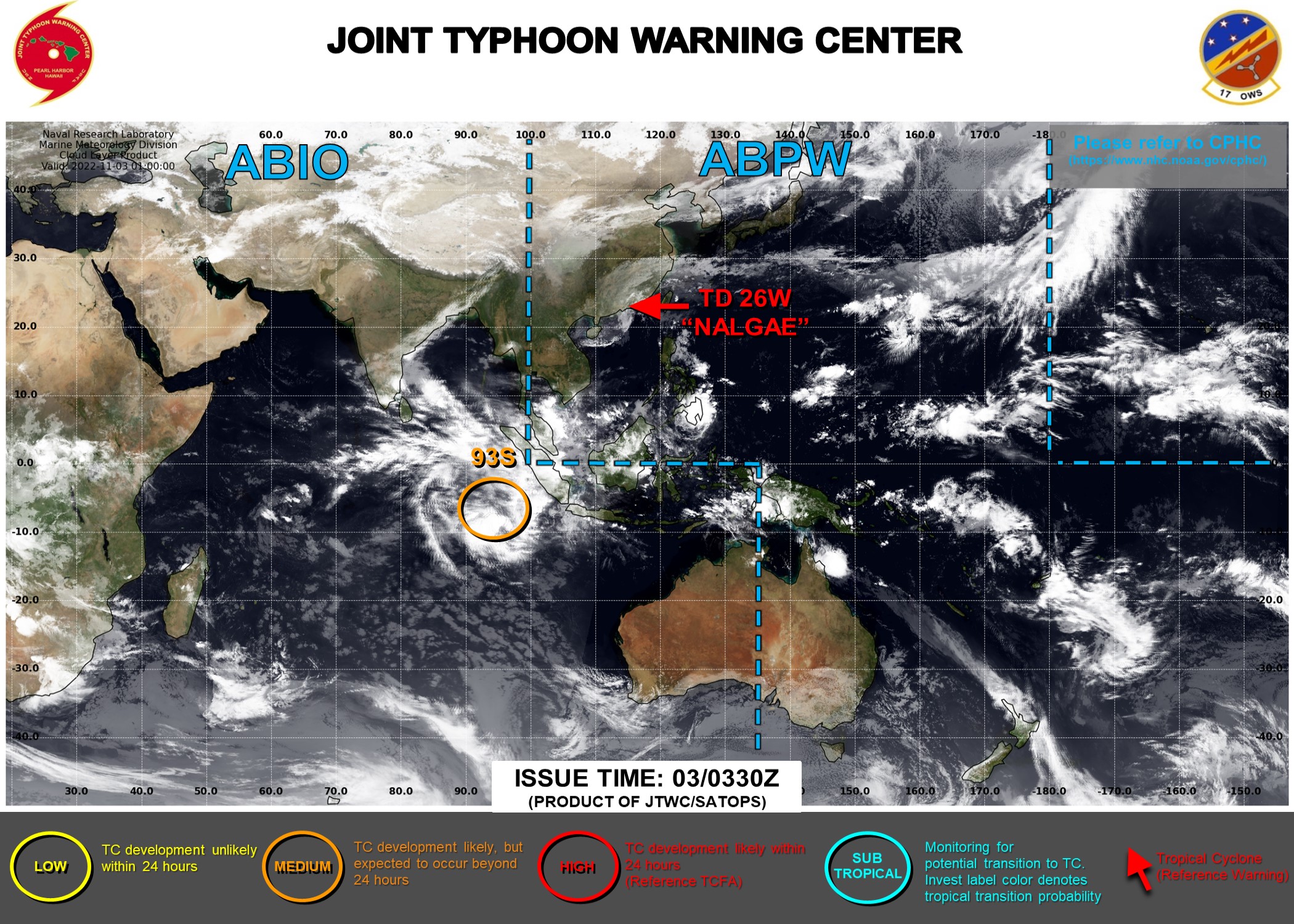
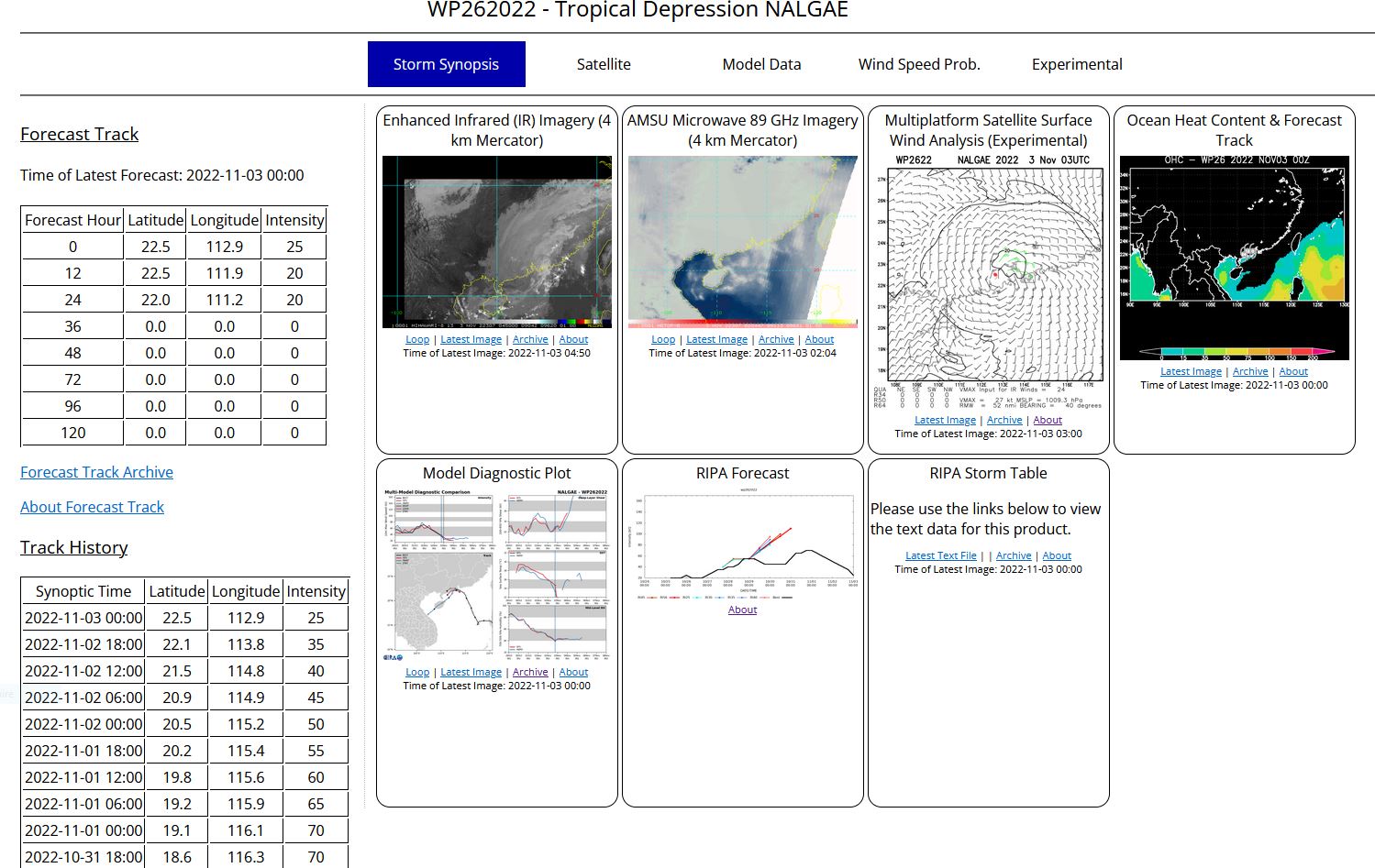
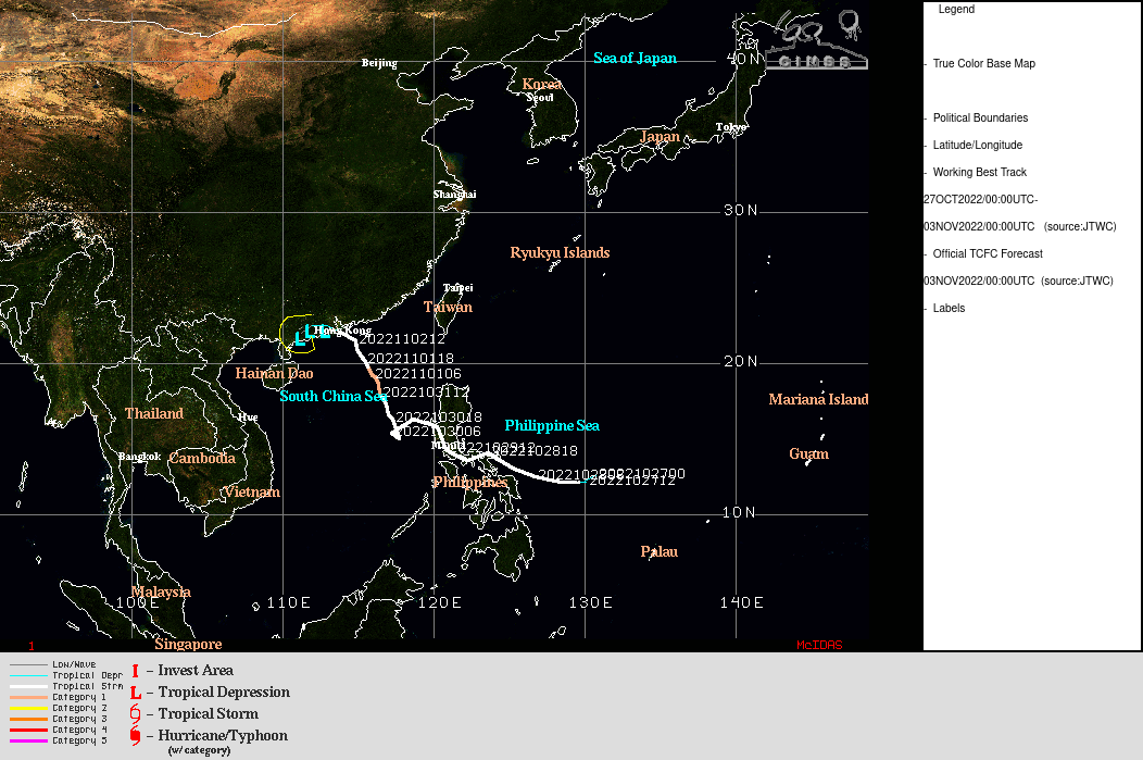
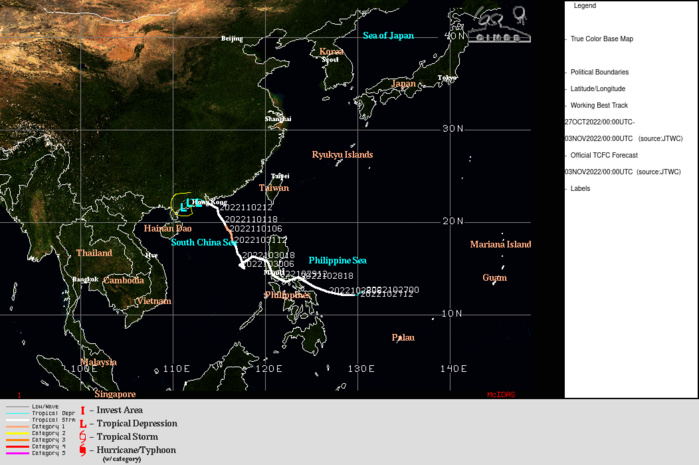
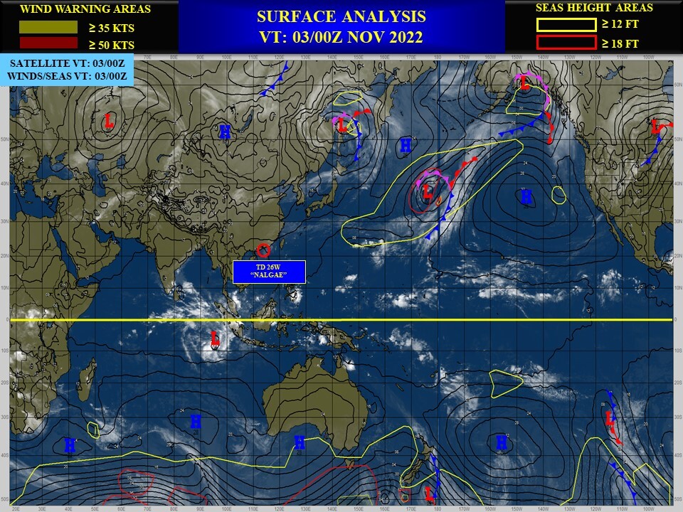
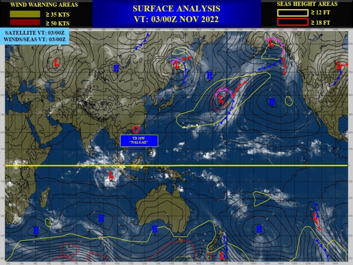
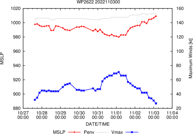
WESTERN NORTH PACIFIC: TD 26W(NALGAE). ESTIMATED LOCATION AND INTENSITY AT 03/00UTC. WARNING 29/FINAL ISSUED AT 03/03UTC.
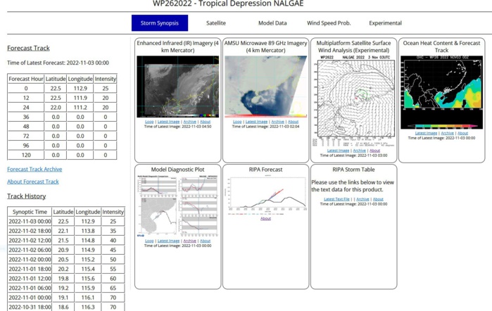
REMARKS: 030300Z POSITION NEAR 22.5N 112.6E. 03NOV22. TROPICAL DEPRESSION 26W (NALGAE), LOCATED APPROXIMATELY 73 NM WEST OF HONG KONG, HAS TRACKED WEST-NORTHWESTWARD AT 09 KNOTS OVER THE PAST SIX HOURS. ANIMATED MULTISPECTRAL SATELLITE IMAGERY (MSI) AND ANIMATED RADAR IMAGERY FROM HONG KONG SHOW A VERY SHALLOW AND WEAK LOW LEVEL CIRCULATION CENTER (LLCC) MOVING INLAND TO THE WEST OF SHENZEN. THE SYSTEM HAS RAPIDLY WEAKENED AND FILLED, WITH PRESSURE READINGS FROM THE REGION SHOWING A MINIMUM PRESSURE OF 1012 MB. THE INITIAL POSITION IS ASSESSED WITH HIGH CONFIDENCE BASED ON THE RADAR AND MSI DEPICTIONS. THE INITIAL INTENSITY IS ALSO ASSESSED WITH HIGH CONFIDENCE BASED ON A CIMSS OPEN-AIIR INTENSITY ESTIMATE OF 25 KNOTS. THE SYSTEM IS EXPECTED TO SLOWLY DRIFT TOWARDS THE WEST AND ULTIMATELY SOUTHWEST OVER THE NEXT 24 HOURS WHILE CONTINUING TO WEAKEN. HOWEVER, IT IS POSSIBLE THAT THE SHALLOW REMNANT CIRCULATION COULD POTENTIALLY REMAIN QUASI-STATIONARY IN THE GUANGSHOU BASIN AS IT UNDERGOES DISSIPATION. THIS IS THE FINAL WARNING ON THIS SYSTEM BY THE JOINT TYPHOON WRNCEN PEARL HARBOR HI.
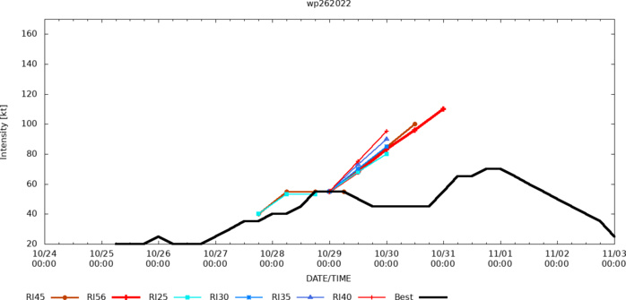
ESTIMATED PEAK INTENSITY WAS 70KT: CAT 1 US.
2622102418 95N1372E 15
2622102500 99N1364E 15
2622102506 103N1361E 20
2622102512 106N1358E 20
2622102518 111N1349E 20
2622102600 117N1337E 25
2622102606 120N1330E 20
2622102612 121N1322E 20
2622102618 121N1316E 20
2622102700 121N1311E 25
2622102706 121N1306E 30
2622102712 121N1301E 35
2622102718 121N1290E 35
2622102800 122N1279E 40
2622102806 124N1266E 40
2622102812 131N1253E 45
2622102818 137N1239E 55
2622102900 136N1222E 55
2622102906 140N1216E 55
2622102912 149N1211E 50
2622102918 158N1202E 45
2622103000 159N1188E 45
2622103003 157N1178E 45
2622103006 150N1174E 45
2622103012 152N1177E 45
2622103018 161N1173E 45
2622103100 166N1170E 55
2622103106 171N1167E 65
2622103112 176N1165E 65
2622103118 181N1163E 70
2622110100 185N1162E 70
2622110106 190N1160E 65
2622110112 195N1157E 60
2622110118 200N1155E 55
2622110200 205N1152E 50
2622110206 210N1151E 45
2622110212 216N1147E 40
2622110218 221N1138E 35
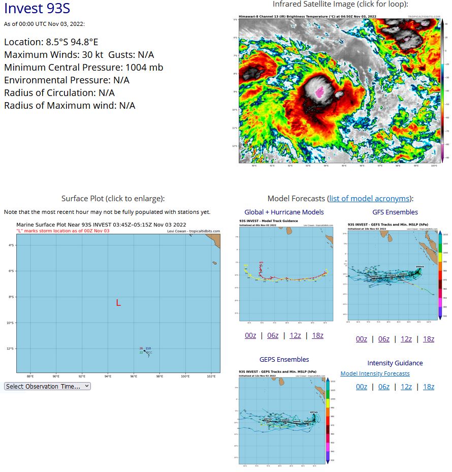
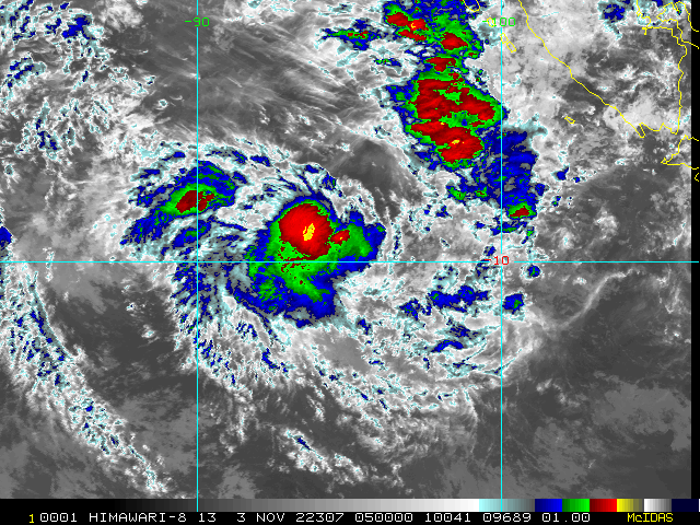
SOUTH INDIAN OCEAN: INVEST 93S. ESTIMATED LOCATION AND INTENSITY AT 03/00UTC. ADVISORY(ABIO) ISSUED AT 03/0230UTC.
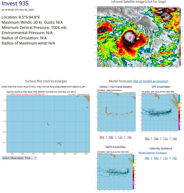
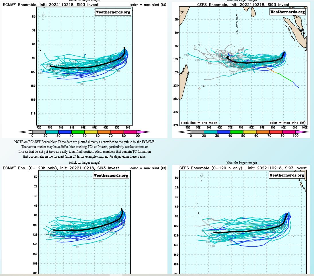
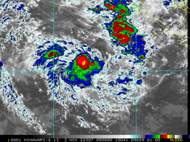
THE AREA OF CONVECTION (INVEST 93S) PREVIOUSLY LOCATED NEAR 5.4S 94.7E IS NOW LOCATED NEAR 8.5S 94.8E, APPROXIMATELY 252 NM NORTH- NORTHWEST OF COCOS ISLANDS, AUSTRALIA. ANIMATED MSI AND A 022125Z SSMIS 91GHZ MICROWAVE IMAGE DEPICTS A BROAD CIRCULATION WITH FLARING CONVECTION OBSCURING THE LOW LEVEL CIRCULATION (LLC). THE ENVIRONMENT IS NOT TOO SHABBY FOR 93S TO DEVELOP WITH FAIR POLEWARD OUTFLOW, LOW- MODERATE (15-20KT) VWS, AND WARM (27-28C) SST. GLOBAL MODELS ARE IN AGREEMENT THAT THE SYSTEM WILL TRACK SOUTH-SOUTHWESTWARD OVER THE NEXT 24-48 HOURS. INTENSITY GUIDANCE IS MORE MIXED, WITH THE MAJORITY OF GUIDANCE INCLUDING GFS, BEING UNEXCITED ABOUT THE SYSTEM AND SHOWING LITTLE IN THE WAY OF DEVELOPMENT. THE ECMWF ON THE OTHER HAND SHOWS A BRIEF WINDOW OF INTENSIFICATION WITHIN THE NEXT 24-36 HOURS, REACHING MINIMAL TROPICAL STORM STRENGTH BEFORE RAPIDLY WEAKENING. MAXIMUM SUSTAINED SURFACE WINDS ARE ESTIMATED AT 28 TO 33 KNOTS. MINIMUM SEA LEVEL PRESSURE IS ESTIMATED TO BE NEAR 1004 MB. THE POTENTIAL FOR THE DEVELOPMENT OF A SIGNIFICANT TROPICAL CYCLONE WITHIN THE NEXT 24 HOURS IS UPGRADED TO MEDIUM.
SH, 93, 2022110112,42S, 934E, 20, 1007, DB
SH, 93, 2022110118,47S, 942E, 20, 1007, DB
SH, 93, 2022110200,54S, 944E, 20, 1006, DB
SH, 93, 2022110206,61S, 946E, 25, 1007, TD
SH, 93, 2022110212,67S, 950E, 25, 1007, TD
SH, 93, 2022110218,75S, 951E, 25, 1004, TD
SH, 93, 2022110300,85S, 948E, 30, 1004, TD
SH, 93, 2022110118,47S, 942E, 20, 1007, DB
SH, 93, 2022110200,54S, 944E, 20, 1006, DB
SH, 93, 2022110206,61S, 946E, 25, 1007, TD
SH, 93, 2022110212,67S, 950E, 25, 1007, TD
SH, 93, 2022110218,75S, 951E, 25, 1004, TD
SH, 93, 2022110300,85S, 948E, 30, 1004, TD
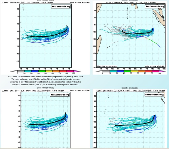
GLOBAL MODELS ARE IN AGREEMENT THAT THE SYSTEM WILL TRACK SOUTH-SOUTHWESTWARD OVER THE NEXT 24-48 HOURS. INTENSITY GUIDANCE IS MORE MIXED, WITH THE MAJORITY OF GUIDANCE INCLUDING GFS, BEING UNEXCITED ABOUT THE SYSTEM AND SHOWING LITTLE IN THE WAY OF DEVELOPMENT. THE ECMWF ON THE OTHER HAND SHOWS A BRIEF WINDOW OF INTENSIFICATION WITHIN THE NEXT 24-36 HOURS, REACHING MINIMAL TROPICAL STORM STRENGTH BEFORE RAPIDLY WEAKENING.
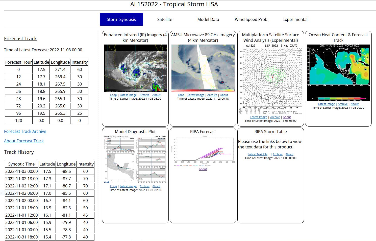
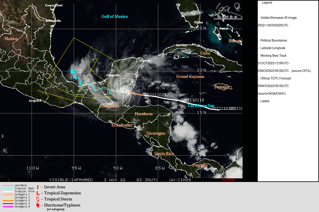
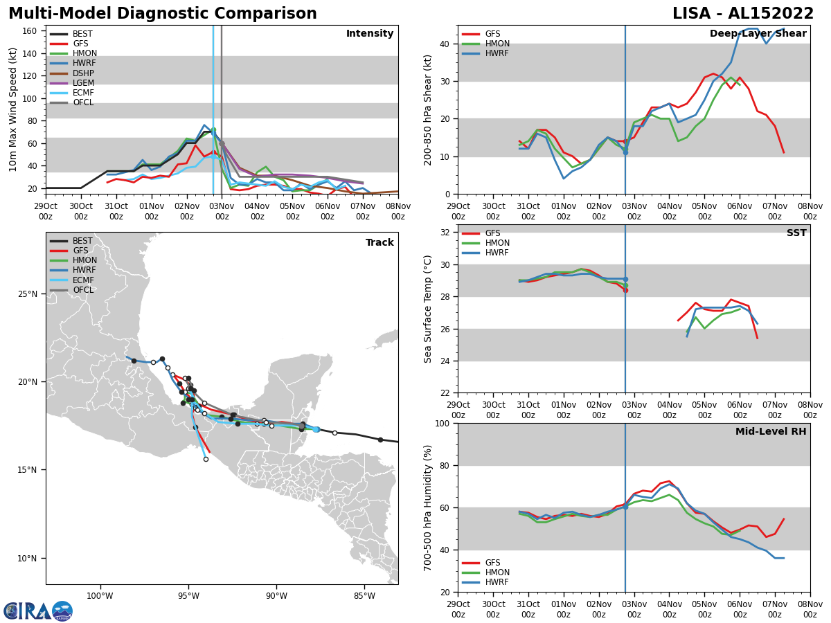
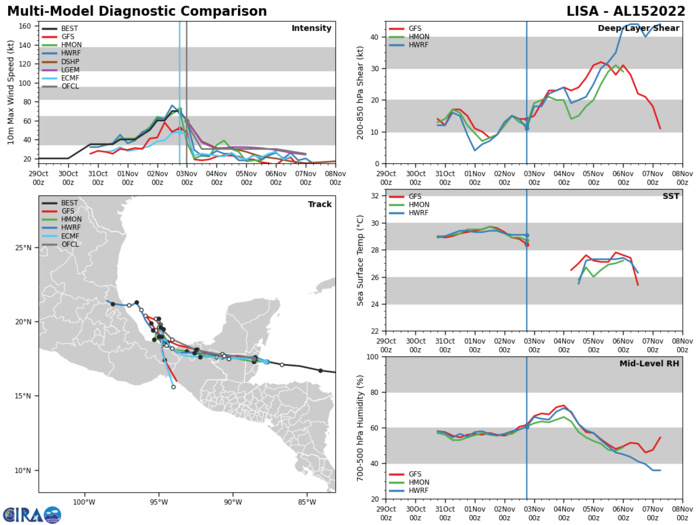
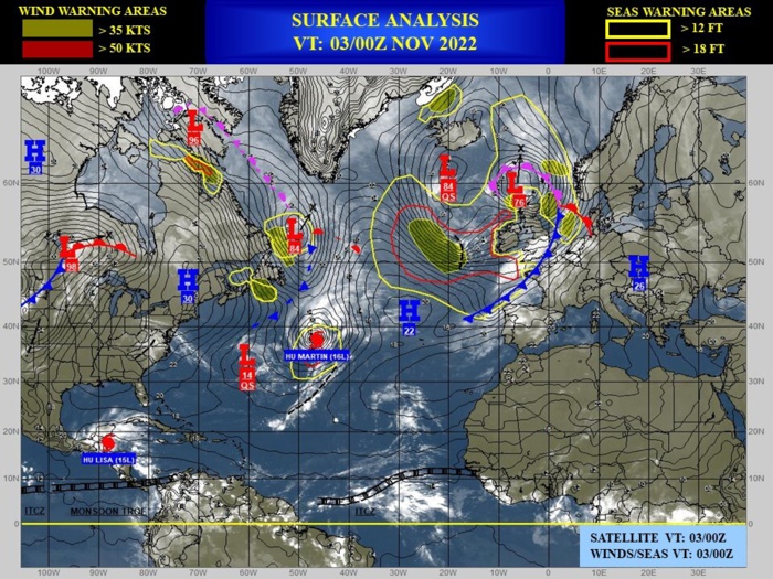
NORTH ATLANTIC OCEAN:TS 15L(LISA). ESTIMATED LOCATION AND INTENSITY AT 03/00UTC. NHC COMMENTS.
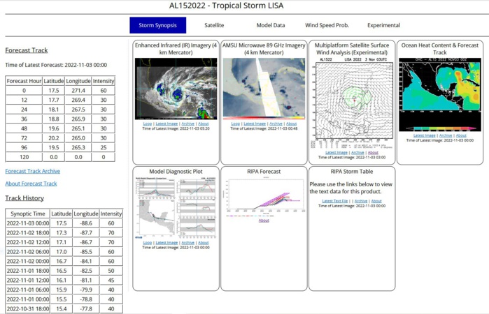
Tropical Storm Lisa Discussion Number 14 NWS National Hurricane Center Miami FL AL152022 1000 PM CDT Wed Nov 02 2022 Satellite and radar imagery showed Lisa made landfall earlier this evening around 2120 UTC southwest of Belize City. The maximum sustained winds and minimum central pressure were estimated to be 75 kt and 990 mb, respectively. The storm has moved farther inland and the initial intensity has been reduced to 50 kt based on a standard inland decay rate. Rapid weakening is expected to continue overnight and into tomorrow due to land interaction and Lisa is forecast to be a tropical depression on Thursday. Even though the cyclone is expected to emerge over the Bay of Campeche in a couple of days, strong southwesterly vertical wind shear will likely prevent intensification. The NHC intensity forecast remains largely unchanged from the previous advisory and still shows Lisa dissipating by the end of the forecast period. Lisa is moving westward at an estimated 10 kt. This general motion is expected to continue for the next day or so until the storm crosses over the Bay of Campeche. The cyclone is then forecast to turn to the northwest and slow in forward speed, eventually stalling between 60 to 72 hours until the low-level flow turns Lisa southward. The official track forecast is very similar to the previous advisory and close to the various consensus aids. Key Messages: 1. Heavy rainfall and flash flooding is expected across portions of Belize, northern Guatemala, and portions of southeastern Mexico during the next day or so. 2. Water levels are likely to remain elevated in areas of onshore flow along the coast of Belize overnight. 3. Tropical storm conditions are expected to spread inland over Belize, northern Guatemala, southern portions of the Yucatan peninsula of Mexico overnight. FORECAST POSITIONS AND MAX WINDS INIT 03/0300Z 17.6N 89.1W 50 KT 60 MPH...INLAND 12H 03/1200Z 17.7N 90.6W 30 KT 35 MPH...INLAND 24H 04/0000Z 18.1N 92.5W 30 KT 35 MPH...INLAND 36H 04/1200Z 18.8N 94.1W 30 KT 35 MPH...INLAND 48H 05/0000Z 19.6N 94.9W 30 KT 35 MPH...OVER WATER 60H 05/1200Z 20.2N 95.2W 30 KT 35 MPH 72H 06/0000Z 20.2N 95.0W 30 KT 35 MPH 96H 07/0000Z 19.5N 94.7W 25 KT 30 MPH...POST-TROP/REMNT LOW 120H 08/0000Z...DISSIPATED $$ Forecaster Bucci/Brown
1522102718 116N 648W 15
1522102800 117N 652W 20
1522102806 119N 656W 20
1522102812 120N 660W 20
1522102818 123N 666W 20
1522102900 129N 672W 20
1522102906 133N 683W 20
1522102912 136N 693W 20
1522102918 142N 698W 20
1522103000 146N 703W 20
1522103006 151N 711W 25
1522103012 155N 722W 30
1522103018 157N 733W 35
1522103100 157N 744W 35
1522103106 156N 755W 35
1522103112 155N 767W 35
1522103118 155N 778W 40
1522110100 156N 788W 40
1522110106 159N 799W 40
1522110112 162N 812W 45
1522110118 165N 825W 50
1522110200 167N 841W 60
1522110206 170N 855W 60
1522110212 171N 867W 70
1522110218 173N 877W 70
1522110300 175N 886W 50
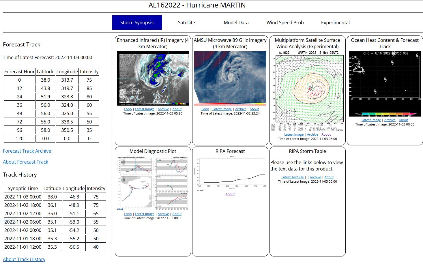
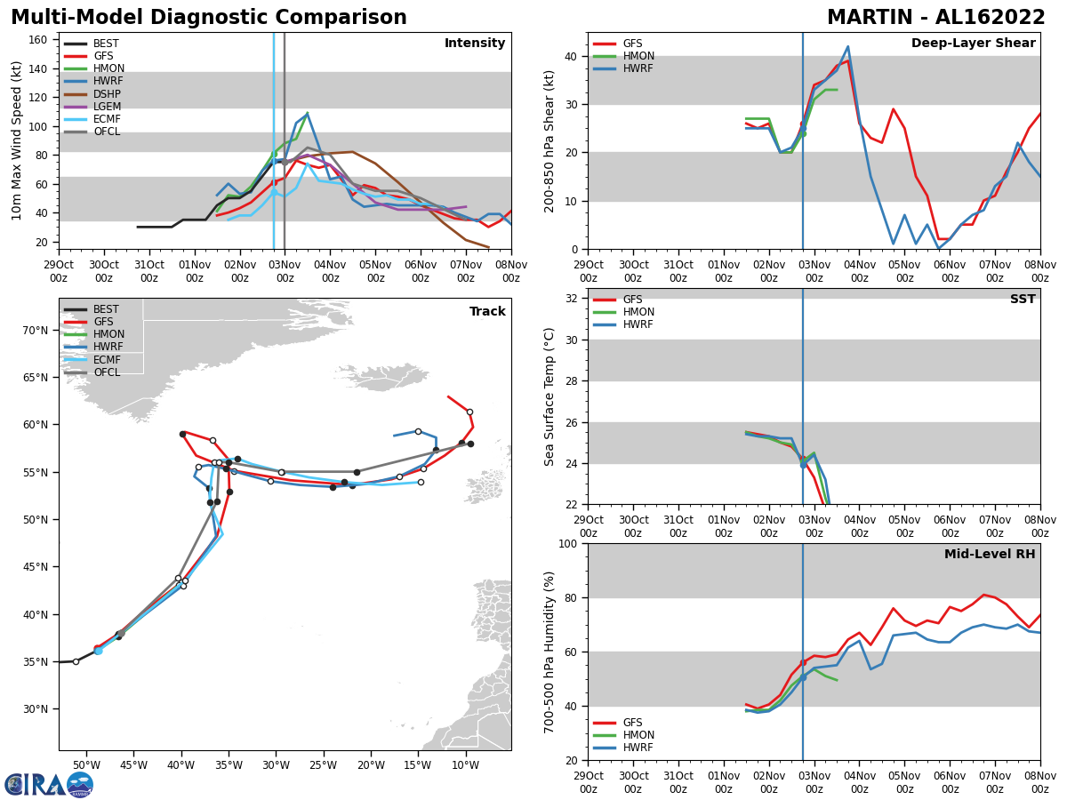
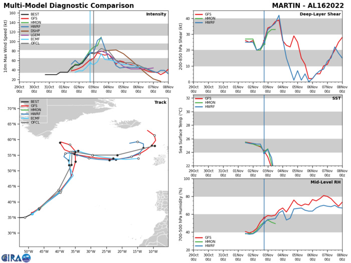
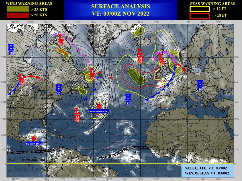
NORTH ATLANTIC OCEAN:HU 16L(MARTIN). ESTIMATED LOCATION AND INTENSITY AT 03/00UTC. NHC COMMENTS.
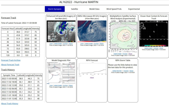
Hurricane Martin Discussion Number 7 NWS National Hurricane Center Miami FL AL162022 300 AM GMT Thu Nov 03 2022 Martin remains in impressive high-latitude late-season hurricane. Recent infrared satellite imagery shows deep convection wrapping around a ragged eye. The hurricane's cloud shield has begun expanding over the northern and northwestern portions of the storm suggesting that the system's extratropical transition is beginning. Subjective Dvorak intensity estimates from TAFB and SAB range from 65 to 77 kt, and the initial wind speed will remain on the higher end of those estimates at 75 kt. The global model guidance indicates that Martin will strengthen tonight and early Thursday as it transforms into an extratropical cyclone. That transition is expected to be complete by about 1800 UTC on Thursday. The guidance continues to depict a very strong sting-jet-like feature around the southern and southwestern portions of the storm, and the NHC forecast therefore calls for some strengthening during the next 12 hours or so. Martin's wind field is also forecast to rapidly expand in size during the next day or so, and this is reflected in the wind radii forecast. The baroclinic forcing should begin to decrease by late tomorrow, with gradual weakening occurring after that time, however Martin is forecast to remain a very large and powerful cyclone over the North Atlantic for the next several days. Martin continues to accelerate, and it is now moving northeastward at about 34 kt. A faster north-northeastward motion is expected overnight, followed by northward turn on Thursday as Martin moves around the eastern side of a strong deep-layer trough. The trough is forecast to capture Martin by 36 hours, and the merged system is expected to slow down considerably, and then turn eastward in the mid-latitude flow. The updated track forecast is slightly faster during the first 24 hours, but little change was required thereafter. The forecast is a blend of mostly the GFS and ECMWF global model guidance. FORECAST POSITIONS AND MAX WINDS INIT 03/0300Z 39.4N 44.9W 75 KT 85 MPH 12H 03/1200Z 43.8N 40.3W 85 KT 100 MPH 24H 04/0000Z 51.9N 36.2W 80 KT 90 MPH...POST-TROP/EXTRATROP 36H 04/1200Z 56.0N 36.0W 60 KT 70 MPH...POST-TROP/EXTRATROP 48H 05/0000Z 56.0N 35.0W 55 KT 65 MPH...POST-TROP/EXTRATROP 60H 05/1200Z 55.0N 29.5W 55 KT 65 MPH...POST-TROP/EXTRATROP 72H 06/0000Z 55.0N 21.5W 50 KT 60 MPH...POST-TROP/EXTRATROP 96H 07/0000Z 58.0N 9.5W 35 KT 40 MPH...POST-TROP/EXTRATROP 120H 08/0000Z...DISSIPATED $$ Forecaster Brown
1622103018 344N 625W 30
1622103100 351N 628W 30
1622103106 348N 630W 30
1622103112 348N 616W 30
1622103118 351N 609W 35
1622110100 351N 595W 35
1622110106 355N 575W 35
1622110112 353N 565W 45
1622110118 353N 552W 50
1622110200 351N 542W 50
1622110206 349N 530W 55
1622110212 350N 511W 65
1622110218 361N 489W 75
1622110300 380N 463W 75
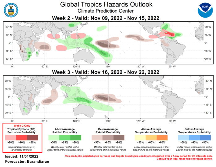
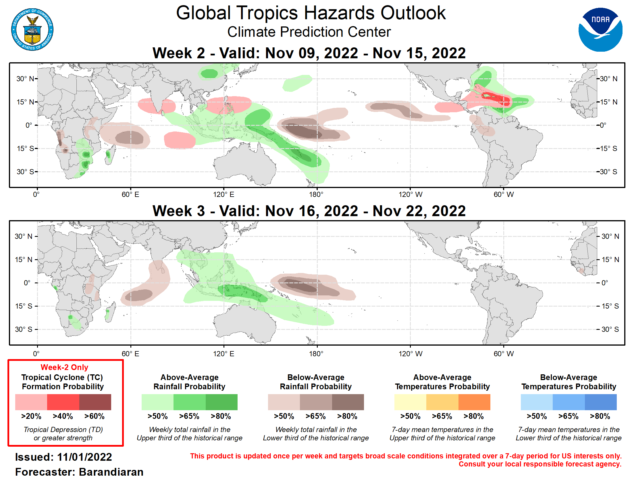
Outlook Discussion Last Updated - 11/01/22 Valid - 11/09/22 - 11/22/22 The state of the Madden-Julian Oscillation (MJO) has been muddled lately while the ongoing La Niña continues to dominate the global tropical convection pattern. Enhanced (suppressed) convection remains over the Maritime Continent (near the Date Line) but otherwise there is little organization with respect to tropical convection. There has been very little eastward propagation of the main convective envelope. This is evident in the RMM index, which has oscillated in intensity but has remained along the boundary between phases 6 and 7 for nearly two weeks. Looking ahead, most dynamical model depictions of the RMM index continue to keep the signal confined to the top half of the diagram. Rapid eastward propagation in week 1 is a common feature in model solutions consistent with Kelvin wave activity, before moving the index back towards phase 6 or within the unit circle in weeks 2 and 3. The last week has seen tropical cyclone (TC) activity in the West Pacific and Atlantic Basins. On October 26, TC Nalgae formed several hundred miles east of the Philippines. As this system tracked west over the Philippines and is currently over the South China Sea, it is anticipated to make landfall over the southern coast of China in the coming days. On October 30, TC Banyan formed in nearly the same location as Nalgae. The remnants of this short-lived TC are just east of the Philippines and will bring periods of heavy rain to the southern and central Philippines. Please refer to the Joint Typhoon Warning Center for the latest information on TCs Nalgae and Banyan. In the Atlantic Basin, TC Lisa formed in the central Caribbean on October 31, and TC Martin formed northeast of Bermuda in the North Atlantic Ocean. Lisa is moving west through the Caribbean and is forecast to make landfall in Central America in the next 36-48 hours. Martin is moving northward and is not likely to have any impacts on land. Please refer to the National Hurricane Center for the latest information on TCs Lisa and Martin. Looking ahead to week 2, the near-stationary MJO and La Niña base state provide favorable conditions for continued TC formation for the West Pacific. Model guidance from the ECMWF and GEFS indicate increased probabilities of TC formation covering a broad area from the South China Sea eastward into Philippine Sea and Pacific waters south of Japan. Anomalous low-level westerlies, which have been favorable to TC development recently, are forecast to continue over the tropical southeastern Indian Ocean, therefore a slight probability of TC formation is included for the region. In the Caribbean Sea, both the GEFS and ECMWF show an increased probability of TC formation in week two, with increased Rossby wave activity and SSTs still warm enough to fuel TC genesis. The precipitation outlook for the next two weeks is based on anticipated TC tracks, ongoing La Nina conditions, and consensus of GEFS, CFS, and ECMWF ensemble mean solutions. Suppressed (enhanced) rainfall continues near and to the west of the Date Line (over the Maritime Continent) due to ongoing La Nina conditions. A secondary area of below-normal precipitation is favored for the western tropical Indian Ocean for weeks 2 and 3. Above normal precipitation is favored during week 2 for the northern coast of South America and the eastern Caribbean, consistent with heightened TC activity during this time period.
