Menu

20W(ROKE)gaining latitude&weakening steadily//TS 16E(ORLENE)peaking at CAT2 by 48H//09L(IAN) hybrid features//GTHO map//30/09utc


CLICK ON THE IMAGERIES BELOW TO GET THEM ENLARGED

JTWC IS ISSUING 6HOURLY WARNINGS AND 3HOURLY SATELLITE BULLETINS ON 20W(ROKE).


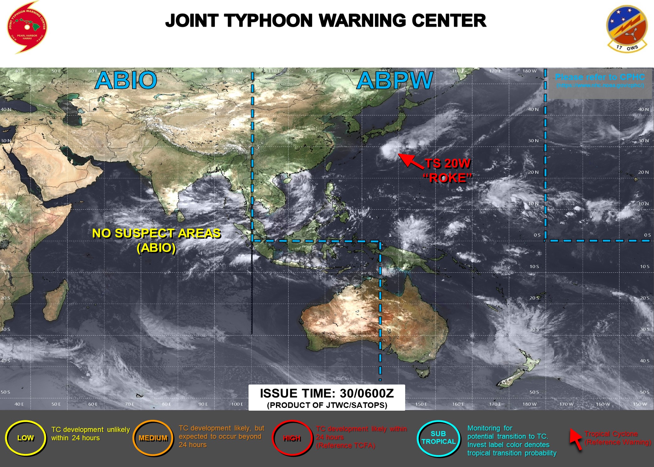
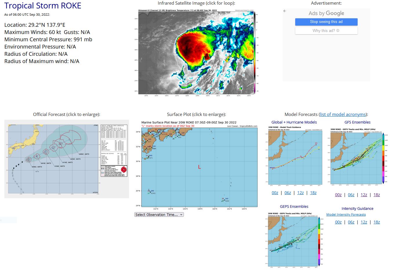
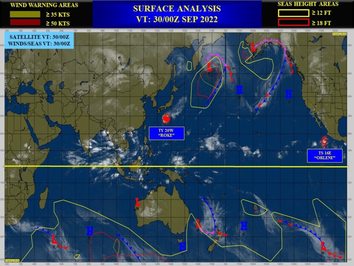
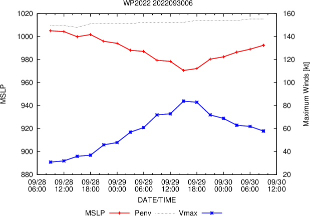
WESTERN NORTH PACIFIC: TS 20W(ROKE). ESTIMATED LOCATION AND INTENSITY AT 30/06UTC. WARNING 9 ISSUED AT 30/09UTC.
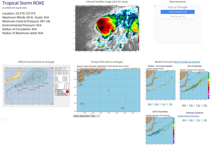
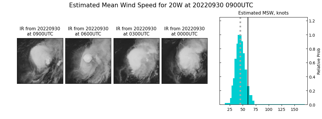
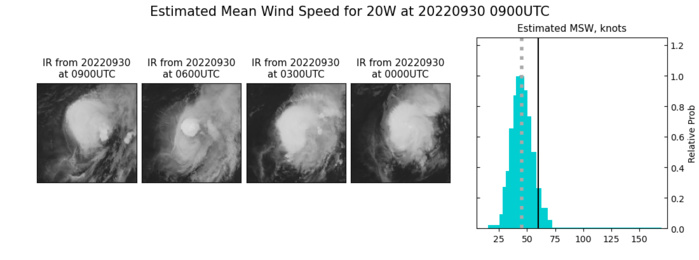
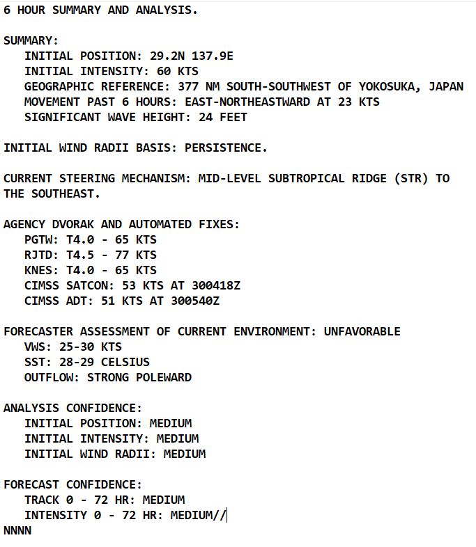
SATELLITE ANALYSIS, INITIAL POSITION AND INTENSITY DISCUSSION: ANIMATED MULTISPECTRAL SATELLITE IMAGERY (MSI) SHOWS THE SYSTEM CONTINUED TO ACCELERATE NORTHEASTWARD UNDER THE PREVAILING  WESTERLIES. LOW LEVEL CLOUD STREAKS ALONG THE WESTERN SIDE FEEDING INTO AN OBSCURED LOW LEVEL CIRCULATION (LLC) HAVE BECOME INCREASINGLY  EXPOSED AS THE CENTRAL CONVECTION IS SHEARED NORTHEASTWARD. THE  INITIAL POSITION IS DERIVED AT USING LOW CLOUD TRACING INTO THE  OBSCURED LLC. THE INITIAL INTENSITY IS BASED ON AN OVERALL ASSESSMENT  OF AGENCY AND AUTOMATED DVORAK ESTIMATES THAT ARE ON A  WEAKENING TREND.
SATELLITE ANALYSIS, INITIAL POSITION AND INTENSITY DISCUSSION: ANIMATED MULTISPECTRAL SATELLITE IMAGERY (MSI) SHOWS THE SYSTEM CONTINUED TO ACCELERATE NORTHEASTWARD UNDER THE PREVAILING WESTERLIES. LOW LEVEL CLOUD STREAKS ALONG THE WESTERN SIDE FEEDING INTO AN OBSCURED LOW LEVEL CIRCULATION (LLC) HAVE BECOME INCREASINGLY EXPOSED AS THE CENTRAL CONVECTION IS SHEARED NORTHEASTWARD. THE INITIAL POSITION IS DERIVED AT USING LOW CLOUD TRACING INTO THE OBSCURED LLC. THE INITIAL INTENSITY IS BASED ON AN OVERALL ASSESSMENT OF AGENCY AND AUTOMATED DVORAK ESTIMATES THAT ARE ON A WEAKENING TREND.
20w_300600sair.jpg 20W_300600sair.jpg  (493.73 KB)

20W(ROKE)gaining latitude&weakening steadily//TS 16E(ORLENE)peaking at CAT2 by 48H//09L(IAN) hybrid features//GTHO map//30/09utc

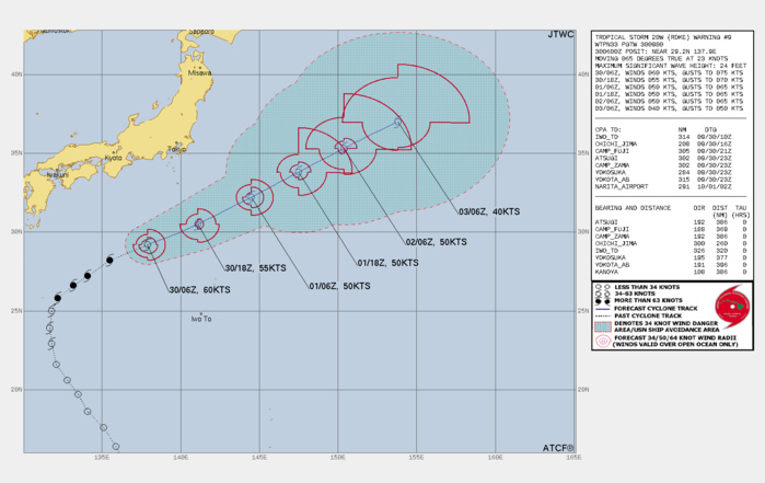
FORECAST REASONING.  SIGNIFICANT FORECAST CHANGES: THERE ARE NO SIGNIFICANT CHANGES TO THE FORECAST FROM THE PREVIOUS WARNING.  FORECAST DISCUSSION: TS ROKE WILL CONTINUE EAST-NORTHEASTWARD  THROUGHOUT THE FORECAST. AROUND TAU 36, A MID-LATITUDE SHORTWAVE TROUGH WILL DIG IN FROM THE NORTH AND WEAKEN THE STEERING STR AND BRING IN A SECONDARY STR BEHIND IT THAT WILL COMPETE WITH THE  STEERING, LEADING TO A DECELERATION IN THE STORM MOTION. THE  UNFAVORABLE CONDITIONS WILL GRADUALLY WEAKEN THE SYSTEM DOWN TO 40KTS BY TAU 72. CONCURRENTLY AROUND TAU 36, AS THE SYSTEM GETS EMBEDDED DEEPER INTO THE PREVAILING WESTERLIES AND APPROACH THE BAROCLINIC ZONE, TS 20W WILL BEGIN SUBTROPICAL TRANSITION AND BY TAU 72 WILL TRANSFORM INTO A GALE-FORCE SUBTROPICAL CYCLONE.
FORECAST REASONING. SIGNIFICANT FORECAST CHANGES: THERE ARE NO SIGNIFICANT CHANGES TO THE FORECAST FROM THE PREVIOUS WARNING. FORECAST DISCUSSION: TS ROKE WILL CONTINUE EAST-NORTHEASTWARD THROUGHOUT THE FORECAST. AROUND TAU 36, A MID-LATITUDE SHORTWAVE TROUGH WILL DIG IN FROM THE NORTH AND WEAKEN THE STEERING STR AND BRING IN A SECONDARY STR BEHIND IT THAT WILL COMPETE WITH THE STEERING, LEADING TO A DECELERATION IN THE STORM MOTION. THE UNFAVORABLE CONDITIONS WILL GRADUALLY WEAKEN THE SYSTEM DOWN TO 40KTS BY TAU 72. CONCURRENTLY AROUND TAU 36, AS THE SYSTEM GETS EMBEDDED DEEPER INTO THE PREVAILING WESTERLIES AND APPROACH THE BAROCLINIC ZONE, TS 20W WILL BEGIN SUBTROPICAL TRANSITION AND BY TAU 72 WILL TRANSFORM INTO A GALE-FORCE SUBTROPICAL CYCLONE.

MODEL DISCUSSION: NUMERICAL MODELS ARE IN TIGHT AGREEMENT BUT GIVEN THE COMPLEX STEERING BEYOND TAU 36, THERE IS ONLY MEDIUM CONFIDENCE IN THE JTWC TRACK AND INTENSITY FORECASTS.

20W(ROKE)gaining latitude&weakening steadily//TS 16E(ORLENE)peaking at CAT2 by 48H//09L(IAN) hybrid features//GTHO map//30/09utc

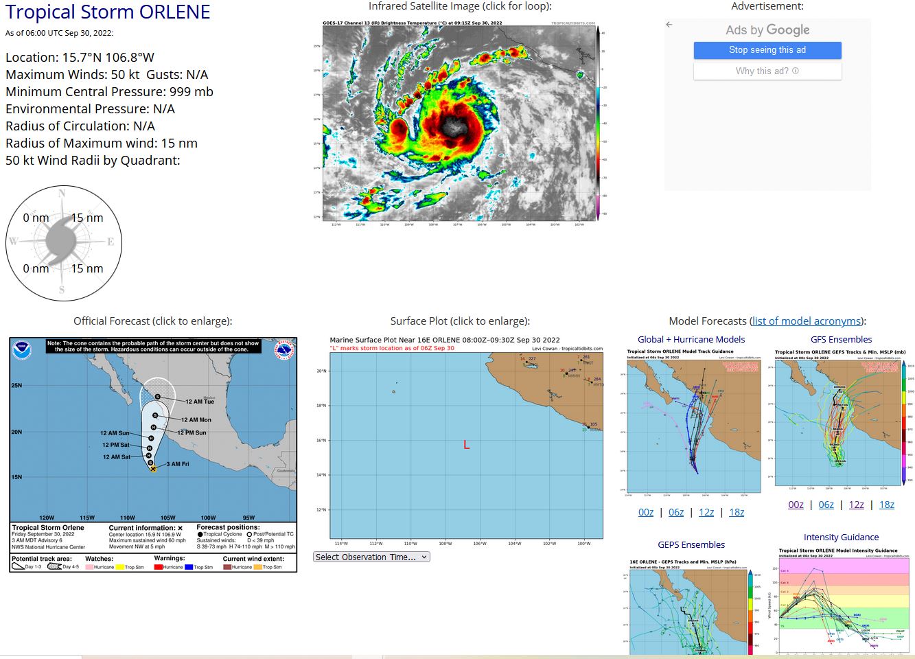
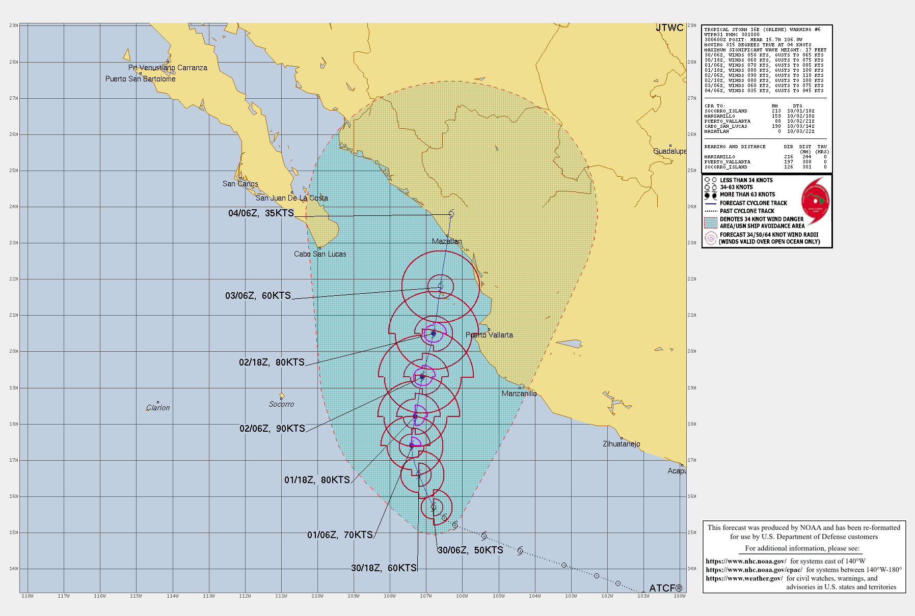
EASTERN NORTH PACIFIC: TS 16E(ORLENE). ESTIMATED LOCATION AND INTENSITY AT 30/06UTC. WARNING6 ISSUED AT 30/10UTC. NHC COMMENTS.
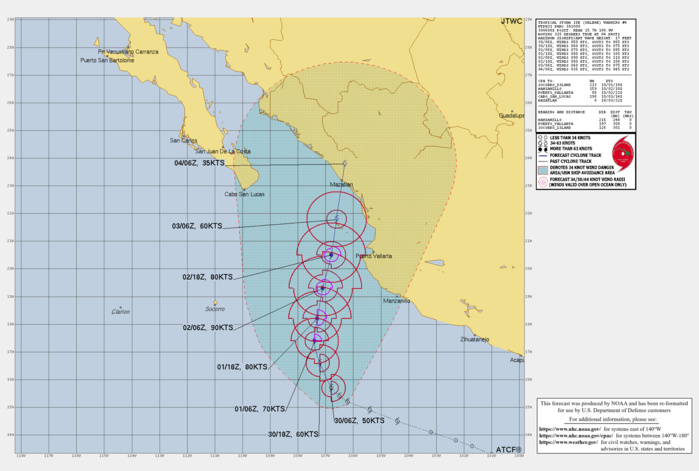

WTPZ41 KNHC 300834 TCDEP1  Tropical Storm Orlene Discussion Number   6 NWS National Hurricane Center Miami FL       EP162022 300 AM MDT Fri Sep 30 2022  Orlene continues to gain strength.  An earlier microwave overpass  revealed a well-defined curved band wrapping into a developing inner  core.  Persistent deep convection is over the estimated low-level  center location, with cloud tops near -80 degrees Celsius. The  UW-CIMSS ADT objective Dvorak estimate as well as the Data-T number  from SAB have increased from the previous advisory, and therefore  the initial intensity has been nudged up to 50 kt.    The storm has turned northwestward and is heading 320/4 kt as it  begins to slowly round the western periphery of a mid-level ridge  located over Mexico.  A turn to the north should occur by tonight  followed by a turn to the north-northeast along with a slight  increase in forward speed, as Orlene rounds the ridge and gets  caught in the flow between the ridge and an upper trough to its  west.  The consensus track guidance has shifted slightly eastward  this cycle, partially due to the ECMWF track coming into better  agreement with the rest of the global models.  The NHC track  forecast was also adjusted a little to the right, but remains just  west of the consensus. Based on the trends in the track forecast,  there is an increasing probability that Orlene may affect the coast  of the Mexican state of Jalisco as it passes just to the west of  that location in 2-3 days. Therefore, watches may be required for a  portion of that coastline later this morning.   Orlene is within an environment favorable for strengthening, with  plenty of atmospheric moisture, low vertical wind shear, and water  temperatures of 29 degrees C.  The cyclone's forecast path should  keep it within these conditions for the next 36-48 h.  With there  now being evidence of an inner core, Orlene's rate of strengthening  should increase soon.  After 48 h, strong southwesterly shear is  forecast to begin impacting the cyclone and should entrain dry  mid-tropospheric air into its circulation.  This should cause  Orlene to weaken before it reaches the coast of Mexico early next  week.  Based on the small size of the cyclone, fairly rapid changes  in its intensity are possible, both while strengthening and  weakening.  The NHC forecast is a little higher that the previous  one and is very near the various multi-model consensus solutions.
WTPZ41 KNHC 300834 TCDEP1 Tropical Storm Orlene Discussion Number 6 NWS National Hurricane Center Miami FL EP162022 300 AM MDT Fri Sep 30 2022 Orlene continues to gain strength. An earlier microwave overpass revealed a well-defined curved band wrapping into a developing inner core. Persistent deep convection is over the estimated low-level center location, with cloud tops near -80 degrees Celsius. The UW-CIMSS ADT objective Dvorak estimate as well as the Data-T number from SAB have increased from the previous advisory, and therefore the initial intensity has been nudged up to 50 kt. The storm has turned northwestward and is heading 320/4 kt as it begins to slowly round the western periphery of a mid-level ridge located over Mexico. A turn to the north should occur by tonight followed by a turn to the north-northeast along with a slight increase in forward speed, as Orlene rounds the ridge and gets caught in the flow between the ridge and an upper trough to its west. The consensus track guidance has shifted slightly eastward this cycle, partially due to the ECMWF track coming into better agreement with the rest of the global models. The NHC track forecast was also adjusted a little to the right, but remains just west of the consensus. Based on the trends in the track forecast, there is an increasing probability that Orlene may affect the coast of the Mexican state of Jalisco as it passes just to the west of that location in 2-3 days. Therefore, watches may be required for a portion of that coastline later this morning. Orlene is within an environment favorable for strengthening, with plenty of atmospheric moisture, low vertical wind shear, and water temperatures of 29 degrees C. The cyclone's forecast path should keep it within these conditions for the next 36-48 h. With there now being evidence of an inner core, Orlene's rate of strengthening should increase soon. After 48 h, strong southwesterly shear is forecast to begin impacting the cyclone and should entrain dry mid-tropospheric air into its circulation. This should cause Orlene to weaken before it reaches the coast of Mexico early next week. Based on the small size of the cyclone, fairly rapid changes in its intensity are possible, both while strengthening and weakening. The NHC forecast is a little higher that the previous one and is very near the various multi-model consensus solutions.

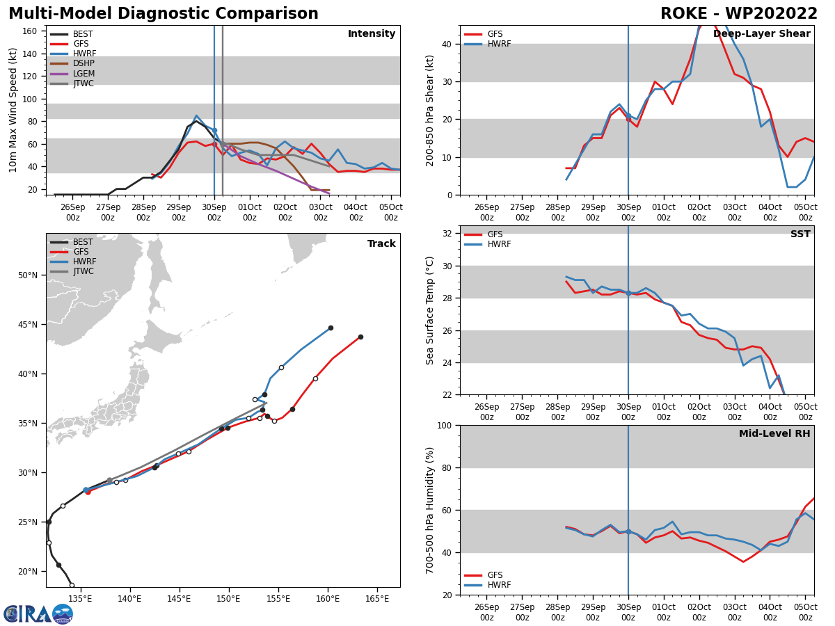
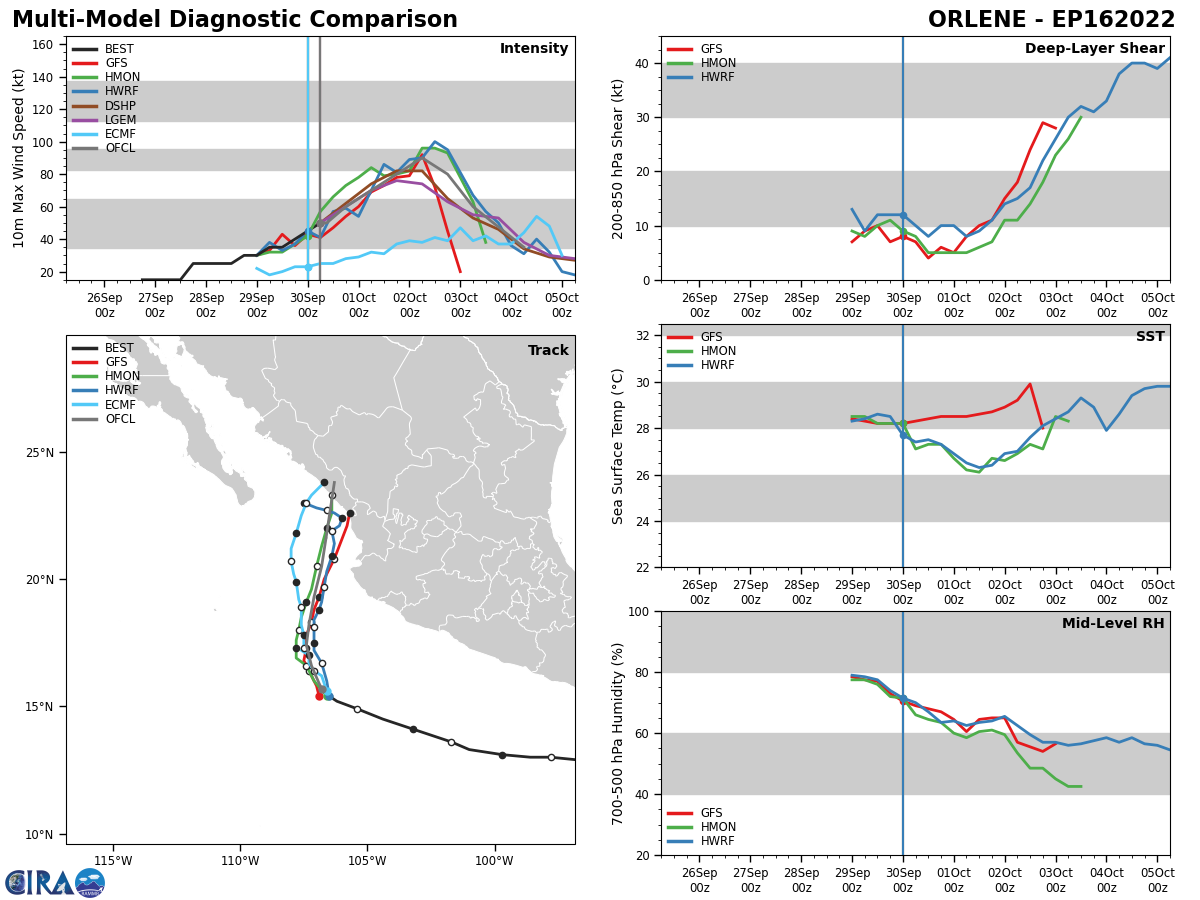
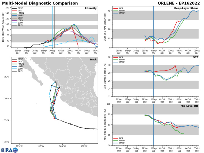
ATTACHED BELOW IS THE CTCX MULTI RUN DIAGNOSTIC COMPARISON.


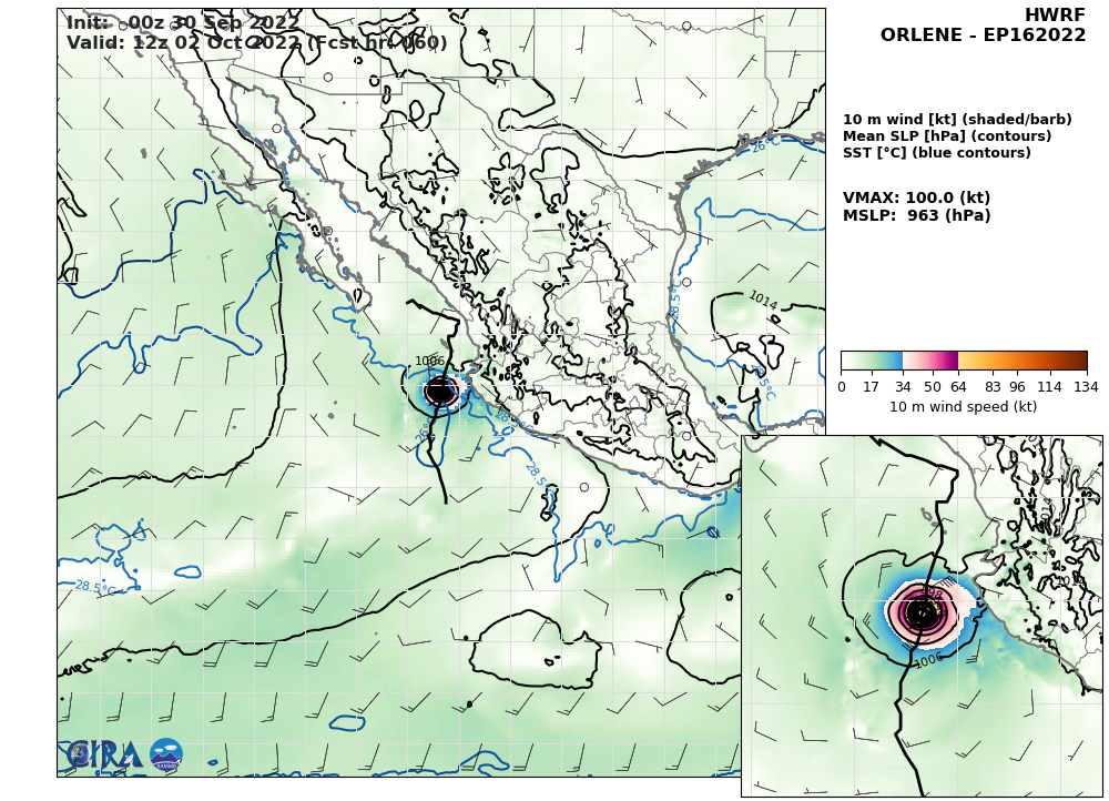
HWRF AT 30/00UTC: 100KT AT +60H. ATTACHED BELOW IS HMON AT 30/00UTC: 96KT AT +54H.


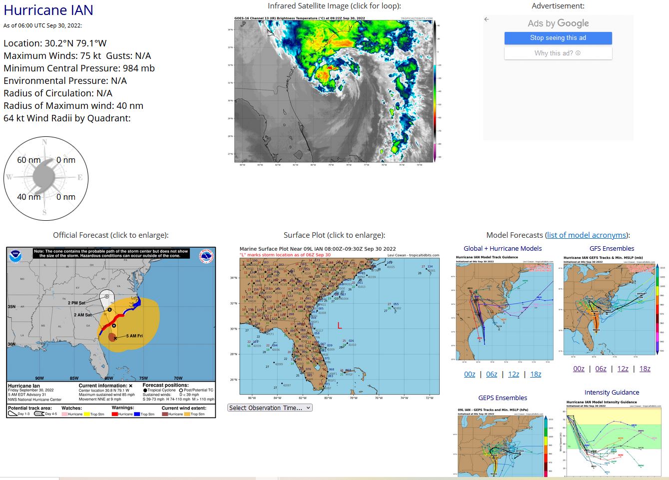
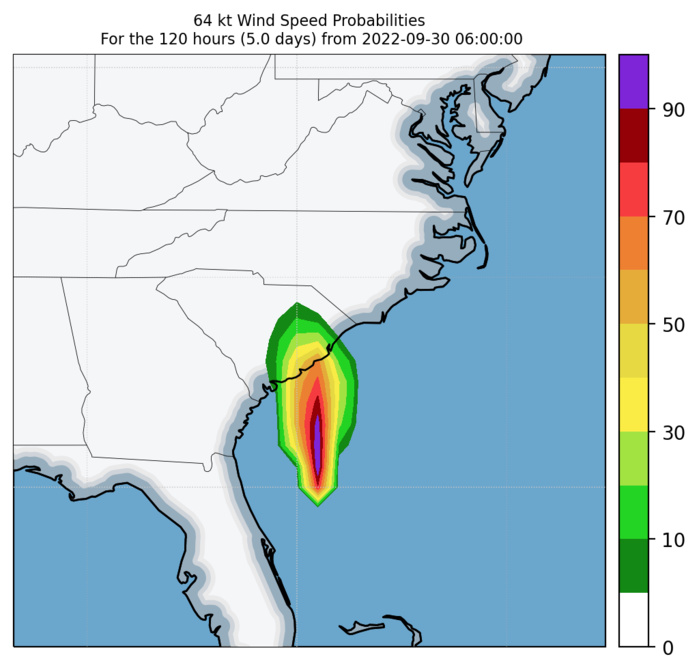
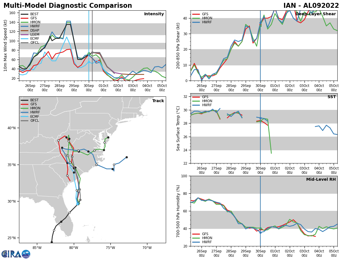
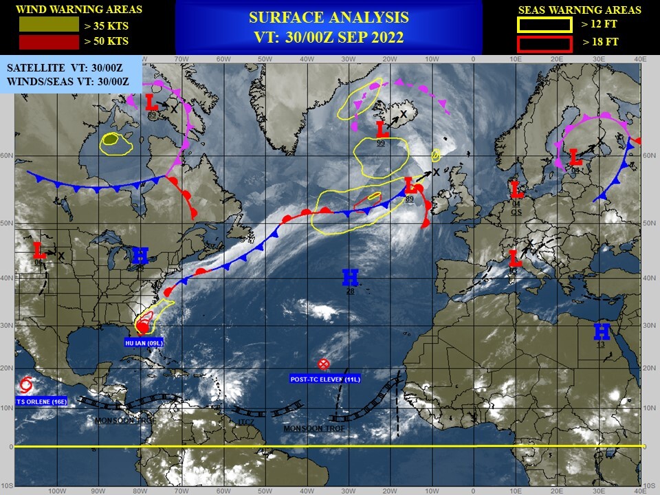
NORTH ATLANTIC: HU 09L(IAN). ESTIMATED LOCATION AND INTENSITY AT 30/06UTC. WARNING 31 ISSUED AT 30/09UTC. NHC COMMENTS.
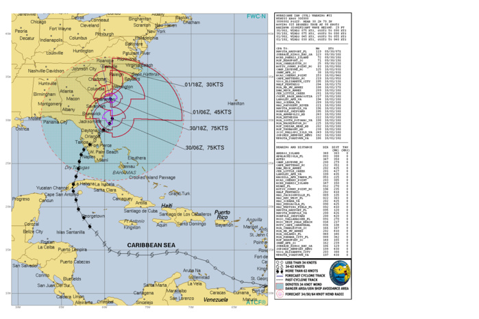

ZCZC MIATCDAT4 ALL TTAA00 KNHC DDHHMM   Hurricane Ian Discussion Number  31 NWS National Hurricane Center Miami FL       AL092022 500 AM EDT Fri Sep 30 2022   Ian continues to display hybrid tropical/extratropical  characteristics, and the satellite appearance is increasingly  taking on the pattern of an occluded low.  Some deep convection has  still been developing just northwest of the center, however.  Based  on SFMR measurements from an earlier Air Force Reserve Hurricane  Hunter aircraft, the initial intensity is 75 kt, and as of right  now, all sustained hurricane-force winds are located within the  western semicircle.  The motion of Ian's center has been somewhat discontinuous during  the past 6 to 12 hours, with multiple swirls apparently rotating  around a common center.  The smooth motion is toward the  north-northeast, or 015/9 kt, although Ian should turn northward  very soon.  A turn toward the north-northwest is expected by tonight  as Ian moves around and merges with a shortwave trough over the  southeastern United States.  Track models appear to have stabilized,  and all show Ian's center crossing the coast of South Carolina this  afternoon, and then moving across eastern South Carolina and central  North Carolina tonight and on Saturday.  Since there has been no  noticeable shift in the guidance on this cycle, the new NHC forecast  essentially lies right on top of the previous prediction.  Although very strong southwesterly shear is affecting Ian, the  hurricane is likely deriving its energy from a mixture of the warm  waters of the Gulf Stream and favorable interaction with the  southeastern U.S. shortwave trough.  Those two influences should  continue today, and no significant changes to the intensity are  expected up until Ian's anticipated landfall this afternoon, which  is generally in line with the SHIPS and LGEM guidance.  It should be  noted that hurricane-force winds are expected to develop within the  eastern semicircle soon, particularly as Ian begins to move faster  toward the north.  After landfall, fast weakening is expected, and  Ian is also forecast to become fully extratropical by 36 hours, if  not a little sooner.  The extratropical low is then forecast to  dissipate near the North Carolina/Virginia border by Saturday night.   One additional note: a frontal boundary that extends to the  northeast of Ian is expected to shift inland later today, and the  extensive area of tropical-storm-force winds shown in the  northeastern quadrant is forecast to contract considerably later  today and tonight.    Key Messages:   1. There is a danger of life-threatening storm surge today along the  coasts of northeast Florida, Georgia, and the Carolinas within the  Storm Surge Warning areas.  Residents in these areas should follow  any advice given by local officials.   2. Hurricane-force winds are expected along the coasts of South Carolina and southeastern North Carolina within the Hurricane  Warning area by this afternoon.  Hurricane conditions are possible  in North Carolina within the Hurricane Watch area by this afternoon.  Preparations should be rushed to completion.   3. Ongoing major to record river flooding will continue through next  week across portions of central Florida. Considerable flooding is  expected through today across portions of coastal and northeast  South Carolina. Locally considerable flooding is possible across  portions of North Carolina and southern Virginia through today.
ZCZC MIATCDAT4 ALL TTAA00 KNHC DDHHMM Hurricane Ian Discussion Number 31 NWS National Hurricane Center Miami FL AL092022 500 AM EDT Fri Sep 30 2022 Ian continues to display hybrid tropical/extratropical characteristics, and the satellite appearance is increasingly taking on the pattern of an occluded low. Some deep convection has still been developing just northwest of the center, however. Based on SFMR measurements from an earlier Air Force Reserve Hurricane Hunter aircraft, the initial intensity is 75 kt, and as of right now, all sustained hurricane-force winds are located within the western semicircle. The motion of Ian's center has been somewhat discontinuous during the past 6 to 12 hours, with multiple swirls apparently rotating around a common center. The smooth motion is toward the north-northeast, or 015/9 kt, although Ian should turn northward very soon. A turn toward the north-northwest is expected by tonight as Ian moves around and merges with a shortwave trough over the southeastern United States. Track models appear to have stabilized, and all show Ian's center crossing the coast of South Carolina this afternoon, and then moving across eastern South Carolina and central North Carolina tonight and on Saturday. Since there has been no noticeable shift in the guidance on this cycle, the new NHC forecast essentially lies right on top of the previous prediction. Although very strong southwesterly shear is affecting Ian, the hurricane is likely deriving its energy from a mixture of the warm waters of the Gulf Stream and favorable interaction with the southeastern U.S. shortwave trough. Those two influences should continue today, and no significant changes to the intensity are expected up until Ian's anticipated landfall this afternoon, which is generally in line with the SHIPS and LGEM guidance. It should be noted that hurricane-force winds are expected to develop within the eastern semicircle soon, particularly as Ian begins to move faster toward the north. After landfall, fast weakening is expected, and Ian is also forecast to become fully extratropical by 36 hours, if not a little sooner. The extratropical low is then forecast to dissipate near the North Carolina/Virginia border by Saturday night. One additional note: a frontal boundary that extends to the northeast of Ian is expected to shift inland later today, and the extensive area of tropical-storm-force winds shown in the northeastern quadrant is forecast to contract considerably later today and tonight. Key Messages: 1. There is a danger of life-threatening storm surge today along the coasts of northeast Florida, Georgia, and the Carolinas within the Storm Surge Warning areas. Residents in these areas should follow any advice given by local officials. 2. Hurricane-force winds are expected along the coasts of South Carolina and southeastern North Carolina within the Hurricane Warning area by this afternoon. Hurricane conditions are possible in North Carolina within the Hurricane Watch area by this afternoon. Preparations should be rushed to completion. 3. Ongoing major to record river flooding will continue through next week across portions of central Florida. Considerable flooding is expected through today across portions of coastal and northeast South Carolina. Locally considerable flooding is possible across portions of North Carolina and southern Virginia through today.

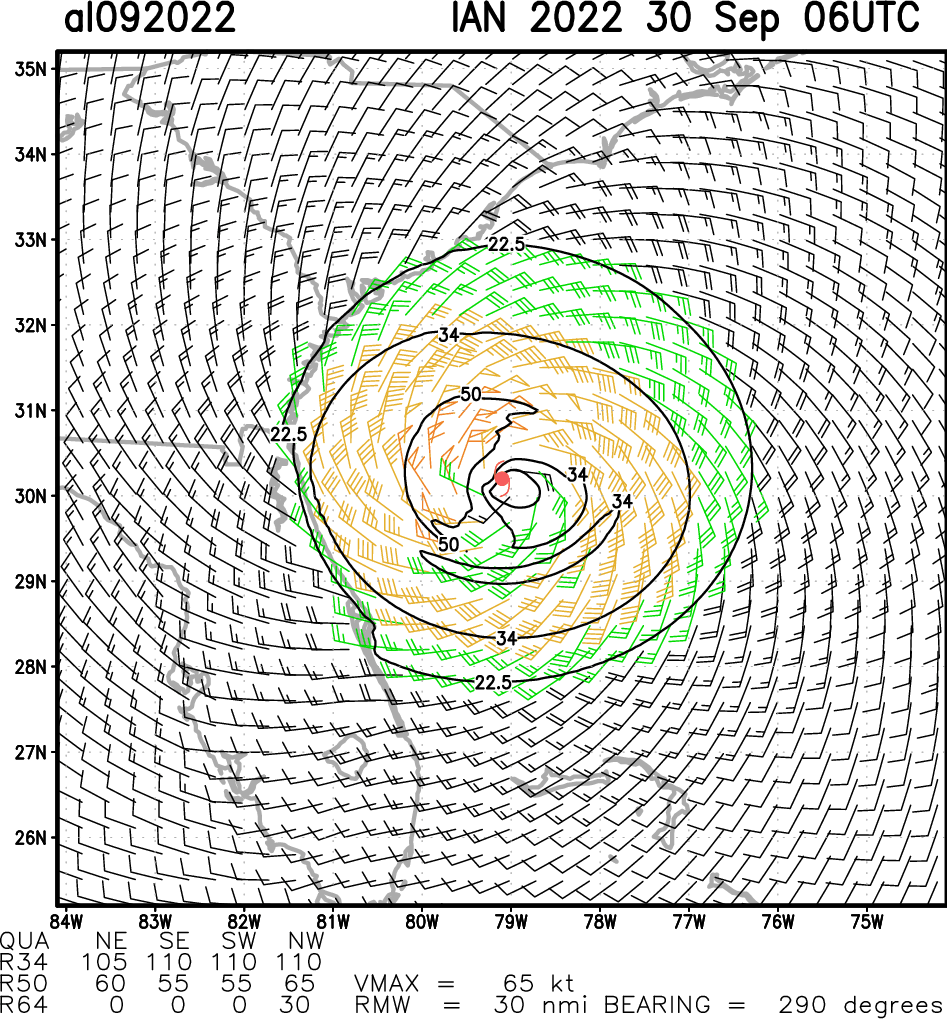
Aircraft-based Tropical Cyclone Surface Wind Analysis
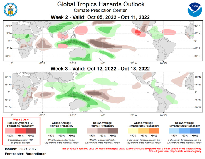


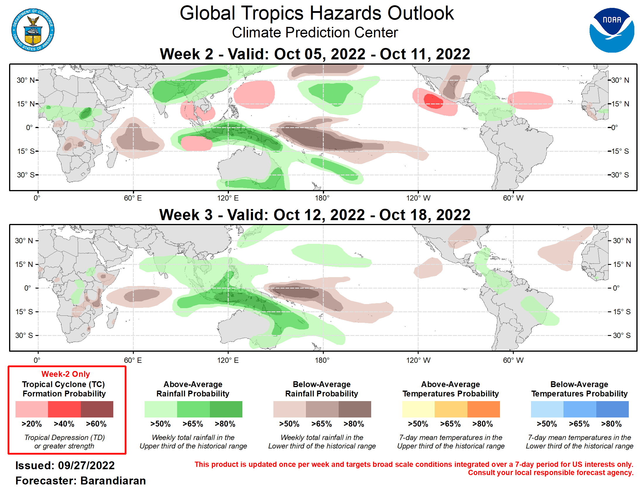
Outlook Discussion Last Updated - 09/27/22 Valid - 10/05/22 - 10/18/22 Madden-Julian Oscillation (MJO) activity is increasing after a recent period of incoherent tropical convective activity. Tropical convection is coalescing into a wave 1-like pattern with enhanced(suppressed) convection over the Maritime Continent(Eastern Pacific) and modest eastward propagation of these features, especially the suppressed phase. Looking ahead, there is widespread agreement among dynamical model RMM-based forecasts for the high probability of an upcoming significant MJO event. The general consensus is that the RMM signal will emerge from the unit circle during the week-1 timeframe in phase 4 or 5 and amplify significantly while propagating slowly eastward during weeks 2-3.  Tropical cyclone (TC) activity has been high over the last week. A pair of TCs formed south of Japan (Noru, 9/22; Kulap, 9/25). Noru became a strong typhoon and is currently moving toward the Vietnam coast, while Kulap has stayed out to sea and is set to become an extratropical system in the coming days. TC Newton formed in the East Pacific on 9/21 and dissipated quickly without affecting land. TC Ashley formed in the southern Indian Ocean 9/26 but is not expected to have any impacts to land. In the Atlantic Basin, TC Hermine formed near the Cape Verde Islands on 9/23 and quickly dissipated. Later on 9/23, TC Ian formed in the Caribbean Sea, and is currently near Cuba as an intensifying hurricane. Ian is anticipated to come ashore along the eastern Gulf Coast in the coming days with the potential for heavy rain and high winds during the next few days. Please refer to the National Hurricane Center (NHC) for more information and the latest forecasts.  Looking ahead to week 2, heightened MJO activity and the La Niña base state when coupled with a westerly wind burst over the equatorial Indian Ocean depicted in multiple dynamical models provide favorable conditions for TC formation on either side of the equator for the Eastern Indian Ocean. Model guidance from the ECMWF and GEFS also indicate heightened probabilities of TC formation during the week-2 time period covering a broad area in Philippine Sea, the Eastern Pacific Basin and the Main Development Region (MDR) of the Atlantic Basin.  The precipitation outlook for the next two weeks is based on anticipated TC tracks, ongoing La Nina conditions, and consensus of GEFS, CFS, and ECMWF ensemble mean solutions. Suppressed (enhanced) rainfall continues near and to the west of the Date Line (over the Maritime Continent) due to ongoing La Nina conditions and anticipated MJO phase. Below-normal precipitation is anticipated for the western tropical Indian Ocean for both weeks 2 and 3.  For hazardous weather conditions in your area during the coming two-week period, please refer to your local NWS office, the Medium Range Hazards Forecast produced by the Weather Prediction Center, and the CPC Week-2 Hazards Outlook. Forecasts made over Africa are made in coordination with the International Desk at CPC.
Outlook Discussion Last Updated - 09/27/22 Valid - 10/05/22 - 10/18/22 Madden-Julian Oscillation (MJO) activity is increasing after a recent period of incoherent tropical convective activity. Tropical convection is coalescing into a wave 1-like pattern with enhanced(suppressed) convection over the Maritime Continent(Eastern Pacific) and modest eastward propagation of these features, especially the suppressed phase. Looking ahead, there is widespread agreement among dynamical model RMM-based forecasts for the high probability of an upcoming significant MJO event. The general consensus is that the RMM signal will emerge from the unit circle during the week-1 timeframe in phase 4 or 5 and amplify significantly while propagating slowly eastward during weeks 2-3. Tropical cyclone (TC) activity has been high over the last week. A pair of TCs formed south of Japan (Noru, 9/22; Kulap, 9/25). Noru became a strong typhoon and is currently moving toward the Vietnam coast, while Kulap has stayed out to sea and is set to become an extratropical system in the coming days. TC Newton formed in the East Pacific on 9/21 and dissipated quickly without affecting land. TC Ashley formed in the southern Indian Ocean 9/26 but is not expected to have any impacts to land. In the Atlantic Basin, TC Hermine formed near the Cape Verde Islands on 9/23 and quickly dissipated. Later on 9/23, TC Ian formed in the Caribbean Sea, and is currently near Cuba as an intensifying hurricane. Ian is anticipated to come ashore along the eastern Gulf Coast in the coming days with the potential for heavy rain and high winds during the next few days. Please refer to the National Hurricane Center (NHC) for more information and the latest forecasts. Looking ahead to week 2, heightened MJO activity and the La Niña base state when coupled with a westerly wind burst over the equatorial Indian Ocean depicted in multiple dynamical models provide favorable conditions for TC formation on either side of the equator for the Eastern Indian Ocean. Model guidance from the ECMWF and GEFS also indicate heightened probabilities of TC formation during the week-2 time period covering a broad area in Philippine Sea, the Eastern Pacific Basin and the Main Development Region (MDR) of the Atlantic Basin. The precipitation outlook for the next two weeks is based on anticipated TC tracks, ongoing La Nina conditions, and consensus of GEFS, CFS, and ECMWF ensemble mean solutions. Suppressed (enhanced) rainfall continues near and to the west of the Date Line (over the Maritime Continent) due to ongoing La Nina conditions and anticipated MJO phase. Below-normal precipitation is anticipated for the western tropical Indian Ocean for both weeks 2 and 3. For hazardous weather conditions in your area during the coming two-week period, please refer to your local NWS office, the Medium Range Hazards Forecast produced by the Weather Prediction Center, and the CPC Week-2 Hazards Outlook. Forecasts made over Africa are made in coordination with the International Desk at CPC.
Rédigé par PATRICK HOAREAU le Friday, September 30th 2022 à 14:48