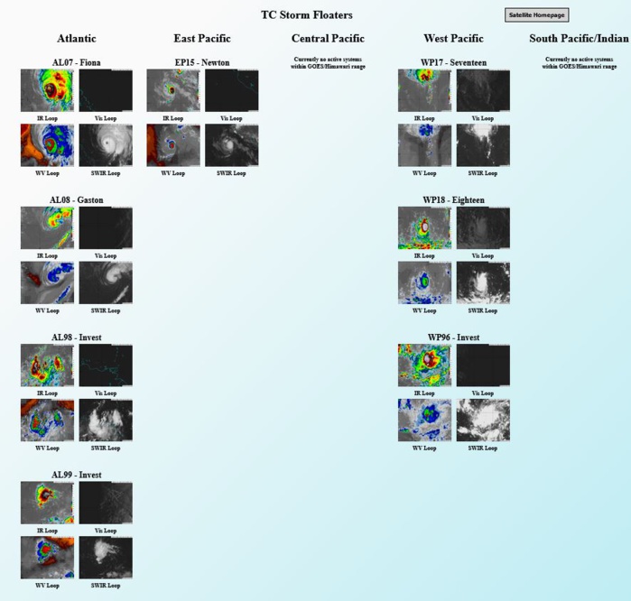
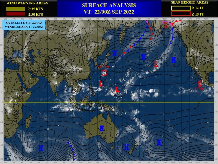
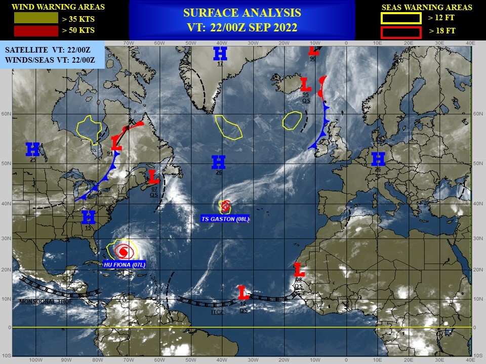
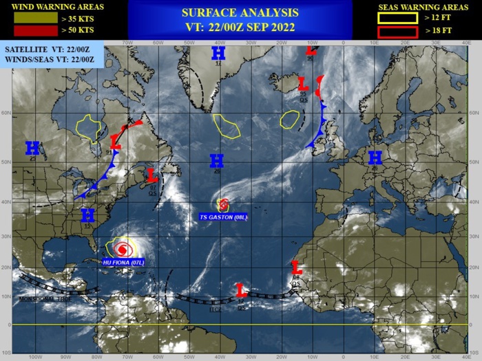
CLICK ON THE IMAGERIES BELOW TO GET THEM ENLARGED
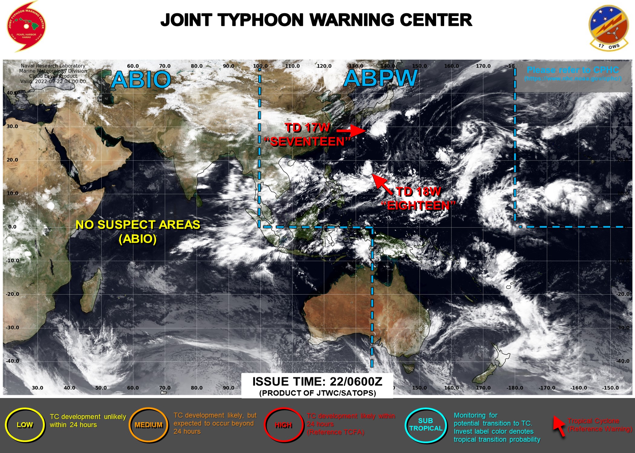
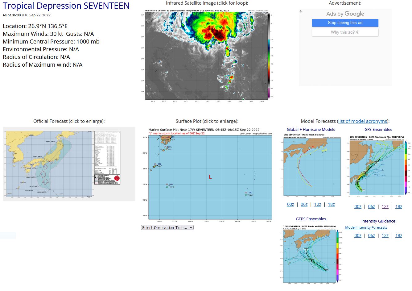
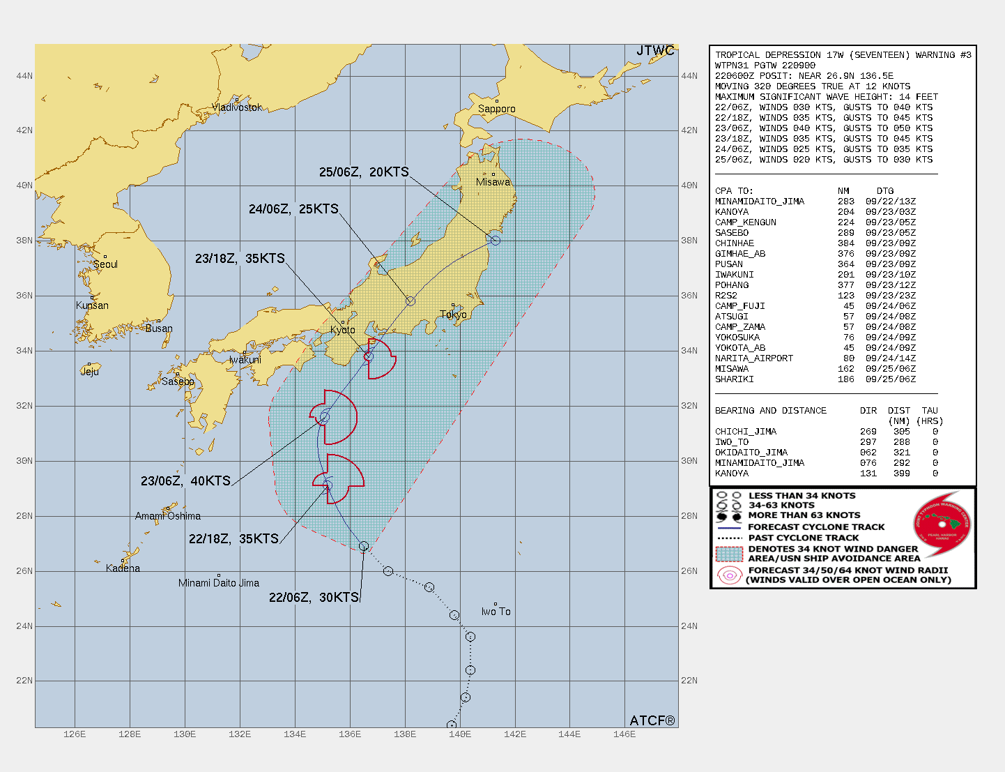
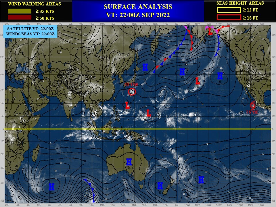
WESTERN NORTH PACIFIC: TD 17W. ESTIMATED LOCATION AND INTENSITY AT 22/06UTC. WARNING 3 ISSUED AT 22/09UTC.
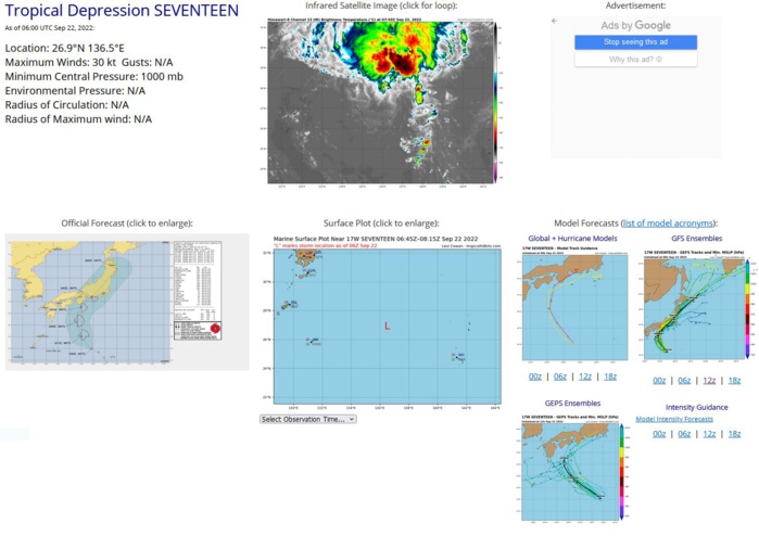
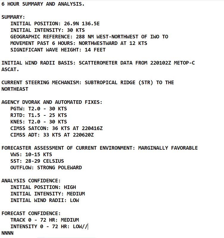
SATELLITE ANALYSIS, INITIAL POSITION AND INTENSITY DISCUSSION: ANIMATED MULTISPECTRAL SATELLITE IMAGERY (MSI) DEPICTS A FULLY EXPOSED LOW-LEVEL CIRCULATION CENTER (LLCC), WITH DEEP PERSISTENT CONVECTION DISPLACED TO THE NORTHERN SECTOR OF THE SYSTEM. AN EARLIER BULLSEYE 220102Z METOP-C ASCAT IMAGE REVEALED A TIGHTLY WOUND 30KT SYSTEM. THE INITIAL POSITION IS PLACED WITH HIGH CONFIDENCE BASED ON THE MSI IMAGERY. THE INITIAL INTENSITY OF 30 KTS IS ASSESSED WITH MEDIUM CONFIDENCE BASED ON THE PREVIOUS ASCAT, ALONG WITH THE AGREEMENT OF THE AGENCY DVORAK INTENSITY ESTIMATES, PGTW T2.0, RJTD T1.5 AND THE OBJECTIVE INTENSITY ESTIMATES LISTED BELOW.
WP, 17, 2022092000,184N, 1381E, 15,1006
WP, 17, 2022092006,193N, 1390E, 15,1006
WP, 17, 2022092018,214N, 1402E, 20,1004
WP, 17, 2022092100,224N, 1404E, 20,1004
WP, 17, 2022092106,236N, 1404E, 20,1004
WP, 17, 2022092112,244N, 1398E, 20,1004
WP, 17, 2022092118,254N, 1389E, 25,1004
WP, 17, 2022092200,260N, 1374E, 30,1002
WP, 17, 2022092206,269N, 1365E, 30,1000
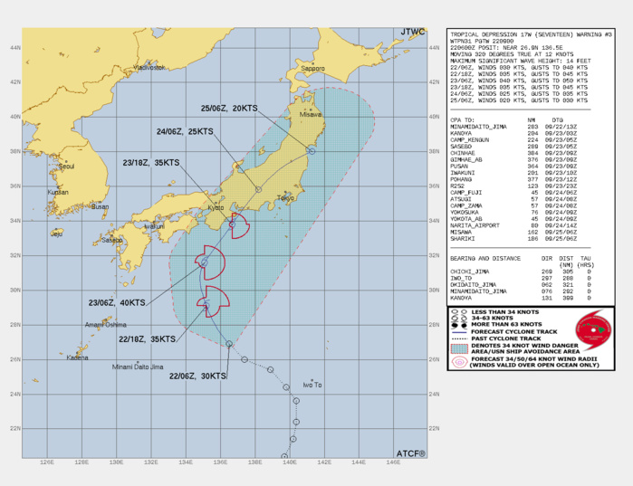
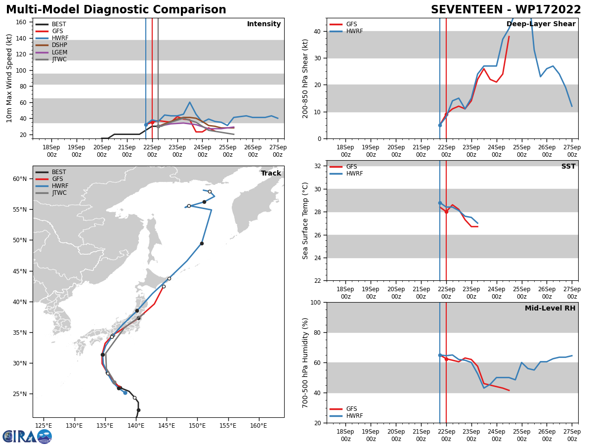
FORECAST REASONING. SIGNIFICANT FORECAST CHANGES: THERE ARE NO SIGNIFICANT CHANGES TO THE FORECAST FROM THE PREVIOUS WARNING. FORECAST DISCUSSION: ENVIRONMENTAL CONDITIONS REMAIN MARGINALLY FAVORABLE AS CHARACTERIZED BY WARM SEA SURFACE TEMPERATURES (SSTS) (28-29C), AND STRONG POLEWARD OUTFLOW INDUCED BY AN UPPER LEVEL TROUGH, SITUATED TO THE NORTHWEST OF 17W. AS TD 17W TRACKS POLEWARD ALONG THE WESTERN PERIPHERY OF A DEEP-LAYER SUBTROPICAL RIDGE (STR), TD 17W WILL BEGIN TO ROUND THE RIDGE AXIS BETWEEN TAUS 12 AND 24 AND INCREASE IN TRACK SPEED AND ONLY INCREASE INTENSITY TO A PEAK OF 40KTS AS AN APPROACHING UPPER-LEVEL TROUGH MOVES IN FROM THE WEST. AS THE SYSTEM NEARS THE COAST OF JAPAN, IT WILL BEGIN TO ENCOUNTER STRONGER LOW-LEVEL SHEAR JUST BEFORE MAKING LANDFALL ON MAINLAND HONSHU, NEAR THE CITY OF TAHARA, AICHI PREFECTURE, JAPAN JUST AFTER TAU 36. TD 17W WILL CONTINUE ON A NORTHEAST TRACK OVER LAND AND ENCOUNTER THE RUGGED TERRAIN, WHEREBY IT WILL QUICKLY DECREASE IN INTENSITY AND LIKELY DISSIPATE BETWEEN TAU 48 AND TAU 72 OVER LAND, HOWEVER, A SLIGHT CHANCE REMAINS FOR THE SYSTEM TO DISSIPATE OVER WATER.
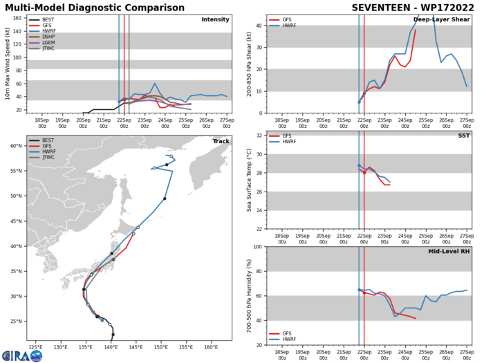
MODEL DISCUSSION: NUMERICAL MODEL GUIDANCE REMAINS IN OVERALL TIGHT AGREEMENT EXCEPT FOR JGSM AND NAVGEM, WHICH ARE THE WESTERN OUTLIERS THROUGH TAU 36, THEN QUICKLY CROSSES RIGHT OF ALL TRACKS. EXCLUDING JGSM AND NAVGEM, FROM THE TRACK ENVELOPE THERE IS ONLY A 57NM SPREAD IN THE SOLUTIONS UNTIL TAU 48. AFTER TAU 48 THE CIRCULATION BECOMES VERY WEAK AND THE ALONG-TRACK AND CROSS TRACK SPREAD WIDENS TO 320NM INDUCING A LACK OF CONFIDENCE BETWEEN TAU 48 AND 72. THE MOST LIKELY CAUSE OF THE LARGER SPREAD IS POSSIBLY DUE THE LAND INTERACTION AND SHORTWAVE TROUGH INTERACTION. THEREFORE, THE JTWC OFFICIAL TRACK FORECAST IS PLACED WITH MEDIUM CONFIDENCE THROUGH TAU 36 AND IS LOW THEREAFTER AS MODEL GUIDANCE LOSES THE LOW-LEVEL CIRCULATION OVER THE JAPANESE ALPS. THE JTWC INITIAL INTENSITY CONFIDENCE IS MEDIUM UP TO TAU 36, BUT DECREASES TO LOW AFTER LANDFALL DURING THE LAND INTERACTION.
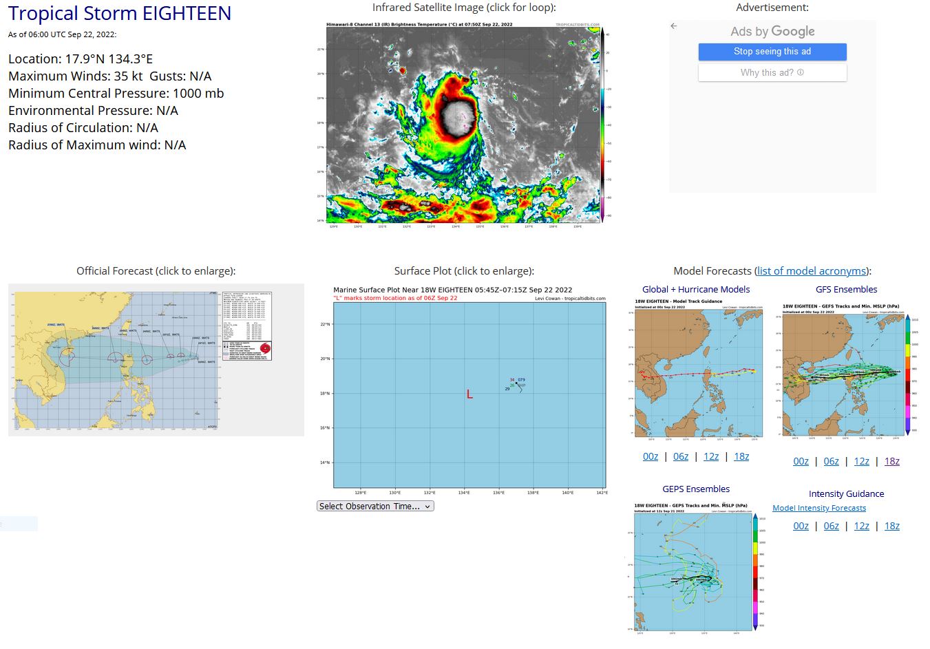
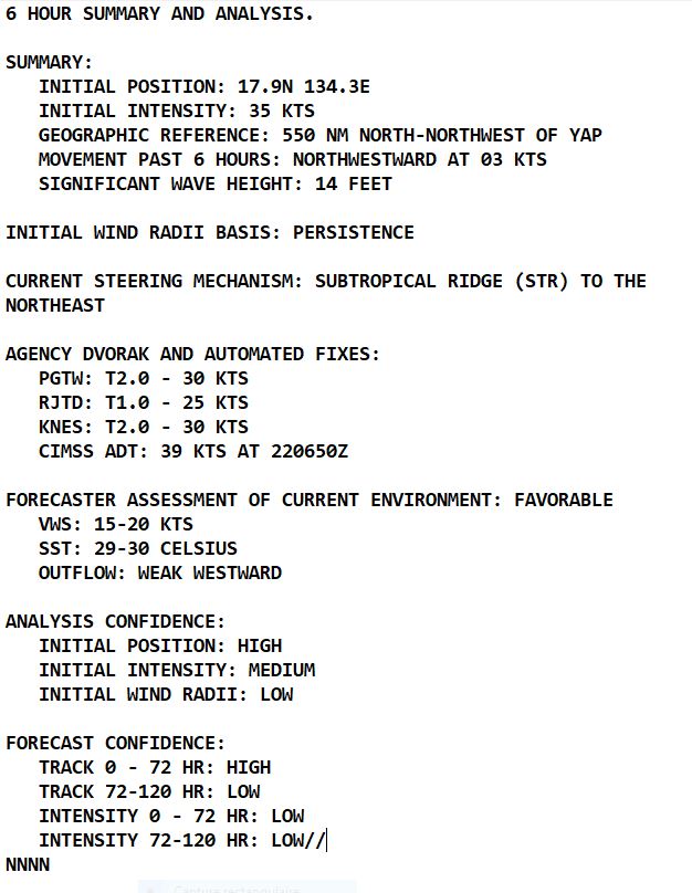
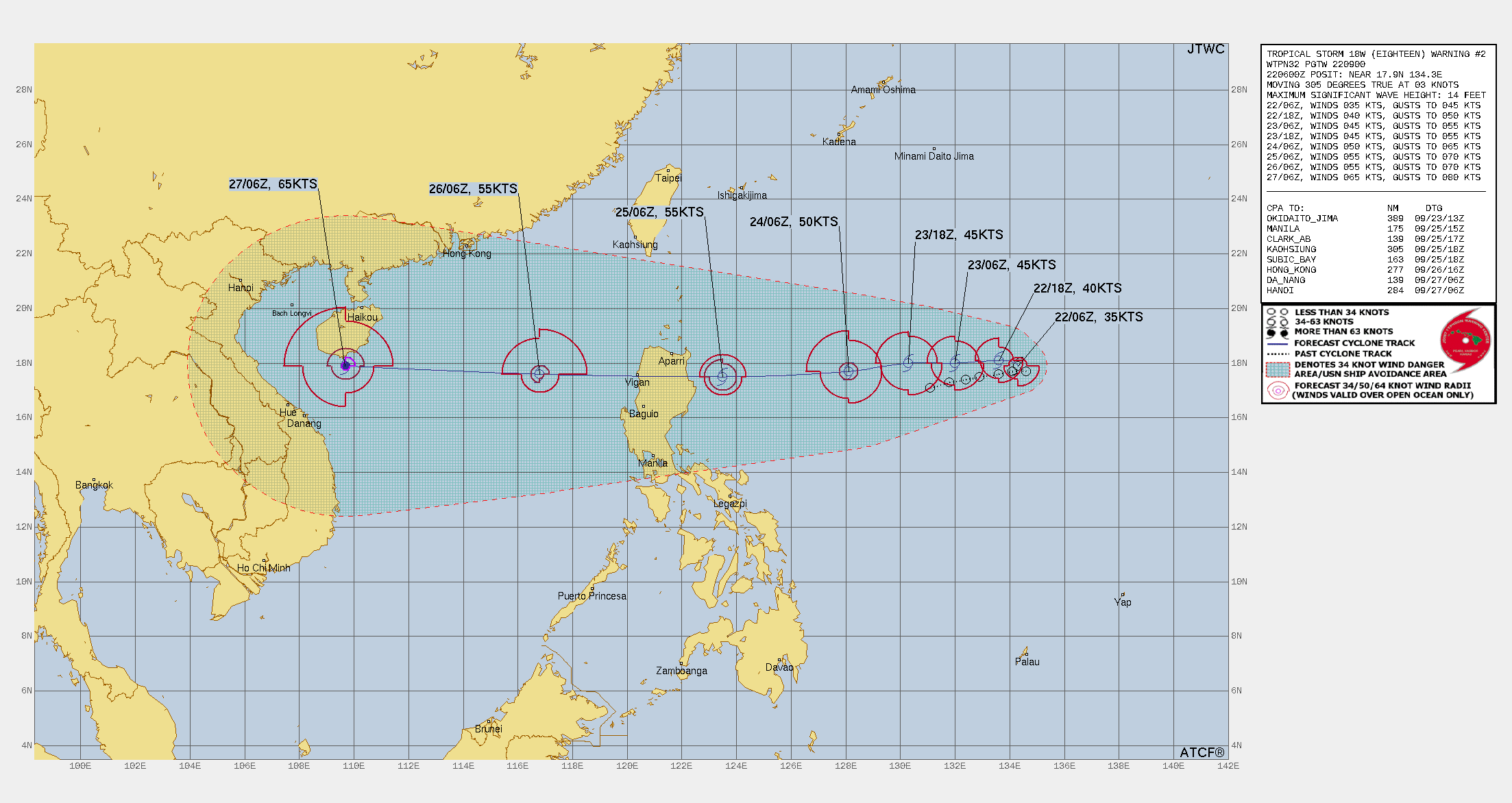
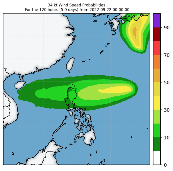
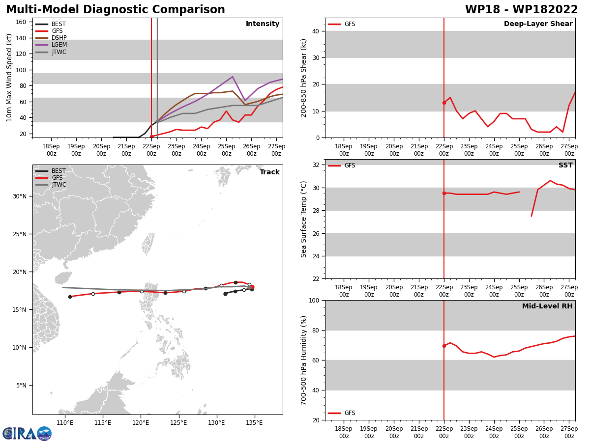
WESTERN NORTH PACIFIC: TS 18W. ESTIMATED LOCATION AND INTENSITY AT 22/06UTC. WARNING 2 ISSUED AT 22/09UTC.
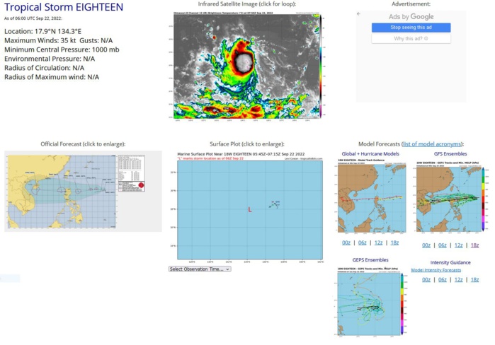
SATELLITE ANALYSIS, INITIAL POSITION AND INTENSITY DISCUSSION: ANIMATED MULTISPECTRAL SATELLITE IMAGERY (MSI) DEPICTS PERSISTENT DEEP CONVECTION WRAPPING INTO A LOW LEVEL CIRCULATION CENTER (LLCC) AS WELL AS EVIDENCED ON A 220552Z GMI 89GHZ MICROWAVE IMAGE. THE INITIAL POSITION IS PLACED WITH HIGH CONFIDENCE BASED ON THE ANIMATED MULTISPECTRAL IMAGERY AND THE PREVIOUSLY MENTIONED MICROWAVE IMAGERY. THE INITIAL INTENSITY IS PLACED WITH MEDIUM CONFIDENCE BASED ON AN OLDER 220105Z METOP-C ASCAT AND A LATER 220413Z AMSR2 WINDSPEED IMAGE. THE ENVIRONMENTAL CONDITIONS ARE FAVORABLE FOR GREATER DEVELOPMENT WITH MOSTLY WESTWARD OUTFLOW, LOW VERTICAL WIND SHEAR, AND WARM (28-29C) SST VALUES.
WP, 18, 2022092012,171N, 1311E, 15,1008
WP, 18, 2022092018,173N, 1318E, 15,1008
WP, 18, 2022092100,174N, 1324E, 15,1008
WP, 18, 2022092106,175N, 1329E, 15,1007
WP, 18, 2022092112,176N, 1336E, 15,1007
WP, 18, 2022092118,177N, 1341E, 20,1007
WP, 18, 2022092200,177N, 1346E, 30,1003
WP, 18, 2022092206,179N, 1343E, 35,1000
WP, 18, 2022092018,173N, 1318E, 15,1008
WP, 18, 2022092100,174N, 1324E, 15,1008
WP, 18, 2022092106,175N, 1329E, 15,1007
WP, 18, 2022092112,176N, 1336E, 15,1007
WP, 18, 2022092118,177N, 1341E, 20,1007
WP, 18, 2022092200,177N, 1346E, 30,1003
WP, 18, 2022092206,179N, 1343E, 35,1000
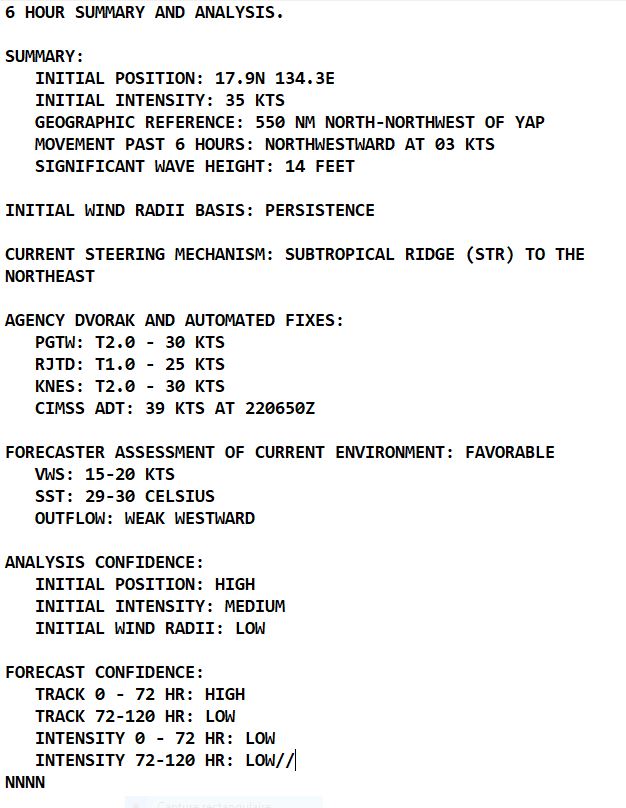
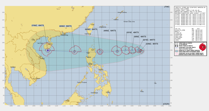
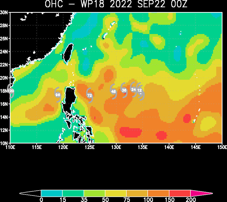
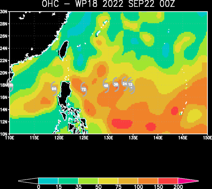
FORECAST REASONING. SIGNIFICANT FORECAST CHANGES: THERE ARE NO SIGNIFICANT CHANGES TO THE FORECAST FROM THE PREVIOUS WARNING. FORECAST DISCUSSION: TS 18W REMAINS IN A QUASI-STATIONARY MOTION DUE TO A WEAK SYNOPTIC STEERING PATTERN WITH A COL DIRECTLY TO THE NORTH, IMPEDING ITS MOTION. THE DEEP-LAYER SUBTROPICAL RIDGE TO THE NORTHEAST WILL BEGIN TO BUILD AND BECOME THE DOMINATE STEERING FEATURE WITHIN THE NEXT 12 HOURS, FORCING TS 18W ON A WESTWARD JOG TOWARDS THE LUZON COAST OF THE PHILIPPINES. AS TS 18W TRANSITS OVER THE VERY WARM AND HIGH OCEAN HEAT CONTENT (OHC) OF THE PHILIPPINE SEA, IT WILL BEGIN TO INCREASE STEADILY WITH THE LACK OF VERTICAL WIND SHEAR, AND AN INCREASE OF POLEWARD OUTFLOW. THIS ENHANCED ENVIRONMENT WILL ALLOW THE SYSTEM TO INTENSIFY TO 55 KNOTS BY TAU 72. AFTER THE SYSTEM REACHES LUZON, IT WILL INITIALLY LOSE SOME INTENSITY OVER THE RUGGED TERRAIN BUT THEN REEMERGE OVER THE SOUTH CHINA SEA ON A CONTINUED WESTWARD TRACK. SHORTLY AFTER ENTERING THE SCS, TS 18W WILL STEADILY INTENSIFY TO TYPHOON STRENGTH NEAR HAINAN, CHINA, BETWEEN TAU 96 AND TAU 120.
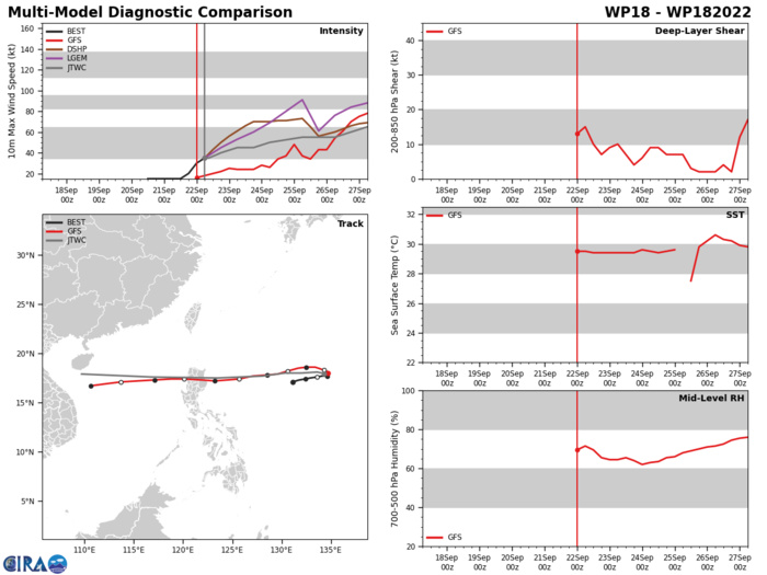
MODEL DISCUSSION: NUMERICAL MODELS ARE IN OVERALL TIGHT AGREEMENT WITH ONLY A 30NM SPREAD WITHOUT NAVGEM, THE SOLE LEFT OUTLIER. ADDING NAVGEM INDUCES A 158NM SPREAD THROUGH TAU 48 AND ONLY SPREADS. THE JTWC TRACK GUIDANCE LIES CLOSE TO ECMWF AND GFS THROUGH TAU 72 WITH HIGH CONFIDENCE. HOWEVER, ONCE THE SYSTEM MAKES LANDFALL OVER LUZON, THE CONFIDENCE WEAKENS GREATLY INDUCING TRACK SPREAD AND LOWERS THE TRACK CONFIDENCE THROUGH THE REMAINING FORECAST PERIOD. INTENSITY GUIDANCE INDICATES A HIGH SPREAD OF UNCERTAINLY. THEREFORE, THE JTWC INTENSITY FORECAST IS PLACED WITH LOW CONFIDENCE.
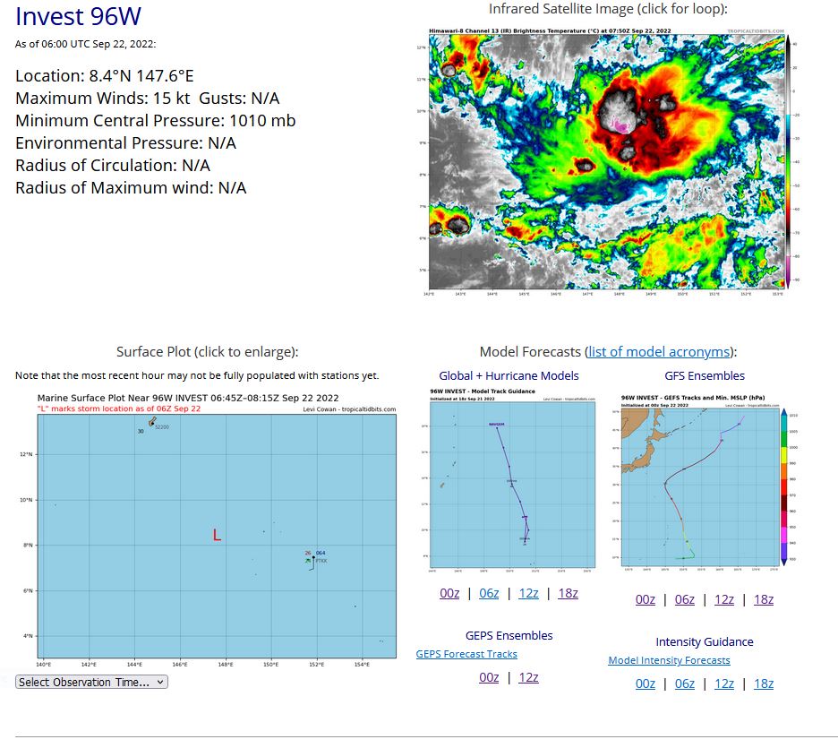
WESTERN NORTH PACIFIC: INVEST 96W. ESTIMATED LOCATION AND INTENSITY AT 22/06UTC.
WP, 96, 2022092112,83N, 1493E, 15,1010
WP, 96, 2022092118,83N, 1488E, 15,1010
WP, 96, 2022092200,83N, 1482E, 15,1010
WP, 96, 2022092206,84N, 1476E, 15,1010
WP, 96, 2022092118,83N, 1488E, 15,1010
WP, 96, 2022092200,83N, 1482E, 15,1010
WP, 96, 2022092206,84N, 1476E, 15,1010
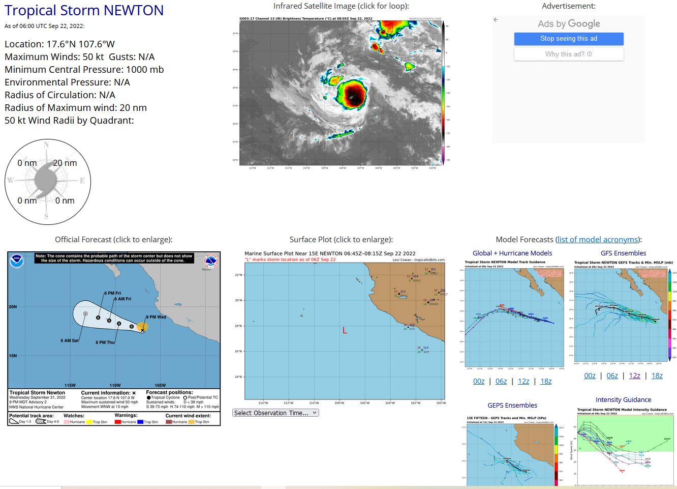
EASTERN NORTH PACIFIC: TS 15E(NEWTON). ESTIMATED LOCATION AND INTENSITY AT 22/06UTC. NHC COMMENTS.
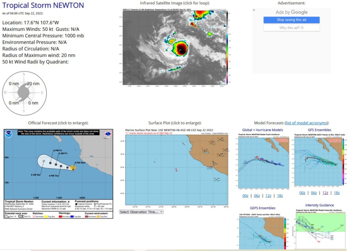
ZCZC MIATCDEP5 ALL TTAA00 KNHC DDHHMM Tropical Storm Newton Discussion Number 3 NWS National Hurricane Center Miami FL EP152022 300 AM MDT Thu Sep 22 2022 Newton is a small, but well-organized tropical cyclone. The earlier banding pattern has now evolved more into a very small central dense overcast. While we have not received any recent microwave or scatterometer data in the last 6 hours, the earlier GPM pass at 2207 UTC suggested a formative inner core was taking shape. Satellite intensity estimates cover a large range this morning, from T2.5/35-kt from SAB, T3.5/55-kt from TAFB, and T2.8/41-kt from UW-CIMSS ADT. Favoring the higher end of those estimates, the initial intensity was raised to 50-kt for this advisory. Newton continues to move to the west-northwest but is beginning to slow down somewhat, with the latest estimate at 285/8 kt. This general motion with an additional slow down in forward motion is expected over the next 24-36 hours as the system remains steered by a prominent mid-level ridge to the northeast. The NHC track this cycle was adjusted ever so slightly faster, but remains close to the tightly clustered consensus aids. The intensity forecast is a bit tricky for Newton. The storm is very small, and has not been recently sampled by scatterometer or microwave imagery, so it is unclear if the inner core structure seen earlier on microwave yesterday evening has persisted. Vertical wind shear, as diagnosed by the GFS and ECMWF-based SHIPS is expected to remain at or under 10 kts for the next 2-3 days. However, the tropical cyclone will be moving over the cold wake induced by Hurricane Kay and more recently Tropical Storm Madeline over the last several weeks. Sea-surface temperatures (SSTs) drop below 26 C in around 24 hours. The global models respond to this environment by showing all convection collapsing near Newton in 24-48 hours and it seems that the small circulation will not be able to survive these anomalously cold SSTs. Then again, the cyclone is so small, the guidance may not be resolving the current structure of the cyclone well. Thus the latest NHC intensity forecast calls for a little bit of additional intensification today, similar to the SHIPS guidance in the short-term. After that, the cooler SSTs should induce a weakening trend, and Newton is still expected to become a post-tropical remnant low by 60 hours, continuing to blend the dynamical and statistical intensity aids. FORECAST POSITIONS AND MAX WINDS INIT 22/0900Z 17.7N 107.8W 50 KT 60 MPH 12H 22/1800Z 18.0N 109.1W 55 KT 65 MPH 24H 23/0600Z 18.2N 110.5W 50 KT 60 MPH 36H 23/1800Z 18.6N 112.0W 45 KT 50 MPH 48H 24/0600Z 19.2N 113.5W 40 KT 45 MPH 60H 24/1800Z 19.3N 115.0W 30 KT 35 MPH...POST-TROP/REMNT LOW 72H 25/0600Z 19.3N 116.5W 25 KT 30 MPH...POST-TROP/REMNT LOW 96H 26/0600Z...DISSIPATED $$ Forecaster Papin NNNN
EP, 15, 2022092000,156N, 1000W, 25
EP, 15, 2022092006,159N, 1007W, 25
EP, 15, 2022092012,164N, 1012W, 25
EP, 15, 2022092018,167N, 1018W, 25
EP, 15, 2022092100,167N, 1021W, 25,1008
EP, 15, 2022092106,167N, 1033W, 25,1008
EP, 15, 2022092112,169N, 1044W, 25,1007
EP, 15, 2022092118,172N, 1055W, 30,1007
EP, 15, 2022092200,175N, 1066W, 40,1004
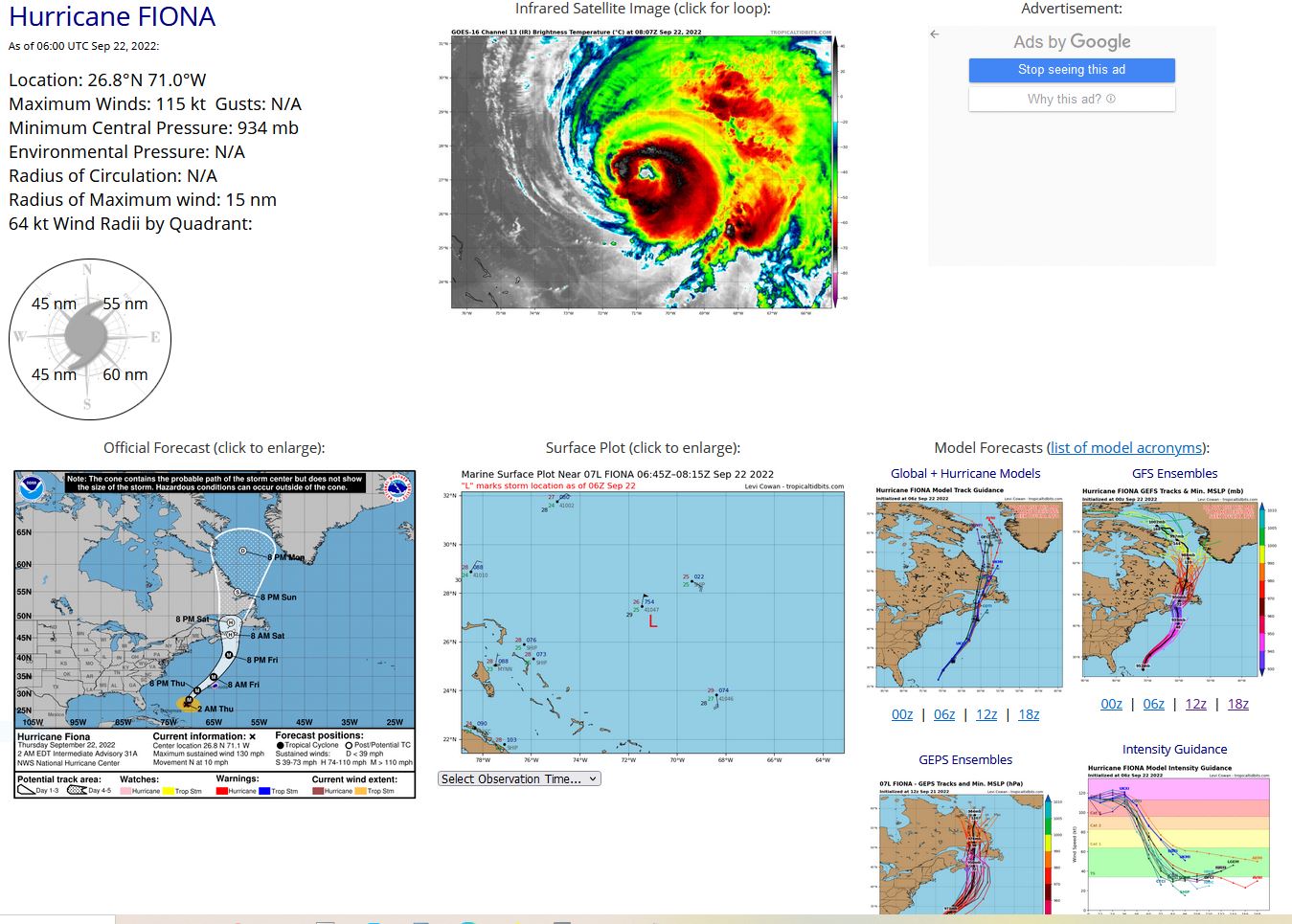
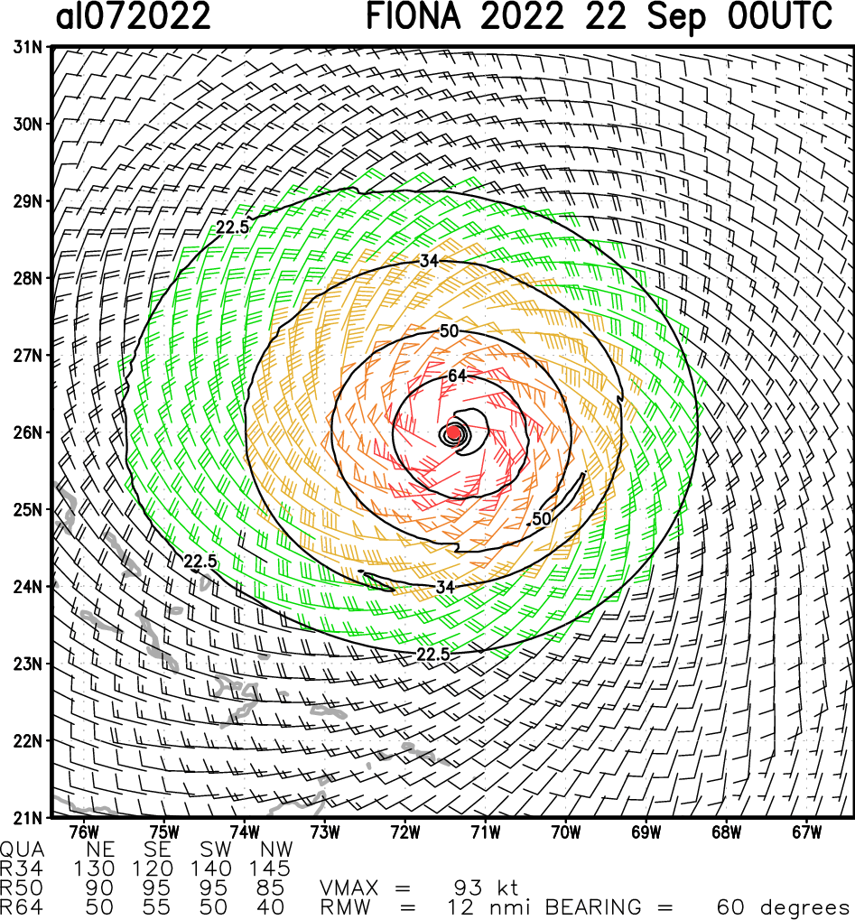
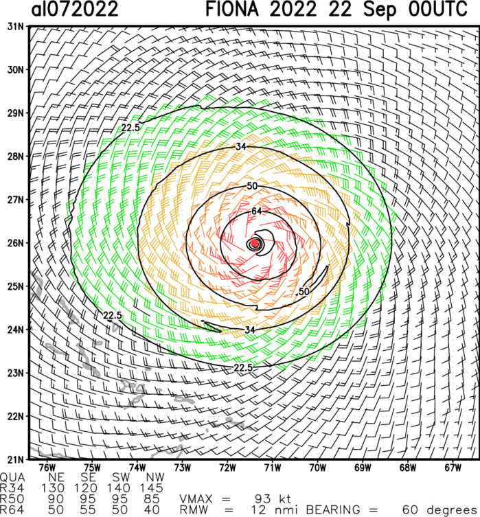
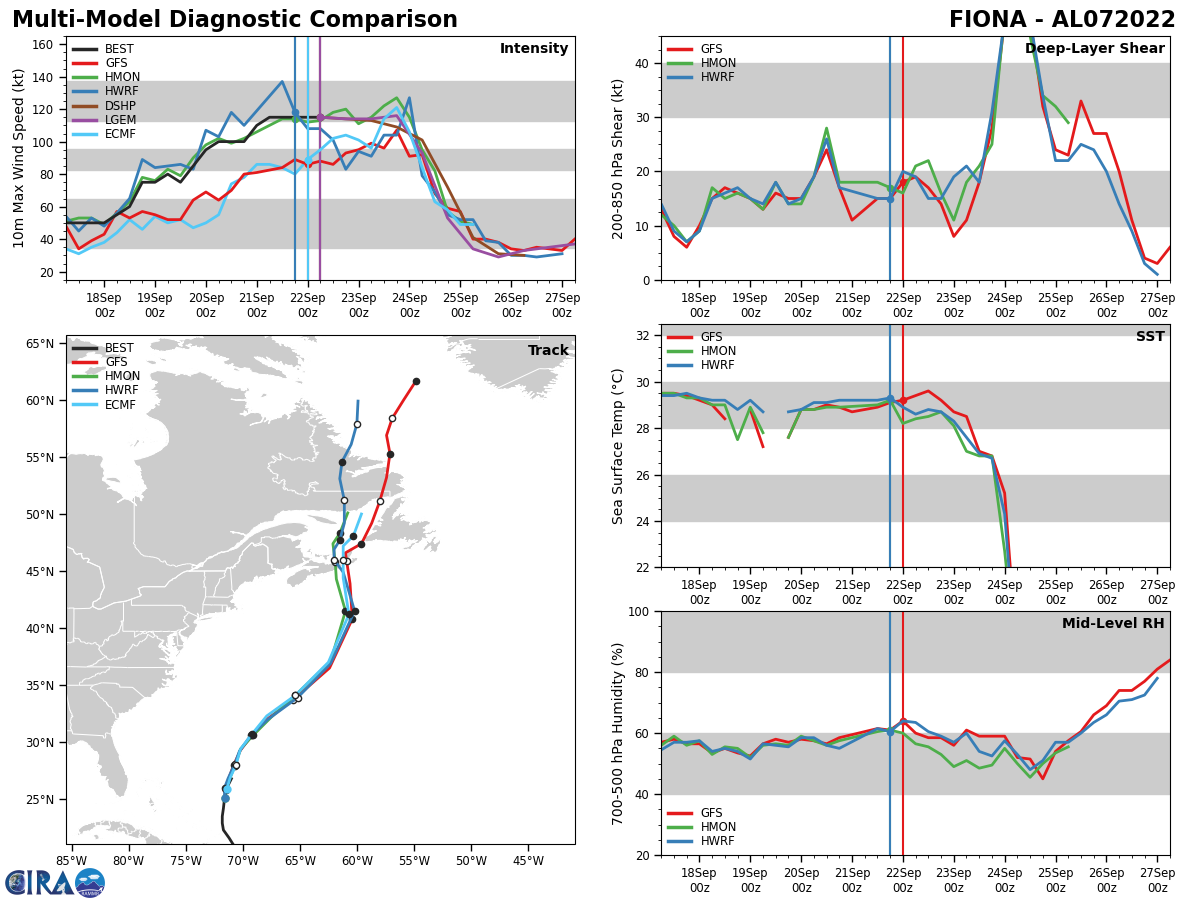
NORTH ATLANTIC: HU 07L(FIONA). ESTIMATED LOCATION AND INTENSITY AT 22/06UTC. NHC COMMENTS.
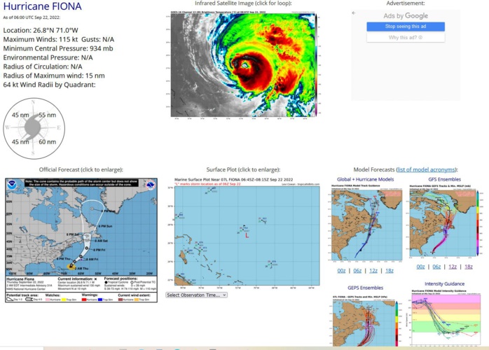
000 WTNT42 KNHC 220857 TCDAT2 Hurricane Fiona Discussion Number 32 NWS National Hurricane Center Miami FL AL072022 500 AM EDT Thu Sep 22 2022 Fiona is showing signs of slow decay in satellite imagery, with the eye gradually becoming cloud filled and the eyewall convection becoming more ragged. However, this has not yet led to a significant decrease in the satellite intensity estimates, which range from 100-130 kt. The initial intensity is held at 115 kt pending the arrival of the next Air Force Reserve Hurricane Hunter aircraft, but this could be a little generous. The hurricane has turned north-northeastward during the past several hours with the initial motion now 025/11 kt. Fiona is expected to accelerate in a generally north-northeasterly direction for the next 24 h or so as it is steered along the southern edge of the mid-latitude westerlies. This motion should take the center northwest of Bermuda in 24-30 h. After that time, an even faster motion is forecast as the hurricane interacts with a powerful deep-layer trough moving into the Atlantic from the northeastern United States. This interaction should steer the cyclone toward Atlantic Canada later Friday and Friday night. After 48 h, a northward motion at a decreasing forward speed is expected, with the center moving near or over, eastern Nova Scotia, the Gulf of St. Lawrence, and portions of Newfoundland and Labrador into the Labrador Sea by days 4 and 5. The track guidance remains very tightly clustered, and the new NHC track forecast is again mainly an update of the previous prediction. Little change, or perhaps a slow decrease in intensity is expected during the next 24 h or so while Fiona remains over warm waters of 29-30 degrees Celsius and in a generally low-shear environment. After that, interaction with the aforementioned mid-latitude trough should begin the process of extratropical transition, which should complete between 48-60 h as the center of Fiona approaches Nova Scotia. The extratropical low is forecast to continue producing hurricane-force winds as it crosses Nova Scotia and moves into the Gulf of St. Lawrence through 60 h, and it is expected to continue producing gale-force winds as it moves across Newfoundland and Labrador until near the end of the forecast period. There is little change in the intensity guidance from the previous advisory, and there are only minor changes in the intensity forecast. The wind radii were modified based on a combination of scatterometer and synthetic aperture radar data. Key Messages: 1. Hurricane conditions are expected on Bermuda tonight through Friday morning, and a Hurricane Warning has been issued for the island. 2. Fiona is expected to affect portions of Atlantic Canada as a powerful hurricane-force cyclone late Friday and Saturday, and significant impacts from high winds, storm surge, and heavy rainfall are becoming increasingly likely. Interests in these areas should closely monitor the progress of Fiona and updates to the forecast. 3. Large swells generated by Fiona are expected to cause dangerous and possibly life-threatening surf and rip current conditions along the east coast of the United States, the Bahamas, Bermuda, and Atlantic Canada during the next few days. Please consult products from your local weather office. FORECAST POSITIONS AND MAX WINDS INIT 22/0900Z 27.4N 70.6W 115 KT 130 MPH 12H 22/1800Z 29.3N 69.7W 115 KT 130 MPH 24H 23/0600Z 32.5N 66.9W 110 KT 125 MPH 36H 23/1800Z 37.4N 63.3W 105 KT 120 MPH 48H 24/0600Z 43.0N 61.3W 95 KT 110 MPH 60H 24/1800Z 46.7N 60.9W 75 KT 85 MPH...POST-TROP/EXTRATROP 72H 25/0600Z 49.7N 60.4W 55 KT 65 MPH...POST-TROP/EXTRATROP 96H 26/0600Z 57.0N 58.5W 35 KT 40 MPH...POST-TROP/EXTRATROP 120H 27/0600Z 62.5N 58.0W 30 KT 35 MPH...POST-TROP/EXTRATROP $$ Forecaster Beven
AL, 07, 2022092100,229N, 718W,110, 951
AL, 07, 2022092106,235N, 718W,115, 942
AL, 07, 2022092112,242N, 717W,115, 937
AL, 07, 2022092118,251N, 716W,115, 937
AL, 07, 2022092200,260N, 714W,115, 934
AL, 07, 2022092206,268N, 710W,115, 934
AL, 07, 2022092106,235N, 718W,115, 942
AL, 07, 2022092112,242N, 717W,115, 937
AL, 07, 2022092118,251N, 716W,115, 937
AL, 07, 2022092200,260N, 714W,115, 934
AL, 07, 2022092206,268N, 710W,115, 934
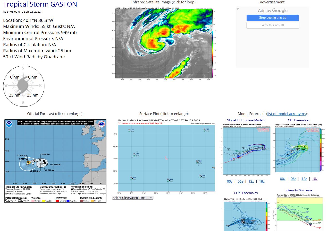
NORTH ATLANTIC: TS 08L(GASTON). ESTIMATED LOCATION AND INTENSITY AT 22/06UTC. NHC COMMENTS.
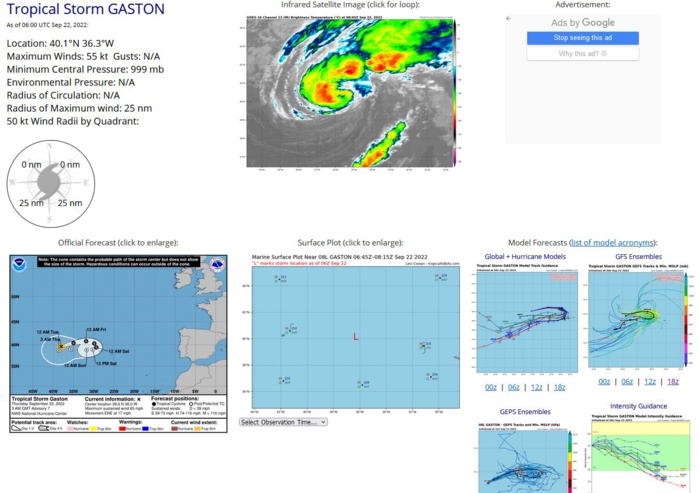
000 WTNT43 KNHC 220842 TCDAT3 Tropical Storm Gaston Discussion Number 8 NWS National Hurricane Center Miami FL AL082022 900 AM GMT Thu Sep 22 2022 GOES-16 Enhanced BD-curve infrared imagery and a recent GMI microwave pass showed that Gaston had maintained a deep convective inner core during the past several hours. Subsequently, a primary curved band with -66C cloud tops has developed in the western semicircle. A compromise of the subjective satellite intensity estimates from TAFB and SAB, along with a UW-CIMSS AiDT estimated, yields an initial intensity of 55 kt for this advisory. Although the intensity guidance agrees that Gaston will commence a slow weakening trend soon, predicting when Gaston will become a post-tropical cyclone or if it transitions into an extratropical low is problematic. The GFS and ECMWF-SHIPS statistical diagnostics indicate that Gaston will complete extratropical transition in just 6 hours, which appears unrealistic. On the other hand, the FSU Cyclone phase forecast for the GFS and UKMET suggest that the system will maintain a symmetric lower-tropospheric warm core while moving south of the upper westerlies on Friday. The latter scenario seems more reasonable since Gaston is sustaining inner core convection and the wind flow aloft becomes a bit more diffluent as it approaches the Azores Islands. Afterwards, the global simulated IR forecasts show Gaston becoming a post-tropical cyclone (loss of tropical cloud pattern characteristics) in 48 hours due to sub-24C SSTs, an increasing stable/dry surrounding atmosphere, and strong northerly shear. The NHC forecast is based on the above mentioned global model guidance and shows Gaston becoming a post-tropical cyclone on Saturday. Gaston's initial motion is estimated to be east-northeastward, or 070/15 kt. The are no significant changes to the previous track forecast or synoptic reasoning. Gaston is expected to move east-northeastward to eastward through Friday morning. Afterward, the Azores high is predicted to strengthen and cause Gaston to gradually turn southward. Beyond 48 hours, the global and hurricane models indicate that the cyclone will turn toward the west-southwest to west in response to the aforementioned high-pressure building to the north and northeast of the system. The NHC forecast is based on this scenario and lies between the TVCA and HCCA consensus models. Because the latest forecast track of Gaston brings the cyclone near or over the western and central Azores islands before becoming post-tropical, The Azores Meteorological Service has issued a Tropical Storm Warning for their western and central island chains. FORECAST POSITIONS AND MAX WINDS INIT 22/0900Z 40.3N 35.4W 55 KT 65 MPH 12H 22/1800Z 40.9N 32.6W 55 KT 65 MPH 24H 23/0600Z 40.7N 30.0W 55 KT 65 MPH 36H 23/1800Z 39.8N 28.8W 50 KT 60 MPH 48H 24/0600Z 38.9N 29.1W 45 KT 50 MPH...POST-TROPICAL 60H 24/1800Z 38.5N 30.4W 45 KT 50 MPH...POST-TROPICAL 72H 25/0600Z 38.6N 32.2W 40 KT 45 MPH...POST-TROPICAL 96H 26/0600Z 38.2N 35.9W 35 KT 40 MPH...POST-TROPICAL 120H 27/0600Z 37.1N 39.8W 30 KT 35 MPH...POST-TROPICAL $$ Forecaster Roberts
AL, 08, 2022092100,356N, 441W, 45,1004
AL, 08, 2022092106,370N, 431W, 55,1000
AL, 08, 2022092112,379N, 420W, 55,1000
AL, 08, 2022092118,387N, 406W, 55,1000
AL, 08, 2022092200,393N, 388W, 55,1000
AL, 08, 2022092206,401N, 363W, 55, 999
AL, 08, 2022092106,370N, 431W, 55,1000
AL, 08, 2022092112,379N, 420W, 55,1000
AL, 08, 2022092118,387N, 406W, 55,1000
AL, 08, 2022092200,393N, 388W, 55,1000
AL, 08, 2022092206,401N, 363W, 55, 999
