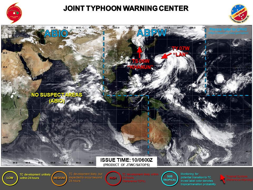
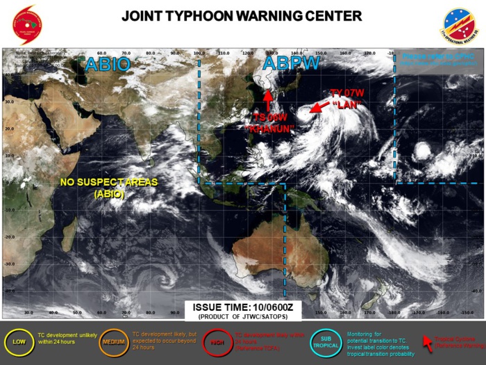
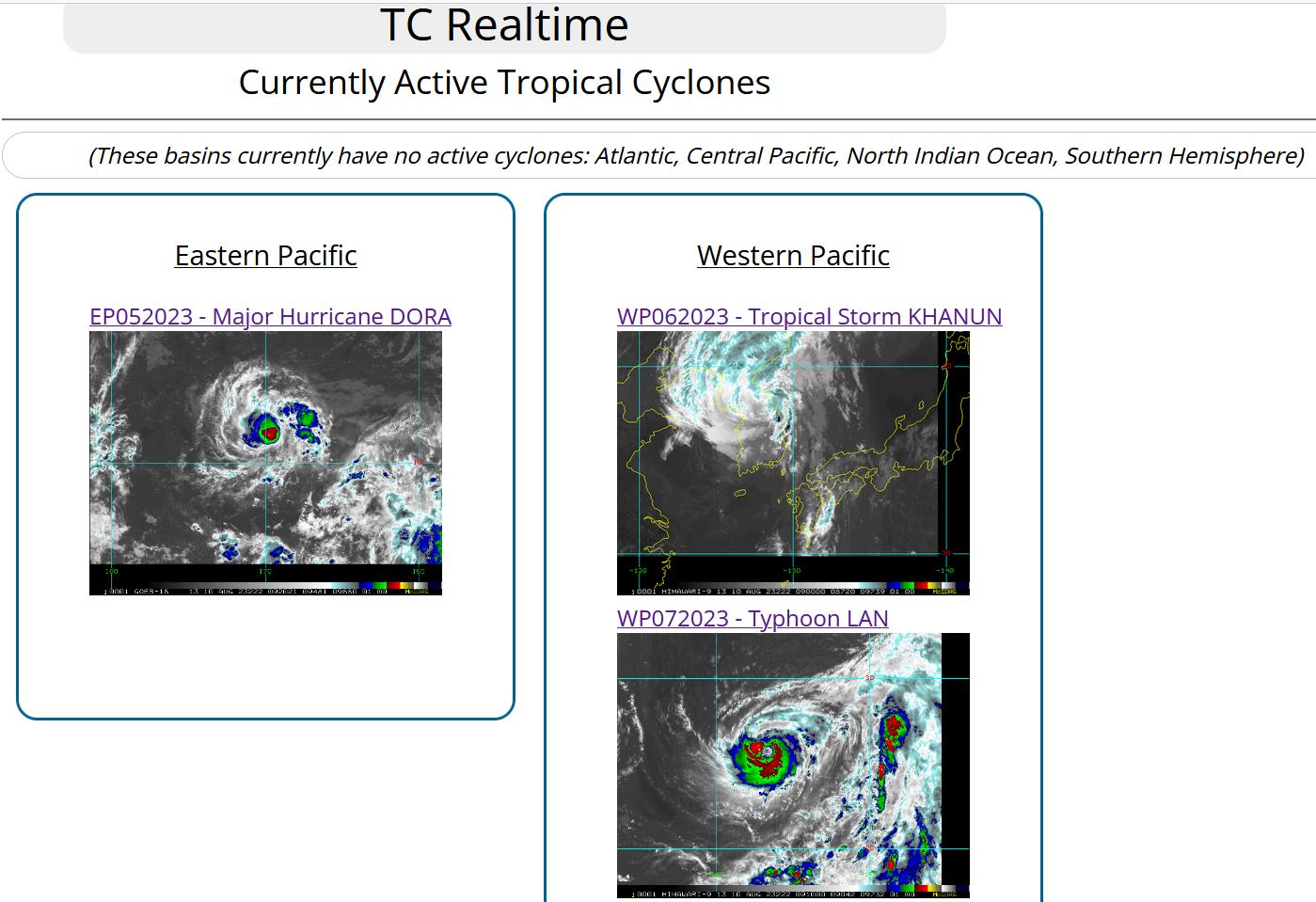
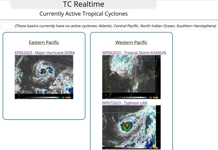
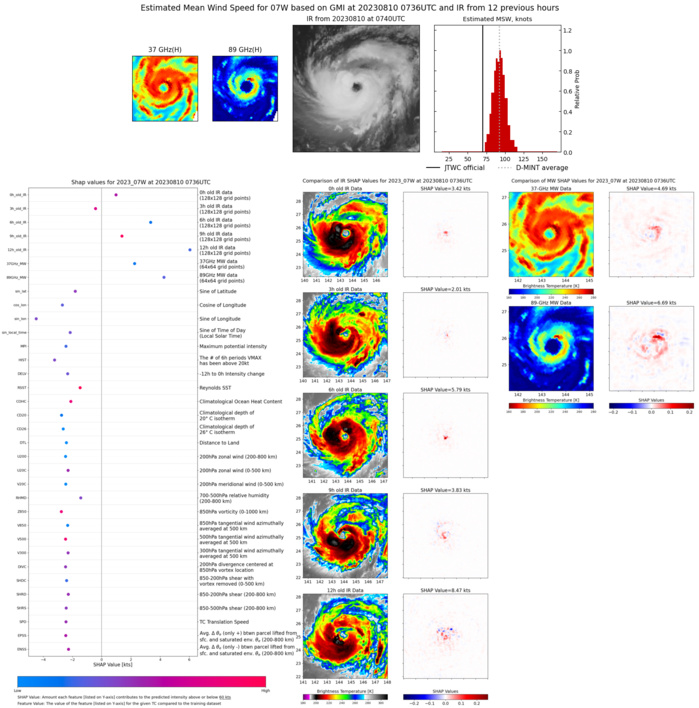
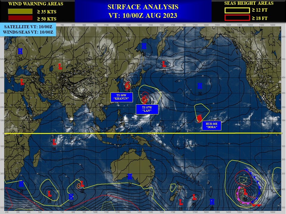
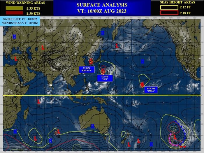
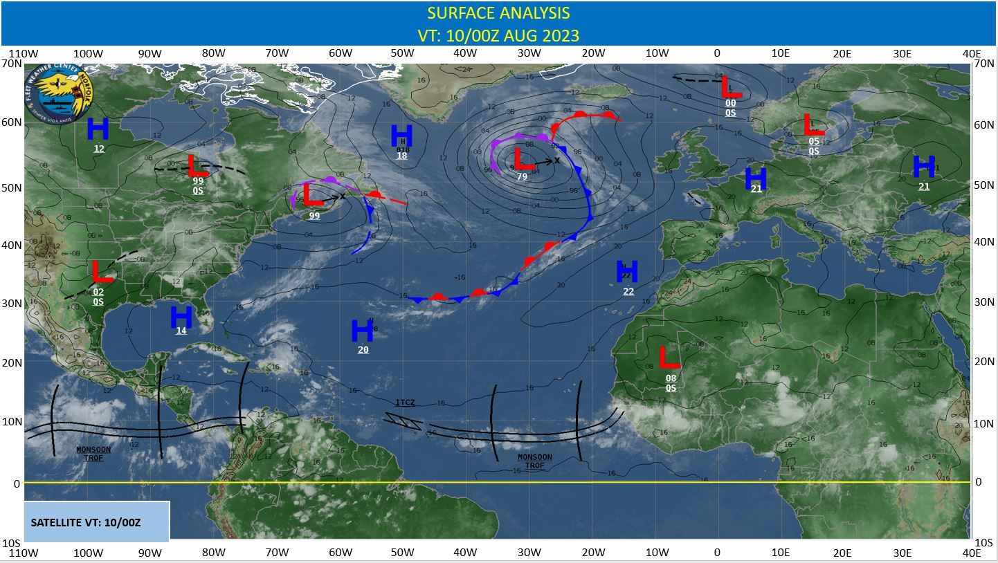
CLICK ON THE IMAGERIES BELOW TO GET THEM ENLARGED
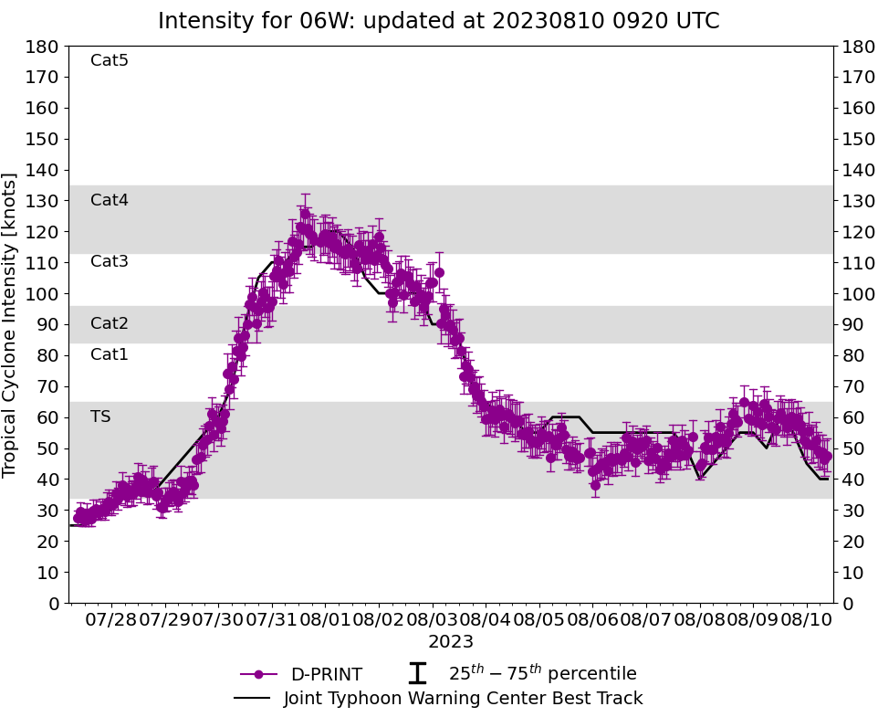
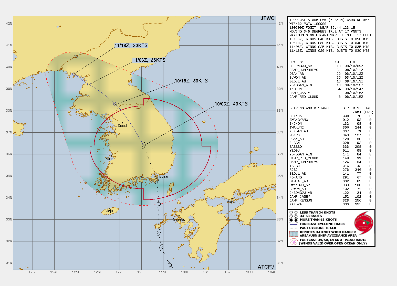
WESTERN NORTH PACIFIC: TS 06W(KHANUN). CURRENT ESTIMATED INTENSITY IS 40 KNOTS: -10 KNOTS/24H.
0623080800 290N1309E 40
0623080806 294N1307E 45
0623080812 300N1304E 50
0623080818 305N1298E 55
0623080900 309N1293E 55
0623080906 317N1289E 50
0623080912 324N1288E 60
0623080918 337N1288E 55
0623081000 348N1287E 45
0623081006 364N1281E 40
0623080806 294N1307E 45
0623080812 300N1304E 50
0623080818 305N1298E 55
0623080900 309N1293E 55
0623080906 317N1289E 50
0623080912 324N1288E 60
0623080918 337N1288E 55
0623081000 348N1287E 45
0623081006 364N1281E 40
WARNING 57 ISSUED AT 10/0900UTC.
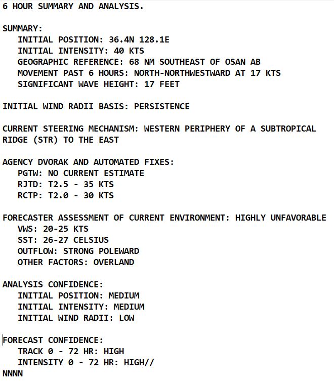
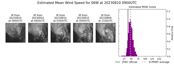
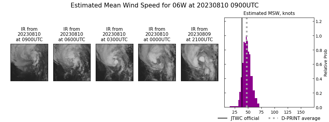
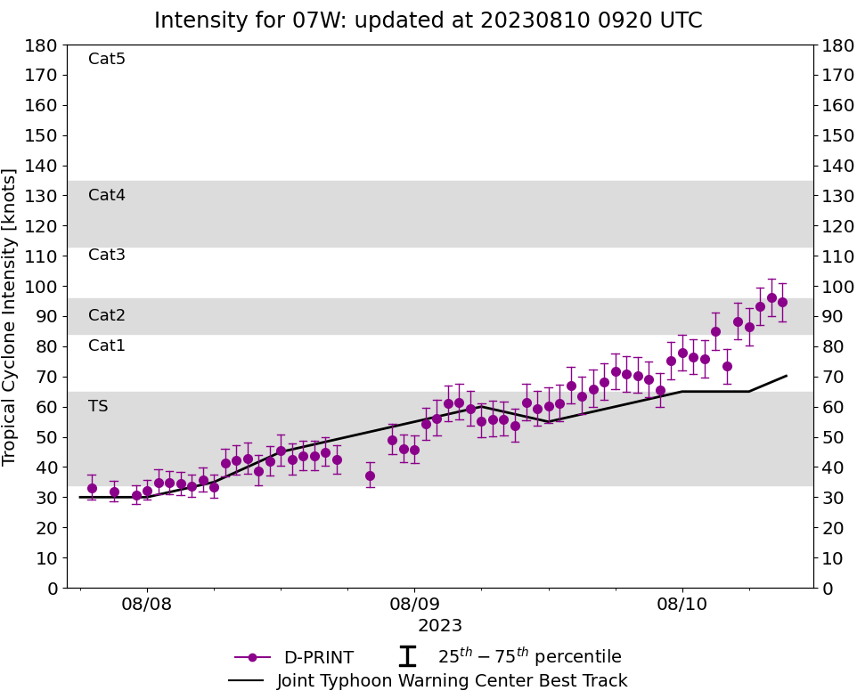
SATELLITE ANALYSIS, INITIAL POSITION AND INTENSITY DISCUSSION: ANIMATED MULTISPECTRAL SATELLITE IMAGERY (MSI) DEPICTS A LOW LEVEL CIRCULATION ALMOST FULLY OBSCURED BY LINGERING DEEP CONVECTION. A 100407Z AMSR2 89GHZ MICROWAVE IMAGE REVEALS A FRAGMENTED CIRCULATION WITH MINIMAL COHESION OR SIGNIFICANT BANDING FEATURES EVIDENT. THE INITIAL POSITION IS PLACED WITH MEDIUM CONFIDENCE BASED ON THE MSI AND AMSR2 IMAGERY. THE INITIAL INTENSITY OF 40 KTS IS ASSESSED WITH MEDIUM CONFIDENCE BASED ON RJTD AND RCTD DVORAK INTENSITY ESTIMATES GENERALLY MATCHING CIMSS D-PRINT OF 47KTS.
TC Warning Graphic
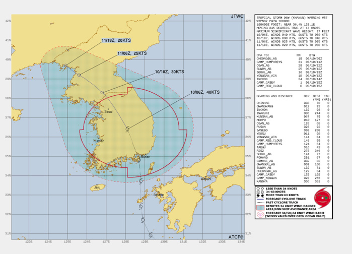
FORECAST REASONING. SIGNIFICANT FORECAST CHANGES: THERE ARE NO SIGNIFICANT CHANGES TO THE FORECAST FROM THE PREVIOUS WARNING. FORECAST DISCUSSION: TS 06W IS FORECAST TO TRACK GENERALLY NORTH-NORTHWESTWARD THROUGH THE FORECAST PERIOD. AS THE SYSTEM TRACKS POLEWARD ALONG THE KOREAN PENINSULA, IT WILL RAPIDLY WEAKEN AND EVENTUALLY DISSIPATE NEAR 36.
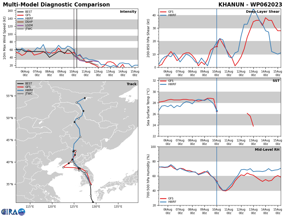
Model Diagnostic Plot
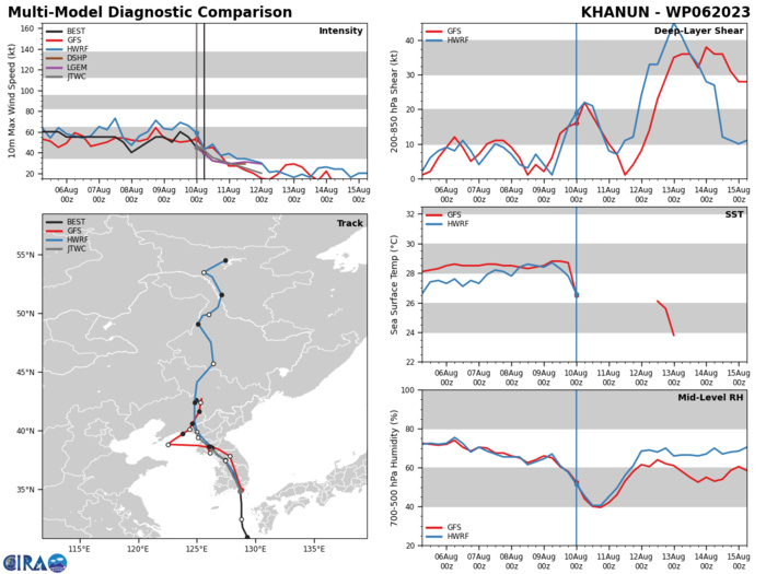
MODEL DISCUSSION: BOTH TRACK AND INTENSITY GUIDANCE IS IN EXCELLENT AGREEMENT. THE JTWC FORECAST LIES NEAR THE MULTI MODEL ENSEMBLE MEANS.
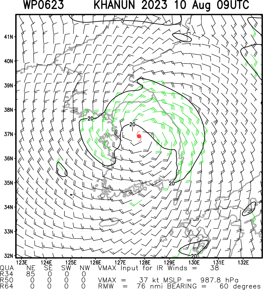
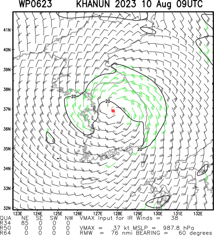
Multiplatform Satellite Surface Wind Analysis (Experimental)
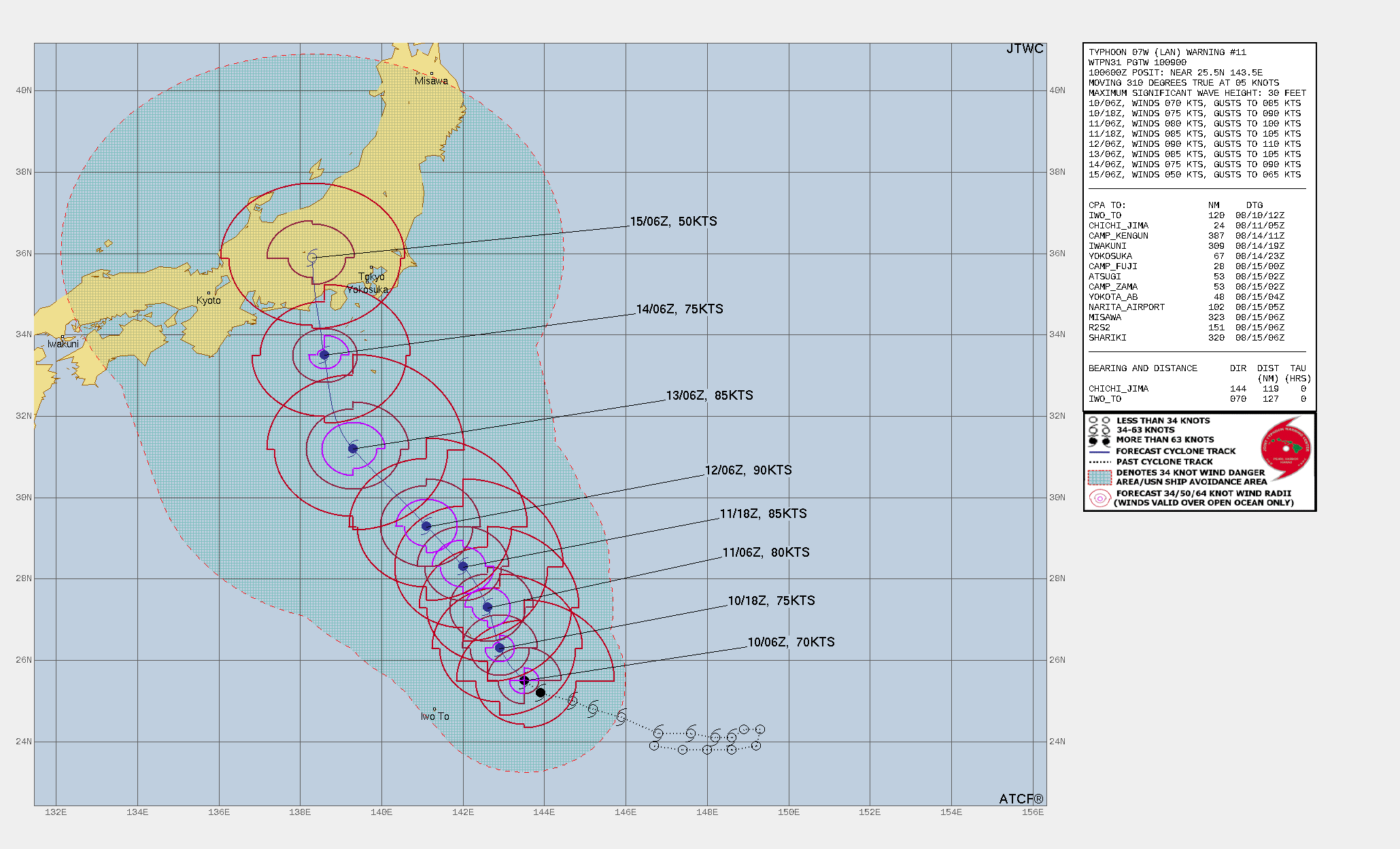
WESTERN NORTH PACIFIC: TY 07W(LAN). CURRENT ESTIMATED INTENSITY IS 70 KNOTS/CAT 1 US: +10 KNOTS/24H.
0723080800 243N1489E 30
0723080806 241N1486E 35
0723080812 241N1482E 45
0723080818 242N1476E 50
0723080900 242N1468E 55
0723080906 246N1459E 60
0723080912 248N1452E 55
0723080918 250N1447E 60
0723081000 252N1439E 65
0723081006 255N1435E 70
0723080806 241N1486E 35
0723080812 241N1482E 45
0723080818 242N1476E 50
0723080900 242N1468E 55
0723080906 246N1459E 60
0723080912 248N1452E 55
0723080918 250N1447E 60
0723081000 252N1439E 65
0723081006 255N1435E 70
WARNING 11 ISSUED AT 10/0900UTC.
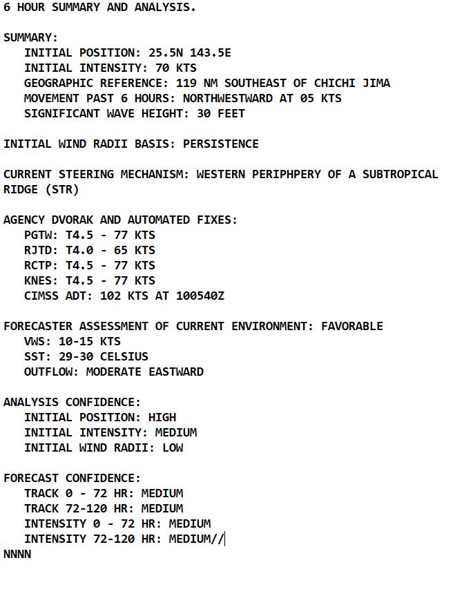
CLICK ON THE IMAGERY BELOW TO GET IT ANIMATED AND ENLARGED.
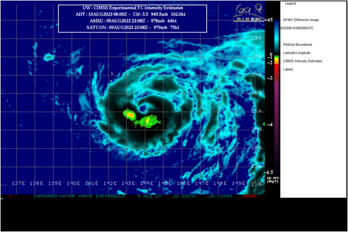
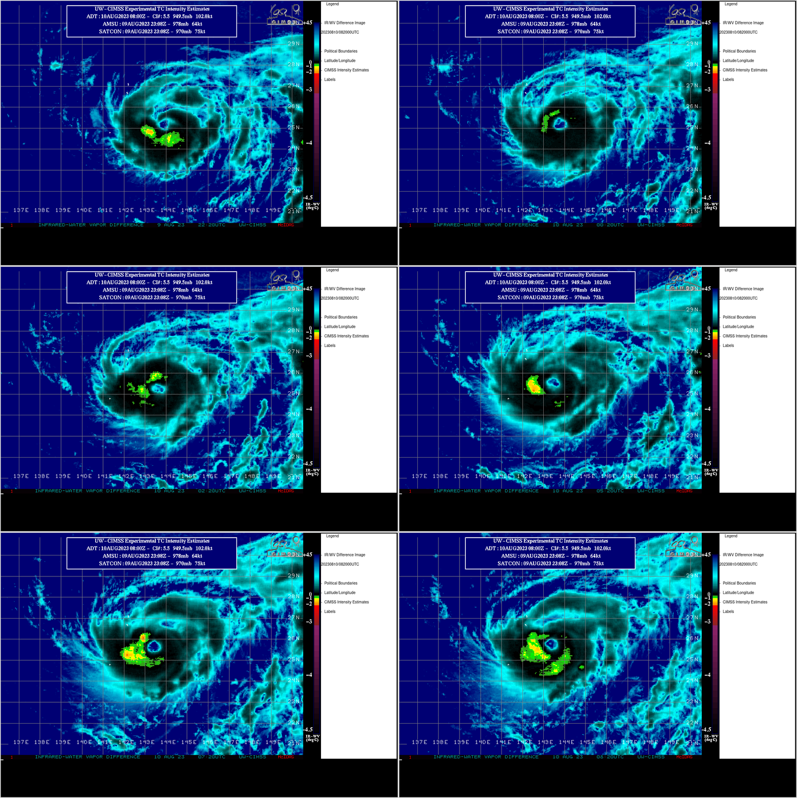
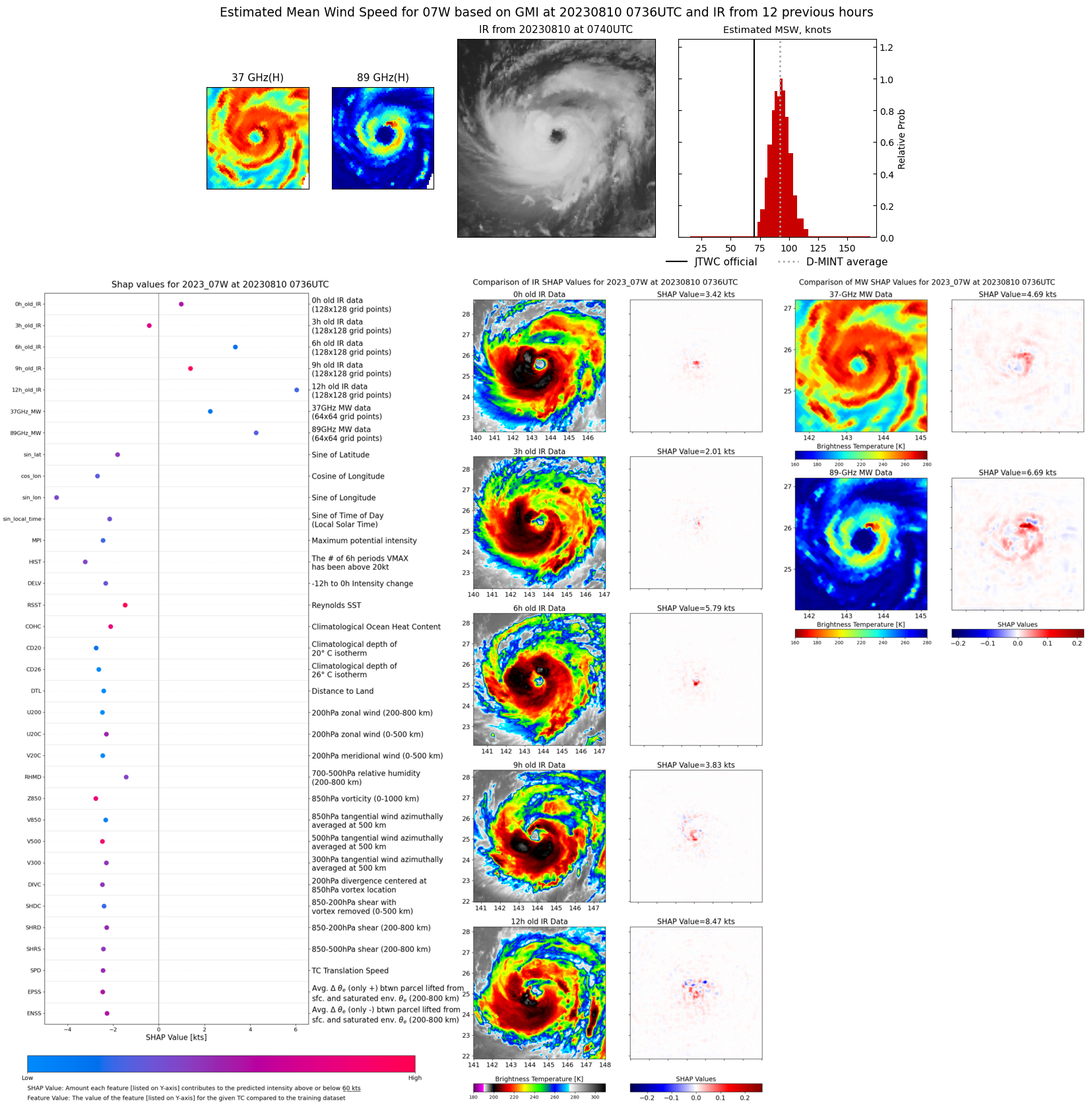
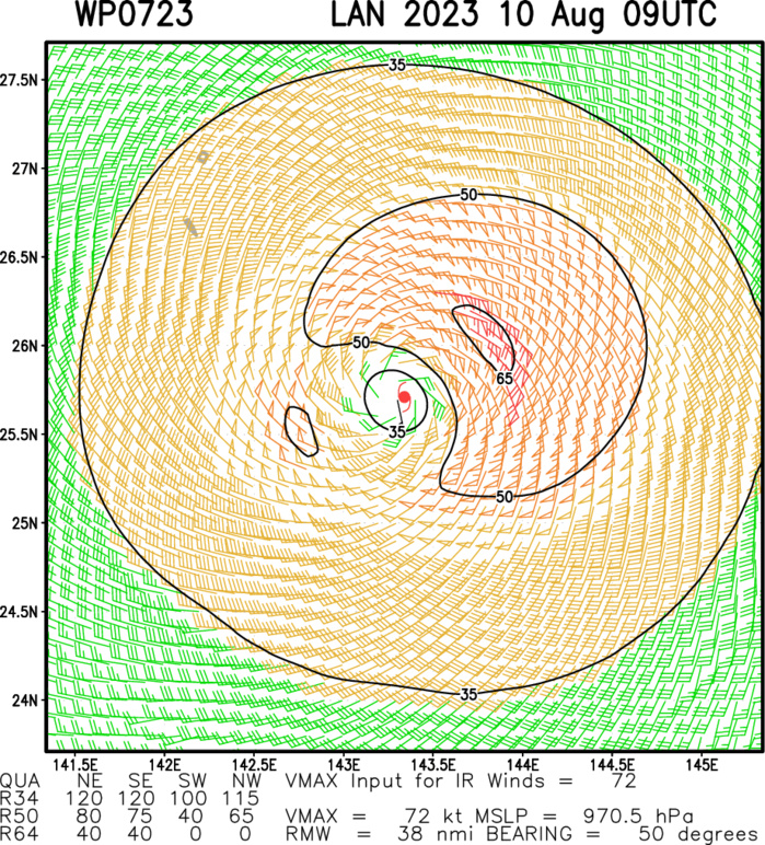
SATELLITE ANALYSIS, INITIAL POSITION AND INTENSITY DISCUSSION: ANIMATED MULTISPECTRAL SATELLITE IMAGERY (MSI) DEPICTS A RELATIVELY SMALL, TYPHOON STRENGTH CIRCULATION WITH A ROUGHLY 30NM RAGGED EYE FEATURE. A RECENT 100400Z AMSR2 89GHZ MICROWAVE IMAGE REVEALS A SINGLE DOMINANT BAND OF DEEP CONVECTION NEARLY ENCIRCLING THE LLCC, BEYOND WHICH THERE IS MINIMAL ORGANIZED DEEP CONVECTIVE ACTIVITY. THE INITIAL POSITION IS PLACED WITH HIGH CONFIDENCE BASED ON MSI AND AMSR2 IMAGERY. THE INITIAL INTENSITY OF 70 KTS IS ASSESSED WITH MEDIUM CONFIDENCE BASED PRIMARILY ON AGENCY DVORAK INTENSITY ESTIMATES WHICH ALL SUPPORT 75KTS. THE BULK OF THE REMAINING AUTOMATED INTENSITY ESTIMATES ARE SUSPICIOUSLY HIGH, IN MOST CASES HOVERING AROUND 100KTS WHICH BASED ON CONFIRMATION FROM PREVIOUS SAR AND SMAP PASSES IS WELL BEYOND REALITY.
TC Warning Graphic
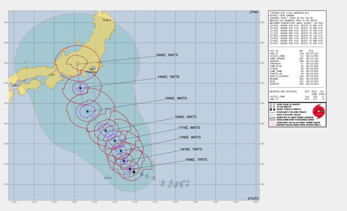
FORECAST REASONING. SIGNIFICANT FORECAST CHANGES: THERE ARE NO SIGNIFICANT CHANGES TO THE FORECAST FROM THE PREVIOUS WARNING. FORECAST DISCUSSION: TY 07W (LAN) IS FORECAST TO CONTINUE TRACKING NORTHWESTWARD UNDER THE STEERING INFLUENCE OF THE STR TO THE EAST. OVER THE NEXT TWO DAYS, FUELED BY LOW VERTICAL WIND SHEAR AND WARM SEA SURFACE TEMPERATURES, 07W IS FORECAST TO REACH 90KTS BY TAU 48. AS THE STR TO THE EAST REORIENTS AND SHIFTS, TRACK SPEEDS WILL INCREASE AS THE SYSTEM PASSES 30N. BY TAU 72, SUBSTANTIAL DRY AIR AND SUBSIDENCE ALOFT WILL CONSPIRE TO GRADUALLY WEAKEN THE SYSTEM AS IT STEADIES UP ON A COLLISION COURSE WITH MAINLAND JAPAN. BASED ON THE OTHERWISE FAVORABLE CONDITIONS OF THE SSTS AND SHEAR VALUES, 07W IS FORECAST TO MAKE LANDFALL AS A TYPHOON, PROCEEDING INLAND AND IMPACTING THE KANTO PLAIN AND YOKOSUKA AREAS.
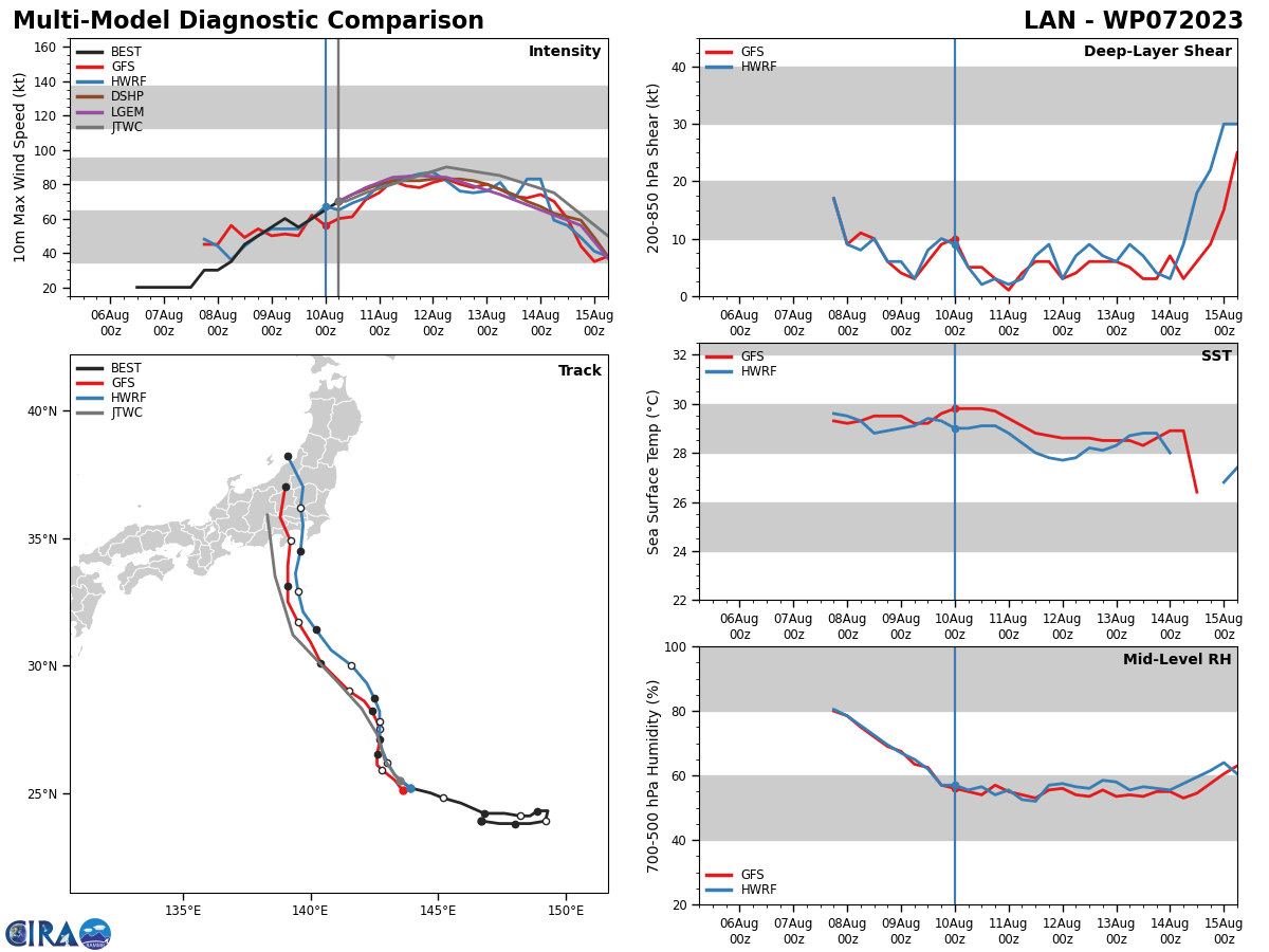
Model Diagnostic Plot
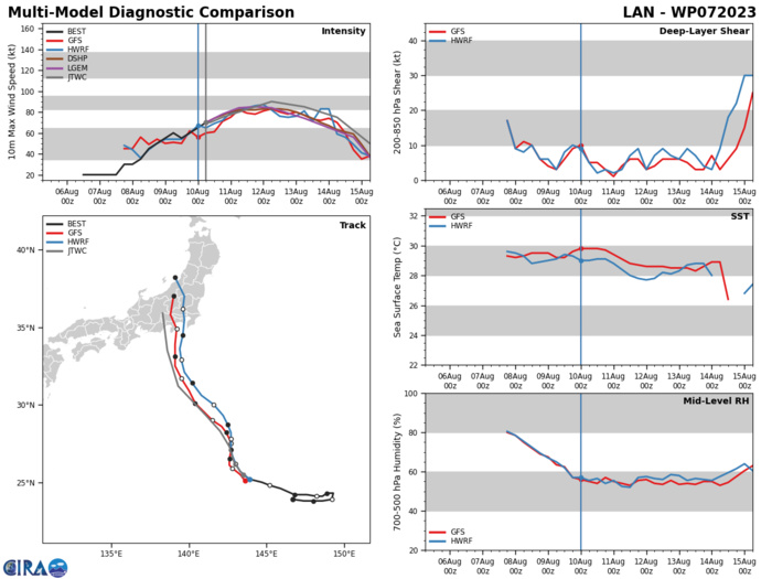
MODEL DISCUSSION: NUMERICAL MODELS ARE IN GOOD AGREEMENT WITH ALL MEMBERS GENERALLY FOLLOWING THE JTWC FORECAST TRACK AND IMPACTING JAPAN BY TAU 100 JUST WEST OF TOKYO. THERE IS A MODERATE AMOUNT OF CROSS TRACK SPREADING WITH TIME, AS NVGM HEADS FOR KYOTO TO THE WEST AND COAMPS-TC (GFS) HEADS FOR MISAWA TO THE EAST, WITH THE BULK OF THE REMAINING MEMBERS DOWN THE MIDDLE. FOR THIS REASON THE JTWC TRACK FORECAST IS PLACED WITH OVERALL MEDIUM CONFIDENCE. RELIABLE MODEL INTENSITY GUIDANCE IS IN GOOD AGREEMENT WITH ALL MEMBERS INTENSIFYING THE SYSTEM THROUGH TAU 48, AFTER WHICH A GRADUAL WEAKENING TREND THROUGH LANDFALL. FOR THIS REASON THE JTWC INTENSITY FORECAST IS ALSO PLACED WITH OVERALL MEDIUM CONFIDENCE.
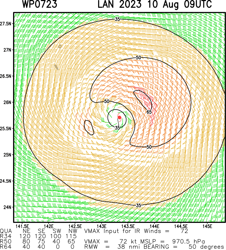
Multiplatform Satellite Surface Wind Analysis (Experimental)
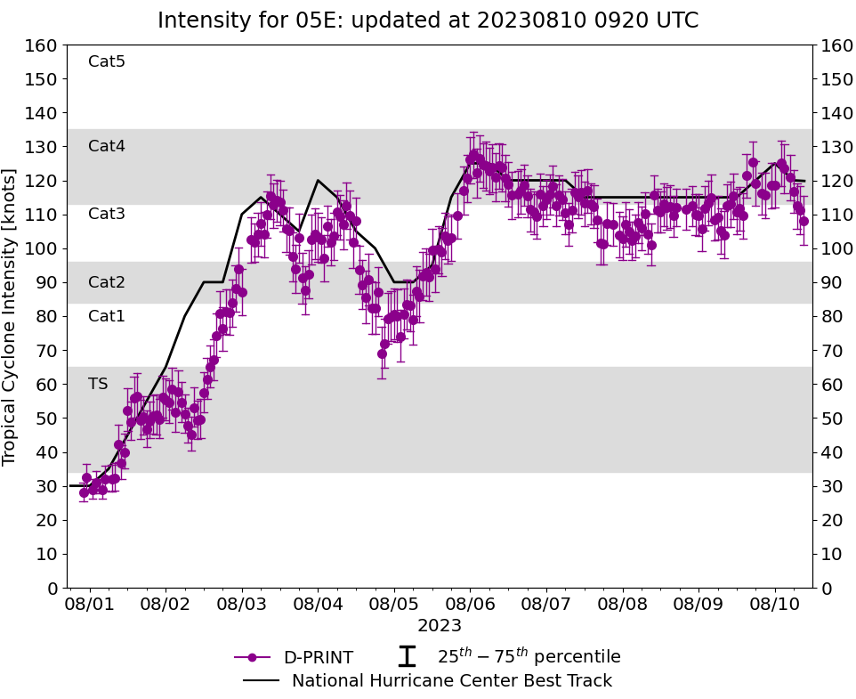
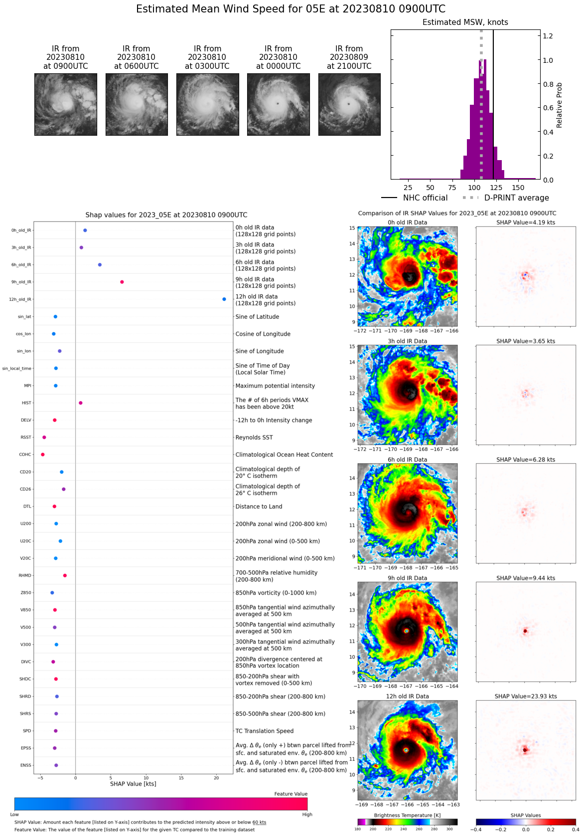
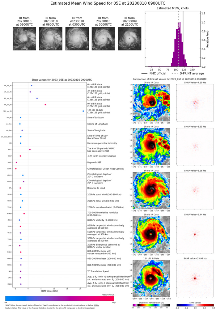
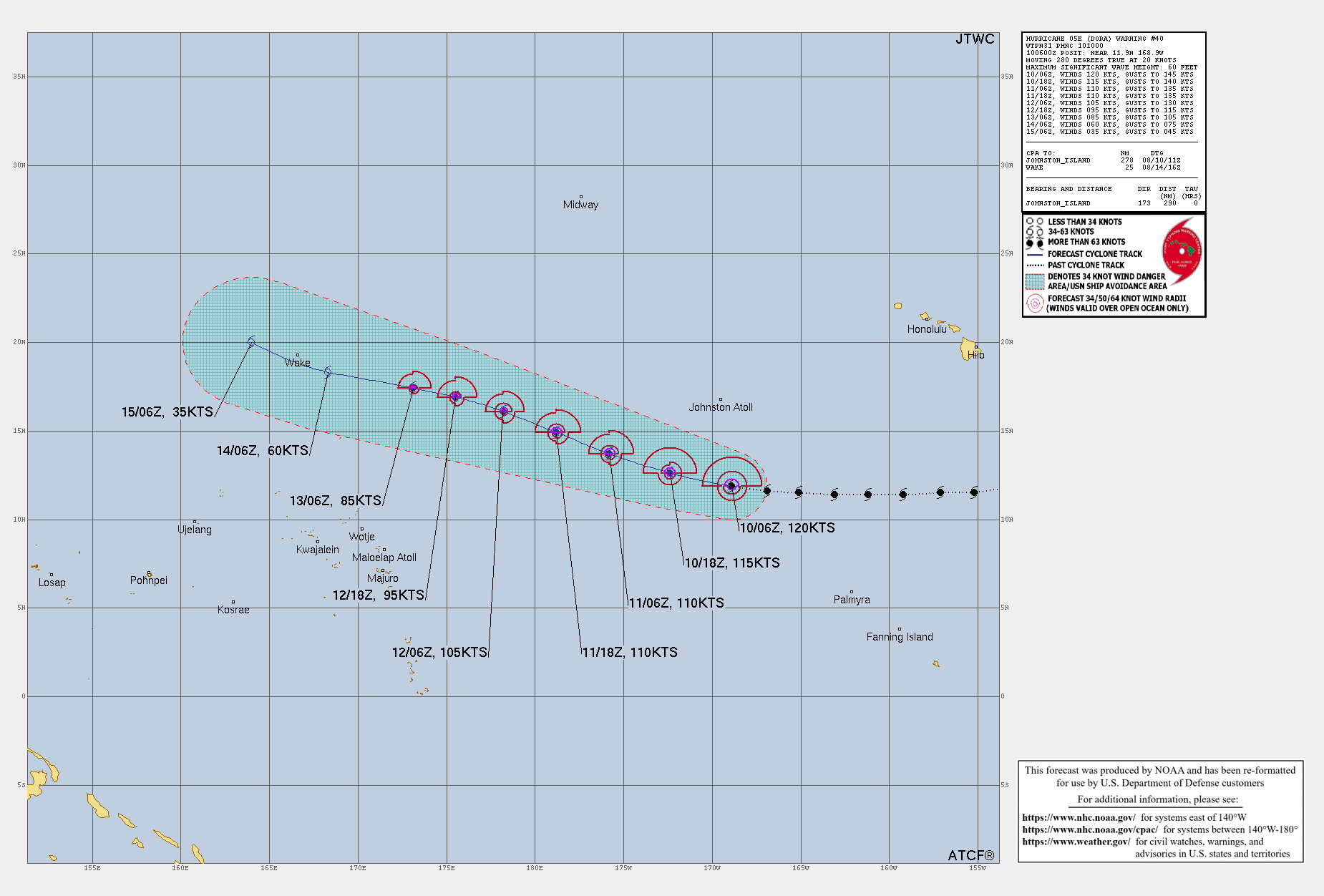
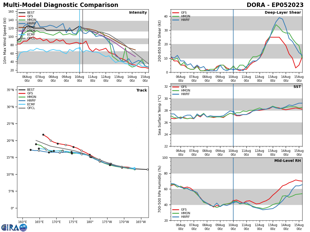
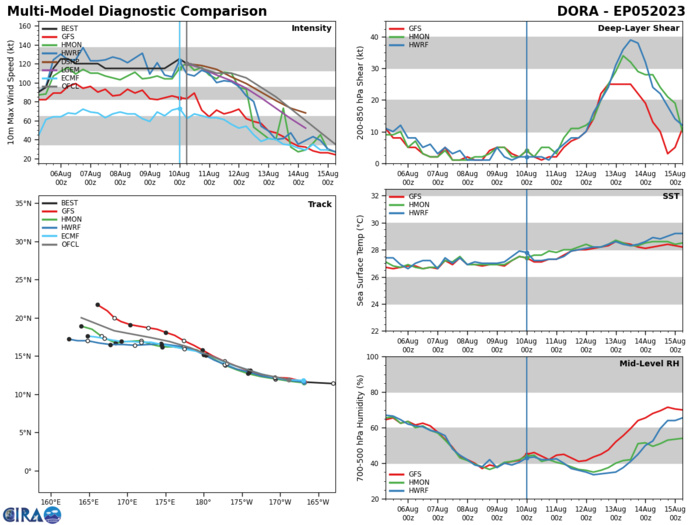
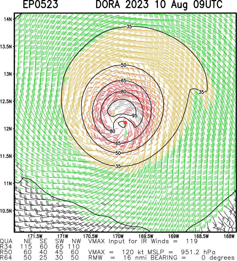
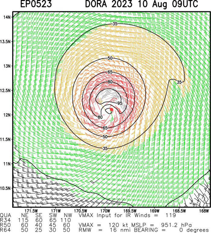
CENTRAL NORTH PACIFIC: HU 05E(DORA). CURRENT ESTIMATED INTENSITY IS 120 KNOTS/CAT 4 US: +5 KNOTS/24H.
0523080800 121N1513W 115
0523080806 118N1533W 115
0523080812 115N1552W 115
0523080818 115N1571W 115
0523080900 114N1592W 115
0523080906 114N1612W 115
0523080912 114N1631W 115
0523080918 115N1651W 120
0523081000 116N1669W 125
0523081006 119N1689W 120
0523080806 118N1533W 115
0523080812 115N1552W 115
0523080818 115N1571W 115
0523080900 114N1592W 115
0523080906 114N1612W 115
0523080912 114N1631W 115
0523080918 115N1651W 120
0523081000 116N1669W 125
0523081006 119N1689W 120
WARNING 40 ISSUED AT 10/1000UTC. TC Warning Graphic
Model Diagnostic Plot
Multiplatform Satellite Surface Wind Analysis (Experimental)
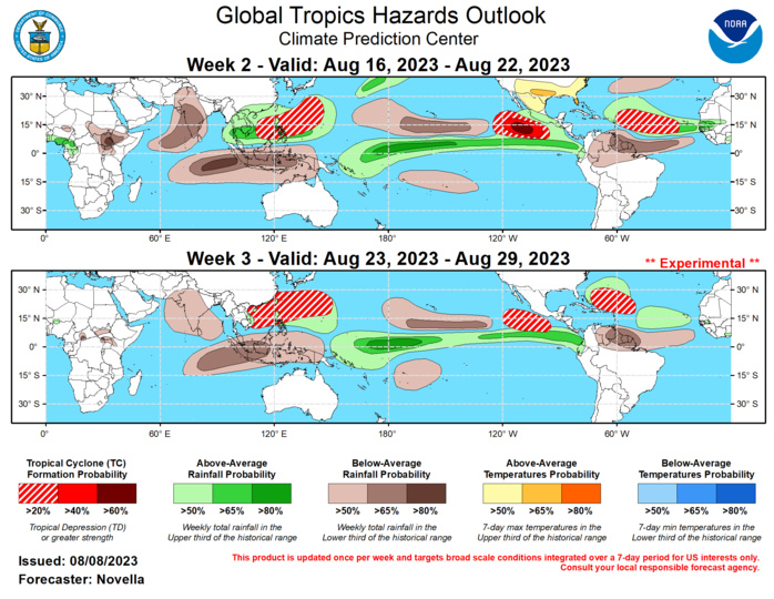
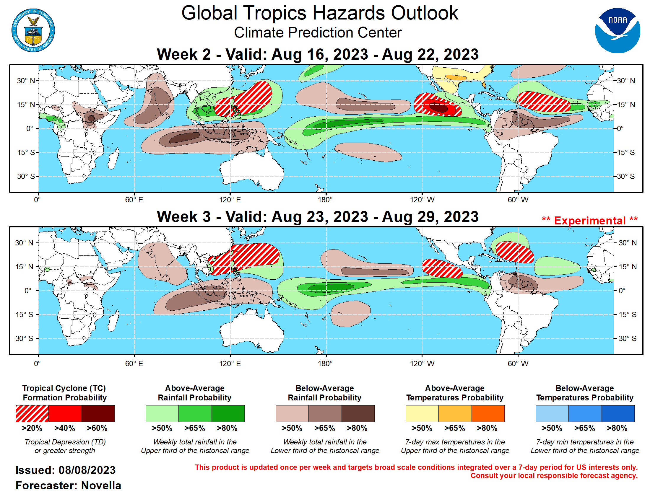
Last Updated - 08/08/23 Valid - 08/16/23 - 08/29/23 The RMM index showed a renewed MJO signal over the Western Hemisphere during the past week, having exited the unit circle for the first time in nearly a month. However, this signal has since weakened, as the recent uptick in amplitude is likely tied to the passage of Tropical Cyclone (TC) Dora in the central Pacific. The associated emergence of anomalous lower-level westerlies along and north of the equator looks to reinforce the low frequency atmospheric response across the equatorial Pacific. The observed upper-level velocity potential anomaly fields also appear to be at odds with any renewed MJO activity, which generally reflect a pattern that is more consistent with the ongoing El Nino base state, modulated by other modes of tropical variability. Looking ahead, dynamical model RMM forecasts largely favor a weakened and disorganized MJO through late August. Some extended range solutions point to possible reemergence of the MJO over the western Pacific, but there remains a good deal of uncertainty in this realization given the high degree of spread in the ensemble guidance. In the absence of a coherent, eastward propagating MJO, the ongoing El Nino base state is expected to remain the dominant driver on convective anomalies and TC genesis potential. The upper-level environment forecast, combined with predicted equatorial Kelvin and/or Rossby wave activity and a more active climatology during late August, looks to be conducive for TC development in the eastern Pacific and Atlantic. In the western Pacific, there are lowered chances for tropical cyclogenesis following a fairly active period in the basin during July. Since forming on 7/28, TC Khanun remains active in the western Pacific and is currently located to the south of Honshu, Japan at Tropical Storm strength. The Joint Typhoon Warning Center (JTWC) forecasts Khanun to begin tracking northward into the East China Sea and make landfall to the west of Busan, Korea in the next day or so. Locally heavy rainfall and elevated wind speeds are likely in the near-term for portions of southern Japan and the Korean Peninsula before the system is expected to dissipate over northeastern China. Since forming on 8/2 in the eastern Pacific, TC Dora has steadily tracked westward into the central Pacific where it has maintained Major Hurricane (category 4) intensity since this past weekend. Its current position to the south of Hawaiian islands is favored to bring periods of high winds and high surf to many parts of the state. Despite being a compact system, the Central Pacific Hurricane Center (CPHC) expects Dora to maintain Major Hurricane intensity through late this week while continuing to track westward towards the Date Line. Both deterministic and ensemble guidance suggest Dora will become a transpacific system, reaching the western Pacific basin as it gradually weakens near Wake Island late in week-1. During the past seven days, two TCs developed in the global tropics. To the southeast of Khanun, TC Lan formed near 24N/149E on 8/8. The JTWC expects Lan to initially track to the west then turn and accelerate northwestward under the influence of an approaching mid-level trough during the next several days. Both the GEFS and ECMWF ensembles are in good agreement favoring an eventual track towards Honshu, Japan, and possibly bring locally heavy precipitation and high winds later in week-1. In the eastern Pacific, TC Eugene formed on 8/5 to the south of Mexico. Eugene peaked at Tropical Storm strength before encountering cold waters to the west of Baja California and becoming a post-tropical cyclone on 8/7. Its remnant circulation is soon expected to become absorbed in the westerlies where enhanced mid-tropospheric moisture is favored to bring increased precipitation amounts to parts of California and the Great Basin during the next few days. For week-2, probabilistic TC tools are fairly muted in regards to new areas for formation over the western Pacific. Although weaker, anomalous lower-level cyclonic flow remains favored in the extended range tools over the South China and Philippine Sea, and slight (20%) chances are posted. In the wake of a potential TC forming in the eastern pacific during week-1 (currently 50% formation chances based on the National Hurricane Center's 7-day TWO), ensembles and probabilistic tools have been consistent in favoring another area of TC development to south of Mexico early in week-2. Given additional support from the upper-level velocity potential forecasts depicting equatorial Kelvin and Rossby wave activity over the tropical Americas, high (60%) chances of formation are issued in week-2. Ensembles also point to a northwestward track of the mean low which could trigger a Gulf of California moisture surge and bring enhanced precipitation amounts to parts of the Desert Southwest during week-2. In the Atlantic, both the GEFS and ECMWF ensembles favor the passage of a tropical wave in the Main Development Region (MDR) with increased chances of formation in the probabilistic tools. Although the ECMWF has been fairly bullish with the signals, only slight (20%) chances are posted given less support from the GEFS, as this potential may also be tempered by the El Nino background state. Given continued, albeit weak support in the extended range ECMWF, slight (20%) chances for additional TC formation are posted in the western Pacific during week-3. The favored persistence of anomalous lower-level westerlies in the extended range tools during week-3 over the eastern Pacific supports slight (20%) chances for the TC development to the south of Mexico. In the Atlantic, a broad area of slight (20%) chances is issued over parts of the Caribbean and western Atlantic, should there be any delay in formation associated with a tropical disturbance favored in the MDR during week-2. The precipitation outlook for weeks 2 and 3 are based on a historical skill weighted blend of GEFS, CFS, ECCC and ECMWF ensemble guidance, influences from anticipated TC tracks, and strong consideration of historical precipitation patterns associated with summer season El Nino events. For temperatures, there are elevated chances for above-normal temperatures throughout much of the western and southern CONUS tied to the persistence of amplified mid-level ridging over North America. Above-normal temperatures are also favored over parts of western Europe, as well as over the Indian subcontinent due to below-normal monsoonal rain forecast. For hazardous weather concerns in your area during the next two weeks, please refer to your local NWS office, the Medium Range Hazards Forecast from the Weather Prediction Center (WPC), and the CPC Week-2 Hazards Outlook. Forecasts issued over Africa are made in coordination with the International Desk at CPC.
